- Table View
- List View
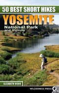
50 Best Short Hikes: Yosemite National Park and Vicinity
by Elizabeth Wenk50 Best Short Hikes: Yosemite National Park and Vicinity leads hikers of all skill levels to some of the most stunning landscapes Yosemite has to offer including: bubbling alpine creeks, smooth glaciated slabs, giant sequoias, deep dark blue lakes, and rock as far as the eye can see. In addition to in-depth hike descriptions, the author has also included information about the parks natural history, complex landscape, and its human history. Additional information includes tips on keeping yourself and your family safe, the park's natural predators, and helpful weather information.
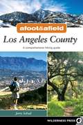
Afoot and Afield: Los Angeles County
by Jerry SchadJerry Schad is your knowledgeable and reliable guide for the 192 trips in this book--ranging from gentle family walks in Griffith Park to strenuous treks over the spine of the San Gabriel Mountains. Whether you see solace from the crowds, a cardiovascular workout, or a new perspective of the natural world around you, this book provides all you need to know.The second edition of this popular book covers all of the county's open spaces. A total of 192 hikes-including 17 new ones-are described in detail with trips organized into specific areas. Illustrated; detailed maps.
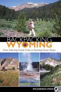
Backpacking Wyoming
by Douglas LorainWyoming boasts countless outstanding backcountry destinations. While some of these attractions are world famous, many are virtually unknown even to the savviest locals. Award-winning author Douglas Lorain details both famous and hidden treasures in his picks of Wyoming's 28 most enjoyable backpack trips. Lasting from three days to two weeks, these carefully chosen itineraries offer the hiker mountain scenery, magnificent wildlife, colorful geologic marvels, and reasonable daily mileage goals. This in-depth guide reveals the best trips in and around Yellowstone and Grand Teton National Parks, the Beartooth and Bighorn Mountains, the Absaroka and Snowy Ranges, the Wind River Range, and such treasures as the Wyoming, Gros Ventre, Bear Lodge, and Salt River Mountains. Each of the trips rates scenery, solitude, and difficulty; specifies mileage, elevation gain, days on the trail, and shuttle distance; and notes special attractions, required permits, and challenges. A detailed map and photographs accompany each trip. Everything the backcountry adventurer needs for a "trip of a lifetime."
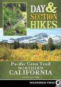
Day & Section Hikes Pacific Crest Trail: Northern California
by Wendy LautnerInstead of guiding travelers through the arduous task of hiking the entire PCT, the goal of this book is to help plan trips that incorporate hiking on the PCT in Northern California, whether hikers have just an afternoon to spare or want to escape for the entire weekend. The author's hike choices most often include the opportunity for a wilderness swim or a summit hike to take in outstanding views. Maps and elevation graphs were carefully produced using GPS data collected by the author while out on the trail.
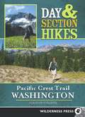
Day & Section Hikes Pacific Crest Trail: Washington
by Adrienne SchaeferDiscover the best segments of the Pacific Crest Trail in Washington with this succinct and portable guide. Instead of guiding hikers through the arduous task of hiking the entire Pacific Crest Trail, this guide helps travelers plan trips that incorporate hiking on the PCT. From the mighty waters of the Columbia River to the majestic peaks of the North Cascades, the hikes collected in this book represent a culmination of the author's experiences along a trail full of culture, history, and breathtaking scenery. Carefully edited maps and elevation graphs generated with GPS data collected by the author on the trail will help make any trip a success. This cargo-pocket guide offers author-tested advice to help hikers make the most of their time away from civilization.
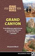
One Best Hike: Grand Canyon
by Elizabeth WenkOne of the world's most spectacular places, the Grand Canyon annually attracts over 4 million visitors who peer over the edge of the abyss. A smaller number of them trek from the rim to the banks of the Colorado River on one of the nation's best-known hikes. Many of these hikers are inadequately prepared for the rigors of what can be a deadly journey. This indispensable guide describes the most popular route into the canyon - the 16.2 mile round-trip route from the South Rim to the Colorado River. It addresses the many possible hazards (extreme heat, cold, elevation gain/loss of over 9,000 feet), gives advice on physical conditioning, and includes helpful charts, maps, and GPS waypoints for the best rest points. The hike itself is covered mile by mile, with expert coaching and hints along the way. Experienced and novice hikers alike will benefit from its encouraging, can-do approach.

Top Trails: Los Angeles
by Jerry SchadFrom the Santa Monica Mountains to Angeles National Forest, from Orange County to the San Bernardino and the San Jacinto Mountains,Southland hiking guru Jerry Schad describes the "must do" trails in the greater Los Angeles area. The highly visual, easy access guidebook includes a range of trails for all levels and abilities suitable for walking, hiking, running, and mountain biking. Each trail has a custom map, "don't get lost" trail milestones, elevation profiles, and the full range of trail features so hikers, cyclists, dog walkers and stroller users know exactly what to expect. This new edition describes a total of 57 trips and nine new trails including Corral Canyon in Malibu, Sycamore Canyon Waterfall, Oat Mountain in the Santa Susana Mountains, and Cobal Canyon Loop near Claremont.

Final Flight
by Peter StekelIn October 2005, two mountaineers climbing above Mendel Glacier in the High Sierra finds the mummified remains of a man in a WW II uniform, entombed in the ice. The "Iceman" discovery creates a media storm which draws author Peter Stekel to investigate and stumble upon the case of a navigation training flight crew missing since 1942. Early attempts at recovery are thwarted due to empty graves, botched records, bad weather, bad luck, and bad timing. Then, in 2007, Stekel himself discovers a second body in the glacier. Through meticulous research, interviews, and his own mountaineering trips to the site, Stekel uncovers the identities of these four young men. Final Flight explores the story of the ill-fated flight and the misinformation surrounding it for over 60 years. The book is a gripping account that's part mystery, part history, and a personal journey to uncover the truth of the events that occurred on November 18, 1942. In the process, Stekel rewrites the young aviators' last days and takes us on their final flight.
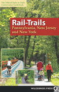
Rail-Trails Pennsylvania, New Jersey, and New York
by Rails-to-Trails-ConservancyAcross the country, more than 1,600 unused railroad corridors have been converted to level, public, multiuse trails, where people can enjoy a fitness run, a leisurely bike ride, or a stroll with the family. In this newest addition to the popular series, the Rails-to-Trails Conservancy presents the Northeast's finest rail-trails. Rail-Trails Northeast covers one hundred of New Jersey, New York, and Pennsylvania's rail-trails. With a rich industrial and passenger rail history, the Northeast is one of the densest rail-trail regions in the country. Rural, suburban, or urban, rail-trails serve as the backbone of an impressive trail system. This two-color book includes succinct descriptions of each trail from start to finish, plus at-a-glance summary information indicating permitted uses, surface type, length, and directions to trailheads for each trail. Every trip has a detailed map that includes start and end points, trailhead, parking, restroom facilities, and other amenities.
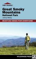
Top Trails: Great Smoky Mountains National Park
by Johnny MolloyThe best way to enjoy the Great Smoky Mountains National Park is to get away from the roads and into the heart of the park, letting all your senses absorb the very essence of these old mountains. But with the overwhelming mileage of trails, an uninformed hiker in the park is faced with a hit or miss choice of hikes. Weather, season, and day of the week can make a trail alluring or as overcrowded as Newfound Gap Road on a weekend summer day. Why take a chance on a hike that might not suit your needs? That's what this book is for -- to help you make the most of your precious time while in the Smokies.Day hiking is the best and most popular way to break into the Smokies backcountry, which is where you want to be. Information at the beginning of each hike includes trail use, length, vertical feet, a rating system for difficulty, as well as a list of hike features and nearby facilities. "Best time" tells when to enjoy the hike, finding the trail gives concise directions. A running narrative follows, telling hikers what they will see along the hike. A photo, trail map, quick glance hiker milestones, elevation profile and are outlined for each hike, making this a user friendly guide.One-way hikes take you to a particular rewarding destination and back on the same trail. Going over the same trail twice can have its advantages, though. The return trip allows you to see everything from the opposite vantage point. Loop day hikes go to a destination as well, but return you to your point of origin without having to retrace your steps. Some hikers just can't stand the thought of covering the same ground twice with the hundreds of untrodden Smokies trail miles that await them. Loop hikes are generally longer and harder than the there and back hikes, but a bigger challenge can reap bigger rewards.For those with the inclination, the several overnight hikes offer yet another great way to explore the Smokies. These overnight loops take you into the backcountry for 3 days and two nights, offering the best backpacking in the park.This book will help you make every step count, whether you are leading the family on a brief day hike or undertaking a challenging backpack into the remote reaches of the Smokies. With your precious time and the knowledge herein imparted to you, your outdoor experience will be realized to its fullest.
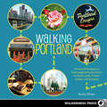
Walking Portland
by Becky OhlsenFrom a massive urban forest to the tiniest brewpub, Portland offers a huge variety of entertainments within a surprisingly compact area. Organic coffeeshops line the streets at the foot of an extinct volcano, and independent bookstores nestle up against food-cart pods. Already famous for its great beer, the city has become a center for serious dining on a reasonable budget. And thanks to years of progressive urban planning, Portland's layout makes it a walker's nirvana.In Walking Portland, devoted local Becky Ohlsen guides you through the Rose City's many charms, from idyllic waterfront fountains to the more obscure and out-of-the-way pockets of cool. On each walk, you'll discover hidden gardens, historic landmarks, award-winning restaurants, old-school taverns, oddball shops, and edgy warehouse galleries in some of the Northwest's most exciting neighborhoods. You'll cross bridges and graveyards, wander a Smithsonian-honored boulevard, see experiments in urban renewal (some inspiring, some dubious) and be regaled with stories of the city's colorful past. Whether you're looking for a leisurely stroll full of shopping and snacks or a vigorous trek over tree-covered hillsides, grab this book, step outside and . . . walk Portland.
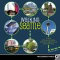
Walking Seattle
by Clark HumphreyThe Queen City of the Pacific Northwest was once known principally for the spectacular forests, mountains, and waters surrounding it.But now, what's in Seattle is as famous as what's outside it. This is a vibrant young city full of attractions. It's a center for several hi-tech industries and a crossroads of global cultures.Seattle is also one of the most walkable cities in the country. It's full of cozy bungalows, stately mansions, postmodern palaces, and outdoor art all over. It has wide boulevards, narrow cobblestone lanes, and carless pedestrian pathways.Walking Seattle reveals 35 specially designed urban treks that are not only good exercise but are a great way to soak up the city's history, culture, parks, and vibe.Commentary includes trivia about architecture, local culture, and neighborhood history, plus tips on where to dine, have a drink, or shop.Each tour includes a neighborhood map and vital public transportation and parking information.Route summaries make each walk easy to follow, and a "Points of Interest" section lists each walk's highlights.Local insider Clark Humphrey leads you from Greenwood to Rainier Beach, from Green Lake to Fauntleroy, and many places in between.Walking Seattle. Get it, and get moving.
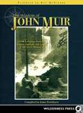
The Wisdom of John Muir
by Anne Rowthorn Bill MckibbenThe Wisdom of John Muir marries the best aspects of a Muir anthology with the best aspects of a Muir biography. The fact that it is neither, and yet it is both, distinguishes this book from the many extant books on John Muir. Building on her lifelong passion for the work and philosophy of John Muir, author Anne Rowthorn has created this entirely new treatment for showcasing the great naturalist's philosophy and writings. By pairing carefully selected material from various stages of Muir's life, Rowthorn's book provides a view into the experiences, places, and people that inspired and informed Muir's words and beliefs. The reader feels able to join in with Muir's own discoveries and transformations over the arc of his life. Rowthorn is careful not to overstep her role: she stands back and lets Muir's words speak for themselves.
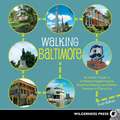
Walking Baltimore
by Evan BalkanWalking Baltimore includes Charm City's well-known neighborhoods - Downtown, the Inner Harbor, Mount Vernon, and Fells Point. But in the voice of its insider author, the book also covers lesser-known and far-flung corners, revealing what makes Baltimore such a wonderful and fascinating destination and hometown. Full of little-known facts and trivia, this book shows how and why Baltimore was an essential player in the country's early history and continues to be influential today. Here is a city almost unparalleled in American history and it lives up to its modern reputation as a quirky, come-as-you-are and be-what-you'll-be place. The zany Baltimore-based film director John Waters (of Hairspray fame) summed it up best when he said, "It's as if every freak in the South was headed to New York City, ran out of gas in Baltimore, and decided to stay."
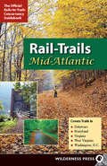
Rail-Trails Mid-Atlantic
by Rails-to-Trails-ConservancyThe official guidebooks for the nationwide rail-trails system, the new Rail-Trails series books have an easy-to-use layout and design, clear maps, and precise trip descriptions. With more than 65 rural, suburban, and urban trails spanning 800 miles, Rail-Trails Mid-Atlantic covers trails in Delaware, Maryland, Virginia, Washington, D.C., and West Virginia. Stroll through shady pines and deep forests, visit a Christmas tree farm, and watch grazing llamas along the mid-Atlantic's historic rail-trails. Includes two-color maps for each trip and succinct directions.
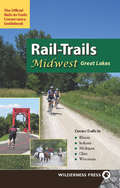
Rail-Trails Midwest Great Lakes
by Rails-to-Trails-ConservancyIn this edition in the popular series, the Rails-to-Trails Conservancy presents the best of the Great Lakes rail-trails, home to the most rail-trails in the country. With 113 rural, suburban, and urban trails threading through nearly 2300 miles, Rail-Trails Midwest: Great Lakes covers Illinois, Indiana, Michigan, Ohio, and Wisconsin. Many rail-trails are paved and run through the most popular parts of town, such as the 61-mile Illinois Prairie Path, which links Chicago-area suburbs. Others take you back in time for a look at regional history, like Ohio's 11-mile Holmes County Trail. The Midwest has thousands of miles of rail corridor that have been turned into 360 rail-trails in the Great Lakes alone. Every trip has a detailed map that includes start and end points, trailhead, parking, restroom facilities, and other amenities. Many of the level rail-trails are suitable for walking, jogging, bicycling, inline skating, wheelchairs, and horses.
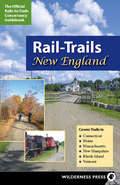
Rail-Trails New England
by Rails-to-Trails-ConservancyWith 60 rural, suburban, and urban trails threading through 622 miles, Rail-Trails New England covers Maine, Vermont, New Hampshire, Rhode Island, Massachusetts, and Connecticut. This two-color book includes succinct descriptions of each trail from start to finish, plus at-a-glance summary information indicating permitted uses, surface type, length, and directions to trailheads for each trail.Every trip has a detailed map that includes start and end points, trailheads, parking, restroom facilities, and other amenities.
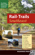
Rail-Trails Southeast
by Rails-to-Trails-ConservancyThe official guidebooks for the nationwide rail-trails system, the new Rail-Trails series books have an easy-to-use layout and design, clear maps, and precise trip descriptions. With 55 rural, suburban, and urban trails spanning 630 miles, Rail-Trails Southeast covers Alabama, Florida, Georgia, Louisiana, Mississippi, North and South Carolina, and Tennessee. Visit historic battlefields, see the world's largest cast-iron statue, travel through a gorge, and watch beavers and herons along the Southeast's historic rail-trails. Includes two-color maps for each trip and succinct directions.
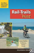
Rail-Trails West
by Rails-to-Trails-ConservancyIn this edition in the popular series, the Rails-to-Trails Conservancy presents the best of the West. With 70 rural, suburban, and urban trails threading through 1,050 miles, Rail-Trails West covers 60 trails in California, eight in Arizona, and two in Nevada. Many rail-trails offer escapes from city life, like the Mount Lowe Railway Trail, high above the buzzing Los Angeles basin on a rail line vacationers once took to a mountaintop resort. Others offer the pure sensory thrill of sweeping terrain, like Arizona's 7-mile Prescott Peavine Trail. Still more juxtapose the natural world with the railroad's industrial past, like Nevada's Historic Railroad Hiking Trail, which passes through five massive tunnels to reach Hoover Dam. Every trip has a detailed map, directions to the trailhead, and information about parking, restroom facilities, and other amenities. Many of the level rail-trails are suitable for walking, jogging, bicycling, inline skating, wheelchairs, and horses.
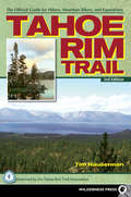
Tahoe Rim Trail
by Tim HausermanThe 165-mile Tahoe Rim Trail is considered one of the world's premier trails. Accessible by hikers, equestrians, skiers and mountain bikers (for the non-wilderness portions), it winds completely around spectacular Lake Tahoe, the highest and largest alpine lake in North America. The trail crosses through six counties, three national forests, and two states and was completed in 2001 largely by volunteer labor.The best-selling Tahoe Rim Trail has been revised to reflect the latest conditions and routing of the trail and includes information for over 20 miles of new trail. Updated topographic maps depict the entire route, along with the easy (and fun) to read trail directions, the book includes fascinating information on the plants and animals you'll see along the trail, plus essential advice for planning a hike on the TRT, whether it's a day's outing or a 2-week circuit of the entire lake.The first and only how-to guide to this popular trail, it is the official guidebook of the Tahoe Rim Trail Association, whose mission is to improve, maintain and promote the trail.
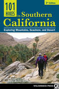
101 Hikes in Southern California
by David Money Harris Jerry SchadTrek the diverse terrain of Southern California, from desert to beach to mountaintop, on an easy stroll or overnight adventure, with this ultimate guide to the 101 best hikes in the Southland. Covers the Santa Monica, San Gabriel, San Jacinto, and San Bernardino mountains, and the Mojave and Colorado deserts. This updated and revised edition of one of our best-selling guidebooks includes 12 new hikes and updated information for hikes from the previous edition. All trips have been rehiked for this update. Each trip includes a map, photos, trail highlights, and symbols to tell you the basics of the trip at a glance. Each map now includes key GPS coordinates.
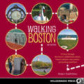
Walking Boston
by Robert Todd FeltonBoston is a walker's town. It's as clear as the brick red path marking the Freedom Trail, the bright blue signs of the Harborwalk, and the green of the Emerald Necklace series of parks. Boston's nearly 400-year history has led to the development of hidden neighborhoods, historic sites, and iconic parks that tempt both Bostonians and visitors out onto the sidewalks, paths, and trails lacing this close-knit city. In addition, the Big Dig project, which helped revive downtown and the waterfront by moving Interstate 93 underground, has created an energy and excitement that has driven projects like the Harborwalk and the Rose Fitzgerald Kennedy Greenway. Walking Boston offers the best of Boston's new and old rambles. This portable guide features detailed maps, original photos, and public transportation information for every trip. Route summaries make each walk easy to follow, and a "Points of Interest" section summarizes each walk's highlights.
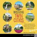
Walking Twin Cities
by Sherman Wick Holly DayEven though they're often lumped together, the Twin Cities are two distinct cities with very different histories. Minneapolis is the Mill City, the City of Lakes, composed mostly of flat prairies. St. Paul is the Capital City, built on rolling hills and high river bluffs.Culturally, the cities have their differences, too. Minneapolis is home to world-renowned theatres and modern art galleries, while St. Paul is the home of many of the state's institutions, from the seat of government to the seat of the Roman Catholic Archdiocese of St. Paul and Minneapolis. Minneapolis is a newer city, which is reflected in the architecture and overall vibe, while St. Paul's older neighborhoods feature some of the most intact Victorian-era houses in the country. Because of their locations on the west and east sides of the Mississippi River, critics say that Minneapolis is more like a modern West Coast city, while St. Paul is akin to a historic East Coast city.Both cities are linked by the Mississippi River-the same force that shaped their origins. St. Paul developed earlier, mostly because it was more easily accessible via the river. Another similarity between the two cities is the foresight by the Victorians who succeeded the cities' founders to invest money into their communities-both cities set aside large tracts of land for public use all along the rivers and lakes. Some of the most beautiful parks were plotted in the early days of the cities.Even today there are big differences between the cities. For example, St. Paulites, gluttons for punishment, host the annual Winter Carnival during the coldest time of the year. Minneapolitans take the easy way out by celebrating the Aquatennial Festival each summer. Despite having their city festivals at opposite ends of the solstice, Minnesotans love the outdoors. Even with the notoriously fierce winters, Minnesotans statistically spend more time outside than most.Whether you're interested in art, culture, history, or nature, there's a walk in this book designed for your interests. We hope that it serves not only as a guidebook for (re)discovering the Twin Cities, but as a springboard for additional explorations.This book contains 35 walks of varying levels of difficulty, built around the natural, architectural, and historical attractions of Minneapolis and St. Paul. The downtown areas of both cities are explored in depth, as well as many of the neighborhoods, scenic parks, and lakes that are scattered through the area.
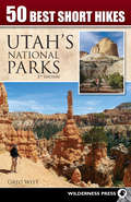
50 Best Short Hikes in Utah's National Parks
by Greg WittUtah's five national parks-Arches, Bryce, Canyonlands, Capitol Reef, and Zion-hold some of the most awe-inspiring geology on the planet. Each park offers visitors the dramatic scenery that invites exploration and discovery.In 50 Best Short Hikes in Utah's National Parks, veteran hiking guide Greg Witt shares the best routes in each park, hikes that are both "must see" and accessible. Park visitors who are short on time will find this book to be the ideal traveling companion, because it quickly helps readers identify the hikes and sights that will make the best use of their time and provide maximum enjoyment.Each hike in the book includes distances, highlights, area maps, and easy-to-follow trailhead directions to make hike selection fast and efficient. Once on the trail, the detailed maps, route description, and interpretive details insure that hikers get the most out of their trip.Even avid hikers and experienced desert explorers will find new insights and discoveries as Witt's interesting and approachable style details the geologic forces that created this landscape. He brings to life the human history-prehistoric cliff-dwellers, native tribes, ranchers, farmers, loggers, miners, and outlaws-that adds to the color of the Colorado Plateau where these five parks are set.
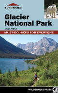
Top Trails: Glacier National Park
by Jean ArthurGlacier National Park's remote locale allows visitors to experience an intact ecosystem that hosts nearly all wildlife and bird species that were found a century ago when Congress designated the 1.2 million acres as America's 10th national park. Here at that Crown of the Continent, hikers use the guide to access a mountain pass where meltwater drains to three different oceans. Trail users retrace routes to some 200 sapphire blue or turquoise green lakes, following trails along some of the park's 1,557 miles of streams and rivers and discovering some of Glacier's 200 named waterfalls. The ever-changing landscape encourages trail users, photographers, and nature lovers to return to Glacier to explore glacial tarns as they melt, aspens as they quake golden in the fall, and even recovering landscapes from large wildfires a decade ago. This guide also reveals historically significant information about the park and the trails, culturally significant waypoints, Blackfeet Indian and other Native American traditional use, ongoing scientific research and sustainable practices in Glacier.Top Trails: Glacier National Park by local author Jean Arthur leads visitors to secluded trails and unique settings while providing details of current and past human activity, wildlife movement, wildfire's importance, and geologic changes that altered the landscape and created America's 10th national park.The unique approach of Top Trails: Glacier National Park reveals why certain trails wend alongside sensitive meadows or climb above crystalline lakes. The guide leads hikers to backcountry respites, unique to Glacier. The guide also traces outlaws, poachers, and mining ventures that occurred inside the current park boundary.