- Table View
- List View

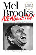
All About Me!: My Remarkable Life in Show Business
by Mel BrooksAt 95, the legendary Mel Brooks continues to set the standard for comedy across television, film, and the stage. Now, for the first time, this EGOT (Emmy, Grammy, Oscar, Tony) winner shares his story in his own words. <P><P>“Laugh-out-loud hilarious and always fascinating, from the great Mel Brooks. What else do you expect from the man who knew Jesus and dated Joan of Arc?&”—Billy Crystal <P><P>For anyone who loves American comedy, the long wait is over. Here are the never-before-told, behind-the-scenes anecdotes and remembrances from a master storyteller, filmmaker, and creator of all things funny. <P><P>All About Me! charts Mel Brooks’s meteoric rise from a Depression-era kid in Brooklyn to the recipient of the National Medal of Arts. Whether serving in the United States Army in World War II, or during his burgeoning career as a teenage comedian in the Catskills, Mel was always mining his experiences for material, always looking for the perfect joke. His iconic career began with Sid Caesar’s Your Show of Shows, where he was part of the greatest writers&’ room in history, which included Carl Reiner, Neil Simon, and Larry Gelbart. After co-creating both the mega-hit 2000 Year Old Man comedy albums and the classic television series Get Smart, Brooks’s stellar film career took off. He would go on to write, direct, and star in The Producers, The Twelve Chairs, Blazing Saddles, Young Frankenstein, Silent Movie, High Anxiety, and Spaceballs, as well as produce groundbreaking and eclectic films, including The Elephant Man, The Fly, and My Favorite Year. Brooks then went on to conquer Broadway with his record-breaking, Tony-winning musical, The Producers. All About Me! offers fans insight into the inspiration behind the ideas for his outstanding collection of boundary-breaking work, and offers details about the many close friendships and collaborations Brooks had, including those with Sid Caesar, Carl Reiner, Gene Wilder, Madeleine Kahn, Alfred Hitchcock, and the great love of his life, Anne Bancroft. Filled with tales of struggle, achievement, and camaraderie (and dozens of photographs), readers will gain a more personal and deeper understanding of the incredible body of work behind one of the most accomplished and beloved entertainers in history. <P><P><b>A New York Times Best Seller</b>
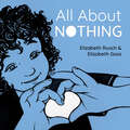
All About Nothing (All About Noticing)
by Elizabeth RuschAn artful picture book exploration of negative space and the beauty of nothingness. This mindful meditation encourages children to see the world differently.Nothing is really something! What might be hidden in the space around things, and how is that space important? In art, this is known as negative space, but &“nothing&” can be thought of more broadly—as free time during the day or the space between people. When we allow ourselves a moment of nothingness, we make room for creativity and so much more.
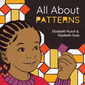
All About Patterns (All About Noticing)
by Elizabeth RuschAn enlightening picture book exploration about how patterns fill and shape our everyday lives. This mindful meditation challenges kids to see the world differently.What do you know about patterns? There are simple alternating patterns and more complex ones that spin and spread out. There are patterns in stories and patterns in music. When you dance, you're making patterns with your whole body.You might even notice a comforting pattern to your day. When that pattern is broken, everything can feel chaotic. But sometimes breaking a pattern can make room for a new one worth repeating!A thought-provoking and visually stunning exploration of the math, art, and emotion of patterns.
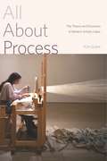
All About Process: The Theory and Discourse of Modern Artistic Labor
by Kim GrantIn recent years, many prominent and successful artists have claimed that their primary concern is not the artwork they produce but the artistic process itself. In this volume, Kim Grant analyzes this idea and traces its historical roots, showing how changing concepts of artistic process have played a dominant role in the development of modern and contemporary art. This astute account of the ways in which process has been understood and addressed examines canonical artists such as Monet, Cézanne, Matisse, and De Kooning, as well as philosophers and art theorists such as Henri Focillon, R. G. Collingwood, and John Dewey. Placing “process art” within a larger historical context, Grant looks at the changing relations of the artist’s labor to traditional craftsmanship and industrial production, the status of art as a commodity, the increasing importance of the body and materiality in art making, and the nature and significance of the artist’s role in modern society. In doing so, she shows how process is an intrinsic part of aesthetic theory that connects to important contemporary debates about work, craft, and labor. Comprehensive and insightful, this synthetic study of process in modern and contemporary art reveals how artists’ explicit engagement with the concept fits into a broader narrative of the significance of art in the industrial and postindustrial world.
All About Process: The Theory and Discourse of Modern Artistic Labor
by Kim GrantIn recent years, many prominent and successful artists have claimed that their primary concern is not the artwork they produce but the artistic process itself. In this volume, Kim Grant analyzes this idea and traces its historical roots, showing how changing concepts of artistic process have played a dominant role in the development of modern and contemporary art.This astute account of the ways in which process has been understood and addressed examines canonical artists such as Monet, Cézanne, Matisse, and De Kooning, as well as philosophers and art theorists such as Henri Focillon, R. G. Collingwood, and John Dewey. Placing “process art” within a larger historical context, Grant looks at the changing relations of the artist’s labor to traditional craftsmanship and industrial production, the status of art as a commodity, the increasing importance of the body and materiality in art making, and the nature and significance of the artist’s role in modern society. In doing so, she shows how process is an intrinsic part of aesthetic theory that connects to important contemporary debates about work, craft, and labor.Comprehensive and insightful, this synthetic study of process in modern and contemporary art reveals how artists’ explicit engagement with the concept fits into a broader narrative of the significance of art in the industrial and postindustrial world.
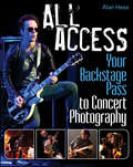
All Access
by Alan HessAdvice, inspiration, and insight for taking remarkable concert photosConcert photography poses a unique set of challenges to photographers, including night or low-light, inconsistent stage lighting, a moving subject matter, limitations on vantage point, complex exposure situations, and no chance for re-takes. Compounded with those hurdles is a lack of resources on this subject?until now. All Access: Your Backstage Pass to Concert Photography fills this gap and provides you with all the information you need to know, from choosing the right gear and camera settings to negotiating rights to publish or share photos as well as how to best edit your photos in post-production. Reveals essential techniques and valuable best practices for dealing with the unique challenges of concert photographyFeatures more than 200 stunning concert photographs to inspire you and illustrate the tips and techniques the author describesWritten by experienced author and well-known concert photographer Alan HessAll Access: Your Backstage Pass to Concert Photography is an ideal resource if you are determined to learn the skills necessary to capture clear, well-composed, and professional-level concert photos.
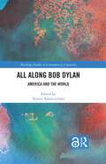
All Along Bob Dylan: America and the World (Routledge Studies in Contemporary Literature)
by J. Roger KurtzAll Along Bob Dylan: America and the World offers an important contribution to thinking about the artist and his work. Adding European and non-English speaking contexts to the vibrant field of Dylan studies, the volume covers a wide range of topics and methodologies while dealing with the inherently complex and varied material produced or associated with the iconic artist. The chapters, organized around three broad thematic sections (Geographies, Receptions and Perspectives), address the notions of audience, performance and identity, allowing to map out the structure of feeling and authenticity, both, in the case of the artist and his audience. Taking its cue from the collapse of the so-called high-/ low culture split following from the Nobel Prize, the book explores the argument that Dylan (and all popular music) can be interpreted as literature and offers discussions in the context of literary traditions, or visual culture and music. This contributes to a nuanced and complex portrayal of the seminal cultural phenomenon called Bob Dylan.
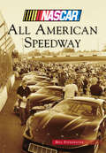
All American Speedway
by Bill PoindexterIt began as a rodeo arena with bucking broncos entertaining an annual gathering for the Placer County Fair in Roseville, California, about 10 miles east of Sacramento. The rodeo grounds eventually gave way to a different kind of horsepower in 1955, when a dirt track was built. The original Roseville Speedway later became All American Speedway. The surface was paved in 1972, and three years later, its signature race, the Rose Classic, was born. Future NASCAR drivers Ernie Irvan, Mike Skinner, and more visited the track. The Rose Classic went away in the early 1990s, but NASCAR Whelen All-American Series action lives on each year.
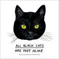
All Black Cats are Not Alike
by Peter Arkle Goldwasser AmyEvery cat owner knows that no two cats are alike. This pitch-perfect illustrated book proves this simple fact by diving whiskers first into the unique personality, charisma, and character of 50 real all-black cats. From Alfie, who "has no tolerance for wet humans or being ignored," to Sashi, who "enjoys freeze-dried chicken by candlelight and full-on body rubs," each cat comes to life through a lovingly hand-drawn portrait and quick-witted profile. Delightfully quirky and utterly charming, this motley crew of black cats will win over anyone with a dry sense of humor.
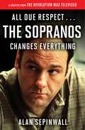
All Due Respect ... The Sopranos Changes Everything
by Alan Sepinwall"The Sopranos is the one [show] that made the world realize something special was happening on television. It rewrote the rules and made TV a better, happier place for thinking viewers, even as it was telling the story of a bunch of stubborn, ignorant, miserable excuses for human beings" (From All Due Respect…The Sopranos Changes Everything). In this chapter from the critically acclaimed book The Revolution Was Televised, Alan Sepinwall explores why The Sopranos was critical to ushering in a new golden age in television. Drawing on a new interview with creator David Chase, Sepinwall weaves fascinating behind-the-scenes details about the show with his trademark incisive criticism—including his theory on the controversial series finale.
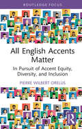
All English Accents Matter: In Pursuit of Accent Equity, Diversity, and Inclusion (Routledge Studies in Sociolinguistics)
by Pierre Wilbert OrelusOrelus' valuable study draws on the scholarly work of sociocultural and postcolonial theorists, as well as testimonies collected from study participants, to explore accentism, the systemic form of discrimination against speakers whose accents deviate from a socially constructed norm. Orelus examines the manner in which accents are acquired and the effects of such acquisition on the learning and educational experiences of linguistically and culturally diverse students. He goes on to demonstrate the ways and the degree to which factors such as race, class, and country of origin are connected with nonstandard accent-based discrimination. Finally, this book proposes alternative ways to challenge and counter the accentism that minority groups, including linguistically and culturally diverse groups, have faced in schools and in society at large. It will be of interest to all of those concerned with linguistic/accent-based prejudice and the experience of those who face it.
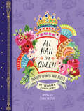
All Hail the Queen: Twenty Women Who Ruled
by Jennifer LewisDiscover twenty true stories of royal intrigue, power, and passion, brought to life through the gorgeous illustrations of Jennifer Orkin Lewis and the witty words of Shweta Jha. From Cleopatra to Empress Wu Zetian, Marie Antoinette to Queen Liliuokalani of Hawaii, these extraordinary female monarchs from all over the world have captured imaginations throughout the ages. With a deluxe foil-spangled two-piece case, this elegant and diverse celebration of women in charge makes the perfect Mother's Day or girlfriend go-to gift for the queen in our lives.
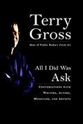
All I Did Was Ask: Conversations with Writers, Actors, Musicians, and Artists
by Terry Gross"I'm Terry Gross and this is Fresh Air . . ."Now available in paperback--a selection of revealing interviews from the award-winning National Public Radio showOriginating from WHYY-FM in Philadelphia and heard on more than 450 NPR stations, Fresh Air with Terry Gross has become a daily habit with millions of listeners nationwide--a must for anyone hoping to keep up with what's happening in the arts. Over the last twenty years, Terry's guests have included our most significant writers, actors, musicians, comics, and visual artists.For her first collection, Terry has chosen more than three dozen timeless interviews that prove to be as lively on the page as they were on the radio. Her questions--probing yet sensitive--encourage revelations from figures as diverse as John Updike, Isabella Rossellini, Conan OBrien, Samuel L. Jackson, Johnny Cash, and Nicolas Cage. And in her introduction, the generally self-effacing host of Fresh Air does something she wouldnt dream of doing on the air--she reveals a thing or two about herself.
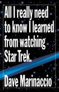
All I Really Need to Know I Learned from Watching Star Trek
by Dave MarinaccioHow to win at poker. The power of a business's mission statement. If you can dial a telephone, you can do anything. These are the lessons to be learned from "Star Trek." First a hit television show, and then a pop culture phenomenon, "Star Trek" is now the basis for inspiration and guidance in our daily lives. ALL I REALLY NEED TO KNOW I LEARNED FROM WATCHING STAR TREK is an anthology of valuable lessons that can be found within the episodes of "Star Trek." Discover why its dangerous to wear a plain red shirt, why Captain Kirk was such a superb leader, and why you should always help people in need.
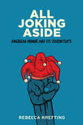
All Joking Aside: American Humor and Its Discontents
by Rebecca KreftingA professor of American Studies—and stand-up comic—examines sharply focused comedy and its cultural utility in contemporary society.Outstanding Academic Title, ChoiceIn this examination of stand-up comedy, Rebecca Krefting establishes a new genre of comedic production, "charged humor," and charts its pathways from production to consumption. Some jokes are tears in the fabric of our beliefs—they challenge myths about how fair and democratic our society is and the behaviors and practices we enact to maintain those fictions. Jokes loaded with vitriol and delivered with verve, charged humor compels audiences to action, artfully summoning political critique. Since the institutionalization of stand-up comedy as a distinct cultural form, stand-up comics have leveraged charged humor to reveal social, political, and economic stratifications. All Joking Aside offers a history of charged comedy from the mid-twentieth century to the early aughts, highlighting dozens of talented comics from Dick Gregory and Robin Tyler to Micia Mosely and Hari Kondabolu. The popularity of charged humor has waxed and waned over the past sixty years. Indeed, the history of charged humor is a tale of intrigue and subversion featuring dive bars, public remonstrations, fickle audiences, movie stars turned politicians, commercial airlines, emergent technologies, neoliberal mind-sets, and a cavalcade of comic misfits with an ax to grind. Along the way, Krefting explores the fault lines in the modern economy of humor, why men are perceived to be funnier than women, the perplexing popularity of modern-day minstrelsy, and the way identities are packaged and sold in the marketplace.Appealing to anyone interested in the politics of humor and generating implications for the study of any form of popular entertainment, this history reflects on why we make the choices we do and the collective power of our consumptive practices. Readers will be delighted by the broad array of comic talent spotlighted in this book, and for those interested in comedy with substance, it will offer an alternative punchline.
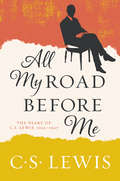
All My Road Before Me: The Diary of C. S. Lewis, 1922-1927
by C. S. LewisA repackaged edition of the revered author’s diary from his early twenties—a thought-provoking work that reveals his earliest thinking about war, atheism, religion, and humanity.While serving his country in the Great War, C. S. Lewis’ the great British writer, scholar, lay theologian, broadcaster, and Christian apologist—made a pact with a close friend and fellow soldier. If one of them died, the survivor would take care of his family—a promise Lewis honored. Developing a deep friendship with his fallen friend’s mother, Jane King Moore, Lewis moved into the Moore household after the war. Returning to Oxford, the twenty-three-year old Lewis—then a staunch atheist—struggled to adapt to life in post-war England. Eager to help the tormented young man, Jane encouraged him keep a diary of his day-to-day life. Those reflections are collected in this illuminating journal. Covering five remarkable years in Lewis's life, All My Road Before Me charts the inspirations and intellectual and spiritual development of a man whose theology and writing—including Mere Christianity, The Screwtape Letters, The Great Divorce, The Chronicles of Narnia, and many other beloved classics—has had immense influence on the Christian world.
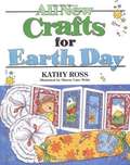
All New Crafts for Earth Day
by Kathy RossPresents over twenty simple craft projects for Earth Day that young children can make from everyday materials.
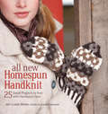
All New Homespun Handknit: 25 Small Projects to Knit with Handspun Yarn
by Amy Clarke MooreA follow-up to the original Homespun Handknit - a perennial bestseller for two decades - this collection revitalizes the craft of handspun yarn for a whole new generation of spinners and knitters. Packed with modern and traditional spinning know-how and 25 sophisticated, easy-to-learn projects, the guide helps crafters create unique gifts and wearable fashion while refining their skills and enhancing their understanding of this popular art form. With designs from some of the most influential knitters and spinners working today - including Kathryn Alexander, Jeanine Bakridges, and Abby Franquemont - this inspiring resource features hats, mittens, scarves, socks, bags, children's items, wraps, and home décor options to challenge fiber artists of all skill levels. Imparting essential and informative advice - on measuring yarns, reviewing woolen versus worsted, drive/tension differences, special techniques, and basic yarn dynamics - and complemented by basic knitting and spinning glossaries, this refreshing contemporary companion to a much-loved classic is an indispensable addition to every craft lover's bookshelf.
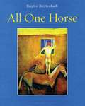
All One Horse
by Breyten BreytenbachAll One Horse is a marvel-filled journey through Breyten Breytenbach's kaleidoscopic imagination. The electrifying colors and penetrating images of his paintings converse with his lyrical and satirical dream-fables. These visions and parables emerge from a mélange of cultures and traditions: African and Eastern thought, the spirit world, and the spheres of visual art, philosophy, history and politics. Breytenbach's watercolors communicate in hieroglyphs, where private conversation embraces myth and dream. These reflections and images - clear and complex at once - are cries for human dignity and justice, are truth disguised as play. With octopus-like grace, Breytenbach pulls together worlds and watches them dance and struggle together; echoes of Afrikaans haunt his English, the fantastic melds into the quotidian, love glimmers beneath rage, the immediate rises to the universal.
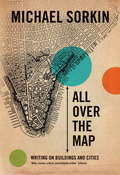
All Over the Map
by Michael SorkinRobert Hughes once described Michael Sorkin as "unique in America--brave, principled, highly informed and fiercely funny." All Over the Map confirms all of these superlatives as Sorkin assaults "the national security city, with its architecture of manufactured fear."
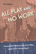
All Play and No Work: American Work Ideals and the Comic Plays of the Federal Theatre Project
by Paul GagliardiMany of the Federal Theatre Project (FTP) plays Paul Gagliardi analyzes in All Play and No Work feature complex portrayals of labor and work relief at a time when access to work was difficult. Gagliardi asks, what does it mean that many plays produced by the FTP celebrated forms of labor like speculation and swindling? All Play and No Work directly contradicts the promoted ideals of work found in American society, culture, and within the broader New Deal itself. Gagliardi shows how comedies of the Great Depression engaged questions of labor, labor history, and labor ethics. He considers the breadth of the FTP’s production history, staging plays including Ah, Wilderness!, Help Yourself, and Mississippi Rainbow. Gagliardi examines backstage comedies, middle-class comedies, comedies of chance, and con-artist comedies that employed diverse casts and crew and contained radical economic and labor ideas. He contextualizes these plays within the ideologically complicated New Deal, showing how programs like the Social Security Act straddled progressive ideals and conservative, capitalist norms. Addressing topics including the politicization of theatrical labor and the real dangers of unchecked economic con artists, the comic plays of the FTP reveal acts of political resistance and inequality that reflected the concerns of their audiences.
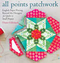
All Points Patchwork: English Paper Piecing beyond the Hexagon for Quilts & Small Projects
by Diane GillelandThe key to perfect patchwork is getting all of the points to match up — which is no easy feat! Set yourself up for success with the rediscovered technique of English paper piecing. Using paper templates to guide your pattern, you can expertly fit your quilting shapes together before you even start sewing. All Points Patchwork takes you far beyond traditional hexagons and accommodates triangles, diamonds, octagons, and even curved shapes. Simple instructions for decorating clothing, bedding, and home decor open up astounding possibilities for quilters of all levels.
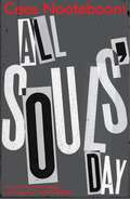
All Souls' Day
by Cees Nooteboom"An outstanding addition to an impressive oeuvre" Times Literary SupplementArthur Daane, a documentary film-maker and inveterate globetrotter, wanders the streets of Berlin, a city whose recent past provides the perfect backdrop for his reflections on life and the universe as he collects images for his latest project - a film that will show the world through his eyes.With his circle of friends - a philosopher, a sculptor and a physicist - Daane discusses everything from history to metaphysics and the meaning of our contemporary existence, often over a hearty meal. Then, one cold winter's day, Daane meets the history student Elik Oranje and his world is turned upside down. And when she unexpectedly leaves the city for Spain, Daane is compelled to follow.All Souls' Day is an elegiac love story, a poignant and affecting tale in which the city of Berlin plays a prominent role, by one of Europe's major contemporary writers.Translated from the Dutch by Susan Massotty"Displays with admirable lucidity the workings of a humane, civilized, and consistently interesting mind" Kirkus Reviews"One of the most remarkable writers of our time" ALBERTO MANGUEL