- Table View
- List View
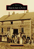
Around Ovid (Images of America)
by Ovid Historical SocietyOn land freed from American Indians upon the orders of George Washington, the town of Ovid was formed in 1794, after military lots were numbered by Simeon DeWitt and his assistants. In 1860, construction was completed on three brick buildings that became known as the Three Bears, which served as the town's courthouse, eventually served as the Seneca County Seat, and now serve as the Town of Ovid municipal offices. Gradually, more settlers came, cleared land, built roads, started businesses, and founded churches and schools. Bordered by the Seneca and Cayuga Lakes, where barges were used to transport goods, the town developed a vibrant farming community with productive orchards and vineyards. Tourism flourished, and summer homes were built by those looking to escape the city. One of these summer homes was that of Herman Westinghouse, who worked together with his brother George Westinghouse on their company's myriad inventions.
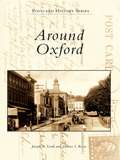
Around Oxford
by Joseph A. Lordi Dolores I. RoweAround Oxford features vintage postcards and photographs from Oxford and the surrounding area, including Lincoln University--the oldest African American institution of higher learning in America--and Nottingham. With the arrival of the Philadelphia-to-Baltimore railroad in 1860, Oxford began to grow and prosper. Because the area is one of the most fertile regions of Pennsylvania, it became a major agricultural center. Along with carriage and candy making, the surrounding area produced important industries, including chrome and magnesium mining, pottery making, and the quarrying of limestone.
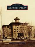
Around Perry
by Christina B. NolanFertile land, waterpower, energetic residents, and a sea serpent all contributed to the growth of the town and village of Perry. The town of Perry was first settled in 1807, and later took the name of Commodore Oliver Hazard Perry, the hero of the War of 1812. Early mills along Silver Creek provided materials for the growing village, which was incorporated in 1830. Perry made headlines in 1855, when a sea serpent was sighted on Silver Lake and people flocked to the area. The mystery went unsolved until remains of the hoax were found in the ashes of the Walker House in 1857. Perry continued to grow, with Main Street businesses changing with the needs of residents. Later industries replaced the early mills, and immigrants arrived to work in the textile factories. Educational, religious, and civic buildings were added to the community, and farms grew in the countryside.
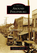
Around Philipsburg (Images of America)
by Dennis Mcgeehan Debra Schnarrs McgeehanPhilipsburg is a community on the Moshannon Creek, which flows east off the Allegheny Mountains in central Pennsylvania. The region was blessed with rich seams of bituminous coal that have provided the area with employment and prosperity. With interests in Philadelphia, the Philips brothers of England founded a colony in the wilds of frontier Pennsylvania in 1797. A gristmill, sawmill, iron forge, and screw factory began the taming of the wilderness. The Philips brothers eventually returned to England over political differences, but the town they founded carried on. Coal, timber, clay, railroads, and metal fabrication have created a community intensely proud of its history. Prone to flooding, the Moshannon Creek divides Centre and Clearfield Counties. This collection of photographs includes communities on both sides of the creek, highlighting the area's people, industry, commerce, architecture, and famous visitors to the town.
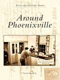
Around Phoenixville (Postcard History Series)
by Vincent Martino Jr.The small town of Phoenixville has a multifaceted industrious past that developed around the Phoenix Iron Company, the silk mill, and the Byrne Knitting Mill. It grew steadily through an influx of European immigrants drawn to the area by the promise of work. This growth resulted in Phoenixville's many cultural institutions, such as the Knights of Columbus, the St. Anna Italian Club, and the Holy Trinity Church. The vintage postcards in Around Phoenixville depict the people, places, and events that have shaped the community's rich history and heritage, with images of such landmarks as the Phoenix Hotel, the West End Fire Company, and the construction of the Gay Street Bridge.
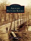
Around Picture Rocks (Images of America)
by Sherry A. GardnerWhen the Sprout and Burrows families purchased what became Picture Rocks for $2,500 in October 1848, the land was considered worthless. The town consisted of a single house and a sawmill that sat at the bend of Muncy Creek. The mill produced window sashes and doors that were in demand for new homes being built in the West Branch Valley. In 1856, S. H. Burrows began manufacturing furniture. Then in the early 1850s, a chapel was built in eight days so that the Baptist community had a place to worship. Around Picture Rocks documents the evolution of this section of Lycoming County. Among the many original structures featured in the book is part of the old Handle and Excelsior building that still greets visitors as they cross the Muncy Creek.
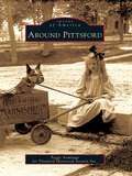
Around Pittsford (Images of America)
by Peggy Armitage Pittsford Historical Society Inc.Winding north through Pittsford, Otter Creek has powered the lumber, grain, and marble mills essential to this region since 1770. Chittenden lies east of Pittsford, on the west flank of the Green Mountains, where iron and manganese deposits supplied Pittsford's iron industry. To the south, Pittsford and Proctor share deep marble formations that support the economies of both towns. The first settlers were farmers drawn to the valley's fertile soil and mountain forests. They were joined by lumber barons, lawyers, merchants, and artists. European and French Canadian immigrants soon followed and farmed, built the railroad, or quarried and carved marble. Closely linked by the industries that helped build them, these communities have evolved into today's thriving hometowns of workers in Rutland.
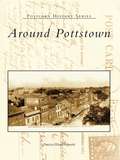
Around Pottstown
by Patricia Wanger SmithAround Pottstown travels back to Pottstown's golden era. Since its founding in 1752, Pottstown has had a catalytic effect on the surrounding area with its industrial and commercial growth during the nineteenth and twentieth centuries. The horse and wagon gave way to new transportation methods, such as canal boats, railroads, and bridges, which afforded connections to the world market. Most importantly, this collection of vintage postcards shows Pottstown's citizens through the places where they shopped, went to school, worshiped, and celebrated life.

Around Randolph Township and Guys Mills
by Cheryl Seber WeiderspahnThe first frontier settlement in what is now Randolph Township took place in 1795 when a handful of brave pioneers overcame incredible odds to settle in the Pennsylvania wilderness. Slowly Randolph became dotted with small clearings, followed by self-sufficient farms. Ambitious tradesmen sold services, and scores of businesses sprouted up. Schools and churches followed as the crossroads of Guys Mills, Black Ash, Mount Hope, Brawley Stand, and Hickory Corners flourished, attracting men of influence. Rev. Timothy Alden, founder of Allegheny College, was pastor of Guys Mills Congregational Church. Famed abolitionist John Brown walked six miles to church in Guys Mills. During the great oil boom, John D. Rockefeller investigated the town's oil wells. Pennsylvania senator Raymond E. Smith resided here. Black Ash's Clint Brown enjoyed a 15-year major-league pitching career with the Cleveland Indians and Chicago White Sox and held a major-league record.
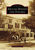
Around Remsen and Steuben (Images of America)
by Megan Plete PostolThe first settlers of the rugged wilderness that became the towns of Remsen and Steuben were hearty pioneers, Welsh immigrants, and a famous Revolutionary War hero. The untamed forest of Oneida County proved challenging but not insurmountable for Remsen’s first settler Barnabas Mitchell and the noble Friedrich Wilhelm August Heinrich Ferdinand Steuben, who was famed with being the sturdy backbone of Washington’s Continental Army and known as the “Drillmaster of the Revolution.” The area flourished into a place of farming, manufacturing, business, and religion. Settlers ranged from rollicking woodsmen to large working families to pious pastors. There were so many churches that the lands of Steuben became known as “the singing hills.” It has been said that the courage of a Welshman rises in proportion to the obstacles thrown in his path. This book strives to tell their tales through visuals of old Remsen and Steuben.
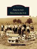
Around Selinsgrove (Images of America)
by Jim CampbellWhile Selinsgrove is typical of the many towns located along the shores of the Susquehanna River, it has cultivated its own identity as the home of Susquehanna University, founded in 1858 as the Missionary Institute and later becoming one of the nation's first coeducational colleges. Prior to the Pennsylvania Canal, several Selinsgrove mills were vital in the worldwide flour trade, where wheat was ground into flour and floated on arks downriver to Baltimore. For most of the 20th century, Rolling Green Park was a leading recreational attraction, and for over 60 years the Selinsgrove Speedway's sprint car races have caused spectators to hail it as "the fastest half-mile dirt track in the East." What truly makes Selinsgrove and the surrounding area prominent is the unique individuals that have marked its history. Through more than 200 photographs, many previously unpublished, Around Selinsgrove depicts the places and people who have made these communities into what they are today.
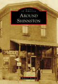
Around Shinnston
by Robert P. Bice IIISurrounding the West Fork River and its tributaries, the communities in northern Harrison County are rich in both history and pride. With an abundance of natural resources, such as coal and oil, the areas featured in Around Shinnston developed into industries that brought growth and commerce. Many of these towns were named for the coal companies that established mines there, including Gypsy and Owings. Viropa was named for Virginia, Ohio, and Pennsylvania, while Wyatt, previously called Goosetown, was renamed to honor a local physician. Big Elm once carried the roots of the largest water elm tree on record, and Enterprise was a large Indian territory. Shinnston is the largest community in Clay District (third largest in Harrison County) and is home to the oldest structure in this part of the state. These areas were the "heart of the Bituminous Coal Fields" and today take pride in their history.
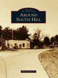
Around South Hill
by John Caknipe Jr.South Hill was formerly located on the old Buckhorn Road near the Meherrin River. It was the site of the first chartered school in Mecklenburg County in 1814. When the founder/teacher/minister/postmaster died in 1857, many from the community relocated 3 miles east to the Boydton-Petersburg Plank Toll Road. In 1888, W. W. "Buck" Harris, a local wheelwright and landowner at Piney Pond and Plank Road, died. At auction, 55 acres of his property were purchased, platted, and parceled for sale by A. E. Batemen and Charles Peck to establish a new South Hill community, which surrounded the Atlantic-Danville Railroad depot. Following this, South Hill became known as the town of highways. With each new highway came significant changes for the town and county.
Around Squam Lake (Images of America)
by Bruce D. HealdLocated in the foothills of the White Mountains, Squam Lake was not discovered by English settlers until the mid-1700s. However, the lake area had long been inhabited by the Abenaki Nation of the Algonquin Federation. These people called the waters Kees-ee-hunk-nip-ee, meaning "goose lake in the highlands" (later shortened to Kusumpy or Casumpa) and also Asquam, meaning "water." The latter name was eventually shortened to become Squam Lake. With more than two hundred rare images, Around Squam Lake celebrates the beauty, the geology, and the history of Squam Valley. The book includes early Native American lore and the gradual development of what are known as the Five Towns-namely, Moultonboro, Sandwich, Holderness, Center Harbor, and Ashland. It reflects upon "big" Squam Lake and Little Squam Lake (where On Golden Pond was filmed), highlighting the shoreline points and coves, the succession of islands that dot the surface, and the surrounding mountains, which include the Squam Mountain range, the Sandwich range, and Red Hill, which rises at the head of the valley.
Around St. Clair
by St. Clair Community and Historical SocietySt. Clair lies in a narrow valley rich with anthracite resources. The town was born around 1831, during the great hard coal boom in northeast Pennsylvania. Over the years the town expanded to surrounding areas or patches known as Arnouts Addition, Wadesville, Dark Water, New Castle, Mount Laffee, Crow Hollow, Ravensdale, Lorraine, Diener's Hill, East Mines, and Mill Creek. People came from these areas to work in the mines, railroads, and supporting industries. As the demand for coal increased, the town grew to a high point of 7,000 residents. The decline of the coal industry also brought the decline of the railroads, and the population of St. Clair fell. The photographs in Around St. Clair show the fortitude of its people; the notable residents who have gained national acclaim for their achievements in the labor movement, medical field, and professional sports; and the diverse cultures that make up the town.
Around Surry County (Black America Series)
by Evelyn Scales ThompsonFrom slavery in the 1800s to freedom in the 1950s, Black America Series: Around Surry County traces the footsteps of African Americans through their transition from house servants and field hands to land owners, farmers, andsuccessful small business proprietors. This detailed pictorial history celebrates and honors the strong faith, courage, and determination of the Surry County area's black community.
Around Swanzey: Swanzey, Ashuelot, Winchester, Richmond, Fitzwilliam, and Hinsdale (Images of America)
by Pamela Apkarian-RussellNestled against the Massachusetts and Vermont borders are six New Hampshire communities largely unconnected with the rest of their home state. The picturesque bedroom and summer vacation communities of Swanzey, Ashuelot, Winchester, Richmond, Fitzwilliam, and Hinsdale all developed from industrial or agricultural economies, although this fact is less than apparent today. The factories have nearly all vanished, and so has the extreme wealth and glamorous lifestyle of former residents like playwright Denman Thompson. Routes 10 and 12 are still the main roads that connect these towns, however, and the Ashuelot River is slowly recovering from years of pollution in a return to its pure and natural state. In fact, the area's Old Homestead persona seems to have experienced a revival in recent years in the absence of major industry, and it becomes more and more important for residents and tourists alike to be reminded of the area's nineteenth-century economic development.
Around Sylvan Beach (Images of America)
by Brandy AnnOn the sandy shores and calm waters of Oneida Lake rests Sylvan Beach. For many years, the entire region was simply known as Fish Creek, and it was settled by George Haskins in the early 1800s. When the Erie Canal was completed in 1825, the area began to flourish. James D. Spencer arrived in the hamlet of Fish Creek in the 1840s and settled near Wood River and the Oswego Midland Railroad station. In the 1870s, he began to develop the sandy shores along Oneida Lake, and the first visitors to Spencer's Grove arrived in August 1878. Sylvan Beach received its name in the spring of 1886, when the New York, Ontario and Western Railroad built a loop into Spencer's Grove. Sylvan Beach continued to thrive with the addition of the railway station, allowing the shipment of produce and lumber as well as the arrival of large numbers of vacationers. These vintage images chronicle the history of Sylvan Beach and its surrounding communities, illustrating the region's strong link to the vast history of America.
Around Terlingua
by Robert E. Wirt Thomas C. AlexThe origin of the name "Terlingua" is obscure and lost in time. For the past century and a half, the area covered by the name has expanded to include numerous concentrations of people engaged to varying degrees in ranching, farming, and mining, or the support thereof. Farmers and ranchers produced agricultural products, woodcutters supplied timbers for the mines or fuel for the furnaces, and storekeepers supplied the goods needed for sustenance of this diverse community that was spread over much of south Brewster County in West Texas. Hispanic people who began settling the region in the 18th century were the backbone of the mining industry. Many of the families here today are descendants of the mine workers and continue contributing to the community. This story tells of the establishment and abandonment of Terlingua following the rise and decline in demand for mercury and how the ghost town was resurrected in the 20th century.
Around Three Mile Bay (Images of America)
by Elaine T. BockThree Mile Bay, located just below the Canadian border in the town of Lyme, was settled between 1810 and 1820. Early immigrants from Canada and Europe were drawn by the abundance of water-powered mills and factories along the area's waterways. At the mouth of Three Mile Creek stood the sawmill of Peter and Richard Estes, built in 1820; from 1860 to the 1900s, limestone quarried in the Three Mile Bay area was known for its superior quality. Resident Asa Wilcox built 48 brigs, propellers, schooners, and other seafaring vessels from 1835 to 1853, some ultimately joining the approximately 500 shipwrecked vessels now resting at the bottom of Lake Ontario. Fishing and selling potash were often carried on by farmers as side ventures. When loads of potash, and occasionally wheat, were hauled to Albany, on the return trip merchandise was brought back to be sold in local stores. For generations, families developed their trades and helped to sustain the hard-working people of the hamlet of Three Mile Bay.
Around Trona and Searles Valley
by Russell L. Kaldenberg James L. Fairchild Searles Valley Historical SocietyTrona was once the most populous community in the Upper Mojave Desert. Originally explored by the Death Valley 49ers in 1850, Searles Valley was formed by remnants of the Owens River Lakes. The small towns of Borosolvay, Magnesium, Burnham, and Slaterange City prospered for a period before fading. Homewood Canyon, Westend, Argus, Pioneer Point, and Trona continue to provide pleasant housing for Searles Valley residents. The valley is dominated by mining history, and Searles Valley Minerals still produces products for worldwide markets. Wyatt Earp played cards and gambled at Poeville and was arrested in 1910 in Searles Valley for claim jumping. In 1913, Stafford Wallace Austin helped create the planned town of Trona. Amelia Earhart's husband, George Putnam, died at the Trona Hospital in 1950. Sit down and enjoy the jaunt through some of the most interesting history in the West.
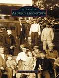
Around Uniontown
by Victoria Dutko LeonelliOnce scattered with frontier forts and Native American paths, Uniontown has changed considerably since Henry Beeson, a Virginia Quaker, offered fifty-four lots for sale on July 4, 1776. Around Uniontown captures this history with nearly two hundred vintage images culled from personal collections and the Uniontown Public Library's archives. In these pages, revisit 1896, when Uniontown had its greatest patriotic festivity. View beautiful tree-lined streets with the magnificent homes of coal barons. Visit the "patch towns," and meet the people who lived and worked during the booming coal and coke era. Witness the sensational Polly Williams murder trial, and learn about some of the unique individuals who have called Uniontown home, such as Gen. George C. Marshall, David Blythe, and "Crazy Billy."
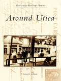
Around Utica (Postcard History Series)
by Evelyn R. EdwardsAround Utica features the work of A. J. Manning, who traveled with his camera through picturesque central New York in the early 1900s. Manning recorded historic events, such as Sherman Notification Day in 1908, honoring William Howard Taft's vice presidential nominee James Schoolcraft Sherman; catastrophes, such as the fires at Utica Free Academy and the YMCA; and nostalgic scenes of everyday life. His images were produced in small quantities as real-photo postcards, which today are quite rare and much sought after by collectors.
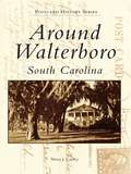
Around Walterboro, South Carolina
by Sherry J. CawleyWalterboro is a city of beautiful, living memories, with Old South plantations dotting its surrounding countrysides and peaceful scenes graced by Spanish moss swaying gently from hundred-year-old live oak trees. Established as a summer haven for rice planters from lower Colleton County in 1784, Walterboro served a similar purpose from the 1920s to the 1950s, when it was "The Place" to stop for anxious vacationers making the trek from New York to Florida. Around Walterboro hopes to recapture those earlier days when Walterboro's main commercial ingredients were made up of family-owned businesses located along two-lane highways instead of today's chain motels and fast food restaurants stationed along the exits on expressways. This volume allows the reader to walk down dusty, shady country roads, examine the exteriors and explore the interiors of some of Colleton County's most historic buildings, and stroll along the avenues of downtown Walterboro and the beaches of Edisto Island.
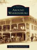
Around Warrensburg (Images of America)
by John T. Hastings Warrensburgh Historical SocietyWilliam Bond became the first Warrensburg settler, when he arrived in the Echo Lake area, in 1787. Shortly thereafter, Warrensburg became known as "the Bridge" because it was the location of the only bridge in the area that crossed the Schroon River. In February 1813, the town of Warrensburg was formed from part of Thurman. By the mid-1800s, A. C. Emerson and B. P. Burhans had moved to Warrensburg and begun to harness the waterpower of the Schroon River and utilize the nearby timber resource. The Emerson sawmill and Burhans's tannery and gristmill provided employment and capital to support a growing and thriving town. Other industries, such as a woolen mill and pants factory, sash and blind factory, shirt factory, and shoe peg factory, soon followed. With the dawn of the 20th century, improved transportation in the form of railroads and the automobile began bringing more people to Warren County. This trend continues today as numerous visitors summer in the Adirondacks to enjoy the clean air and water of the north country.