- Table View
- List View
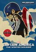
Phase Two: The Winter Soldier
by Alex IrvineAfter the Avengers save the planet from Loki and the Chitauri at the Battle of New York, Captain America is working for S.H.I.E.LD. in Washington, DC. He soon realizes adjusting to the modern world is the least of his worries when the integrity of the agency is compromised and Director Nick Fury is attacked by an elusive assassin. Now a fugitive from his former allies, Captain America must get to the bottom of the international conspiracy and the identity of the mysterious Winter Soldier. For the first time in print, experience the excitement of the complete cinematic story of Marvel's Captain America: The Winter Soldier. © 2016 MARVEL. All rights reserved.

Phatkyachi Shiksha
by Tara ChaudhariThere was one obedient servant in the king's dormitory. The servant had a job to arrange mattresses. Once He mistakenly slept at the king’s mattress, someone complained to the king. The King gave a punishment to the servant. The Birbal to saved the life of a servant.
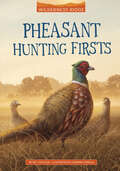
Pheasant Hunting Firsts (Wilderness Ridge)
by Art CoulsonEleven-year-old Zach Feather can't wait to go on his first pheasant hunting trip, especially when he learns his parents have a surprise for him—a new bird dog! The family travels across the state from the Cherokee reservation in eastern Oklahoma to hunt pheasant on a relative's ranch. There are more surprises—including a rattlesnake encounter—in store for Zach on his first hunt. Along the way, he learns that hunting is about more than just finding pheasants. It's also about patience and the things in life that are most important—hunting with his dog and his family.
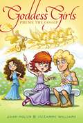
Pheme the Gossip
by Joan Holub Suzanne WilliamsGet to know Goddess Girl Pheme...the original "gossip girl"!As the goddess girl of rumor and gossip, Pheme prides herself on being "in the know" and having the most up-to-date info on anyone and everyone at Mount Olympus Academy. To make sure that people really get her VIP messages, her words tend to linger in cloud letters above her head--just in case people don't catch what she says! But not everyone is thrilled with Pheme's insider knowledge on everything MOA--including the Goddess Girls. Can Pheme ever be trusted? Or will this "gossip girl" find herself on the other end of the rumors?
Phenomena: 21 Extraordinary Stories (Critical Reading Series)
by Henry Billings Melissa BillingsThe high-interest, controlled readability Critical Reading Series contains fascinating nonfiction and exercises that build reading comprehension and critical thinking skills.
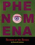
Phenomena: Secrets of the Senses
by Donna M. JacksonCan paranormal experiences help solve crimes?What makes us have chills when we go to a haunted house?Can dogs detect cancer? Your senses send your brain messages. But what do those messages say? Find out how to interpret your senses and explore ways that technology is changing the way we experience the world around us.
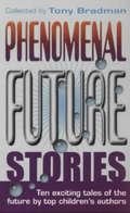
Phenomenal Future Stories
by Tony BradmanA cloned boy looking for his 'father'; the dramatic rescue of a captive tiger; the submersion of the Scottish isles in a flood; a girl who finds out why cyber-pets will never be as good as the real thing - these are among the fascinating scenarios conjured up in this world-shattering collection of original stories. Published for the new Millenium, contributing authors include such well-respected names as Jan Mark and Mary Hoffman.
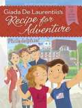
Philadelphia! (Recipe for Adventure #8)
by Giada De Laurentiis Brandi Dougherty Francesca GambatesaThe votes are in! The Bertolizzi siblings are headed to Philadelphia for their latest great culinary adventure.When Zia Donatella comes to live with the Bertolizzi family, little do Alfie and his older sister, Emilia, know what's in store for them. Zia Donatella is determined to show them how a home-cooked meal is better than even the best takeout pizza. And when Zia's plan actually transports Alfie and Emilia to famous food cities around the world, they learn firsthand how food can not only take you places but also bring you back home.In this adventure, Zia sends the entire Bertolizzi family to the city of brotherly love - Philadelphia! Known as the "birthplace of America," Philadelphia welcomes the family with its historic blend of colonial buildings, national landmarks, and equally revolutionary cuisine. Their Philadelphia tour guide, Emma, shows the family that foodie destinations like Reading Terminal Market and 9th Street have as rich a history as the Liberty Bell.
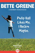
Philip Hall Likes Me. I Reckon Maybe.
by Bette GreeneBeth Lambert has a crush on Philip Hall, who is better than she is at just about everything--or is he? Philip Hall is the handsomest, smartest, fastest boy in Miss Johnson's class. He beats Beth Lambert in math, spelling, reading, sports... and she adores him. <P><P> Beth suspects Philip likes her too, only she can't quite get him to admit it. In fact, he won't even invite her to his birthday party because he's afraid the other boys will call him a sissy. But then Beth begins to wonder: Maybe Philip only wins because she's letting him. Maybe she could beat him at everything. That would show Philip Hall! Because if being friends with a girl is bad... getting beaten by a girl is much, much worse. <P> <b>Newbery Medal Honor book</b>
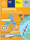
Philip's Essential School Atlas (Philip's World Atlas #25)
by Philip's Maps"An excellent world atlas. Very illuminating, good colours, clear texts...good glossary and, last but not least, up-to-date". Amazon customer review- The ideal school atlas for Key Stage 3 pupils and Scotland's National Qualifications., 11-14 years old- All updated for 2024 specifically to meet curriculum needs- Specially focused 16-page UK and Ireland section- Comprehensive 62-page world section includes thematic maps on the environment, climate change, people, quality of life, and energy- Published in association with the Royal Geographical SocietyPhilip's RGS Essential School Atlas has been specially created for lower-secondary geography students (11-14 year olds). The maps have been carefully designed to be uncluttered and easy to read, containing specially selected place names and detail. A clear set of symbols and scale information accompanies every map, with a useful introductory section covering basic atlas skills, including aerial photographs and satellite images to further explain particular features on the maps. Latitude and longitude co-ordinates are included in the index, alongside figure-letter references. Fully up-to-date, the atlas includes detailed regional maps, charts and satellite images of Europe, Italy, the Middle East, China, Japan, Kenya, USA, Brazil, and the Arctic and Antarctica. It also focuses on areas of special interest for students of geography, such as Japan's volcanoes and earthquakes, and conservation in Kenya.Philip's RGS Essential School Atlas is ideal for special project work and is available in both hardback and paperback editions.
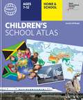
Philip's RGS Children's School Atlas (Philip's World Atlas #26)
by David Wright Jill Wright Philip's Maps Rachel Noonan"This is such a great book for primary school age children and a little beyond for finding out about the world, its countries and people" Amazon customer review- Philip's atlas, designed specially to use at home and at school with guidance for parents and teachers- Clear maps and fascinating facts bring geography to life for readers aged 7-12- Published by Philip's the UK's leading school atlas publisher, in association with the Royal Geographical Society- Quizzes, activity ideas and puzzles to make learning fun- Past winner of the Geographical Association's award for making a significant contribution to geographyThe atlas is organized spread by spread in the classic sequence: first Europe, then its land neighbour Asia, followed by Africa, Australia and Oceania, North America and South America.Illustrated with captivating full-colour photographs and packed with fact boxes, curiosities, flags, stamps and quiz questions, Philip's RGS Children's Atlas is both fun to use and easy to understand.Now in its 16th edition, Philip's RGS Children's Atlas is a past winner of the Geographical Association's award for making a significant contribution to geography. The atlas was judged "an excellent 'all round' children's atlas with simple yet well-designed maps, well-illustrated with colour photographs. It links places to issues, events and real people, giving a clear sense of place."
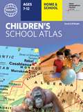
Philip's RGS Children's Atlas (Philip's World Atlas #27)
by David Wright Jill Wright Philip's Maps"This is such a great book for primary school age children and a little beyond for finding out about the world, its countries and people" Amazon customer review- Philip's atlas, designed specially to use at home and at school with guidance for parents and teachers- Clear maps and fascinating facts bring geography to life for readers aged 7-12- Published by Philip's in association with the Royal Geographical Society- Quizzes, activity ideas and puzzles to make learning fun- Past winner of the Geographical Association's award for making a significant contribution to geographyThe atlas is organized spread by spread in the classic sequence: first Europe, then its land neighbour Asia, followed by Africa, Australia and Oceania, North America and South America. Illustrated with captivating full-colour photographs and packed with fact boxes, curiosities, flags, stamps and quiz questions, Philip's RGS Children's Atlas is both fun to use and easy to understand.Now in its 17th edition, Philip's RGS Children's Atlas is a past winner of the Geographical Association's award for making a significant contribution to geography. The atlas was judged "an excellent 'all round' children's atlas with simple yet well-designed maps, well-illustrated with colour photographs. It links places to issues, events and real people, giving a clear sense of place."
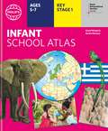
Philip's RGS Infant School Atlas: Key Stage 1 (Ages 5-7) (Philip's World Atlas #27)
by David Wright Philip's Maps Rachel NoonanWritten for 5 to 7 year-old this atlas is ideal for teaching Key Stage 1, helping to cover geography, history, science, citizenship and literacy requirements- Written by experts Professor David Wright and Rachel Noonan- Published in association with the Royal Geographical Society- 50 pages of clear, child-friendly maps showing our world today- Countries of the world brought to life with flags, illustrations and photos- Bold text, simple words and short sentences to encourage reading skills- Starts with the Earth as a Planet then zooms into each of the world's regions with maps and illustrations- Numbered balloons on each map link to photos of a real placeFully revised and updated, the atlas is for children aged 5-7 in the early stages of reading, with simple text to explain what is happening on the maps and illustrations - all compatible with National Curriculum Key Stage 1.Clear, child-friendly maps are combined with vibrant photographs and facts about the world. Guidance is given at the beginning of the atlas on how to use the maps, encouraging the early development of map skills. Each colourful spread is illustrated with photographs and packed with fact boxes, curiosities, flags, stamps and simple quiz questions. Philip's RGS Infant School Atlas is both fun to use and easy to understand. The text is simple and uncomplicated to encourage early reading skills.
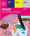
Philip's RGS Infant's School Atlas (Philip's World Atlas #27)
by David Wright Jill Wright Philip's MapsWritten for 5 to 7 year-old this atlas is ideal for teaching Key Stage 1, helping to cover geography, history, science, citizenship and literacy requirements- Written by experts Professor David Wright and Rachel Noonan- Published in association with the Royal Geographical Society- 50 pages of clear, child-friendly maps showing our world today- Countries of the world brought to life with flags, illustrations and photos- Bold text, simple words and short sentences to encourage reading skills- Starts with the Earth as a Planet then zooms into each of the world's regions with maps and illustrations- Numbered balloons on each map link to photos of a real placeFully revised and updated, the atlas is for children aged 5-7 in the early stages of reading, with simple text to explain what is happening on the maps and illustrations - all compatible with National Curriculum Key Stage 1.Clear, child-friendly maps are combined with vibrant photographs and facts about the world to provide essential geographical information for young children. Guidance is given at the beginning of the atlas on how to use the maps, encouraging the early development of map skills and knowledge of the world. Each colourful spread is illustrated with photographs and packed with fact boxes, curiosities, flags, stamps and simple quiz questions. Philip's RGS Infant School Atlas is both fun to use and easy to understand. The text is simple and uncomplicated to encourage early reading skills.
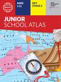
Philip's RGS Junior School Atlas (Philip's World Atlas #28)
by Philip's MapsThe 11th edition of the market-leading atlas for primary school pupils, Philip's RGS Junior School Atlas has been fully revised and updated with all the latest facts and curriculum requirements. - The essential atlas for primary schools with clear and easy-to-follow maps and diagrams - updated for 2021/22- Published in association with the Royal Geographical Society- Recommended for Key Stage 2 of the National Curriculum - and all 7-11 year olds - An excellent introduction to mapping concepts such as scale, direction, symbols, longitude and latitude- 22-page Britain and Ireland section with clear thematic charts, diagrams and large-scale regional maps- 22-page section on The World, with political maps - and thematic treatment of key themes, from volcanoes and earthquakes to transport and tourism- Continents section with physical and political maps- Easy-to-follow map references and 1,000-place indexThe market-leading atlas for pupils at primary schools, Philip's RGS Junior School Atlas is a stimulating and authoritative first introduction to the world of maps, and is recommended for Key Stage 2 of the National Curriculum.The introductory section describes the meaning of scale, how to measure distances using the maps, and explains the symbols on the maps.The following section is devoted to the United Kingdom and Ireland. Thematic maps cover topics such as mountains and rivers, climate and weather, population and cities, farming and fishing, industry and energy, transport, tourism and conservation. Regional maps of England and Wales, Scotland and Ireland complete this section.The rest of the atlas is made up of world thematic maps and world continental maps. Included are topics such as the world's climate, vegetation, agriculture, energy sources, and environmental concerns, such as global warming. A simple letter-figure index completes the atlas - a useful introduction to help the young reader find his/her way around the maps. Available in both hardback and paperback editions.
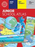
Philip's RGS Junior School Atlas (Philip's World Atlas #28)
by Philip's MapsThe 12th edition of the market-leading atlas for primary school pupils, Philip's RGS Junior School Atlas has been fully revised and updated with all the latest facts and curriculum requirements.- The essential atlas for primary schools with clear and easy-to-follow maps and diagrams - updated for 2024/2025- Published in association with the Royal Geographical Society- Recommended for Key Stage 2 of the National Curriculum - and all 7-11 year olds - An excellent introduction to mapping concepts such as scale, direction, symbols, longitude and latitude- 22-page Britain and Ireland section with clear thematic charts, diagrams and large-scale regional maps- 22-page section on The World, with political maps - and thematic treatment of key themes, from volcanoes and earthquakes to transport and tourism- Continents section with physical and political maps- Easy-to-follow map references and 1,000-place indexThe introductory section describes the meaning of scale, how to measure distances using the maps, and explains the symbols on the maps.The following section is devoted to the United Kingdom and Ireland. Thematic maps cover topics such as mountains and rivers, climate and weather, population and cities, farming and fishing, industry and energy, transport, tourism and conservation. The rest of the atlas is made up of world thematic maps and world continental maps. Included are topics such as the world's climate, vegetation, agriculture, energy sources, and environmental concerns, such as global warming. A simple letter-figure index completes the atlas. Available in both Hardback and Paperback editions.