- Table View
- List View
Frontier and Future Development of Information Technology in Medicine and Education
by James J. Jong Hyuk Park Shaozi Li Qun Jin Xiaohong JiangIT changes everyday's life, especially in education and medicine. The goal of ITME 2013 is to further explore the theoretical and practical issues of IT in education and medicine. It also aims to foster new ideas and collaboration between researchers and practitioners.
Frontier and Innovation in Future Computing and Communications
by James J. Jong Hyuk Park Albert Zomaya Hwa-Young Jeong Mohammad ObaidatIT technology engineering changes everyday life, especially in Computing and Communications. The goal of this book is to further explore the theoretical and practical issues of Future Computing and Communications. It also aims to foster new ideas and collaboration between researchers and practitioners.
Frontiers and Advances in Positive Learning in the Age of InformaTiOn (PLATO)
by Olga Zlatkin-TroitschanskaiaResearch on students’ media use outside of education is just slowly taking off. Influences of information and communication technologies (ICT) on human information processing are widely assumed and particularly effects of dis- and misinformation are a current threat to democracies. Today, higher education competes with a very diverse (online) media landscape and domain-specific content from sources of varying quality, ranging from high-quality videographed lectures by top-level university lecturers, popular-scientific video talks, collaborative wikis, anonymous forum comments or blog posts to YouTube remixes of discipline factoids and unverified twitter feeds. Self-organizing learners need more knowledge, skills, and awareness on how to critically evaluate quality and select trustworthy sources, how to process information, and what cognitive, affective, attitudinal, behavioral, and neurological effects it can have on them in the long term. The PLATO program takes on the ambitious goal of uniting strands of research from various disciplines to address these questions through fundamental analyses of human information processing when learning with the Internet. This innovative interdisciplinary approach includes elements of ICT innovations and risks, learning analytics and large-scale computational modelling aimed to provide us with a better understanding of how to effectively and autonomously acquire reliable knowledge in the Information Age, how to design ICTs, and shape social and human-machine interactions for successful learning. This volume will be of interest to researchers in the fields of educational sciences, educational measurement and applied branches of the involved disciplines, including linguistics, mathematics, media studies, sociology of knowledge, philosophy of mind, business, ethics, and educational technology.
Frontiers in AI and Computational Technologies: Proceeding of ICONEST 2024 (Information Systems Engineering and Management #40)
by Ahmed J. Obaid Muthmainnah Muthmainnah Zdzisław Polkowski Adriana Burlea-SchiopoiuThis book presents recent research on the application of Artificial Intelligence and Computational Technologies, as discussed at the 2nd International Conference on Emerging Trends in AI and Computational Technologies. The contributions in this volume highlight the advancements in AI fields and computational technologies such as machine learning, generative intelligence, and language-based models and illustrate their transformative impact on their applications. This proceeding, comprising many techniques that focus on using AI in many fields such as Climate Change and Biodiversity Conservation, Sustainability and Environmental Impact, Education and Learning Techniques, Smart City Planning and Management, and Agriculture for Sustainable Food Production, also introduces innovative methodologies and presents the findings derived from their original research. Theoretical and empirical studies featured in this book employ a range of computational techniques, including deep learning frameworks, data-driven analysis, and optimization algorithms. These approaches enhance the performance and efficiency of various applications in sectors like healthcare, finance, and entertainment. Additionally, the book explores the ethical implications of deploying AI technologies and provides strategies to navigate the associated risks.The chapters discuss essential topics such as methodology, validation, and the implications of AI in real-world scenarios, making this book a vital resource for understanding and leveraging the power of Artificial Intelligence and Computational Technologies in contemporary applications.
Frontiers in Algorithmics
by Jianxin Wang Chee YapThis book constitutes the proceedings of the 9th International Workshop on Frontiers in Algorithmics, FAW 2015, held in Guilin, China, in July 2015. The 28 papers presented in this volume were carefully reviewed and selected from 65 submissions. They deal with graph algorithms, approximation algorithms, combinatorial optimization, parameterized algorithms, and online algorithms.
Frontiers in Algorithmics: 11th International Workshop, FAW 2017, Chengdu, China, June 23-25, 2017, Proceedings (Lecture Notes in Computer Science #10336)
by Mingyu Xiao and Frances RosamondThis book constitutes the proceedings of the 11th International Workshop on Frontiers in Algorithmics, FAW 2017, held in Chengdu, China, in June 2017.The 24 papers presented in this volume were carefully reviewed and selected from 61 submissions. They deal with all aspects of theoretical computer science and algorithms.
Frontiers in Algorithmics: 12th International Workshop, FAW 2018, Guangzhou, China, May 8–10, 2018, Proceedings (Lecture Notes in Computer Science #10823)
by Jianer Chen Pinyan LuThis book constitutes the refereed proceedings of the 12th International Workshop on Frontiers in Algorithmics, FAW 2018, held in Guangzhou, China, in May 2018.The 23 full papers presented in this volume were carefully reviewed and selected from 38 submissions. The papers of this workshop provide a focused forum on current trends of research on algorithms, discrete structures, and their applications.
Frontiers in Algorithmics: 13th International Workshop, FAW 2019, Sanya, China, April 29 – May 3, 2019, Proceedings (Lecture Notes in Computer Science #11458)
by Xiaotie Deng Yijia Chen Mei LuThis book constitutes the proceedings of the 13th International Workshop on Frontiers in Algorithmics, FAW 2019, held in Sanya, China, in April/May 2019. The 15 full papers presented in this volume were carefully reviewed and selected from 21 submissions. The workshop provides a focused forum on current trends of research on algorithms, discrete structures, and their applications, and brings together international experts at the research frontiers in these areas to exchange ideas and to present significant new results.
Frontiers in Algorithmics: 14th International Workshop, FAW 2020, Haikou, China, October 19-21, 2020, Proceedings (Lecture Notes in Computer Science #12340)
by Minming LiThis book constitutes the proceedings of the 14th International Workshop on Frontiers in Algorithmics, FAW 2020, held in Haikou, China, in May 2020. The conference was held virtually due to the COVID-19 pandemic. The 12 full papers presented in this volume were carefully reviewed and selected from 15 submissions. The workshop provides a focused forum on current trends of research on algorithms, discrete structures, and their applications, and brings together international experts at the research frontiers in these areas to exchange ideas and to present significant new results. The papers detail graph theory, scheduling and algorithm and complexity.
Frontiers in Computational Fluid-Structure Interaction and Flow Simulation: Research From Lead Investigators Under Forty - 2018 (Modeling and Simulation in Science, Engineering and Technology)
by Tayfun E. TezduyarComputational fluid-structure interaction and flow simulation are challenging research areas that bring solution and analysis to many classes of problems in science, engineering, and technology. Young investigators under the age of 40 are conducting much of the frontier research in these areas, some of which is highlighted in this book. The first author of each chapter took the lead role in carrying out the research presented. The topics covered include Computational aerodynamic and FSI analysis of wind turbines,Simulating free-surface FSI and fatigue-damage in wind-turbine structural systems,Aorta flow analysis and heart valve flow and structure analysis,Interaction of multiphase fluids and solid structures,Computational analysis of tire aerodynamics with actual geometry and road contact, andA general-purpose NURBS mesh generation method for complex geometries.This book will be a valuable resource for early-career researchers and students — not only those interested in computational fluid-structure interaction and flow simulation, but also other fields of engineering and science, including fluid mechanics, solid mechanics and computational mathematics – as it will provide them with inspiration and guidance for conducting their own successful research. It will also be of interest to senior researchers looking to learn more about successful research led by those under 40 and possibly offer collaboration to these researchers.
Frontiers in Computational Fluid-Structure Interaction and Flow Simulation: Research from Lead Investigators Under Forty - 2023 (Modeling and Simulation in Science, Engineering and Technology)
by Tayfun E. TezduyarComputational fluid-structure interaction (FSI) and flow simulation are challenging research areas that bring solution and analysis to many classes of problems in science, engineering, and technology. Young investigators under the age of 40 are conducting much of the frontier research in these areas, some of which is highlighted in this volume. The first author of each chapter took the lead role in carrying out the research presented. Some of the topics explored includeDirect flow simulation of objects represented by point cloudsComputational investigation of leaflet flutter in thinner biological heart valve tissuesHigh-fidelity simulation of hydrokinetic energy applicationsHigh-resolution isogeometric analysis of car and tire aerodynamicsComputational analysis of air-blast-structure interactionHeart valve computational flow analysis with boundary layer and leaflet contact representationComputational thermal multi-phase flow for metal additive manufacturingThis volume will be a valuable resource for early-career researchers and students — not only those interested in computational FSI and flow simulation, but also other fields of engineering and science, including fluid mechanics, solid mechanics, and computational mathematics – as it will provide them with inspiration and guidance for conducting their own successful research. It will also be of interest to senior researchers looking to learn more about successful research led by those under 40 and possibly offer collaboration to these researchers.
Frontiers in Computational and Systems Biology
by Jianfeng Feng Wenjiang Fu Fengzhu SunThis unique volume surveys state-of-the-art research on statistical methods in molecular and systems biology, with contributions from leading experts in the field. Each chapter discusses theoretical aspects, applications to biological problems, and possible future developments. Topics and features: presents the use of thermodynamic models to analyze gene regulatory mechanisms; reviews major algorithms for RNA secondary structure prediction; discusses developments in the area of oligo arrays; examines the application of models of stochastic processes in nonequilibrium thermodynamics and biological signal transduction; describes phylogenetic footprinting methods for TFBS identification; introduces penalized regression-based methods for constructing genetic interaction or regulatory networks; investigates the specific role played by irreversible Markov processes in modeling cellular biochemical systems; explores the concept of gene modules in a transcriptional regulatory network.
Frontiers in Computer Education: Proceedings of the 2nd International Conference on Frontiers in Computer Education (ICFCE 2014), Wuhan, China, December 24-25, 2014
by Yuanzhi WangThis proceedings volume contains selected papers presented at the 2014 International Conference on Frontiers in Computer Education (ICFCE 2014), which was held December 24-25, 2014, in Wuhan, China. The objective of this conference was to provide a forum for different researchers in different fields, especially Computer Education as well as Information Technology, to exchange their various findings. The papers have been grouped under the following overarching themes: Computer Science, Computer Education, Education and Teaching Reform, and Communication and Intelligent Control.
Frontiers in Cyber Security: 4th International Conference, FCS 2021, Haikou, China, December 17–19, 2021, Revised Selected Papers (Communications in Computer and Information Science #1558)
by Ding Wang Yuan Hong Yuqing Zhang Chunjie CaoThis volume constitutes the proceedings of the 4th International Conference on Frontiers in Cyber Security, FCS 2021, held in Haikou, China, in December 2021. The 20 full papers along with the 2 short papers presented were carefully reviewed and selected from 58 submissions. The papers are organized in topical sections on: intelligent security; system security; network security; multimedia security; privacy, risk and trust; data and application security.
Frontiers in Cyber Security: 5th International Conference, FCS 2022, Kumasi, Ghana, December 13–15, 2022, Proceedings (Communications in Computer and Information Science #1726)
by Fagen Li Emmanuel AheneThis book constitutes the refereed proceedings of the 5th International Conference on Frontiers in Cyber Security, FCS 2022, held in Kumasi, Ghana, during December 13–15, 2022. The 26 full papers were included in this book were carefully reviewed and selected from 65 submissions. They were organized in topical sections as follows: ioT Security; artificial intelligence and cyber security; blockchain technology and application; cryptography; database security; quantum cryptography; and network security.
Frontiers in Cyber Security: 6th International Conference, FCS 2023, Chengdu, China, August 21–23, 2023, Revised Selected Papers (Communications in Computer and Information Science #1992)
by Rongxing Lu Haomiao YangThis volume constitutes the refereed proceedings of the 6th International Conference on Frontiers in Cyber Security, FCS 2023, held in Chengdu, China, in August 2023.The 44 full papers included in this book were carefully reviewed and selected from 89 submissions. They were organized in topical sections as follows: Blockchain and Distributed Systems; Network Security and Privacy Protection; Cryptography and Encryption Techniques; Machine Learning and Security; and Internet of Things and System Security.
Frontiers in Cyber Security: 7th International Conference, FCS 2024, Chongqing, China, July 26–28, 2024, Proceedings, Part I (Communications in Computer and Information Science #2315)
by Xinwen Fu Min Huang Biwen ChenThis two-volume set, CCIS 2315 and CCIS 2316, constitutes the refereed proceedings of the 7th International Conference on Frontiers in Cyber Security, FCS 2024 held in Chongqing, China, during July 26–28, 2024. The 47 full papers presented in these two volumes were carefully reviewed and selected from 121 submissions. The papers are organized in the following topical sections: Part I: Machine Learning and Differential Privacy; Federated Learning; Privacy-Preserving Services; Blockchain and Distributed System; Public-Key Cryptography; Multi-Party Computation. Part II: Multi-Party Computation; Smart Grid; Authentication and Deduplication.
Frontiers in Cyber Security: 7th International Conference, FCS 2024, Chongqing, China, July 26–28, 2024, Proceedings, Part II (Communications in Computer and Information Science #2316)
by Xinwen Fu Min Huang Biwen ChenThis two-volume set, CCIS 2315 and CCIS 2316, constitutes the refereed proceedings of the 7th International Conference on Frontiers in Cyber Security, FCS 2024 held in Chongqing, China, during July 26–28, 2024. The 47 full papers presented in these two volumes were carefully reviewed and selected from 121 submissions. The papers are organized in the following topical sections: Part I: Machine Learning and Differential Privacy; Federated Learning; Privacy-Preserving Services; Blockchain and Distributed System; Public-Key Cryptography; Multi-Party Computation. Part II: Multi-Party Computation; Smart Grid; Authentication and Deduplication.
Frontiers in Cyber Security: First International Conference, FCS 2018, Chengdu, China, November 5-7, 2018, Proceedings (Communications in Computer and Information Science #879)
by Tsuyoshi Takagi Fagen Li Chunxiang Xu Xiaosong ZhangThis book constitutes the proceedings of the First International Conference on Frontiers in Cyber Security, held in Chengdu, China, in November 2018. The 18 full papers along with the3 short papers presented were carefully reviewed and selected from 62 submissions. The papers are organized in topical sections, namely: symmetric key cryptography, public key cryptography, post-quantum cryptography, cloud security and data deduplication, access control, attack and behavior detection, system and network security, security design.
Frontiers in Cyber Security: Second International Conference, FCS 2019, Xi'an, China, November 15–17, 2019, Proceedings (Communications in Computer and Information Science #1105)
by Yong Yu Jinguang Han Bazhong Shen Baocang WangThis book constitutes the proceedings of the Second International Conference on Frontiers in Cyber Security, FCS 2019, held in Xi'an, China, in November 2019. The 20 full papers along with the 2 short papers presented were carefully reviewed and selected from 67 submissions. The papers are organized in topical sections on: symmetric key cryptography; public key cryptography; post-quantum cryptography: signature; attack and behavior detection; authenticated key agreement; blockchain; system and network security.
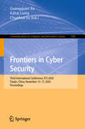
Frontiers in Cyber Security: Third International Conference, FCS 2020, Tianjin, China, November 15–17, 2020, Proceedings (Communications in Computer and Information Science #1286)
by Chunhua Su Kaitai Liang Guangquan XuThis book constitutes the proceedings of the Third International Conference on Frontiers in Cyber Security, FCS 2020, held in Tianjin, China*, in November 2020. The 39 full papers along with the 10 short papers presented were carefully reviewed and selected from 143 submissions. The papers are organized in topical sections on: IoT security; artificial intelligence; blockchain; cyber-physical systems security; cryptography; database security; depth estimation; mobile security; network security; privacy; program analysis; quantum cryptography; steganography; web security.*The conference was held virtually due to the COVID-19 pandemic.
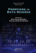
Frontiers in Data Science (Chapman & Hall/CRC Big Data Series)
by Matthias Dehmer and Frank Emmert-StreibFrontiers in Data Science deals with philosophical and practical results in Data Science. A broad definition of Data Science describes the process of analyzing data to transform data into insights. This also involves asking philosophical, legal and social questions in the context of data generation and analysis. In fact, Big Data also belongs to this universe as it comprises data gathering, data fusion and analysis when it comes to manage big data sets. A major goal of this book is to understand data science as a new scientific discipline rather than the practical aspects of data analysis alone.
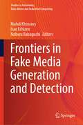
Frontiers in Fake Media Generation and Detection (Studies in Autonomic, Data-driven and Industrial Computing)
by Isao Echizen Mahdi Khosravy Noboru BabaguchiThe book presents recent advances in the generation and detection of fake multimedia. It also presents some frontiers in defensive techniques in front of skillfully cloned media. The ultimate purpose of the research direction presented by this book is to build up a trustworthy media network benefited by an iron dome in front of media clones’ attacks. The book focusses on (1) applications of deep generative models in the generation of fake multimedia, and (2) cyber-defensive and detective techniques in front of cyberattacks. The book is composed of three parts: (i) introduction, (ii) fake media generation, and (iii) fake media detection.
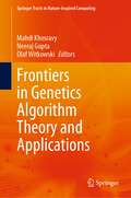
Frontiers in Genetics Algorithm Theory and Applications (Springer Tracts in Nature-Inspired Computing)
by Neeraj Gupta Mahdi Khosravy Olaf WitkowskiThis book reviews recent advances in theory and applications of genetic algorithm (GA). The book is composed of five parts; Part 1 of the book involves the chapters about the advances in GA theory. Part 2 concerns applications in health, society, and economy. Part 3 has an inclusive focus on application in power systems, and Part 4 concerns the applications of GA in electrical vehicle industries. Finally, Part 5 includes applications in signal and image processing.
