- Table View
- List View
Spatial Big Data Science
by Shashi Shekhar Zhe JiangEmerging Spatial Big Data (SBD) has transformative potential in solving many grand societal challenges such as water resource management, food security, disaster response, and transportation. However, significant computational challenges exist in analyzing SBD due to the unique spatial characteristics including spatial autocorrelation, anisotropy, heterogeneity, multiple scales and resolutions which is illustrated in this book. This book also discusses current techniques for, spatial big data science with a particular focus on classification techniques for earth observation imagery big data. Specifically, the authors introduce several recent spatial classification techniques, such as spatial decision trees and spatial ensemble learning. Several potential future research directions are also discussed. This book targets an interdisciplinary audience including computer scientists, practitioners and researchers working in the field of data mining, big data, as well as domain scientists working in earth science (e. g. , hydrology, disaster), public safety and public health. Advanced level students in computer science will also find this book useful as a reference.
Spatial Cloud Computing: A Practical Approach
by Chaowei Yang Qunying HuangAn exploration of the benefits of cloud computing in geoscience research and applications as well as future research directions, Spatial Cloud Computing: A Practical Approach discusses the essential elements of cloud computing and their advantages for geoscience. Using practical examples, it details the geoscience requirements of cloud computing, c
Spatial Cognition XI: 11th International Conference, Spatial Cognition 2018, Tübingen, Germany, September 5-8, 2018, Proceedings (Lecture Notes in Computer Science #11034)
by Sarah Creem-Regehr Johannes Schöning Alexander KlippelThis book constitutes the thoroughly refereed proceedings of the 11th International Conference, Spatial Cognition 2018, held in Tübingen, Germany, in September 2018. The 22 revised full papers presented in this book were carefully selected and reviewed from 44 submissions. They focus on the following topics: navigating in space; talking about space; agents, actions, and space; and individuals in space.
Spatial Cognition XII: 12th International Conference, Spatial Cognition 2020, Riga, Latvia, August 26–28, 2020, Proceedings (Lecture Notes in Computer Science #12162)
by Jurǵis Šķilters Nora S. Newcombe David UttalThis book constitutes the thoroughly refereed proceedings of the 12th International Conference, Spatial Cognition 2020, held in Riga, Latvia, in September 2020. The physical event was postponed to 2021 due to the COVID-19 pandemic. The 19 full papers and 6 short papers presented in this book were carefully selected and reviewed from 50 submissions. They focus on the following topics: spatial representation and cognitive maps; navigation and wayfinding; spatial representation in language, logic, and narrative; and spatial abilities and learning.
Spatial Cognition XIII: 13th International Conference, Spatial Cognition 2024, Dublin, Ireland, June 25–28, 2024, Proceedings (Lecture Notes in Computer Science #14756)
by Gavin Duffy Marija Živković Jeffrey Buckley Marianna PagkratidouThis book constitutes the proceedings of the 13th International Conference, Spatial Cognition 2024, held in Dublin, Ireland, during June 25 - 29, 2024. The 9 full papers were carefully reviewed and selected from 12 submissions. The papers are organized in topical sections as follows: Mathematics; Gender Differences; STEAM (Science, Technology, Engineering, Art, and Mathematics); and Early Childhood.
Spatial Computing (The MIT Press Essential Knowledge Series)
by Shashi Shekhar Pamela VoldAn accessible guide to the ideas and technologies underlying such applications as GPS, Google Maps, Pokémon Go, ride-sharing, driverless cars, and drone surveillance. Billions of people around the globe use various applications of spatial computing daily—by using a ride-sharing app, GPS, the e911 system, social media check-ins, even Pokémon Go. Scientists and researchers use spatial computing to track diseases, map the bottom of the oceans, chart the behavior of endangered species, and create election maps in real time. Drones and driverless cars use a variety of spatial computing technologies. Spatial computing works by understanding the physical world, knowing and communicating our relation to places in that world, and navigating through those places. It has changed our lives and infrastructures profoundly, marking a significant shift in how we make our way in the world. This volume in the MIT Essential Knowledge series explains the technologies and ideas behind spatial computing.The book offers accessible descriptions of GPS and location-based services, including the use of Wi-Fi, Bluetooth, and RFID for position determination out of satellite range; remote sensing, which uses satellite and aerial platforms to monitor such varied phenomena as global food production, the effects of climate change, and subsurface natural resources on other planets; geographic information systems (GIS), which store, analyze, and visualize spatial data; spatial databases, which store multiple forms of spatial data; and spatial statistics and spatial data science, used to analyze location-related data.
Spatial Contact Problems in Geotechnics
by Sergey AleynikovThis book presents a systematic approach to numerical solution for a wide range of spatial contact problems of geotechnics. On the basis of the boundary element method new techniques and effective computing algorithms are considered. Special attention is given to the formulation and analysis of the spatial contact models for elastic bases. Besides the classical schemes of contact deformation, new contact models are discussed for spatially nonhomogeneous and nonlinearly elastic media properly describing soil properties.
Spatial Data Analysis: Models, Methods and Techniques
by Jinfeng Wang Manfred M. FischerThe availability of spatial databases and widespread use of geographic information systems has stimulated increasing interest in the analysis and modelling of spatial data. Spatial data analysis focuses on detecting patterns, and on exploring and modelling relationships between them in order to understand the processes responsible for their emergence. In this way, the role of space is emphasised , and our understanding of the working and representation of space, spatial patterns, and processes is enhanced. In applied research, the recognition of the spatial dimension often yields different and more meaningful results and helps to avoid erroneous conclusions. This book aims to provide an introduction into spatial data analysis to graduates interested in applied statistical research. The text has been structured from a data-driven rather than a theory-based perspective, and focuses on those models, methods and techniques which are both accessible and of practical use for graduate students. Exploratory techniques as well as more formal model-based approaches are presented, and both area data and origin-destination flow data are considered.
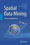
Spatial Data Mining
by Deren Li Shuliang Wang Deyi Li#65533; This book is an updated version of awell-received book previously published in Chinese by Science Press of China(the first edition in 2006 and the second in 2013). It offers a systematic andpractical overview of spatial data mining, which combines computer science andgeo-spatial information science, allowing each field to profit from theknowledge and techniques of the other. To address the spatiotemporalspecialties of spatial data, the authors introduce the key concepts andalgorithms of the data field, cloud model, mining view, and Deren Li methods. The data field method captures the interactions between spatial objects bydiffusing the data contribution from a universe of samples to a universe ofpopulation, thereby bridging the gap between the data model and the recognitionmodel. The cloud model is a qualitative method that utilizes quantitativenumerical characters to bridge the gap between pure data and linguisticconcepts. The mining view method discriminates the different requirements byusing scale, hierarchy, and granularity in order to uncover the anisotropy ofspatial data mining. The Deren Li method performs data preprocessing to prepareit for further knowledge discovery by selecting a weight for iteration in orderto clean the observed spatial data as much as possible. In addition to theessential algorithms and techniques, the book provides application examples ofspatial data mining in geographic information science and remote sensing. Thepractical projects include spatiotemporal video data mining for protectingpublic security, serial image mining on nighttime lights for assessing theseverity of the Syrian Crisis, and the applications in the government project'the Belt and Road Initiatives'.
Spatial Data and Intelligence: 4th International Conference, SpatialDI 2023, Nanchang, China, April 13–15, 2023, Proceedings (Lecture Notes in Computer Science #13887)
by Yafei Li Xiang Li Xiaofeng Meng Jianqiu Xu Xueying Zhang Yuming Fang Bolong ZhengThis book constitutes the refereed proceedings of the 4th International Conference on Spatial Data and Intelligence, SpatialDI 2023, held in Nanchang, China, in April 13–15, 2023.The 18 full papers included in this book were carefully reviewed and selected from 68 submissions. They were organized in topical sections as follows: traffic management; visualization analysis; spatial big data analysis; spatiotemporal data mining; spatiotemporal data storage; and metaverse.
Spatial Data and Intelligence: 5th China Conference, SpatialDI 2024, Nanjing, China, April 25–27, 2024, Proceedings (Lecture Notes in Computer Science #14619)
by Xiaofeng Meng Xueying Zhang Bolong Zheng Danhuai Guo Di Hu Chunju ZhangThis book constitutes the refereed post proceedings of the 5th China Conference on Spatial Data and Intelligence, SpatialDI 2024, held in Nanjing, China, during April 25–27, 2024. The 25 full papers included in this book were carefully reviewed and selected from 95 submissions. They were organized in topical sections as follows: Spatiotemporal Data Analysis, Spatiotemporal Data Mining, Spatiotemporal Data Prediction, Remote Sensing Data Classification and Applications of Spatiotemporal Data Mining.
Spatial Data and Intelligence: First International Conference, SpatialDI 2020, Virtual Event, May 8–9, 2020, Proceedings (Lecture Notes in Computer Science #12567)
by Xiaofeng Meng Zhiming Ding Xing Xie Yang YueThis book constitutes the proceedings of the First International Conference on Spatial Data and Intelligence, SpatialDI 2020, which was held on May 8-9, 2020. The conference was planned to take place in Shenzhen, China, and changed to an online format due to the COVID-19 pandemic. The 21 full papers presented in this volume were carefully reviewed and selected from 50 submissions. They were organized in topical sections named: traffic management; data science; and visualization science.
Spatial Data and Intelligence: Second International Conference, SpatialDI 2021, Hangzhou, China, April 22–24, 2021, Proceedings (Lecture Notes in Computer Science #12753)
by Gang Pan Xiaofeng Meng Zhiming Ding Yong Li Yunjun Gao Hui Lin Qingfeng GuanThis book constitutes the proceedings of the Second International Conference on Spatial Data and Intelligence, SpatialDI 2021, which was held during April 22-24, 2021 in Hangzhou, China.The 14 full papers and 7 short papers presented in this volume were carefully reviewed and selected from 72 submissions. They are organized in the topical sections named: traffic management, data science, and city analysis.
Spatial Data and Intelligence: Third International Conference, SpatialDI 2022, Wuhan, China, August 5–7, 2022, Revised Selected Papers (Lecture Notes in Computer Science #13614)
by Yu Liu Xiaofeng Meng Jianzhong Li Guoliang Li Qingfeng Guan Huayi Wu Xuan Song Guoqiong LiaoThis book constitutes the refereed proceedings of the Third International Conference, SpatialDI 2022, Wuhan, China, August 5–7, 2022, Revised Selected Papers. The 19 full papers and 1 short paper included in this book were carefully reviewed and selected from 77 submissions. They were organized in topical sections as follows: Traffic Management, Data science, City Analysis.
Spatial Database for GPS Wildlife Tracking Data
by Ferdinando Urbano Francesca CagnacciThis book guides animal ecologists, biologists and wildlife and data managers through a step-by-step procedure to build their own advanced software platforms to manage and process wildlife tracking data. This unique, problem-solving-oriented guide focuses on how to extract the most from GPS animal tracking data, while preventing error propagation and optimizing analysis performance. Based on the open source PostgreSQL/PostGIS spatial database, the software platform will allow researchers and managers to integrate and harmonize GPS tracking data together with animal characteristics, environmental data sets, including remote sensing image time series, and other bio-logged data, such as acceleration data. Moreover, the book shows how the powerful R statistical environment can be integrated into the software platform, either connecting the database with R, or embedding the same tools in the database through the PostgreSQL extension Pl/R. The client/server architecture allows users to remotely connect a number of software applications that can be used as a database front end, including GIS software and WebGIS. Each chapter offers a real-world data management and processing problem that is discussed in its biological context; solutions are proposed and exemplified through ad hoc SQL code, progressively exploring the potential of spatial database functions applied to the respective wildlife tracking case. Finally, wildlife tracking management issues are discussed in the increasingly widespread framework of collaborative science and data sharing. GPS animal telemetry data from a real study, freely available online, are used to demonstrate the proposed examples. This book is also suitable for undergraduate and graduate students, if accompanied by the basics of databases
Spatial Decision Support Systems: Principles and Practices
by Ramanathan Sugumaran John DegrooteThis book provides a comprehensive examination of the various aspects of SDSS evolution, components, architecture, and implementation. Integrating research from a variety of disciplines, it supplies a complete overview of SDSS technologies and their application. This groundbreaking reference provides thorough coverage of the roots of SDSS. It explains the core principles of SDSS, how to use them in various decision making contexts, and how to design and develop them using readily available enabling technologies and commercial tools.
Spatial Econometrics using Microdata
by Di Go Legros Jean DubéThis book provides an introduction to spatial analyses concerning disaggregated (or micro) spatial data.Particular emphasis is put on spatial data compilation and the structuring of the connections between the observations. Descriptive analysis methods of spatial data are presented in order to identify and measure the spatial, global and local dependency.The authors then focus on autoregressive spatial models, to control the problem of spatial dependency between the residues of a basic linear statistical model, thereby contravening one of the basic hypotheses of the ordinary least squares approach.This book is a popularized reference for students looking to work with spatialized data, but who do not have the advanced statistical theoretical basics.
Spatial Grasp as a Model for Space-based Control and Management Systems
by Peter Simon SapatyGovernmental agencies and private companies of different countries are actively moving into space around Earth with the aim to provide smart communication and industry, security, and defense solutions. This often involves massive launches of small, cheap satellites in low earth orbits, which is also contributing to the growth of space debris. The book offers a high-level holistic system philosophy, model, and technology that can effectively organize distributed space-based systems, starting with their planning, creation, and growth. The Spatial Grasp Technology described in the book, based on parallel navigation and pattern-matching of distributed environments with high-level recursive mobile code, can effectively provide any networking protocols and important system applications, by integrating and tasking available terrestrial and celestial equipment. This book contains practical examples of technology-based solutions for tracing hypersonic gliders, continuing observation of certain objects and infrastructures on Earth from space, space-based command and control of large distributed systems, as well as collective removal of increasing amounts of space junk. Earlier versions of this technology were prototyped and used in different countries, with the current version capable of being quickly implemented in traditional industrial or even university environments. This book is oriented toward system scientists, application programmers, industry managers, and university students interested in advanced MSc and PhD projects related to space conquest and distributed system management. Dr Peter Simon Sapaty, Chief Research Scientist, Ukrainian Academy of Sciences, has worked with networked systems for five decades. Outside of Ukraine, he has worked in the former Czechoslovakia (now Czech Republic and Slovakia), Germany, the UK, Canada, and Japan as a group leader, Alexander von Humboldt researcher, and invited and visiting professor. He launched and chaired the Special Interest Group (SIG) on Mobile Cooperative Technologies in Distributed Interactive Simulation project in the United States, and invented a distributed control technology that resulted in a European patent and books with Wiley, Springer, and Emerald. He has published more than 250 papers on distributed systems and has been included in the Marquis Who’s Who in the World and Cambridge Outstanding Intellectuals of the 21st Century. Peter also works with several international scientific journals.
Spatial Modelling of Flood Risk and Flood Hazards: Societal Implications (GIScience and Geo-environmental Modelling)
by Biswajeet Pradhan Hamid Reza Pourghasemi Gouri Sankar Bhunia Pravat Kumar Shit Partha Pratim AdhikaryFloods and flash floods with hydro-meteorological and tropical cyclones are the some of the most devastating natural disasters causing massive damages to natural and man-made features. Flood hazards are a major threat to human life, properties (agricultural area, yield production, building and homes) and infrastructures (bridges, roads, railways, urban infrastructures, etc). Flood hazards susceptibility mapping (risk assessment) and modelling is an essential step for early warning systems, emergency services, prevention and mitigation of future environmental and social hazards and implementation of risk management strategies. Due to the lack of proper information, technology-based policies and strategies, mapping and modelling can often not be implemented to the best possible level. Geo-spatial techniques have enjoyed rising interest in recent decades among the earth environmental and social sciences research communities for their powerful ability to solve and understand various complex problems and develop novel approaches toward sustainable earth and human society. By linking geo-spatial computational intelligence techniques with societal and environmental-oriented problems, this book demonstrates geospatial technology approaches to data mining techniques, data analysis, modelling, risk assessment and visualization and management strategies in different aspects of flood hazards. We believe that a diverse group of academics, scientists, geographers, hydrologist, remote sensing and GIS expertise, environmentalists, meteorologists and computing experts with a common interest in geospatial sciences within the earth environmental sciences and humanistic and social sciences will find this book to be of great value.
Spatial Multimedia and Virtual Reality
by Antonio S. CamaraThe intersection of two disciplines and technologies which have become mature academic research topics in the 1990s was destined to be a dynamic area for collaboration and publication. However, until now no significant book-length treatment of the meeting of GIS and Virtual Reality has been available. This volume puts that situation to rights by bringing these together to cement some common understanding and principles in a potentially highly promising area for technological collaboration and cross-fertilisation. The result is a volume which ranges in subject matter from studies of a Virtual GIS Room to Spatial Agents, and from an Environmental Multimedia System to Computer-Assisted 3D Geographic Education. All the contributors are well-known international scientists, principally from the computational side of GIS. It will be a valuable resource for any GIS researcher or professional looking to understand the leading edge of this fertile field.
Spatial Network Data
by Dev OliverThis brief explores two of the main challenges of spatial network data analysis: the many connected components in the spatial network and the many candidates that have to be processed. Within this book, these challenges are conceptualized, well-defined problems are explored, and critical techniques are discussed. The process of summarizing spatial network data entails finding a compact description or representation of observations or activities on large spatial or spatiotemporal networks. However, summarizing spatial network data can be computationally challenging for various reasons, depending on the domain. The content has applications for professionals, organizations, and researchers in transportation safety, public safety, public health, disaster response, and related fields.
Spatial Networking in the United Physical, Virtual, and Mental World (Studies in Systems, Decision and Control #533)
by Peter S. SapatyThe current book chooses graphs and networks as primary and global research objectives after reviewing different types and areas of networking and existing works on graph and network operations. The ideas of this book originate from the WAVE approach which allowed us, more than half a century ago, to implement citywide heterogeneous computer networks and solve distributed problems on them in flexible and mobile way. The invented management paradigm evolved into Spatial Grasp Technology resulted in European patent and nine previous books oriented on concrete applications in social and defense systems, security, crises management, collective robotics, space research, and others. Many obtained results were dealing with graph and network structures and problems which were extremely important in the researched areas. It aims at development of higher-level social infrastructures effectively integrating different types of networking under the same universal approach, also application of networking in new areas like organoids and brain research. This book is oriented toward system scientists, application programmers, industry managers, university students, philosophers, psychologists, and United Nations personnel too.
Spatial Socio-econometric Modeling: A Low-Code Toolkit for Spatial Data Science and Interactive Visualizations Using R (Springer Texts in Social Sciences)
by Manuel S. González CanchéWith the primary goal of expanding access to spatial data science tools, this book offers dozens of minimal or low-code functions and tutorials designed to ease the implementation of fully reproducible Spatial Socio-Econometric Modeling (SSEM) analyses. Designed as a University of Pennsylvania Ph.D. level course for sociologists, political scientists, urban planners, criminologists, and data scientists, this textbook equips social scientists with all concepts, explanations, and functions required to strengthen their data storytelling. It specifically provides social scientists with a comprehensive set of open-access minimal code tools to:•Identify and access place-based longitudinal and cross-sectional data sources and formats•Conduct advanced data management, including crosswalks, joining, and matching•Fully connect social network analyses with geospatial statistics•Formulate research questions designed to account for place-based factors in model specification and assess their relevance compared to individual- or unit-level indicators•Estimate distance measures across units that follow road network paths •Create sophisticated and interactive HTML data visualizations cross-sectionally or longitudinally, to strengthen research storytelling capabilities•Follow best practices for presenting spatial analyses, findings, and implications•Master theories on neighborhood effects, equality of opportunity, and geography of (dis)advantage that undergird SSEM applications and methods•Assess multicollinearity issues via machine learning that may affect coefficients' estimates and guide the identification of relevant predictors•Strategize how to address feedback loops by using SSEM as an identification framework that can be merged with standard quasi-experimental techniques like propensity score models, instrumental variables, and difference in differences•Expand the SSEM analyses to connections that emerge via social interactions, such as co-authorship and advice networks, or any form of relational dataThe applied nature of the book along with the cost-free, multi-operative R software makes the usability and applicability of this textbook worldwide.
Spatial Synthesis: Computational Social Science and Humanities (Human Dynamics in Smart Cities)
by Xinyue Ye Hui LinThis book describes how powerful computing technology, emerging big and open data sources, and theoretical perspectives on spatial synthesis have revolutionized the way in which we investigate social sciences and humanities. It summarizes the principles and applications of human-centered computing and spatial social science and humanities research, thereby providing fundamental information that will help shape future research. The book illustrates how big spatiotemporal socioeconomic data facilitate the modelling of individuals’ economic behavior in space and time and how the outcomes of such models can reveal information about economic trends across spatial scales. It describes how spatial social science and humanities research has shifted from a data-scarce to a data-rich environment. The chapters also describe how a powerful analytical framework for identifying space-time research gaps and frontiers is fundamental to comparative study of spatiotemporal phenomena, and how research topics have evolved from structure and function to dynamic and predictive. As such this book provides an interesting read for researchers, students and all those interested in computational and spatial social sciences and humanities.
Spatial Temporal Patterns for Action-Oriented Perception in Roving Robots II
by Paolo Arena Luca PatanèThis book presents the result of a joint effort from different European Institutions within the framework of the EU funded project called SPARK II, devoted to device an insect brain computational model, useful to be embedded into autonomous robotic agents. Part I reports the biological background on Drosophila melanogaster with particular attention to the main centers which are used as building blocks for the implementation of the insect brain computational model. Part II reports the mathematical approach to model the Central Pattern Generator used for the gait generation in a six-legged robot. Also the Reaction-diffusion principles in non-linear lattices are exploited to develop a compact internal representation of a dynamically changing environment for behavioral planning. In Part III a software/hardware framework, developed to integrate the insect brain computational model in a simulated/real robotic platform, is illustrated. The different robots used for the experiments are also described. Moreover the problems related to the vision system were addressed proposing robust solutions for object identification and feature extraction. Part IV includes the relevant scenarios used in the experiments to test the capabilities of the insect brain-inspired architecture taking as comparison the biological case. Experimental results are finally reported, whose multimedia can be found in the SPARK II web page: www. spark2. diees. unict. it
