- Table View
- List View
Foundations of Engineering Geology
by Tony Waltham A.C. WalthamNow in full colour, the third edition of this well established book provides a readable and highly illustrated overview of the aspects of geology that are most significant to civil engineers.Sections in the book include those devoted to the main rock types, weathering, ground investigation, rock mass strength, failures of old mines, subsidence on peats and clays, sinkholes on limestone and chalk, water in landslides, slope stabilization and understanding ground conditions. The roles of both natural and man-induced processes are assessed, and this understanding is developed into an appreciation of the geological environments potentially hazardous to civil engineering and construction projects. For each style of difficult ground, available techniques of site investigation and remediation are reviewed and evaluated.Each topic is presented as a double page spread with a careful mix of text and diagrams, with tabulated reference material on parameters such as bearing strength of soils and rocks. This new edition has been comprehensively updated and covers the entire spectrum of topics of interest for both students and practitioners in the field of civil engineering.
Foundations of Environmental Economics (Springer Texts in Business and Economics)
by Wolfgang Buchholz Dirk RübbelkeThis textbook provides a solid introduction to the theoretical and empirical aspects of environmental economics, and their links to environmental policy. It advocates drawing on the economist’s toolbox as a powerful means of finding solutions to environmental problems by addressing the conflict between the societal costs of pollution on the one hand, and the financial costs of emissions reduction on the other. The book presents the main economic theory approaches to handling environmental problems and assessing the monetary value of environmental quality; the most relevant environmental policy instruments and challenges involved in their effective real-world application; and both national and global environmental problems addressed by environmental negotiations and agreements. Given its scope, the book offers a valuable basis of information for students, and for policymakers pursuing effective environmental policies.
Foundations of Environmental Economics: An Introduction to the Economic Analysis of National and International Environmental Challenges (Springer Texts in Business and Economics)
by Wolfgang Buchholz Dirk Rübbelke Christiane ReifThis textbook provides a solid introduction to the theoretical and empirical aspects of environmental economics and their links to environmental policy. In this second edition, all chapters have been updated and restructured, and new sections have been added to reflect a greater focus on climate policy. Starting from the need to balance the social costs of pollution against the financial costs of emission abatement, the book discusses the major issues that arise in the context of environmental policy – such as the potential and limitations of monetary valuation of the environment (and in particular the contingent valuation method) and the design of environmental policy. With regard to the choice of environmental policy instruments, the book focuses on the price-based instruments preferred by economists, i.e., environmental taxes and emissions trading, discussing in detail not only their many advantages but also their drawbacks. The second edition especially focuses on green industrial policy as a complementary measure to price-based instruments, the distributional effects of environmental policies, and the resulting challenges for political feasibility. Moreover, the book deals extensively with international environmental problems, in particular climate protection, which is a global public good that will be underprovided when certain countries refuse to cooperate and contribute. Approaches to overcoming this underprovision are described in far more detail than in the first edition, both theoretically and empirically – in particular by assessing the functions of the many international environmental agreements in this field. Finally, a new chapter considers adaptation strategies, especially in the water sector, as an additional pillar of climate policy.
Foundations of Mathematics and Physics One Century After Hilbert: New Perspectives
by Joseph KouneiherThis book explores the rich and deep interplay between mathematics and physics one century after David Hilbert’s works from 1891 to 1933, published by Springer in six volumes. The most prominent scientists in various domains of these disciplines contribute to this volume providing insight to their works, and analyzing the impact of the breakthrough and the perspectives of their own contributions. The result is a broad journey through the most recent developments in mathematical physics, such as string theory, quantum gravity, noncommutative geometry, twistor theory, Gauge and Quantum fields theories, just to mention a few. The reader, accompanied on this journey by some of the fathers of these theories, explores some far reaching interfaces where mathematics and theoretical physics interact profoundly and gets a broad and deep understanding of subjects which are at the core of recent developments in mathematical physics. The journey is not confined to the present state of the art, but sheds light on future developments of the field, highlighting a list of open problems. Graduate students and researchers working in physics, mathematics and mathematical physics will find this journey extremely fascinating. All those who want to benefit from a comprehensive description of all the latest advances in mathematics and mathematical physics, will find this book very useful too.
Foundations of Quantum Mechanics (Lecture Notes in Physics #1003)
by Roderich TumulkaThis book introduces and critically appraises the main proposals for how to understand quantum mechanics, namely the Copenhagen interpretation, spontaneous collapse, Bohmian mechanics, many-worlds, and others. The author makes clear what are the crucial problems, such as the measurement problem, related to the foundations of quantum mechanics and explains the key arguments like the Einstein-Podolsky-Rosen argument and Bell’s proof of nonlocality. He discusses and clarifies numerous topics that have puzzled the founding fathers of quantum mechanics and present-day students alike, such as the possibility of hidden variables, the collapse of the wave function, time-of-arrival measurements, explanations of the symmetrization postulate for identical particles, or the nature of spin. Several chapters are devoted to extending the different approaches to relativistic space-time and quantum field theory. The book is self-contained and is intended for graduate students and researchers who want to step into the fundamental aspects of quantum physics. Given its clarity, it is accessible also to advanced undergraduates and contains many exercises and examples to master the subject.
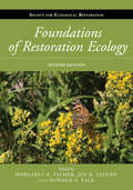
Foundations of Restoration Ecology (Science Practice Ecological Restoration)
by Richard J. Hobbs Joy Zedler Margaret Palmer Donald A. FalkAs the practical application of ecological restoration continues to grow, there is an increasing need to connect restoration practice to areas of underlying ecological theory. Foundations of Restoration Ecology is an important milestone in the field, bringing together leading ecologists to bridge the gap between theory and practice by translating elements of ecological theory and current research themes into a scientific framework for the field of restoration ecology.Each chapter addresses a particular area of ecological theory, covering traditional levels of biological hierarchy (such as population genetics, demography, community ecology) as well as topics of central relevance to the challenges of restoration ecology (such as species interactions, fine-scale heterogeneity, successional trajectories, invasive species ecology, ecophysiology). Several chapters focus on research tools (research design, statistical analysis, modeling), or place restoration ecology research in a larger context (large-scale ecological phenomena, macroecology, climate change and paleoecology, evolutionary ecology).The book makes a compelling case that a stronger connection between ecological theory and the science of restoration ecology will be mutually beneficial for both fields: restoration ecology benefits from a stronger grounding in basic theory, while ecological theory benefits from the unique opportunities for experimentation in a restoration context.Foundations of Restoration Ecology advances the science behind the practice of restoring ecosystems while exploring ways in which restoration ecology can inform basic ecological questions. It provides the first comprehensive overview of the theoretical foundations of restoration ecology, and is a must-have volume for anyone involved in restoration research, teaching, or practice.
Foundations of Restoration Ecology (The Science and Practice of Ecological Restoration Series)
by Donald A. Falk Joy B. Zedler Karen Holl Margaret A. PalmerThe practice of ecological restoration, firmly grounded in the science of restoration ecology, provides governments, organizations, and landowners a means to halt degradation and restore function and resilience to ecosystems stressed by climate change and other pressures on the natural world. Foundational theory is a critical component of the underlying science, providing valuable insights into restoring ecological systems effectively and understanding why some efforts to restore systems can fail. In turn, on-the-ground restoration projects can help to guide and refine theory, advancing the field and providing new ideas and innovations for practical application.This new edition of Foundations of Restoration Ecology provides the latest emerging theories and ideas in the science of restoration ecology. Fully one-third longer than the first edition and comprehensive in scope, it has been dramatically updated to reflect new research. Included are new sections devoted to concepts critical to all restoration projects as well as restoration of specific ecosystem processes, including hydrology, nutrient dynamics, and carbon. Also new to this edition are case studies that describe real-life restoration scenarios in North and South America, Europe, and Australia. They highlight supporting theory for restoration application and other details important for assessing the degree of success of restoration projects in a variety of contexts. Lists at the end of each chapter summarize new theory introduced in that chapter and its practical application.Written by acclaimed researchers in the field, this book provides practitioners as well as graduate and undergraduate students with a solid grounding in the newest advances in ecological science and theory.
Foundations of Rock Mechanics in Oil and Gas Engineering
by Yuanfang Cheng Chuanliang Yan Zhongying HanThis book introduces the basic theoretical knowledge of rock mechanics and its application in petroleum engineering. It covers the gamut of the formulas and calculations for petroleum engineers that have been compiled over decades, while others are meant to help guide the engineer through some of the more recent breakthroughs in the industry’s technology.The topics are introduced at a level that should give a good basic understanding of the subject:• Basic concepts of stress and strain• Experimental method of rock mechanics• Rock deformation and strength characteristics• Rock strength failure criterion• In situ stress state• Application method of rock mechanics theory in the field of wellbore stability• Application method of rock mechanics theory in the field of sand production• Application method of rock mechanics theory in the field of hydraulic fracturing.This textbook contains abundant figures, illustrations, and tables, providing valuable examples and exercises.Key Features and Benefits for the Reader: • Helps in understanding the basic concepts of rock mechanics• Applies rock mechanics theory and method to various fields of petroleum engineering• Includes a large number of calculations, tables, and equations that are very useful for petroleum engineers• Presents new and updated sections in rock mechanics of petroleum engineering.
Foundations of Social Entrepreneurship: Theory, Practical Tools and Skills
by Tanja CollavoFoundations of Social Entrepreneurship presents definitions of social entrepreneurship, explains its benefits and challenges, describes the components of an ecosystem of support, and presents practical tools to approach social entrepreneurial projects. It is designed to be easily approachable by anyone without prior in-depth knowledge of the subject. The book is divided into two parts; the first provides readers with theoretical foundations to understand the phenomenon of social entrepreneurship, its different interpretations, the context in which it developed, and its socio-economic function. The second part of the book covers what it takes to create and manage a social entrepreneurial initiative. Pedagogical features are incorporated throughout to aid learning. They include summary tables, international case studies of social entrepreneurs from both developed and emerging economies, as well as suggested exercises and examples of how the tools presented are used in practice. Truly global in its scope, with a strong emphasis on combining theory with practice, this text should be core reading for advanced undergraduate and postgraduate students studying Social Entrepreneurship, Enterprise, and Responsible Business. Online resources include links to resources, chapter-by-chapter PowerPoint slides and instructor's manual.
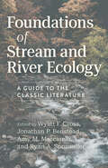
Foundations of Stream and River Ecology: A Guide to the Classic Literature
by Nancy B. GrimmFor students and practitioners, a comprehensive primer on the key literature in stream and river ecology. The study of streams and rivers combines ecology, chemistry, hydrology, and geology to reveal the factors that control the biological diversity and functioning of these unique ecosystems. Although stream ecology is a relatively young discipline, foundational papers published over the past half century have shaped our current understanding of these ecosystems and have informed our efforts to manage and protect them. Organized by topics such as the physical template, community structure, food webs, ecosystem energetics, and nutrient dynamics, the chapters of this book offer summaries of the key literature, historical and contextual information, and insightful discussions of how past research has influenced present studies and may shape future work.
Foundations of Sustainable Business: Theory, Function, and Strategy
by Nada R. Sanders; John D. WoodSustainability as a strategic priority for all aspects of business, the text clearly defines all key concepts and shows how social, economic, and environmental trends are interconnected and relevant to corporate strategy. While the text provides an honest look at climate change, human trafficking, and environmental issues such as water shortage and ecosystem health,all normative guidance is based on traditional business value propositions, taking into account cost, risk, strategy, marketing potential, and operational feasibility.
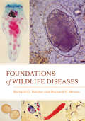
Foundations of Wildlife Diseases
by Richard N. Brown Richard G. BotzlerFoundations of Wildlife Diseases is a comprehensive overview of the basic principles that govern the study of wildlife diseases. The authors integrate theoretical foundations with a thorough examination of the factors that can affect the health and fitness of animals. They include specific information on a wide array of infectious agents such as bacteria, viruses, arthropods, fungi, protista, and helminths, as well as immunity to these agents. Also provided is a foundation for the study of noninfectious diseases, cancers, and prion diseases that affect wildlife. Supporting students, faculty, and researchers in areas related to wildlife management, biology, and veterinary sciences, this volume fills an important gap in wildlife disease resources, focusing on mammalian and avian wildlife while also considering reptiles and amphibians.Foundations of Wildlife Diseases provides students with a structure for thinking about and understanding infective agents and their interactions with wildlife. Each chapter includes an outline, select definitions and concepts, an overview and summary, and literature cited.
Foundations of a Sustainable Economy: Moral, Ethical and Religious Perspectives (Finance, Governance and Sustainability)
by Umar BurkiThis book addresses current practices related to sustainable development, its challenges and the future. People belonging to different genders regardless of their age, social class and education should be equal as citizens and individuals, and identical in their rights and responsibilities. The business sector, authorities, societies and religious circles have the potential to play a fundamental role in curbing social ills and the degradation of the environment in this modern world. The authors of this book argue that without good governance, the status of a human being is unlikely to improve. They make the case that to achieve sustainability, government, society and the economy must ensure a platform for people to participate in decision-making and benefit from the rights they are accorded. By covering a range of perspectives across economic, social and moral life, the book will shed light on the problems and possible solutions to sustainable development and the triple bottom line, of people, planet and profit, under the umbrella of morals and divine law. This will be a useful guide for undergraduate and postgraduate students across multiple disciplines, such as economics, religious studies, business studies, political science, anthropology and sociology.
Foundations of a Sustainable Market Economy: Guiding Principles for Change
by Gjalt de Jong Margreet Boersma-de JongThe free market underpins our economy and our way of thinking around enterprise and value, but it is also a major factor in the sustainability problems that we now live with. Climate change, child labour and oil spills are just a few of the many problems associated with our economic activity and, although many companies have made an effort to produce more sustainably, the pace of change is much too slow. This engaging and accessible textbook teaches students the relationship between the economy and sustainability, assessing the hand of the free market on company behaviour and, ultimately, providing a framework for transition to a sustainable economy.Using case studies and optional assessment questions, this textbook explains to students what a market is at the macro level and then translates the effects of the market to industries and subsequently to the strategic choices of companies at the micro level. It adopts a model of 8 guiding principles that underpin the current free market economy and 8 guiding principles for the sustainable market economy. Switching these deeply held principles will be essential to any serious transition to a sustainable economy.
Foundations of the Earth
by H. H. Shugart"Where were you when I laid the foundation of the earth?" God asks Job in the "Whirlwind Speech," but Job cannot reply. This passage -- which some environmentalists and religious scholars treat as a "green" creation myth -- drives H. H. Shugart's extraordinary investigation, in which he uses verses from God's speech to Job to explore the planetary system, animal domestication, sea-level rise, evolution, biodiversity, weather phenomena, and climate change.Shugart calls attention to the rich resonance between the Earth's natural history and the workings of religious feeling, the wisdom of Bible scripture, and the arguments of Bible ethicists. The divine questions that frame his study are quintessentially religious, and the global changes humans have wrought on the Earth operate in not only the physical, chemical, and biological spheres but also the spiritual realm. Shugart offers a universal framework for recognizing and confronting the global challenges humans now face: the relationship between human technology and large-scale environmental degradation; the effect of invasive species on the integrity of ecosystems; the role of humans in generating wide biotic extinctions; and the future functioning of our oceans and tides.
Foundations of the Earth: Global Ecological Change and the Book of Job
by H.H. Shugart"Where were you when I laid the foundation of the earth?" God asks Job in the "Whirlwind Speech," but Job cannot reply. This passage—which some environmentalists and religious scholars treat as a "green" creation myth—drives renowned ecologist H. H. Shugart's extraordinary investigation, in which he uses verses from God's speech to Job to explore the planetary system, animal domestication, sea-level rise, evolution, biodiversity, weather phenomena, and climate change. Shugart calls attention to the rich resonance between the Earth's natural history and the workings of religious feeling, the wisdom of biblical scripture, and the arguments of Bible ethicists. The divine questions that frame his study are quintessentially religious, and the global changes humans have wrought on the Earth operate not only in the physical, chemical, and biological spheres but also in the spiritual realm. Shugart offers a universal framework for recognizing and confronting the global challenges humans now face: the relationship between human technology and large-scale environmental degradation, the effect of invasive species on the integrity of ecosystems, the role of humans in generating wide biotic extinctions, and the future of our oceans and tides.
Four Colors Suffice: How the Map Problem Was Solved - Revised Color Edition (Princeton Science Library #128)
by Robin WilsonOn October 23, 1852, Professor Augustus De Morgan wrote a letter to a colleague, unaware that he was launching one of the most famous mathematical conundrums in history--one that would confound thousands of puzzlers for more than a century. This is the amazing story of how the "map problem" was solved. The problem posed in the letter came from a former student: What is the least possible number of colors needed to fill in any map (real or invented) so that neighboring counties are always colored differently? This deceptively simple question was of minimal interest to cartographers, who saw little need to limit how many colors they used. But the problem set off a frenzy among professional mathematicians and amateur problem solvers, among them Lewis Carroll, an astronomer, a botanist, an obsessive golfer, the Bishop of London, a man who set his watch only once a year, a California traffic cop, and a bridegroom who spent his honeymoon coloring maps. In their pursuit of the solution, mathematicians painted maps on doughnuts and horseshoes and played with patterned soccer balls and the great rhombicuboctahedron. It would be more than one hundred years (and countless colored maps) later before the result was finally established. Even then, difficult questions remained, and the intricate solution--which involved no fewer than 1,200 hours of computer time--was greeted with as much dismay as enthusiasm. Providing a clear and elegant explanation of the problem and the proof, Robin Wilson tells how a seemingly innocuous question baffled great minds and stimulated exciting mathematics with far-flung applications. This is the entertaining story of those who failed to prove, and those who ultimately did prove, that four colors do indeed suffice to color any map. This new edition features many color illustrations. It also includes a new foreword by Ian Stewart on the importance of the map problem and how it was solved.
Four Degrees of Global Warming: Australia in a Hot World
by Peter ChristoffAt Copenhagen in December 2009, the international community agreed to limit global warming to below two degrees Celsius to avoid the worst impacts of human-induced climate change. However climate scientists agree that current national emissions targets collectively will still not achieve this goal. Instead, the ‘ambition gap’ between climate science and climate policy is likely to lead to average global warming of around four degrees Celsius by or before 2100. If a ‘Four Degree World’ is the de facto goal of policy, we urgently need to understand what this world might look like. Four Degrees of Global Warming: Australia in a Hot World outlines the expected consequences of this world for Australia and its region. Its contributors include many of Australia’s most eminent and internationally recognized climate scientists, climate policy makers and policy analysts. They provide an accessible, detailed, dramatic, and disturbing examination of the likely impacts of a Four Degree World on Australia’s social, economic and ecological systems. The book offers policy makers, politicians, students, and anyone interested climate change, access to the most recent research on potential Australian impacts of global warming, and possible responses.
Four Lost Cities: A Secret History Of The Urban Age
by Annalee NewitzA quest to explore some of the most spectacular ancient cities in human history—and figure out why people abandoned them. In Four Lost Cities, acclaimed science journalist Annalee Newitz takes readers on an entertaining and mind-bending adventure into the deep history of urban life. Investigating across the centuries and around the world, Newitz explores the rise and fall of four ancient cities, each the center of a sophisticated civilization: the Neolithic site of Çatalhöyük in Central Turkey, the Roman vacation town of Pompeii on Italy’s southern coast, the medieval megacity of Angkor in Cambodia, and the indigenous metropolis Cahokia, which stood beside the Mississippi River where East St. Louis is today. Newitz travels to all four sites and investigates the cutting-edge research in archaeology, revealing the mix of environmental changes and political turmoil that doomed these ancient settlements. Tracing the early development of urban planning, Newitz also introduces us to the often anonymous workers—slaves, women, immigrants, and manual laborers—who built these cities and created monuments that lasted millennia. Four Lost Cities is a journey into the forgotten past, but, foreseeing a future in which the majority of people on Earth will be living in cities, it may also reveal something of our own fate.
Four Revolutions in the Earth Sciences
by James Lawrence PowellJames Lawrence Powell serves as executive director of the National Physical Science Consortium, a partnership among government agencies and laboratories, industry, and higher education dedicated to increasing the number of American citizens with graduate degrees in the physical sciences and related engineering fields, emphasizing recruitment of a diverse applicant pool that includes women and minorities. He received his Ph.D from the Massachusetts Institute of Technology and has taught at Oberlin College and served as its acting president. He has also been president of Franklin and Marshall College, Reed College, the Franklin Institute Science Museum in Philadelphia, and the Los Angeles County Museum of Natural History. Presidents Ronald Reagan and George H. W. Bush both appointed Powell to the National Science Board. He is also the author of The Inquisition of Climate Science.
Four Revolutions in the Earth Sciences: From Heresy to Truth
by James PowellOver the course of the twentieth century, scientists came to accept four counterintuitive yet fundamental facts about the Earth: deep time, continental drift, meteorite impact, and global warming. When first suggested, each proposition violated scientific orthodoxy and was quickly denounced as scientific—and sometimes religious—heresy. Nevertheless, after decades of rejection, scientists came to accept each theory. The stories behind these four discoveries reflect more than the fascinating push and pull of scientific work. They reveal the provocative nature of science and how it raises profound and sometimes uncomfortable truths as it advances. For example, counter to common sense, the Earth and the solar system are older than all of human existence; the interactions among the moving plates and the continents they carry account for nearly all of the Earth's surface features; and nearly every important feature of our solar system results from the chance collision of objects in space. Most surprising of all, we humans have altered the climate of an entire planet and now threaten the future of civilization. This absorbing scientific history is the only book to describe the evolution of these four ideas from heresy to truth, showing how science works in practice and how it inevitably corrects the mistakes of its practitioners. Scientists can be wrong, but they do not stay wrong. In the process, astonishing ideas are born, tested, and over time take root.
