- Table View
- List View
From Stardust to First Cells: The Origin and Evolution of Early Life
by Sankar ChatterjeeThis book presents a groundbreaking hypothesis to answer one of the greatest scientific mysteries: How did life begin? Like a detective piecing together seemingly disparate bits of evidence, Dr. Sankar Chatterjee combines the most recent discoveries in cosmology, geology, chemistry, information systems, and biology, weaving a vast tapestry from the threads of current research. Dr. Chatterjee convincingly argues that the odyssey of life first began when the fundamental building blocks were brought to Earth by meteorites. These cosmic compounds concentrated and simmered like a soup in hydrothermal crater-caldrons. Through a system of subterranean vent networks, a biosynthetic-rich variety of organic compounds mixed and matched into a recipe of rich biomolecules guided by prebiotic information systems. Through symbiosis, these complex biopolymers gradually assemble into membrane-bound protocells. At each stage of this evolutionary progression, through natural selection, they refined with increasing stability and complexity, ultimately leading to the emergence of the first cells about four billion years ago. In this book, Dr. Chatterjee tells this story in rigorous detail in language that is both accessible and engaging.
From Traditional to Modern African Water Management: Lessons for the Future
by Andreas Haarstrick Chrispin Kowenje Timothy Biswick Gideon Ajeagah Stephen Ojwach Oluwatoyin A. Odeku Gnon BabaThis book preserves and scientifically interprets the African foreknowledge on water resources management. It offers insight into the relevance of the traditional knowledge and practices to modern approaches on sustainable water management. The African continent has partially preserved its natural habitat for centuries. In this book, this knowledge is combined with the current scientific understanding. The traditional practices are categorized as: i) water harvesting, ii) water transportation, iii) water storage and conservation, iv) water treatments, v) myths and folk stories about water management or conservation, vi) water resource management systems, and vii) soil–water–forest conservation/management systems sub-topics. The findings presented here are in line with SDG 6, which aims at ensuring availability and sustainable management of water and sanitation for all by the year 2030.
From Walden to Wall Street: Frontiers of Conservation Finance
by James N. Levitt"From Walden to Wall Street makes clear that a system of market-based conservation finance is vital to the future of environmental conservation." -Henry M. Paulson, Chairman and CEO, Goldman Sachs Group, Inc.; Chairman of the Board of Governors, The Nature Conservancy In the absence of innovation in the field of conservation finance, a daunting funding gap faces conservationists aiming to protect America's system of landscapes that provide sustainable resources, water, wildlife habitat, and recreational amenities. Experts estimate that the average annual funding gap will be between $1.9 billion and $7.7 billion over the next forty years. Can the conservation community come up with new methods for financing that will fill this enormous gap? Which human and financial resources will allow us to fund critical land conservation needs? From Walden to Wall Street brings together the experience of more than a dozen pioneering conservation finance practitioners to address these crucial issues. Contributors present groundbreaking ideas including mainstreaming environmental markets; government ballot measures for land conservations; convertible tax-exempt financing; and private equity markets. The creativity and insight of From Walden to Wall Street offers considerable hope that, even in this era of widespread financial constraints, the American conservation community's financial resources may potentially grow dramatically in both quantity and quality in the decades to come.
From Walmart to Al Qaeda: An Interdisciplinary Approach to Globalization
by David MurilloFrom Walmart to Al Qaeda explains the fuzzy, complex and seemingly incomprehensible concept of globalization. What is globalization? What are the core topics, theories and competing ideologies? Are we walking towards homogenization or towards a global collision of cultures and identities? The potential risks and challenges for the global economy, corporations and political regimes are acknowledged by most but not fully understood. This book provides a refreshing new look at how society is being shaped by globalization and how these apparent destructive patterns can be both explained and potentially remedied.Globalization is both a concept and a cliché. It is a term that is used to explain an economic system or the state of the world. David Murillo sets out the questions and identifies the interrelationships of different disciplines to both understand the issues and also find solutions. The book discusses globalization and current attempts to conceptualize and measure it. There are theoretical and ideological debates on whether globalization is inevitable and the various alternatives for interpreting how the world works.Accompanying Teaching Notes are available on request with the purchase of this book.
From Waste to Value: Valorisation Pathways for Organic Waste Streams in Circular Bioeconomies (Routledge Studies in Waste Management and Policy)
by Antje Klitkou Arne Martin Fevolden Marco CapassoFrom Waste to Value investigates how streams of organic waste and residues can be transformed into valuable products, to foster a transition towards a sustainable and circular bioeconomy. The studies are carried out within a cross-disciplinary framework, drawing on a diverse set of theoretical approaches and defining different valorisation pathways. Organic waste streams from households and industry are becoming a valuable resource in today’s economies. Substances that have long represented a cost to companies and a burden for society are now becoming an asset. Waste products, such as leftover food, forest residues and animal carcasses, can be turned into valuable products such as biomaterials, biochemicals and biopharmaceuticals. Exploiting these waste resources is challenging, however. It requires that companies develop new technologies and that public authorities introduce new regulation and governance models. This book helps policy-makers govern and regulate bio-based industries, and helps industry actors to identify and exploit new opportunities in the circular bioeconomy. Moreover, it provides important insights for all students and scholars concerned with renewable energy, sustainable development and climate change.
From Workshop to Waste Magnet: Environmental Inequality in the Philadelphia Region
by Diane SicotteLike many industrialized regions, the Philadelphia metro area contains pockets of environmental degradation: neighborhoods littered with abandoned waste sites, polluting factories, and smoke-belching incinerators. However, other neighborhoods within and around the city are relatively pristine. This eye-opening book reveals that such environmental inequalities did not occur by chance, but were instead the result of specific policy decisions that served to exacerbate endemic classism and racism. From Workshop to Waste Magnet presents Philadelphia's environmental history as a bracing case study in mismanagement and injustice. Sociologist Diane Sicotte digs deep into the city's past as a titan of American manufacturing to trace how only a few communities came to host nearly all of the area's polluting and waste disposal land uses. By examining the complex interactions among economic decline, federal regulations, local politics, and shifting ethnic demographics, she not only dissects what went wrong in Philadelphia but also identifies lessons for environmental justice activism today. Sicotte's research tallies both the environmental and social costs of industrial pollution, exposing the devastation that occurs when mass quantities of society's wastes mix with toxic levels of systemic racism and economic inequality. From Workshop to Waste Magnet is a compelling read for anyone concerned with the health of America's cities and the people who live in them.
From the City as a Project to the City Project: Volume I: History (The Urban Book Series)
by Fernando Carrión Mena Sebastián Rodríguez AlvarezThe city has historically been conceived as a project, with a sense of duty to be: it is the prefiguration of a reality that emerges from the negation of the pre-existing city. The city anticipates a desired future from an ideal perspective that tends to overcome the existing structural or particular challenges of the present. It can be argued that this proposition represents the historical trajectory of urban thought on a planetary scale. Therefore, the prospective dimension of the city constituted a central dynamic in urban theory throughout history, leading to the emergence of planning as a key approach.The history of the city as a project is the core of the first volume in this two-part contribution. It presents an overview of diverse city projects that have been pursued throughout history, providing a framework for exploring new perspectives of urban development. The cities profiled and analyzed here reflect a living catalog of initiatives that can inform promising directions. More than a compilation, this volume compares and critically assesses these historical projects to provide a grounding for the contemporary advances presented in the second volume.
From the Corn Belt to the Gulf: Societal and Environmental Implications of Alternative Agricultural Futures
by Joan Iverson Nassauer Mary V. Santelmann Donald ScaviaNutrients from farms in the Mississippi River Basin are the leading cause of the Gulf of Mexico‘s 'Dead Zone,' a 5,000 to 7,000 square mile region where declining oxygen levels are threatening the survival of marine life. From the Corn Belt to the Gulf explores how new agricultural policy can help alleviate this problem, and at the same time improve water quality overall, enhance biodiversity, improve the quality of life for the people who live and work in Corn Belt communities, and relieve downstream flooding. The themes of the book are the far-reaching environmental impacts of Corn Belt agriculture, including associated economic and social effects at multiple spatial scales - and the potential for future agricultural policy to address those impacts through changes in agricultural landscapes and practices. We know that the environmental 'footprint' of Corn Belt agriculture extends beyond farmland and adjacent lakes and streams to groundwater, rivers, cities downstream, into the Gulf of Mexico, and, ultimately, to global oceanic and atmospheric systems. And we acknowledge that agricultural policies, including commodity support payments, have economic impacts at the national and international levels. Pressing negotiations with America‘s trade partners, along with increasing societal attention to both the costs and environmental effects of current agricultural policy, are creating momentum for policy change. From the Corn Belt to the Gulf presents innovative, integrated assessments of the agriculture and ecological systems in the Mississippi River Basin along with studies of local Iowa agricultural watersheds. Contributors from multiple academic and professional disciplines discuss how agricultural policies have contributed to current environmental conditions, and, in what the authors term 'alternative futures' for agricultural landscapes, envision how new policy can help achieve more beneficial patterns.
From the Earth's Core to Outer Space
by Ilmari HaapalaFrom the Earth's Core to Outer Space focuses on four themes: (1) Evolving Earth's crust, (2) Changing Baltic Sea, (3) Climate Change, and (4) Planet Earth, third stone from Sun. The focus on these four topics provides both a state of the art review of earth science topics of particular importance to Scandinavia and the Baltic and also the global context in which a consideration of these topics must be made. It finishes by discussing our use of space born technologies for understanding these topics and places the Earth within the context of our neighbouring planets and their satellites. The first theme includes papers on the structure, origin and evolution of the Earth's crust and in particular the ore deposits in Fennoscandia, plate-tectonic drift of Fennoscandia (Baltica), and postglacial isostatic rebound of the crust. The second theme contains papers dealing with changes in the ice season of the Baltic Sea, inflow and stagnation in deep basins, biology of the Baltic Sea, and carbon dioxide balance in sea water. The third theme deals with origin and evolution of oxygen in atmosphere, postglacial climate change, effects of aerosols and greenhouse gases on climate, interplay between anthropogenic and natural factors in the current climate change, and Earth's water resources. The fourth theme includes articles on Earth's space environment, use of satellites in cartography and geodesy, information obtained by space probes on Mars and other planets and their moons, and possibilities to find life on them.
From the Farm to the Table: What All Americans Need to Know about Agriculture (Culture of the Land)
by Gary HolthausA portrait of the realities of agricultural life in today&’s world, based on interviews with more than forty farm families. In this book, dozens of farm families from America&’s heartland detail the practices and values that relate to their land, work, and communities. Their stories reveal that those who make their living in agriculture—despite stereotypes of provincialism perpetuated by the media—are savvy to the influence of world politics on local issues. Gary Holthaus demonstrates how outside economic, governmental, legal, and business developments play an increasingly influential, if not controlling, role in every farmer&’s life. The swift approval of genetically modified crops by the federal government, the formation of huge agricultural conglomerates, and the devastating environmental effects of chemical fertilizers, pesticides, and herbicides are just a few issues buffeting family farms. From the Farm to the Table explores farmers&’ experiences to offer a deeper understanding of how we can create sustainable and vibrant land-based communities by adhering to fundamental agrarian values. &“Tells the story of modern agriculture through engaging interviews with men and women who make a living farming in southeastern Minnesota. In a tone reminiscent of Wendell Berry&’s A Place on Earth, he examines the far-reaching effects of genetically modified organisms, free-trade agreements that nurture &‘transnational corporate profit,&’ dependence on fossil fuel-derived chemicals, and the toll all this has taken on the land and farmers.&” —Library Journal
From the Millpond to the Sea: One River, Three Tributaries, Four Dams (Excelsior Editions)
by Akiko BuschA personal narrative that considers the ecological, social, and human interests around dams in New York's Hudson River Valley.Sixty-seven tributaries flow into the Hudson River watershed, and over half are impeded by some sixteen-hundred-plus dams. Vestiges of early American infrastructure, most have outlived their purposes. Today, they restrict biodiversity; obstruct fish migration; raise the temperature of impounded water; and trap sediment, creating artificial flow patterns. Focusing on four key sites in the watershed, From the Millpond to the Sea advocates for their removal and the reconnection of free-flowing waterways and in doing so considers three options: maintenance, neglect, and removal. Along with the ecology of dam removal, the book looks to the abiding associations we have with waterways, arteries we use in our own cognitive mapmaking. Free-flowing water and still water imprint themselves differently on the human psyche, whether drawing us to meditative thought or conveying ideas about continuity and momentum. A fast-moving stream and a reflective pond speak to contrasting health of facets of human experience: motion and stillness, force and passivity. In considering how reconnecting streams answers to urgent ecological concerns, the book also reflects on the abiding associations we have with the water and land around us.
From the Mines to the Streets
by Benjamin Kohl Linda Farthing Félix MuruchiFrom the Mines to the Streets draws on the life of Félix Muruchi to depict the greater forces at play in Bolivia and elsewhere in South America during the last half of the twentieth century. It traces Félix from his birth in an indigenous family in 1946, just after the abolition of bonded labor, through the next sixty years of Bolivia’s turbulent history. As a teenager, Félix followed his father into the tin mines before serving a compulsory year in the military, during which he witnessed the 1964 coup d’état that plunged the country into eighteen years of military rule. He returned to work in the mines, where he quickly rose to become a union leader. The reward for his activism was imprisonment, torture, and exile. After he came home, he participated actively in the struggles against neoliberal governments, which led in 2006—the year of his sixtieth birthday—to the inauguration of Evo Morales as Bolivia’s first indigenous president. The authors weave Muruchi’s compelling recollections with contextual commentary that elucidates Bolivian history. The combination of an unforgettable life story and in-depth text boxes makes this a gripping, effective account, destined to become a classic sourcebook.
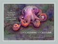
From the Seashore to the Seafloor: An Illustrated Tour of Sandy Beaches, Kelp Forests, Coral Reefs, and Life in the Ocean's Depths
by Janet VoightAn octopus expert and celebrated artist offer a deep dive to meet the enchanting inhabitants of the world’s marine ecosystems. Have you ever walked along the beach and wondered what kind of creatures can be found beneath the waves? Have you pictured what it would be like to see the ocean not from the shore but from its depths? These questions drive Janet Voight, an expert on mollusks who has explored the seas in the submersible Alvin that can dive some 14,000 feet below the water’s surface. In this book, she partners with artist Peggy Macnamara to invite readers to share her undersea journeys of discovery. With accessible scientific descriptions, Voight introduces the animals that inhabit rocky and sandy shores, explains the fragility of coral reefs, and honors the extraordinary creatures that must search for food in the ocean’s depths, where light and heat are rare. These fascinating insights are accompanied by Macnamara’s stunning watercolors, which illuminate these ecosystems and other scenes from Voight’s research. Together, they show connections between life at every depth—and warn of the threats these beguiling places and their eccentric denizens face.
Frontex and the Rising of a New Border Control Culture in Europe (Border Regions Series)
by Antonia-Maria SarantakiThis book examines the rapidly expanding EU agency’s distinct role in EU border control, showing that Frontex is a prominent border control actor that reshapes the EU borders by promoting a new border control culture. Bringing culture into the analysis of Frontex, this book offers an alternative in-depth understanding of the agency’s function, focusing on the production and diffusion of border control assumptions and practices within a border control community. Based on data drawn from primary research at Frontex and two EU external borders, namely Lampedusa and Evros, this book examines Frontex’s contribution to the emergence of a new border control culture in Europe, replacing the pre-existing Schengen culture. Compared with the existing literature on Frontex, this novel account takes into consideration the evolving nature of borders and border control, discussing three contemporary challenges for the established border control regime: Brexit, the COVID-19 pandemic, and hard security preoccupations, such as the fall-out from the Russian invasion in Ukraine and the weaponisation of migration at the Greek-Turkish land border. Frontex and the Rising of a New Border Control Culture in Europe will appeal to scholars and students of border management, EU studies, migration, geography, international relations, and security, along with policymakers and practitioners with an interest in EU border control and Frontex.
Frontier Assemblages: The Emergent Politics of Resource Frontiers in Asia (Antipode Book Series)
by Jason Cons Michael EilenbergFrontier Assemblages offers a new framework for thinking about resource frontiers in Asia Presents an empirical understanding of resource frontiers and provides tools for broader engagements and linkages Filled with rich ethnographic and historical case studies and contains contributions from noted scholars in the field Explores the political ecology of extraction, expansion and production in marginal spaces in Asia Maps the flows, frictions, interests and imaginations that accumulate in Asia to transformative effect Brings together noted anthropologists, geographers and sociologists
Frontier Making in the Amazon: Economic, Political and Socioecological Conversion (Key Challenges in Geography)
by Antonio Augusto IorisThis book discusses the outcomes of more than ten years of research in the southern tracts of the Amazon region, and addresses the expansion of the agricultural frontier, consolidation of the agribusiness-based economy, and expansion of regional infrastructure (roads, dams, urban centres, etc).It combines extensive empirical evidence with the international literature on frontier-making and regional Amazonian development, and adopts a critical politico-geographical perspective that will benefit scholars in various other disciplines.This book is intended to push the current theoretical and methodological boundaries regarding the controversies and impacts of agribusiness in the region. A new international scientific network, led by the author, is investigating the broader context of the themes analysed here.
Frontier Road: Power, History, and the Everyday State in the Colombian Amazon (Antipode Book Series)
by Simón UribeFrontier Road uses the history of one road in southern Colombia—known locally as “the trampoline of death”—to demonstrate how state-building processes and practices have depended on the production and maintenance of frontiers as inclusive-exclusive zones, often through violent means. Considers the topic from multiple perspectives, including ethnography of the state, the dynamics of frontiers, and the nature of postcolonial power, space, and violence Draws attention to the political, environmental, and racial dynamics involved in the history and development of transport infrastructure in the Amazon region Examines the violence that has sustained the state through time and space, as well as the ways in which ordinary people have made sense of and contested that violence in everyday life Incorporates a broad range of engaging sources, such as missionary and government archives, travel writing, and oral histories
Frontier Studies in Soil Science (Frontier Studies in Soil Science)
by Avelino Núñez-DelgadoThis is the first book where top researchers focus on presenting new research proposals in soil science. All the authors contributing to the book have a solid background and experience in specific fields of soil science, allowing them to propose the critical lines of future development in their respective and particular paths of cut-edge investigation. The primary audiences for the work are scientists/researchers working in these fields, as well as students interested in the views from top scientists on recent and future trends in the area, and all those in the overall society desiring to be aware of possible pathways for the future of soil science.
Frontier Thinking and Human-Nature Relations: We Were Never Western (Routledge Explorations in Environmental Studies)
by E. C. KeskitaloCombining historical, social and regulative analysis, this book builds a compelling critique of ‘frontier thinking’ as it continues to form our assumptions about social and environmental organisation – in ways that impact not least the present environmental crisis.This book systematically identifies the ways in which images of nature and society are formed by the historically developed frontier-oriented narratives which have underpinned much Anglo-American and Anglocentric thought. The book confronts these conceptions at large, showing that they never held empirically, and contrasts them with the situation in northern Europe, where diverging assumptions are integral to this day. Through this juxtaposition, this book illustrates not only the pervasiveness of structures of understanding in steering policy but also the varying traditions regarding how understandings of the environment can be formed.This study highlights how historical thought patterns, formed for very different reasons than exist today, continue to shape our assumptions about nature, the relation between urban and rural areas and our understanding of ourselves in relation to the environment. This book will be of wide interest to a range of academics and students in the fields of geography, anthropology, environmental studies, sociology, political science and development studies, amongst others.
Frontier and Metropolis: Regions, Cities, and Identities in Canada before 1914
by J.M.S. CarelessThe regional character of Canada and the crucial role of metropolitan development in its history have been recurring themes in the work of J.M.S. Careless. In these essays he returns to those themes, discussing how national and regional identity in Canada show vital links with metropolitan-hinterland relationship across time and space.The first essay presents an overall appraisal of the historic connections between metropolitan centres and frontiers or regions in Canada. These connections might be manifested in economic structures, political fabrics, or social networks, and also in modes of opinion and popular images and traditions. The second part of the book inquires into some major conceptual treatments given to frontier and metropolis in history. The third seeks to evaluate the impact of metropolitanism on distinctive features of identity that are revealed in Canadian historical experience. A fourth essays rounds out the volume by discussing the influence of external metropolanism in Canada.Careless endows his subject with the combined fornce of his own continuing research, his sensitivity to the new historical scholarship, and the lively and penetrating mind that have made him one of Canada's leading historians for more than thirty years.
Frontiers in Development Policy
by Shahid Yusuf Raj Nallari Breda Griffith Rwitwika BhattacharyaThe global crisis of 2008-09 has brought to the forefront a plethora of economic and political policy issues. There is a re-opening of discussion on basic economic concepts, appropriate framework for analysis, role of private and public sectors in the economy, structural transformation of economies, human development and managing of growing risks and crises. The purpose of this book has been to bring home the inter-linkages in various parts of the economy and the need for practical policy making to reach development goals while being aware of the instabilities, complexities and downside risks inherent in the nature of a an economy operating in a globalized world. Thematically, this book focuses on two core types of policy: policies that promote strong, sustainable and inclusive growth in low income and middle income developing countries and new and emerging policies that necessitates a discussion amongst policy makers and practitioners. Throughout the book, the authors provide insight in to the different types of policy approaches that can be taken to help the economy grow. Ultimately the book looks to foster discussion amongst policy makers on growth and development.
Frontiers in General Relativity (Lecture Notes in Physics #984)
by Dirk Puetzfeld Peter A. HoganThis book discusses some of the open questions addressed by researchers in general relativity. Photons and particles play important roles in the theoretical framework, since they are involved in analyzing and measuring gravitational fields and in constructing mathematical models of gravitational fields of various types. The authors highlight this aspect covering topics such as the construction of models of Bateman electromagnetic waves and analogous gravitational waves, the studies of gravitational radiation in presence of a cosmological constant and the gravitational compass or clock compass for providing an operational way of measuring a gravitational field. The book is meant for advanced students and young researchers in general relativity, who look for an updated text which covers in depth the calculations and, equally, takes on new challenges. The reader, along the learning path, is stimulated by provocative examples interspersed in the text that help to find novel representations of the uses of particles and photons.
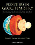
Frontiers in Geochemistry: Contribution of Geochemistry to the Study of the Earth
by Andrew Parker Russell HarmonThis book is a contribution to the International Year of Planet Earth arising from the 33rd International Geological Congress, held in Oslo, Norway during August 2008. The first section of the book considers aspects of geochemical processes which led to the development of the solid Earth as it is today. The second portion of the book shows how the rapidly-evolving analytical tools and approaches presently used by geochemists may be used to solve emerging environmental and other societal problems. This unique collection of reviews, with contributions from a range of internationally distinguished scientists, will be invaluable reading for advanced students and others interested in the central role geochemistry in the earth sciences.
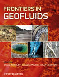
Frontiers in Geofluids
by Bruce Yardley Craig Manning Grant GarvenFrontiers in Geofluids is a collection of invited papers chosen to highlight recent developments in our understanding of geological fluids in different parts of the Earth, and published to mark the first ten years of publication of the journal Geofluids. The scope of the volume ranges from the fundamental properties of fluids and the phase relationships of fluids encountered in nature, to case studies of the role of fluids in natural processes. New developments in analytical and theoretical approaches to understanding fluid compositions, fluid properties, and geological fluid dynamics across a wide range of environments are included. A recurrent theme of research published in Geofluids is the way in which similar approaches can be applied to geological fluids in very different settings and this is reflected in the diverse range of applications of fluid studies that are included here. They include deep groundwater flow, hydrocarbons in faulted sedimentary basins, hydrothermal ores, and multiphase flow in mid-ocean ridge systems. Other topics covered are geothermal waters, crustal metamorphism, and fluids in magmatic systems. The book will be of great interest to researchers and students interested in crustal and mantle fluids of all sorts.
Frontiers in Geographical Teaching (Collected Works of Richard J. Chorley)
by Richard J. Chorley Peter HaggettOriginally published in 1965 and with a second edition in 1970. Building upon the original two Madingley Hall seminars for teachers of non-university geography in 1965, this book presents an updated research picture of the 1970 transatlantic perspective. Answering the questions "What is happening in geography" and "What impact does this have on school geography", this provided a real link for students who were then making the increasingly difficult transition from school to university geography. Originally receiving a hostile reaction from British journals, the book’s diagnosis and prognosis were a forerunner of developments in methodological changes of the discipline. This work collects a series of essays delineating geographic concepts in terms of the philosophic underpinnings, assessment of the geomorphic system, climatology, and social economic and historical changing trends. Techniques are reviewed including quantitative methods for geomorphology and social geography, fieldwork both in urban areas and land-use surveys, and finally in physical planning. Final analyses examine and contrast the teaching methods and courses in American and British High Schools, Colleges and Universities.