- Table View
- List View
Frontiers in Membrane Technology: 7th IWA-RMTC 2024 (Lecture Notes in Civil Engineering #525)
by Giorgio Mannina How Yong NgThis volume highlights the latest advances, innovations, and applications related to membrane technologies for water and wastewater treatment as presented by leading researchers at the 7th IWA Regional Membrane Technology Conference (IWA-RMTC), held in Palermo, Italy on June 18-21, 2024. The event took place together with the International Conference on Wider-Uptake of Water Resource Recovery from Wastewater Treatment (ICWRR). The contributions cover a wide range of topics such as membrane materials and configurations, hybrid membrane processes, drinking water treatment, domestic/industrial wastewater treatment, water reuse, resource recovery from wastewater, energy recovery from water and wastewater, desalination, membrane fouling mechanisms and control. The contributions were selected by means of a rigorous peer-review process and highlight many exciting ideas that will spur novel research directions and foster multidisciplinary collaboration among different water specialists.
Frontiers in Nature-based Tourism: Lessons from Finland, Iceland, Norway and Sweden
by Peter Fredman Liisa TyrväinenNature has been a key attraction factor for tourism in the Nordic countries for decades. The demand for nature-based tourism has steadily grown and is one of the most rapidly expanding sectors within tourism across Europe and elsewhere. This demand has created opportunities for nature-based tourism to develop as an economic diversification tool within regions rich in natural amenities. But nature-based tourism is not only about tourism businesses and tourists visiting nature. The natural environment as a basis for tourism involves many challenges related to local communities, public access, nature protection and the management of natural resources.This book covers a broad set of topics in contemporary nature-based tourism from Finland, Iceland, Norway and Sweden. Areas discussed are innovation, fishing rights and supply of angling, recreation experience preferences, national park attractions, the cultural clash between established outdoor recreational use and new tourism activities, the Right of Public Access as opportunity and obstacle, preferences of tourism landscapes, controversies around wilderness development, management of hiking trails, eco-tourism certification, and financing of recreational infrastructure.This book was published as a special issue of the Scandinavian Journal of Hospitality and Tourism.
Frontiers in Soil Science Research: Report of a Workshop
by National Research Council of the National AcademiesThere has been renewed interest in soil and soil science in recent years as the recognition that biogeochemical processes that occur at the Earth's surface influence global climate change, land degradation and remediation, the fate and transport of nutrients and contaminants, soil and water conservation, soil and water quality, food sufficiency and safety, and many other issues pertinent to the stewardship and conservation of land and water resources. In some areas of the Earth we have approached near irreversible soil conditions that may threaten the existence of future generations. Understanding the long-term implications of decreased soil quality and addressing the aforementioned challenges will require new information based on advances and breakthroughs in soil science research that need to be effectively communicated to stakeholders, policy makers, and the general public. On December 12-14, 2005, the National Academies convened the Frontiers in Soil Science Research Workshop, summarized in this volume, to identify emerging areas for research in soil science by addressing the interaction of soil science subdisciplines, collaborative research with other disciplines, and the use of new technologies in research. The workshop focused around seven key questions addressing research frontiers for the individual soil science disciplines, and also addressing the need for integration across soil science with other disciplines.
Frontiers of Discontinuous Numerical Methods and Practical Simulations in Engineering and Disaster Prevention
by Lu Zheng Yuzo Ohnishi Takeshi Sasaki Guangqi ChenAnalysis of large deformation, rigid body movement and strain or stress for discontinuous materials is often required for project designs and plans in the fields of engineering and disaster prevention. Many numerical simulation and analysis methods have been developed for the requirement from science and technology people since 1970s. Among them, D
Frontiers of Energy and Environmental Engineering
by Ran Chen Jimmy C.M. Kao Wen-Pei SungFrontiers of Energy and Environmental Engineering brings together 192 peer-reviewed papers presented at the 2012 International Conference on Frontiers of Energy and Environment Engineering, held in Hong Kong, December 11-13, 2012. The aim of the conference was to provide a platform for researchers, engineers and academics as well as industry profes
Frontiers of Fundamental Physics FFP16: Fundamental Physics and Physics Education (Springer Proceedings in Physics #392)
by Burra G. Sidharth Marisa Michelini Ekrem Aydiner Christian CordaThis book is a collection of contributions presented at the 16th annual international symposium “Frontiers of Fundamental Physics” (FFP16), supported by Istanbul University. As a document of the latest occurrence of this very important gathering, it presents the most recent advances in fundamental physics and physics teaching. For nearly fifteen years, the FFP has attracted some of the greatest physicists in the world. The broad objective of the entire endeavor has been to enable scholars working in slightly different areas to meet on a single platform. Even with this particular year’s safety restrictions arising from Covid, we feel that the general mission has been carried out as fully as in any year. The book features addresses given by a host of expert contributors, all of which are organized according to seven individual themes. The areas covered include Astronomy and Astrophysics, Particle Physics, Theoretical Physics, Gravitation and Cosmology, Computational Physics, Condensed Matter Physics, Complex Systems and related areas. This book should prove to be a veritable bounty for anyone with an interest in the continued evolution of our understanding of the physical world.
Frontiers of Land and Water Governance in Urban Areas (Routledge Special Issues on Water Policy and Governance)
by Thomas Hartmann and Tejo SpitA society that intensifies and expands the use of land and water in urban areas needs to search for solutions to manage the frontiers between these two essential elements for urban living. Sustainable governance of land and water is one of the major challenges of our times. Managing retention areas for floods and droughts, designing resilient urban waterfronts, implementing floating homes, or managing wastewater in shrinking cities are just a few examples where spatial planning steps into the governance arena of water management and vice versa. However, water management and spatial planning pursue different modes of governance, and therefore the frontiers between the two disciplines require developing approaches for setting up governance schemes for sustainable cities of the future. What are the particularities of the governance of land and water? What is the role of regional and local spatial planning? What institutional barriers may arise? This book focuses on questions such as these, and covers groundwater governance, water supply and wastewater treatment, urban riverscapes, urban flooding, flood risk management, and concepts of resilience. The project resulted from a Summer School by the German Academy for Spatial Research and Planning (ARL) organized by the editors at Utrecht University in 2013.This book was published as a special issue of Water International.
Fronts, Waves and Vortices in Geophysical Flows
by Jan-Bert FlorMost well known structures in planetary atmospheres and the Earth's oceans are jets or fronts interacting with vortices on a wide range of scales. The transition from one state to another, such as in unbalanced or adjustment flows, involves the generation of waves as well as the interaction of coherent structures with these waves. This book presents a fluid mechanics perspective to the dynamics of fronts and vortices and their interaction with waves in geophysical flows. It provides a basic physical background for modeling coherent structures in a geophysical context, and it gives essential information on advanced topics such as spontaneous wave emission and wavemomentum transfer in geophysical flows. Based on a set of lectures by leading specialists, this text is targeted at graduate students, researchers and engineers in geophysics and environmental fluid mechanics.
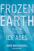
Frozen Earth
by Douglas MacdougallIn this engrossing and accessible book, Doug Macdougall explores the causes and effects of ice ages that have gripped our planet throughout its history, from the earliest known glaciation--nearly three billion years ago--to the present. Following the development of scientific ideas about these dramatic events, Macdougall traces the lives of many of the brilliant and intriguing characters who have contributed to the evolving understanding of how ice ages come about. As it explains how the great Pleistocene Ice Age has shaped the earth's landscape and influenced the course of human evolution, Frozen Earth also provides a fascinating look at how science is done, how the excitement of discovery drives scientists to explore and investigate, and how timing and chance play a part in the acceptance of new scientific ideas. Macdougall describes the awesome power of cataclysmic floods that marked the melting of the glaciers of the Pleistocene Ice Age. He probes the chilling evidence for "Snowball Earth," an episode far back in the earth's past that may have seen our planet encased in ice from pole to pole. He discusses the accumulating evidence from deep-sea sediment cores, as well as ice cores from Greenland and the Antarctic, that suggests fast-changing ice age climates may have directly impacted the evolution of our species and the course of human migration and civilization. Frozen Earth also chronicles how the concept of the ice age has gripped the imagination of scientists for almost two centuries. It offers an absorbing consideration of how current studies of Pleistocene climate may help us understand earth's future climate changes, including the question of when the next glacial interval will occur.
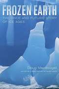
Frozen Earth: The Once and Future Story of Ice Ages
by Doug MacdougallIn this engrossing and accessible book, Doug Macdougall explores the causes and effects of ice ages that have gripped our planet throughout its history, from the earliest known glaciation--nearly three billion years ago--to the present. Following the development of scientific ideas about these dramatic events, Macdougall traces the lives of many of the brilliant and intriguing characters who have contributed to the evolving understanding of how ice ages come about. As it explains how the great Pleistocene Ice Age has shaped the earth's landscape and influenced the course of human evolution, Frozen Earth also provides a fascinating look at how science is done, how the excitement of discovery drives scientists to explore and investigate, and how timing and chance play a part in the acceptance of new scientific ideas. Macdougall describes the awesome power of cataclysmic floods that marked the melting of the glaciers of the Pleistocene Ice Age. He probes the chilling evidence for "Snowball Earth," an episode far back in the earth's past that may have seen our planet encased in ice from pole to pole. He discusses the accumulating evidence from deep-sea sediment cores, as well as ice cores from Greenland and the Antarctic, that suggests fast-changing ice age climates may have directly impacted the evolution of our species and the course of human migration and civilization. Frozen Earth also chronicles how the concept of the ice age has gripped the imagination of scientists for almost two centuries. It offers an absorbing consideration of how current studies of Pleistocene climate may help us understand earth's future climate changes, including the question of when the next glacial interval will occur.
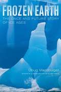
Frozen Earth: The Once and Future Story of Ice Ages
by Douglas MacdougallDoug Macdougall explores the causes and effects of ice ages that have gripped our planet throughout its history, from the earliest known glaciations -- nearly three billion years ago -- to the present.
Frozen Earth: The Once and Future Story of Ice Ages
by Douglas MacdougallAn accessible account of the nature and global effects of Ice Ages, including the history of how several maverick scientists developed various pieces of our current scientific theory of these times, and how recent studies of Pleistocene climate may help us understand Earth's future climate changes.
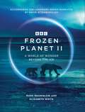
Frozen Planet II
by Elizabeth White Mark BrownlowACCOMPANIES THE LANDMARK SERIES NARRATED BY DAVID ATTENBOROUGHFind a world of wonder beyond the ice. 'Looking down at our planet from space it may come as a surprise how much of it is blanketed in snow and ice. These vast frozen wildernesses cover more than a fifth of the earth ... From the highest peaks to snow-bound deserts to alien worlds deep beneath the ice, they are home to an astonishing array of animals found nowhere else on earth.'David Attenborough, from the series.Frozen Planet II celebrates the surprisingly diverse worlds of ice - a world that is disappearing before our very eyes. Previously undiscovered stories, from chameleons giving birth on the frosty slopes of Mount Kenya to endangered Amur leopards in the Russian forest and killer whales hunting Weddell seals on ice floes in the Antarctic, shed new light on the beauty and the peril of the world's most fragile ecosystems. Behind-the-scenes insights explore the unique challenges of filming in these frozen worlds, where camera crew and wildlife alike brave the extreme conditions.With over 250 stunning full-colour photographs, Frozen Planet II reveals the wonders of the fastest-changing part of our planet, as we may never see them again.
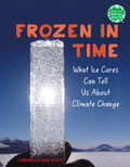
Frozen in Time: What Ice Cores Can Tell Us About Climate Change (Books for a Better Earth)
by Carmella Van VleetA dazzling introduction to paleoclimatology for kids, connecting the methods that scientists use to study our climate history with future climate change solutions.Believe it or not, ice isn&’t always just frozen water. In fact, most of the ice covering our planet contains thousands of years' worth of information about our atmosphere. This ice is made up of a lot more than snow—it has soot, volcanic ash, gasses, and other substances that affect the climate. And if we drill a piece of that ice? We get a frozen time capsule, courtesy of Earth. In this exhilarating middle grade nonfiction book by a former educator, kids are immersed in the field of paleoclimatology. Readers go along on an ice core expedition, run through each step in the collecting and transporting process, review the fascinating components of an ice core, and explore the specialized labs where scientists examine them.But these pieces of our planet are more than just cool records. By preserving and studying these frosty collections of climate history, we can learn from previous patterns and better protect our planet in the future. The final chapter focuses on ice as a key tool in the fight against climate change.With crystal-clear explanations and an engaging, kid friendly tone, the book features 15+ full-color photographs, diagrams, interviews with paleoclimatologists, a glossary of terms, and simple experiments for budding scientists at home. Books for a Better Earth are designed to inspire children to become active, knowledgeable participants in caring for the planet they live on.A Junior Library Guild Gold Standard Selection
Frugal Innovation and Its Implementation: Leveraging Constraints to Drive Innovations on a Global Scale (Contributions to Management Science)
by Alexander Brem Nivedita AgarwalThis book discusses several product development strategies and tools employed by organizations around the world to implement frugal innovations. Over the past decade, frugal innovations have caught the attention of countless management scholars. This book comes at the right time for academics and practitioners alike, as it explores how the concept of frugal innovation has evolved over the past several years and is shifting its focus from merely featuring ‘cost’ driven innovations to being more ‘resourceful’ and ‘sustainable’ at its core. Furthermore, in light of the ongoing digital revolution and emergence of new business models such as sharing economy and circular economy, the book highlights recent and upcoming trends and their impacts on frugal innovation strategies.
Frugal Innovation: A Global Research Companion (Routledge Studies in Innovation, Organizations and Technology)
by Adela J. McMurray Gerrit A. De WaalCustomers are increasingly seeking "low-cost, high-quality" or what is known as frugal products that meet the buyer’s needs while reducing the associated cost of ownership. This book examines the developing principles and theories of frugal innovations across the globe. The authors identify frugal innovation (FI) using a multi-method approach to data analysis. They argue that the concept of frugality as a societal/ethical value has undergone several changes and propose a differentiated model of frugal innovations. They address frugal innovations that have never been accessible to the public. Hands-on case studies across multiple industry sectors and countries, supported by theory, provide multiple learning opportunities. The authors explore the relationship between FI and digitalization and technology, and discuss how FI can be applied in the context of contemporary issues such as food security. Further, they articulate the mechanisms by which FI beliefs and values can be incorporated into organizational culture. The final chapters address both ethical and controversial views of frugal innovation. The book is a valuable resource for students in business courses, for industry professionals wanting to improve their triple bottom line, and for educators wanting to influence and change the mind-sets of the younger generations to effectively deal with today’s and tomorrow’s challenges.
Fruit Ripening
by Christopher Davies Véronique Cheynier Autar K. Mattoo Autar Handa Don Grierson Asaph Aharoni Angelos Kannellis Cornelius Barry Mathilde Causse Arun Sharma Hiroshi Ezura Mondher Bouzayen Alisdair Fernie Jean Claude Pech Kunsog Chen Pravendra Nath Abhay Dandekar Joseph Hirschberg Mark Tucker Kailash Bansal Jim Giovannoni Christophe Rothan Giovanni GiulianoFruit ripening is an important aspect of fruit production. The timing of it affects supply chains and buying behaviour, and for consumers ripeness not only affects perceptions of health but has nutritional effects too. Ripeness is closely related to spoilage which has a major financial impact on agricultural industries. Currently there are fast moving developments in knowledge of the factors affecting fruit ripeness, and this up-to-date monograph seeks to draw together the disparate research in this area. The aim of the book is to produce a comprehensive account covering almost every area related to fruit ripening including the latest molecular mechanisms regulating fruit ripening, its impact on human nutrition and emerging research and technologies.
Fruit Ripening: Physiology, Signalling and Genomics
by Christopher Davies Véronique Cheynier Autar Handa Don Grierson Asaph Aharoni Angelos Kannellis Cornelius Barry Mathilde Causse Arun Sharma Hiroshi Ezura Alisdair Fernie Kunsog Chen Joseph Hirschberg Mark Tucker Kailash Bansal Jim Giovannoni Christophe Rothan Giovanni Giuliano Abhaya DandekarFruit ripening is an important aspect of fruit production. The timing of it affects supply chains and buying behaviour, and for consumers ripeness not only affects perceptions of health but has nutritional effects too. Ripeness is closely related to spoilage which has a major financial impact on agricultural industries. Currently there are fast moving developments in knowledge of the factors affecting fruit ripeness, and this up-to-date monograph seeks to draw together the disparate research in this area. The aim of the book is to produce a comprehensive account covering almost every area related to fruit ripening including the latest molecular mechanisms regulating fruit ripening, its impact on human nutrition and emerging research and technologies.
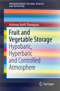
Fruit and Vegetable Storage
by Anthony Keith ThompsonThis Brief reviews the effects of increasing and reducing atmospheric pressure on the postharvest life of fruit and vegetables. The text covers the common methods and technologies used and evaluates the history and benefits of hypobaric and hyperbaric storage. Both of these techniques have the potential to address quantitative and qualitative challenges in the postharvest sector of the fresh fruit and vegetables industry. Hypobaric and Hyperbaric Storage of Fruit and Vegetables reports on the effects of storage on over 45 types of fruit and vegetables, as well as on whole plants and cut flowers. As consumer demand for high quality product increases, proper postharvest storage will continue to gain in importance. The environmental conditions used in storage have a vital influence on the quality, safety and health benefits of fruit and vegetables.
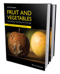
Fruit and Vegetables: Harvesting, Handling and Storage (Springerbriefs In Food, Health, And Nutrition Ser.)
by Anthony Keith ThompsonCompletely revised, updated and enlarged, now encompassing two volumes, this third edition of Fruit and Vegetables reviews and evaluates, in comprehensive detail, postharvest aspects of a very wide international range of fresh fruit and vegetables as it applies to their physiology, quality, technology, harvest maturity determination, harvesting methods, packaging, postharvest treatments, controlled atmosphere storage, ripening and transportation. The new edition of this definitive work, which contains many full colour photographs, and details of species not covered in the previous editions, provides key practical and commercially-oriented information of great use in helping to ensure that fresh fruit and vegetables reach the retailer in optimum condition, with the minimum of deterioration and spoilage. With the constantly increasing experimental work throughout the world the book incorporates salient advances in the context of current work, as well as that dating back over a century, to give options to the reader to choose what is most relevant to their situation and needs. This is important because recommendations in the literature are often conflicting; part of the evaluation of the published results and reviews is to guide the reader to make suitable choices through discussion of the reasons for diverse recommendations. Also included is much more on the nutritional values of fruit and vegetables, and how these may vary and change postharvest. There is also additional information on the origin, domestication and taxonomy of fruit and vegetables, putting recommendations in context. Fruits and Vegetables 3e is essential reading for fruit and vegetable technologists, food scientists and food technologists, agricultural scientists, commercial growers, shippers, packhouse operatives and personnel within packaging companies. Researchers and upper level students in food science, food technology, plant and agricultural sciences will find a great deal of use within this popular book. All libraries in research establishments and universities where these subjects are studied and taught should have copies readily available for users.
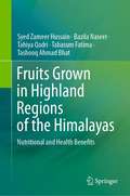
Fruits Grown in Highland Regions of the Himalayas: Nutritional and Health Benefits
by Syed Zameer Hussain Bazila Naseer Tahiya Qadri Tabasum Fatima Tashooq Ahmad BhatThis book discusses different fruit crops and provides first-hand information on the nutritional composition of commercially important, as well as unexplored fruits, which are grown in Jammu, Kashmir and Ladakh. A detailed nutritional profile of each fruit is presented in the book. The potential health implications against cardiovascular diseases, diabetes, carcinoma, oxidative damage, asthma, aging and cognition are discussed and explained. Besides, nutritional composition and medicinal implications, origin, morphology, taxonomy and production scenarios of unexplored, as well as commercially important fruits, have also been highlighted in the book. This book will be of interest to students and researchers involved in agricultural sciences, food science, nutrition and the Indian medicine system.
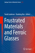
Frustrated Materials and Ferroic Glasses (Springer Series in Materials Science #275)
by Turab Lookman Xiaobing RenThis book provides a comprehensive introduction to ferroics and frustrated materials. Ferroics comprise a range of materials classes with functionalities such as magnetism, polarization, and orbital degrees of freedom and strain. Frustration, due to geometrical constraints, and disorder, due to chemical and/or structural inhomogeneities, can lead to glassy behavior, which has either been directly observed or inferred in a range of materials classes from model systems such as artificial spin ice, shape memory alloys, and ferroelectrics to electronically functional materials such as manganites. Interesting and unusual properties are found to be associated with these glasses and have potential for novel applications. Just as in prototypical spin glass and structural glasses, the elements of frustration and disorder lead to non-ergodocity, history dependence, frequency dependent relaxation behavior, and the presence of inhomogeneous nano clusters or domains. In addition, there are new states of matter, such as spin ice; however, it is still an open question as to whether these systems belong to the same family or universality class.The purpose of this work is to collect in a single volume the range of materials systems with differing functionalities that show many of the common characteristics of geometrical frustration, where interacting degrees of freedom do not fit in a lattice or medium, and glassy behavior is accompanied by additional presence of disorder. The chapters are written by experts in their fields and span experiment and theory, as well as simulations. Frustrated Materials and Ferroic Glasses will be of interest to a wide range of readers in condensed matter physics and materials science.
Fueling Up: The Economic Implications of America's Oil and Gas Boom
by Trevor Houser Shashank MohanNew drilling techniques for oil and natural gas are propelling an energy production renaissance in the United States. As the US economy struggles to emerge from the Great Recession, many see the boom as a possible source of economic salvation that could reduce unemployment and revitalize American manufacturing. Until now, however, there has been little objective analysis of the energy boom's economic consequences.In this major study, Trevor Houser and Shashank Mohan fill that gap. They assess the impact of the recent and projected increase in domestic energy production on US GDP, employment growth, manufacturing competitiveness, household expenditures, and international trade balance. Alongside its economic impact, the American energy revolution is raising new environmental and trade policy questions. What are the consequences for the environment and global warming of increased domestic oil and gas production? Should companies be allowed to export the energy they produce or will doing so undermine American manufacturing competitiveness? Houser and Mohan provide independent research and analysis that will help policymakers navigate these issues.
Fuelling War: Natural Resources and Armed Conflicts (Adelphi series #373)
by Philippe Le BillonA generous endowment of natural resources should favour rapid economic and social development. The experience of countries like Angola and Iraq, however, suggests that resource wealth often proves a curse rather than a blessing. Billions of dollars from resource exploitation benefit repressive regimes and rebel groups, at a massive cost for local populations. This Adelphi Paper analyses the economic and political vulnerability of resource-dependent countries; assesses how resources influence the likelihood and course of conflicts; and discusses current initiatives to improve resource governance in the interest of peace. It concludes that long-term stability in resource-exporting regions will depend on their developmental outcomes, and calls for a broad reform agenda prioritising the basic needs and security of local populations.
Fuji: A Mountain in the Making
by Andrew W. BernsteinA panoramic biography of Japan&’s iconic mountain from the Ice Age to the presentMount Fuji is everywhere recognized as a wonder of nature and enduring symbol of Japan. Yet behind the picture-postcard image is a history filled with conflict and upheaval. Violent eruptions across the centuries wrought havoc and instilled fear. Long an object of worship, Fuji has been inhabited by deities that changed radically over time. It has been both a totem of national unity and a flashpoint for economic and political disputes. And while its soaring majesty has inspired countless works of literature and art, the foot of the mountain is home to military training grounds and polluting industries. Tracing the history of Fuji from its geological origins in the remote past to its recent inscription as a World Heritage Site, Andrew Bernstein explores these and other contradictions in the story of the mountain, inviting us to reflect on the relationships we share with the nonhuman world and one another.Beautifully illustrated, Fuji presents a rich portrait of one of the world&’s most celebrated sites, revealing a mountain forever in the making and offering a meditation on the ability of landscape both to challenge and inspire.