- Table View
- List View
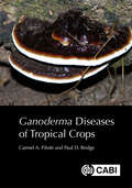
Ganoderma Diseases of Tropical Crops
by Paul Bridge Dr Carmel A PilottiThe fungal genus Ganoderma includes around 80 currently recognized species that are widely distributed in temperate, subtropical and tropical regions, and cause disease in a range of economically important perennial crops and tree-like plants. Ganoderma root and lower stem rots have a significant impact on yields from crops including oil palm, coconut, beverage crops, Acacia and rubber. The identification of species responsible for stem and butt rots is often ambiguous as closely related species may only be distinguished by subtle morphological differences. Within species there can be considerable morphological plasticity and this can make morphology-based identification difficult, particularly for species described from a single specimen. Molecular techniques are helping to slowly resolve Ganoderma taxonomy but it will be some time (if ever) before the taxonomy is fully resolved. This book brings together information on Ganoderma species that are reported to be responsible for crop diseases in tropical and sub-tropical agriculture and covers taxonomy, biology, genetics, aetiology, epidemiology and control. This book is an essential resource for researchers in Ganoderma in crop science and tropical agriculture, as well as practitioners and industry.
Garbage In, Garbage Out: Solving the Problems with Long-distance Trash Transport
by Vivian E. ThomsonYour garbage is going places you'd never imagine. What used to be sent to the local dump now may move hundreds of miles by truck and barge to its final resting place. Virtually all forms of pollution migrate, subjected to natural forces such as wind and water currents. The movement of garbage, however, is under human control. Its patterns of migration reveal much about power sharing among state, local, and national institutions, about the Constitution's protection of trash transport as a commercial activity, and about competing notions of social fairness. In Garbage In, Garbage Out, Vivian Thomson looks at Virginia's status as the second-largest importer of trash in the United States and uses it as a touchstone for exploring the many controversies around trash generation and disposal.Political conflicts over waste management have been felt at all levels of government. Local governments who want to manage their own trash have fought other local governments hosting huge landfills that depend on trash generated hundreds of miles away. State governments have tried to avoid becoming the dumping grounds for cities hundreds of miles away. The constitutional questions raised in these battles have kept interstate trash transport on Congress's agenda since the early 1990s. Whether the resulting legislative proposals actually address our most critical garbage-related problems, however, remains in question.Thomson sheds much-needed light on these problems. Within the context of increased interstate trash transport and the trend toward privatization of waste management, she examines the garbage issue from a number of perspectives--including the links between environmental justice and trash management, a critical evaluation of the theoretical and empirical relationship between economic growth and environmental improvement, and highlighting the ways in which waste management practices in the US differ from those in the European Union and Japan. Thomson then provides specific, substantive recommendations for our own policymakers.Everything eventually becomes trash. As we explore the long, often surprising, routes our garbage takes, we begin to understand that it is something more than a mere nuisance that regularly "disappears" from our curbside. Rather, trash generation and management reflect patterns of consumption, political choices over whether garbage is primarily pollution or commerce, the social distribution of environmental risk, and how our daily lives compare with those of our counterparts in other industrialized nations.
Garbage Wars: The Struggle for Environmental Justice in Chicago (Urban and Industrial Environments)
by David Naguib PellowA study of the struggle for environmental justice, focusing on conflicts over solid waste and pollution in Chicago.In Garbage Wars, the sociologist David Pellow describes the politics of garbage in Chicago. He shows how garbage affects residents in vulnerable communities and poses health risks to those who dispose of it. He follows the trash, the pollution, the hazards, and the people who encountered them in the period 1880-2000. What unfolds is a tug of war among social movements, government, and industry over how we manage our waste, who benefits, and who pays the costs.Studies demonstrate that minority and low-income communities bear a disproportionate burden of environmental hazards. Pellow analyzes how and why environmental inequalities are created. He also explains how class and racial politics have influenced the waste industry throughout the history of Chicago and the United States. After examining the roles of social movements and workers in defining, resisting, and shaping garbage disposal in the United States, he concludes that some environmental groups and people of color have actually contributed to environmental inequality.By highlighting conflicts over waste dumping, incineration, landfills, and recycling, Pellow provides a historical view of the garbage industry throughout the life cycle of waste. Although his focus is on Chicago, he places the trends and conflicts in a broader context, describing how communities throughout the United States have resisted the waste industry's efforts to locate hazardous facilities in their backyards. The book closes with suggestions for how communities can work more effectively for environmental justice and safe, sustainable waste management.
Garden Cities
by Sarah RutherfordGarden Cities: the phrase is redolent of Arts and Crafts values and nineteenth-century utopianism. But despite being the culmination of a range of influential movements, and having global influence themselves, in fact there were only ever two true, self-contained Garden Cities in England - far more numerous were Garden Suburbs and Villages. Crystallised in England by social visionary Ebenezer Howard and executed in many cases by planners and architects Barry Parker and Raymond Unwin, the concept arose from nineteenth-century industrial settlements like Port Sunlight (and, earlier, Saltaire and Akroyden), and also from the City Beautiful movement in the US. The settlements were designed to promote healthy and comfortable individual and community life, as well as supporting commerce and industry, and were - and are - instantly and attractively recognisable. This book is a beautifully illustrated guide to the movement as a whole, from its earliest influences through practical difficulties in implementation to the continuing vitality of the communities which are its legacy.
Garden Cities of To-Morrow
by Ebenezer HowardOriginally published in 1898 as To-Morrow: A peaceful path to reform, "the book", writes F.J. Osborn "holds a unique place in town planning literature, is cited in all planning bibliographies, stands on the shelves of the more important libraries, and is alluded to in most books on planning; yet most of the popular writers on planning do not seem to have read it - or if they have read it, to remember what it says." The book led directly to two experiments in town-founding that by imitation, and imitation of imitation, have had a profound influence on practical urban development throughout the world. The book was responsible for the introduction of the term Garden City in numbers of languages - Cite-Jardin, Gartenstadt, Ciudad-jardin, Tuinstad - and set into motion ideas that have helped transform the scientific and political outlook on town structure and town growth. With urban renewal and the development of suburban communities as features of the contemoprary American scene, Garden cities of To-Morrow becomes "must" reading. In the words of Lewis Mumford: "This is not merely a book for Technicians: above all it is a book for citizens, for the people whose actively expressed needs, desires and interests should guide the planner and administrator at every turn." This book was first published in it's current form in 1965.
Garden Revolution: How Our Landscapes Can Be a Source of Environmental Change
by Thomas Christopher Larry WeanerAHS Book Award winner This lushly-photographed reference is an important moment in horticulture that will be embraced by anyone looking for a better, smarter way to garden. Larry Weaner is an icon in the world of ecological landscape design, and now his revolutionary approach is available to all gardeners. Garden Revolution shows how an ecological approach to planting can lead to beautiful gardens that buck much of conventional gardening’s counter-productive, time-consuming practices. Instead of picking the wrong plant and then constantly tilling, weeding, irrigating, and fertilizing, Weaner advocates for choosing plants that are adapted to the soil and climate of a specific site and letting them naturally evolve over time. Allowing the plants to find their own niches, to spread their seed around until they find the microclimate and spot that suits them best, creates a landscape that is vibrant, dynamic, and gorgeous year after year.
Gardening Eden: How Creation Care Will Change Your Faith, Your Life, and Our World
by Michael AbbateBefore the snake,the apple,and the Ten Commandments,God created a garden..."Spiritual environmentalism" did not start out as an oxymoron-it was an invitation. Yet today, many believe God's first job description for humankind has been replaced by other "worthier pursuits". Why has this simple instruction become so controversial? How does one sort through all the mixed messages? Is changing our lives to save the world really our responsibility-or even possible?Gardening Eden invites you to consider a new, spiritual perspective to practical environmentalism. The question is not whether our souls find expression and inspiration in our incredible planet, but how best to preserve that fundamental connection. Green living is no longer a fad-simple lifestyle solutions are now available to everyone. Discover creation care as an act of worship and a call to deeper harmony with our Creator, our fellow gardeners, and our living Earth. Gardening Eden is the primer in how this shift will transform not only our world, but your very soul.From the Trade Paperback edition.
Gardening The World
by Veronica StrangAround the world, intensifying development and human demands for fresh water are placing unsustainable pressures on finite resources. Countries are waging war over transboundary rivers, and rural and urban communities are increasingly divided as irrigation demands compete with domestic desires. Marginal groups are losing access to water as powerful elites protect their own interests, and entire ecosystems are being severely degraded. These problems are particularly evident in Australia, with its industrialised economy and arid climate. Yet there have been relatively few attempts to examine the social and cultural complexities that underlie people's engagements with water. Based on long-term ethnographic fieldwork in two major Australian river catchments (the Mitchell River in Cape York, and the Brisbane River in southeast Queensland), this book examines their major water using and managing groups: indigenous communities, farmers, industries, recreational and domestic water users, and environmental organisations. It explores the issues that shape their different beliefs, values and practices in relation to water, and considers the specifically cultural or sub-cultural meanings that they encode in their material surroundings. Through an analysis of each group's diverse efforts to 'garden the world', it provides insights into the complexities of human-environmental relationships.
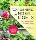
Gardening Under Lights: The Complete Guide for Indoor Growers
by Leslie F. Halleck“If you want to grow plants indoors, you need this book.” —Niki Jabbour, author and staff writer at savvygardening.comGardening Under Lights is a highly-detailed, accessible guide for seed starters, plant collectors, houseplant fans, and anyone who wants to successfully garden indoors any time of the year. You’ll learn the basics of photosynthesis, the science of light, how to accurately measure how much light a plant needs, and details about the most up-to-date tools and gear available. Also included are tips and techniques for helping ornamental plants (like orchids, succulents, bonsai, and more) and edible plants (arugula, cannabis, oregano, tomatoes, and more) thrive indoors. Whether you are a vegetable gardener who wants to extend the growing season, a balcony gardener short on outdoor space, or a specialty plant collector, Gardening Under Lights is a must-have.
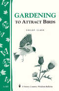
Gardening to Attract Birds: Storey's Country Wisdom Bulletin A-205 (Storey Country Wisdom Bulletin Ser.)
by Shelby ClarkSince 1973, Storey's Country Wisdom Bulletins have offered practical, hands-on instructions designed to help readers master dozens of country living skills quickly and easily. There are now more than 170 titles in this series, and their remarkable popularity reflects the common desire of country and city dwellers alike to cultivate personal independence in everyday life.
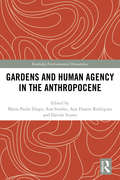
Gardens and Human Agency in the Anthropocene (Routledge Environmental Humanities)
by Ana Simões Maria Paula Diogo Ana Duarte Rodrigues Davide ScarsoThis volume discusses gardens as designed landscapes of mediation between nature and culture, embodying different levels of human control over wilderness, defining specific rules for this confrontation and staging different forms of human dominance. The contributing authors focus on ways of rethinking the garden and its role in contemporary society, using it as a crossover platform between nature, science and technology. Drawing upon their diverse fields of research, including History of Science and Technology, Environmental Studies, Gardens and Landscape Studies, Urban Studies, and Visual and Artistic Studies, the authors unveil various entanglements woven in the past between nature and culture, and probe the potential of alternative epistemologies to escape the predicament of fatalistic dystopias that often revolve around the Anthropocene debate. This book will be of great interest to those studying environmental and landscape history, the history of science and technology, historical geography, and the environmental humanities.
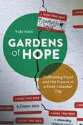
Gardens of Hope: Cultivating Food and the Future in a Post-Disaster City
by Dr. Yuki KatoSocial changes through urban gardening and farmingGardens are often spaces of hope, expected to solve many problems in a city including food insecurity and climate resilience. In fact, there has been a historical trend of urban gardening gaining popularity during times of crisis. Gardens of Hope is the story of urban gardening in New Orleans in the decade after Hurricane Katrina. Yuki Kato highlights the impact urban gardens have on communities after disasters and the efforts of well-intended individuals envisioning alternative futures in the form of urban farming.Drawing on repeated interviews with residents who began cultivation projects in New Orleans between 2005 and 2015, Kato explains how good intentions and grit were not enough to implement or sustain urban gardeners’ visions for the post-disaster city’s future. Coining the term “prefigurative urbanism,” Kato illustrates how individuals tried to realize alternative ways of living and working in the city through pragmatism and innovation. Gardens of Hope asks key questions about what inspires and enables individuals to pursue prefigurative urbanism and about the potential and limitations of this form of civic engagement to bring about short- and long-term changes in cities undergoing transformation, from gentrification, post-pandemic recovery, to climate change.
Gas Dynamics with Applications in Industry and Life Sciences: On Gas Kinetic/Dynamics and Life Science Seminar, March 25–26, 2021 and March 17–18, 2022 (Springer Proceedings in Mathematics & Statistics #429)
by Larisa Beilina Mohammad Asadzadeh Shigeru TakataThis proceedings volume gathers selected contributions presented at two instances of the "JSPS/SAC Seminar: On Gas Kinetic/Dynamics and Life Science", held by the Chalmers University of Technology and University of Gothenburg, Sweden, on March 25-26, 2021 (virtual) and March 17-18, 2022 (virtual).Works in this book provide a concise approach to the theoretical and numerical analysis of kinetic type equations that arise, for example, in modeling industrial, medical, and environmental problems. Readers will find some of the most recent theoretical results, newly developed numerical methods in the field, and some open problems. Possible application areas encompass fission/fusion energy, electromagnetics, nuclear science and engineering, medical service, radiation oncology, and plants growth conditions, to name a few. The JSPS/SAC seminars are jointly organized by JSPS (Japan Society for the Promotion of Science)—Stockholm Office and the Department of Mathematical Sciences, Chalmers University of Technology & University of Gothenburg, Sweden. These seminars foster discussions on the mathematical theory, industrial and life science applications, and numerical analysis of non-linear hyperbolic partial differential equations modeling collision-less plasma and charged particles.Chapter 4 is available open access under a Creative Commons Attribution 4.0 International License via link.springer.com.Chapter 11 is available open access under a Creative Commons Attribution 4.0 International License via link.springer.com.
Gas Explosion and Its Protection Technology in Process Industries
by Zhirong Wang Xingyan CaoThis open access book first introduces the explosive characteristics of combustible gas in the process industrial device, and then introduces the influence law of structural effect on gas explosion characteristics and deflagration to detonation process, and finally introduces the suppression mechanism and protection technology of gas explosion. This book takes the process industrial gas explosion characteristics and its protection as the research object, and discusses the gas explosion characteristics and its protection theory in details. This book can be used as the undergraduate and graduate textbook of safety engineering and related engineering majors in universities, and also as a reference for scientific research staff in safety science and engineering and related disciplines, and also for the reference of safety technology and management personnels.
Gas Hydrates
by Carlo Giavarini Keith HesterGas hydrates are both a huge energy resource and an environmental challenge. They have a significant impact on society because of their applications to the future of energy, protection of the environment and fuel transportation. Gas Hydrates opens up this fascinating, multidisciplinary field to non-specialists. It provides a scientific study of gas hydrates that considers their potential as an energy source while assessing the possible risk to the environment. The authors also examine the feasibility of using these natural compounds for storing and transporting gases such as methane and carbon dioxide. Diagrams and photos are used throughout Gas Hydrates to help readers understand the scientific and technical content. Each section has been designed so it can be read independently by academics and professionals in the oil and gas industry, as well as by all those with an interest in how hydrates combine to be an energy resource, an industrial challange and a geological hazard.
Gaseous Ion Mobility, Diffusion, and Reaction (Springer Series on Atomic, Optical, and Plasma Physics #105)
by Larry A. ViehlandThis book is about the drift, diffusion, and reaction of ions moving through gases under the influence of an external electric field, the gas temperature, and the number density. While this field was established late in the 19th century, experimental and theoretical studies of ion and electron swarms continue to be important in such varied fields as atomic and molecular physics, aeronomy and atmospheric chemistry, gaseous electronics, plasma processing, and laser physics. This book follows in the rigorous tradition of well-known older books on the subject, while at the same time providing a much-needed overview of modern developments with a focus on theory. Graduate students and researchers new to this field will find this book an indispensable guide, particularly those involved with ion mobility spectrometry and the use of ion transport coefficients to test and improve ab initio ion-neutral interaction potentials. Established researchers and academics will find in this book a modern companion to the classic references.
Gashydrate – Eine Einführung in Grundlagenforschung und Anwendung
by Judith M. SchicksGashydrate, auch „brennendes Eis“ genannt, sind faszinierende, eisähnliche Feststoffe, die aus Wasser- und Gasmolekülen aufgebaut sind und weltweit an allen aktiven und passiven Kontinentalhängen und in Permafrostgebieten vorkommen. Doch ihr unauffälliges Erscheinungsbild täuscht: Die Einschlussverbindungen können beachtliche Mengen Methangas enthalten. Daher besteht einerseits die Hoffnung auf einen möglichen neuen Energieträger und andererseits die Sorge um eine nicht zu unterschätzende Quelle an klimaschädlichem Methangas. Gashydrate, hat die neueste Forschung gezeigt, bieten zudem in vielen Bereichen industrieller Anwendung eine durchaus vielversprechende Alternative zu konventionellen Verfahren.Das vorliegende Buch gibt eine Einführung in die physikalisch-chemischen Grundlagen der Hydratbildung und die Strukturen der Gashydratphasen. Basierend auf diesem grundlegenden Verständnis erklärt es die natürlichen Gashydratvorkommen und zeichnet mögliche Methoden des Abbaus und der Gewinnung von Methangas auf. Es beleuchtet Risiken, die von den Gashydratvorkommen in der Natur ausgehen könnten, und führt in die Möglichkeiten der Nutzung dieser Einschlussverbindungen in verschiedenen industriellen Anwendungsbereichen wie z.B. der Aufbereitung von Abwässern oder der Speicherung von Gasen ein.Zielgruppe dieser kompakten Einführung in die verschiedenen Aspekte der Gashydratforschung sind Studierende der Chemie und Geowissenschaften, Ingenieure, Techniker oder auch Wissenschaftler.
Gaslighted: How the Oil and Gas Industry Shortchanges Women Scientists
by Christine L. WilliamsThe oil and gas industry is one of the richest and most powerful industries in the world. In recent years, company avowals in support of diversity, much-touted programs for "women in STEM," and, most importantly, a tight labor market with near parity in women pursuing geoscience credentials might lead us to expect progress for women in this industry's corporate ranks. Yet, for all the talk of "the great crew change," the industry remains overwhelmingly white and male. Sociologist Christine L. Williams asks, where are the women? To answer this question, Williams embarked on a decade-long investigation—one involving one hundred in-depth interviews, a longitudinal survey, and ethnographic research—that allowed her to observe the industry in times of boom and bust. She found that when the industry expands, women may be able to walk through the door, but when the industry contracts, the door becomes a revolving one, whirling ever faster, as companies retreat to their white male core. These gendered outcomes are obscured by firms' stated commitments to diversity in hiring and the language of merit. The result is organizational gaslighting, a radical dissonance between language and practice that Williams exposes for all.
Gastronomy and Urban Space: Changes and Challenges in Geographical Perspective (The Urban Book Series)
by Andrzej Kowalczyk Marta DerekThis book focuses on the relationship between gastronomy and urban space. It highlights the intrinsic role of eating establishments and the gastronomy industry for cities by assessing their huge impacts on urban changes and discussing some of the challenges posed by new developments.Written by authors with a background in geography, it starts by discussing theoretical aspects of studies on gastronomy in urban space to place the subject in the broader context of urban geography. Covering both changes and challenges in gastronomy in urban space, it presents a wide range of problems, which are described and analysed using various case studies from Europe and other parts of the world.
Gastrospaces: A Philosophical Study of Where We Eat (Critical Food Studies)
by Matteo Bonotti Andrea Borghini Nicola Piras Beatrice SeriniThis book explores the moral and political significance of gastrospaces: the spaces where we eat. It adopts an innovative approach, combining analytic political philosophy and analytic ontology, to lay down the theoretical foundations for a multi- and interdisciplinary research agenda on the complex interconnections between food and space.Social science and humanities scholars have studied the ties between food consumption and space from multiple angles. This book sets up a different and more foundational approach, which engages with these bodies of work and integrates them into a coherent framework. While taking the reader through a theoretical journey of varying complexities, the book also illustrates the social, political, and cultural significance of gastrospaces by surveying an array of examples from diverse historical and geographical contexts. It then draws on political philosophy to show that gastrospaces are sites of justice and injustice and complements this analysis by developing an ontological model for gastrospaces that facilitates a systematic analysis of their social, political, and cultural significance. The book ends with a toolbox for the study of gastrospaces that different stakeholders may apply to their respective contexts of intervention.This book will appeal to philosophers, political scientists, food scholars, geographers, and anyone interested in the intersection between food and space. By focusing on a wide range of real-world topics related to gastrospaces, such as racist dress codes, family-friendly restaurants, speakeasies, and gendered kitchen designs, the book will also be of interest to nonacademic stakeholders such as urban planners, policymakers, designers, managers, and consumers.
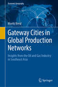
Gateway Cities in Global Production Networks: Insights from the Oil and Gas Industry in Southeast Asia (Economic Geography)
by Moritz BreulThis book provides a comprehensive analysis of the role of gateway cities in contemporary circuits of global production. Apart from facilitating the interlinking of economic activities in the surrounding regions with the global economy, gateway cities have enormous implications for how certain regions participate in the global economy. Based on a case study of the oil and gas industry in Southeast Asia the book maps gateway cities, explores why these cities have come to occupy a gateway role, and evaluates their implications for regional economic development. To this aim, the book links components from research on the World City Network with Global Production Network research and demonstrates how this intersection creates synergies for studying the role of cities in economic globalization. The main audiences that this book appeals to are researchers and students interested in debates on regional development and the role of cities in the global economy. The book is also attractive to scholars interested in the organization of extractive industries.
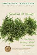
Gathering Moss / Reserva de musgo (Spanish Edition): Una historia natural y cultural de los musgos
by Robin Wall KimmererEl extraordinario debut literario de Robin Wall Kimmerer, autora del bestseller internacional Una trenza de hierba sagradaViviendo en los límites de nuestra percepción ordinaria, los musgos son un elemento común del mundo natural, que sin embargo suele pasar desapercibido. Reserva de musgo es una fascinante mezcla de ciencia y reflexión personal que invita a los lectores a explorar y aprender de la vida elegante y sencilla de los musgos. En esta serie de ensayos personales encadenados entre sí, Robin Wall Kimmerer acompaña a sus lectores a comprender cómo viven los musgos y cómo sus vidas se entrelanzan con las de innumerables seres en el mundo natural, entre ellos, los seres humano. Con la precisión científica de su formación como botánica, Kimmerer explica la biología de los musgos con claridad y profundidad, al tiempo que, desde su experiencia como madre, maestra y mujer indígena, nos invita a reflexionar sobre lo que estos fascinantes y humildes organismos tienen para enseñarnos. Una historia natural y cultural que se convierte en una poderosa metáfora que nos ilumina otras maneras en las que podemos existir en el mundo.———The acclaimed literary debut of Robin Wall Kimmerer, author of the New York Times bestseller Braiding Sweetgrass.Living at the limits of our ordinary perception, mosses are a common but largely unnoticed element of the natural world. Gathering Moss is a beautifully written mix of science and personal reflection that invites readers to explore and learn from the elegantly simple lives of mosses.Robin Wall Kimmerer's book is not an identification guide, nor is it a scientific treatise. Rather, it is a series of linked personal essays that will lead general readers and scientists alike to an understanding of how mosses live and how their lives are intertwined with the lives of countless other beings, from salmon and hummingbirds to redwoods and rednecks. Kimmerer clearly and artfully explains the biology of mosses, while at the same time reflecting on what these fascinating organisms have to teach us.Drawing on her diverse experiences as a scientist, mother, teacher, and writer of Native American heritage, Kimmerer explains the stories of mosses in scientific terms as well as in the framework of indigenous ways of knowing. In her book, the natural history and cultural relationships of mosses become a powerful metaphor for ways of living in the world.Gathering Moss will appeal to a wide range of readers, from bryologists to those interested in natural history and the environment, Native Americans, and contemporary nature and science writing.
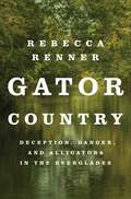
Gator Country: Deception, Danger, and Alligators in the Everglades
by Rebecca RennerA New York Times Editors' Choice"Delivers everything its title promises and much more." - NPR"Remarkable... Every species, and every person who fights for its continued existence, deserves a book like this." — The New York Times"This nail-biter account has the intensity of the best true crime... A high-def tale that ensnares you from the start." —PeopleDavid Grann meets Susan Orlean in this page-turning true story of an underground operation into the mysterious world of alligator poaching and its larger than life Floridian charactersTo catch a Florida Man, you have to become one, and that’s what Officer Jeff Babauta did. As his ponytailed, whiskey-soaked alter ego, he established Sunshine Alligator Farm. His goal? Infiltrate the shady world of illegal poachers in the Florida Everglades in order to protect the natural world.A head-spinning adventure soon unfolds. Jeff deals with glow-in-the-dark alligators and high-speed airboat rides, but quickly learns that not all poachers are villains. They’re simply people trying to survive, fighting against the poverty and greed holding them down. Jeff wants to solve the mystery of alligator poachers, and in doing so he must venture deeper into a strange ecosystem where right is wrong, and justice comes at the cost of those who’ve welcomed him into their world.Gator Country is the twisting true story of the impossible choices individuals must make to stay afloat in this world. Through its wholly unique blend of reporting, nature writing, and personal narrative, this book transports readers to vibrant and dangerous Florida landscapes and offers intimate portraits of those who call the region home. Broad in scope and vivid in detail, Gator Country is a fast paced tale of the risks people will take to survive in one of the world's most beautiful yet formidable landscapes and the undercover investigation that threatens to topple the whole scheme.
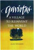
Gaviotas: A Village to Reinvent the World
by Alan WeismanThe story of Gaviotas, a village in a remote area of Colombia once thought uninhabitable, and the simple, affordable technology that was developed there and is now in use throughout Colombia.
Gcec 2017: Proceedings Of The 1st Global Civil Engineering Conference (Lecture Notes in Civil Engineering #9)
by Biswajeet PradhanThis book gathers the proceedings of the 1st Global Civil Engineering Conference, GCEC 2017, held in Kuala Lumpur, Malaysia, on July 25–28, 2017. It highlights how state-of-the-art techniques and tools in various disciplines of Civil Engineering are being applied to solve real-world problems. The book presents interdisciplinary research, experimental and/or theoretical studies yielding new insights that will advance civil engineering methods. The scope of the book spans the following areas: Structural, Water Resources, Geotechnical, Construction, Transportation Engineering and Geospatial Engineering applications.