- Table View
- List View

Gebäudeautomation in Wohn- und Wirtschaftsimmobilien: Energetische Einsparpotenziale durch Gebäudeautomation (Studien zum nachhaltigen Bauen und Wirtschaften)
by Thomas Glatte Giulio SaricMit Gebäudeautomation lassen sich Komfort und Sicherheit eines Gebäudes steigern. Dazu kommt das Potenzial, die Energieeffizienz der Immobilie zu erhöhen, was wirschaftliche Vorteile bei der Bewirtschaftung mit sich bringt. Diese Publikation untersucht verschiedene Smart-Home Technologien im Hinblick auf die Senkung der Energiekosten und vergleicht den ökonomischen Nutzen zwischen Wirtschafts- und Wohnimmobilien. Dabei werden die Anwendungsfelder Beleuchtung, Klimatisierung und Beschattung analysiert und bewertet.
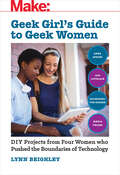
Geek Girl's Guide to Geek Women
by Lynn BeighleyThis hands-on book takes a look at four brilliant women -- Ada Lovelace, Anna Atkins, Hildegard Von Bingen, and Maria Telkes -- and the world-changing innovations they created. Walk in their footsteps as you discover how these women became inventors, learn what inspired them, and then try your hand at recreating their most famous inventions -- computer programs, solar photography, codes and ciphers, and water purifiers.
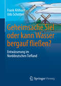
Geheimsache Siel oder kann Wasser bergauf fließen?
by Frank Ahlhorn Udo SchottenThema des vorliegenden Buches ist der Umgang mit dem Wasser an der niedersächsischen Küste (hier: die Entwässerung der niedrig liegenden Landschaft), eine fundamentale Angelegenheit für die Menschen, die hier leben und arbeiten. Für ein junges Zielpublikum wird unterhaltsam erläutert, wohin das Wasser fließt und welche Anstrengungen unsere Vorfahren unternommen hatten, damit wir in dieser Landschaft (über)leben können. Darüber hinaus werden Veränderungen, die z. B. über den Klimawandel auf diese Landschaft einwirken, in die Entdeckungsreise der vier Protagonisten eingebunden.
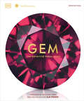
Gem
by DKPrepare to be dazzled by this shining and sumptuous visual guide to the world&’s greatest treasures. Feast your eyes on glittering gemstones, kaleidoscopic minerals, and famous trinkets in this comprehensive exploration of Earth&’s finest jewels.Following a foreword from Aja Raden, hundreds of pages take a lavish look at precious stones, precious metals, and organic gems in all their natural wonder. From agate to zoisite, everything under the Sun is encapsulated in spectacular photography and accessible text. Trace the history of gemmology and get the inside story on our planet&’s most famous and fabulous gems, including the mysterious Hope Diamond, the stunning Koh-i-Noor of the Crown Jewels, and exquisite Fabergé eggs. Find out their physical properties, check the price tags, and discover the most remarkable record-breakers.This exceptionally extravagant book is a picture-packed, fact-filled celebration guaranteed to bring sparkle to your life and your library.
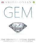
Gem: The Definitive Visual Guide
by Aja Raden DkA dazzling visual guide to precious and semiprecious stones, organic gems, and precious metals that showcases beautiful, specially commissioned images as well as science, natural history, mythology, and true stories of adventure and discovery. <p><p> From diamonds and sapphires to emeralds and obsidian, Gem profiles all the key gemstones and other precious materials. Its stunning images show the jewels in their different cuts, colors, and uses. See the exquisite jewelry pieces of royalty around the world, high-society women, and Native American traditions. Visit the Russian Amber Room, study the details of a Fabergé egg, and find out what characteristics are needed for a record-breaking gem. <p> The stories, myths, and legends that surround the most celebrated gems and jewel-laden artifacts from around the world are revealed, from their journeys in the company of royalty, film stars, and thieves to the curse of the Hope Diamond. Follow the history of the world's most famous jewelry houses and their designers, including Cartier, Harry Winston, Tiffany & Co., and more. <p> For additional information about the world's natural treasures, an 80-page reference section at the back of the book highlights a variety of other rocks and minerals, and a color guide directory groups gems according to their main color. <p> Created in association with the Smithsonian Institution and featuring a foreword by New York Times-bestselling author Aja Raden, Gem combines lavish photographs with expert knowledge, making it perfect for gift-giving.
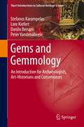
Gems and Gemmology: An Introduction for Archaeologists, Art-Historians and Conservators (Short Introductions to Cultural Heritage Science)
by Peter Vandenabeele Stefanos Karampelas Lore Kiefert Danilo BersaniThis book provides a lucid introduction to the basics of gemmology. It familiarizes archaeologists, art historians and conservators with the science of gemstones and allows them to understand the basic concepts of their provenance, typology and treatments.Which are the main types of gems? What treatments can be applied? How does one analyse gems? How can gems contribute to archaeometrical research?This volume is written by four experts in the fields of gemmology and archaeometry and addresses both students who need an introduction to this field and professionals who want to refresh their knowledge of the topic. This work is part of a series of introductory texts that deal with a broad range of materials-related topics in archaeometry.
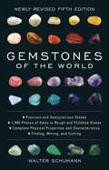
Gemstones of the World: Newly Revised
by Walter SchumannTruly the ultimate one-volume book every hobbyist, jeweler, jewelry maker, and rockhound will ever need! Chock-full of more than 1,500 full-color photos showcasing each precious and semiprecious stone in both its rough and polished state, this bestselling reference book from leading geology expert Walter Schumann will be your go-to identification guide. <p><p>Following the spectacular success of the first four editions of Gemstones of the World, the revised fifth edition exhibits important updates and a beautiful new cover. All the gemstones ever discovered are treated here in their many variations. More than 1,500 full-color photos showcase each precious and semiprecious stone in both its rough natural state and its polished and cut renditions. Each entry offers complete information on a stone's formation and structure; physical properties and characteristics; and methods of working, cutting, and polishing. <p><p>You'll find full treatments of lesser-known gems and minerals—from andalusite to vesuvianite—and a special section devoted to rocks as precious stones, including alabaster, onyx, obsidian, and fossils. Organic gem materials such as coral, ivory, amber, and pearl are also covered, along with more recently discovered stones like charoite. Additionally, this all-inclusive rocks and minerals book includes imitations, synthetics, and combined stones. Charts and tables help you identify unknown gemstones and—when you’re in the market—how to check for authenticity. <p><p>Whether you’re a beginner rock enthusiast or geologist, or are looking for a crystal book to support your spirituality practice, Gemstones of the World will bring new beauty and wisdom to your bookshelf.
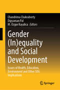
Gender (In)equality and Social Development: Issues of Health, Education, Environment and Other SDG Implications
by Chandrima Chakraborty Dipyaman Pal M. Ozgur KayalicaThis book focuses on gender issues and its relation with social development, in shaping the current and future global scenario, considering three broad dimensions, namely health, education, and environment, and other SDG implications. It specifically highlights environmental awareness policy, women empowerment, marginalized women, poverty, government policy, women in labor force, childcare services in reducing gender inequality and beneficial to SDGs. The book provides a wealth of information for researchers, undergraduates and postgraduates, as well as policymakers and government officials. Faculty members of economics and other disciplines like business and management, environmental studies, sociology, education, health economics among others can teach their students using this book as reference. The book also provides a valuable source of information for policy makers related to ministries of women and child development, gender equality, child development and family welfare, and so on.
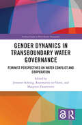
Gender Dynamics in Transboundary Water Governance: Feminist Perspectives on Water Conflict and Cooperation (Earthscan Studies in Water Resource Management)
by Jenniver Sehring Rozemarijn ter Horst and Margreet ZwarteveenThis volume assesses the nexus of gender and transboundary water governance, containing empirical case studies, discourse analyses, practitioners’ accounts, and theoretical reflections. Transboundary water governance exists at the intersection of two highly masculinised fields: diplomacy and water resources management. In both fields, positions are mainly held by men, and core ideas, norms, and guiding principles that are presented as neutral, are both shaped by men and based on male experiences. This book sheds light on the often hidden gender dynamics of water conflict and cooperation at the transboundary level and on the implicit assumptions that guide research and policies. The individual chapters of the book, based on case studies from around the world, reveal the gendered nature of water diplomacy, take stock of the number of women involved in organisations that govern shared waters, and analyse programmes that have been set up to promote women in water diplomacy and the obstacles that they face. They explore and contest leading narratives and knowledge that have been shaped mainly by privileged men, and assess how the participation of women concretely impacts the practices, routines, and processes of water negotiations. This volume will be of great interest to students and scholars of water governance, water diplomacy, gender, international relations and environmental politics. It will also be of interest to professionals and policymakers involved in supporting gender mainstreaming in water cooperation.
Gender Equality and Sustainable Development (Pathways to Sustainability)
by Melissa LeachFor pathways to be truly sustainable and advance gender equality and the rights and capabilities of women and girls, those whose lives and well-being are at stake must be involved in leading the way. Gender Equality and Sustainable Development calls for policies, investments and initiatives in sustainable development that recognize women’s knowledge, agency and decision-making as fundamental. Four key sets of issues - work and industrial production; population and reproduction; food and agriculture, and water, sanitation and energy provide focal lenses through which these challenges are considered. Perspectives from new feminist political ecology and economy are integrated, alongside issues of rights, relations and power. The book untangles the complex interactions between different dimensions of gender relations and of sustainability, and explores how policy and activism can build synergies between them. Finally, this book demonstrates how plural pathways are possible; underpinned by different narratives about gender and sustainability, and how the choices between these are ultimately political. This timely book will be of great interest to students, scholars, practitioners and policy makers working on gender, sustainable development, development studies and ecological economics.
Gender Equality in the EU and Ukraine: Women’s Rights in a Time of War (Routledge Studies in Gender and Economics)
by Maryana Prokop Oleksandra Struk Agata WłodkowskaThis book provides a comprehensive analysis of gender equality and women’s rights in Ukraine and the European Union, focusing on both political security and economic– social dimensions.The first part examines European gender policy standards in Ukraine, feminist foreign policy, women’s involvement in political protests, and the influential roles of First Ladies like Brigitte Macron, Agata Kornhauser- Duda, and Olena Zelenska in promoting gender equality. It also explores gendered aspects of military service, the portrayal of female refugees, and the EU’s response to sexual violence in the context of Russia’s war against Ukraine. The second part addresses economic and social issues, including the intersection of gender equality with sustainable development, gender- responsive budgeting, and women’s roles in business. It highlights women’s contributions to nonprofit organizations and discusses the experiences of Ukrainian female students in Poland as well as the status of single mothers in Ukraine and the UK.The study is relevant for policy formulation by institutions working on gender equality, foreign affairs, and human rights. It is also a valuable resource for universities, research institutes, think tanks, and civil society organizations involved in gender equality, human rights, and peacebuilding in Ukraine and Europe. The interdisciplinary nature of the publication, which integrates research from politics, law, sociology, international relations, economics, and pedagogy, makes it applicable to both general and specialized courses. It is dedicated to researchers and students in the social sciences, offering key insights for courses in gender studies, political science, international relations, human rights studies, eastern policy of EU, development studies, and European integration, and providing a foundation for critical reflection on gender equality policies and EU integration.
Gender Inequalities in Africa’s Mining Policies: A Study of Inequalities, Resource Conflict and Sustainability
by Francis OnditiThis book develops a discursive ‘equalitarian’ theoretical framework for studying African mining ecosystem issues and policy interventions. The theory of ‘equalitarianism’ is developed as an alternative to the reductionist approach that has dominated post-colonial debates about the classical jus ad bellum requirements to empower women in development spaces. However, the classical approach narrows the debate down to “women issues,” rather than the ‘whole-of-society.’ As a consequence of this reductionism, women continue to be devalued in the mining sector, characterized by poverty traps, power struggles, and a lack of capacity to engage in large-scale mining (LSM) activities. This book advances principles for a holistic approach, and spells out the implications for women across the mining value chain. Drawing on moral scholarship, the book poses that for women to gain access to strategic spaces in the mining sector, the drive for empowerment must be embedded within ‘whole-of-society’ principles. This book is of interest to scholars researching gender policy, public policy, political philosophy, conflictology, and human geography. It also offers practitioners a guide for evaluating their policy work on mainstreaming gender in the mining sector, presenting options for financing, forging partnership and planning for an inclusive economic development in Africa, and beyond.
Gender Ironies of Nationalism: Sexing the Nation
by Tamar MayerThis book provides a unique social science reading on the construction of nation, gender and sexuality and on the interactions among them. It includes international case studies from Indonesia, Ireland, former Yugoslavia, Liberia, Sri Lanka, Australia, the USA, Turkey, China, India and the Caribbean.The contributors offer both the masculine and feminine perspective, exposing how nations are comprised of sexed bodies, and exploring the gender ironies of nationalism and how sexuality plays a key role in nation building and in sustaining national identity.The contributors conclude that control over access to the benefits of belonging to the nation is invariably gendered; nationalism becomes the language through which sexual control and repression is justified masculine prowess is expressed and exercised. Whilst it is men who claim the prerogatives of nation and nation building it is, for the most part, women who actually accept the obligation of nation and nation building.
Gender Planning and Development: Theory, Practice and Training
by Caroline MoserGender planning is not an end in itself but a means by which women, through a process of empowerment, can emancipate themselves. Ultimately, its success depends on the capacity of women's organizations to confront subordination and create successful alliances which will provide constructive support in negotiating women's needs at the level of household, civil society, the state and the global system.Gender Planning and Development provides an introduction to an issue of primary importance and constant debate. It will be essential reading for academics, practitioners, undergraduates and trainees in anthropology, development studies, women's studies and social policy.
Gender Politics in the Asia-Pacific Region (Routledge International Studies of Women and Place #No.3)
by Brenda S.A. Yeoh Peggy Teo Shirlena HuangAmidst the unevenness and unpredictability of change in the Asia-Pacific region, women's lives are being transformed. This volume takes up the challenge of exploring the ways in which women are active players, collaborators, participants, leaders and resistors in the politics of change in the region. The editors focus attention on the politics of gender as a mobilizing centre for identities, and the ways in which individualized identity politics may be linked to larger collective emancipatory projects based on shared interests, practical needs, or common threats. Collectively, the chapters illustrate the complexity of women's strategies, the diversity of sites for action, and the flexibility of their alliances as they carve out niches for themselves in what are still largely patriarchal worlds. This book will be of vital interest to scholars in a range of subjects, including gender studies, human geography, women's studies, Asian studies, sociology and anthropology.
Gender Responsive and Participatory Budgeting: Imperatives for Equitable Public Expenditure (SpringerBriefs in Environment, Security, Development and Peace #22)
by Cecilia NgThis unique book focuses on the hybridization of grassroots participation in planning, implementing, and developing gender-responsive budgeting. It explores the possibilities for gender sensitive budgeting when implemented using techniques that have been popularized by participatory governance activists. A combination of the two allows for a whole new way of ensuring public budgets are used equitably.
Gender Smart Mobility: Concepts, Methods, and Practices (Transport and Mobility)
by Hilda Rømer Christensen Lena Levin Michala Hvidt BreengaardThis book presents gender and diversity in smart transport as a cutting-edge issue in urban contexts around the globe. It addresses new challenges and possibilities related to the smart transport sector. It demonstrates how gender and diversity are entangled in concepts and various forms of current smart mobility practices in policy, planning, and innovation. Gender Smart Mobility is presented as a game changer for future transport planning and mobility practices and how smart mobility technologies and practices might be created as a common good for all. The readers are presented with fresh approaches ranging from intersectional and visual analysis of smart mobility, gender scripts and language, to gendered innovation of design and planning. Moreover, the readers will encounter engaging boxed features which present historical, cross-cultural, and methodological examples and pose questions for critical thinking. This book meets a need for a systematic, accessible, and practical introduction and is of interest to city planners, transport providers, and politicians as well as the general public. It will also be a valuable reference for graduate and postgraduate students at technical universities, schools of architecture and planning, and for students and faculties in the social sciences, humanities, and IT and design studies. The Open Access version of this book, available at www.taylorfrancis.com, has been made available under a Creative Commons Attribution-NonCommercial-NoDerivatives 4.0 International license. Funded by the University of Copenhagen and the Swedish National Road and Transport Research Institute.
Gender and Agrarian Reforms (Routledge International Studies of Women and Place)
by Susie JacobsThe redistribution of land has profound implications for women and for gender relations; however, gender issues have been marginalised from both theoretical and policy discussions of agrarian reform. This book presents an overview of gender and agrarian reform experiences globally. Jacobs highlights case studies from Latin America, Asia, Africa and eastern Europe and also compares agrarian and land reforms organised along collective lines as well as along individual household lines. This volume will be of interest to scholars in Geography, Women’s Studies, and Economics.
Gender and Climate Change Financing: Coming out of the margin (Routledge IAFFE Advances in Feminist Economics)
by Mariama WilliamsThis book discusses the state of global climate change policy and the financing of climate resilient public infrastructure. It explains the sources of tensions and conflict between developing and developed countries with regard to global climate protection policies, and highlights the biases and asymmetries that may work against gender equality, women’s empowerment and poverty eradication. Gender and Climate Change Financing: Coming Out of the Margin provides an overview of the scientific, economic and political dynamics underlying global climate protection. It explores the controversial issues that have stalled global climate negotiations and offers a clear explanation of the link between adaptation and mitigation strategies and gender issue. It also maps the full range of public, private and market-based climate finance instruments and funds. This book will be a useful tool for those engaged with climate change, poverty eradication, gender equality and women’s empowerment.
Gender and Climate Change: An Introduction
by Irene DankelmanAlthough climate change affects everybody it is not gender neutral. It has significant social impacts and magnifies existing inequalities such as the disparity between women and men in their vulnerability and ability to cope with this global phenomenon. This new textbook, edited by one of the authors of the seminal Women and the Environment in the Third World: Alliance for the Future (1988) which first exposed the links between environmental degradation and unequal impacts on women, provides a comprehensive introduction to gender aspects of climate change. Over 35 authors have contributed to the book. It starts with a short history of the thinking and practice around gender and sustainable development over the past decades. Next it provides a theoretical framework for analyzing climate change manifestations and policies from the perspective of gender and human security. Drawing on new research, the actual and potential effects of climate change on gender equality and women's vulnerabilities are examined, both in rural and urban contexts. This is illustrated with a rich range of case studies from all over the world and valuable lessons are drawn from these real experiences. Too often women are primarily seen as victims of climate change, and their positive roles as agents of change and contributors to livelihood strategies are neglected. The book disputes this characterization and provides many examples of how women around the world organize and build resilience and adapt to climate change and the role they are playing in climate change mitigation. The final section looks at how far gender mainstreaming in climate mitigation and adaptation has advanced, the policy frameworks in place and how we can move from policy to effective action. Accompanied by a wide range of references and key resources, this book provides students and professionals with an essential, comprehensive introduction to the gender aspects of climate change.
Gender and Climate Change: Impacts, Science, Policy
by Joane NagelDoes gender matter in global climate change? This timely and provocative book takes readers on a guided tour of basic climate science, then holds up a gender lens to find out what has been overlooked in popular discussion, research, and policy debates. We see that, around the world, more women than men die in climate-related natural disasters; the history of science and war are intimately interwoven masculine occupations and preoccupations; and conservative men and their interests drive the climate change denial machine. We also see that climate policymakers who embrace big science approaches and solutions to climate change are predominantly male with an ideology of perpetual economic growth, and an agenda that marginalizes the interests of women and developing economies. The book uses vivid case studies to highlight the often surprising, gendered impacts of climate changes.This new edition is a thorough update that includes revised and new chapters and new material that takes account of the significant advances in climate research, environmental and social theory, and the many political and social challenges posed in the wake of US elections, Covid-19 pandemic, and rapidly changing climate and environment. The new edition also takes account of important social and cultural movements that resist challenges to women’s rights and advocate for gender, sexuality, and racial justice.This book will appeal to students, researchers, and academicians interested in environmental studies and gender studies. It also will be of interest to policymakers, activists, and others involved with environmental policy and governance.
Gender and Development (Routledge Perspectives on Development)
by Janet MomsenGlobal financial problems, rising food prices, climate change, international migration - increasingly by women - conflict situations in many poor countries, the spread of tropical diseases such as malaria and dengue fever and the increased incidence of HIV/AIDS and TB, and changing patterns of trade have all added new dimensions to gender issues in developing countries. These problems are frequently being brought to public attention in the media and through long-haul tourism. Consequently students' interest in gender and development has grown considerably in the last few years. This updated second edition provides a concise, accessible introduction to Gender and Development issues in the developing world and in the transition countries of Eastern and Central Europe. The nine chapters include discussions on changes in theoretical approaches, gender complexities and the Millennium Development Goals; social and biological reproduction including differing attitudes to family planning by states and variation in education and access to housing; differences in health and violence at major life stages for women and men and natural disasters and gender roles in rural and urban areas. The penultimate chapter considers the impact of broad economic changes such as the globalization of trade and communications on gender differences in economic activity and the final chapter addresses international progress towards gender equality as measured by the global gender gap. The text is particularly strong on environmental aspects and the new edition builds on this to consider the effects of climate change and declining natural resources illustrated by a case study of changing gender roles in fishing in India. There is also enhanced coverage of topics such as global trade, sport as a development tool, masculinities, and sustainable agriculture. Maps, statistics, references and boxed case studies have been updated throughout and their coverage widened. Gender and Development is the only broad based introduction to the topic written specifically for a student audience. It features student friendly items such as chapter learning objectives, discussion questions, annotated guides to further reading and websites. The text is enlivened throughout with examples and case studies drawn from the author's worldwide field research and consultancies with international development agencies over four decades and her experience of teaching the topic to undergraduates and postgraduates in many countries. It will be an essential text for a variety of courses on development, women's studies, sociology, anthropology and geography.
Gender and Development (Routledge Perspectives on Development)
by Janet MomsenThis revised and updated third edition of Gender and Development provides a concise, accessible introduction to gender and development issues in the developing world and in the transition countries of Eastern and Central Europe. The nine chapters include discussions on: changes in theoretical approaches, gender complexities and the Sustainable Development Goals; social and biological reproduction including changing attitudes to family planning; variation in education and access to housing; differences in health and violence at major life stages for women and men; natural disasters, climate change and declining natural resources, and gender roles in rural and urban areas. There is also enhanced coverage of topics such as global trade, sport as a development tool, masculinities and sustainable agriculture. Maps, statistics, have been updated throughout and their coverage widened. New case studies have been added on Bangladesh, on violence in Peru and India, halal tourism and on garbage collection in the Maldives. The book features student-friendly items such as chapter learning objectives, discussion questions, annotated guides to further reading and websites. The text is enlivened throughout with examples and case studies drawn from the author’s worldwide field research and consultancies with international development agencies over four decades and her experience of teaching the topic to undergraduates and postgraduates in many countries. Gender and Development is the only broad-based introduction to the topic written specifically for a student audience. It will be an essential text for a variety of courses on development, women’s studies, sociology, anthropology and geography.
Gender and Environment
by Susan BuckinghamAccessible and lively, this is the first introductory level text to introduce the key issues in the rapidly growing area of gender and environment. This text provides an analysis of how gender relations affect the natural environment and of how environmental issues have a differential impact on women and men.Using case studies from the developed and developing worlds, this text covers· gendered roles in the family· community and international connections· conception· giving birth· western practices· the body and the self.
Gender and Environment: Critical Concepts In The Environment (Routledge Introductions to Environment: Environment and Society Texts)
by Susan BuckinghamThis completely revised second edition of Gender and Environment explains the inter-relationship between gender relations and environmental problems and practices, and how they affect and impact on each other. Explaining our current predicament in the context of historical gender and environment relations, and contemporary theorisations of this relationship, this book explores how gender and environment are imbricated at different scales: the body; the household, community and city through concepts of work; and at the global. The final chapter draws these themes together through a consideration of waste and shows that gender is an important dimension in how we define, categorise, generate and manage waste, and how this contributes to environmental problems. Contemporary examples of environmental activism are juxtaposed with past campaigns throughout the book to demonstrate how protest and activism is as gendered as the processes which have created the situations protested about. The author’s experiences of working with both the European Union on gender mainstreaming environmental research and practice, and with environmental groups on gender-based campaigns provide unique insights and case studies which inform the book. The book provides a contemporary text book with a strong research foundation, drawing on the author’s extensive research, professional and practice activity on the gender/environment relationship over the past 20 years, in a wide range of geographical contexts.