- Table View
- List View
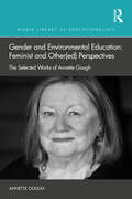
Gender and Environmental Education: The Selected Works of Annette Gough (World Library of Educationalists)
by Annette GoughThis timely book provides a starting point for critical analysis and discourse about the status of gendered perspectives in environmental education research.Through bringing together selected writings of Annette Gough, it documents the evolving discussions of gender in environmental education research since the mid-1990s, from its origins in putting women on the agenda through to women’s relationships with nature and ecofeminism, as well as writings that engage with queer theory, intersectionality, assemblages, new materialisms, posthumanism and the more-than-human. The book is both a collection of Annette Gough, and her collaborators, writings around these themes and her reflections on the transitions that have occurred in the field of environmental education related to gender since the late 1980s, as well as her deliberations on future directions.An important new addition to the World Library of Educationalists, this book foregrounds women, their environmental perspectives, and feminist and other gendered research, which have been marginalised for too long in environmental education.
Gender and Family Among Transnational Professionals (Routledge International Studies of Women and Place)
by Anne Coles Anne-Meike FechterWhile interest in migration flows is ever-growing, this has mostly concentrated on disadvantaged migrants moving from developing to Western industrialised countries. In contrast, Euro-American mobile professionals are only now becoming an emergent research topic. Similarly, debates on the connections between gender and migration rarely consider these kind of migrants. This volume fills these gaps by investigating impact of relocation on gender and family relations among today’s transnational professionals.
Gender and Gentrification (Routledge Critical Studies in Urbanism and the City)
by Winifred CurranThis book explores how gentrification often reinforces traditional gender roles and spatial constructions during the process of reshaping the labour, housing, commercial and policy landscapes of the city. It focuses in particular on the impact of gentrification on women and racialized men, exploring how gentrification increases the cost of living, serves to narrow housing choices, make social reproduction more expensive, and limits the scope of the democratic process. This has resulted in the displacement of many of the phenomena once considered to be the emancipatory hallmarks of gentrification, such as gayborhoods. The book explores the role of gentrification in the larger social processes through which gender is continually reconstituted. In so doing, it makes clear that the negative effects of gentrification are far more wide-ranging than popularly understood, and makes recommendations for renewed activism and policy that places gender at its core. This is valuable reading for students, researchers, and activists interested in social and economic geography, city planning, gender studies, urban studies, sociology, and cultural studies.
Gender and Landscape: Renegotiating the Moral Landscape (Routledge International Studies of Women and Place #Vol. 6)
by Lorraine Dowler Josephine Carubia Bonj SzczygielGender and Landscape is a feminist inquiry into a long-ignored area of study: the landscape. Although there has been an exhaustive investigation into issues of gender as they intersect with space and place, very little has been written about the gendering of the landscape. This volume provides a bridge between feminist discussions of space and place as something 'lived' and landscape interpretations as something 'viewed'.
Gender and Religion in the City: Women, Urban Planning and Spirituality (Routledge Studies in Gender and Environments)
by Clara GreedThis book provides a conceptual, historical and contemporary context to the relationships between gender, religion and cities. It draws together these three components to provide an innovative view of how religion and gender interact and affect urban form and city planning. While there have been many books that deal with religion and cities; gender and cities; and gender and religion, this book is unique in bringing these three subjects together. This trio of inter-relationships is first explored within Western Christianity: in Roman Catholicism, Protestantism, Eastern Orthodoxy and in the Pentecostal and Charismatic movements. A wider perspective is then provided in chapters on the ways in which Islam shapes urban development and influences the position of Muslim women in urban space. While official religions have declined in the West there is still a desire for new forms of spirituality, and this is discussed in chapters on municipal spirituality and on the rise of paganism and the links to both environmentalism and feminism. Finally, ways of taking into account both gender and religion within the statutory urban planning system are presented. This book will be of great interest to those researching environment and gender, urban planning and sustainability, human geography and religion.
Gender and Rural Geography: Identity, Sexuality and Power in the Countryside
by Jo LittleGender and Rural Geography explores the relationship between gender and rurality. Feminist theory, gender relations and sexuality have all become central concerns of geographical research and significant progress has been made in terms of our understanding of both the broad relationship between gender and geography and the more detailed differences in the lives of men and women over space. The development of feminist perspectives and the study of gender relations in geography, has, however, been fairly uneven over the discipline. Both theoretical and empirical work on gender has tended to be concentrated within social and cultural geography. Moreover it has been directed largely towards the urban sphere.
Gender and Rurality (Routledge International Studies of Women and Place)
by Barbara Pini Lia BryantThe study of gender in rural spaces is still in its infancy. Thus far, there has been little exploration of the constitution of the varied and differing ways that gender is constituted in rural settings. This book will place the question of gender, rurality and difference at its center. The authors examine theoretical constructions of gender and explore the relationship between these and rural spaces. While there have been extensive debates in the feminist literature about gender and the intersection of multiple social categories, rural feminist social scientists have yet to theorize what gender means in a rural context and how gender blurs and intersects with other social categories such as sexuality, ethnicity, class and (dis)ability. This book will use empirical examples from a range of research projects undertaken by the authors as well as illustrations from work in the Australasia region, Europe, and the United States to explore gender and rurality and their relation to sexuality, ethnicity, class and (dis)ability.
Gender and the Political Economy of Conflict in Africa: The persistence of violence (Routledge Studies in African Development)
by Meredeth TurshenViolence affects the economy of production and the ecology of reproduction— the production of economic goods and services and the generational reproduction of workers, the regeneration of the capacity to work and maintenance of workers on a daily basis, and the renewal of culture and society through community relations and the education of children Gender and the Political Economy of Conflict in Africa explores the persistence of violence in conflict zones in Africa using a political economy framework. This framework employs an analysis of violence on both edges of the spectrum—a macro-economic analysis of violence against workers and a micro-political analysis of the violence in women’s reproductive lives. These analyses come together to create a new explanation of why violence persists, a new political economy of violence against women, and a new theoretical understanding of the relation between production and reproduction. Three case studies are discussed: the Democratic Republic of the Congo (violence in an era of conflict), Sierra Leone (violence post-conflict), and Tanzania (which has not seen armed conflict on the mainland). This book fills a significant gap on the political economy of war and women/gender for advanced undergraduate and postgraduate students as well as researchers in African Studies, Gender Studies, and Peace and Conflict Studies.
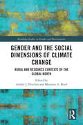
Gender and the Social Dimensions of Climate Change: Rural and Resource Contexts of the Global North (Routledge Studies in Gender and Environments)
by Amber J. Fletcher and Maureen G. ReedDispelling the myth that people in the Global North share similar experiences of climate change, this book reveals how intersecting social dimensions of climate change—people, processes, and institutions—give rise to different experiences of loss, adaptation, and resilience among those living in rural and resource contexts of the Global North. Bringing together leading feminist researchers and practitioners from three countries—Australia, Canada, and Spain—this collection documents gender relations in fossil fuel, mining, and extractive industries, in land-based livelihoods, in approaches for inclusive environmental policy, and in the lived experience of climate hazards. Uniquely, the book brings together the voices, expertise, and experiences of both academic researchers and women whose views have not been prioritized in formal policies—for example, women in agriculture, Indigenous women, immigrant women, and women in male-dominated professions. Their contributions are insightful and compelling, highlighting the significance of gaining diverse perspectives for a fuller understanding of climate change impacts, more equitable processes and strategies for climate change adaptation, and a more welcoming climate future. This book will be vital reading for students and scholars of gender studies, environmental studies, environmental sociology, geography, and sustainability science. It will provide important insights for planners, decision makers, and community advocates to strengthen their understanding of social dimensions of climate change and to develop more inclusive and equitable adaptation policies, plans, and practices.
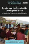
Gender and the Sustainable Development Goals: Infrastructure, Empowerment and Education (Routledge/ISDRS Series in Sustainable Development Research)
by Astrid SkjervenThis book sheds light on the important and mostly neglected role that gender plays in achieving the UN Sustainable Development Goals, doing so by investigating three key problem areas: empowerment, education, and infrastructure. Starting with a theoretical and methodological framework, this edited collection contains 12 chapters from scholars and researchers from around the world. The book includes numerous case studies discussing the current status of gender equality relating to the SDGs. It reinforces the significance of gender for sustainable and just development, highlighting how women play a major role in work organization, disaster management, income, household maintenance, and mediation of knowledge. "Women" as a classification encompasses much diversity with many intersecting axes of difference; this book focuses on the excluded and disadvantaged majority social group, without imposing homogeneity on that categorization. Many chapters focus on critical situations occurring in the Global South, where these issues are highly prominent, and importantly, these contributions are written by local scholars. Finally, the volume provides pathways for basic and professional gender responsive education and innovation in the field. The book will generate important discussions in interdisciplinary research and higher education settings focusing on sustainable development, gender, equality, human rights, and education.
Gender at the Border: Entrepreneurship in Rural Post-Socialist Hungary (Border Regions Ser.)
by Janet Henshall MomsenLooking at two contrasting border regions, one in western Hungary, one in the east of the country, this volume is the first to combine an examination of border related issues with gender and economic development. By comparing and critically analyzing the relative levels of encouragement of entrepreneurial activities and gender differences, it highlights the importance of borders within the changing European Union. Despite the assumption that entrepreneurship would be strongest near the western border with Austria, the findings show that, on the contrary, many women in western Hungary would rather avoid the risk of being self-employed by getting well-paid jobs in Austria or working for foreigners, while in the east of the country, entrepreneurship was often the only possible way of earning a living. It also highlights the importance of setting up a business to the empowerment of women in both regions, by giving them a bigger decision-making role in the family.
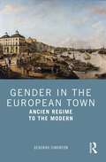
Gender in the European Town: Ancien Regime to the Modern
by Deborah SimontonMoving from the mid-seventeenth century to the near present, this book marks physical and conceptual changes across European towns and examines how gender was implicated and imbricated in those changes. As places which fostered and disseminated key social, economic, political and cultural developments, towns were central to the creation of gendered identities and the transmission of ideas across local, national and transnational boundaries. From 1650 to 2000, towns grew rapidly and responded to the needs for new infrastructures, physical reconfiguration and ideas of citizenship. Gender relations vary over space and time and are continually altering; such variation underlines the need for a thorough non- or even anti-essentialism. Drawing primarily on three themes of economy, civic identity and uses of space, the volume shows that urban development, and responses to it, is not gender neutral and thus argues for the fundamental importance of a gendered perspective. Gender in the European Town is a useful resource for all students and scholars interested in urban history and its interaction with gender from 1650 to the present.
Gender, Agriculture and Agrarian Transformations: Changing Relations in Africa, Latin America and Asia (Earthscan Food and Agriculture)
by Carolyn E. SachsThis book presents research from across the globe on how gender relationships in agriculture are changing. In many regions of the world, agricultural transformations are occurring through increased commodification, new value-chains, technological innovations introduced by CGIAR and other development interventions, declining viability of small-holder agriculture livelihoods, male out-migration from rural areas, and climate change. This book addresses how these changes involve fluctuations in gendered labour and decision making on farms and in agriculture and, in many places, have resulted in the feminization of agriculture at a time of unprecedented climate change. Chapters uncover both how women successfully innovate and how they remain disadvantaged when compared to men in terms of access to land, labor, capital and markets that would enable them to succeed in agriculture. Building on case studies from Africa, Latin America and Asia, the book interrogates how new agricultural innovations from agricultural research, new technologies and value chains reshape gender relations. Using new methodological approaches and intersectional analyses, this book will be of great interest to students and scholars of agriculture, gender, sustainable development and environmental studies more generally.
Gender, Asset Accumulation and Just Cities: Pathways to transformation
by Caroline O.N. MoserWith more than half the world’s population now living in urban areas, urbanisation is undoubtedly one of the most important phenomena of the 21st century. However, despite increasing recognition of the critical relationship between economic and social development in cities, gender issues are often overlooked in understanding the complexities of current urbanisation processes. This book seeks to rectify this neglect. Gender, Asset Accumulation and Just Cities explores the contribution that a focus on the gendered nature of asset accumulation brings to the goal of achieving just, more equitable cities. To date neither the academic debates nor the formulated policy and practice on just cities has included a focus on gender-based inequalities, discriminations, or opportunities. From a gender perspective, a separate discourse exists, closely associated with gender justice, particularly in relation to urban rights and democracy. Neither, however, has addressed the implications for women’s accumulation of assets and associated empowerment for transformational pathways to just cities. In this book, contributors specifically focus on gender and just cities from a wide range of gendered perspectives that include households, housing, land, gender-based violence, transport, climate, and disasters.
Gender, Climate Change and Livelihoods: Vulnerabilities and Adaptations
by Margaret Alston Salim Momtaz Elizabeth Bryan Muhammad Asaduzzaman Nahid Rezwana Aden Aw-Hassan Elisabeth Garner Patricia E. Perkins Agnes Babugura Bipasha Baruah Abderrahim Bentaibi Quinn Bernier Yvonne Braun Boubaker Dhehibi Diana Hummel Zobaidul Kabir Edward Kato Francis Mwesigye Dina Najjar Balikisu Osman Elizabeth Opiyo Onyango Shahreen ShehwarThis book applies a gendered lens to evaluate the dynamic linkages between climate change and livelihoods in developing countries. It examines how climate change affects women and men in distinct ways, and what the implications are for earning income and accessing the natural, social, economic, and political resources required to survive and thrive. The book's contributing authors analyze the gendered impact of climate change on different types of livelihoods, in distinct contexts, including urban and rural, and in diverse geographic locations, including Asia, Africa and the Caribbean. It focuses on understanding how public policies and power dynamics shape gendered vulnerabilities and impacts, how gender influences coping and adaptation mechanisms, and how civil society organizations incorporate gender into their climate advocacy strategies. This book: -Provides cutting-edge scholarship on an underrepresented area of climate change: the gendered impacts of climate change on livelihoods. -Covers a range of different types of livelihoods and geographic locations. -Involves contributors from a diverse array of cultural and scholarly backgrounds, bringing contrasting perspectives to the topic. This book is recommended for scholars, students, and practitioners who study or work in fields such as climate change, gender, livelihoods, public policy, economic development, and agriculture.
Gender, Democracy and Institutional Development in Africa (Gender, Development and Social Change)
by Njoki Nathani WaneThis book analyses African foundations of gender, education, politics, democracy and institutional development by stimulating theoretical discourses. It offers a discursive framework on ways to examine the conceptualizations of African social development and a critical discourse on debunking the misconceptions that are attached to African location in the global arena. The volume challenges the danger of minimizing and oversimplifying the role of Africa in the international space. This will be ideal for researchers, students and scholars in the areas of African and gender studies, development, politics and education.
Gender, Environment and Sustainable Development: Challenges and Responses from India
by Shweta PrasadThis book studies environment and sustainable development from the perspective of gender. It focuses on three major themes, including sustainability of development practices, policy perspectives on environmental management and climate change and its gendered impact. It includes contributions from academicians working across disciplines and practitioners working at the grassroots levels. The book addresses issues facing India amid a growing global environmental crisis and suggests policy measures for environmental protection and to improve the quality of life of its inhabitants. Lucid and topical, the volume will be an indispensable resource for students, researchers of gender, environment and sustainable development, sociology and public policy. It will also be a great resource for advocacy groups, non-governmental organisations (NGOs) and policymakers working in the area.
Gender, Ethnicity and Place: Women and Identity in Guyana (Routledge Studies in Development and Society)
by Linda Peake D. Alissa TrotzThis book is concerned with the nature of the relationship between gender, ethnicity and poverty in the context of the external and internal dynamics of households in Guyana. Using detailed data collected from male and female respondents in three separate locations, two urban and one rural, and across two major ethnic groups, Afro-Guyanese and Indo-Guyanese, the authors discuss the links between gender and race, exploring development issues from a feminist perspective.
Gender, Food and COVID-19: Global Stories of Harm and Hope (Routledge Focus on Environment and Sustainability)
by Paige Castellanos, Carolyn E. Sachs and Ann R. TickamyerThis book documents how COVID-19 impacts gender, agriculture, and food systems across the globe with on-the-ground accounts and personal reflections from scholars, practitioners, and community members. During the coronavirus pandemic with many people under lockdown, continual agricultural production and access to food remain essential. Women provide much of the formal and informal work in agriculture and food production, distribution, and preparation often under precarious conditions. A cadre of scholars and practitioners from across the globe provide their timely observations on these issues as well as more personal reflections on its impact on their lives and work. Four major themes emerge from these accounts and are interwoven throughout: the pervasiveness of food insecurity, the ubiquity of women’s care work, food justice, and policies and research that can that can result in a resilience that reimagines the future for greater gender and intersectional equality. We identify what lessons we can learn from this global pandemic about research and practices related to gender, food, and agricultural systems to strive for more equitable arrangements. This book will be of great interest to students, scholars and practitioners working on gender and food and agriculture during this global pandemic and beyond.
Gender, Intersectionality and Climate Institutions in Industrialised States (Routledge Studies in Gender and Environments)
by Gunnhildur Lily Magnusdottir and Annica KronsellThis book explores how climate institutions in industrialized countries work to further the recognition of social differences and integrate this understanding in climate policy making. With contributions from a range of expert scholars in the field, this volume investigates policy-making in climate institutions from the perspective of power as it relates to gender. It also considers other intersecting social factors at different levels of governance, from the global to the local level and extending into climate-relevant sectors. The authors argue that a focus on climate institutions is important since they not only develop strategies and policies, they also (re)produce power relations, promote specific norms and values, and distribute resources. The chapters throughout draw on examples from various institutions including national ministries, transport and waste management authorities, and local authorities, as well as the European Union and the UNFCCC regime. Overall, this book demonstrates how feminist institutionalist theory and intersectionality approaches can contribute to an increased understanding of power relations and social differences in climate policy-making and in climate-relevant sectors in industrialized states. In doing so, it highlights the challenges of path dependencies, but also reveals opportunities for advancing gender equality, equity, and social justice. Gender, Intersectionality and Climate Institutions in Industrialized States will be of great interest to students and scholars of climate politics, international relations, gender studies and policy studies.
Gender, Migration and Domestic Service (Routledge International Studies of Women and Place)
by Janet Henshall MomsenThis book examines a wide range of migration patterns which have arisen, and exposes the tensions and difficulties including: * legal and empowerment issues * cultural and language diversities and barriers * the impact of live-in employment. The book features case studies taken from Europe, South and North America, the Caribbean, Asia, and Africa and uses original fieldwork using quantitative and qualitative methods.
Gender, Migration and Social Transformation: Intersectionality in Bolivian Itinerant Migrations (Gender, Space and Society)
by Tanja BastiaIntersectionality can be used to analyse whether migration leads to changes in gender relations. This book finds out how migrants from a peri-urban neighbourhood on the outskirts of Cochabamba, Bolivia, make sense of the migration journeys they have undertaken. Migration is intrinsically related to social transformation. Through life stories and community surveys, the author explores how gender, class, and ethnicity intersect in people’s attempts to make the most of the opportunities presented to them in distant labour markets. While aiming to improve their economic and material conditions, migrants have created a new transnational community that has undergone significant changes in the ways in which gender relations are organised. Women went from being mainly housewives to taking on the role of the family’s breadwinner in a matter of just one decade. This book asks and addresses important questions such as: what does this mean for gender equality and women’s empowerment? Can we talk of migration being emancipatory? Does intersectionality shed light in the analysis of everyday social transformations in contexts of transnational migrations? This book will be useful to researchers and students of human geography, development studies and Latin America area studies.
Gender, Migration and the Dual Career Household (Routledge International Studies of Women and Place #Vol. 4)
by Irene HardillThis book explores the gender issues associated with international migration in dual career households. Adopting a feminist approach, the author links research in economics, sociology, management and business and human geography to explore post-industrial managerial and professional careers. Particular emphasis is placed on the way in which social mobility and spatial mobility are entwined. The author explores the location and mobility decisions of dual career households, examining their personal and household biographies as well as published statistics. Of essential interest to scholars of human geography, sociology and gender studies, this book will also interest those working in organizational, migration and urban studies.
Gender, Mobilities, and Livelihood Transformations: Comparing Indigenous People in China, India, and Laos (Routledge Studies in Development, Mobilities and Migration)
by Kyoko Kusakabe Ragnhild Lund Smita Mishra Panda Yunxian WangIn the era of globalization many minority populations are subject to marginalization and expulsion from their traditional habitats due to rapid economic restructuring and changing politico-spatial relations. This book presents an analytical framework for understanding how mobility is an inherent part of such changes. The book demonstrates how current neoliberal policies are making people increasingly on the move – whether voluntarily or forced, and whether individually, as family, or as whole communities – and how such mobility is changing the livelihoods of indigenous people, with particular focus on how these transformations are gendered. It queries how state policies and cross-border and cross-regional connections have shaped and redefined the livelihood patterns, rights and citizenship, identities, and gender relations of indigenous peoples. It also identifies the dynamic changes that indigenous men and women are facing, given rapid infrastructure improvements and commercialization and/or industrialization in their places of Environment. With a focus on mobility, this innovative book gives students and researchers in development studies, gender studies, human geography, anthropology and Asian studies a more realistic assessment of peoples livelihood choices under a time of rapid transformation, and the knowledge produced may add value to present development policies and practices.
Gender, Place and the Labour Market
by Sarah JenkinsAlthough research on the labour market has remained central to the development of work on gender in geography, there has been an absence of texts on the importance of space in relation to employment. This volume explores the geography of women's participation in the UK labour market and centres on the importance of work-home interdependencies and factors which both influence women's decision-making processes and contribute to the formation of their perceived societal role. The book draws on interviews with individual women about the influential factors in deciding whether or not they participate in the formal labour market. It highlights the importance of social and cultural factors in addition to the availability of jobs in the local economy in influencing labour market participation. It also compares the choices the Government claims to provide with the choices individual women feel they have when it comes to negotiating their everyday lives.
