- Table View
- List View
Gender, Planning and Human Rights (Routledge International Studies of Women and Place)
by Tovi FensterChallenging the traditional treatment of human rights cast in purely legal frameworks, the authors argue that, in order to promote the notion of human rights, its geographies and spatialities must be investigated and be made explicit. A wealth of case studies examine the significance of these components in various countries with multi-cultured societies, and identify ways to integrate human rights issues in planning, development and policy making. The book uses case studies from UK, Israel, Canada, Singapore, USA, Peru, European Union, Australia and the Czech Republic.
Gender, Power and Knowledge for Development (Routledge Explorations in Development Studies)
by Lata NarayanaswamyKnowledge-for-development is under-theorised and under-researched within development studies, but as a set of policy objectives it is thriving within development practice. Donors and other agencies are striving to improve the flow of information within and between decision-makers and so-called ‘poor and marginalized groups’ in order to promote economic and social development, including the empowerment of women. Gender, Power and Knowledge for Development questions the assumptions and practice of the knowledge-for-development industry. Using a qualitative, multi-site ethnographical study of a Northern-based gender information service and its ‘beneficiaries’ in India, the book queries the utility of the knowledge paradigm itself and the underlying assumption that a knowledge deficit exists in the Global South. It questions the value of practices designed to address this presumed deficit that seek to increase information without addressing the specific problems of the knowledge systems being targeted for support. After reviewing the evidence, the book recommends that international organisations, governments and practitioners move away from the belief that information intermediaries can employ progressive correctives to ‘tinker at the edges’ and thus resolve the shortcomings of on-going attempts to use knowledge alone as a driver of development. Gender, Power and Knowledge for Development will be of great interest to researchers, students in development studies, gender studies, and communication studies as well as INGOs, donor agencies and groups engaged in information for development (i4D), ICT for development (ICT4D), Tech4Dev, knowledge mobilization and knowledge-for-development (K4D).
Gender, Work and Space (Routledge International Studies of Women and Place)
by Susan Hanson Geraldine PrattGender, Work and Space explores how social boundaries are constructed between women and men, and among women living in different places. Focusing on work, the segregation of men and women into different occupations, and variations in women's work experiences in different parts of the city, the authors argue that these differences are grounded, constituted in and through, space, place, and situated social networks.The sheer range and depth of this extraordinary study throws new light on the construction of social, geographic, economic, and symbolic boundaries in ordinary lives.
Gender-Based Violence and Layered Disasters: Place, Culture and Survival (Routledge Studies in Hazards, Disaster Risk and Climate Change)
by Rachel Pain Nahid RezwanaThis book investigates the widespread and persistent relationship between disasters and gender-based violence, drawing on new research with victim-survivors to show how the two forms of harm constitute ‘layered disasters’ in particular places, intensifying and reproducing one another. The evidence is now overwhelming that disasters and gender-based violence are closely connected, not just in moments of crisis but in the years that follow as the social, economic and environmental impacts of disasters play out. This book addresses two key gaps in research. First, it examines what causes the relationship between disasters and gender-based violence to be so widespread and so enduring. Second, it highlights victim-survivors’ own accounts of gender-based violence and disasters. It does so by presenting findings from original research on cyclones and flooding in Bangladesh and the UK and a review of global evidence on the Covid-19 pandemic. Drawing on feminist theories, it conceptualises the coincidence of gender-based violence, disasters and other aggravating factors in particular places as ‘layered disasters.’ Taking an intersectional approach that emphasises the connections between culture, place, patriarchy, racism, poverty, settler-colonialism, environmental degradation and climate change, the authors show the significance of gender-based violence in creating vulnerability to future disasters. Forefronting victim-survivors’ experiences and understandings, the book explores the important role of trauma, and how those affected go about the process of survival and recovery. Understanding disasters as layered casts light on why tackling gender-based violence must be a key priority in disaster planning, management and recovery. The book concludes by exploring critiques of existing formal responses, which often ignore or underplay gender-based violence. The book will be of interest to all those interested in understanding the causes and impacts of disasters, as well as scholars and researchers of gender and gender-based violence.
Gender-Transformative Approaches for Climate Change Adaptation: Policies and Practices from the Global South (Springer Climate)
by Anindita Sarkar Nairwita BandyopadhyayThis book offers an array of narratives and recommendations for gender-transformative climate change adaptation strategies based on research and evidence from the Global South. We look at gender-transformative adaptation (GTA) as a process that aims to address gender and power imbalance and strive for a change at the institutional level to enable empowering consequences through the meaningful and equal participation of women and men in leadership, policy, and decision-making processes. It makes four main contributions. First, it collates scholarship on the politics of adaptation and how policies affect men and women differently in communities and different geographical locations. Second, it captures pathways for parallel goals of `climate action' (SDG 13) and `achieving gender equality and empowerment' (SDG 5) through transformative ideas. Third, it curates new methodologies and adds knowledge to the gender transformative research (GTR) and assesses its potential for challenging and addressing gender power equations. Fourth, it voices the parallel ideas and evidence, placing women as both &“victims of climate change&” and as the &“new change makers&” in the path of climate adaptation.
Gendered Experiences of Genocide: Anfal Survivors in Kurdistan-Iraq (Voices In Development Management Ser.)
by Choman HardiBetween February and September 1988, the Iraqi government destroyed over 2000 Kurdish villages, killing somewhere between 50,000 and 100,000 civilians and displacing many more. The operation was codenamed Anfal which literally means 'the spoils of war'. For the survivors of this campaign, Anfal did not end in September 1988: the aftermath of this catastrophe is as much a part of the Anfal story as the gas attacks, disappearances and life in the camps. This book examines Kurdish women's experience of violence, destruction, the disappearance of loved ones, and incarceration during the Anfal campaign. It explores the survival strategies of these women in the aftermath of genocide. By bringing together and highlighting women's own testimonies, Choman Hardi reconstructs the Anfal narrative in contrast to the current prevailng one which is highly politicised, simplified, and nationalistic. It also addresses women's silences about sexual abuse and rape in a patriarchal society which holds them responsible for having been a victim of sexual violence.
Gendering Smart Mobilities (Transport and Mobility)
by Tanu Priya Uteng Hilda Rømer Christensen Lena LevinThis book considers gender perspectives on the ‘smart’ turn in urban and transport planning to effect-ively provide ‘mobility for all’ while simultaneously attending to the goal of creating green and inclusive cities. It deals with the conceptualisation, design, planning, and execution of the fast-emerging ‘smart’ solutions. The volume questions the efficacy of transformations being brought by smart solutions and highlights the need for a more robust problem formulation to guide the design of smart solutions, and further maps out the need for stronger governance to manage the introduction and proliferation of smart technologies. Authors from a range of disciplinary backgrounds have contributed to this book, designed to converse with mobility studies, transport studies, urban-transport planning, engineering, human geography, sociology, gender studies, and other related fields. The book fills a substantive gap in the current gender and mobility discourses, and will thus appeal to students and researchers studying mobilities in the social, political, design, technical, and environmental sciences.
Gene Flow: Monitoring, Modeling and Mitigation
by Wei Wei And C. Neal Stewart JrGene flow is a natural process that occurs spontaneously and enables the evolution of life. However, with the release of genetically modified organisms, concerns have focused on introduced foreign transgenes and their dispersal in nature through gene flow. This book examines gene flow of transgenes, such as herbicide resistance genes, with the goal of understanding the factors that may affect the process of gene flow. A greater biological understanding is essential to make sound management regulatory decisions when also taking into consideration the processes that happen in conventional plants. Monitoring, modelling, and mitigation are the three most closely related elements of gene flow. The book includes both scientific reviews and perspectives on gene flow and experimental case studies, including studies of gene flow in soybean and poplar. The authors present diverse views and research methodologies to understand transgene flow. This book: Focuses on applications of gene flow (monitoring, modelling, and mitigation); Includes both review chapters and case studies; Is written by international team of scientists currently working in gene flow. This book will be valuable for students and researchers in genetics, biotechnology, plant science, and environmental science. It also provides key insights of value to regulators of biotechnology as well as policy-makers.
Gene Pool Diversity and Crop Improvement
by Vijay Rani Rajpal S. Rama Rao S. N. RainaThe world population is estimated to reach to more than 10 billion by the year 2050. These projections pose a challenging situation for the agricultural scientists to increase crops productivity to meet the growing food demands. The unavailability and/or inaccessibility to appropriate gene pools with desired traits required to carry out genetic improvement of various crop species make this task formidable for the plant breeders. Incidentally, most of the desired genes reside in the wild genetic relatives of the crop species. Therefore, exploration and characterization of wild genetic resources of important crop species is vital for the efficient utilization of these gene pools for sustainable genetic improvements to assure food security. Further, understanding the myriad complexities of genic and genomic interactions among species, more particularly of wild relatives of crop species and/or phylogenetically distant germplasm, can provide the necessary inputs to increase the effectiveness of genetic improvement through traditional and/or genetic engineering methods. This book provides comprehensive and latest insights on the evolutionary genesis of diversity, access and its utilization in the evolution of various crop species. A comprehensive account of various crops, origin, exploitation of the primary, secondary and tertiary gene pools through breeding, biosystematical, cytogenetical and molecular phylogenetical relationships, and genetic enhancement through biotechnological interventions among others have been provided as the necessary underpinnings to consolidate information on the effective and sustainable utilization of the related genetic resources. The book stresses upon the importance of wild germplasm exploration, characterization and exploitation in the assimilation of important crop species. The book is especially intended for students and scientists working on the genetic improvement of crop species. Plant Breeders, Geneticists, Taxonomists, Molecular Biologists and Plant Biotechnologists working on crop species are going to find this book very useful.
General Agriculture for West Africa (Routledge Library Editions: Agriculture #13)
by Q.B. Olatunji AnthonioFirst published in 1979. This study examines various aspects of agriculture in West Africa. There is a strong chapter on the economics of agriculture and records, farm machinery, agricultural improvement, fish and the basics of crop and livestock production are all dealt with. The role of government policy in the improvement of agriculture is also examined. This title will be useful to undergraduates concerned with agriculture who want a good grounding before going on to their specialised fields of the applied sciences, as well as to those interested in commercial farming and policy makers in civil administration.
General Reference Architecture Frameworks (Studies in Systems, Decision and Control #73)
by Octavian IordacheStudying high complexity projects implementation is the object of this book. Multiple interactions and emergences are the core of higher complexity and of associated models and projects. The starting point of our approach is the observed similarity or isomorphism of roadmaps toward higher complexity and of reference architectures for different domains of reality. The objective is to propose a General Polytopic Roadmaps (GPTR) and a General Reference Architecture Framework (GRAF) and use these for 8D Program implementation. The GPTR shows the stages: 0D, 1D, 2D, 4D, and 8D. The book is divided into 8 chapters. Chapter 1 introduces the GRAF as a 4D of 4D polytope. Chapter 2 emphasizes the role for the dialogue of processes in duality, of the logic of contradiction, of iteration and of included middle to face high complexity. Chapter 3 refers to operations and equipments of engineering interest as permutations, mixings and separations. Chapter 4 refers to modeling and simulation. Chapter 5 concerns creative design models. Dual process design, and processes integration are presented. Industry 4.0, future developments to Industry 8.0 and chemical engineering paradigms are evaluated in Chapter 6. Chapter 7 focuses on complex systems as production systems of systems architecture frameworks, decision models, operations processes, and cyber-physical social systems. Chapter 8 discusses implementation of high complexity projects for different levels of reality. The book is useful to engineers, researchers, entrepreneurs, and students in different branches of production, science, and engineering of high complexity.
General Relativity and Cosmology: A First Encounter (Graduate Texts in Physics)
by Ronald J. AdlerGravitational physics has now become a mainstream topic in physics and physics teaching. In particular cosmology and gravitational wave physics are at the focus of a great deal of current research. Thus it is important to introduce students to General Relativity as soon as reasonable. This textbook offers a brief but comprehensive treatment accessible to advanced undergraduate students, graduate students, and any physicist or mathematician interested in understanding the material in a short time. The author, an experienced teacher of the subject, has included numerous examples and exercises to help students consolidate the ideas they have learned.
General Relativity and its Applications: Black Holes, Compact Stars and Gravitational Waves
by Paolo Pani Valeria Ferrari Leonardo GualtieriContaining the latest, groundbreaking discoveries in the field, this text outlines the basics of Einstein’s theory of gravity with a focus on its most important astrophysical consequences, including stellar structures, black holes and the physics of gravitational waves. Blending advanced topics - usually not found in introductory textbooks - with examples, pedagogical boxes, mathematical tools and practical applications of the theory, this textbook maximises learning opportunities and is ideal for master and graduate students in Physics and Astronomy. Key features:• Provides a self-contained and consistent treatment of the subject that does not require advanced previous knowledge of the field.• Explores the subject with a new focus on gravitational waves and astrophysical relativity, unlike current introductory textbooks.• Fully up-to-date, containing the latest developments and discoveries in the field.
General Relativity: Analytic and Symbolic Problems with Mathematica (Series in Astronomy and Astrophysics)
by Nicola VittorioThis book provides General Relativity problems to be tackled both analytically and symbolically-numerically with the Mathematica software. In the first case, the reader is guided in setting up the appropriate solutions. In the second case, the reader is provided with very illustrative notebooks to carry out the steps necessary to solve a General Relativity problem. These include the calculation of the Christoffel symbols, Riemann, Ricci, Einstein and energy-momentum tensors, as well as the resolution of the field equations of General Relativity in different astrophysical/cosmological contexts, with and without the introduction of a cosmological constant. This study guide should be used alongside existing textbooks to provide additional learning and engagement opportunities for advanced undergraduate and graduate students in physics and astrophysics taking courses on general relativity. It may also be of interest to mathematics students interested in celestial mechanics and space sciences.A number of the Mathematica codes used in this book can be accessed online here; [INSERT URL WHEN AVAILABLE]Key Features:• Promotes the "learning by doing" approach, guiding the student in the building of the mathematical apparatus necessary to solve problems in General Relativity.• Encourages the development of analytical skills to address and solve specific and challenging problems in General Relativity.• Develops symbolic-numerical skills to address problems (often already solved analytically) so that the reader is prepared to attack even more elaborate calculations in General Relativity.
General Theory of Light Propagation and Imaging Through the Atmosphere
by T. Stewart MckechnieThis book lays out a new, general theory of light propagation and imaging through Earth's turbulent atmosphere. Current theory is based on the - now widely doubted - assumption of Kolmogorov turbulence. The new theory is based on a generalized atmosphere, the turbulence characteristics of which can be established, as needed, from readily measurable properties of point-object, or star, images. The pessimistic resolution predictions of Kolmogorov theory led to lax optical tolerance prescriptions for large ground-based astronomical telescopes which were widely adhered to in the 1970s and 1980s. Around 1990, however, it became clear that much better resolution was actually possible, and Kolmogorov tolerance prescriptions were promptly abandoned. Most large telescopes built before 1990 have had their optics upgraded (e. g. , the UKIRT instrument) and now achieve, without adaptive optics (AO), almost an order of magnitude better resolution than before. As well as providing a more comprehensive and precise understanding of imaging through the atmosphere with large telescopes (both with and without AO), the new general theory also finds applications in the areas of laser communications and high-energy laser beam propagation.
General Theory of Light Propagation and Imaging Through the Atmosphere (Progress in Optical Science and Photonics #20)
by T. Stewart McKechnieThis 2nd edition lays out an updated version of the general theory of light propagation and imaging through Earth’s turbulent atmosphere initially developed in the late ‘70s and ‘80s, with additional applications in the areas of laser communications and high-energy laser beam propagation. New material includes a chapter providing a comprehensive mathematical tool set for precisely characterizing image formation with the anticipated Extremely Large Telescopes (ELTS), enabling a staggering range of star image shapes and sizes; existing chapters rewritten or modified so as to supplement the mathematics with clearer physical insight through written and graphical means; a history of the development of present-day understanding of light propagation and imaging through the atmosphere as represented by the general theory described. Beginning with the rudimentary, geometrical-optics based understanding of a century ago, it describes advances made in the 1960s, including the development of the ‘Kolmogorov theory,’ the deficiencies of which undermined its credibility, but not before it had done enormous damage, such as construction of a generation of underperforming ‘light bucket’ telescopes. The general theory requires no a priori turbulence assumptions. Instead, it provides means for calculating the turbulence properties directly from readily-measurable properties of star images.
General and Statistical Thermodynamics (Graduate Texts in Physics)
by Raza Tahir-KheliThis textbook provides comprehensive information on general and statistical thermodynamics. It begins with an introductory statistical mechanics course, deriving all the important formulae meticulously and explicitly, without mathematical shortcuts. In turn, the main part of the book focuses on in-depth discussions of the concepts and laws of thermodynamics, van der Waals, Kelvin and Claudius theories, ideal and real gases, thermodynamic potentials, phonons and all related aspects. To elucidate the concepts introduced and to provide practical problem-solving support, numerous carefully worked-out examples are included. The text is clearly written and punctuated with a number of interesting anecdotes. The book also provides alternative solutions to problems and second equivalent explanations of important physical concepts. This second edition has been expanded to cover the foundations of superconductivity with new chapters on Cooper pairs, the Bogoliubov transformation, and superconductivity. It is suitable as a main thermodynamics textbook for upper-undergraduate students and provides extensive coverage, allowing instructors to ‘pick and choose’ the elements that best match their class profile.
Generalized Dynamics of Soft-Matter Quasicrystals: Mathematical Models, Solutions and Applications (Springer Series in Materials Science #260)
by Tian-You Fan Wenge Yang Hui Cheng Xiao-Hong SunThis book highlights the mathematical models and solutions of the generalized dynamics of soft-matter quasicrystals (SMQ) and introduces possible applications of the theory and methods. Based on the theory of quasiperiodic symmetry and symmetry breaking, the book treats the dynamics of individual quasicrystal systems by reducing them to nonlinear partial differential equations and then provides methods for solving the initial-boundary value problems in these equations. The solutions obtained demonstrate the distribution, deformation and motion of SMQ and determine the stress, velocity and displacement fields. The interactions between phonons, phasons and fluid phonons are discussed in some fundamental materials samples. The reader benefits from a detailed comparison of the mathematical solutions for both solid and soft-matter quasicrystals, gaining a deeper understanding of the universal properties of SMQ. The second edition covers the latest research progress on quasicrystals in topics such as thermodynamic stability, three-dimensional problems and solutions, rupture theory, and the photonic band-gap and its applications. These novel chapters make the book an even more useful and comprehensive reference guide for researchers in condensed matter physics, chemistry and materials sciences.
Generalized Frequency Distributions for Environmental and Water Engineering
by Vijay P. Singh Lan ZhangA multitude of processes in hydrology and environmental engineering are either random or entail random components which are characterized by random variables. These variables are described by frequency distributions. This book provides an overview of different systems of frequency distributions, their properties, and applications to the fields of water resources and environmental engineering. A variety of systems are covered, including the Pearson system, Burr system, and systems commonly applied in economics, such as the D'Addario, Dagum, Stoppa, and Esteban systems. The latter chapters focus on the Singh system and the frequency distributions deduced from Bessel functions, maximum entropy theory, and the transformations of random variables. The final chapter introduces the genetic theory of frequency distributions. Using real-world data, this book provides a valuable reference for researchers, graduate students, and professionals interested in frequency analysis.
Generalized Statistical Thermodynamics: Thermodynamics of Probability Distributions and Stochastic Processes (Understanding Complex Systems)
by Themis MatsoukasThis book gives the definitive mathematical answer to what thermodynamics really is: a variational calculus applied to probability distributions. Extending Gibbs's notion of ensemble, the Author imagines the ensemble of all possible probability distributions and assigns probabilities to them by selection rules that are fairly general. The calculus of the most probable distribution in the ensemble produces the entire network of mathematical relationships we recognize as thermodynamics. The first part of the book develops the theory for discrete and continuous distributions while the second part applies this thermodynamic calculus to problems in population balance theory and shows how the emergence of a giant component in aggregation, and the shattering transition in fragmentation may be treated as formal phase transitions. While the book is intended as a research monograph, the material is self-contained and the style sufficiently tutorial to be accessible for self-paced study by an advanced graduate student in such fields as physics, chemistry, and engineering.
Generalized Wavelets and Hypergroups
by Khalifa TrimecheWavelets have recently been enjoying a period of popularity and rapid growth, and the influence of wavelet methods now extends well beyond mathematics into a number of practical fields, including statistics. The theory of hypergroups can be traced back to the turn of the century, and following its formalization in the early 1970s, the area has now
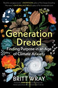
Generation Dread: Finding Purpose In An Age Of Climate Anxiety
by Britt Wray“Generation Dread is a vital and deeply compelling read.”—Adam McKay, award-winning writer, director, and producer (Vice, Succession, Don’t Look Up) “Read this courageous book.”—Naomi Klein, author of This Changes Everything “Wray shows finally that meaningful living is possible even in the face of that which threatens to extinguish life itself.”—Dr. Gabor Maté, author of When the Body Says No When we’re faced with record-breaking temperatures, worsening wildfires, more severe storms, and other devastating effects of climate change, feelings of anxiety and despair are normal. In Generation Dread, Britt Wray reminds us that our distress is, at its heart, a sign of our connection to and love for the world. The first step toward becoming a steward of the planet is connecting with our climate emotions—seeing them as a sign of our humanity and empathy and learning how to live with them. Britt Wray, a scientist and expert on the psychological impacts of the climate crisis, brilliantly weaves together research, insight from climate-aware therapists, and personal experience, to illuminate how we can connect with others, find purpose, and thrive in a warming, climate-unsettled world.
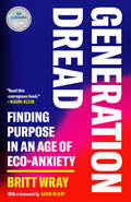
Generation Dread: Finding Purpose in an Age of Climate Crisis
by Britt WrayFINALIST FOR THE GOVERNOR GENERAL'S LITERARY AWARDA CBC BEST CANADIAN NONFICTION BOOK OF 2022AN INDIGO TOP TEN BEST SELF-HELP BOOK OF 2022"A vital and deeply compelling read.&” —Adam McKay, award-winning writer, director and producer (Don&’t Look Up)&“Britt Wray shows that addressing global climate change begins with attending to the climate within.&” —Dr. Gabor Maté, author of The Myth of Normal"Read this courageous book.&” —Naomi KleinAn impassioned generational perspective on how to stay sane amid climate disruption.Climate and environment-related fears and anxieties are on the rise everywhere. As with any type of stress, eco-anxiety can lead to lead to burnout, avoidance, or a disturbance of daily functioning. In Generation Dread, Britt Wray seamlessly merges scientific knowledge with emotional insight to show how these intense feelings are a healthy response to the troubled state of the world. The first crucial step toward becoming an engaged steward of the planet is connecting with our climate emotions, seeing them as a sign of humanity, and learning how to live with them. We have to face and value eco-anxiety, Wray argues, before we can conquer the deeply ingrained, widespread reactions of denial and disavowal that have led humanity to this alarming period of ecological decline.It&’s not a level playing field when it comes to our vulnerability to the climate crisis, she notes, but as the situation worsens, we are all on the field—and unlocking deep stores of compassion and care is more important than ever. Weaving in insights from climate-aware therapists, critical perspectives on race and privilege in this crisis, ideas about the future of mental health innovation, and creative coping strategies, Generation Dread brilliantly illuminates how we can learn from the past, from our own emotions, and from each other to survive—and even thrive—in a changing world.
Generation Green
by Linda Sivertsen Tosh SivertsenWe all know about the Earth's environmental crisis, but there is someone who can truly make a difference: you. If you text your friends or chat with them online, download music to your iPod, or toss bottles and papers into recycling bins, you're already more eco-savvy than you think. It's just as easy to do even more to help save the earth, and Generation Green shows you how. This book: Lays out the inside scoop on the biggest issues affecting our planet, such as global warming and overflowing landfills * Offers dozens of tips on how to shop, dress, eat, and travel the green way * Includes interviews with teens like you who are involved with fun, innovative green causes * Shows that being environmentally conscious can be a natural part of your life -- and your generation's contribution to turning things around. It doesn't matter if you can't vote or drive. Your efforts -- big or small -- will contribute to saving the planet. It's time for all of us to take action. It's time to go green!
Generation Green: The Ultimate Teen Guide to Living an Eco-Friendly Life
by Linda Sivertsen Tosh SivertsenWe all know about the Earth's environmental crisis, but there is someone who can truly make a difference: you. If you text your friends or chat with them online, download music to your iPod, or toss bottles and papers into recycling bins, you're already more eco-savvy than you think. It's just as easy to do even more to help save the earth, and Generation Green shows you how. This book lays out the inside scoop on the biggest issues affecting our planet, such as global warming and overflowing landfills. Offers dozens of tips on how to shop, dress, eat, and travel the green way. Includes interviews with teens like you who are involved with fun, innovative green causes. Shows that being environmentally conscious can be a natural part of your life -- and your generation's contribution to turning things around. It doesn't matter if you can't vote or drive. Your efforts -- big or small -- will contribute to saving the planet. It's time for all of us to take action. It's time to go green!
