- Table View
- List View
Geomorphology of Georgia (Geography of the Physical Environment)
by Levan TielidzeThis book provides a comprehensive overview of the geomorphology of Georgia. It describes a country characterized by geological, geomorphological and geographical diversities, located in the Caucasus region at the crossroads of Europe and Asia. This book is based on the results of several years of geomorphological studies and research in Georgia, published for the first time in English, and covers a gap in research in the field of world regional geomorphology. The landscapes of Georgia consist of high glacial mountains, medium and high mountains with deeply fragmented features, narrow and deep gorges and canyons, seaside lowlands, volcanic cones, uplands and mountain ranges, intermountain plains, hollows and highlands. The peculiarity of the landscape greatly affects the natural conditions. In several chapters, this book describes the diversity of climate, hydrographic network, vegetation cover, soils, fauna, exogenic processes, natural and anthropogenic landscapes. This volume provides the readers with the opportunity to explore the variety of landscapes and landforms in this diverse and fascinating country through informative texts illustrated with many color maps and photographs. Geomorphology of Georgia appeals to scientists, scholars, teachers and any readers interested in geology, physical geography, geomorphology, tourism and environmental protection. It is a rich resource for field trips and a comprehensive guide for travelers interested in the geomorphology of Georgia.
Geomorphology of Proglacial Systems: Landform and Sediment Dynamics in Recently Deglaciated Alpine Landscapes (Geography of the Physical Environment)
by Tobias Heckmann David MorcheThis book discusses the recession of alpine glaciers since the end of the Little Ice Age (LIA), which has been accelerating in the past decades. It provides an overview of the research in the field, presenting definitions and information about the different proglacial areas and systems. A number of case studies are from the PROSA project group which encompasses the expertise of geomorphologists, geologists, glaciologists and geodesists. The PROSA joint project (High-resolution measurements of morphodynamics in rapidly changing PROglacial Systems of the Alps) is determined to tackle the problems of geomorphic activity on sediment export through a quantification of sediment fluxes effected by the aforementioned geomorphic processes within the forefield of the Gepatschferner glacier (Central Alps, Austria).
Geomorphology of Upland Peat: Erosion, Form and Landscape Change (RGS-IBG Book Series #70)
by Jeff Warburton Martin EvansThe Geomorphology of Upland Peat offers a detailed synthesis of existing literature on peat erosion, incorporating new research ideas and data from two leading experts in the field. Presents the most detailed and current work to date Written in a style that is both intelligent and accessible Fully illustrated with original drawings and photographs Relevant and information for a broad audience working on organic sediments in various environments
Geomorphology of the Northeast Region of Brazil (The Latin American Studies Book Series)
by Vanda Claudino-Sales José Falcão SobrinhoThe Brazilian Northeast, comprising 1,600,000 km2 and nine States (Alagoas, Bahia, Ceará, Maranhão, Paraíba, Pernambuco, Piauí, Rio Grande do Norte, Sergipe), has an enormous diversity of geomorphological landscapes. Despite the wealth of relief, the available studies do not present, in detail, the regional geomorphological elements. However, it is necessary to allow the advancement of geographic science and related areas, create appropriate processes for the use and occupation of geographic space, guide land-use planning and environmental planning, and encourage conservationist practices. The chapters, written by the best geomorphological specialists in each segment, present unique, rich, and unpublished material that treats the reality of the geomorphological landscape in the Brazilian Northeast. It starts with a theoretical discussion on advances in the analysis of geomorphology by State, showing an unprecedented and functional geographic division.
Geomorphology: Or The Study Of Geomorphology (Collected Works of Richard J. Chorley)
by Richard J. Chorley Stanley A. Schumm David E. SugdenOriginally published in 1984. This major text covers the whole discipline of geomorphology, presenting a clear and comprehensive overview of the field, drawing on the full range of modern research. Landforms and their formative processes are treated on a broad spectrum of spatial scales, and examples are drawn from the major geological, climatic and biotic environments. The book is divided conveniently into some 170 clearly defined sections to allow readers to make the most efficient use of those parts of the text relevant to their particular needs. After introducing the basic concepts such as systems analysis, morphologic and cascading systems, the historical-evolutionary approach and process-response geomorphology, the book moves on to the geological background to geomorphology and then the extensive third part deals with the geomorphic processes and responding landforms. Part four examines climatic geomorphology and the appendix touches on applied geomorphology, especially fluvial processes.
Geomorphology: Pure and Applied (Routledge Library Editions: Geology #13)
by M.G. HartThis unique treatment of geomorphology, first published in 1986, provides a comprehensive work to enable students to see the subject as a whole. Taking the concepts that run through the subject and cut across its standard divisions, the book summarises the history of intellectual debate in geomorphology and then describes modern developments, both pure and applied.
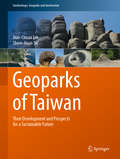
Geoparks of Taiwan: Their Development and Prospects for a Sustainable Future (Geoheritage, Geoparks and Geotourism)
by Jiun-Chuan Lin Shew-Jiuan SuThis book offers an essential introduction to Taiwan’s geoparks, issues related to their development, and prospects for a sustainable future. It discusses how promoting geoparks can serve as a tool for a sustainable society based on the lessons learned in Taiwan. Situated in a tectonically dynamic geological setting (at the boundary of the Eurasian and the Philippine Plates) and culturally diversified geographical setting, Taiwan is an ideal candidate for showcasing its “natural wonders” in geoparks, promoting landscape conservation, and expanding the horizons of geoheritage world-wide. The book begins by illustrating the physical and human environments of Taiwan’s geoparks, helping readers understand their foundation. In turn, the second section includes chapters describing the development of all six Taiwanese geoparks, offering comprehensive information on each. Lastly, it illustrates the social development and mechanisms used to promote each geopark.
Geoparticipatory Spatial Tools (Local and Urban Governance)
by Jiří PánekThe book explores the key factors affecting the successful implementation of public participation spatial systems in participatory planning as part of the urban governance system. It brings insight from nation-wide research in the Czech Republic and the implications to other countries in the region and beyond. The main aim of the proposed book is to analyse the state-of-the-art of using geoparticipatory tools for citizens’ participation in community decision-making process and to suggest the effective implementation of the geoparticipatory tools available in urban governance. This book explores the situation in the Czech Republic as a representative of for Eastern Bloc country, three decades after the political transition, on its way to public participation in local and urban governance. The active involvement of the citizens into the local and urban decision making process via geoparticipatory spatial tools is becoming a popular research field among human geographers, behavioural geographers, GIS scientists, environmental psychologists, policy scientists and many others scientific areas.
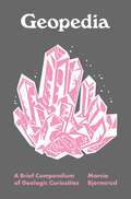
Geopedia: A Brief Compendium of Geologic Curiosities (Pedia Books #6)
by Marcia BjornerudA garden of geologic delights for all EarthlingsGeopedia is a trove of geologic wonders and the evocative terms that humans have devised to describe them. Featuring dozens of entries—from Acasta gneiss to Zircon—this illustrated compendium is brimming with lapidary and lexical insights that will delight rockhounds and word lovers alike.Geoscientists are magpies for words, and with good reason. The sheer profusion of minerals, landforms, and geologic events produced by our creative planet demands an immense vocabulary to match. Marcia Bjornerud shows how this lexicon reflects not only the diversity of rocks and geologic processes but also the long history of human interactions with them.With wit and warmth, she invites all readers to celebrate the geologic glossary—a gallimaufry of allusions to mythology, imports from diverse languages, embarrassing anachronisms, and recent neologisms. This captivating book includes cross-references at the end of each entry, inviting you to leave the alphabetic trail and meander through it like a river. Its pocket-friendly size makes it the perfect travel companion no matter where your own geologic forays may lead you.With whimsical illustrations by Haley Hagerman, Geopedia is a mix of engaging and entertaining facts about how the earth works, how it has coevolved with life over billions of years, and how our understanding of the planet has deepened over time.Features a real cloth cover with an elaborate foil-stamped design
Geopedology
by Joseph Alfred Zinck Graciela Metternicht Gerardo Bocco Héctor Francisco Del ValleThis book offers a proven approach for reliable mapping of soil-landscape relationships to derive information for policy, planning and management at scales ranging from local to regional. It presents the theoretical and conceptual framework of the geopedologic approach and a bulk of applied research showing its application and benefits for knowledge generation relevant to geohazard studies, land use conflict analysis, land use planning, land degradation assessment, and land suitability analysis. Soil is a vital resource for society at large and an important determinant of the economic status of nations. The intensification of natural disasters and the increased land use competition for food and energy have raised awareness of the relevant role the pedosphere plays in natural and anthropogenic environments. Recent papers and global initiatives show a renewed interest in soil research and its applications for improved planning and management of this fragile and finite resource.
Geopedology: An Integration Of Geomorphology And Pedology For Soil And Landscape Studies
by Joseph Alfred Zinck Graciela Metternicht Héctor Francisco del Valle Marcos Angelini<p>This updated and revised second edition brings geopedology issues into the current context. This new edition extends the work on popular topics such as digital soil mapping, GIS and landscape mapping, and it also gives valuable insight with up-to-date theoretical discussions and new application with relevant case studies. This textbook offers a proven approach for reliable mapping of soil-landscape relationships to derive information for policy, planning and management at scales ranging from local to regional. Filled with didactic elements such as case studies, visual aids (maps, charts and figures), questions and answers, the book is of interest to geohazard studies, land use conflict analysis, land use planning, land degradation assessment, and land suitability analysis.<p> <p>Soil is a vital resource for society at large and an important determinant of the economic status of nations. The intensification of natural disasters and the increased land use competition for food and energy have raised awareness of the relevant role the pedosphere plays in natural and anthropogenic environments. Recent papers and global initiatives show a renewed interest in soil research and its applications for improved planning and management of this fragile and finite resource.<p>
Geopedology: An Integration of Geomorphology and Pedology for Soil and Landscape Studies
by Joseph Alfred Zinck Graciela Metternicht Héctor Francisco del Valle Marcos AngeliniThis updated and revised second edition brings geopedology issues into the current context. This new edition extends the work on popular topics such as digital soil mapping, GIS and landscape mapping, and it also gives valuable insight with up-to-date theoretical discussions and new application with relevant case studies. This textbook offers a proven approach for reliable mapping of soil-landscape relationships to derive information for policy, planning and management at scales ranging from local to regional. Filled with didactic elements such as case studies, visual aids (maps, charts and figures), questions and answers, the book is of interest to geohazard studies, land use conflict analysis, land use planning, land degradation assessment, and land suitability analysis. Soil is a vital resource for society at large and an important determinant of the economic status of nations. The intensification of natural disasters and the increased land use competition for food and energy have raised awareness of the relevant role the pedosphere plays in natural and anthropogenic environments. Recent papers and global initiatives show a renewed interest in soil research and its applications for improved planning and management of this fragile and finite resource.
Geophysical & Astrophysical Convection (The Fluid Mechanics of Astrophysics and Geophysics)
by Robert M. Kerr Peter A. FoxGeophysical and Astrophysical Convection collects important papers from an international group of the world's foremost researchers in geophysical and astrophysical convection to present a concise overview of recent thinking in the field. Topics include: Atmospheric convection, solar and stellar convection, unsteady non-penetrative thermal convectio
Geophysical Approach to Marine Coastal Ecology: The Case of Iriomote Island, Japan (Springer Oceanography)
by Shinya Shimokawa Tomokazu Murakami Hiroyoshi KohnoThis book presents recent results of collaborative studies in geophysics and ecology, focusing on the relationship between the physical environment and the distribution of the marine coastal ecosystems. The study area, the Sakiyamawan–Amitoriwan nature conservation area in Iriomote Island of Japan, is the only oceanic nature conservation area in the country. The area has no access roads, and the bay perimeter is uninhabited; therefore, it preserves the natural environment with very little human impact. In addition, it has various environmental gradients such as topography and inflows from rivers with mangrove forests which affect the distribution of marine coastal ecosystems such as those containing reef-building corals, sea grasses, and hermit crabs. For these reasons, the area is one of the best places for the study of the relationship between the physical environment and the distribution of the marine coastal ecosystems, a relationship that is important for their conservation but has not been investigated fully. This book is aimed at students and researchers in the fields of oceanography and marine coastal ecology as well as general readers who are interested in coral reefs, diving, and nature conservation.
Geophysical Exploration for Hydrocarbon Reservoirs, Geothermal Energy, and Carbon Storage: New Technologies and AI-based Approaches
by Said GaciA practical guide to the latest technologies and techniques in subsurface energy exploration In Geophysical Exploration for Hydrocarbon Reservoirs, Geothermal Energy, and Carbon Storage: New Technologies and AI-based Approaches, distinguished researcher Said Gaci delivers a practice-oriented overview and comparison of the concepts, methods, and workflows for the geophysical characterization of hydrocarbon and geothermal reservoirs, including those reservoirs suitable for large-scale carbon sequestration. Organized into four parts, the book begins with a summary of novel petroleum exploration technologies and discussions of illustrative case studies from around the world. It then explains how to integrate seismic and other non-invasive surveying methods for a comprehensive multiscale reservoir characterization. The third part explores the implementation of artificial intelligence tools in remote exploration, rock typing, and fluid prediction. The final part demonstrates how to apply hydrocarbon exploration methods to the exploration and development of geothermal reservoirs and underground carbon dioxide storage sites. Readers will find: A multidisciplinary approach to combining conventional hydrocarbon exploration techniques with the power of artificial intelligenceA thorough understanding of subsurface reservoir systems that links recent technical advances with new geological insights Practice-oriented discussions of advanced technologies for non-invasive reservoir characterizationSelected case studies that illustrate the application of novel concepts in a real-world setting Perfect for geologists, geoengineers, geophysicists, and fossil fuel professionals, Geophysical Exploration for Hydrocarbon Reservoirs, Geothermal Energy, and Carbon Storage will also benefit anyone aiming to remain at the forefront of subsurface energy exploration in the twenty-first century.
Geophysical Fluid Dynamics I: An Introduction to Atmosphere—Ocean Dynamics: Homogeneous Fluids (Springer Textbooks in Earth Sciences, Geography and Environment)
by Emin ÖzsoyThis textbook develops a fundamental understanding of geophysical fluid dynamics by providing a mathematical description of fluid properties, kinematics and dynamics as influenced by earth’s rotation. Its didactic value is based on elaborate treatment of basic principles, derived equations, exemplary solutions and their interpretation.Both starting graduate students and experienced scientists can closely follow the mathematical development of the basic theory applied to the flow of uniform density fluids on a rotating earth, with (1) basic physics introducing the "novel" effects of rotation for flows on planetary scales, (2) simplified dynamics of shallow water and quasi-geostrophic theories applied to a variety of steady, unsteady flows and geophysical wave motions, demonstrating the restoring effects of Coriolis acceleration, earth’s curvature (beta) and topographic steering, (3) conservation of vorticity and energy at geophysical scales, and (4) specific applications to help demonstrate the ability to create and solve new problems in this very rich field. A comprehensive review of the complex geophysical flows of the ocean and the atmosphere is closely knitted with this basic description, intended to be developed further in the second volume that addresses density stratified geophysical fluid dynamics.
Geophysical Fluid Dynamics II: Stratified / Rotating Fluid Dynamics of the Atmosphere—Ocean (Springer Textbooks in Earth Sciences, Geography and Environment)
by Emin ÖzsoyThis book develops a fundamental understanding of geophysical fluid dynamics based on a mathematical description of the flows of inhomogeneous fluids. It covers these topics:1. development of the equations of motion for an inhomogeneous fluid 2. review of thermodynamics 3. thermodynamic and kinetic energy equations 4. equations of state for the atmosphere and the ocean, salt, and moisture effects 5. concepts of potential temperature and potential density 6. Boussinesq and quasi-geostrophic approximations 7. conservation equations for vorticity, mechanical and thermal energy instability theories, internal waves, mixing, convection, double-diffusion, stratified turbulence, fronts, intrusions, gravity currentsGraduate students will be able to learn and apply the basic theory of geophysical fluid dynamics of inhomogeneous fluids on a rotating earth, including:1. derivation of the governing equations for a stratified fluid starting from basic principles of physics 2. review of thermodynamics, equations of state, isothermal, adiabatic, isentropic changes 3. scaling of the equations, Boussinesq approximation, applied to the ocean and the atmosphere 4. examples of stratified flows at geophysical scales, steady and unsteady motions, inertia-gravity internal waves, quasi-geostrophic theory 5. vorticity and energy conservation in stratified fluids6.boundary layer convection in stratified containers and basins
Geophysical Hazards
by Tom BeerThis volume, written by the Hazards Science Team of the International Year of Planet Earth, brings together some of the most influential international scientists dealing with Natural Hazards and Society's response to natural hazards. It recognises that hazards, like poverty, will always be with us but that concerted and organised societal response can prevent a hazard becoming a disaster. By bringing together geoscientists, social scientists and those concerned with the administration of international science and international disaster reduction, this book details the state-of-the-science as well as the state-of-the-response in natural hazards.
Geophysical Methods for Cultural Heritage Management (Springer Geophysics)
by Salvatore Piro Marilena Cozzolino Elisa Di Giovanni Paolo Mauriello Daniela ZamunerThis book provides information and tools necessary to bridge and integrate the knowledge gaps related to the acquisition and processing of archaeological data, specifically in the field of preventive diagnostics, urban centers, archaeological parks and historical monuments, through activities that involve the application of non-invasive diagnostic detection systems, in the field of applied geophysics. The principal aim of this book is to define a tool for experts that work in the frame of Cultural Heritage and to identify a procedure of intervention transferable and usable in different geographical contexts and areas of investigations: it could help to decide the better technique of investigation to apply in relation to the predictive characteristics of the archaeological site and the objectives of the survey. The book is divided in two parts. The first one explains the theory of ground high resolution penetrating radar (GPR), electrical resistivity tomography (ERT), controlled source electromagnetism system, differential magnetic method and the scenario of integrated methods of different geophysical techniques. Each section covers the basic theory (complete description of the physical parameters involved in the method), field instruments (description of all systems actually offered by commercial companies), field techniques (presentation of the main procedures and setting parameters used to explore the ground surface during data acquisition), techniques of data processing and representation (main processing routines and comparison between different techniques; presentation of different typologies of graphical representation), and the possibility and limitations of methods (explanation of best and worst conditions of implementation of the geophysical technique in relation to the contrasts between archaeological features and the natural background and the features of the instruments and arrays). The second part describes some applications of geophysical prospection to Cultural Heritage in detailed case histories, divided in sections relative to monuments, historical buildings, urban centres, archaeological parks and ancient viability. Moreover, examples of integration of three-dimensional reliefs and geophysical diagnostic of a monuments and studies of large scale reconnaissance implemented into a Geographical Information System are treated. In each case study the authors cover the description of the archaeological or historical contest; an explanation of the problem to solve; a choice of the geophysical methods; the setting of the procedure of data acquisition; techniques of data processing; a representation, interpretation, and discussion of the results.
Geophysical Methods: Fundamentals, Applications, and Case Studies
by O.P. Mishra D.C. NaskarThis book includes a complete background on geophysical methods of exploration, practices, and case histories for a better understanding of the subject of geophysics and its applicability in diverse fields of exploration. It details both conventional and advanced geophysical techniques, with descriptions of the physics involved in different methodologies. Divided into 16 chapters, the book includes detailed discussions of the theory of individual methods, the operation of specific instruments, the presentation of results, and their interpretation.Features: Discusses potential geophysical methods and applications in mineral exploration Reviews natural hazard risk mitigation using geophysical methods Covers surface, air, marine, and well logging geophysical applications in natural resource exploration Includes electrical, electromagnetic, seismic, and radioactive geophysical methods supported by successful case histories Strengthens mathematical and problem-solving skills covering all the geophysical aspects This book is aimed at graduate and post-graduate students in applied geophysics, exploration geophysics, marine geophysics, engineering, and environmental geophysics.
Geophysical Monitoring for Geologic Carbon Storage (Geophysical Monograph Series)
by Lianjie HuangGeophysical Monitoring for Geologic Carbon Storage Geophysical Monitoring for Geologic Carbon Storage Storing carbon dioxide in underground geological formations is emerging as a promising technology to reduce carbon dioxide emissions in the atmosphere. A range of geophysical techniques can be deployed to remotely track carbon dioxide plumes and monitor changes in the subsurface, which is critical for ensuring for safe, long-term storage. Geophysical Monitoring for Geologic Carbon Storage provides a comprehensive review of different geophysical techniques currently in use and being developed, assessing their advantages and limitations. Volume highlights include: Geodetic and surface monitoring techniques Subsurface monitoring using seismic techniques Subsurface monitoring using non-seismic techniques Case studies of geophysical monitoring at different geologic carbon storage sites The American Geophysical Union promotes discovery in Earth and space science for the benefit of humanity. Its publications disseminate scientific knowledge and provide resources for researchers, students, and professionals.
Geophysical Studies in the Caucasus
by Lev Eppelbaum Boris KhesinThe subject of this book is the methodology and results of integrated geophysical investigations in the Caucasian region, mainly interpretation of magnetic and gravity anomalies with utilization of a huge petrophysical database for the evaluation of geological structure and mineral resources. Relative voluminous geophysical data are useful for the Earth Sciences researchers interested in the Caucasian region (and adjacent and similar regions) characterized by complicated geological structure, inclined magnetization (polarization), uneven topography and mountain/sea transition. Examination of geophysical fields verified by super-deep wells drilling indicates that magmatic rocks of the Lesser Caucasus are extended northward under thick sedimentary cover of the Kura Depression up to the Greater Caucasus. These rocks form hidden petroleum-bearing traps of a newly identified type. On the basis of geophysical studies (mainly inexpensive magnetic and electric methods), a new copper-polymetallic province in the Greater Caucasus has been revealed. a newly developed integrated approach and special information-statistical techniques for processing and interpretation of geophysical data facilitate detection of important geological features, e.g. hidden intersections of linear structures that control location of large commercial ore and oil-and-gas deposits, as well as focuses of dangerous geodynamic events at a depth. Numerous illustrations (including colour) elucidate different problems and solutions on various scales and in diverse geological-geophysical environments. Many aspects of this book have been presented at the teaching courses for bachelors, masters and doctors at the Tel-Aviv University (Tel Aviv, Israel) and Ben-Gurion University (Be'er-Sheva, Israel). Benefits to readers are predetermined by the combination of the authors many-years personal experience in the geophysical studies of Azerbaijan and other regions of the Caucasus with the authors' knowledge of the modern level of geophysics in the world.
Geophysical Waves and Flows: Theory and Applications in the Atmosphere, Hydrosphere and Geosphere
by David E. LoperWaves and flows are pervasive on and within Earth. This book presents a unified physical and mathematical approach to waves and flows in the atmosphere, oceans, rivers, volcanoes and the mantle, emphasizing the common physical principles and mathematical methods that apply to a variety of phenomena and disciplines. It is organized into seven parts: introductory material; kinematics, dynamics and rheology; waves in non-rotating fluids; waves in rotating fluids; non-rotating flows; rotating flows; and silicate flows. The chapters are supplemented by 47 'fundaments', containing knowledge that is fundamental to the material presented in the main text, organized into seven appendices: mathematics; dimensions and units; kinematics; dynamics; thermodynamics; waves; and flows. This book is an ideal reference for graduate students and researchers seeking an introduction to the mathematics of waves and flows in the Earth system, and will serve as a supplementary textbook for a number of courses in geophysical fluid dynamics.
Geophysics and Geosequestration
by Malcolm Wilson Thomas L. Davis Martin LandrøGeosequestration involves the deep geological storage of carbon dioxide from major industrial sources, providing a potential solution for reducing the rate of increase of atmospheric concentrations of carbon dioxide and mitigating climate change. This volume provides an overview of the major geophysical techniques and analysis methods for monitoring the movement and predictability of carbon dioxide plumes underground. Comprising chapters from eminent researchers, the book is illustrated with practical examples and case studies of active projects and government initiatives, and discusses their successes and remaining challenges. A key case study from Norway demonstrates how governments and other stake-holders could estimate storage capacity and design storage projects that meet the requirements of regulatory authorities. Presenting reasons for embracing geosequestration, technical best practice for carbon management, and outlooks for the future, this volume provides a key reference for academic researchers, industry practitioners and graduate students looking to gain insight into subsurface carbon management.

Geophysics for the Mineral Exploration Geoscientist
by Michael Dentith Stephen T. MudgeProviding a balance between principles and practice, this state-of-the-art overview of geophysical methods takes readers from the basic physical phenomena, through the acquisition and processing of data, to the creation of geological models of the subsurface and data interpretation to find hidden mineral deposits. Detailed descriptions of all the commonly used geophysical methods are given, including gravity, magnetic, radiometric, electrical, electromagnetic and seismic methods. Each technique is described in a consistent way and without complex mathematics. Emphasising extraction of maximum geological information from geophysical data, the book also explains petrophysics, data modelling and common interpretation pitfalls. Packed with full-colour figures, also available online, the text is supported by selected examples from around the world, including all the major deposit types. Designed for advanced undergraduate and graduate courses in minerals geoscience, this is also a valuable reference for professionals in the mining industry wishing to make greater use of geophysical methods.