- Table View
- List View
Literary Feminist Ecologies of American and Caribbean Expansionism: Errand into the Wilderness (Routledge Environmental Literature, Culture and Media)
by Christine M. Battista Melissa R. SandeThis book synthesizes ecofeminist theory, American studies, and postcolonial theory to interrogate what New Americanist William V. Spanos articulates as the "errand into the wilderness": the ethic of Puritanical expansionism at the heart of the U.S. empire that moved westward under Manifest Destiny to colonize Native Americans, non-whites, women, and the land. The project explores how the legacy of the errand has been articulated by women writers, from the slave narrative to contemporary fiction. Uniting texts across geographical and temporal boundaries, the book constructs a theoretical approach for reading and understanding how women authors craft counter-narratives at the intersection of metaphorical and literal landscapes of colonization. It focuses on literature from the United States and the Caribbean, including the slave narratives by Sojourner Truth, Harriet E. Wilson, and Harriet Jacobs, and contemporary work by Toni Morrison, Maryse Condé, Edwidge Danticat, and Native American writer Linda Hogan. It charts the contrast between America’s earliest idyllic visions and the subsequent reality: an era of unprecedented violence against women of color and the environment. This study of many canonical writers presents an important and illuminating analysis of American mythologies that continue to impact the cultural landscape today. It will be a significant discussion text for students, scholars, and researchers in environmental humanities, ecofeminism, and postcolonial studies.
Literature and Cartography: Theories, Histories, Genres (The\mit Press Ser.)
by Anders Engberg-PedersenThe relationship of texts and maps, and the mappability of literature, examined from Homer to Houellebecq.Literary authors have frequently called on elements of cartography to ground fictional space, to visualize sites, and to help readers get their bearings in the imaginative world of the text. Today, the convergence of digital mapping and globalization has spurred a cartographic turn in literature. This book gathers leading scholars to consider the relationship of literature and cartography. Generously illustrated with full-color maps and visualizations, it offers the first systematic overview of an emerging approach to the study of literature.The literary map is not merely an illustrative guide but represents a set of relations and tensions that raise questions about representation, fiction, and space. Is literature even mappable? In exploring the cartographic components of literature, the contributors have not only brought literary theory to bear on the map but have also enriched the vocabulary and perspectives of literary studies with cartographic terms. After establishing the theoretical and methodological terrain, they trace important developments in the history of literary cartography, considering topics that include Homer and Joyce, Goethe and the representation of nature, and African cartographies. Finally, they consider cartographic genres that reveal the broader connections between texts and maps, discussing literary map genres in American literature and the coexistence of image and text in early maps. When cartographic aspirations outstripped factual knowledge, mapmakers turned to textual fictions.ContributorsJean-Marc Besse, Bruno Bosteels, Patrick M. Bray, Martin Brückner, Tom Conley, Jörg Dünne, Anders Engberg-Pedersen, John K. Noyes, Ricardo Padrón, Barbara Piatti, Simone Pinet, Clara Rowland, Oliver Simons, Robert Stockhammer, Dominic Thomas, Burkhardt Wolf
Literature and Ecofeminism: Intersectional and International Voices (Routledge Environmental Humanities)
by Douglas A. Vakoch Sam MickeyBringing together ecofeminism and ecological literary criticism (ecocriticism), this book presents diverse ways of understanding and responding to the tangled relationships between the personal, social, and environmental dimensions of human experience and expression. Literature and Ecofeminism explores the intersections of sexuality, gender, embodiment, and the natural world articulated in literary works from Shakespeare through to contemporary literature. Bringing together essays from a global group of contributors, this volume draws on American literature, as well as Spanish, South African, Taiwanese, and Indian literature, in order to further the dialogue between ecofeminism and ecocriticism and demonstrate the ongoing relevance of ecofeminism for facilitating critical readings of literature. In doing so, the book opens up multiple directions for ecofeminist ideas and practices, as well as new possibilities for interpreting literature. This comprehensive volume will be of great interest to students and scholars of ecocriticism, ecofeminism, literature, gender studies, and the environmental humanities.
Literature and Ecotheology: From Chaos to Cosmos (ISSN)
by George B. HandleyLiterature and Ecotheology: From Chaos to Cosmos challenges us in a time of climate crisis to find more common ground between the dual projects of ecocriticism and ecotheology.This book argues that in our postsecular age, literature has become an important repository of theological wisdom that can, like formal work in ecotheology, provide the moral grounds for environmental care. However, for any cosmological understanding to be adequate to the challenges before us, it must be responsive to the often-painful contingencies and uncertainties that inhere in the cosmos, something that both ecocriticism and ecotheology have often neglected. After a treatment of the ecocritical and ecotheological questions that pertain to the religious/secular divide, the study then turns to four contemporary American writers—Annie Dillard, Cormac McCarthy, Marilynne Robinson, and David James Duncan—as examples. Each uses the contingency of literary form and its promise of wholeness in order to imagine reasons for hope in light of the unpredictability and untold human and more-than-human suffering that lie at the heart of nature.The book will be of interest to students, scholars and researchers interested in ecotheology, religious studies, environmental literature, the environmental humanities, and environmental studies more broadly. It offers a needed paradigm shift in how Western societies have tended to misuse both secularity and religion.
Literature of Agricultural Research
by J. Richard Blanchard Harald OstvoldThis title is part of UC Press's Voices Revived program, which commemorates University of California Press’s mission to seek out and cultivate the brightest minds and give them voice, reach, and impact. Drawing on a backlist dating to 1893, Voices Revived makes high-quality, peer-reviewed scholarship accessible once again using print-on-demand technology. This title was originally published in 1958.
Literatures of Urban Possibility (Literary Urban Studies)
by Lieven Ameel Jason Finch Markku SalmelaThis book demonstrates how city literature addresses questions of possibility. In city literature, ideas of possibility emerge primarily through two perspectives: texts may focus on what is possible for cities, and they may present the urban environment as a site of possibility for individuals or communities. The volume combines reflections on urban possibility from a range of geographical and cultural contexts—in addition to the English-speaking world, individual chapters analyse possible cities and possible urban lives in Turkey, Israel, Finland, Germany, Russia and Sweden. Moreover, by engaging with issues such as city planning, mass housing, gentrification, informal settlements and translocal identities, the book shows imaginative literature at work outlining what possibility means in cities.
Literaturunterricht und Krise: Aktuelle Herausforderungen in Welt und Fach (Deutschdidaktik)
by Julia Stetter Sebastian SusteckDer Literaturunterricht steht unter Druck. Bildungspolitisch ungeliebt und didaktisch zunehmend ratlos betrachtet, lässt Literatur sich nur schwer in Kompetenzraster integrieren und steht zudem im Verdacht, zu den existenziellen Problemen der Gegenwart zu wenig zu sagen zu haben. Der Band öffnet neue Perspektiven auf den heutigen Literaturunterricht, der in multiplen Krisen gefangen scheint und im Kreuzfeuer von Entwicklungen steht, die allgemein mit Problemen deutscher Schulen assoziiert werden. Die Beiträge betonen dagegen die Bedeutung der Literatur für den Unterricht sowie die Rolle des Literaturunterrichts in der Reaktion auf die Krisen der Gegenwart.
Lithic Technological Organization and Paleoenvironmental Change
by Erick Robinson Frédéric SelletThe objective of this edited volume is to bring together a diverse set of analyses to document how small-scale societies responded to paleoenvironmental change based on the evidence of their lithic technologies. The contributions bring together an international forum for interpreting changes in technological organization - embracing a wide range of time periods, geographic regions and methodological approaches. As technology brings more refined information on ancient climates, the research on spatial and temporal variability of paleoenvironmental changes. In turn, this has also broadened considerations of the many ways that prehistoric hunter-gatherers may have responded to fluctuations in resource bases. From an archaeological perspective, stone tools and their associated debitage provide clues to understanding these past choices and decisions, and help to further the investigation into how variable human responses may have been. Despite significant advances in the theory and methodology of lithic technological analysis, there have been few attempts to link these developments to paleoenvironmental research on a global scale.
Lithic Technological Systems and Evolutionary Theory
by Nathan Goodale William Andrefsky Jr.Stone tool analysis relies on a strong background in analytical and methodological techniques. However, lithic technological analysis has not been well integrated with a theoretically-informed approach to understanding how humans procured, made, and used stone tools. Evolutionary theory has great potential to fill this gap. This collection of essays brings together several different evolutionary perspectives to demonstrate how lithic technological systems are a byproduct of human behavior. The essays cover a range of topics, including human behavioral ecology, cultural transmission, phylogenetic analysis, risk management, macroevolution, dual inheritance theory, cladistics, central place foraging, costly signaling, selection, drift, and various applications of evolutionary ecology.
Lithium Isotopes: A Tracer of Past and Present Silicate Weathering (Elements in Geochemical Tracers in Earth System Science)
by Philip A. Strandmann Mathieu Dellinger A. Joshua WestLithium isotopes are a relatively novel tracer of present and past silicate weathering processes. Given that silicate weathering is the primary long-term method by which CO2 is removed from the atmosphere, Li isotope research is going through an exciting phase. We show the weathering processes that fractionate dissolved and sedimentary Li isotope ratios, focusing on weathering intensity and clay formation. We then discuss the carbonate and silicate archive potential of past seawater δ7Li. These archives have been used to examine Li isotope changes across both short and long timescales. The former can demonstrate the rates at which the climate is stabilised from perturbations via weathering, a fundamental piece of the puzzle of the long-term carbon cycle.
Lithofacies Paleogeography and Geological Survey of Shale Gas (The China Geological Survey Series)
by Wei Liang Chuanlong Mou Xiuping Wang Qiyu Wang Xiangying Ge Bowen Zan Kenken Zhou Xiaowei ChenThis is an open access book. This book presents new theory and methods on compiling lithofacies paleogeographic maps as a key tool for guiding geological survey on shale gas. The fundamental goal of the shale gas geological survey is to find the ‘dessert’ area. It is therefore suggested that the lithofacies paleogeographic study and the technique of mapping should be a solid scientific basis for shale gas exploration. It takes Ordovician Wufeng-Silurian Longmaxi Formation in Sichuan Basin and its adjacent area as an example to illustrate how to find the ‘dessert’ area of shale gas in geological survey phase by compiling lithofacies paleogeographic map. It’s a valuable reference for both scientific research and teaching courses in the fields of sedimentary lithofacies, paleogeography, stratigraphy, and oil and gas.
Lithosphere Dynamics and Sedimentary Basins of the Arabian Plate and Surrounding Areas
by François Roure Ammar A. Amin Sami Khomsi Mansour A. M. Al GarniPresenting selected papers from the International Lithosphere Program (ILP) Task Force, this book highlights the links between deep Earth (mantle) and shallow processes in areas of active tectonics in the Arabian Plate and surrounding areas. It also provides key information on energy resources in these areas. It comprises a collection of research studies from the Middle East, North Africa and the Mediterranean domain, focusing on (1) the lithospheric architecture of the Arabian Plate, (2) tectonics and sedimentation in the Gulf of Corinth, (3) Triassic carbonate breccias and seismic imagery in Iraq, (4) reservoirs, aquifers and fluid transfers in Saudi Basins, (5) salt tectonics in Yemen, and (6) Cretaceous-Eocene foreland inversions in Saudi Arabia.
Lithosphere Dynamics and Sedimentary Basins: The Arabian Plate and Analogues
by Francois Roure Khalid Al Hosani Richard Ellison Stephen LokierThis book will constitute the proceedings of the ILP Workshop held in Abu Dhabi in December 2009. It will include a reprint of the 11 papers published in the December 2010 issue of the AJGS, together with 11 other original papers.
Lithosphere Dynamics and Sedimentary Basins: The Arabian Plate and Analogues (Frontiers in Earth Sciences)
by Francois Roure Khalid Al Hosani Richard Ellison Stephen LokierThis book will constitute the proceedings of the ILP Workshop held in Abu Dhabi in December 2009. It will include a reprint of the 11 papers published in the December 2010 issue of the AJGS, together with 11 other original papers.
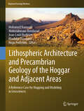
Lithospheric Architecture and Precambrian Geology of the Hoggar and Adjacent Areas: A Reference Case for Mapping and Modeling in Geosciences (Regional Geology Reviews)
by Abderrahmane Bendaoud Mohamed Hamoudi Jean-Louis Bodinier Khadidja Ouzegane Hugo PerfettiniThis book presents the latest advances in mapping the geological structures and modeling the geodynamical and petrological processes in the Hoggar shield and adjacent areas of the northeast West African Craton, which is home to the oldest rocks in Algeria. Its respective chapters discuss the structural geology, geophysical methods, igneous processes, metamorphic petrology and metallogeny. The mapping and modeling are based on satellite data and scanning electron microscopy (SEM), so the mapping ranges from continental to crystalline scale and the ages range from 3.2 Ga to the recent Cenozoic. Further, various types of commercial and open source software (partially developed by the authors) were used. Gathering papers by respected experts in the methods applied and the Algerian Precambrian domain, the book offers a valuable reference guide to a range of mapping and modeling methodologies, as well as a geological and geophysical description of the Hoggar shield and the northeast West African Craton.
Lithostratigraphy of Iran (Springer Geology)
by Mansour GhorbaniThis book discusses the entire lithostratigraphy of Iran from the Proterozoic to recent. This unique book manages to elucidate the stratigraphy of Iran, after an exhausting and long-term process; the creation of a comprehensive stratigraphic framework required input from many Iranian specialist stratigraphers - a process which will be ongoing in the future. However, the main purpose of this work is to provide a concise summary of the state of the art of the lithostratigraphy for Iranian formations. The geology of the various sedimentary basins is described for each geological time period, together with the constituent lithostratigraphic units. The available stratigraphic data are summarized in tables, providing all relevant references. Finally, the book presents the spatial and temporal distribution of the various formations, together with their geographic locations, type sections and lithological composition.
Lithostratigraphy of Sicily
by Luca BasiloneThis book offers as comprehensive an overview as possible of the lithostratigraphy of the Italian region of Sicily, taking into account the multiplicity of formational and terminological variability developed over more than a century of studies and publications. It presents stratigraphic terminology, the geological lexicon and the main stratigraphic subdivisions that are not familiar to Sicilian geologists. The new stratigraphic methods and the use of formations as mapping units have prompted the acquisition of new lithostratigraphic data, and a review of the previous units and their comparison with the new collected data, enabling the definition of a number of new lithostratigraphic units. The book summarizes the results in 77 worksheets containing the most important information regarding the lithological, sedimentological and microfacies characteristics, the measured thicknesses, areal extent and the regional aspects, the paleoenvironmental, paleogeographic and paleo-tectonics setting, compiled according to standard procedures and nomenclature rules provided by the International Commission on Stratigraphy (ICS).
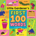
Little Gardener's First 100 Words
by Tenisha BernalThe perfect primer for budding gardeners, this board book introduces little ones to 100 different items found in the garden!From bugs to tools, each page in this unique first words book is filled with things found in the garden—above and below the ground!Little ones can learn about the parts of a plant, the different herbs, fruits, and vegetables that can grow in a garden, and the names of tools that make gardening easier. There is even a page dedicated to urban gardening for those who don't have yards!Detailed illustrations and brightly colored backgrounds are sure to engage even the youngest of nature enthusiasts. This perfect gift for budding gardeners will show them the tools they need to create and care for their very own garden.
Little Ice Ages Vol1 Ed2: Ancient And Modern (Routledge Studies In Physical Geography Ser. #Vol. 5)
by Jean M GroveFirst published in 2004. Since The Little Ice Age was published in 1988, interest in climatic history has grown rapidly and research in the area has flourished. A vast amount of new data has become available from sources such as ice cores, speleothems and tree rings. The picture that we have of past climates and glacier oscillations has extended further into the past and has become more detailed. However, the knowledge of climate change on the decennial and centennial timescale, to which glacier history can contribute, is scarce and is in demand when attempting to predict future change, especially with regard to global warming. New chapters and material have been included throughout the book, which tend to confirm and elaborate on the conclusions of the first edition. The glacial evidence has been presented in the context of the oceanographic and icecap studies that have provided such exciting results. Little Ice Ages is structured in three parts: • Part 1 details the evidence for glacier variations in the last thousand years in different parts of the world and the associated climatic fluctuations. • Part 2 brings together the evidence for the timing of glacier variations in the course of the Holocene. • Part 3 views the Holocene record in a longer time context, especially as it appears in ice cores, and goes on to consider the likely causes of climatic variability on a Little Ice Age timescale and some of its physical, biological and human consequences. It becomes apparent in Little Ice Ages that the glacier record provides a valuable indication of the nature of climatic fluctuations on the land areas of the globe. The record points to periods of cooling which were more numerous and less continuous than was believed to be the case twenty years ago. There appears to be no single explanation for the variability. Volcanism, solar variability and ocean currents have all played their parts and prediction continues to present many problems. Some authorities have thrown doubt on the existence of the Little Ice Age, but Little Ice Ages makes the case for a climatic sequence that can usefully be called the Little Ice Age and which had predecessors occurring at intervals of several centuries throughout much of the last 10,000 years.
Little Ice Ages Vol2 Ed2: Ancient And Modern (Routledge Studies In Physical Geography Ser. #Vol. 5)
by Jean M GroveFirst Published in 2004. Routledge is an imprint of Taylor & Francis, an informa company.
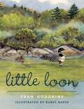
Little Loon
by Fran HodgkinsLittle Loon traces the birth and first summer of a loon chick on a New England lake, ending with the loon&’s migration for the winter. Readers follow along as the baby loon grows and discovers the world around her. Along the way, they&’ll learn that loons are so perfectly adapted to life in the water that it&’s very difficult for them to walk on land. They only come out of the water to lay eggs, so their nests are built are very close to shore and are very susceptible to flooding in heavy rains. Readers will also discover that the biggest threats to loons come from people—boats, pollution, and fishing tackle. Lavishly illustrated in full color, the book closes with a page of pertinent loon facts and ways for children to help protect this beloved waterfowl.
Little Zoologist (A Science Tots Book)
by Dan TaylorTeach your baby all about being a zoologist with this new board book published in partnership with Smithsonian.Scales. Notebooks. Habitats. Microscopes. Zoologists do a lot more than just feed and take care of animals and now young babies and toddlers will be able to learn all about what it means to be a zoologist and what tools they use as part of their job in this exciting and fun book in a new board book series published in conjunction with the Smithsonian Institute.
Livable Cities: Urban Heat Islands Mitigation for Climate Change Adaptation Through Urban Greening
by Antonella Trombadore Mohsen Aboulnaga Mona Mostafa Ahmed AbouaianaLivable Cities: Urban Heat Islands Mitigation for Climate Change Adaptation Through Urban Greening elucidates on livability in urban areas, providing readers with definitions and indicators of what makes a city livable. It comprehensively introduces the urban heat island effect (UHIE) and offers strategies for mitigating high surface temperatures in metropolitan areas and adapting to climate change (CC). The coverage highlights the linkage between UHIE and Sustainable Development Goals (SDGs), the socio-economic impacts of urban heat islands (UHIs), their effect on livability for citizens, and the costs and benefits of mitigating UHI. In addition, it encompasses background information about the problems and challenges that megacities face in the 21st century, followed by the cooling benefits that can be achieved from the different types of urban green coverage (UGC), whether conventional or innovative. The book presents case studies on six cities that have successfully applied UGC: Chicago (United States), Curitiba (Brazil), Stuttgart (Germany), Tokyo (Asia), Melbourne (Australia), and Johannesburg (South Africa). Additional case studies illustrate UHIE mapping in greater Cairo, Egypt, and Rome, Italy, to determine hot spot areas that need interventions and prioritization of UGC. Highlights also include the role of blue and green infrastructures in creating livable cities in the post-COVID-19 world, trends of bi-correlation between urban green spaces (UGSs), UGC, and COVID-19, and global patterns of UGSs to shape better healthy, sustainable, and resilient cities. Explains urban heat islands, their causes, and strategies for climate change adaptation to create livable cities; Highlights the role of urban green coverage in post-COVID-19 regulations in shaping more livable, sustainable, and resilient cities.Explores ways to reduce the urban heat island effect by exploiting urban greening to mitigate high temperatures in large cities like Cairo and Rome.
Live Sustainably Now: A Low-Carbon Vision of the Good Life
by Karl CoplanAny realistic response to climate change will require reducing carbon emissions to a sustainable level. Yet even people who already recognize that the climate is the most urgent issue facing the planet struggle to understand their individual responsibilities. Is it even possible to live with a sustainable carbon footprint in modern American society—much less to live well? What are the options for those who would like to make climate awareness part of their daily lives but don’t want to go off the grid or become a hermit?In Live Sustainably Now, Karl Coplan shares his personal journey of attempting to cut back on carbon without giving up the amenities of a suburban middle-class lifestyle. Coplan chronicles the joys and challenges of a year on a carbon budget—kayaking to work, hunting down electric-car charging stations, eating a Mediterranean-style diet, and enjoying plenty of travel on weekends and vacations while avoiding long-distance flights. He explains how to set a personal carbon cap and measure your actual footprint, with his own results detailed in monthly diary entries. Presenting the pros and cons of different energy, transportation, and lifestyle options, Live Sustainably Now shows that there does not have to be a trade-off between the ethical obligation to maintain a sustainable carbon footprint and the belief that life should be fulfilling and fun. This powerful and persuasive book provides an individual-level blueprint for a carbon-sustainable tweak to the American dream.
Lived Experiences of Resilience in Disaster: Riding the Waves of Survival and Making Meaning
by Theresia CitraningtyasCapturing new waves of thought on resilience and recovery, Citraningtyas explores how people survive and make meaning in disasters by bringing together survivor experiences from natural disaster events in two vastly different cultural contexts. By presenting a holistic model of conceptualising people’s experiences of dealing with disastrous situations, this book transcends psychiatric approaches of trauma recovery. It uses metaphors to present harrowing and inspiring survivor narratives from the 2004 tsunami in Aceh and the 2003 Canberra bushfires and analyzes the ways in which survivors tried to cope and make sense of their experiences as well as their own lives, in order to cope. Through embodied metaphors to unravel different aspects of meaning‑making following disasters, Citraningtyas provides insights into how culture can shape our experiences and responses to disaster, and brings forth deep commonalities in inherently human experiences.This book will appeal to researchers interested in understanding trauma resilience and recovery as well as mental health practitioners and disaster survivors.
