- Table View
- List View
Mapping Geospatial Citizenship: The Power of Participatory GIS (SpringerBriefs in GIS)
by Kousik Das Malakar Supriya RoyParticipatory GIS (PGIS) is important in social science research because it provides a powerful tool for exploring and comprehending various socio-spatial phenomena. It makes it easier to investigate intricate spatial relationships, community dynamics, and the effects of policies and interventions on local populations. Researchers can also use it to map and analyze the spatial distribution of social concerns, resources, and assets within a community. This Brief delves into the transformative potential of Participatory GIS (PGIS) in empowering communities and amplifying their voices through geospatial technologies. This book provides an in-depth discussion of PGIS, including approaches, data collection techniques, participatory mapping, critical discussions, the concept and thinking of geospatial citizenship, applications of participatory GIS in terms of socio-ecological concern, geographies and socio-spatial ecologies of a societal space, community cartography, challenges, and future directions. The book also offers real-world case studies that leverage PGIS technology to map the voices of ordinary people. Case studies include mapping natural resource management, modelling mangrove forest ecologies, indigenous technical knowledge of fish catching, social vulnerability to climate change in the coastal community, and identification of traditional coastal fishing sites. The book emphasizes the necessity of community involvement in decision-making processes, as well as the awareness of their perspectives in formulating policies and programs, through the lens of PGIS. It highlights how geospatial technologies can be a strong tool for community empowerment, allowing individuals to actively shape their surroundings and build a sense of ownership over their shared spaces.
Mapping Global Dynamics: Geographic Perspectives from Local Pollution to Global Evolution
by Gilbert AhamerThis book asks: What are the most suitable “mapping strategies” for detecting patterns of global dynamics?It adopts a spatial perspective when trying to understand “Global Dynamics” – and sets out to revolutionise the concept of space as such. Spatial views – on levels of increasing abstraction, reflection and self-organisation – are developed along eight case studies including air emissions, environmental radioactivity, deforestation, energy from biomass, land use change, food supply, water quality and cooperative interdisciplinary learning for global change.This book’s conceptual innovation consists in performing a transformation from “space & time” into “functional state space & evolutionary time” in order to better recognise the structural patterns of long-term global dynamics. A transdisciplinary readership in academia – including geography, philosophy, economics, global change and future research – that is interested in enlarging scientific concepts beyond classical borders – would be most welcome!
Mapping India: Transitions and Transformations, 18th–19th Century
This book presents an alternate history of colonial India in the 18th and the 19th centuries. It traces the transitions and transformations during this period through art, literature, music, theatre, satire, textiles, regime changes, personal histories and migration. The essays in the volume examine historical events and movements which questioned the traditional parameters of identity and forged a new direction for the people and the nation. Viewing the age through diverse disciplinary angles, the book also reflects on the various reimaginings of India at the time. This volume will be of interest to academics and researchers of modern Indian history, cultural studies and literature. It will also appeal to scholars interested in the anthropological, sociological and psychological contexts of imperialism.
Mapping Israel, Mapping Palestine: How Occupied Landscapes Shape Scientific Knowledge (Inside Technology)
by Jess BierDigital practices in social and political landscapes: Why two researchers can look at the same feature and see different things.Maps are widely believed to be objective, and data-rich computer-made maps are iconic examples of digital knowledge. It is often claimed that digital maps, and rational boundaries, can solve political conflict. But in Mapping Israel, Mapping Palestine, Jess Bier challenges the view that digital maps are universal and value-free. She examines the ways that maps are made in Palestine and Israel to show how social and political landscapes shape the practice of science and technology.How can two scientific cartographers look at the same geographic feature and see fundamentally different things? In part, Bier argues, because knowledge about the Israeli military occupation is shaped by the occupation itself. Ongoing injustices—including checkpoints, roadblocks, and summary arrests—mean that Palestinian and Israeli cartographers have different experiences of the landscape. Palestinian forms of empirical knowledge, including maps, continue to be discounted.Bier examines three representative cases of population, governance, and urban maps. She analyzes Israeli population maps from 1967 to 1995, when Palestinian areas were left blank; Palestinian state maps of the late 1990s and early 2000s, which were influenced by Israeli raids on Palestinian offices and the legacy of British colonial maps; and urban maps after the Second Intifada, which show how segregated observers produce dramatically different maps of the same area. The geographic production of knowledge, including what and who are considered scientifically legitimate, can change across space and time. Bier argues that greater attention to these changes, and to related issues of power, will open up more heterogeneous ways of engaging with the world.
Mapping It Out: Expository Cartography for the Humanities and Social Sciences (Chicago Guides To Writing, Editing, And Publishing Ser.)
by Mark MonmonierWriters know only too well how long it can take—and how awkward it can be—to describe spatial relationships with words alone. And while a map might not always be worth a thousand words, a good one can help writers communicate an argument or explanation clearly, succinctly, and effectively. In his acclaimed How to Lie with Maps, Mark Monmonier showed how maps can distort facts. In Mapping it Out: Expository Cartography for the Humanities and Social Sciences, he shows authors and scholars how they can use expository cartography—the visual, two-dimensional organization of information—to heighten the impact of their books and articles. This concise, practical book is an introduction to the fundamental principles of graphic logic and design, from the basics of scale to the complex mapping of movement or change. Monmonier helps writers and researchers decide when maps are most useful and what formats work best in a wide range of subject areas, from literary criticism to sociology. He demonstrates, for example, various techniques for representing changes and patterns; different typefaces and how they can either clarify or confuse information; and the effectiveness of less traditional map forms, such as visibility base maps, frame-rectangle symbols, and complementary scatterplot designs for conveying complex spatial relationships. There is also a wealth of practical information on map compilation, cartobibliographies, copyright and permissions, facsimile reproduction, and the evaluation of source materials. Appendixes discuss the benefits and limitations of electronic graphics and pen-and-ink drafting, and how to work with a cartographic illustrator. Clearly written, and filled with real-world examples, Mapping it Out demystifies mapmaking for anyone writing in the humanities and social sciences. "A useful guide to a subject most people probably take too much for granted. It shows how map makers translate abstract data into eye-catching cartograms, as they are called. It combats cartographic illiteracy. It fights cartophobia. It may even teach you to find your way."—Christopher Lehmann-Haupt, The New York Times
Mapping Legalities: Urbanisation, Law and Informal Work (Routledge Studies in Urbanism and the City)
by Roopa Madhav Thomas CogginThis book maps the interactions between informal workers and the law within the urban and spatial environment. It focuses on access to physical space, revealing the punitive ways in which globally law regulates space and informal work which relies on space.Across various cities worldwide, the chapters in this book uncover how informal workers remain at the policy and legal margins of urban society and reveal their ongoing endeavour for social and legal protection within local jurisdictional contexts. It spans multiple themes, ranging from street vending to informal work in the gig economy. They shed light on the collective influence of the law and the pursuit of a modern city in contributing to the marginalisation of informal workers. Despite this, the chapters illuminate the strategies employed by informal workers to leverage the law in acknowledging their contributions and asserting their presence in the city.The book is targeted towards an academic audience and practitioners specialising in law, urban studies, and the informal economy. The reader will gain an in-depth and cross-jurisdictional understanding of the indispensable role played by informal workers in providing services to a broader urban population, ranging from street vendors to sanitation workers and sex workers.

Mapping Medieval Geographies
by Keith D. LilleyMapping Medieval Geographies explores the ways in which geographical knowledge, ideas and traditions were formed in Europe during the Middle Ages. Leading scholars reveal the connections between Islamic, Christian, Biblical and Classical geographical traditions from Antiquity to the later Middle Ages and Renaissance. The book is divided into two parts: Part I focuses on the notion of geographical tradition and charts the evolution of celestial and earthly geography in terms of its intellectual, visual and textual representations; whilst Part II explores geographical imaginations; that is to say, those 'imagined geographies' that came into being as a result of everyday spatial and spiritual experience. Bringing together approaches from art, literary studies, intellectual history and historical geography, this pioneering volume will be essential reading for scholars concerned with visual and textual modes of geographical representation and transmission, as well as the spaces and places of knowledge creation and consumption.
Mapping Men and Empire: Geographies of Adventure
by Richard PhillipsFirst published in 1996. Routledge is an imprint of Taylor & Francis, an informa company.
Mapping Modernities: Geographies Of Central And Eastern Europe
by Alan DingsdaleThis text draws on research carried out since 1989/1991 to describe, interpret and explain the place and spatial order of modernities in Central and Eastern Europe since 1920, to give a theoretically underpinned, regional geography of the area
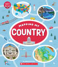
Mapping My Country: (learn About) (Learn About)
by Jeanette FerraraA perfect first introduction to maps and map skills for young readers!There are families living in countries across the Americas and all around the world. From Canada, the United States, and Mexico to Central America, countries can look very different but still have a lot in common. Learn how to use map features like a key, compass rose, and a scale to answer questions about direction, measurement, and symbols. Look at photos of different countries, and use the maps inside the book to navigate and compare what is the same and what is different between them. At the end, you will be ready to draw a map of your own country. All this and more in Mapping My Country!ABOUT THIS SERIES:Starting from their bedroom, and moving to their home, street, neighborhood, town, state, country, continent, and finally, planet, children will gain a whole new understanding of their place in the world with this engaging picture book series. With illustrated maps drawn at different scales and vibrant photographs throughout to illustrate real locations, children will learn about map features, how to read maps and answer questions, and how to draw their own maps. Maps are everywhere and understanding them is key to navigating our world. With this brand new and original four-book series, children will expand their role as citizens.
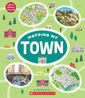
Mapping My Town (Learn About)
by Jeanette FerraraA perfect first introduction to maps and map skills for young readers!Families can live in all kinds of towns. From urban and suburban, to rural communities, towns can look different but still have a lot in common. Learn how to use map features like a key, compass rose, and a scale to answer questions about direction, measurement, and symbols. Look at photos of different types of towns and use the maps inside the book to navigate and compare what is the same and what is different about living in a city, suburb, or farming community. At the end, you will be ready to draw a map of your own town. All this and more in Mapping My Town!ABOUT THIS SERIES: Starting from their bedroom, and moving to their home, street, neighborhood, town, state, country, continent, and finally, planet, children will gain a whole new understanding of their place in the world with this engaging picture book series. With illustrated maps drawn at different scales and vibrant photographs throughout to illustrate real locations, children will learn about map features, how to read maps and answer questions, and how to draw their own maps. Maps are everywhere and understanding them is key to navigating our world. With this brand new and original four-book series, children will expand their role as citizens.
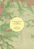
Mapping Nature across the Americas
by James R. Akerman Kathleen A. BrosnanMaps are inherently unnatural. Projecting three-dimensional realities onto two-dimensional surfaces, they are abstractions that capture someone’s idea of what matters within a particular place; they require selections and omissions. These very characteristics, however, give maps their importance for understanding how humans have interacted with the natural world, and give historical maps, especially, the power to provide rich insights into the relationship between humans and nature over time. That is just what is achieved in Mapping Nature across the Americas. Illustrated throughout, the essays in this book argue for greater analysis of historical maps in the field of environmental history, and for greater attention within the field of the history of cartography to the cultural constructions of nature contained within maps. This volume thus provides the first in-depth and interdisciplinary investigation of the relationship between maps and environmental knowledge in the Americas—including, for example, stories of indigenous cartography in Mexico, the allegorical presence of palm trees in maps of Argentina, the systemic mapping of US forests, and the scientific platting of Canada’s remote lands.
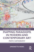
Mapping Paradigms in Modern and Contemporary Art: Poetic Cartography (Routledge Advances in Art and Visual Studies)
by Simonetta MoroMapping Paradigms in Modern and Contemporary Art defines a new cartographic aesthetic, or what Simonetta Moro calls carto-aesthetics, as a key to interpreting specific phenomena in modern and contemporary art, through the concept of poetic cartography. The problem of mapping, although indebted to the "spatial turn" of poststructuralist philosophy, is reconstructed as hermeneutics, while exposing the nexus between topology, space-time, and memory. The book posits that the emergence of "mapping" as a ubiquitous theme in contemporary art can be attributed to the power of the cartographic model to constitute multiple worldviews that can be seen as paradigmatic of the post-modern and contemporary condition. This book will be of particular interest to scholars in art history, art theory, aesthetics, and cartography.
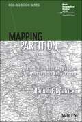
Mapping Partition: Politics, Territory and the End of Empire in India and Pakistan (RGS-IBG Book Series)
by Hannah FitzpatrickMAPPING PARTITION “A hugely productive partnership between geography and history, ‘Mapping Partition’ does a great service to the field of Partition studies - it leaves us in no doubt about both the long-term cartographical processes that contributed to how South Asia was divided in 1947, and the importance of bringing a geographer’s insights to bear on this complex history of boundary making.” Professor Sarah Ansari, Professor of History (South Asia), Royal Holloway University of London “Fitzpatrick produces spatial readings of partition’s knowledge formations, geopolitical imaginaries, administrative cartography, and legal geographical expertise. These enrich the histories and geographies of partition through painstaking archival, textual, and visual analysis which will resonate far beyond historical geography and South Asian studies.” Professor Stephen Legg, Professor of Historical Geography, University of Nottingham Mapping Partition delivers the first in-depth geographical account of the partition of India and Pakistan in 1947. The book explores the impact of colonial geography and geographers on the boundary, both during the partition process and in the period preceding it. Drawing on extensive archival research, Hannah Fitzpatrick argues that colonial geographical knowledge underpinned the partition process in heretofore unacknowledged ways. The author also discusses the consequences of placing different ethnic, communal, and linguistic groups onto the colonial map and the growing importance of majority and minority populations in representative democratic politics. Mapping Partition: Politics, Territory and the End of Empire in India and Pakistan is required reading for students and researchers studying geography, colonial and imperial history, South Asian studies, and interdisciplinary border studies.
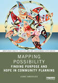
Mapping Possibility: Finding Purpose and Hope in Community Planning (Routledge Equity, Justice and the Sustainable City series)
by Leonie SandercockMapping Possibility traces the intertwined intellectual, professional, and emotional life of Leonie Sandercock. With an impressive career spanning nearly half a century as an educator, researcher, artist, and practitioner, Sandercock is one of the leading figures in community planning, dedicating her life to pursuing social, cultural, and environmental justice through her work. In this book, Leonie Sandercock reflects on her past writings and films, which played an important role in redefining the field in more progressive directions, both in theory and practice. It includes previously published essays in conjunction with insightful commentaries prefacing each section, and four new essays, two discussing Sandercock’s most recent work on a feature-film project with Indigenous partners. Innovative, visionary, and audacious, Leonie’s community-based scholarship and practice in the fields of urban planning and community development have engaged some of the most intractable issues of our time – inequality, discrimination, and racism. Through award-winning books and films, she has influenced the planning field to become more culturally fluent, addressing diversity and difference through structural change. This book draws a map of hope for emerging planners dedicated to equity, justice, and sustainability. It will inspire the next generation of community planners, as well as current practitioners and students in planning, cultural studies, urban studies, architecture, and community development.
Mapping Spatial Relations, Their Perceptions and Dynamics
by Susanne Rau Ekkehard SchönherrThis book is the product of an eponymous workshop, which took place in Erfurt in May, 2012, and which has since then been supplemented with four further contributions. The topics focus on the potential mapping of perceived urban space and spatial hierarchies as a consequence of social usage (undertaken by a variety of active participants) together with spatio-temporal changes as a result of factors such as demographic urban growth and decline. Historians, cartographers and geographers are brought together to present and discuss different models, ideas and new methods of spatial analysis and modes of representing changes in perceptions. The two main subjects are: the epistemology of spatial change and the question of (historical) media and adequate presentation. This work represents a first step toward the development of a new model for mapping urban changes and spatial relations concerning the past, present and future.
Mapping Species Distributions
by Janet Franklin Jennifer A. MillerMaps of species' distributions or habitat suitability are required for many aspects of environmental research, resource management and conservation planning. These include biodiversity assessment, reserve design, habitat management and restoration, species and habitat conservation plans and predicting the effects of environmental change on species and ecosystems. The proliferation of methods and uncertainty regarding their effectiveness can be daunting to researchers, resource managers and conservation planners alike. Franklin summarises the methods used in species distribution modeling (also called niche modeling) and presents a framework for spatial prediction of species distributions based on the attributes (space, time, scale) of the data and questions being asked. The framework links theoretical ecological models of species distributions to spatial data on species and environment, and statistical models used for spatial prediction. Providing practical guidelines to students, researchers and practitioners in a broad range of environmental sciences including ecology, geography, conservation biology, and natural resources management.
Mapping The Zone: Improving Flood Map Accuracy
by National Research Council of the National AcademiesFederal Emergency Management Agency (FEMA) Flood Insurance Rate Maps portray the height and extent to which flooding is expected to occur, and they form the basis for setting flood insurance premiums and regulating development in the floodplain. As such, they are an important tool for individuals, businesses, communities, and government agencies to understand and deal with flood hazard and flood risk. Improving map accuracy is therefore not an academic question--better maps help everyone. Making and maintaining an accurate flood map is neither simple nor inexpensive. Even after an investment of more than $1 billion to take flood maps into the digital world, only 21 percent of the population has maps that meet or exceed national flood hazard data quality thresholds. Even when floodplains are mapped with high accuracy, land development and natural changes to the landscape or hydrologic systems create the need for continuous map maintenance and updates. Mapping the Zone examines the factors that affect flood map accuracy, assesses the benefits and costs of more accurate flood maps, and recommends ways to improve flood mapping, communication, and management of flood-related data.
Mapping Transition in the Pamirs
by Hermann Kreutzmann Teiji WatanabeBy emphasizing on the Pamir region a comprehensive overviewof path-dependent and recent developments in a remote mountain region isprovided in this book. Overall neglect in the mountainous periphery iscontrasted by shifting the centre of attention to the Pamirssituated at the interface between South and Central Asia. From colonialtimes to now there has been a debate on grasping and locating the area. Herefield-work based contributions are collected to provide a variety ofperspectives on the Pamirs highlighting transformation and transition inPost-Soviet societies as well as in Afghanistan and Pakistan. The similarecological environment across borders features the common groundwhile analyzing development processes in a set of case studies that aim athighlighting certain aspects of regional development.
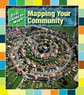
Mapping Your Community
by Marta Segal Block Daniel R. BlockWhy do we use maps? How can you map your classroom? What does a map of your state look like? Read this title learn how communities can be mapped. Different uses for maps are explained, and readers can learn how maps of their school, neighborhood, city and state might look. Map-making activities teach readers to map their street and classroom.
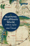
Mapping an Atlantic World, circa 1500
by Alida C. MetcalfHow did intricately detailed sixteenth-century maps reveal the start of the Atlantic World?Beginning around 1500, in the decades following Columbus's voyages, the Atlantic Ocean moved from the periphery to the center on European world maps. This brief but highly significant moment in early modern European history marks not only a paradigm shift in how the world was mapped but also the opening of what historians call the Atlantic World. But how did sixteenth-century chartmakers and mapmakers begin to conceptualize—and present to the public—an interconnected Atlantic World that was open and navigable, in comparison to the mysterious ocean that had blocked off the Western hemisphere before Columbus's exploration?In Mapping an Atlantic World, circa 1500, Alida C. Metcalf argues that the earliest surviving maps from this era, which depict trade, colonization, evangelism, and the movement of peoples, reveal powerful and persuasive arguments about the possibility of an interconnected Atlantic World. Blending scholarship from two fields, historical cartography and Atlantic history, Metcalf explains why Renaissance cosmographers first incorporated sailing charts into their maps and began to reject classical models for mapping the world. Combined with the new placement of the Atlantic, the visual imagery on Atlantic maps—which featured decorative compass roses, animals, landscapes, and native peoples—communicated the accessibility of distant places with valuable commodities. Even though individual maps became outdated quickly, Metcalf reveals, new mapmakers copied their imagery, which then repeated on map after map. Individual maps might fall out of date, be lost, discarded, or forgotten, but their geographic and visual design promoted a new way of seeing the world, with an interconnected Atlantic World at its center.Describing the negotiation that took place between a small cadre of explorers and a wider class of cartographers, chartmakers, cosmographers, and artists, Metcalf shows how exploration informed mapmaking and vice versa. Recognizing early modern cartographers as significant agents in the intellectual history of the Atlantic, Mapping an Atlantic World, circa 1500 includes around 50 beautiful and illuminating historical maps.