- Table View
- List View
Mapping an Empire: The Geographical Construction of British India, 1765-1843
by Matthew H. EdneyIn this fascinating history of the British surveys of India, Matthew H. Edney relates how imperial Britain used modern survey techniques to not only create and define the spatial image of its Empire, but also to legitimate its colonialist activities. "There is much to be praised in this book. It is an excellent history of how India came to be painted red in the nineteenth century. But more importantly, "Mapping an Empire" sets a new standard for books that examine a fundamental problem in the history of European imperialism. " D. Graham Burnett, "Times Literary Supplement" ""Mapping an Empire" is undoubtedly a major contribution to the rapidly growing literature on science and empire, and a work which deserves to stimulate a great deal of fresh thinking and informed research. " David Arnold, "Journal of Imperial and Commonwealth History" "This case study offers broadly applicable insights into the relationship between ideology, technology and politics. . . . Carefully read, this is a tale of irony about wishful thinking and the limits of knowledge. " "Publishers Weekly" "
Mapping and Navigation
by Cynthia Light Brown Beth Hetland Patrick McgintyHow did we get from 20-foot-long maps to GPS devices small enough to fit in the palm of our hands? How does GPS work and what can it tell us? How do ancient mapmaking techniques used by the Romans and Greeks influence the satellite technologies we use today? The history of mapmaking is full of remarkable characters who charted the unknown with an ever-changing set of tools. In Mapping and Navigation: The History and Science of Finding Your Way, kids ages 9-12 will learn the history and science behind the evolution of mapmaking, and how much is still out there for discovery.Readers will explore ideas through hands-on experiments while learning new terminology and interesting facts. Projects include using triangulation to measure distances, creating contour lines on a mini-mountain to understand elevation changes on a map, and inventing a sundial and compass to understand the basics of navigation. Whether mapping the solar system or mapping their own backyard, all readers will be able to understand mapping technologies and see the world in new and exciting ways.
Mapping and Spatial Analysis of Socio-economic and Environmental Indicators for Sustainable Development: Case Studies from North Africa (Advances in Science, Technology & Innovation)
by Noamen Rebai Mohamed MastereThis book presents most recent research studies on mapping and spatial analysis of socio-economic and environmental indicators used by various national and international contributors to regional development projects. It gathers the best contributions to the 1st International Conference on Mapping and Spatial Analysis of Socio-Economic and Environmental Indicators for the Local and Regional Sustainable Development. The conference was held in southern Tunisia, Tataouine in March 2015.The research studies focused on generating and analyzing indicators in various domains of Agriculture, Energy, Industry, Tourism, Transport, Urban Planning, Exploitation of Natural Resources, Infrastructure, Health, Environment, Education, Information and Communication Technologies, Social Affairs and Employability, and Culture and Sport. Socio-economic and environmental indicators are important in regional development plans and strategies as they allow to observe and analyze changes in the economic growth and to measure their impact on the environment and on social networks/daily life of citizens. On the basis of well-defined geomatic approaches, and particularly, through sophisticated digital mapping and spatio-temporal analyses, authors focused on retrieving indicators to evaluate the exploitation rate of natural resources, intensity of the energy consumption in various economic sector, net migratory flows, quality checking of the air in urban areas, adaptation to climate change, and vulnerability of the coastal domain and risk of marine submersion due to sea-level rise. The book is of interest not only to investors and contributors to regional development projects, but also to all relevant policy makers.
Mapping of Parent Hamiltonians
by Martin GreiterThis monograph introduces an exact model for a critical spin chain with arbitrary spin S, which includes the Haldane--Shastry model as the special case S=1/2. While spinons in the Haldane-Shastry model obey abelian half-fermi statistics, the spinons in the general model introduced here obey non-abelian statistics. This manifests itself through topological choices for the fractional momentum spacings. The general model is derived by mapping exact models of quantized Hall states onto spin chains. The book begins with pedagogical review of all the relevant models including the non-abelian statistics in the Pfaffian Hall state, and is understandable to every student with a graduate course in quantum mechanics.
Mapping of Parent Hamiltonians: From Abelian and non-Abelian Quantum Hall States to Exact Models of Critical Spin Chains (Springer Tracts in Modern Physics #244)
by Martin GreiterThis monograph introduces an exact model for a critical spin chain with arbitrary spin S, which includes the Haldane--Shastry model as the special case S=1/2. While spinons in the Haldane-Shastry model obey abelian half-fermi statistics, the spinons in the general model introduced here obey non-abelian statistics. This manifests itself through topological choices for the fractional momentum spacings. The general model is derived by mapping exact models of quantized Hall states onto spin chains. The book begins with pedagogical review of all the relevant models including the non-abelian statistics in the Pfaffian Hall state, and is understandable to every student with a graduate course in quantum mechanics.
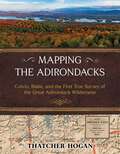
Mapping the Adirondacks: Colvin, Blake, and the First True Survey of the Great Adirondack Wilderness
by Thatcher HoganNew York State&’s famous Adirondack landscape is immense, spanning over six million acres of public forests, lakes, rivers, mountains, and private lands. In full color featuring hundreds of detailed maps and photos, Mapping the Adirondacks celebrates it all with the first clear account of the original surveyor who explored and fully comprehended it—Verplanck Colvin. &“Everywhere below,&” Colvin wrote, &“were lakes and mountains so different from all maps, yet so immovably true.&”His monumental accomplishment helped motivate the citizens of New York in 1894 to legally protect it for generations to come. As an eighteen-year-old budding travel writer, explorer and surveyor, Colvin began personally mapping a half-million acres of true Adirondack wilderness in 1865. Then, shortly after the state began partially funding his audacious project, Colvin reinvented himself as the &“Superintendent" of a &“Survey of the Adirondack Wilderness&” and hired another equally intrepid surveyor to help—his ever-dependable friend Mills Blake. They extended the scope and granularity of their survey several times, hired hundreds of Adirondack guides and other talented people to assist, and devoted twenty-eight years to the challenge of professionally surveying the Adirondacks. Author Thatcher Hogan has carefully gleaned narratives and illustrations from Colvin&’s notoriously dense annual reports and reassembled them with additional historic photographs to chronicle a compelling, true story of rugged exploration. After a novice&’s explanation of Colvin and Blake&’s surveying terms, the book follows their progress with one hundred of Hogan&’s new maps and summit views. The Adirondack landscape remains formidable and fascinating—many of the views are those that Colvin first discovered. Along the way, Hogan uncovers a story of intense ambition, physical hardships, and a weatherproof friendship. The state&’s meager investment in their work paid off many times over. Colvin and Blake&’s surveys provided New York with the incontrovertible evidence needed to prevail in hundreds of complex Adirondack land disputes. Most significantly, it enabled the state to consolidate and expand its extraordinary Adirondack Forest Preserves—the prized mountains, forests, and waters of today&’s beloved Park.

Mapping the Chinese and Islamic Worlds
by Hyunhee ParkLong before Vasco da Gama rounded the Cape of Good Hope en route to India, the peoples of Africa, the Middle East, and Asia engaged in vigorous cross-cultural exchanges across the Indian Ocean. This book focuses on the years 700 to 1500, a period when powerful dynasties governed both regions, to document the relationship between the Islamic and Chinese worlds before the arrival of the Europeans. Through a close analysis of the maps, geographic accounts, and travelogues compiled by both Chinese and Islamic writers, the book traces the development of major contacts between people in China and the Islamic world and explores their interactions on matters as varied as diplomacy, commerce, mutual understanding, world geography, navigation, shipbuilding, and scientific exploration. When the Mongols ruled both China and Iran in the thirteenth and fourteenth centuries, their geographic understanding of each other's society increased markedly. This rich, engaging, and pioneering study offers glimpses into the worlds of Asian geographers and mapmakers, whose accumulated wisdom underpinned the celebrated voyages of European explorers like Vasco da Gama.
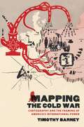
Mapping the Cold War
by Timothy BarneyIn this fascinating history of Cold War cartography, Timothy Barney considers maps as central to the articulation of ideological tensions between American national interests and international aspirations. Barney argues that the borders, scales, projections, and other conventions of maps prescribed and constrained the means by which foreign policy elites, popular audiences, and social activists navigated conflicts between North and South, East and West. Maps also influenced how identities were formed in a world both shrunk by advancing technologies and marked by expanding and shifting geopolitical alliances and fissures. Pointing to the necessity of how politics and values were "spatialized" in recent U.S. history, Barney argues that Cold War-era maps themselves had rhetorical lives that began with their conception and production and played out in their circulation within foreign policy circles and popular media. Reflecting on the ramifications of spatial power during the period, Mapping the Cold War ultimately demonstrates that even in the twenty-first century, American visions of the world--and the maps that account for them--are inescapably rooted in the anxieties of that earlier era.
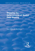
Mapping the Determinants of Spatial Data Sharing (Routledge Revivals)
by Uta Wehn de MontalvoThis title was first published in 2003. With the increasing use of GIS in industrialised and developing countries, the availability of spatial data has become an issue that affects many public and private sector organisations. They are faced with the high cost and substantial effort involved in the generation of spatial data and so the sharing of this data is increasingly being seen as a way of overcoming expense and easing availability and access. But this can provide a way of using GIS effectively only if the key players involved in the use and supply of spatial data are willing to share. This book employs a theory from social psychology as an organising framework to systematize the determinants of organisations' spatial data sharing behaviour. It develops a model which explains the likely willingness of key individuals within organisations to engage in spatial data exchanges across organisational boundaries and then tests this on a survey based in South Africa.
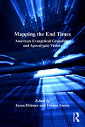
Mapping the End Times: American Evangelical Geopolitics and Apocalyptic Visions (Critical Geopolitics)
by Jason Dittmer Tristan SturmOver the last quarter-century, evangelicalism has become an important social and political force in modern America. Here, new voices in the field are brought together with leading scholars such as William E. Connolly, Michael Barkun, Simon Dalby, and Paul Boyer to produce a timely examination of the spatial dimensions of the movement, offering useful and compelling insights on the intersection between politics and religion. This comprehensive study discusses evangelicalism in its different forms, from the moderates to the would-be theocrats who, in anticipation of the Rapture, seek to impose their interpretations of the Bible upon American foreign policy. The result is a unique appraisal of the movement and its geopolitical visions, and the wider impact of these on America and the world at large.
Mapping the Frontier: A Memoir of Discovery from Coastal Maine to the Alaskan Rim
by Rufus Harvey SargentAlaska in 1900 was unexplored frontier, a land where risk, danger, and ultimate adventure made teamwork essential. Maine native R. Harvey Sargent led the U. S. Geological Survey in Alaska for over three decades, 1901-1936, charting the vast expanses of this remarkably beautiful and treacherous land. A pioneer of modern mapping, Sargent introduced 20th-century &“firsts&”: photogrammetry and aerial surveys in Alaska, and the first professional surveys of China&’s mountainous interior.Mapping the Frontier: A Memoir of Discovery from Coastal Maine to the Alaskan Rim publishes for the first time Harvey Sargent&’s diary of his explorations in the world&’s outer edges, from China to Mexico, Utah, Arizona, Montana, and Alaska. He was the son of a sea captain, born with exploration and adventure in his veins. Grounded in the foundations of his childhood home of Sedgwick, Maine, to his family residence for a half-century with USGS in Washington, D. C., Sargent&’s lively narrative is beautifully illustrated with period maps and photographs. The reader will experience the breathtaking majesty of the Grand Canyon; the deadly harsh winters of Utah&’s dessert; misty fjords and dramatic icebergs of Glacier Bay National Park; and Sargent&’s discovery of Alaska&’s Aniakshak crater, today the country&’s most remote National Monument and Preserve.
Mapping the Journey: Case Studies in Strategy and Action toward Sustainable Development
by Lorinda R. Rowledge Russell Barton Kevin Brady James Fava Cynthia Figge Konrad Saur Steven YoungThis illuminating new book presents a series of in-depth case studies from around the world based on numerous personal interviews with organizational leaders and focusing on their journey towards sustainability. The aim is to provide visions of a more sustainable future, and shed light on the path, milestones and solutions – in particular the management processes these organizations employed – to provide a reliable compass that others can follow. Although each organization must take steps to fit its particular circumstance, business conditions and culture, Mapping the Journey proves that valuable lessons can be learned by setting aside critique as to where these organizations may yet make progress and instead focusing on the guidelines, targets, measures of success, tools and techniques and valuable wisdom about how pioneer organisations are travelling toward a prosperous, sustainable future. Each organization included has crafted its own unique strategic responses to an identified need for increased sustainability. While none can be said to have reached the end-point of a sustainable development strategy, all have found that, by addressing the challenge of sustainable industrial practices, they have found innovative solutions, new opportunities for revenue generation, better relationships with customers, new business and product opportunities and a boost to morale from the executive ranks to front-line employees. Mapping the Journey examines both public and private organizations worldwide: SJ Rail of Sweden; Sony Corporation; SC Johnson; TransAlta Corporation; Patagonia; Henkel; Volvo; ASG; Interface Flooring Systems; Suncor; DaimlerChrysler; AssiDoman; Germany's Centre for Technology Assessment and the Dutch National Environmental Policy Plan. These case studies provide an inspiring framework of effective processes for defining a sustainable development strategy and transforming it successfully into actions and results.
Mapping the Moral Geographies of Education: Character, Citizenship and Values (Routledge Spaces of Childhood and Youth Series)
by Sarah MillsThis book explores the growth of ‘character education’ in schools and youth organisations over the last decade. It delves into historical and contemporary debates through a geopolitical lens. With a renewed focus on values and virtues such as grit, gumption, perseverance, resilience, generosity, and neighbourliness, this book charts the re-imagining and re-fashioning of a ‘character agenda’ in England and examines its multiscalar geographies. It explores how these moral geographies of education for children and young people have developed over time. Drawing on original research and examples from schools, military and uniformed youth organisations, and the state-led National Citizen Service, the book critically examines the wider implications of the ‘character agenda’ across the UK and beyond. It does so by raising a series of questions about the interconnections between character, citizenship, and values and highlighting how these moral geographies reach far beyond the classroom or campsite. Offering critical insights on the roles of character, citizenship and values in modern education, this book will be of immense value to educationists, teachers and policymakers. It will appeal students and scholars of human geography, sociology, education studies, cultural studies and history.
Mapping the Nation: History and Cartography in Nineteenth-Century America
by Susan SchultenIn the nineteenth century, Americans began to use maps in radically new ways. For the first time, medical men mapped diseases to understand and prevent epidemics, natural scientists mapped climate and rainfall to uncover weather patterns, educators mapped the past to foster national loyalty among students, and Northerners mapped slavery to assess the power of the South. After the Civil War, federal agencies embraced statistical and thematic mapping in order to profile the ethnic, racial, economic, moral, and physical attributes of a reunified nation. By the end of the century, Congress had authorized a national archive of maps, an explicit recognition that old maps were not relics to be discarded but unique records of the nation's past. All of these experiments involved the realization that maps were not just illustrations of data, but visual tools that were uniquely equipped to convey complex ideas and information. In Mapping the Nation, Susan Schulten charts how maps of epidemic disease, slavery, census statistics, the environment, and the past demonstrated the analytical potential of cartography, and in the process transformed the very meaning of a map. Today, statistical and thematic maps are so ubiquitous that we take for granted that data will be arranged cartographically. Whether for urban planning, public health, marketing, or political strategy, maps have become everyday tools of social organization, governance, and economics. The world we inhabit--saturated with maps and graphic information--grew out of this sea change in spatial thought and representation in the nineteenth century, when Americans learned to see themselves and their nation in new dimensions.
Mapping the Nation: History and Cartography in Nineteenth-Century America
by Susan Schulten&“A compelling read&” that reveals how maps became informational tools charting everything from epidemics to slavery (Journal of American History). In the nineteenth century, Americans began to use maps in radically new ways. For the first time, medical men mapped diseases to understand and prevent epidemics, natural scientists mapped climate and rainfall to uncover weather patterns, educators mapped the past to foster national loyalty among students, and Northerners mapped slavery to assess the power of the South. After the Civil War, federal agencies embraced statistical and thematic mapping in order to profile the ethnic, racial, economic, moral, and physical attributes of a reunified nation. By the end of the century, Congress had authorized a national archive of maps, an explicit recognition that old maps were not relics to be discarded but unique records of the nation&’s past. All of these experiments involved the realization that maps were not just illustrations of data, but visual tools that were uniquely equipped to convey complex ideas and information. In Mapping the Nation, Susan Schulten charts how maps of epidemic disease, slavery, census statistics, the environment, and the past demonstrated the analytical potential of cartography, and in the process transformed the very meaning of a map. Today, statistical and thematic maps are so ubiquitous that we take for granted that data will be arranged cartographically. Whether for urban planning, public health, marketing, or political strategy, maps have become everyday tools of social organization, governance, and economics. The world we inhabit—saturated with maps and graphic information—grew out of this sea change in spatial thought and representation in the nineteenth century, when Americans learned to see themselves and their nation in new dimensions.
Mapping the Ottomans
by Palmira Brummett"Simple paradigms of Muslim-Christian confrontation and the rise of Europe in the seventeenth century do not suffice to explain the ways in which European mapping envisioned the "Turks" in image and narrative. Rather, maps, travel accounts, compendia of knowledge, and other texts created a picture of the Ottoman Empire through a complex layering of history, ethnography, and eyewitness testimony, which juxtaposed current events to classical and biblical history; counted space in terms of peoples, routes, and fortresses; and used the land and seascapes of the map to assert ownership, declare victory, and embody imperial power's reach. Enriched throughout by examples of Ottoman self-mapping, this book examines how Ottomans and their empire were mapped in the narrative and visual imagination of early modern Europe's Christian kingdoms. The maps serve as centerpieces for discussions of early modern space, time, borders, stages of travel, information flows, invocations of authority, and cross-cultural relations"--"This book examines how the Ottomans and their empire were mapped in the narrative and visual imagination of the Christian kingdoms of early modern Europe. Simple paradigms of Muslim-Christian confrontation and the 'rise' of Europe in the seventeenth century do not suffice to explain the ways in which European mapping envisioned the "Turks" in image and narrative. Rather, maps, travel accounts, compendia of knowledge, and other texts created a picture of the Ottoman empire through a complex layering of history, ethnography, and eyewitness testimony which juxtaposed current events to classical and Biblical history; counted space in terms of peoples, routes, and fortresses; and used the land and seascapes of the map to assert ownership, declare victory, and embody the reach of imperial power. Maps here serve as centerpieces for a discussion of early modern space, time, borders, stages of travel, information flows, invocations of authority, and cross-cultural relations. The book is enriched throughout by examples of Ottoman self-mapping"--
Mapping the Risk of Flood, Mass Movement and Local Subsidence: A New Proposal for Major Cities (SpringerBriefs in Earth Sciences)
by Juan Carlos Mora ChaparroThis book proposes a methodology for the identification of flooding in urban areas, by the denomination of 1) urban hydrographic basin; and 2) polygon of flood risk. This work will enable readers to elaborate a preventive program in Latin America and analogous regions. The authorities could use it as a basis to create urban planning strategies or preventive programs to reduce or eliminate the flooding hazard. The growth of an urban area implies that the natural terrain is covered by an asphalt folder, which results in an Urban Hydrographic Basin where rainwater drains down its streets filtering through sewers towards rainwater drains or wastewater. Initially, the drainages are calculated according to the population in a specific urban area, however, the population growth causes the growth of the urban area, where the old drainages and new roads are linked, causing their saturation and chaos. More water runs down the streets and is accumulated in the lower areas, causing flooding.
Mapping the Rural Problem in the Baltic Countryside: Transition Processes in the Rural Areas of Estonia, Latvia and Lithuania (Perspectives On Rural Policy And Planning Ser.)
by Ilkka AlanenThe agricultural privatization strategy adopted in Estonia, Latvia and Lithuania was based on the premise that family farms are the most effective alternative to socialist large-scale agriculture. In addition, international organizations, particularly the World Bank, made recommendations concerning reform speed, synchronization and ownership rights that would facilitate transferring resources from large-scale producers to family farmers. This book provides a critical and comparative analysis of the implementation of this policy, and in particular the strategy promoted by the World Bank. The preservation of large-scale production is the key to Estonia's success while its eradication from Latvia and Lithuania did not produce a family farm system. Work productivity and the extent of plot farming are the indicators of success or failure. Research findings on deindustrialization, the hardships faced by new enterprises, rural tourism, increasing poverty, and problems in the civil society as presented in this book shed new light on these and other key issues in transition strategy.
Mapping the Subject: Geographies of Cultural Transformation
by Nigel Thrift Steve PileRejecting static and reductionist understandings of subjectivity, this book asks how people find their place in the world. Mapping the Subject is an inter-disciplinary exploration of subjectivity, which focuses on the importance of space in the constitution of acting, thinking, feeling individuals. The authors develop their arguments through detailed case studies and clear theoretical expositions. Themes discussed are organised into four parts: constructing the subject, sexuality and subjectivity, the limits of identity, and the politics of the subject. There is, here, a commitment to mapping the subject - a subject which is in some ways fluid, in other ways fixed; which is located in constantly unfolding power, knowledge and social relationships. This book is, moreover, about new maps for the subject.
Mapping, Monitoring, and Modeling Land and Water Resources: Advanced Techniques Using Open Source Software
by Pravat Kumar Shit, Pulakesh Das, Gouri Sankar Bhunia, and Dipanwita DuttaThe wide range of challenges in studying Earth system dynamics due to uncertainties in climate change and complex interference from human activities is creating difficulties in managing land and water resources and ensuring their sustainable use. Mapping, Monitoring, and Modeling Land and Water Resources brings together real-world case studies accurately surveyed and assessed through spatial modeling. The book focuses on the effectiveness of combining remote sensing, geographic information systems, and R. The use of open source software for different spatial modeling cases in various fields, along with the use of remote sensing and geographic information systems, will aid researchers, students, and practitioners to understand better the phenomena and the predictions by future analyses for problem-solving and decision-making.
Mapping: A Critical Introduction to Cartography and GIS (Critical Introductions to Geography #11)
by Jeremy W. CramptonMapping: A Critical Introduction to Cartography and GIS is an introduction to the critical issues surrounding mapping and Geographic Information Systems (GIS) across a wide range of disciplines for the non-specialist reader. Examines the key influences Geographic Information Systems (GIS) and cartography have on the study of geography and other related disciplines Represents the first in-depth summary of the “new cartography” that has appeared since the early 1990s Provides an explanation of what this new critical cartography is, why it is important, and how it is relevant to a broad, interdisciplinary set of readers Presents theoretical discussion supplemented with real-world case studies Brings together both a technical understanding of GIS and mapping as well as sensitivity to the importance of theory
Mapping: Ways of Representing the World (Insights Into Human Geography)
by Daniel Dorling David FairbairnIllustrates how maps tell us as much about the people and the powers which create them, as about the places they show. Presents historical and contemporary evidence of how the human urge to describe, understand and control the world is presented through the medium of mapping, together with the individual and environmental constraints of the creator of the map.
Maps & Civilization: Cartography in Culture and Society
by Norman J. ThrowerIn this concise introduction to the history of cartography, Norman J. W. Thrower charts the intimate links between maps and history from antiquity to the present day. A wealth of illustrations, including the oldest known map and contemporary examples made using Geographical Information Systems (GIS), illuminate the many ways in which various human cultures have interpreted spatial relationships. The third edition of Maps and Civilization incorporates numerous revisions, features new material throughout the book, and includes a new alphabetized bibliography. Praise for previous editions of Maps and Civilization: “A marvelous compendium of map lore. Anyone truly interested in the development of cartography will want to have his or her own copy to annotate, underline, and index for handy referencing.”—L. M. Sebert, Geomatica
Maps and Civilization: Cartography in Culture and Society
by Thrower Norman J. W.In this concise introduction to the history of cartography, Norman J. W. Thrower charts the intimate links between maps and history from antiquity to the present day. A wealth of illustrations, including the oldest known map and contemporary examples made using Geographical Information Systems (GIS), illuminate the many ways in which various human cultures have interpreted spatial relationships. The third edition of Maps and Civilization incorporates numerous revisions, features new material throughout the book, and includes a new alphabetized bibliography.
Maps and Geography (Ken Jennings’ Junior Genius Guides)
by Ken JenningsDiscover fun facts about the world and become a master of geography with this interactive trivia book from Jeopardy! host and champion and New York Times bestselling author Ken Jennings.With this Junior Genius Guide to maps and geography, you&’ll become an expert and wow your friends and teachers with clever facts: Did you know that the biggest desert in the world is actually covered in snow? Or that Christopher Columbus wasn&’t the first to think the Earth was round? With great illustrations, cool trivia, and fun quizzes to test your knowledge, this guide will have you on your way to whiz-kid status in no time!