- Table View
- List View
Remote Sensing Advances for Earth System Science
by Diego Fernández-Prieto Roberto SabiaTo better understand the various processes and interactions that govern the Earth system and to determine whether recent human-induced changes could ultimately de-stabilise its dynamics, both natural system variability and the consequences of human activities have to be observed and quantified. In this context, the European Space Agency (ESA) published in 2006 the document "The Changing Earth: New Scientific Challenges for ESA's Living Planet Programme" as the main driver of ESA's new Earth Observation (EO) science strategy. The document outlines 25 major scientific challenges covering all the different aspects of the Earth system, where EO technology and ESA missions may provide a key contribution. In this framework, and aiming at enhancing the ESA scientific support towards the achievement of "The Challenges", the Agency has launched in 2008 a new initiative - the Changing Earth Science Network - to support young scientists to undertake leading-edge research activities contributing to achieve the 25 scientific challenges of the LPP by maximising the use of ESA data. The initiative is implemented through a number of research projects proposed and led by early-stage scientists at post-doctoral level for a period of two years which are summarized in this SpringerBrief. These projects undertake innovative research activities furthering into the most pressing issues of the Earth system, while exploiting ESA missions data with special attention to the ESA data archives and the new Earth Explorer missions.
Remote Sensing Application II: A Climate Change Perspective in Agriculture (New Frontiers in Regional Science: Asian Perspectives #77)
by Tofael AhamedThis book focuses solely on the issues of agricultural productivity analysis with advanced modeling approaches bringing solutions to food-insecure regions of the world, especially in south and southeast Asia and in Africa. Advanced modeling tools and their use in regional planning provide an outstanding opportunity to help face the challenges of climate change. The sudden effect of flash floods, drought, salinity, and sea water rises causing saltwater intrusions and its impact on agricultural production are some of the disastrous results of climate change. In this edited volume, information on climate-induced impacts for flooding, flash floods, and drought impact on agricultural crops is provided to address possible solutions for food security in south Asia, southeast Asia, and some regions of Africa. Leading-edge research methodology is presented as it relates to remote sensing applications for regional science and allied fields. In regional policy planning, agriculture andforestry play key roles in food security along with environmental conservation and depend on geo-spatial variability. Satellite remote sensing and geographical information systems have an immense potential to encompass all these factors and to catalogue the regional variability of climate change and climate economics. In the satellite remote sensing domain, advanced modeling tools, deep learning applications, and cloud-based earth engines significantly increase the flexibility of decision making and its application for regional perspectives. The result can increase agricultural and forest productivity and ensure its resilience and sustainability. The book’s chapters introduce modeling techniques such as machine learning and fuzzy expert system using satellite remote sensing datasets based on cloud application. These methods assist regional planners to increase crop production, land use, and detection of changes in land cover in order to better understand their vulnerability toclimate-related disaster. Furthermore, remote sensing and in-depth GIS analysis are integrated with machine learning to address natural uncertainties such as flash floods, droughts, and cyclones so that emergency responses for agricultural production management can be adopted more effectively.
Remote Sensing Digital Image Analysis
by John A. RichardsRemote Sensing Digital Image Analysis provides the non-specialist with an introduction to quantitative evaluation of satellite and aircraft derived remotely retrieved data. Since the first edition of the book there have been significant developments in the algorithms used for the processing and analysis of remote sensing imagery; nevertheless many of the fundamentals have substantially remained the same. This new edition presents material that has retained value since those early days, along with new techniques that can be incorporated into an operational framework for the analysis of remote sensing data. The book is designed as a teaching text for the senior undergraduate and postgraduate student, and as a fundamental treatment for those engaged in research using digital image processing in remote sensing. The presentation level is for the mathematical non-specialist. Since the very great number of operational users of remote sensing come from the earth sciences communities, the text is pitched at a level commensurate with their background. Each chapter covers the pros and cons of digital remotely sensed data, without detailed mathematical treatment of computer based algorithms, but in a manner conductive to an understanding of their capabilities and limitations. Problems conclude each chapter.
Remote Sensing Digital Image Analysis
by John A. RichardsRemote Sensing Digital Image Analysis provides a comprehensive treatment of the methods used for the processing and interpretation of remotely sensed image data. Over the past decade there have been continuing and significant developments in the algorithms used for the analysis of remote sensing imagery, even though many of the fundamentals have substantially remained the same. As with its predecessors this new edition again presents material that has retained value but also includes newer techniques, covered from the perspective of operational remote sensing. The book is designed as a teaching text for the senior undergraduate and postgraduate student, and as a fundamental treatment for those engaged in research using digital image analysis in remote sensing. The presentation level is for the mathematical non-specialist. Since the very great number of operational users of remote sensing come from the earth sciences communities, the text is pitched at a level commensurate with their background. The chapters progress logically through means for the acquisition of remote sensing images, techniques by which they can be corrected, and methods for their interpretation. The prime focus is on applications of the methods, so that worked examples are included and a set of problems conclude each chapter.
Remote Sensing Geology
by Ravi P. GuptaOver the past decade, advances in sensor technology, processing algorithms, and computational capacity have taken remote sensing to a level where observations can be transformed into quantitative measurements, and the technology can be used in near real-time for mapping, monitoring and decision-making. For the third edition, this widely acclaimed book has been fully revised, enlarged and updated. It covers remote sensing in a wide range of optical, thermal, and microwave wavelengths and their host of geologic applications featuring sample applications from around the globe. In addition, it presents state-of-the-art content on emerging themes such as atmospheric interactions, spectroscopy, spectral indices, prospectivity modelling, and multi-sensor geodata integration. The subject matter is presented at a basic level, offering students an excellent introductory text on remote sensing. Further, the main part of the book will also be of great value to active researchers. Excerpt from the review of Remote Sensing Geology (2nd ed. , 2003): International Journal of Applied Earth Observation and Geoinformation, 5 (2004) 239-240 ". . . . Graduate students, research workers and professional earth scientists will use this book to their advantage and with pleasure; it is well-written, to the point and with an emphasis on understanding the principles underlying this wide spectre of technology in its application to the earth sciences. Remote sensing is a fascinating subject; so is geology. The author has fully succeeded in providing a fascinating book that combines them in a handy volume. " Jan J. Nossin
Remote Sensing Image Classification in R (Springer Geography)
by Courage KamusokoThis book offers an introduction to remotely sensed image processing and classification in R using machine learning algorithms. It also provides a concise and practical reference tutorial, which equips readers to immediately start using the software platform and R packages for image processing and classification. This book is divided into five chapters. Chapter 1 introduces remote sensing digital image processing in R, while chapter 2 covers pre-processing. Chapter 3 focuses on image transformation, and chapter 4 addresses image classification. Lastly, chapter 5 deals with improving image classification. R is advantageous in that it is open source software, available free of charge and includes several useful features that are not available in commercial software packages. This book benefits all undergraduate and graduate students, researchers, university teachers and other remote- sensing practitioners interested in the practical implementation of remote sensing in R.
Remote Sensing Image Fusion (Signal and Image Processing of Earth Observations)
by Luciano Alparone Bruno Aiazzi Stefano Baronti Andrea GarzelliA synthesis of more than ten years of experience, Remote Sensing Image Fusion covers methods specifically designed for remote sensing imagery. The authors supply a comprehensive classification system and rigorous mathematical description of advanced and state-of-the-art methods for pansharpening of multispectral images, fusion of hyperspectral and
Remote Sensing Image Fusion: A Practical Guide
by John van Genderen Christine PohlRemote Sensing Image Fusion: A Practical Guide gives an introduction to remote sensing image fusion providing an overview on the sensors and applications. It describes data selection, application requirements and the choice of a suitable image fusion technique. It comprises a diverse selection of successful image fusion cases that are relevant to other users and other areas of interest around the world. The book helps newcomers to obtain a quick start into the practical value and benefits of multi-sensor image fusion. Experts will find this book useful to obtain an overview on the state of the art and understand current constraints that need to be solved in future research efforts. For industry professionals the book can be a great introduction and basis to understand multisensor remote sensing image exploitation and the development of commercialized image fusion software from a practical perspective. The book concludes with a chapter on current trends and future developments in remote sensing image fusion. Along with the book, RSIF website provides additional up-to-date information in the field.
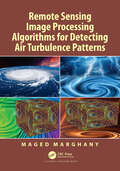
Remote Sensing Image Processing Algorithms for Detecting Air Turbulence Patterns
by Maged MarghanyInjuries due to air turbulence has increased recently, therefore there is considerable concern and interest in understanding and detecting it more accurately. Presently hardly any research deals with air turbulence detection using remote sensing images. Most works use conventional optical remote sensing data with classical methods such as a library spectral signature, band ratio, and principal component analysis without designating new methods and technology. Very little research has attempted to implement optical and microwave remote sensing images for air turbulence detections.This book provides new image processing procedures for air turbulence detection using advanced remote sensing images and quantum image processing. Currently, there is a huge gap between research work in the field of air turbulence detection and advanced remote sensing technology. Most of the theories are not operated in terms of software modules. Most of the software packages in the field of remote sensing images cannot deal with advanced image processing techniques in air turbulence detections due to heavy mathematics work. In this view, this book fills a gap between advanced remote sensing technology and air turbulence detection. For instance, quantum image processing with a new generation of remote sensing technology such as RADARSAT-2 SAR images is also implemented to provide accurate air turbulence detections.
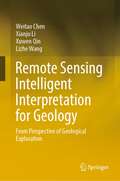
Remote Sensing Intelligent Interpretation for Geology: From Perspective of Geological Exploration
by Lizhe Wang Weitao Chen Xianju Li Xuwen QinThis book presents the theories and methods for geology intelligent interpretation based on deep learning and remote sensing technologies. The main research subjects of this book include lithology and mineral abundance. This book focuses on the following five aspects: 1. Construction of geology remote sensing datasets from multi-level (pixel-level, scene-level, semantic segmentation-level, prior knowledge-assisted, transfer learning dataset), which are the basis of geology interpretation based on deep learning. 2. Research on lithology scene classification based on deep learning, prior knowledge, and remote sensing. 3. Research on lithology semantic segmentation based on deep learning and remote sensing. 4. Research on lithology classification based on transfer learning and remote sensing. 5. Research on inversion of mineral abundance based on the sparse unmixing theory and hyperspectral remote sensing. The book is intended for undergraduate and graduate students who are interested in geology, remote sensing, and artificial intelligence. It is also used as a reference book for scientific and technological personnel of geological exploration.
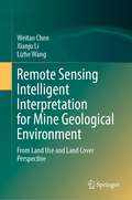
Remote Sensing Intelligent Interpretation for Mine Geological Environment: From Land Use and Land Cover Perspective
by Lizhe Wang Weitao Chen Xianju LiThis book examines the theory and methods of remote sensing intelligent interpretation based on deep learning. Based on geological and environmental effects on mines, this book constructs a set of systematic mine remote sensing datasets focusing on the multi-level task with the system of “target detection→scene classification→semantic segmentation." Taking China’s Hubei Province as an example, this book focuses on the following four aspects: 1. Development of a multiscale remote sensing dataset of the mining area, including mine target remote sensing dataset, mine (including non-mine areas) remote sensing scene dataset, and semantic segmentation remote sensing dataset of mining land cover. The three datasets are the basis of intelligent interpretation based on deep learning. 2. Research on mine target remote sensing detection method based on deep learning. 3. Research on remote sensing scene classification method of mine and non-mine areas based on deep learning. 4. Research on the fine-scale classification method of mining land cover based on semantic segmentation.The book is a valuable reference both for scholars, practitioners and as well as graduate students who are interested in mining environment research.
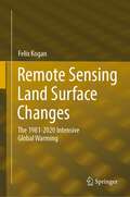
Remote Sensing Land Surface Changes: The 1981-2020 Intensive Global Warming
by Felix KoganThis book discusses the detrimental consequences of climate-related land changes over a 40-year period between 1981 and 2020, and focuses on how climate warming is deteriorating the agricultural system due to excessive heat, lack of moisture and more intensive and widespread droughts leading to a reduction of agricultural production. Most of the existing literature on the unfavourable consequences of global warming for land are based on a relatively short period of weather station data, covering local land areas with limited networks and monitoring parameters. These concerns have led to the use of satellite data, whose measurements are controlled by such vegetation characteristics as chlorophyll, carotenoids, moisture contents in the plants and temperature inside the vegetation community. Therefore, the discussion of this book is completely based on high-resolution global land surface measurements by the sensors on the National Oceanic and Atmospheric Administration’s (NOAA) operational afternoon polar-orbiting satellites. The book also focuses on understanding climate change impacts on land changes where humans are living, and combines biophysically-grounded methods and the 40-year data to develop models for monitoring large-scale Earth warming impacts on land and for timely prediction of climate consequences for humans. These 40-year trends in land characteristics will help to better inform the assessment of potential changes in the future and how to reach human sustainability. The book will of interest to scientists using satellite remote sensing to track climate change impacts on land over time, as well as students and researchers in climatology and environmental sustainability.
Remote Sensing Monitoring and Evaluation of Degraded Grassland in China: Accounting of Grassland Carbon Source and Carbon Sink (Springer Geography)
by Wei Zhou Jianlong Li Tianxiang YueThis book focuses on grassland ecosystem evaluation including vegetation coverage, net primary productivity, carbon sink accounting, and grassland degradation evaluation based on mutual data resource, ecosystem model simulation, remote sensing monitoring and driving mechanism exploration. It aims to provide a guide seeking to understand the overall situation of grassland in China in the context of global climate change and build a scenario for the driving force quantitative evaluation. It will be an essential reference to the terrestrial ecosystem carbon cycle and degraded grassland ecological restoration engineer implementation. Chapters are carefully developed to cover (1) situation of grassland in China; (2) spatial-temporal of grassland coverage in China;(3) net primary productivity evaluation; (4) carbon sink/source accounting and its carbon-hydrology effect;(5) grassland landscape pattern; (6) grassland degradation evaluation based on remote sensing;(7) Grassland degradation restoration and constructing green ecological protective screen. The new scenario and driving mechanism evaluation model make this book a valuable read for researcher of land ecosystem carbon cycle, ecosytem degradation remote sensing evaluation as well as organizations engaged in eco-restoration practices.
Remote Sensing Technology in Forensic Investigations: Geophysical Techniques to Locate Clandestine Graves and Hidden Evidence
by G. Clark DavenportRemote Sensing Technology in Forensic Investigations provides a basic understanding of concepts involved in the use of basic geophysical surveying, metal detectors, magnetics, electromagnetics and ground penetrating radar in police and forensic investigations. Such technology can be vital in locating clandestine, buried evidence which is often concealed in the subsurface underground. Crime scene investigation and evidence collection entails locating, identifying, collecting, and cataloging. Such physical evidence searches are time consuming and can often lead to searches that require excavations, which in itself that can destroy evidence. The noninvasive, nondestructive methods outlined in this book can both reduce the time spent on searches and excavations, thereby increasing the probability of locating vital physical evidence. As such, the application of remote sensing methods has gained increased acceptance, and seen increased usage, by investigators. Remote sensing methods are based on making indirect measurements of the surface of and within the earth. The resulting measurement information can be presented in either an imaging format— such as in aerial photography—or a non-imaging format, such as in a profile or contour map. These measurements can be interpreted to identify and characterize contrasts due to differences in physical and natural properties of the materials being studied. This can include physical evidence, remains, and clandestine graves. This book will serve as a handy introductory primer to the technology, techniques, and application of such techniques. Throughout, numerous references and additional resources are provided for those investigators, forensic anthropology, and police professionals who want further information on the technology’s usage for investigative purposes.
Remote Sensing Time Series
by Wolfgang Wagner Claudia Kuenzer Stefan DechThis volume comprises an outstanding variety of chapters on Earth Observation based time series analyses, undertaken to reveal past and current land surface dynamics for large areas. What exactly are time series of Earth Observation data? Which sensors are available to generate real time series? How can they be processed to reveal their valuable hidden information? Which challenges are encountered on the way and which pre-processing is needed? And last but not least: which processes can be observed? How are large regions of our planet changing over time and which dynamics and trends are visible? These and many other questions are answered within this book "Remote Sensing Time Series Analyses - Revealing Land Surface Dynamics". Internationally renowned experts from Europe, the USA and China present their exciting findings based on the exploitation of satellite data archives from well-known sensors such as AVHRR, MODIS, Landsat, ENVISAT, ERS and METOP amongst others. Selected review and methods chapters provide a good overview over time series processing and the recent advances in the optical and radar domain. A fine selection of application chapters addresses multi-class land cover and land use change at national to continental scale, the derivation of patterns of vegetation phenology, biomass assessments, investigations on snow cover duration and recent dynamics, as well as urban sprawl observed over time.

Remote Sensing Time Series Image Processing (Imaging Science)
by Qihao WengToday, remote sensing technology is an essential tool for understanding the Earth and managing human-Earth interactions. There is a rapidly growing need for remote sensing and Earth observation technology that enables monitoring of world&’s natural resources and environments, managing exposure to natural and man-made risks and more frequently occurring disasters, and helping the sustainability and productivity of natural and human ecosystems. The improvement in temporal resolution/revisit allows for the large accumulation of images for a specific location, creating a possibility for time series image analysis and eventual real-time assessments of scene dynamics. As an authoritative text, Remote Sensing Time Series Image Processing brings together active and recognized authors in the field of time series image analysis and presents to the readers the current state of knowledge and its future directions. Divided into three parts, the first addresses methods and techniques for generating time series image datasets. In particular, it provides guidance on the selection of cloud and cloud shadow detection algorithms for various applications. Part II examines feature development and information extraction methods for time series imagery. It presents some key remote sensing-based metrics, and their major applications in ecosystems and climate change studies. Part III illustrates various applications of time series image processing in land cover change, disturbance attribution, vegetation dynamics, and urbanization. This book is intended for researchers, practitioners, and students in both remote sensing and imaging science. It can be used as a textbook by undergraduate and graduate students majoring in remote sensing, imaging science, civil and electrical engineering, geography, geosciences, planning, environmental science, land use, energy, and GIS, and as a reference book by practitioners and professionals in the government, commercial, and industrial sectors.
Remote Sensing and Digital Image Processing with R - Lab Manual
by Marcelo de Carvalho Alves Luciana SanchesThis Lab Manual is a companion to the textbook Remote Sensing and Digital Image Processing with R. It covers examples of natural resource data analysis applications including numerous, practical problem-solving exercises, and case studies that use the free and open-source platform R. The intuitive, structural workflow helps students better understand a scientific approach to each case study in the book and learn how to replicate, transplant, and expand the workflow for further exploration with new data, models, and areas of interest. Features Aims to expand theoretical approaches of remote sensing and digital image processing through multidisciplinary applications using R and R packages. Engages students in learning theory through hands-on real-life projects. All chapters are structured with solved exercises and homework and encourage readers to understand the potential and the limitations of the environments. Covers data analysis in the free and open-source R platform, which makes remote sensing accessible to anyone with a computer. Explores current trends and developments in remote sensing in homework assignments with data to further explore the use of free multispectral remote sensing data, including very high spatial resolution information. Undergraduate- and graduate-level students will benefit from the exercises in this Lab Manual, because they are applicable to a variety of subjects including environmental science, agriculture engineering, as well as natural and social sciences. Students will gain a deeper understanding and first-hand experience with remote sensing and digital processing, with a learn-by-doing methodology using applicable examples in natural resources.
Remote Sensing and GIS Application in Forest Conservation Planning (Advances in Geographical and Environmental Sciences)
by Chaitanya B. Pande Kanak MoharirThis book focuses on the challenges in conservation, management and protection of forests in India as well as other countries, using recently developed technologies. Various topics are discussed including remote sensing, GIS, land use land cover, forest conservation techniques, social economics effects, fire forecasting models and the effect of fire on natural resources, among others. The book provides multi-disciplinary overviews for academicians, administrators, policymakers and professionals involved in the diverse aspects of sustainable forest development, planning and management, and forecasting and extinguishing forest fires. The book helps readers better understand the development of forests by planning and management in India and other countries, with the following focuses: - Forest area conservation in India and other countries - Advanced techniques for planning and conservation of forest cover - Forest conservation modeling using remote sensing and GIS techniques - Forest fire forecasting models used in remote sensing and GIS environments
Remote Sensing and GIS in Ecosystem Management
by Al SampleRecent advances in remote-sensing technology and the processing of remote-sensing data through geographic information systems (GIS) present ecologists and resource managers with a tremendously valuable tool -- but only if they are able to understand its capabilities and capture its potential.Remote Sensing and GIS in Ecosystem Management identifies and articulates current and emerging information needs of those involved with the management of forest ecosystems. It explores the potential of remote-sensing/GIS technologies to address those needs, examining: the need for landscape-scale analysis to support forest ecosystem research and management current challenges in the development of remote-sensing/GIS applications case studies of different forest regions in the United States the potential for further development or declassification of military and aerospace remote-sensing/GIS technologies As well as providing important information for ecologists and resource managers, the book will serve as a valuable resource for legislative and judicial policymakers who do not have a technical background in either remote sensing or resource management but who are nonetheless called upon to make decisions regarding the protection and management of forest ecosystems.
Remote Sensing and GIScience: Challenges and Future Directions
by Pavan Kumar Meenu Rani Haroon Sajjad Bhagwan Singh Chaudhary J. S. RawatThis book covers several themes related to forestry, agriculture, water, soil, urban, and atmospheric research. GIScience technology systems have increased in significance in recent decades and have the ability to acquire information at ground level with a higher spectral resolution using a field radio-spectrometer, which is a great improvement compared to other remote sensing systems. GIScience technology systems are widely used for solving and understanding the concept of forestry, crop, water resources, and related research themes. This book aims to advance the scientific understanding of GIScience technology and applications. The chapters present GIScience data integration with other sources such as LiDAR, Multi-spectral data and their applications in forestry, crop assessment, soil assessment, mineral mapping and related themes. The book will be of interest to geospatial experts, modellers, foresters, agricultural scientists, hyperspectral remote sensing and space community, ecologists and conservation communities, environmental consultants, big data compilers, and computing experts.
Remote Sensing and Geographic Information Systems for Policy Decision Support (Advances in Geographical and Environmental Sciences)
by R. B. Singh Manish Kumar Dinesh Kumar TripathiThe management of data to understand complex and interwoven processes of sustainable development has been a great challenge for researchers, planners, and decision makers. Remote sensing and GIS-based policy decision support systems not only help them to solve spatially related environmental and socio-economic issues; they also provide a powerful tool for integrating spatial and non-spatial datasets with analytical and spatial models and knowledge domains. Recent advances in the modern spatial tools of remote sensing and GIS combined with advanced computation techniques have enhanced the efficiency and capabilities of policy development. This book expands the scientific knowledge base in various physical and socio-economic issues among scholars, planners, and decision makers for policy development and research regarding sustainable development. It also demonstrates the importance of modern spatial decision support tools of remote sensing and GIS to better understand sustainable development processes and policy development. Furthermore, the book discusses case studies providing new insights as to how remote sensing and GIS-based decision support systems contribute to understanding physical and socio-economic processes and developing pragmatic policy for sustainable development.This book covers land surface temperature, hydrological processes, terrain mapping, flood and landslide hazards, land use and land cover dynamics, crime hotspots, urban health issues, tourism, agriculture, forest management, flood mitigation, urban sprawl, and village information systems, among others. Readers will find this book to be an invaluable resource for understanding and solving diverse physical and human issues for policy development related to sustainable planning and management.
Remote Sensing for Characterization of Geohazards and Natural Resources (Springer Remote Sensing/Photogrammetry)
by Andrea Donnellan Estelle Chaussard Cathleen Jones Jingyi Ann ChenThis book provides insights from a geoscientist’s perspective into the benefits and the potential of remote sensing methods to address problems with a high social impact: identifying the drivers of geohazards and developing new methods for monitoring natural resources. The fields covered include volcanic hazards, seismic hazards, landslide hazards, land subsidence hazards and monitoring of natural resources through the use and combination of various remote sensing techniques and modelling approaches. This book should spark collaborations and encourage readers to think beyond disciplines or techniques, as well as enable readers to build their own workflow depending on their study of interest. It provides a much-needed comprehensive review of recent advances that remote sensing methods have brought to geohazards and resources research. It is unique in the way that it unifies geohazards and natural resources research to highlight cross-field advancements and potential areas for multiple fields of science to collaborate. The book intends to provide both a basic understanding of the remote sensing methods used in geohazards and natural resources sciences, with appropriate referencing for readers wishing to further their technique-specific learning, and a detailed application of these methods to a variety of sustainability problems. It aims at providing the reader with workflows for combining multiple techniques with demonstrated results in a variety of disciplines. This approach makes the book useful for both students learning about geohazards and resources, learning about remote sensing methods, and for researchers intending to expand their skill set using methods that have been applied to other fields. This book provides an introduction to each remote sensing method with references for in-depth technical learning which will benefit students in Remote Sensing courses.
Remote Sensing for Food Security (Sustainable Development Goals Series)
by Felix KoganThis volume gathers a variety of applications for remote sensing of vegetation health (VH) and concretely shows how this information can be used in service of ending hunger and of ensuring future food security. In this book’s ten chapters, Dr. Felix Kogan, one of the most prolific scientists in this sphere, shows how a new VH method, designed from operational environmental satellite data, can be used to provide advanced predictions of agricultural losses, helping to enhance food security and reducing the number of hungry people. Topics covered include the scientific basis of the VH method, drought monitoring, prediction of short-term agricultural yield and crop insurance, and impacts of long term climate variability and change on food security. A short discussion on VH for human health-related topics such as detection and prediction of malaria and fire risk is included as well.
Remote Sensing for Geophysicists
by Mukesh GuptaGeophysical exploration methods are very expensive and invasive methods for surveys. Remote sensing methods are non-invasive and much cheaper for investigating the Earth’s surface. This book bridges this gap and aims to integrate exploration geophysics with remote sensing as a cost-effective method which is easy to implement for prospecting in different areas. It provides exploration geophysicists with the necessary information to use advanced remote sensing technology in the exploration of oil and gas, minerals, and groundwater. It describes the integration of remote sensing in each of the nine exploration methods based on over 11 case studies from different countries across the globe.Features: Describes the geophysical exploration methods that geophysicists frequently use, along with suitable remote sensing techniques Offers a well-structured one-stop guide for finding a suitable remote sensing technique for a specific geophysical exploration method Provides case studies on the exploration of oil, gas, and groundwater with step-by-step instructions using remote sensing technology Serves as a practical field book for exploration geophysicists who never used or rarely use remote sensing. Enables exploration geophysicists to understand and interpret remote sensing data for the assessment of complex explorations This book is an excellent resource for professionals, researchers, academics, and students with a background in remote sensing across many disciplines in Earth sciences such as geology, hydrology, petrology, mining, geography, geosciences, etc.
Remote Sensing for Geoscientists: Image Analysis and Integration
by Gary L. ProstThe fourth edition of the bestselling Remote Sensing for Geoscientists: Image Analysis and Integration expands the scope of remote sensing to cover image systems that did not exist 11 years ago when the third edition was published. It is thoroughly updated to meet the needs of readers today and provides examples of new capabilities using Google Earth© and various apps. It describes the latest remote sensing systems and sensors, provides examples of imagery, and explains how to analyze and integrate remote sensing images in projects that require superior results. Lavishly illustrated, it serves as a how-to guide for those using remote sensing in Earth Sciences for mapping and monitoring.New in the Fourth Edition: Thoroughly revised to address remote sensing technological advances achieved in recent years. Includes new examples of using remote sensing for successful projects in water, oil, gas, and mineral exploration and exploitation, forensic remote sensing, and environmental monitoring. Reviews the latest instrumentation, processing, and integrated analysis of imagery. Includes two new chapters, including one on clandestine geologic remote sensing and a new chapter on free Google Earth software to remotely sense anywhere on Earth and process imagery to highlight geologic features. Maintains a clear style and simple language understandable by the average person. This is a terrific, all-encompassing text for professionals in industry and governmental agencies, academics, and students who are part of the remote sensing and geospatial community and working in the fields of geology, geosciences, energy and mining industry, groundwater, and environmental engineering and for those who are involved in monitoring natural resources, the environment, and natural disasters.