- Table View
- List View
At the Margins of Planning: Offshore Wind Farms in the United Kingdom (Ashgate Studies In Environmental Policy And Practice Ser.)
by Stephen A. JayOffshore wind farms are being developed on a major scale around the UK coastline as part of the drive to increase renewable energy production. This presents a new departure for the renewables sector. Having fewer physical constraints than on land, they avoid the planning system, which currently ends at low water mark. However, planning authorities and the communities they represent are deeply concerned about the consequences of offshore wind farms along their coastal zones. This book presents an empirical investigation into the attitudes of local planning authorities into the development of offshore wind farms, examining these findings in light of wider debates about the use and management of the seas and the potential contribution of the mechanisms of planning. The book also raises questions about the geographical limits of planning and how to go about establishing a form of spatial planning to cover the marine environment.
At the Precipice: New Mexico's Changing Climate
by Laura PaskusAt the Precipice explores the question many of us have asked ourselves: What kind of world are we leaving to our children? The realities of climate change consume the media and keep us up at night worrying about the future. But in New Mexico and the larger Southwest, climate change has been silently wreaking havoc: average temperatures in the Upper Rio Grande Basin are increasing at double the global average, super fires like Las Conchas have devastated mountains, and sections of the Rio Grande are drying up.Laura Paskus has tracked the issues of climate change at both the state and federal levels. She shares the frightening truth, both in terms of what is happening in nature and what is not happening to counteract the mounting crisis. She writes, &“I wonder about the coming world. Which trees will grow, which birds will have survived. . . . The door to that new world has opened. And there&’s no going back.&” And yet our future is not yet determined—or is it?
At the Wilderness Edge: The Rise of the Antidevelopment Movement on Canada's West Coast (McGill-Queen's Rural, Wildland, and Resource Studies #11)
by J. I. LittleVancouver prides itself on being a green city, and the west coast is known for its active environmental protest culture. But the roots of this mentality reach far beyond the founding of organizations such as Greenpeace. Small campaigns led by local community groups from the 1960s onward left a lasting impact on the region. At the Wilderness Edge examines five antidevelopment campaigns in and around Vancouver that reflected a dramatic decline in public support for large-scale commercial and industrial projects. J.I. Little describes the highly effective protests that were instrumental in preserving threatened green spaces on Coal Harbour, Hollyburn Ridge, Bowen Island, Gambier Island, and the Squamish estuary, keeping these important British Columbia landmarks from becoming a high-rise development project, a downhill ski resort, a suburban housing tract, an open-pit copper mine, and a major coal port, respectively. Through detailed analysis of development proposals and protests, government studies, and community responses, Little argues that it was not the usual suspects – 1960s radicalism and anti-establishment youth culture – that initiated and carried out these protests, but rather middle-aged, middle-class, politically engaged citizens, many of whom were women. An engaging study of grassroots politics in action, At the Wilderness Edge sheds new light on the rise of environmental consciousness, a pivotal era in the history of British Columbia, the Pacific Northwest, and Canada.
Atlantic Canada's Greatest Storms
by Dan SoucoupA fascinating exploration of the most dramatic storms along Canada&’s Atlantic coast, from 1745&’s Grand Armada Tragedy to the 2017 Ice Storm. Over the centuries, Canada&’s Atlantic coast has been battered by hurricanes and winter blizzards, struck by tornadoes, devastated by floods, and even hit by terrifying tsunamis. Now Dan Soucoup, a historian of Canada&’s Maritime Provinces, explores the region&’s most dramatic storms from the 18th century into the 21st in Atlantic Canada&’s Greatest Storms. Soucoup chronicles the North Atlantic&’s greatest hurricanes, including the 1775 Independence Hurricane, the Saxby Gale in 1869, and Hurricane Igor in 2010. He also recounts a terrifying series of blizzards in 1905, The Year of the Deep Snow, which left passenger trains stranded for days in the Annapolis Valley; as well as Newfoundland&’s 1929 tsunami, which devastated the Burin Peninsula, striking dozens of coastal communities and carrying people and homes out to sea. Features 25 black and white images.
Atlantic Reverberations: French Representations of an American Presidential Election
by Paul C. AdamsThe 2004 US election provided French citizens and their media with a springboard for re-conceiving 'self' and 'other'. Given its prominent opposition to recent US foreign policy such as the invasion of Iraq, a volley of insults and caustic remarks reverberated between France and the US. French observers linked the Bush administration's policies to particular groups and regions within the US, to a democratic deficit, to a perceived threat of US collapse and to the need for a stronger Europe. By examining how the French media - newspapers, television, the internet and scholarly research - represented the election from a critical geopolitical perspective, this book provides the first major in-depth study of views of the US in contemporary foreign media.
Atlantic Shorelines: Natural History and Ecology
by Mark D. BertnessA comprehensive introduction to the natural history and intertidal ecology of East Coast shorelinesAtlantic Shorelines is an introduction to the natural history and ecology of shoreline communities on the East Coast of North America. Writing for a broad audience, Mark Bertness examines how distinctive communities of plants and animals are generated on rocky shores and in salt marshes, mangroves, and soft sediment beaches on Atlantic shorelines.The book provides a comprehensive background for understanding the basic principles of intertidal ecology and the unique conditions faced by intertidal organisms. It describes the history of the Atlantic Coast, tides, and near-shore oceanographic processes that influence shoreline organisms; explains primary production in shoreline systems, intertidal food webs, and the way intertidal organisms survive; sets out the unusual reproductive challenges of living in an intertidal habitat, and the role of recruitment in shaping intertidal communities; and outlines how biological processes like competition, predation, facilitation, and ecosystem engineering generate the spatial structure of intertidal communities.The last part of the book focuses on the ecology of the three main shoreline habitats—rocky shores, soft sediment beaches, and shorelines vegetated with salt marsh plants and mangroves—and discusses in detail conservation issues associated with each of them.
Atlantic Water in the Nordic Seas: Properties, Variability, Climatic Importance (GeoPlanet: Earth and Planetary Sciences)
by Waldemar WalczowskiThe book presents a wide description of hydrographic conditions in the studied area of the Norwegian and Greenland Seas. Variability of the Atlantic Water properties have been presented on the basis of time series obtained from oceanographic measurements performed each summer from 2000 to 2007 by the Institute of Oceanology Polish Academy of Sciences. The warming observed in that period has been described in detail as well as cooling of the Atlantic Water flowing towards the Fram Strait in 2007. Furthermore, concepts regarding multi-branch structure of the West Spitsbergen Current have been presented, types of flows in individual branches as well as variability of the flows. Description of the structure, transports and variability of the sea currents is based mostly on hydrographic measurements and baroclinic calculations. The results confirm a leading role of the ocean in climate shaping and acknowledges the importance of the Thermohaline Circulation for the climate.
Atlantis, the Antediluvian World
by Ignatius DonnellyThe great classic of Atlantis, this book more than any other established the existence of this lost continent for the modern world. Attracting hundreds of thousands of readers and stimulating vast debate, it influenced generations of people including countless scientists who went on to do serious work in their fields, and numerous science-fiction writers. It is a measure of the power of the Atlantis myth that, despite all the evidence to the contrary, the idea of a submerged Atlantic Ocean continent remains vigorous today, long after Donnelly's work first appeared.A lawyer and politician before he turned to writing, Ignatius Donnelly (1831-1901) spent many years amassing evidence for his book on Atlantis. Displaying an immense knowledge of Platonic and Biblical material, comparative archeological discoveries, folk traditions of deluges, and geological data supporting catastrophic volcanic activity, Donnelly staggered his readers with "facts" and overwhelmed them with his many brilliant arguments. Despite the many more recent discoveries that have proved many of his "facts" to be false, his arguments still dazzle and his central myth continues to fascinate. The highly appealing idea of a lost continent with a high civilization, one that was the mother of all other civilizations, is one of the most enduring of all human myths and shows no signs of disappearing.A seminal work on Atlantis and a classic in the history of culture, this book is the starting point for anyone sincerely interested in the Atlantis myth. Still the most readable and imaginative of the books on Atlantis, it is a work that will long outlive most of the more recent accounts. As a study of the golden past, it is an enormously intriguing and enjoyable book.
Atlas de los lugares literarios
by Cris F. OliverUn libro para llegar a los lugares de cuyas páginas te enamoraste. Un precioso álbum repleto de magia ilustrado por Julio Fuentes. ¿Conoces todos los pasadizos secretos de Hogwarts? ¿Cada rincón del reino de Narnia? ¿Podrías situar la Comarca en el mapa de la Tierra Media sin miedo a equivocarte? ¿Has probado todas las golosinas de la Fábrica de Chocolate o tomado el té con el Sombrerero Loco? ¿O prefieres darte una vuelta por la Ciudades de Papel que no aparecen en los mapas? Si tú también te has perdido alguna vez entre las páginas de un libro, este atlas ilustrado con mapas y detalles será tu guía para volver a esos lugares que te atraparon. Girando la segunda estrella a la derecha o siguiendo el camino de baldosas amarillas, descubrirás mundos que solo existen donde las palabras se juntan y de los que no querrás regresar nunca jamás.
Atlas of Bedforms in the Western Mediterranean (Springer Geography)
by Jorge Guillén Juan Acosta Francesco Latino Chiocci Albert PalanquesThis atlas illustrates the characteristics of present-day bedforms, from the shoreline to deep-sea environments, and it also includes short reviews of the main mechanisms that generate such bedforms. The atlas is aimed at the research community, in addition to students, the public at large and companies with interests in the marine environment. The book is divided into seven sections composed of a number of short chapters: 1) bedform analysis and the main physical processes, 2) bedforms in the coastal zone, 3) bedforms on prodeltas and sorted bedforms, 4) bedforms on the continental shelf, 5) bedforms and benthos, 6) bedforms in submarine canyons and 7) slope and deep-sea bedforms. This atlas offers a comprehensive, though not exhaustive, view of the diversity of bedforms and associated processes and of the morphological and temporal scales in the enclosed tideless western Mediterranean Sea.
Atlas of Benthic Foraminifera from China Seas: The Bohai Sea and the Yellow Sea (Springer Geology)
by Yanli Lei Tiegang LiThis atlas gives a comprehensive account on the benthic foraminiferal fauna in the China Seas, especially on the Bohai and the Yellow Seas. Details of about 183 species, subjected to 5 orders, 52 families and 92 genera are included. For each species there is a brief description of the morphological characteristics, synonymised names, measurements and geographical distribution worldwide, as well as a top-level elegant plate illustrated the fossil and live specimens. It could be used as a reference book for researchers working at marine biology, marine geology, micropaleontology, paleoceanography, paleobiology and related fields.
Atlas of Changing South Africa
by A. J. ChristopherThe new edition of the atlas (first published as The Atlas of Apartheid) presents a comprehensive introduction and detailed analysis of the spatial impact of apartheid in South Africa. It covers the period of the National Party Government of 1948 to 1994, and emphasises the changes and the continuing legacy this presents to South Africans at the start of the 21st century. The Atlas makes the unique contribution of presenting the policy and its impact in visual, spatial forms by including over 70 maps, a highly appropriate method considering that apartheid was about the control of space and specific places.
Atlas of Climate Change: Responsibility and Obligation of Human Society (Springer Atmospheric Sciences)
by Fumin Ren Jianbin Huang Wenjie Dong Yan GuoThis atlas and reference resource assembles the latest research findings on the responsibility and obligation of human society for historical climate change. It clearly and quantitatively estimates to what extent the developed and developing world are responsible for historical climate change with regard to anthropogenic carbon and sulfur emissions as well as global carbon trade, and so provides a potential tool to address the controversial issue of carbon emission reduction in international climate negotiations. Since the quantitative attribution of historical climate change is calculated based on CMIP5 models, the fidelity of these models in representing the observed climate change is also evaluated. In addition to evaluation, future climate change based on CMIP5 models is also shown both on global and regional scales (especially for China and its surrounding areas ) in terms of surface air temperature, precipitation, sea surface temperature, atmospheric circulations and Arctic Sea ice. The atlas also makes various comparisons among different multi-model ensemble methods in order to obtain the most reliable estimation.
Atlas of Cursed Places: A Travel Guide to Dangerous and Frightful Destinations
by Olivier Le CarrerOliver Le Carrer brings us a fascinating history and armchair journey to the world's most dangerous and frightful places, complete with vintage maps and period illustrations in a handsome volume. This alluring read includes 40 locations that are rife with disaster, chaos, paranormal activity, and death. The locations gathered here include the dangerous Strait of Messina, home of the mythical sea monsters Scylla and Charybdis; the coal town of Jharia, where the ground burns constantly with fire; Kasanka National Park in Zambia, where 8 million migrating bats darken the skies; the Nevada Triangle in the Sierra Nevada mountains, where hundreds of aircraft have disappeared; and Aokigahara Forest near Mount Fuji in Japan, the world's second most popular suicide location following the Golden Gate Bridge.
Atlas of Early Modern Britain, 1485-1715
by Christopher DaniellThe Atlas of Early Modern Britain presents a unique visual survey of British history from the end of the Wars of the Roses through to the accession of George I in 1715. Featuring 117 maps, accompanied throughout by straightforward commentary and analysis, the atlas begins with a geographical section embracing England, Scotland, Ireland and Wales and providing clear orientation for the reader. It then focuses separately on the sixteenth and seventeenth centuries, dividing its coverage of each into four key themes: Geography and Counties - Outlining in detail how Britain's geography was shaped during the period; Politics and War - the main campaigns, rebellions and political changes in each century; Religion - including denominational concentrations, diocesan boundaries and witch trials; Economy and Culture -charting Britain's wealthiest towns, the locations of Britain's houses of aristocracy and the effects of The Great Fire of London; The broad scope of the atlas combines essential longer-term political, social, cultural and economic developments as well as key events such as the Spanish Armada, the Dissolution of the Monasteries, the Civil War and the Glorious Revolution. Its blend of clear visual aids and concise analysis represents an indispensable background and reference resource for all students of the early modern period.
Atlas of Ecosystem Services: Drivers, Risks, And Societal Responses
by Aletta Bonn Matthias Schröter Cornelia Baessler Stefan Klotz Ralf SeppeltThis book aims to identify, present and discuss key driving forces and pressures on ecosystem services. Ecosystem services are the contributions that ecosystems provide to human well-being. The scope of this atlas is on identifying solutions and lessons to be applied across science, policy and practice. The atlas will address different components of ecosystem services, assess risks and vulnerabilities, and outline governance and management opportunities. The atlas will therefore attract a wide audience, both from policy and practice and from different scientific disciplines. The emphasis will be on ecosystems in Europe, as the available data on service provision is best developed for this region and recognizes the strengths of the contributing authors. Ecosystems of regions outside Europe will be covered where possible.
Atlas of Environmental Risks Facing China Under Climate Change (IHDP/Future Earth-Integrated Risk Governance Project Series)
by Qiuhong Tang Quansheng GeThis atlas provides the most comprehensive and accurate overview of environmental risks relating to climate change vulnerability and adaptation in China. It addresses the agricultural, ecosystem and heat wave health risk posed by climate change and presents the projected environmental risks in the 21st century under climate change and socioeconomic scenarios. The detailed and concise risk assessments are mapped in grid units, allowing easy environmental risk assessment for specific locations. The atlas contributes significantly to the knowledge base for climate change adaptation in China and is a valuable resource for students and professionals in the fields of geographic sciences and climate change.
Atlas of Fallen Dust in Kuwait
by Ali Al-DousariThis open access book serves as an atlas of deposited dust and dust storms in Kuwait in relation to local and global regions. It features a wealth of maps and images of dust storm trajectories in the region, together with detailed descriptions of the chemical and physical properties of fallen dust, including the amount, particle size, statistical parameters, spectra absorption, dust mineralogy, trace and major elements, organic matter, associated pollen, and radionuclides and connected pollutants. Given its scope, the book is a valuable resource for a broad range of researchers, including geologists, chemists, environmentalists, botanists, air quality specialists, nanotechnology scientists, and solar energy experts.
Atlas of Functional Anatomy for Regional Anesthesia and Pain Medicine: Human Structure, Ultrastructure and 3D Reconstruction Images
by Miguel Angel Reina José Antonio De Andrés Admir Hadzic Alberto Prats-Galino Xavier Sala-Blanch André A.J. van ZundertThis is the first atlas to depict in high-resolution images the fine structure of the spinal canal, the nervous plexuses, and the peripheral nerves in relation to clinical practice. The Atlas of Functional Anatomy for Regional Anesthesia and Pain Medicine contains more than 1500 images of unsurpassed quality, most of which have never been published, including scanning electron microscopy images of neuronal ultrastructures, macroscopic sectional anatomy, and three-dimensional images reconstructed from patient imaging studies. Each chapter begins with a short introduction on the covered subject but then allows the images to embody the rest of the work; detailed text accompanies figures to guide readers through anatomy, providing evidence-based, clinically relevant information. Beyond clinically relevant anatomy, the book features regional anesthesia equipment (needles, catheters, surgical gloves) and overview of some cutting edge research instruments (e. g. scanning electron microscopy and transmission electron microscopy). Of interest to regional anesthesiologists, interventional pain physicians, and surgeons, this compendium is meant to complement texts that do not have this type of graphic material in the subjects of regional anesthesia, interventional pain management, and surgical techniques of the spine or peripheral nerves.
Atlas of Global Change Risk of Population and Economic Systems (IHDP/Future Earth-Integrated Risk Governance Project Series)
by Peijun ShiThis book is open access and illustrates the spatial distribution of the global change risk of population and economic systems with the maps of environment, global climate change, global population and economic systems, and global change risk. The risks of global change are mapped at 0.25 degree grid unit. The risk results and their contribution rates of the world at national level are unprecedentedly derived and ranked. The book can be a good reference for researchers and students in the field of global climate change and natural disaster risk management, as well as risk managers and enterpriser to understand the global change risk of population and economic systems.
Atlas of Global Development
by The World BankPublished in association with Harper Collins, the completely revised and updated third edition of the Atlas of Global Development vividly illustrates the key development challenges facing our world today. 'This is an excellent, up-to-date source book which will be invaluable for students of, and staff teaching, higher levels of geography .... a clear, concise, easily-accessible and well-illustrated volume.' - Geographical Association, United Kingdom
Atlas of Industrializing Britain, 1780-1914
by John Langton R.J. MorrisFirst published in 1986. Routledge is an imprint of Taylor & Francis, an informa company.
Atlas of Karst Collapses (Advances in Karst Science)
by Wanfang Zhou Mingtang Lei Xiaozhen Jiang Jianling Dai Meng YanThis book comprehensively documents the various types of karst collapse and related conceptual site models, before discussing these collapses in terms of their impacts on engineering and the environment. Featuring over 200 real-world photos to illustrate the variety of karst collapses and their consequences, the book also provides specific methods and techniques to prevent, investigate, monitor and remediate these collapses. Decades of experience with these collapses make it clear that addressing the related hazards requires a multi-disciplinary approach that integrates geomorphology, engineering geology, hydrology, hydrogeology, biology, geophysics, geochemistry, and risk assessment.
Atlas of Mineral Deposits Distribution in China (The China Geological Survey Series)
by Fanyu Qi Xiaolei Li Yuntao Shang Jie Meng Xuezheng Gao Zhaoyu Kong Haixin Li Haifei YanThis open access book includes instruction of national mineral database 2020 and atlas of national mineral deposits distribution derived from national mineral database 2020. National mineral database 2020 is based on data from National Geological Archives China(NGAC).Moreover, it introduces the construction method and updates maintenance mechanism of the mineral deposits database and proposes the concept of updating data based on collected archives. The construction guideline on national mineral deposits database provides guiding framework for the future development on geological database.
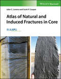
Atlas of Natural and Induced Fractures in Core
by John C. Lorenz Scott P. CooperAn invaluable reference that helps geologists recognize and differentiate the many types of natural fractures, induced fractures and artefacts found in cores Atlas of Natural and Induced Fractures in Core offers a reference for the interpretation of natural and induced fractures in cores. The natural and induced fracture data contained in cores provides a wealth of information once they are recognized and properly interpreted. Written by two experts in the field, this resource provides a much-needed tool to help with the accurate interpretation of these cores. The authorsinclude the information needed to identify different fracture types as well as the criteria for distinguishing between the types of fractures. The atlas shows how to recognize non-fracture artefacts in a core since many of them provide other types of useful information. In addition, the text’s illustrated structures combined with their basic interpretations are designed to be primary building blocks of a complete fracture assessment and analysis. The authors show how to recognize and correctly interpret these building blocks to ensure that subsequent analyses, interpretations, and modeling efforts regarding fracture-controlled reservoir permeability are valid. Presented in full color throughout, this comprehensive reference is written for geologists charged with interpreting fracture-controlled permeability systems in reservoirs as well as for students or other scientists who need to develop the skills to accurately interpret the natural and induced fractures in cores.