- Table View
- List View
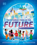
The Children's Book of the Future
by Lavie Tidhar Richard WatsonA Children's Book of the Future is a narrative nonfiction book that will offer an inclusive and hopeful vision of the future, with a diverse, multicultural approach that will appeal to children of all backgrounds and further appeal to the foreign market audience.The book will consist of approximately eighteen chapters that each take inspiration from current scientific research. They'll present engaging, optimistic futures that could result from the real-world science, with insets delving into how that science works. The book will be highly illustrated throughout to make complex ideas more accessible, as well as to better depict the wondrous futures that could be ahead. There will also be a preface, afterword and an activities section.Some of the diverse visions explored include underwater cities; the solar system and space travel; green technologies and sustainability; robots and artificial intelligence; the future of cities; and much more!In short, the book sets out to reclaim the future for current and future generations of children.
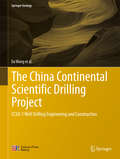
The China Continental Scientific Drilling Project
by Wei Zhang Da Wang Xiaoxi Zhang Guolong Zhao Ruqiang Zuo Jialu Ni Gansheng Yang Jun Jia Kaihua Yang Yongyi Zhu Wenwei Xie Wenjian Zhu Peifeng Zhang Lasheng Fan Jianliang Ye Yongping WangThis book comprehensively introduces the drilling theory and practice behind CCSD-1 well drilling, the first stage of a key national scientific engineering project of China. In addition to access to variety of data and information accumulated decade during the project's decade-long operation, readers also gain insight into state-of-the-art techniques and most recent achievements in China's scientific drilling industry. Specifically, this work introduces the drilling engineering design, well site construction, and equipment and construction situation. It also provides a minute description on the new techniques that were developed for tackling the technical difficulties, expounds in detail the core drilling techniques for hard rock deep well, and treats diamond core drill bits, reaming drilling techniques in hard crystalline rocks, well-deviation control techniques for strong dipping strata, and much more. In summary, this book offers a valuable resource for engineers and technicians who engage in scientific drilling and a variety of resource drilling engineering; teachers and students who are interested in this field will also gain plentiful information. Prof. Da Wang, the former deputy director of China Geological Survey, was the director of the Engineering Centre, chief engineer and drill-site general director of China Continental Scientific Drilling Project.
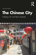
The Chinese City (A\world Bank Publication)
by Weiping Wu Piper GaubatzDrawing on years of research experience and keen observations of the triumphs and problems in China’s cities, the authors provide a foundational understanding of China’s urbanization and cities that is grounded in history and geography and challenges readers to consider Chinese urbanization through multiple disciplinary and thematic lenses. This book is anchored in the spatial sciences, including geography, urban studies, urban planning, and environmental studies. It offers a comprehensive survey of the evolving urban landscape, covering such topics as history and patterns of urbanization, spatial and regional context, models of urban form, economic and social-spatial transformation, urbanism and cultural dynamics, housing and land development, environmental and infrastructure issues, poverty and inequality, and challenges of urban governance. The book highlights both parallels and substantive differences between China and comparable cities and countries elsewhere, given that some urban conditions around the world converge and point to shared catalysts (e.g. internal migration) and globally linked processes (e.g. climate change). It explores the consequences of the demographic, economic, social, and environmental transitions on cities and urban dwellers. Illustrated case studies in each chapter ground the discussion and introduce readers to the diversity of cities and urban life in China. Most chapters also can be used as stand-alone course materials, with suggested references for further reading. Intended for a wide audience in higher education and beyond, this book will be useful to readers interested in Chinese Studies, East Asian Studies, Urban Studies, Urban Geography, or Urban Planning.
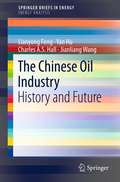
The Chinese Oil Industry
by Charles A. Hall Lianyong Feng Jianliang Wang Yan HuThe Chinese Oil Industry: History and Future presents a wealth of tables and figures with new data on Chinese fossil fuel production and consumption, together with a peak oil model to forecast future trends in energy supply and demand. Energy experts in China and the United States provide you with a unique overview of the entire Chinese oil industry. The authors discuss trends in production and consumption of global significance through to the middle of the 21st century, including the energy returned on energy invested (EROI) for China's oil and gas. The role of oil in the industrialization of China is described as are four phases in the history of the Chinese oil industry. Detailed coverage of resources and exploration, pipeline development, refining and marketing, petroleum and natural gas pricing policies, and international cooperation is followed by consideration of conservation, renewable energy, and environmental impact. The authors also address the importance of coal and the probable future of coal production. - Offers a comprehensive view of the Chinese oil industry - Presents new and previously unpublished data - Covers history and future trends in production and consumption - Introduces a new peak oil model for China - Discusses EROI trend of oil and natural gas and its consequences for the Chinese economy - Written from an objective viewpoint by leading energy experts
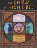
The Chiru of High Tibet
by Jacqueline Briggs MartinThe true gripping story of how scientist George Schaller and four mountain men set out to save the chiru (antelope-like creatures who cannot survive captivity and who live on the high plains of Tibet) from near extinction.
The Chosen City
by Nicholas SchoonThere is endless talk about the need for an urban renaissance; can it happen in the real world? In this broad, challenging and highly engaging book, Nicholas Schoon argues that the foremost priority for regeneration is to make neighbourhoods and cities places where people with choices choose to live.The author surveys the last two centuries of metropolitan growth and decay, analyzes the successes and failures of recent changes in urban policy and proposes a wide range of radical measures to make the renaissance a reality. Comprehensively researched, The Chosen City is a wake up call for everyone interested and involved in urban regeneration - degree students and academics, planning and housing professionals, architects, surveyors, developers and politicians. The text is illustrated with powerful black and white images from a leading national newspaper photographer.
The Cinematic City
by David B. ClarkeThe Cinematic City offers an innovative and thought-provoking insight into cityscape and screenscape and their inter-connection. Illustrated throughout with movie stills, a diverse selection of films (from 'Bladerunner' to 'Little Caesar'), genres, cities and historical periods are examined by leading names in the field. The key dimensions of film and urban theory are introduced before detailed analysis of the various cinematic forms which relate most significantly to the city. From early cinema and documentary film, to film noir, 'New Wave' and 'postmodern cinema', the contributors provide a wealth of empirical material and illustration whilst drawing on the theoretical insights of contemporary feminism, Benjamin, Baudrillard, Foucault, Lacan, and others. The Cinematic City shows how the city has been undeniably shaped by the cinematic form, and how cinema owes much of its nature to the historical development of urban space. Engaging with current theoretical debates, this is a book that is set to change the way in which we think about both the nature of the city and film. Contributors: Giuliana Bruno, Iain Chambers, Marcus Doel, David Clarke, Anthony Easthope, Elisabeth Mahoney, Will Straw, Stephen Ward, John Gold, James Hay, Rob Lapsley, Frank Krutnik
The Circling Sky: On Nature and Belonging in an Ancient Forest
by Neil AnsellFrom a 2018 Wainwright Prize shortlisted author, THE CIRCLING SKY is part childhood memoir, blended with exquisite nature observation, and the story of one man's journey over a year to one of the UK's key natural habitats, the New Forest of HampshireIn the form of several journeys, beginning in January 2019, Neil Ansell returns for solitary walks to the New Forest in Hampshire, close to where he was born. With beautiful sightings and observations of birds, trees, butterflies, insects and landscape, this is also a reflective memoir on childhood, on the history of one of the most ancient and important natural habitats in the United Kingdom, and on the Gypsies who lived there for centuries - and were subsequently expelled to neighbouring cities. It is also part polemic on our collective and individual responsibility for the land and world in which we live, and how we care for it.As Neil Ansell concludes so eloquently, 'Evolution has no choice in what it does, but we do, as a species, if not always as individuals'.
The Circling Sky: On Nature and Belonging in an Ancient Forest
by Neil AnsellFrom a 2018 Wainwright Prize shortlisted author, THE CIRCLING SKY is part childhood memoir, blended with exquisite nature observation, and the story of one man's journey over a year to one of the UK's key natural habitats, the New Forest of HampshireIn the form of several journeys, beginning in January 2019, Neil Ansell returns for solitary walks to the New Forest in Hampshire, close to where he was born. With beautiful sightings and observations of birds, trees, butterflies, insects and landscape, this is also a reflective memoir on childhood, on the history of one of the most ancient and important natural habitats in the United Kingdom, and on the Gypsies who lived there for centuries - and were subsequently expelled to neighbouring cities. It is also part polemic on our collective and individual responsibility for the land and world in which we live, and how we care for it.As Neil Ansell concludes so eloquently, 'Evolution has no choice in what it does, but we do, as a species, if not always as individuals'.(P)2021 Headline Publishing Group Limited
The Circular Bioeconomy in Industry: Strategies for Sustainable Resource Recovery, Environmental Balance, and Ecosystem Protection (Waste as a Resource)
by Alexander Meneses-Jácome Ulrike Schmid-Staiger Tatiana C. Guarín C.This book serves as a starting point for readers to understand the concepts of the circular economy and bioeconomy and how they can be applied to industrial processes. The notion of having eco-friendly industries is a recent development, with a growing interest in the environmental impact of industrial practices, particularly with regard to resource recovery practices for valuable nutrients and byproducts, which aligns with the circular economy and bioeconomy concepts that aim to establish a "continuous flow of materials." Currently, the focus is on studying the environmental impact and developing strategies to achieve a balance with water ecosystems for sustainable and equitable coexistence. The success of these concepts will depend on a robust framework that evaluates the environmental trade-offs and co-benefits of improving industry practices to enhance ecosystem protection. This book introduces circular economy practices in industry, along with tips, procedures, recommendations, and lessons learned.
The Circular Bioeconomy: Institutional and Production Perspectives (Routledge Studies in Ecological Economics)
by Małgorzata Pink Agnieszka JózefowskaFounded on distinct principles to the fossil fuel-based, linear economy, the sustainable, circular bioeconomy requires different social values and institutions and a better understanding of the complexity of the production process. A circular bioeconomy provides a framework for using renewable natural capital to manage land, biodiversity, food, and other industries, with the aim of improving social well-being and environmental safety.The contributors to this book analyse the evolution of the economic system towards the circular economy and bioeconomy and its place in the paradigm of sustainable development. They look at institutions and their importance for the bioeconomy and examine the question of the behaviour of market entities – enterprises and consumers – as well as the meaning of social and environmental responsibility for these entities. They also discuss the issues of the product itself: the process of creation, production, processing and the quality of the product, including its environmental impact throughout its life cycle. The authors also refer to the potential pitfalls and threats related to the implementation of the bioeconomy in both socio-economic and environmental contexts. Individual processes and phenomena are illustrated with case studies and the authors' own research.The book deliberately fosters an interdisciplinary approach founded on cooperation between economists, management specialists, agronomists, biotechnologists, chemists and soil scientists, who together underline the complexity and importance of the interdependence of the economy, society and the natural environment.
The Circular Bioeconomy: Theories And Tools For Economists And Sustainability Scientists
by Piergiuseppe Morone Dalia D’Amato Nicolas Befort Gülşah Yilan
The Circular Economy Handbook: Realizing the Circular Advantage
by Jessica Long Peter Lacy Wesley SpindlerCan we align global production and consumption systems with sustainability? Can business growth actually lead to a healthier planet? Can companies innovate through the circular economy to create competitive advantage and genuine impact? Waste to Wealth proved that the emerging circular economy advantage exists – now Lacy, Long and Spindler show you how to realize it at speed and scale in The Circular Economy Handbook. We stand at a crossroads, with rising geopolitical and geo-economic tensions, massive technological change and a host of social and environmental challenges. We are pushing planetary boundaries to their limits, with climate change and threats to biodiversity and oceans as just a few examples. Significant impacts are already being felt, and both people and planet face potentially catastrophic and irreversible consequences if we don’t urgently change our global model and systems. Our current linear “take, make, waste” models of production and consumption will not be sustainable in a world of some 9 billion people by 2050, especially with ever-expanding rates of consumption. Thriving within these dynamics demands more than incremental adjustments to business-as-usual. The circular economy offers a powerful means to decouple growth from use of scarce and harmful resources, enabling greater production and consumption with fewer negative environmental impacts—at the same time, making companies more innovative and competitive. In fact, this book shows that $4.5 trillion in economic value is at stake. Delivering on the promise of a circular economy demands impact and scale, extending through value chains and, ultimately, disrupting the entire economic system. In The Circular Economy Handbook, the authors illuminate the path from insight to action, from linear to circular. With case studies, advice and practical guidance, they show leaders how to pivot towards a holistic circular organization, embedding circularity internally and delivering broad-based system change. With unique insights across business models, technologies, and industries – featuring stories and real-world examples from circular pioneers – this book is the essential guide to help companies become leaders in the movement to secure the circular economy advantage.
The Circular Economy and the Global South: Sustainable Lifestyles and Green Industrial Development (Pathways to Sustainability)
by Patrick Schröder Manisha Anantharaman Kartika Anggraeni Timothy FoxonThe circular economy is a policy approach and business strategy that aims to improve resource productivity, promote sustainable consumption and production and reduce environmental impacts. This book examines the relevance of the circular economy in the context of developing countries, something which to date is little understood. This volume highlights examples of circular economy practices in developing country contexts in relation to small and medium enterprises (SMEs), informal sector recycling and national policy approaches. It examines a broad range of case studies, including Argentina, Brazil, China, Colombia, India, Indonesia, Kenya, South Africa, and Thailand, and illustrates how the circular economy can be used as a new lens and possible solution to cross-cutting development issues of pollution and waste, employment, health, urbanisation and green industrialisation. In addition to more technical and policy oriented contributions, the book also critically discusses existing narratives and pathways of the circular economy in the global North and South, and how these differ or possibly even conflict with each other. Finally, the book critically examines under what conditions the circular economy will be able to reduce global inequalities and promote human development in the context of the Sustainable Development Goals. Presenting a unique social sciences perspective on the circular economy discourse, this book is relevant to students and scholars studying sustainability in economics, business studies, environmental politics and development studies.
The Circular Economy in Europe: Critical Perspectives on Policies and Imaginaries (Routledge Explorations in Sustainability and Governance)
by Zora Kovacic Roger Strand Thomas VölkerThe Circular Economy in Europe presents an overview and a critical discussion on how circularity is conceived, imagined, and enacted in current EU policy-making. In 2013, the idea of a circular economy entered the stage of European policy-making in the efforts to reconcile environmental and economic policy objectives. In 2019 the European Commission declared in a press release that the Circular Economy Action Plan has been delivered. The level of circularity in the European economy, however, has remained the same. Bringing together perspectives from social sciences, environmental economics and policy analysis, The Circular Economy in Europe provides a critical analysis of policies and promises of the next panacea for growth and sustainability. The authors provide a theoretical and empirical basis to discuss how contemporary societies conceive their need to re-organise production and consumption and explores the messy assemblage of institutions, actors, waste streams, biophysical flows, policy objectives, scientific disciplines, values, expectations, promises and aspirations involved. This book is essential reading for all those interested in understanding how ideas about the circular economy emerged historically, how they gained traction and are used in policy processes, and what the practical challenges in implementing this policy are.
The Circular Economy in the European Union: An Interim Review
by Sepp EisenrieglerThe implementation of the circular economy will entail a major transformation from a resource-destroying, linear economy to a circular one that operates within the planet’s regenerative boundaries. This book presents an interim assessment of the implementation of a circular economy in the EU. It reveals what achievements have been made in various EU institutions, but which are scarcely perceived by the public; which basic scientific principles can be applied in this context; and what NGOs are demanding beyond this progress. It provides convincing arguments for abandoning the “hamster wheel” of material-based satisfaction of our needs, and shows that the primacy of the economy stands in the way of a good life for all. Given its focus, it will appeal to everyone interested in an ecologically sustainable economic system.
The Circular Economy: A User's Guide
by Walter R StahelA Circular Economy seeks to rebuild capital, whether this is financial, manufactured, human, social or natural, and offers opportunities and solutions for all organisations. This book, written by Walter Stahel, who is widely recognised as one of the key people who formulated the concept of the Circular Economy, is the perfect introduction for anyone wanting to quickly get up to speed with this vitally important topic for ensuring sustainable development. It sets out a new framework that refines the concept of a Circular Economy and how it can be applied at industrial levels. This concise book presents the key themes for busy managers and policymakers and some of the newest thinking on the topic of the Circular Economy from one of the leading thinkers in the field. Practical examples and case studies with real-life data are used to elucidate the ideas presented within the book.
The Circular Economy: Economic, Managerial and Policy Implications (Green Energy and Technology)
by Javier Carrillo-Hermosilla Pablo del Río Totti Könnölä Christoph P. KieferThis book provides an in-depth analysis of the concept of the Circular Economy (CE), as well as an assessment of the drivers and barriers for circular practices by firms, and its implications for managers in firms and public policy makers. It includes proposals for policy frameworks and instruments that will encourage the uptake of CE practices. The book is presented in three linked parts. The first part of the book provides a broad view of the topic, put into the wider context of sustainability. In the second part, the drivers of and barriers to the uptake of the CE are analysed, with a special focus on the micro-level not seen often in the previous studies on the CE. This book is of interest to researchers, policy makers and post-graduate students in areas such as environmental management and economics.
The Circular Role of Higher Education: Co-creating Sustainable Communities (International Explorations in Outdoor and Environmental Education #2)
by Lorenzo Lotti Lory BarileThis edited volume presents a series of case studies and research evidence on how global students contribute to widening the debate on sustainability within Higher Education institutions: by offering their own stories, along with academics and external stakeholders they create a unique context where their diverse backgrounds are combined into a wider learning experience. This environment enables them to return to their communities and provide leadership and support in tackling real life sustainability related issues they may face. This book describes this circular and virtuous process, which we refer to as Circular Education. Through this process, Higher Education institutions are enriching environments and supporting communities and their cultural hubs. Readers will discover how students can add to and learn from this critical dialogue with peers, academics, and external stakeholders.It is of interest for students, policymakers, academics and any other institution and organization interested in promoting sustainability in Higher Education.
The Cities That Built the Bible
by Robert R. Cargill“An expert guide and teacher . . . delves into difficult topics with humor and ease. . . . Well worth reading.” —Biblical ArcheologyFor many, the names Bethlehem, Babylon, and Jerusalem are known as the setting for epic stories from the Bible. What often gets missed is that these cities are far more than just the setting for the Bible and its characters—they were instrumental to the creation of the Bible as we know it today.Robert Cargill, archeologist, Bible scholar, and host of the History Channel series Bible Secrets Revealed, blends archaeology, biblical history, and personal journey as he explores ancient cities and their role in the creation of the Bible. He reveals surprising facts such as what the Bible says about the birth of Jesus and how Mary’s Virgin Birth caused problems for the early church. We’ll also see how the God of the Old Testament was influenced by other deities, and how far more books were left out of the Bible than were let in during the canonization process.The Cities That Built the Bible is a magnificent tour through fourteen cities: the Phoenicia cities of Tyre, Sidon, and Byblos, Ugarit, Nineveh, Babylon, Megiddo, Athens, Alexandria, Jerusalem, Qumran, Bethlehem, Nazareth, and Rome. Along the way, Cargill includes photos of artifacts, dig sites, ruins, and relics in this fascinating exploration that sheds new light on the Bible.“A lively personal account that puts flesh and bones on the tale.” —Richard Elliott Friedman, Th.D. author of The Bible with Sources Revealed“Cargill transports readers to these ancient locales, illuminating the municipal dynamics that shaped the Bible.” —Booklist
The Citizen's Guide to Climate Success: Overcoming Myths that Hinder Progress
by Mark JaccardSometimes solving climate change seems impossibly complex, and it is hard to know what changes we all can and should make to help. This book offers hope. Drawing on the latest research, Mark Jaccard shows us how to recognize the absolutely essential actions (decarbonizing electricity and transport) and policies (regulations that phase out coal plants and gasoline vehicles, carbon tariffs). Rather than feeling paralyzed and pursuing ineffective efforts, we can all make a few key changes in our lifestyles to reduce emissions, to contribute to the urgently needed affordable energy transition in developed and developing countries. More importantly, Jaccard shows how to distinguish climate-sincere from insincere politicians and increase the chance of electing and sustaining these leaders in power. In combining the personal and the political, The Citizen's Guide to Climate Success offers a clear and simple strategic path to solving the greatest problem of our times. A PDF version of this title is also available as Open Access on Cambridge Core at doi.org/10.1017/9781108783453.
The Citizen-Powered Energy Handbook
by Greg PahlIn the wake of Hurricane Katrina, Al Gore's summer blockbuster "An Inconvenient Truth," and crude oil prices soaring to all-time highs, more people than ever know the truth about our oil addiction. Global warming is here. M. King Hubbert's oil peak is fast approaching (or may already have arrived). The secret's out: fossil fuel reserves are dwindling and popular interest has created the need for accessible, realistic solutions. The Citizen-Powered Energy Handbook, a clear-eyed view of the critical situation we face, offers ways out. Greg Pahl examines energy technologies currently available and homes in on renewable energy strategies that can be adopted by individuals and communities. Such cooperative initiatives have been common in Europe for years and are beginning to gain a foothold in the US. Each chapter focuses on a different renewable energy category-solar, wind, water, biomass, liquid biofuels, and geothermalathen reviews their advantages and disadvantages and describes numerous examples of successful, proven local initiatives. The Citizen-Powered Energy Handbook is an eloquent appeal for community and regional action to initiate an array of solutions to energy needs until now controlled by large, distant utilities and consortiums. It is time to take back control of the energy and environmental challenges ahead; this book will help people do just that. It is a handbook for anyone ready to take the first steps towards a more sustainable future.
The City Reader (Routledge Urban Reader Series)
by Frederic Stout Richard T. LeGatesThe sixth edition of the highly successful The City Reader juxtaposes the very best classic and contemporary writings on the city to provide the comprehensive mapping of the terrain of Urban Studies and Planning old and new. The City Reader is the anchor volume in the Routledge Urban Reader Series and is now integrated with all ten other titles in the series. This edition has been extensively updated and expanded to reflect the latest thinking in each of the disciplinary areas included and in topical areas such as compact cities, urban history, place making, sustainable urban development, globalization, cities and climate change, the world city network, the impact of technology on cities, resilient cities, cities in Africa and the Middle East, and urban theory. The new edition places greater emphasis on cities in the developing world, globalization and the global city system of the future. The plate sections have been revised and updated. Sixty generous selections are included: forty-four from the fifth edition, and sixteen new selections, including three newly written exclusively for The City Reader. The sixth edition keeps classic writings by authors such as Ebenezer Howard, Ernest W. Burgess, LeCorbusier, Lewis Mumford, Jane Jacobs, and Louis Wirth, as well as the best contemporary writings of, among others, Peter Hall, Manuel Castells, David Harvey, Saskia Sassen, and Kenneth Jackson. In addition to newly commissioned selections by Yasser Elshestawy, Peter Taylor, and Lawrence Vale, new selections in the sixth edition include writings by Aristotle, Peter Calthorpe, Alberto Camarillo, Filip DeBoech, Edward Glaeser, David Owen, Henri Pirenne, The Project for Public Spaces, Jonas Rabinovich and Joseph Lietman, Doug Saunders, and Bish Sanyal. The anthology features general and section introductions as well as individual introductions to the selected articles introducing the authors, providing context, relating the selection to other selection, and providing a bibliography for further study. The sixth edition includes fifty plates in four plate sections, substantially revised from the fifth edition.
The City Reader (Routledge Urban Reader Series)
by Frederic Stout Richard T. LeGatesThe seventh edition of the highly successful The City Reader juxtaposes the very best classic and contemporary writings on the city. Sixty-three selections are included: forty-five from the sixth edition and eighteen new selections, including three newly written exclusively for The City Reader. The anthology features a Prologue essay on "How to Study Cities", eight part introductions as well as individual introductions to each of the selected articles. The new edition has been extensively updated and expanded to reflect the latest thinking in each of the disciplinary and topical areas included, such as sustainable urban development, globalization, the impact of technology on cities, resilient cities, and urban theory. The seventh edition places greater emphasis on cities in the developing world, the global city system, and the future of cities in the digital transformation age. While retaining classic writings from authors such as Lewis Mumford, Jane Jacobs, and Louis Wirth, this edition also includes the best contemporary writings of, among others, Peter Hall, Manuel Castells, and Saskia Sassen. New material has been added on compact cities, urban history, placemaking, climate change, the world city network, smart cities, the new social exclusion, ordinary cities, gentrification, gender perspectives, regime theory, comparative urbanization, and the impact of technology on cities. Bibliographic material has been completely updated and strengthened so that the seventh edition can serve as a reference volume orienting faculty and students to the most important writings of all the key topics in urban studies and planning. The City Reader provides the comprehensive mapping of the terrain of Urban Studies, old and new. It is essential reading for anyone interested in studying cities and city life.