- Table View
- List View
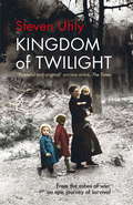
Kingdom of Twilight
by Steven UhlyHISTORICAL FICTION BOOK OF THE MONTH - THE TIMESOne night in autumn 1944, a gunshot echoes through the alleyways of a small town in occupied Poland. An S.S. officer is shot dead by a young Polish Jew, Margarita Ejzenstain. In retaliation, his commander orders the execution of thirty-seven Poles - one for every year of the dead man's life. First hidden by a German couple, Margarita must then flee the brutal advance of the Soviet army with her new-born baby. So begins a thrilling panorama of intermingled destinies and events that reverberate from that single act of defiance. KINGDOM OF TWILIGHT follows the lives of Jewish refugees and a German family resettled from Bukovina, as well as a former S.S. officer, chronicling the geographical and psychological dislocation generated by war. A quest for identity and truth takes them from Displaced Persons camps to Lübeck, Berlin, Tel Aviv and New York, as they try to make sense of a changed world, and of their place in it. Hypnotically lyrical and intensely moving, Steven Uhly's epic novel is a finely nuanced and yet shattering exploration of universal themes: love, hatred, doubt, survival, guilt, humanity and redemption.For readers of HHHH by Laurent Binet, THE KINDLY ONES by Jonathan Littell, THE ZONE OF INTEREST by Martin Amis, and ALL THE LIGHT WE CANNOT SEE by Anthony DoerrTranslated from the German by Jamie Bulloch
Kingdom of Twilight
by Steven UhlyOne night in autumn 1944, a gunshot echoes through the alleyways of a small town in occupied Poland. An S.S. officer is shot dead by a young Polish Jew, Margarita Ejzenstain. In retaliation, his commander orders the execution of thirty-seven Poles - one for every year of the dead man's life. First hidden by a German couple, Margarita must then flee the brutal advance of the Soviet army with her new-born baby. So begins a thrilling panorama of intermingled destinies and events that reverberate from that single act of defiance. KINGDOM OF TWILIGHT follows the lives of Jewish refugees and a German family resettled from Bukovina, as well as a former S.S. officer, chronicling the geographical and psychological dislocation generated by war. A quest for identity and truth takes them from Displaced Persons camps to Lübeck, Berlin, Tel Aviv and New York, as they try to make sense of a changed world, and of their place in it. Hypnotically lyrical and intensely moving, Steven Uhly's epic novel is a finely nuanced and yet shattering exploration of universal themes: love, hatred, doubt, survival, guilt, humanity and redemption.For readers of HHHH by Laurent Binet, THE KINDLY ONES by Jonathan Littell, THE ZONE OF INTEREST by Martin Amis, and ALL THE LIGHT WE CANNOT SEE by Anthony Doerr(P)2017 WF Howes Ltd
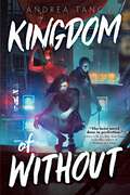
Kingdom of Without
by Andrea TangA wily young thief must use her wits to survive futuristic, alternate history Beijing in this Les Misérables–inspired young adult cyberpunk that is perfect for fans of Six of Crows and Fullmetal Alchemist.When Zhong Ning&’er takes the job, she expects a smash-and-grab burglary she&’s doing to make rent and help out a friend. What she doesn&’t expect: a sad-eyed army boy who dreams of insurrection, a former rebel leader trapped inside a secret lab, a group of aspiring revolutionaries who are first collaborators, then compatriots, and then, perhaps, friends. But this is Beijing, nearly a hundred and fifty years after General Yuan Shikai successfully declared himself emperor in 1915. His descendants rule the country from their seat in the imperial city, their gendarmerie—the Beiyang Army—run the streets, aided by cyborgs and the Brocade Guard. Walls have risen, dividing the city into districts called Rings—nominally only by geography, but in truth by class. Earthquakes devastate the northern farmlands, crops drown in the southern typhoons, and all over the country people are hooked on a drug they call Complacency. As a Sixth Ring girl who watched previous uprisings crushed brutally by the court, Ning&’er isn&’t much of an optimist, and she&’s certainly no revolutionary. But that might not be up to her—as the stakes get higher, the time for passivity is quickly running out, and she must decide if she wants to sit idly in her cynicism, or embrace the breathless, terrible possibility of hope.
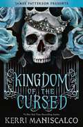
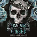
Kingdom of the Cursed (Kingdom of the Wicked #2)
by Kerri ManiscalcoFrom the #1 New York Times bestselling author of the Stalking Jack the Ripper series comes the sizzling, sweepingly romantic sequel to Kingdom of the Wicked. <p><p> One sister. Two sinful princes. Infinite deception with a side of revenge . . . Welcome to Hell. <p><p> After selling her soul to become Queen of the Wicked, Emilia travels to the Seven Circles with the enigmatic Prince of Wrath, where she's introduced to a seductive world of vice. <p><p> She vows to do whatever it takes to avenge her beloved sister, Vittoria . . . even if that means accepting the hand of the Prince of Pride, the king of demons. <p><p> The first rule in the court of the Wicked? Trust no one. With back-stabbing princes, luxurious palaces, mysterious party invitations, and conflicting clues about who really killed her twin, Emilia finds herself more alone than ever before. Can she even trust Wrath, her one-time ally in the mortal world . . or is he keeping dangerous secrets about his true nature? Emilia will be tested in every way as she seeks a series of magical objects that will unlock the clues of her past and the answers she craves . . .
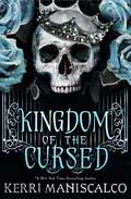
Kingdom of the Cursed (Kingdom of the Wicked)
by Kerri ManiscalcoOne sister. Two sinful princes. Infinite deception with a side of revenge . . . Welcome to Hell.From the #1 New York Times bestselling author Kerri Maniscalco comes the sizzling and sweepingly romantic sequel to Kingdom of the Wicked.With the enigmatic Prince of Wrath at her side, Emilia sold her soul to become Queen of the Wicked and travelled to the Seven Circles to fulfil her vow of avenging her beloved sister. But the first rule in the court of the Wicked? Trust no one. And it quickly becomes clear that nothing in Hell is what it seems. Even Wrath, her onetime ally, may be keeping secrets about his true nature. But that suits Emilia just fine - she's got secrets of her own.Faced with backstabbing courtiers, princes who delight in fear, luxurious palaces, dazzling galas, and conflicting clues about what truly happened to her sister, Emilia finds herself on a mission to unlock the mysteries of her own past and uncover the answers she craves.As long as her sins don't catch up to her first . . .*** PRAISE FOR KERRI MANISCALCO ***'A delicious and intoxicating new fantasy by a master of murder and mayhem' Elizabeth Lim, author of Spin the Dawn'An intoxicating, tightly plotted feast for the senses' Kirkus'A fast-paced adventure steeped in a luscious and dark world' Chloe Gong, NYT bestselling author of These Violent Delights(P) 2021 Hachette Audio
Kingdom of the Cursed: the addictive and alluring fantasy romance set in a world of demon princes and dangerous desires (Kingdom of the Wicked #2)
by Kerri ManiscalcoOne sister. Two sinful princes. Infinite deception with a side of revenge . . . Welcome to Hell.From the #1 New York Times bestselling author Kerri Maniscalco comes the Sunday Times bestselling sizzling and sweepingly romantic sequel to Kingdom of the Wicked. With the Prince of Wrath at her side, Emilia sold her soul to become Queen of the Wicked and travelled to the Seven Circles to fulfil her vow of avenging her sister. But the first rule of the Wicked? Trust no one. And it's soon clear that nothing in Hell is what it seems. Even Wrath may be keeping secrets about his true nature. But that suits Emilia just fine - she's got secrets of her own. Faced with backstabbing courtiers, princes who delight in fear, luxurious palaces, dazzling galas, and conflicting clues, Emilia finds herself on a mission to unlock the mysteries of her own past and uncover the answers she craves. As long as her sins don't catch up to her first . . .This scorching romantasy is perfect for fans of Stephanie Garber, Carissa Broadbent, Lexi Ryan, Lauren Roberts. READERS LOVE KERRI MANISCALCO 'A decadent and pulse raising read filled with sizzling romance, deception and intrigue and I never wanted it to end' ⭐⭐⭐⭐⭐ 'The twists and turns were intense, addictive and had me gaping by the end of the book. The cliff-hanger was MEAN so I eagerly await book 3 so bad!!' ⭐⭐⭐⭐⭐ 'Wrath is beyond words! He has quickly shot up my favourite male main character list, and that's a tough list to get on to!' ⭐⭐⭐⭐⭐ 'Brilliantly steamy scenes that made this more NA than the first and I will tell you I AM HERE FOR IT!!!' ⭐⭐⭐⭐⭐ 'I feel so empty now I have finished this book, I literally was emerged inside. The story is so absolutely heartbreaking and beautiful all at the same time' ⭐⭐⭐⭐⭐
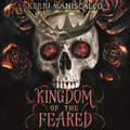
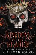
Kingdom of the Feared (Kingdom of the Wicked)
by Kerri ManiscalcoAll hail the king and queen of Hell.Two curses. One prophecy. A reckoning all have feared. And a love more powerful than fate . . .From the #1 New York Times bestselling author of the Stalking Jack the Ripper series comes the dazzling conclusion to the Kingdom of the Wicked trilogy.Emilia is reeling from the shocking discovery that her twin sister, Vittoria, is alive. But before she faces the demons of her past, Emilia yearns to claim her king, the seductive Prince of Wrath, in the flesh. Emilia doesn't simply desire his body, she wants his heart and soul - but that's something the enigmatic demon can't promise her.When a high-ranking member of House Greed is assassinated, Emilia and Wrath are drawn to the rival demon court. Damning evidence points to Vittoria as the murderer and she's quickly declared an enemy of the Seven Circles. Despite her betrayal, Emilia will do anything to solve this new mystery and find out who her sister really is.Together Emilia and Wrath play a sin-fuelled game of deception as they work to stop the unrest that's brewing between witches, demons, shape-shifters and the most treacherous foes of all: the Feared.Emilia was warned that when it came to the Wicked nothing was as it seemed. But, have the true villains been much closer all along? When the truth is finally revealed, it just might end up costing Emilia her heart.(P) 2022 Hachette Audio
Kingdom of the Feared (Kingdom of the Wicked)
by Kerri ManiscalcoFrom the #1 New York Times bestselling author of the Stalking Jack the Ripper series comes the steamy conclusion to Kingdom of the Wicked trilogy. Two curses.One prophecy.A reckoning all have feared. And a love more powerful than fate. All hail the king and queen of Hell. Emilia is reeling from a shocking discovery about her sister, Vittoria. But before she faces the demons of her past, Emilia yearns to claim her king, the seductive Prince of Wrath, in the flesh. She doesn&’t just desire his body; she wants his heart and soul—but that&’s something the enigmatic demon can&’t promise her. When a high-ranking member of House Greed is assassinated, damning evidence somehow points to Vittoria as the murderer. Now, Emilia will do anything to get to the bottom of these accusations against the sister she thought she knew. Together, Emilia and Wrath play a sin-fueled game of deception to solve the murder and stop the unrest that&’s brewing between witches, demons, shape-shifters, and the most treacherous foes of all: the Feared. Emilia was warned that when it came to the Wicked, nothing was as it seemed. But have the true villains been much closer all along? #1 New York Times bestselling author Kerri Maniscalco delivers sizzling romance, sexy secrets, and unexpected twists in this unforgettable conclusion to the Kingdom of the Wicked series! Suggested for ages 16 and up.
Kingdom of the Feared: the addictive and intoxicating fantasy romance finale to the Kingdom of the Wicked series (Kingdom of the Wicked #3)
by Kerri ManiscalcoTwo curses. One prophecy. All hail the king and queen of hell.'Right now, I want the demon, not the prince. Show me why they call you the Wicked. And don't you dare hold back.' The climax of the scorching and addictive Kingdom of the Wicked series, from New York and Sunday Times bestseller Kerri Maniscalco. Emilia yearns to claim her king, the seductive Prince of Wrath, in the flesh. She wants him, heart and soul - but that's something the enigmatic demon can't promise her. When a high-ranking member of House Greed is assassinated, evidence points to Vittoria as the murderer. Now, Emilia will do anything to discover the truth of these accusations against the sister she thought she knew. But when it comes to the Wicked, nothing is as it seems. Have the true villains been much closer all along?READERS LOVE KERRI MANISCALCO'A perfect ending to the trilogy! It was so intense and had secrets unfolding all over the place, I was stunned' ⭐⭐⭐⭐⭐'So many unexpected twists of story made it an absolutely delicious spicy read' ⭐⭐⭐⭐⭐'This book was absolutely everything I needed and MORE!!!!' ⭐⭐⭐⭐⭐'BUT OH MY GOD! This book is everything you could've asked for to wrap up this series!' ⭐⭐⭐⭐⭐
Kingdom of the Mind
by Peter E. Rider Heather McnabbIn A Kingdom of the Mind ethnographers, material culture specialists, and contributors from a wide variety of disciplines explore the impact of the Scots on Canadian life, showing how the Scots' image of their homeland and themselves played an important role in the emerging definition of what it meant to be Canadian.
Kingdom of the Mind: How the Scots Helped Make Canada (McGill-Queen's Studies in Ethnic History)
by Peter E. Rider Heather McNabbIn A Kingdom of the Mind ethnographers, material culture specialists, and contributors from a wide variety of disciplines explore the impact of the Scots on Canadian life, showing how the Scots' image of their homeland and themselves played an important role in the emerging definition of what it meant to be Canadian.
Kingdom of the Two Sicilies: The Time Traveler's Guide (The Time Traveler's Guide)
by Louis MendolaThis is a detailed guide to the kingdom that flourished in southern Italy from 1734 until its annexation to the unified Italy in 1861. As an introduction, it is an abridged edition of the author's print book of the same title, containing the complete main text but without the endnotes, bibliography or specialized appendices on topics such as orders of knighthood and titles of nobility. That volume is the first major history of the kingdom published in English.Encompassing Sicily and the Italian peninsula south of Rome, the Kingdom of the Two Sicilies was the wealthiest, most populous and most technologically advanced of the pre-unitary states of Italy. It is the region from which the greatest number of Italians emigrated after 1880 when, in the wake of the unification, its economy worsened.This book brings us the history of the place but also its people. Actual and virtual visitors will find it highly informative, full of details rarely published elsewhere. The author is an "insider" resident in the former kingdom, the land of his ancestors, a place he has studied for decades. This work reflects uncommon insight, correcting misperceptions by bringing us facts.
Kingdom of the Wicked (Kingdom of the Wicked #1)
by Kerri ManiscalcoA James Patterson Presents Novel From the #1 New York Times and USA Today bestselling author of the Stalking Jack the Ripper series comes a new blockbuster series... Two sisters.One brutal murder. A quest for vengeance that will unleash Hell itself... And an intoxicating romance. Emilia and her twin sister Vittoria are streghe -- witches who live secretly among humans, avoiding notice and persecution. One night, Vittoria misses dinner service at the family's renowned Sicilian restaurant. Emilia soon finds the body of her beloved twin...desecrated beyond belief. Devastated, Emilia sets out to find her sister's killer and to seek vengeance at any cost-even if it means using dark magic that's been long forbidden. Then Emilia meets Wrath, one of the Wicked-princes of Hell she has been warned against in tales since she was a child. Wrath claims to be on Emilia's side, tasked by his master with solving the series of women's murders on the island. But when it comes to the Wicked, nothing is as it seems...
Kingdom of the Wicked (Kingdom of the Wicked)
by Kerri ManiscalcoTwo sisters. One brutal murder. A quest for vengeance that will unleash Hell itself . . .A new series from the #1 New York Times bestselling author of Stalking Jack the Ripper.Emilia and her twin sister Vittoria are streghe - witches who live secretly among humans, avoiding notice and persecution. One night, Vittoria misses dinner service at the family's renowned Sicilian restaurant. Emilia soon finds the body of her beloved twin . . . desecrated beyond belief. Devastated, Emilia sets out to find her sister's killer and to seek vengeance at any cost-even if it means using dark magic that's been long forbidden.Then Emilia meets Wrath, one of the Wicked-princes of Hell she has been warned against in tales since she was a child. Wrath claims to be on Emilia's side, tasked by his master with solving the series of women's murders on the island. But when it comes to the Wicked, nothing is as it seems . . .
Kingdom of the Wicked Complete Trilogy
by Kerri ManiscalcoThe complete trilogy of Kingdom of the Wicked, Kingdom of the Cursed and Kingdom of the Feared, the sinfully sexy fantasy romance series by #1 New York Times bestselling Kerri Maniscalco.Two sisters. One brutal murder. A quest for vengeance that will unleash Hell itself . . .Emilia and her twin sister Vittoria are streghe - witches who live secretly among humans, avoiding notice and persecution. One night, Vittoria misses dinner service at the family's renowned Sicilian restaurant. Emilia soon finds the body of her beloved twin . . . desecrated beyond belief. Devastated, Emilia sets out to find her sister's killer and to seek vengeance at any cost-even if it means using dark magic that's been long forbidden.Then Emilia meets Wrath, one of the Wicked-princes of Hell she has been warned against in tales since she was a child. Wrath claims to be on Emilia's side, tasked by his master with solving the series of women's murders on the island. But when it comes to the Wicked, nothing is as it seems . . .----'Intoxicating' Elizabeth Lim'A fast-paced adventure steeped in a luscious and dark world' Chloe Gong
Kingdom of the Wicked: The addictive and intoxicating romantasy set in world of dark demon princes and spellbinding romance (Kingdom of the Wicked #1)
by Kerri ManiscalcoTwo sisters. One brutal murder. A quest for vengeance that will unleash Hell itself . . . Kingdom of the Wicked is the first in an addictive, intoxicating and darkly romantic fantasy series from a Sunday Times and New York Times bestselling author. Emilia and her twin sister Vittoria are witches, forced to live their lives in secret to avoid persecution. Until one night, Vittoria doesn't come home . . . Then Emilia finds her body, desecrated beyond belief. Devastated, she vows revenge at any cost: even if it means using forbidden magic - or summoning Wrath, one of the princes of the Wicked. Deadly, handsome, and brooding, Wrath claims to be on Emilia's side, tasked with solving a series of murders on the island. But when it comes to the Wicked, nothing is as it seems . . . Tropes Enemies to lovers ⚔️💓 Slow burn ❤️🔥 Forced proximity🔒🫂 One bed 🛏️ Witches and demons ✨👿 This scorching romantasy is perfect for fans of Stephanie Garber, Carissa Broadbent, Lexi Ryan, Lauren Roberts. READERS LOVE KERRI MANISCALCO 'Witches, Demons & Wrath - Oh My!' ⭐⭐⭐⭐⭐ 'Seven deadly sins? Check. Witches? Check. Mouth-watering Italian food? Check, check, check! . . . I just honestly couldn't get enough' ⭐⭐⭐⭐⭐ 'I can't put into words how much I NEED to know what happens next' ⭐⭐⭐⭐⭐ 'This series kept me just as enthralled as the likes of Sarah J Maas and Jennifer Armentrout' ⭐⭐⭐⭐⭐ 'Such a great read, with witchy vibes and dangerously alluring demons' ⭐⭐⭐⭐⭐ 'AHHHH LOVE LOVE LOVE LOVE! This book right here is heaven (or hell). Must buy, absolutely loved it! If you love tattooed, tanned, Italian, angry (but non-toxic) men THEN THIS RIGHT HERE IS FOR YOU' ⭐⭐⭐⭐⭐
Kingdom on Fire: Kareem, Wooden, Walton, and the Turbulent Days of the UCLA Basketball Dynasty
by Scott Howard-CooperIn the tradition of Blood in the Garden and Three-Ring Circus comes a bold narrative history of the iconic UCLA Bruins championship teams led by legendary coach John Wooden—an incredible true story about the messy, never-easy pursuit of perfection set against the turmoil of American culture in the 1960s and 70s. Few basketball dynasties have reigned supreme like the UCLA Bruins did over college basketball from 1965–1975 (seven consecutive titles, three perfect records, an eighty-eight-game winning streak that remains unmatched). At the center of this legendary franchise were the now-iconic players Kareem Abdul Jabbar and Bill Walton, naturally reserved personalities who became outspoken giants when it came to race and the Vietnam War. These generational talents were led by John Wooden, a conservative counterweight to his star players whose leadership skills would transcend the game after his retirement. But before the three of them became history, they would have to make it—together. Los Angeles native and longtime sportswriter for the Los Angeles Times, Scott Howard Cooper draws on more than a hundred interviews and extensive access to many of the principal figures, including Wooden&’s family to deliver a rich narrative that reveals the turmoil at the heart of this storied college basketball program. Making the eye-opening connections between UCLA and the Nixon administration, Ronald Reagan, Muhammad Ali, and others, Kingdom on Fire puts the UCLA basketball team&’s political involvement and influence in full relief for the first time. The story of UCLA basketball is an incredible slice of American history that reveals what it truly takes to achieve and sustain greatness while standing up for what you believe in.
Kingdom to Commune: Protestant Pacifist Culture between World War I and the Vietnam Era
by Patricia AppelbaumAmerican religious pacifism is usually explained in terms of its practitioners' ethical and philosophical commitments. Patricia Appelbaum argues that Protestant pacifism, which constituted the religious center of the large-scale peace movement in the United States after World War I, is best understood as a culture that developed dynamically in the broader context of American religious, historical, and social currents. Exploring piety, practice, and material religion, Appelbaum describes a surprisingly complex culture of Protestant pacifism expressed through social networks, iconography, vernacular theology, individual spiritual practice, storytelling, identity rituals, and cooperative living. Between World War I and the Vietnam War, she contends, a paradigm shift took place in the Protestant pacifist movement. Pacifism moved from a mainstream position to a sectarian and marginal one, from an embrace of modernity to skepticism about it, and from a Christian center to a purely pacifist one, with an informal, flexible theology. The book begins and ends with biographical profiles of two very different pacifists, Harold Gray and Marjorie Swann. Their stories distill the changing religious culture of American pacifism revealed inKingdom to Commune.
Kingdom's Call (Kingdom Series #4)
by Chuck BlackA sworn enemy of the Prince vows to eliminate his Followers.Until the Prince saves his life...For generations the Noble Knights have been in service to the King. Following a strict code of conduct, they preserve the peace in Chessington, the King's chosen city, and rule its citizenry. Sir Gavin is a young and promising Noble Knight, devoted to King and Code.Then a peasant disrupts the tranquility of Chessington, brazenly challenging the Code while claiming to be the son of the King-a Prince. When it is learned that he is actively training a force of men in defiance of the law, the stranger is arrested and executed.But his Followers continue to defy the Code, and Sir Gavin swears to destroy this threat to Chessington-until he himself is grievously wounded in battle. As he faces his own death, Gavin is saved by someone who will transform his heart and change his life...Journey to Arrethtrae, where the King and His Son implement a bold plan to save their kingdom; where courage, faith, and loyalty stand tall in the face of opposition; where good will not bow to evil-and one brave man stands against the Dark Knight.From the Trade Paperback edition.
Kingdom's Dawn (Kingdom Series #1)
by Chuck BlackA Riveting Medieval Parallel to the Bible Good and evil clash. Leinad and Cedric are determined to not only survive, but claim hope and victory! In Kingdom's Dawn, Leinad and Tess, along with all the king's people, must escape slavery by the powerful Lord Fairos. Kingdom's Hope finds them free and arriving in the Chessington Valley. But when they forget the king, will Kergon and the Kessons capture them for good? After many years, Kingdom's Edge finds Cedric living a hopeless life until a stranger appears with powerful words of a new kingdom and a grand army. Finally, Kingdom's Reign marches you through the danger of earth's last days as the evil dark knight threatens to defeat the prince once and for all. Swords, knights, and battles define these captivating tales that parallel biblical events from Genesis to Revelation! He's just a young man, but that doesn't change the truth. He was chosen... Sixteen-year-old Leinad thought he was a common farmer's son, nothing more. He wondered why his father had trained him for years to master the sword--not exactly a tool of the trade for farmers--but one tragic event initiates a world of revelation. Only then does he begin to understand his calling--a calling no other man in the entire kingdom of Arrethtrae can fulfill--a calling given him by the King himself. Teamed with a young slave girl, Leinad is thrust into adversity and danger--for the Dark Knight and his vicious Shadow Warriors will stop at nothing to thwart the King's plan to restore the kingdom. Leinad will need more than a sharp blade and a swift hand to fulfill his mission and survive the evil plots of the King's sworn enemies! Journey to Arrethtrae, where the King and His Son implement a bold plan to save their kingdom; where courage, faith, and loyalty stand tall in the face of opposition; where good will not bow to evil--and the future of a kingdom lies in the hands of a young man. DISCUSSION QUESTIONS INCLUDED Story Behind the Book"When my six kids' eyes glossed over during a reading from the Bible, I paused to explain the significance of redemption to a sin-sick soul. I was rewarded with patronizing elephant nods and more blank stares. Shortly thereafter, I awoke in the middle of the night with a medieval story enveloping my mind. I wrote it down and later read it to my children. Their waning attention transformed into complete anticipation. I was amazed and disappointed. Why did it take a fictional story, not a Bible passage, to get that response? Then I realized--that is how Jesus taught! Parables are powerful! I penned the Kingdom series to help young people get excited about the supremely significant story of Jesus Christ and His mission to save mankind." -- Chuck BlackFrom the Trade Paperback edition.
Kingdom's Dream: (Firebird:5) a captivating and enthralling Welsh saga that will stay with you forever
by Iris GowerIf you like Dilly Court, Rosie Goodwin and Kitty Neale, you will love this atmospheric, mesmerising and heart-wrenching saga from the pen of bestselling author Iris Gower.READERS ARE LOVING KINGDOM'S DREAM!"Totally engrossed from the minute you start reading" - 5 STARS"Excellent read. Another brilliant book from Iris Gower." - 5 STARS"Outstanding" - 5 STARS**********************************************************************************SECRETS AND LOVE AFFAIRS BRING TRAGEDY IN THEIR WAKE AMIDST THE WELSH HILLS...Lovely Katie Cullen is all alone in the world. Her mother has died, and Swansea is no fit place for a young girl on her own. The navvies who are building the new railway roam the streets on pay day looking for trouble, and the peaceful outskirts are transformed into a shanty town as the silver track wends its way to the town centre...So when Katie meets handsome Bull Beynon, the foreman of the railway builders, she falls in love with him at once and longs to be protected by him. But Bull has his own woman, the spirited Rhiannon...Katie and Rhiannon find that they are caught in a network of deception and deceit as their lives become intertwined...and no good can come from secrets and lies.Kingdom's Dream is the fifth novel in Iris Gower's Firebird series. The saga concludes in Paradise Park. Have you read Firebird, Dream Catcher, Sweet Rosie and Daughters of Rebecca where the story began?
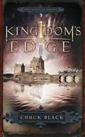
Kingdom's Edge (Kingdom Series #3)
by Chuck BlackA Riveting Medieval Parallel to the Bible Good and evil clash. Leinad and Cedric are determined to not only survive, but claim hope and victory! In Kingdom's Dawn , Leinad and Tess, along with all the king's people, must escape slavery by the powerful Lord Fairos. Kingdom's Hope finds them free and arriving in the Chessington Valley . But when they forget the king, will Kergon and the Kessons capture them for good? After many years, Kingdom's Edge finds Cedric living a hopeless life until a stranger appears with powerful words of a new kingdom and a grand army. Finally, Kingdom's Reign marches you through the danger of earth's last days as the evil dark knight threatens to defeat the prince once and for all. Swords, knights, and battles define these captivating tales that parallel biblical events from Genesis to Revelation! He was doomed to a life of hopelessness and despair. Then the stranger arrived... For Cedric of Chessington, every day is the same: full of poverty and despair. And he knows that will never change. Or so he thinks. Then a stranger comes to the city. Drawn to the man's mysterious ways, Cedric discovers the stranger's humility belies great strength and wisdom. That's when an astounding truth becomes clear--the stranger is a Master of the Sword, and He is there to train Cedric. Suddenly propelled into a desperate battle against evil, Cedric must rely on the Master's training if he is going to survive. But the ultimate battle is yet to come, for the Dark Knight is at work, implementing his plan to take over the kingdom. Will Cedric be ready to stand in the face of pure evil? Journey to Arrethtrae, where the King and His Son implement a bold plan to save their kingdom; where courage, faith, and loyalty stand tall in the face of opposition; where good will not bow to evil; and where hope and compassion are as powerful weapons as the sword. DISCUSSION QUESTIONS INCLUDED Story Behind the Book"When my six kids' eyes glossed over during a reading from the Bible, I paused to explain the significance of redemption to a sin-sick soul. I was rewarded with patronizing elephant nods and more blank stares. Shortly thereafter, I awoke in the middle of the night with a medieval story enveloping my mind. I wrote it down and later read it to my children. Their waning attention transformed into complete anticipation. I was amazed and disappointed. Why did it take a fictional story, not a Bible passage, to get that response? Then I realized--that is how Jesus taught! Parables are powerful! I penned the Kingdom series to help young people get excited about the supremely significant story of Jesus Christ and His mission to save mankind." -- Chuck BlackFrom the Trade Paperback edition.
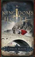
Kingdom's Hope (Kingdom Series #2)
by Chuck BlackA Riveting Medieval Parallel to the Bible Good and evil clash. Leinad and Cedric are determined to not only survive, but claim hope and victory! In Kingdom’s Dawn, Leinad and Tess, along with all the king’s people, must escape slavery by the powerful Lord Fairos. Kingdom’s Hope finds them free and arriving in the Chessington Valley. But when they forget the king, will Kergon and the Kessons capture them for good? After many years, Kingdom’s Edge finds Cedric living a hopeless life until a stranger appears with powerful words of a new kingdom and a grand army. Finally, Kingdom’s Reign marches you through the danger of earth’s last days as the evil dark knight threatens to defeat the prince once and for all. Swords, knights, and battles define these captivating tales that parallel biblical events from Genesis to Revelation! He’s just a young man, but that doesn’t change the truth. He was chosen… Sixteen-year-old Leinad thought he was a common farmer’s son, nothing more. He wondered why his father had trained him for years to master the sword-not exactly a tool of the trade for farmers-but one tragic event initiates a world of revelation. Only then does he begin to understand his calling-a calling no other man in the entire kingdom of Arrethtrae can fulfill-a calling given him by the King himself. Teamed with a young slave girl, Leinad is thrust into adversity and danger-for the Dark Knight and his vicious Shadow Warriors will stop at nothing to thwart the King’s plan to restore the kingdom. Leinad will need more than a sharp blade and a swift hand to fulfill his mission and survive the evil plots of the King’s sworn enemies! Journey to Arrethtrae, where the King and His Son implement a bold plan to save their kingdom; where courage, faith, and loyalty stand tall in the face of opposition; where good will not bow to evil-and the future of a kingdom lies in the hands of a young man. DISCUSSION QUESTIONS INCLUDED Story Behind the Book “When my six kids’ eyes glossed over during a reading from the Bible, I paused to explain the significance of redemption to a sin-sick soul. I was rewarded with patronizing elephant nods and more blank stares. Shortly thereafter, I awoke in the middle of the night with a medieval story enveloping my mind. I wrote it down and later read it to my children. Their waning attention transformed into complete anticipation. I was amazed and disappointed. Why did it take a fictional story, not a Bible passage, to get that response? Then I realized-that is how Jesus taught! Parables are powerful! I penned the Kingdom series to help young people get excited about the supremely significant story of Jesus Christ and His mission to save mankind. ” - Chuck Black From the Trade Paperback edition.
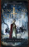
Kingdom's Quest (Kingdom Series #5)
by Chuck BlackHe was called to fulfill a mighty quest, filled with fierce battles. A quest to bring hope to the kingdom…Having narrowly escaped death at the hands of the evil Shadow Warriors, Sir Gavin is given a new name by the Prince to signify his new allegiance–to the cause of the one he once swore to kill. Called to share this message to everyone in the land of Arrethtrae, Sir Gavinaugh takes up his sword and embarks on an epic journey. Winning hearts and minds with the power of his words and his skill with a sword, Gavinaugh travels from one end of the kingdom to the other, telling Outdwellers about the Prince, convincing them to join him. And though Gavinaugh is at times beaten, thrown in prison, or stranded far from home, the Prince himself guides his words, his sword, and his pilgrimage. Journey to Arrethtrae, where the King and His Son implement a bold plan to save their kingdom; where courage, faith, and loyalty stand tall in the face of opposition; where good will not bow to evil–and the Prince’s chosen messenger speaks boldly of his quest.
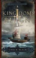
Kingdom's Reign (Kingdom Series #6)
by Chuck BlackAn evil army masses against the Knights of the Prince, and they are outnumbered. Only the King can save them…While the Knights of the Prince train in the Kingdom Across the Sea, the Dark Knight, Lucius, reigns in Arrethtrae with complete authority. But when a small group of loyalists swears allegiance to the King, the Prince returns, and in a mighty battle, Lucius and the Shadow Warriors are vanquished and imprisoned in the Wasteland. Peace and prosperity renew the land, and the Prince rules from the royal city of Chessington. While the heroic Cedric travels as ambassador, he sees that every corner of Arrethtrae reaps the benefits of prosperity brought to the land by the Prince’s reign. But not everyone will swear allegiance to the King, and it seems this paradise may be lost yet again because of the pride and greed of evil men who plot to free the Dark Knight and his minions. Cedric rides desperately to bring the news before it’s too late… Journey to Arrethtrae, where the King and His Son implement a bold plan to save their kingdom; where courage, faith, and loyalty stand tall in the face of opposition; where good will not bow to evil–where the King reigns…along with His Son!