- Table View
- List View
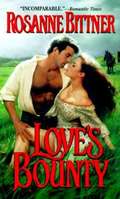
Love's Bounty
by Rosanne BittnerBent on revenge, Callie hires Chris, a bounty hunter, to chase down the outlaws who took her mother's life, stole her means of survival, and destroyed her innocent trust in the good of mankind. She does not know that the man she hires will steal something more from her--her heart.
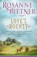
Love's Bounty (Zebra Historical Romance Ser.)
by Rosanne BittnerIn this historical romance, a proud ranch owner finds romance with a reckless bounty hunter while searching for her mother&’s killers. Life hasn&’t been easy on young Callie Hobbs. After her father&’s sudden death and her mother&’s murder, there isn&’t much left for her on the outskirts of Rawlins. Alone with a ranch to run, Callie could sell it all, cut her losses, and find a suitor in town. But Callie knows only one thing will bring her peace: Seeing her mother&’s killers hanged. To find them, she turns to the most ruthless bounty hunter on this side of the country: Christian Mercy. Distant and brooding, Christian Mercy is far from the ideal travel companion. But as their journey unfolds, Callie finds herself falling for those blue eyes that flicker with something deeper than she could have ever anticipated. He wants redemption. She wants revenge. And as they close in on their targets, Callie and Chris bite back a fear worse than death. Could their love for one another douse the burning rage that keeps them going?Praise for USA Today–bestselling Author Rosanne Bittner &“Power, passion, tragedy, and triumph are Rosanne Bittner&’s hallmarks. Again and again she brings readers to tears.&”—RT Book Reviews
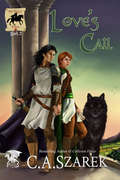
Love's Call: King's Riders Book Two (The King's Riders #2)
by C. A. SzarekBook Two of the Epic Fantasy Romance series, The King’s Riders! <p><p> Leargan Tegran, Captain of Greenwald’s personal guard, is an honorable knight. When his king commands him to wed Senior King’s Rider Ansley Fraser, he intends to follow orders; even as he knows nothing of the girl. Not to mention her blasted wolf bondmate, Ali, who barely lets him near her. <p> Ansley has been in love with Leargan for turns, but marrying him out of duty doesn’t sit well with her. She’ll fight the match tooth and nail—no matter how much she craves to be in his arms and in his bed. <p> The sudden appearance of Avril, a mysterious girl on the run, creates suspicions of powerful magic and evil lurking on the horizon. Dangers lead to a fight Leargan’s not prepared for. With the Province threatened, will duty interfere with Leargan’s orders or entwine him and Ansley regardless of their desires?
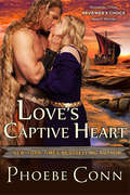
Love's Captive Heart: Author's Cut Edition
by Phoebe ConnEnslaved Handmaiden Finds Love and Freedom in the Viking Warrior Adventure Love's Captive Heart by Phoebe Conn920(AD), Land of the DanesThough she is the beloved handmaiden of Viking lord Raktor's spoiled daughter, Celiese d'Loganville is a slave in a gilded cage. When her mistress refuses to wed a man rumored to be horribly disfigured, Celiese seizes her chance for freedom—maybe even love.Mylan Vandahl has no need of a wife who pities him. But the enchanting—and perplexing—young woman, who fears him and boldly ignores his scars, arouses a need to soothe and tenderly seduce.But after a wedding night of unparalleled passion, the rising dawn reveals Celeise's treachery. Now in the fight of her life, for her dream of home and family, Celeise must find a way to heal Mylan's shattered trust.Other books by Phoebe ConnSavage DestinyDefiant DestinyForbidden DestinyWild DestinyScarlet Destiny
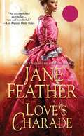
Love's Charade
by Jane FeatherFor an English nobleman, it&’s a dangerous time to be in Paris—and in love—in this suspenseful historical romance by a New York Times–bestselling author.When Justin, Earl of Linton, found a half-starved child on the streets of Paris in the highly charged days before the Terror, his only thought was a bit of charity. He never imagined he would find an incomparably lovely young woman beneath tattered boys&’ clothing—or that she would inspire in him a passion more intense than any he had ever known. But the beautiful Danielle had more secrets in store . . . and Justin would soon learn that one of them was a need for vengeance that might endanger them both.Praise for Love&’s Charade&“Hugely enjoyable historic romance with a rich plot, exciting adventure.&” —Noël Cades, author of The Substitute Bride
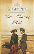
Love's Daring Risk
by Lauralee BlissAARON HARRIS LIVES A SIMPLE LIFE He's always been most at home with the sea-not with beautiful, sophisticated women like reporter Madeline Casey. So Aaron can hardly believe it when the newspaperwoman from the big city seems smitten with him. But soon he begins to suspect she'll do anything to get a scoop-even feign love. Madeline's desperate to save her family's newspaper. And a breaking story about two secretive brothers and their flying machine could be just the headline she needs. But as she chases her lead with Aaron's help, Madeline just might find herself sailing toward a happily-ever-after with the rugged seaman.
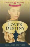
Love's Destiny
by Elizabeth MeyetteWhen Emily Wentworth’s father dies at sea, her father’s friend - and Emily’s appointed guardian - Jonathon Brentwood arrives at her home in London to take her with him to the colonies. Emily, just 17, has decided that she is fully capable of taking care of herself and sets out to prove that to her new guardian.<P><P> Emily’s one chance to remain in London is to marry, but when the opportunity arises, she knows she would rather follow Jonathon across an ocean to a land in upheaval than to stay safely in London.<P> But Jonathon’s involvement in patriot activity against England disturbs—and threatens—Emily, a loyal subject of the king. The colonial rebellion is the backdrop for misunderstanding, fear, mistrust, and danger. Will love’s destiny ensure that Emily and Jonathon stay together, even in the face of death?
Love's Destiny
by Elizabeth MeyetteWhen Emily Wentworth's father dies at sea, her father's friend - and Emily's appointed guardian - Jonathon Brentwood arrives at her home in London to take her with him to the colonies. Emily, just 17, has decided that she is fully capable of taking care of herself and sets out to prove that to her new guardian.Emily's one chance to remain in London is to marry, but when the opportunity arises, she knows she would rather follow Jonathon across an ocean to a land in upheaval than to stay safely in London.But Jonathon's involvement in patriot activity against England disturbs--and threatens--Emily, a loyal subject of the king. The colonial rebellion is the backdrop for misunderstanding, fear, mistrust, and danger. Will love's destiny ensure that Emily and Jonathon stay together, even in the face of death?Sensuality Level: SensualElizabeth Meyette's love of books was ignited when her older sister read Goldilocks and the Three Bears to her. That passion grew into a career as an English teacher, media specialist, poet, and author. She is fortunate to live in Michigan with her beloved husband, Richard, where they are inspired by their walks along the beautiful Great Lakes.

Love's Enduring Promise (Love Comes Softly #2)
by Janette OkeTragedy brought them together, but love bound them into a family. Love's Enduring Promise. Clark and Marty Davis, the pioneer couple thrown together after the death of their first spouses, now preside over a growing number of youngsters in their prairie home. Together they face the joys and trials of life on a homesteader's farm. Will they be able to find a suitable teacher for the long-awaited new school? Is the "very learned" Eastern preacher going to be able to communicate with the simple people of the West? And how do Clark and Marty guide their lovely daughter, now grown to womanhood, in her choice of a partner?
Love's Enlightenment: Rethinking Charity in Modernity
by Ryan Patrick HanleyA number of prominent moral philosophers and political theorists have recently called for a recovery of love. But what do we mean when we speak of love today? Love's Enlightenment examines four key conceptions of other-directedness that transformed the meaning of love and helped to shape the way we understand love today: Hume's theory of humanity, Rousseau's theory of pity, Smith's theory of sympathy, and Kant's theory of love. It argues that these four Enlightenment theories are united by a shared effort to develop a moral psychology that can provide both justificatory and motivational grounds for concern for others in the absence of recourse to theological or transcendental categories. In this sense, each theory represents an effort to redefine the love of others that used to be known as caritas or agape - a redefinition that came with benefits and costs that have yet to be fully appreciated.
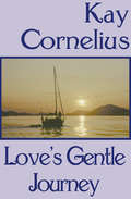
Love's Gentle Journey
by Kay CorneliusThe harsh beauty of the West becomes the backdrop for a romance between two Scottish immigrants in this captivating historical novel. A new world and a new way of life await young Ann McKay, as she makes the perilous journey across the ocean to the American frontier. Although she is afraid to leave the home and family that are all she has ever known, she knows that to grow she must move on. Caleb Craighead is a Scottish school-teacher, newly-ordained in the ministry. His firm beliefs and strong determination to make a difference in the world lead him to the shores of America. He feels that he has been called to this rough new land for a higher purpose. Little does he know that he will not be alone, as a special young woman comes to take her rightful place at his side.
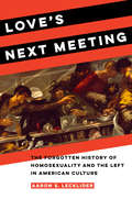
Love's Next Meeting: The Forgotten History of Homosexuality and the Left in American Culture
by Aaron LeckliderHow queerness and radical politics intersected—earlier than you thought. Well before Stonewall, a broad cross section of sexual dissidents took advantage of their space on the margins of American society to throw themselves into leftist campaigns. Sensitive already to sexual marginalization, they also saw how class inequality was exacerbated by the Great Depression, witnessing the terrible bread lines and bread riots of the era. They participated in radical labor organizing, sympathized like many with the early prewar Soviet Union, contributed to the Republicans in the Spanish Civil War, opposed US police and state harassment, fought racial discrimination, and aligned themselves with the dispossessed. Whether they were themselves straight, gay, or otherwise queer, they brought sexual dissidence and radicalism into conversation at the height of the Left's influence on American culture. Combining rich archival research with inventive analysis of art and literature, Love’s Next Meeting explores the relationship between homosexuality and the Left in American culture between 1920 and 1960. Aaron S. Lecklider uncovers a lively cast of individuals and dynamic expressive works, revealing remarkably progressive engagement with homosexuality among radicals, workers, and the poor. Leftists connected sexual dissidence with radical gender politics, antiracism, and challenges to censorship and obscenity laws through the 1920s and 1930s. In the process, a wide array of activists, organizers, artists, and writers laid the foundation for a radical movement through which homosexual lives and experiences were given shape and new political identities were forged. Love's Next Meeting cuts to the heart of some of the biggest questions in American history: questions about socialism, about sexuality, about the supposed clash still making headlines today between leftist politics and identity politics. What emerges is a dramatic, sexually vibrant story of the shared struggles for liberation across the twentieth century.
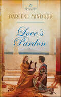
Love's Pardon
by Darlene MindrupA SOLDIER’S PROTECTIONWhen Roman commander Lucius Tindarium finds an injured woman in the desert outside Jerusalem, he rescues her and offers her a safe haven at his mother’s home. Something about the lovely and mysterious Anna touches a chord deep inside him. But how will he safeguard his heart from the truth of her painful past?Fleeing a cruel father and an unwanted marriage, Anna is extremely grateful to the powerful warrior who saved her life. Though she knows she can never have a future with a man who’s not a believer, she cares for him deeply. Can Anna make this hardened Roman soldier believe that their love can overcome all?
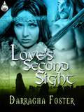
Love's Second Sight
by Darragha FosterAlive with all the passion of the Viking Age, this tale is a seductive clash between tradition, duty, honor, blossoming faith, and enduring love. Action! Adventure! Nasty gods and sexy Norsemen. Join Thorgunna as she braves Love's Second Sight. This may include the best read-aloud-to-each-other foreplay ever.Based on ancient Icelandic sagas, the story of Thorgunna and her predestined true love, Leif Eiricksson, comes alive with the force of a North Atlantic gale.She's a shrewd Viking Age businesswoman with two things Norsemen crave: her beer and her virginity. Not to mention that a nasty little demigod wants her as his "last refuge" of worship. All she wants is to be left alone to run her island and take care of her people. Not so easy when a storm blows true love your way.He is the son of Eirik the Red, founder of the colony of Greenland. Blown off course on his way to Norway, he must choose between the woman of his dreams and his duty to his father, his country, and his king.Fighting a king, Rus traders, and even the gods is nothing compared to the battle of wits and want between Thorgunna and the Norseman who insists on making her his--even if it's over his own dead body.
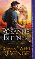
Love's Sweet Revenge
by Rosanne BittnerTheir Passion Shaped a NationOver the years, Jake and Miranda Harkner have endured all the dangers a wild and brutal West could throw at them. Now, settled on their ranch in the beautiful Colorado hill country, they've finally found peace. But for a man like Jake Harkner, danger is always lurking, and the world may not be ready for an infamous outlaw-turned-lawman-turned-legend to hang up his guns.Threatened by cruel men in search of revenge, the Harkner clan must be stronger than ever before. Yet nothing can stop the coming storm. With the Old West dying around them and the rules of this new world ever-changing, Jake vows to end the threat to his family no matter what it takes...Even if it means sacrificing himself so his beloved Miranda may live.Praise for Bestselling Historical Western Romances by Rosanne Bittner:"[A]n emotional powerhouse! The strong flavor of the Wild West combines with a beautiful love story, creating a true saga of the era... This classic historical western is destined for the 'keeper' shelf." -RT Book Reviews, Top Pick"A hero to set feminine hearts aflutter...western romance readers will thoroughly enjoy this." -Library Journal"Fans of such authors as Jodi Thomas and Georgina Gentry will enjoy Bittner's thrilling tale of crime and love in the Old West." -Booklist Online"One of the most powerful voices in western romance." -RT Book Reviews
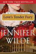
Love's Tender Fury: Love's Tender Fury; Love Me, Marietta; And When Love Commands (The Marietta Danver Trilogy #1)
by Jennifer WildeThis classic New York Times-bestselling historical romance tells the enthralling, passionate story of a young English woman who is wrongly convicted of a crime and auctioned off to the highest bidder in the American colonies <P><P> Born out of wedlock to a London barmaid, Marietta Danver yearns to live life to its fullest despite her humble origins. But her dreams of love and happiness almost die in Newgate Prison, where she is convicted of a crime she didn't commit and deported to North America to be sold into indentured servitude. In the wild Carolinas, Marietta uses her beauty to survive. But in doing so she arouses unruly passions in the hearts of three men: Derek Hawke, the enigmatic planter who buys Marietta for an outrageous sum; brash, charming Jeff Rawlins, who sweeps her away to Louisiana; and a gentleman whose fervor may conceal a violent madness. From New Orleans' red-light district to a fashionable estate in Natchez, from the struggles of a life of bondage to the perils of helping to transport slaves to freedom, Marietta vows to prevail and find a true and lasting love. The Marietta Danver Trilogy also includes Love Me, Marietta and When Love Commands.
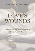
Love's Wounds: Violence and the Politics of Poetry in Early Modern Europe
by Cynthia N. NazarianLove's Wounds takes an in-depth look at the widespread language of violence and abjection in early modern European love poetry. Beginning in fourteenth-century Italy, this book shows how Petrarch established a pattern of inequality between suffering poet and exalted Beloved rooted in political parrhēsia. Sixteenth- and early seventeenth-century French and English poets reshaped his model into an idiom of extravagant brutality coded to their own historical circumstances. Cynthia N. Nazarian argues that these poets exaggerated the posture of the downtrodden lover, adapting the rhetoric of powerless desire to forge a new "countersovereignty" from within the heart of vulnerability—a potentially revolutionary position through which to challenge cultural, religious, and political authority. Creating a secular equivalent to the martyr, early modern sonneteers crafted a voice that was both critical and unstoppable because it suffered.Love’s Wounds tracks the development of the countersovereign voice from Francesco Petrarca to Maurice Scève, Joachim du Bellay, Théodore-Agrippa d’Aubigné, Edmund Spenser, and William Shakespeare. Through interdisciplinary and transnational analyses, Nazarian reads early modern sonnets as sites of contestation and collaboration and rewrites the relationship between early modern literary forms.
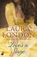
Love's a Stage
by Laura LondonA classic novel from acclaimed author Laura London, for fans of Julie Garwood, Jude Deveraux, Loretta Chase, Johanna Lindsey and Kathleen E. Woodiwiss. She didn't know she'd come face to face with one of England's most notorious rakes. She only knew the golden-haired stranger who came to her rescue as David. Miss Frances Atherton, country parson's daughter, has a lot to learn about London's wicked ways. But not even David's brash charms can distract her from her purpose: to trap the Blue Specter, the infamous smuggler for whose crimes her own father has been imprisoned. The trail is hot and leads to Drury Lane, where she treads the boards as an actress - a shocking profession for a lady. But more shocking still is the discovery that David - Lord Landry - is the most renowned and scandalous playwright of the day...and that she is losing her heart even as she stalks her dangerous prey.Fall in love with the richly romantic, classic love stories of Laura London, author of The Windflower, as her beloved novels are released in ebook for the first time.
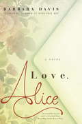
Love, Alice
by Barbara DavisFrom the author of Summer at Hideaway Key comes a sweeping new Southern women's fiction novel about forgiving the past one letter at a time... The truth lies between the lines... A year ago, Dovie Larkin's life was shattered when her fiancé committed suicide just weeks before their wedding. Now, plagued by guilt, she has become a fixture at the cemetery where William is buried, visiting his grave daily, waiting for answers she knows will never come. Then one day, she sees an old woman whose grief mirrors her own. Fascinated, she watches the woman leave a letter on a nearby grave. Dovie ignores her conscience and reads the letter--a mother's plea for forgiveness to her dead daughter--and immediately needs to know the rest of the story. As she delves deeper, a collection of letters from the cemetery's lost and found begins to unravel a decades-old mystery involving one of Charleston's wealthiest families. But even as Dovie seeks to answer questions about another woman's past--questions filled with deception, betrayal, and heartbreaking loss--she starts to discover the keys to love, forgiveness, and finally embracing the future...From the Trade Paperback edition.
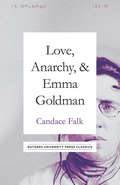
Love, Anarchy, & Emma Goldman: A Biography
by Candace Falk“What this remarkable book does . . . is to remind us of that passion, that revolutionary fervor, that camaraderie, that persistence in the face of political defeat and personal despair so needed in our time as in theirs.” —Howard Zinn “Fascinating …With marvelous clarity and depth, Candace Falk illuminates for us an Emma Goldman shaped by her time yet presaging in her life the situation and conflicts of women in our time.” —Tillie Olsen One of the most famous political activists of all time, Emma Goldman was also infamous for her radical anarchist views and her “scandalous” personal life. In public, Goldman was a firebrand, confidently agitating for labor reform, anarchism, birth control, and women’s independence. But behind closed doors she was more vulnerable, especially when it came to the love of her life. Reissued on the sesquicentennial of Emma Goldman's birth, Love, Anarchy, & Emma Goldman is an account of Goldman’s legendary career as a political activist. But it is more than that—it is the only biography of Emma Goldman. The flow of her life and words is at its core. Here, Candace Falk offers an intimate look at how Goldman’s passion for social reform dovetailed with her passion for one man: Chicago activist, hobo king, and red-light district gynecologist Ben Reitman. This takes us into the heart of their tumultuous love affair, finding that even as Goldman lectured on free love, she confronted her own intense jealousy. As director of the Emma Goldman papers, Falk had access to over 40,000 writings by Goldman—including her private letters and notes—and she draws upon these archives to give us a rare insight into this brilliant, complex woman’s thoughts. The result is both a riveting love story and a primer on an exciting, explosive era in American politics and intellectual life.
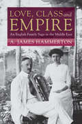
Love, Class and Empire: An English Family Saga in the Middle East (Modern British Histories)
by A. James HammertonEarly twentieth-century Persia and the Persian Gulf presented a largely blank slate to the British, best known only as a vital conduit to India and a site of contest – the 'great game' – with the Russian Empire. As oil discoveries and increasing trade brought new attention, the expanding telegraph and river shipping industries attracted resourceful men into junior positions in remote outposts. Love, Class and Empire explores the experiences of two of these men and their families. Drawing on a wealth of personal letters and diaries, A. James Hammerton examines the complexities of expatriate life in Iran and Iraq, in particular the impact of rapid social mobility on ordinary Britons and their families in the late imperial era. Uniquely, the study blends histories of empire with histories of marriage and family, closely exploring the nature of expatriate love and sexuality. In the process, Hammerton discloses a tender expatriate love story and offers a moving account of transient life in a corner of the informal empire.
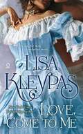
Love, Come to Me
by Lisa KleypasWhen strong and handsome Heath Rayne pulled Lucinda Caldwell from a winter river, he rescued her from an icy death. But soon he was plunging her into a torrid torrent of passion that this New England beauty had never suspected could claim her. Heath was unlike any other man Lucy had ever known: a dashing, mocking, sensuous Southerner who came as a stranger to Lucy's town-and stayed as he stripped away her last shreds of resistance to the demands of desire and the flaming fulfillment of love...
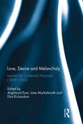
Love, Desire and Melancholy: Inspired by Constance Maynard (1849-1935)
by Elsa Richardson Angharad Eyre Jane MackelworthOriginally inspired by the digitisation of the autobiographical writings of Constance Maynard, this volume considers women’s historical experience of sexuality through the frame of the history of emotions. Constance Maynard (1849-1935) rose to prominence as the first Mistress and Principal of Westfield College, holding that position from 1882 to 1913. However, her writings offer more than an insight into the movement for women’s higher education. As pioneering feminist scholars such as Martha Vicinus have discovered, Maynard’s life writings are a valuable source for scholars of gender and sexuality. Writing about her relationships with other women teachers and students, Maynard attempted to understand her emotions and desires within the frame of her evangelical religious culture. The contributions to this volume draw out the significance of Maynard’s writings for the histories of gender, sexuality, religion, and the emotions. Interdisciplinary in nature, they use the approaches of literary studies, architecture studies, and life writing to understand Maynard and her historical significance. This book was originally published as a special issue of Women’s History Review.
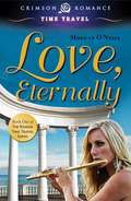
Love, Eternally (Rowan Time Travel #1)
by Morgan O'NeillA witch's ancient curse propels talented flutist Gigi Perrin back to A.D. 408, to the court of the depraved Roman Emperor Honorius and his admirable sister, Princess Galla Placidia.<P><P> There, Gigi grapples with her disbelief about what has happened, and with the strange, new world of violent politics, social upheaval, and Visigoth barbarians straining at the very gates of an empire.<P> Through it all, she must struggle with her powerful attraction to a pagan senator and military commander, Quintus Magnus, a man exotically different from anyone she has ever known. On the brink of a dark and war-torn age, Gigi joins forces with Magnus, battling to save a princess and her people, and ultimately finding love amid the chaos, before the fall of Rome.
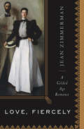
Love, Fiercely: A Gilded Age Romance
by Jean ZimmermanThe true story of the New York society couple portrayed in the John Singer Sargent painting—an architect and an heiress who became passionate reformers. Contemporaries of the Astors and Vanderbilts, they grew up together along the shores of bucolic Staten Island, linked by privilege—her grandparents built the world&’s fastest clipper ship, while his family owned most of Murray Hill. Theirs was a world filled with mansions, balls, summer homes, and extended European vacations. This fascinating biography re-creates the glittering world of Edith Minturn and Isaac Newton Phelps Stokes—and reveals how their love for each other was matched by their dedication to others. Newton became a passionate preserver of New York history and published the finest collection of Manhattan maps and views in a six-volume series. Edith became the face of the age when Daniel Chester French sculpted her for Chicago&’s Columbian Exposition, a colossus intended to match the Statue of Liberty&’s grandeur. But beyond their life of prominence and prestige, Edith and Newton battled together on behalf of New York&’s poor and powerless—and through it all, sustained a strong-rooted marriage. From the splendid cottages of the Berkshires to the salons of 1890s Paris, Love, Fiercely tells the real-life story behind Mr. and Mrs. I .N. Phelps Stokes—one of the Gilded Age&’s most famous works of art. &“With an impressive amount of research behind every page, Zimmerman manages to capture the sweeping drama of the turn of the century as well as the compelling story of a couple who knew how to love, fiercely. Her superb pacing and gripping narrative will appeal to all who enjoy history, biography, and real-life romance.&” —Library Journal