- Table View
- List View
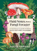
Field Notes from a Fungi Forager: An Illustrated Journey Through the World of Pacific Northwest Mushrooms
by Ashley RodriguezThis gorgeously illustrated compendium is a love letter to mushrooms—and to the Pacific Northwest.From evergreen forests shrouded in mist to the urban backyards of Seattle, mushrooms are everywhere in the Pacific Northwest if you know how to look.Here, forager-chef and forest therapy guide Ashley Rodriguez provides an evocative and personal survey of 50 of the most fantastic mushrooms to be found in the region. This book includes the famous Morchella (morel) and Cantharellus (chanterelle) as well as lesser-known species, like the blueish purple Clitocybe nuda (wood blewit) which smells like frozen orange juice, and Hydnellum peckii (Bleeding tooth fungus), which oozes brilliant red droplets that are widely used as a natural dye. Through the lens of these humble fungi, the interconnectedness of all living things comes into focus.Here you&’ll find:An introduction to mushrooms in the Northwest landscape.Best practices for mushroom foraging and appreciation.50 mushroom profiles, includes information about each mushroom&’s appearance (plus scientific illustrations of each species), what distinguishes them from other species, how they have been used throughout different cultures and lore, and personal field notes from the forest floor.The most prized edible species are paired with mouthwatering sidebars about ways to use that mushroom in the kitchen. Infused with a forager-chef's love of edible mushrooms as well as the reverence of an eco-spiritual guide, this fully illustrated book is as much a treat to read as is to look at.
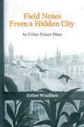
Field Notes from a Hidden City: An Urban Nature Diary
by Esther WoolfsonField Notes From a Hidden City is set against the background of the austere, grey and beautiful northeast Scottish city of Aberdeen. In it, Esther Woolfson examines the elements-geographic, atmospheric and environmental-which bring diverse life forms to live in close proximity in cities. Using the circumstances of her own life, house, garden and city, she writes of the animals who live among us: the birds-gulls, starlings, pigeons, sparrows and others-the rats and squirrels, the cetaceans, the spiders and the insects.In beautiful, absorbing prose, Woolfson describes the seasons, the streets and the quiet places of her city over the course of a year, which begins with the exceptional cold and snow of 2010. Influenced by her own long experience of corvids, she considers prevailing attitudes towards the natural world, urban and non-urban wildlife, the values we place on the lives of individual species and the ways in which man and creature live together in cities.
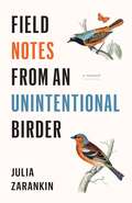
Field Notes from an Unintentional Birder: A Memoir
by Julia ZarankinA writer discovers an unexpected passion for birding, along with a new understanding of the world and her own place in it. <P><P>When Julia Zarankin saw her first red-winged blackbird at the age of thirty-five, she didn’t expect that it would change her life. Recently divorced and auditioning hobbies during a stressful career transition, she stumbled on birdwatching, initially out of curiosity for the strange breed of humans who wear multi-pocketed vests, carry spotting scopes and discuss the finer points of optics with disturbing fervor. What she never could have predicted was that she would become one of them. Not only would she come to identify proudly as a birder, but birding would ultimately lead her to find love, uncover a new language and lay down her roots. <P><P>Field Notes from an Unintentional Birder tells the story of finding meaning in midlife through birds. The book follows the peregrinations of a narrator who learns more from birds than she ever anticipated, as she begins to realize that she herself is a migratory species: born in the former Soviet Union, growing up in Vancouver and Toronto, studying and working in the United States and living in Paris. Coming from a Russian immigrant family of concert pianists who believed that the outdoors were for “other people,” Julia Zarankin recounts the challenges and joys of unexpectedly discovering one’s wild side and finding one’s tribe in the unlikeliest of places. <P><P>Zarankin’s thoughtful and witty anecdotes illuminate the joyful experience of a new discovery and the surprising pleasure to be found while standing still on the edge of a lake at six a.m. In addition to confirmed nature enthusiasts, this book will appeal to readers of literary memoir, offering keen insight on what it takes to find one’s place in the world.
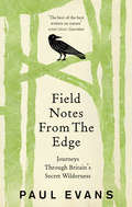
Field Notes from the Edge
by Paul Evans‘A profoundly satisfying read’ Financial TimesIn Field Notes from the Edge, the acclaimed writer of the Guardian's 'Country Diary', Paul Evans, takes us on a journey through the in-between spaces of Nature – such as strandlines, mudflats, cliff tops and caves – where one wilderness is on the verge of becoming another and all things are possible. Here, Evans searches out wildlife and plants to reveal a Nature that is inspiring yet intimidating; miraculous yet mundane; part sacred space, part wasteland. It is here that we tread the edge between a fear of Nature’s dangers and a love of Nature’s beauty.Combining a naturalist’s eye for observation with a poet’s ear for the lyrical, Field Notes from the Edge confirms Paul Evans's place among our leading nature writers today.
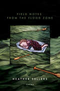
Field Notes from the Flood Zone (American Poets Continuum Series #192)
by Heather SellersFrom the frontlines of climate catastrophe, a poet watches the sea approach her doorstep. Born and raised in Florida, Heather Sellers grew up in an extraordinarily difficult home. The natural world provided a life-giving respite from domestic violence. She found, in the tropical flora and fauna, great beauty and meaningful connection. She made her way by trying to learn the name of every flower, every insect, every fish and shell and tree she encountered. That world no longer exists. In this collection of poems, Sellers laments its loss, while observing, over the course of a year, daily life of the people and other animals around her, on her street, and in her low-lying coastal town, where new high rises soar into the sky as the storm clouds gather with increasing intensity and the future of the community—and seemingly life as we know it—becomes more and more uncertain. Sprung from her daily observation journals, haunted by ghosts from the past, Field Notes from the Flood Zone is a double love letter: to a beautiful and fragile landscape, and to the vulnerable young girl who grew up in that world. It is an elegy for the two great shaping forces in a life, heartbreaking family struggle and a collective lost treasure, our stunning, singular, desecrated Florida, and all its remnant beauty.
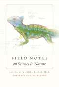
Field Notes on Science and Nature
by Michael R. CanfieldOnce in a great while, as the New York Times noted recently, a naturalist writes a book that changes the way people look at the living world. John James Audubonâe(tm)s Birds of America, published in 1838, was one. Roger Tory Petersonâe(tm)s 1934 Field Guide to the Birds was another. How does such insight into nature develop? Pioneering a new niche in the study of plants and animals in their native habitat, Field Notes on Science and Nature allows readers to peer over the shoulders and into the notebooks of a dozen eminent field workers, to study firsthand their observational methods, materials, and fleeting impressions. What did George Schaller note when studying the lions of the Serengeti? What lists did Kenn Kaufman keep during his 1973 âeoebig yearâe#157;? How does Piotr Naskrecki use relational databases and electronic field notes? In what way is Bernd Heinrichâe(tm)s approach âeoetruly Thoreauvian,âe#157; in E. O. Wilsonâe(tm)s view? Recording observations in the field is an indispensable scientific skill, but researchers are not generally willing to share their personal records with others. Here, for the first time, are reproductions of actual pages from notebooks. And in essays abounding with fascinating anecdotes, the authors reflect on the contexts in which the notes were taken. Covering disciplines as diverse as ornithology, entomology, ecology, paleontology, anthropology, botany, and animal behavior, Field Notes offers specific examples that professional naturalists can emulate to fine-tune their own field methods, along with practical advice that amateur naturalists and students can use to document their adventures.
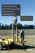
Field Sampling for Environmental Science and Management
by Richard Webster Murray LarkScientists and consultants need to estimate and map properties of the terrestrial environment. These include plant nutrients and parasites in soil, gaseous emissions from soil, pollutant metals and xenobiotics in waste and contaminated land, salt in groundwater and species abundances above ground. The scale varies from small experimental plots to catchments, and the land may be enclosed in fields or be open grassland, forest or desert. Those who sample the variables to obtain the necessary data need guidance on the design and analysis of sampling methods for their conclusions and recommendations to be valid. This book provides that guidance, backed by sound rationale and statistical theory. It concentrates on design-based sampling for estimates of mean values of environmental properties, emphasizing replication and randomization. It starts with simple random sampling and then progresses to more efficient designs, such as spatially stratified random sampling, stratification by classes and cluster sampling. It includes a section on purposive sampling in classical soil survey, which is relevant to other environmental properties such as vegetation. It also describes the effects of bulking on errors and the use of ancillary information and regression to improve estimates. The authors draw the important distinction between design-based sampling for estimating means and model-based methods (geostatistics) for local spatial prediction and mapping, and focus on the latter. They describe designs suitable for computing variograms and prediction by kriging, as well as a staged approach, so that sampling is neither inadequate nor excessive, and designs adapt as knowledge is accumulated. Including numerous worked case studies of sampling in agriculture, ecology and environmental science, the book will be of immediate practical value.
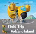
Field Trip to Volcano Island (Field Trip Adventures)
by John HareA wordless picture book adventure takes a group of students to visit a thrilling volcanic island. Perfect for fans of Field Trip to the Moon, Field Trip to the Ocean Deep, and field trips in general!John Hare&’s rich, atmospheric art invites all children to imagine themselves in the story – a story full of surprises and adorable new friends.The same students we met in Field Trip to the Moon and Field Trip to the Ocean Deep travel to a volcano island on a yellow school bus helicopter. When they get there, one student picks flowers as they hike to the top and then accidentally slips down a crater and can&’t get out.The student isn&’t too worried--especially when he meets a lava monster and its children who are fascinated by the flowers. But when they touch them, they burn beyond recognition so the student teaches them how to make a vase using lava from a lava pit, fills it with water from a canteen, and they all sit back to enjoy the flower arrangement until help arrives and rescues the student.A Junior Library Guild Gold Standard SelectionPraise for previous books by John Hare Field Trip to the MoonA Junior Library Guild Gold Standard SelectionA School Library Journal Best Book of the Year A Horn Book Best Book of the Year A Bank Street Best Book of the Year - Outstanding Merit Field Trip to the Ocean DeepA Junior Library Guild Gold Standard Selection"Fans of the previous field-trip story will be pleased to see allusions to it, including character cameos and a glimpse of the space bus."—The Horn Book
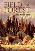
Field and Forest: Classic Hunting Stories
by Stephen J. BodioFor hunters, listening to the accounts of kindred spirits recalling the drama and action that go with good days afield ranks among life's most pleasurable activities. This newly updated volume - with an introduction by editor Stephen J. Bodio -- contains some of the best hunting tales ever written, stories that sweep from charging elephants in the African bush to mountain goats in the mountain crags of the Rockies, from the gallant bird dogs of the Southern pinelands to the great Western hunts of Theodore Roosevelt. Stories include:The Wilderness Hunter by Theodore RooseveltTige&’s Lion by Zane GreyLobo: The King of Currumpaw by Ernest Seton-ThompsonMy Antelope by Grace Gallatin Seton-ThompsonThe Alaskan Grizzly by Harold McCrackenWolf-Hunting in Russia by Henry T. AllenHunting on the Turin Plain by Roy Chapman Andrews
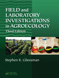
Field and Laboratory Investigations in Agroecology
by Stephen R. GliessmanAgroecology is defined as the application of ecological concepts and principles to the design and management of sustainable food systems. Hence, learning can best be achieved through an experiential approach to the topic. Designed to accompany Agroecology: The Ecology of Sustainable Food Systems, Third Edition, Field and Laboratory Investigations i
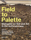
Field to Palette: Dialogues on Soil and Art in the Anthropocene
by Alexandra Toland Jay Stratton Noller Gerd WessolekField to Palette: Dialogues on Soil and Art in the Anthropocene is an investigation of the cultural meanings, representations, and values of soil in a time of planetary change. The book offers critical reflections on some of the most challenging environmental problems of our time, including land take, groundwater pollution, desertification, and biodiversity loss. At the same time, the book celebrates diverse forms of resilience in the face of such challenges, beginning with its title as a way of honoring locally controlled food production methods championed by "field to plate" movements worldwide. By focusing on concepts of soil functionality, the book weaves together different disciplinary perspectives in a collection of dialogue texts between artists and scientists, interviews by the editors and invited curators, essays and poems by earth scientists and humanities scholars, soil recipes, maps, and DIY experiments. With contributions from over 100 internationally renowned researchers and practitioners, Field to Palette presents a set of visual methodologies and worldviews that expand our understanding of soil and encourage readers to develop their own interpretations of the ground beneath our feet.
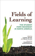
Fields of Learning: The Student Farm Movement in North America (Culture Of The Land Ser.)
by Laura Sayre and Sean Clark“Essays from staff on 15 farms . . . illustrate the trials, tribulations and sheer joys of establishing and maintaining such enterprises.” —USA TodayOriginally published in 2011, Fields of Learning remains the single best resource for students, faculty, and administrators involved in starting or supporting campus farms. Featuring detailed profiles of fifteen diverse student farms on college and university campuses across North America, the book also serves as a history of the student farm movement, showing how the idea of campus farms has come in and out of fashion over the past century and how the tenacious work of students, faculty, and other campus community members has upheld and reimagined the objectives of student farming over time. Ranging in size from less than an acre to hundreds of acres, supplying food to campus dining halls or community food banks, and hosting scientific research projects or youth education programs, student farms highlight the interdisciplinary richness and multifunctionality of agriculture, supporting academic work across a range of fields while simultaneously building community engagement and stimulating critical conversations about environmental and social justice. As institutions of higher learning face new challenges linked to the global climate crisis and public health emergency, this book holds continued relevance for readers in North America and beyond.“A timely and hopeful book.” —Jason Peters, editor of Wendell Berry: Life and Work“The opportunity for students to spend time learning on campus farms is not just a good idea—it should be mandatory.” —Gary Hirshberg, President & CEO, Stonyfield Farm“An excellent book, useful for anyone interested in the past, or the future, of the student farm movement.” —Journal of Agricultural & Food Information
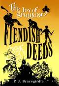
Fiendish Deeds
by BracegirdleDo you dare set foot in Spooking? It's the terrible town on the hideous hill -- and Joy Wells is a proud resident. A fan of classic horror stories, Joy is convinced that famous author E. A. Peugeot based his spine-tingling tales on Spooking. Take the eerie similarities between the nearby swamp and the setting of his masterpiece, "The Bawl of the Bog Fiend." Could the story be true? Could the bog fiend be on the loose? Things become truly horrifying when Joy learns that Darlington, the despicable suburban city where she is forced to go to school, is planning to build a water park over her beloved bog. It is up to her to safeguard the endangered area and its secrets. Little does she know that there is someone determined to destroy not only the bog but the town of Spooking itself -- and anyone who dares stand in his way. P. J. Bracegirdle spins a yarn of delicious devilry and macabre mayhem in the very first book of The Joy of Spooking trilogy.
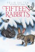
Fifteen Rabbits
by Felix Salten Whittaker ChambersBurrow into this classic tale about a family of rabbits from the author of Bambi.Hops and his young rabbit friends must face all the triumphs and trials in the first year of life in the woods. Life is dangerous in the forest, especially for the fifteen young rabbits who are learning to navigate their home. While there are many wonderful things and other animals to get to know--including a deer by the name of Bambi--there are also dangers, and the constant threat of man. In order to thrive, the rabbits must stick together... Felix Salten's story of the lives of fifteen rabbits is brought back to life in this beautiful repackage.
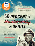
Fifty Percent of Mountaineering is Uphill: The Life of Canadian Mountain Rescue Pioneer Willi Pfisterer
by Susanna PfistererShortlisted for the Alberta Readers' Choice Award!Fifty Percent of Mountaineering Is Uphill is the enthralling true story of Jasper’s Willi Pfisterer, a legend in the field of mountaineering and safety in the Rocky Mountains. For more than thirty years, Willi was an integral part of Jasper’s alpine landscape, guiding climbers up to the highest peaks, and rescuing them from perilous situations.Originally from Austria, this mountain man came to Canada in the 1950s to assail the Rockies, and stayed to become an integral part of mountain safety in Western Canada and the Yukon. His daughter, Susanna Pfisterer, has shaped his stories and lectures as an engaging and educational adventure story that features over 100 archival photographs, including avalanches in the National Parks, highlights from climbing 1,600 peaks and participating in over 700 rescues, and guiding adventures with prime ministers. Accompanied by the humorous wisdom of the “Sidehillgouger,” readers will traverse an historical and spectacular terrain.
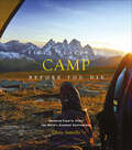
Fifty Places to Camp Before You Die: Camping Experts Share the World's Greatest Destinations (Fifty Places)
by Chris SantellaExplore the world&’s top spots for sleeping under the stars—includes beautiful photos, travel tips, and more! The book features the best destinations for exploring the great outdoors and enjoying the recreational activities that make camping such a time-honored tradition—whether your preference is roughing it in nature or enjoying a campground with all the amenities, a solo hike or a family gathering around the fire. Featuring favorite US National Parks destinations—as well as more exotic locales in Italy, Chile, France, Botswana, Thailand, Germany, and more—Fifty Places to Camp Before You Die provides photographs, helpful if-you-go information, the history behind each site, and tips useful to novice and seasoned campers alike. &“Showcases some of the world&’s most beautiful campsites.&” —The New York Times
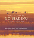
Fifty Places to Go Birding Before You Die: Birding Experts Share the World's Geatest Destinations (Fifty Places)
by Chris SantellaIt’s estimated that 50 to 60 million Americans count birding among their hobbies. Some hang feeders in their backyards and accumulate yard lists; others participate in annual “Christmas Counts”; a select few travel to the ends of the earth in an effort to see every bird in the world. With Fifty Places to Go Birding Before You Die, Chris Santella takes the best-selling “Fifty Places” recipe and applies it to this most popular pastime. Santella presents some of the greatest bird-watching venues in the United States and abroad through interviews with prominent birders, from tour leaders and conservationists to ornithologists and academics. Interviewees include ornithologist Kenn Kaufman; David Allen Sibley, author and illustrator of The Sibley Guide to Birds; Rose Ann Rowlett, the “mother of modern birding”; John Fitzpatrick, director of the Cornell Lab of Ornithology; and Steve McCormick, president and CEO of The Nature Conservancy. The places vary from the urban (New York City’s Central Park) to the mystical (the cloud forests of Triunfo in Chiapas, Mexico) to the extremely remote (the sub-Arctic islands of New Zealand). The book includes 40 gorgeous photographs that capture the vibrancy of our feathered friends, and the beautiful places they call home.
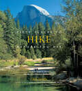
Fifty Places to Hike Before You Die: Outdoor Experts Share the World's Greatest Destinations (Fifty Places Ser.)
by Chris SantellaA breathtaking guide to fifty of the world’s greatest locations to hike, as selected by the experts who have been there.Fifty Places to Hike Before You Die is the latest offering in the bestselling Fifty Places series. Chris Santella, along with top expedition leaders, explores the world’s greatest walking adventures. Some, such as the Lunana Snowman Trek in Bhutan and the Kangshung Valley Trek in Tibet, are grueling multiweek adventures at high altitudes. Others, such as Japan’s Nakesando Trail, move leisurely from village to village, allowing walkers to immerse themselves in the local culture. Whether it’s climbing the Rwandan mountains to view mountain gorillas or strolling through bistros along Italy’s Amalfi Coast, there’s a memorable hike at everyone’s level within these 50 chapters. With commentaries from expert trekkers and insider tips that lead the reader off the beaten path, Santella has again captured the special characteristics that make these must-visit destinations.
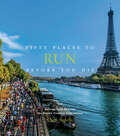
Fifty Places to Run Before You Die: Running Experts Share the World's Greatest Destinations (Fifty Places)
by Chris SantellaA breathtaking guide to the world’s fifty best places to run, as chosen by experts who’ve been there.The beautiful thing about running is that all you need is a trusty pair of shoes and a little determination. When you can practice a sport almost anywhere, from your own neighborhood to courses across the world, where do you begin? In Fifty Places to Run Before You Die, Chris Santella gathers fifty bucket list recommendations from some of the running world’s most accomplished leaders and athletes, including ultra-runner and record breaker Jim Walmsley; Runner’s World chief running officer Bart Yasso; NPR star Peter Sagal; race director of the Boston Marathon Dave McGillivray; U.S. Olympian Magdalena Lewy Boulet; and internationally recognized endurance athlete Dean Karnazes.Featuring a mix of popular foot races (such as marathons, 10Ks, and endurance runs) and scenic trails off the beaten path, this book divulges what makes each venue unique, offering firsthand anecdotes and practical advice for those who aspire to run there. Discover incredible events and trails both national and international, including the Ultra-Trail du Mont-Blanc in France, the New York City Marathon, the Vancouver Sun Run, the Grand Canyon, the Dolomites in Italy, and the Great Ocean Road Marathon in Australia. Fifty Places to Run Before You Die is the essential travel companion for runners of all levels who seek to conquer new terrain while breaking personal records.
Fifty Plants That Changed the Course of History
by Bill LawsOf course, we are entirely dependent on plants for our food and the air we breathe, but did you know that 5,000 mature English oak trees were used in the construction of Admiral Nelson’s flagship HMS Victory, or that sweet peas were involved in the birth of the science of genetics? King Cotton was the driver of the slave trade, which was the first domino to fall in the American Revolution, and cotton was also the catalyst for the Industrial Revolution. <p><p>These, and many other extraordinary facts in Fifty Plants that Changed the Course of History, highlight the dynamic ways in which plants have influenced human history. This beautifully designed and illustrated volume provides an engaging guide to the fifty key plants that have had the most impact on human history. Packed full of information, the book includes details about the habitat and characteristics of each plant, fact boxes, full colour photographs and lovely botanical illustrations. Weaving together strands of economic, political and agricultural history, each entry is a fascinating look at the most influential plants known to mankind.
Fifty Years of the British Indian Ocean Territory: Legal Perspectives (The World of Small States #4)
by Stephen Allen Chris MonaghanThis book offers a detailed account of the legal issues concerning the British Indian Ocean Territory (Chagos Islands) by leading experts in the field. It examines the broader significance of the ongoing Bancoult litigation in the UK Courts, the Chagos Islanders' petition to the European Court of Human Rights and Mauritius' successful challenge, under the UN Convention of the Law of the Sea, to the UK government's creation of a Marine Protected Area around the Chagos Archipelago. This book, produced in response to the 50th anniversary of the BIOT's founding, also assesses the impact of the decisions taken in respect of the Territory against a wider background of decolonization while addressing important questions about the lawfulness of maintaining Overseas Territories in the post-colonial era.The chapter ‘Anachronistic As Colonial Remnants May Be...’ - Locating the Rights of the Chagos Islanders As A Case Study of the Operation of Human Rights Law in Colonial Territories is open access under a CC BY 4.0 license via link.springer.com.
Fig Trees and Humans: Ficus Ecology and Mutualisms across Cultures (Environmental Anthropology and Ethnobiology #32)
by Martine Hossaert-McKey Yildiz Aumeeruddy-ThomasHumans and figs form hybrid communities within the context of anthropogenic landscapes, supported by biocultural mutualisms driven by traits of Ficus species and people’s imagination and practices, and where humans also positively influence Ficus species ecology. Fig Trees and Humans examines the interactions between the biology and ecology of the genus Ficus and how humans use and think of Ficus species across the tropics and in the Mediterranean region. It demonstrates a high level of convergence of material and symbolic uses of human-fig interactions that affect various aspects of human culture, as well as the ecology of wild or cultivated Ficus species.
Fight Global Warming Now: The Handbook for Taking Action in Your Community
by Bill MckibbenBestselling author Bill McKibben turns activist in the first hands-on guidebook to stopping climate change, the world's greatest threats Hurricane Katrina, a rapidly disappearing Arctic and the warmest winter on the East Coast in recorded history. The leading scientist at NASA warns that we have only ten years to reverse climate change; the British government's report on global warming estimates that the financial impact will be greater than the Great Depression and both world wars-combined. Bill McKibben, the author of the first major book on global warming, "The End of Nature," warns that it's no longer time to debate global warming, it's time to fight it. Drawing on the experience of 'Step It Up,' a national day of rallies held on April 14, McKibben and the 'Step It Up' team of organizers provide the facts of what must change to save the climate and show how to build the fight in your community, church, or college. They describe how to launch online grassroots campaigns, generate persuasive political pressure, plan high-profile events that will draw media attention, and other effective actions. This essential book offers the blueprint for a mighty new movement against the most urgent challenge facing us today.
Fighting Dirty: How a Small Community Took on Big Trash
by Poh-Gek ForkertFighting Dirty tells the story of how one small group of farmers, small-town residents, and Indigenous people fought the world’s largest waste disposal company to stop them from expanding a local dumpsite into a massive landfill. As one of the experts brought in to assess the impact the toxic waste would have on the community, Poh-Gek Forkert was part of the adventures and misadventures of their decades-long fight.
Fighting Environmental Crime in Europe and Beyond
by Christoph H. Stefes Ragnhild Sollund Anna Rita GermaniThis book will bring together the findings of a multi-disciplinary and international research project funded by the European Union (EU). "European Union Action to Fight Environmental Crime" (EFFACE) was a 40-month research project that included eleven European research institutions and think tanks and was led by Ecologic Institute Berlin. EFFACE assessed the impacts of environmental crime as well as effective and feasible policy options for combating it from an multidisciplinary perspective, with a focus on the EU. As part of this project, numerous instances of environmental crime within and outside of the EU were studied and are now presented in this volume. This edited collection is highly innovative in showing not only the many facets of environmental crime, but also how it should be conceptualised and the consequences. An original and rigorous study, this book will be of particular interest to policy makers and scholars of green criminology and environmental studies.