- Table View
- List View
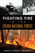
Fighting Fire in the Sierra National Forest
by Marcia Penner FreedmanTo live in the foothills on the periphery of the Sierra National Forest is to live with the certainty of summer wildfires. Each year, from April forward, Californians watch the sky and sniff the air for telltale signs of smoke. While fire remains a constant threat, the strategy for combating it has evolved with the understanding of its beneficial role in the forest environment. Marcia Penner Freedman traces the history of firefighting and fire management from the forest's early years through the policy shifts that began in the 1960s and the measures used today.
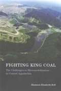
Fighting King Coal: The Challenges to Micromobilization in Central Appalachia
by Shannon Elizabeth BellIn the coal-mining region of Central Appalachia, mountaintop-removal mining and coal-industry-related flooding, water contamination, and illness have led to the emergence of a grassroots, women-driven environmental justice movement. But the number of local activists is small relative to the affected population, and recruiting movement participants from within the region is an ongoing challenge. In Fighting King Coal, Shannon Elizabeth Bell examines an understudied puzzle within social movement theory: why so few of the many people who suffer from industry-produced environmental hazards and pollution rise up to participate in social movements aimed at bringing about social justice and industry accountability. Using the coal-mining region of Central Appalachia as a case study, Bell investigates the challenges of micromobilization through in-depth interviews, participant observation, content analysis, geospatial viewshed analysis, and an eight-month "Photovoice" project -- an innovative means of studying, in real time, the social dynamics affecting activist involvement in the region. Although the Photovoice participants took striking photographs and wrote movingly about the environmental destruction caused by coal production, only a few became activists. Bell reveals the importance of local identities to the success or failure of local recruitment efforts in social movement struggles, ultimately arguing that, if the local identities of environmental justice movements are lost, the movements may also lose their power.
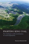
Fighting King Coal: The Challenges to Micromobilization in Central Appalachia (Urban and Industrial Environments)
by Shannon Elizabeth BellAn examination of why so few people suffering from environmental hazards and pollution choose to participate in environmental justice movements. In the coal-mining region of Central Appalachia, mountaintop-removal mining and coal-industry-related flooding, water contamination, and illness have led to the emergence of a grassroots, women-driven environmental justice movement. But the number of local activists is small relative to the affected population, and recruiting movement participants from within the region is an ongoing challenge. In Fighting King Coal, Shannon Elizabeth Bell examines an understudied puzzle within social movement theory: why so few of the many people who suffer from industry-produced environmental hazards and pollution rise up to participate in social movements aimed at bringing about social justice and industry accountability. Using the coal-mining region of Central Appalachia as a case study, Bell investigates the challenges of micromobilization through in-depth interviews, participant observation, content analysis, geospatial viewshed analysis, and an eight-month “Photovoice” project—an innovative means of studying, in real time, the social dynamics affecting activist involvement in the region. Although the Photovoice participants took striking photographs and wrote movingly about the environmental destruction caused by coal production, only a few became activists. Bell reveals the importance of local identities to the success or failure of local recruitment efforts in social movement struggles, ultimately arguing that, if the local identities of environmental justice movements are lost, the movements may also lose their power.
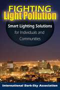
Fighting Light Pollution
by The International Dark-Sky AssociationThe first practical guide to alleviating an increasingly prevalent environmental concern.
Fighting Toxics: A Manual for Protecting your Family, Community, and Workplace
by John O'Connor Barry Commoner Gary Cohen Barry National Toxics CampaignFighting Toxics is a step-by-step guide illustrating how to investigate the toxic hazards that may exist in your community, how to determine the risks they pose to your health, and how to launch an effective campaign to eliminate them.
Fighting Westway: Environmental Law, Citizen Activism, and the Regulatory War That Transformed New York City
by William W. BuzbeeFrom 1971 to 1985, battles raged over Westway, a multibillion-dollar highway, development, and park project slated for placement in New York City. It would have projected far into the Hudson River, including massive new landfill extending several miles along Manhattan's Lower West Side. The most expensive highway project ever proposed, Westway also provoked one of the highest stakes legal battles of its day. In Fighting Westway, William W. Buzbee reveals how environmentalists, citizens, their lawyers, and a growing opposition coalition, despite enormous resource disparities, were able to defeat this project supported by presidents, senators, governors, and mayors, much of the business community, and most unions. Although Westway's defeat has been derided as lacking justification, Westway's critics raised substantial and ultimately decisive objections. They questioned claimed project benefits and advocated trading federal Westway dollars for mass transit improvements. They also exposed illegally disregarded environmental risks, especially to increasingly scarce East Coast young striped bass often found in extraordinarily high numbers right where Westway was to be built.Drawing on archival records and interviews, Buzbee goes beyond the veneer of government actions and court rulings to illuminate the stakes, political pressures, and strategic moves and countermoves that shaped the Westway war, a fight involving all levels and branches of government, scientific conflict, strategic citizen action, and hearings, trials, and appeals in federal court. This Westway history illuminates how high-stakes regulatory battles are fought, the strategies and power of America's environmental laws, ways urban priorities are contested, the clout of savvy citizen activists and effective lawyers, and how separation of powers and federalism frameworks structure legal and political conflict. Whether readers seek an exciting tale of environmental, political, and legal conflict, to learn what really happened during these battles that transformed New York City, or to understand how modern legal frameworks shape high stakes regulatory wars, Fighting Westway will provide a good read.
Fighting for Farming Justice: Diversity, Food Access and the USDA (Earthscan Food and Agriculture)
by Terri R. JettThis book provides a detailed discussion of four class-action discrimination cases that have recently been settled within the United States Department of Agriculture (USDA) and have led to a change in the way in which the USDA supports farmers from diverse backgrounds. These settlements shed light on why access to successful farming has been so often limited to white men and/or families, and significantly this has led to a change for opportunities in the way the USDA supports famers from diverse backgrounds. With chapters focusing on each settlement Jett provides an overview of the USDA before diving into a closer discussion of the four key settlements, involving African American farmers (Pigford), Native Americans (Keepseagle), Woman famers (Love) and Latino(a) farmers (Garcia), and the similarities between each. This title places and emphasis on what is happening in farming culture today, drawing connections between these four settlements and the increasing attention on urban farming, community gardens, farmers markets, organic farming and the slow food movement, through to the larger issues of food justice and access to food. Fighting for Farming Justice will be of interest to scholars of food justice and the farming arena, as well as those in the fields of Agricultural Economics, Civil Rights Law and Ethic Studies.
Fighting for Love in the Century of Extinction: How Passion and Politics Can Stop Global Warming
by Eban GoodsteinThe central idea in Fighting for Love in the Century of Extinction is simple: Unchecked, global warming threatens to destroy one of every two animals, birds, plants, reptiles, forests, fish and other creatures alive today on the earth. This looming ecological collapse will only be arrested if we can articulate and embrace what the natural world means to each of us, and then fight a series of hard political battles to preserve creation. On a subject about which it is easy to feel despair, Goodstein offers a realistic, ambitious, and hopeful political solution to avoid a century of mass extinction, a vision grounded in a moral view that embraces the interconnection of all life forms on the planet. Emerging from his work as both an economist and a leader in the clean energy movement, this passionate book sets a new frame for helping Americans understand global warming as the challenge of our generation. Weaving personal narrative with scientific facts, Goodstein begins with an overview of the current global warming crisis. In Chapters 2 and 3 ("Wealth" and "Knowledge") he explores the question of whether the scale of mass extinction we are beginning to witness in the 21st century has more ominous implications for human welfare than it did in the 20th century. By destroying so much of creation,will we destroy the foundation of our own material prosperity? By tearing out so many pages in the book of life, are we depriving future generations of a vast store of knowledge? In "Spirit," he stresses the need to re-spiritualize the way we talk about the natural world. Without an effective moral language that reflects our deeply felt love of nature and its diversity, effective political action is impossible. "Politics" argues that if we are to hold global heating to the manageable, low end, Americans must stabilize emissions of global warming pollutants and begin to invest tens of billions of dollars every year in clean-energy technology solutions for the future. Stabilizing the climate requires strong leadership from the federal government --we must elect clean-energy leaders into the Senate, the House, and the Oval Office in the next few years. How to do this, by becoming involved in electoral politics, is the subject of the final chapter, "Solutions."
Fighting for the Future of Food: Activists versus Agribusiness in the Struggle over Biotechnology (Social Movements, Protest and Contention #35)
by William A. Munro Rachel SchurmanWhen scientists working in the agricultural biotechnology industry first altered the genetic material of one organism by introducing genes from an entirely different organism, the reaction was generally enthusiastic. To many, these genetically modified organisms (GMOs) promised to solve the challenges faced by farmers and to relieve world hunger. Yet within a decade, this &“gene revolution&” had abruptly stalled. Widespread protests against the potential dangers of &“Frankenfoods&” and the patenting of seed supplies in the developing world forced the industry to change course. As a result, in the late 1990s, some of the world&’s largest firms reduced their investment in the agricultural sector, narrowed their focus to a few select crops, or sold off their agricultural divisions altogether.Fighting for the Future of Food tells the story of how a small group of social activists, working together across tables, continents, and the Internet, took on the biotech industry and achieved stunning success. Rachel Schurman and William A. Munro detail how the anti-biotech movement managed to alter public perceptions about GMOs and close markets to such products. Drawing strength from an alternative worldview that sustained its members&’ sense of urgency and commitment, the anti-GMO movement exploited political opportunities created by the organization and culture of the biotechnology industry itself. Fighting for the Future of Food ultimately addresses society&’s understanding and trust (or mistrust) of technological innovation and the complexities of the global agricultural system that provides our food.
Fighting for the River: Gender, Body, and Agency in Environmental Struggles
by Özge YakaFighting for the River portrays women's intimate, embodied relationships with river waters and explores how those relationships embolden local communities' resistance to private run-of-the-river hydroelectric power plants in Turkey. Building on extensive ethnographic research, Özge Yaka develops a body-centered, phenomenological approach to women's environmental activism and combines it with a relational ontological perspective. In this way, the book pushes beyond the "natural resources" frame to demonstrate how our corporeal connection to nonhuman entities is constitutive of our more-than-human lifeworld. Fighting for the River takes the human body as a starting point to explore the connection between lived experience and nonhuman environments, treating bodily senses and affects as the media of more-than-human connectivity and political agency. Analyzing local environmental struggles as struggles for coexistence, Yaka frames human-nonhuman relationality as a matter of socio-ecological justice.
Fighting to Breathe: Race, Toxicity, and the Rise of Youth Activism in Baltimore (California Series in Public Anthropology #54)
by Nicole FabricantIndustrial toxic emissions on the South Baltimore Peninsula are among the highest in the nation. Because of the concentration of factories and other chemical industries in their neighborhoods, residents face elevated rates of lung cancer and other respiratory illnesses in addition to heart attacks, strokes, and cardiovascular disease, all of which can lead to premature death. Fighting to Breathe follows a dynamic and creative group of high school students who decided to fight back against the race- and class-based health disparities and inequality in their city. For more than a decade, student organizers stood up to unequal land use practices and the proposed construction of an incinerator and instead initiated new waste management strategies. As a Baltimore resident and activist-scholar, Nicole Fabricant documents how these young organizers came to envision, design, and create a more just and sustainable Baltimore.
Filling The Earth With Trash (Green Earth Science Discovery Library)
by Jeanne SturmYoung Readers Will Discover What Happens To Trash In A Landfill.
Film and Everyday Eco-disasters
by Robin L. Murray Joseph K. HeumannEco-disasters such as coal-mining accidents, oil spills, and food-borne diseases appear regularly in the news, making them seem nearly commonplace. These ecological crises highlight the continual tensions between human needs and the environmental impact these needs produce. Contemporary documentaries and feature films explore environmental-human conflicts by depicting the consequences of our overconsumption and dependence on nonrenewable energy.Film and Everyday Eco-disasters examines changing perspectives toward everyday eco-disasters as reflected in the work of filmmakers from the silent era forward, with an emphasis on recent films such as Dead Ahead, an HBO dramatization of the Exxon Valdez disaster; Total Recall, a science fiction action film highlighting oxygen as a commodity; The Devil Wears Prada, a comment on the fashion industry; and Food, Inc., a documentary interrogation of the food industry. The authors evaluate not only the success of these films as rhetorical arguments but also their rhetorical strategies. This interdisciplinary approach to film studies fuses cultural, economic, and literary critiques in articulating an approach to ecology that points to sustainable development as an alternative to resource exploitations and their associated everyday eco-disasters.
Film and the Natural Environment: Elements and Atmospheres (Short Cuts)
by Adam O'BrienEnvironmental themes are present in cinema more than ever before. But the relationship between film and the natural world is a long and complex one, not reducible to issues such as climate change and pollution. This volume demonstrates how an awareness of natural features and dynamics can enhance our understanding of three key film-studies topics – narrative, genre, and national cinema. It does so by drawing on examples from a broad historical and geographical spectrum, including Sunrise, A River Called Titas, and Profound Desires of the Gods. The first introductory text on a topic which has long been overlooked in the discipline, Film and the Natural Environment argues that the nonhuman world can be understood not just as a theme but as a creative resource available to all filmmakers. It invites readers to consider some of the particular strengths and weaknesses of cinema as communicator of environmental phenomena, and collates ideas and passages from a range of critics and theorists who have contributed to our understanding of moving images and the natural world.
Final Flight
by Peter StekelIn October 2005, two mountaineers climbing above Mendel Glacier in the High Sierra finds the mummified remains of a man in a WW II uniform, entombed in the ice. The "Iceman" discovery creates a media storm which draws author Peter Stekel to investigate and stumble upon the case of a navigation training flight crew missing since 1942. Early attempts at recovery are thwarted due to empty graves, botched records, bad weather, bad luck, and bad timing. Then, in 2007, Stekel himself discovers a second body in the glacier. Through meticulous research, interviews, and his own mountaineering trips to the site, Stekel uncovers the identities of these four young men. Final Flight explores the story of the ill-fated flight and the misinformation surrounding it for over 60 years. The book is a gripping account that's part mystery, part history, and a personal journey to uncover the truth of the events that occurred on November 18, 1942. In the process, Stekel rewrites the young aviators' last days and takes us on their final flight.
Finance Policy for Renewable Energy and a Sustainable Environment (ISSN)
by Michael CurleyThis book explains how environmental projects and improvements are achieved through the imposition of regulations, on the one hand, and financial incentives on the other. It discusses how those incentives can be organized to achieve the greatest environmental benefits at the lowest possible cost to the public. It presents the best environmental finance policies for the financing of alternative energy projects so that the ultimate cost of delivered power will decline. It also examines the challenges of the next generation of environmental programs.
Finance or Food?: The Role of Cultures, Values, and Ethics in Land Use Negotiations
by Philip McMichael Hilde Bjørkhaug Bruce MuirheadExploring the ways in which culture, systems of value, and ethics impact agriculture, this volume addresses contemporary land questions and conditions for agricultural land management. Throughout, the editors and contributors consider a range of issues, including pressure on farmland, international and global trade relations, moral and ethical questions, and implications for governance. The focus of Finance or Food? is land use in Australia, Canada, and Norway, chosen for their commonalities as well as their differences. With reference to these specific national contexts, the contributors explore political, ecological, and ethical debates concerning food production, alternative energy, and sustainability. The volume argues that recognition of food, finance, energy, and climate crises is driving investments and reframing the strategies of development agencies. At the same time, food producers, small farmers, and pastoralists facing eviction from their land are making their presence felt in this debate, not just locally, but in national policy arenas and international fora as well. This volume investigates the many ways in which this process is occurring and draws out the cultural implications of new developments in global land use. An important intervention into a timely debate, Finance or Food? will be essential reading for both academics and policymakers.
Financing Climate Action: India in a Global Context
by Runa Sarkar Mritiunjoy MohantyThe urgency of mitigating climate change is mounting globally, and developing countries have a key role to play in ensuring a sustainable future. This book provides a comprehensive overview of all aspects of climate finance from the perspective of developing economies, with a focus on India.Catalysing climate action requires economic and societal adjustments, beginning with additional resource mobilisation, capital reallocation and financing structures supported by appropriate regulations, reasonably functioning markets and effective institutions. Through an integrated assessment of macro-financial policies and market microstructures, this book provides a thorough understanding of how countries in the Global South can effectively mobilise and deploy financial resources to address climate change challenges. It brings together the views of academics, bureaucrats, policy analysts and civil society organisations that are actively engaged in climate finance to discuss challenges and options for India as it seeks to finance effective climate action. It offers a plurality of often-opposing ideas and observations, rooted in the reality of India’s political economy. The volume presents novel solutions as well as lessons from international experiences to initiate and accelerate the flow of finance into climate related activities.This book will be an essential resource for scholars in environmental studies, development economics, and public policy, while offering crucial insights for policymakers and practitioners engaged in sustainable finance.This book is freely available as a downloadable Open Access PDF at http://www.taylorfrancis.com under a Creative Commons (CC-BY-NC-ND) 4.0 license.
Financing for Low-carbon Energy Transition: Unlocking the Potential of Private Capital
by Venkatachalam Anbumozhi Kaliappa Kalirajan Fukunari KimuraThis book is the first comprehensive assessment of the state of low-carbon investments in Asia, analyzing the rationales, mandates and public–private financing activities. Based on the experiences of several regional initiatives wherein public financing is catalyzing private investments in low-carbon infrastructure, this book proposes a framework that can be used as a tool to identify factors that influence private investment decisions and policy instruments that can scale up the private capital.Placing the Asian economies onto a low-carbon development pathway requires an unprecedented shift in investments. This book addresses this situation by asking questions such as: • What is the central role of private finance in achieving the Paris Agreement targets? • What key policy levers and risk mitigation can governments use in an effort to unlock the potentials of private capital? • How can regionally coordinated actions hold significant promise for scaling up private investments?
Financing the Green Transformation
by Ulrich Volz Judith Böhnke Vanessa Eidt Laura Knierim Katharina Richert Greta-Maria RoeberPlanetary boundaries and a scarcity of natural resources will require a significant boost of investment into clean and renewable energy and a more efficient use of resources in developing, emerging and advanced economies alike. In this context, the financial sector will have to play a key role in providing 'green finance' for sustainable investment and development. Against this backdrop, this book investigates the challenges for developing and emerging economies in enhancing green financingfor sustainable, low-carbon investment, using Indonesia as a case study. Based on surveys in the Indonesian banking and corporate sectors and expert interviews, the book devises innovative policy recommendations for governments to develop a framework conducive to fostering green investments.
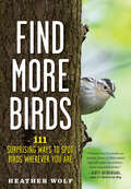
Find More Birds: 111 Surprising Ways To Spot Birds Wherever You Are
by Heather Wolf“Packed with excellent photos and tips, deeply relatable anecdotes, and a palpable sense of joy, this gem of a book will make you a better birder.”—Rosemary Mosco, author of A Pocket Guide to Pigeon Watching A gorgeously photographed trove of 111 ingenious tips for seeing more birds wherever you are—from crowd favorites (hummingbirds, owls, eagles) to species you’ve never spotted before Seeing more birds than you ever imagined and witnessing exciting avian drama is possible—whether you’re on the go or in your own neighborhood, local park, or backyard. As Heather Wolf explains, it all comes down to how you tune in to the show happening around you, the one in which birds—highly skilled at staying under the radar—are the stars. In Find More Birds, Heather shares her very best tactics—and the jaw-dropping photographs they helped her capture. Look for birds at their favorite “restaurants”— from leaf litter to berry bushes, and ball fields to small patches of mud. Watch for “tree bark” that moves . . . you may find it has feathers. Try simply sitting on the ground for a revealing new perspective. Plus, special tips point the way to crowd favorites such as hummingbirds, owls, and eagles—and can’t-miss bird behaviors. As your senses sharpen and “noticing” becomes second nature, Find More Birds will turn your daily routines into bird-finding adventures, too. Whether you’re strolling down the block or parking your car, you never know what will surprise you next!
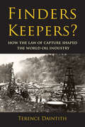
Finders Keepers?: How the Law of Capture Shaped the World Oil Industry
by Terence DaintithSince the beginnings of the oil industry, production activity has been governed by the 'law of capture,' dictating that one owns the oil recovered from one's property even if it has migrated from under neighboring land. This 'finders keepers' principle has been excoriated by foreign critics as a 'law of the jungle' and identified by American commentators as the root cause of the enormous waste of oil and gas resulting from US production methods in the first half of the twentieth century. Yet while in almost every other country the law of capture is today of marginal significance, it continues in full vigour in the United States, with potentially wasteful results. In this richly documented account, Terence Daintith adopts a historical and comparative perspective to show how legal rules, technical knowledge (or the lack of it) and political ideas combined to shape attitudes and behavior in the business of oil production, leading to the original adoption of the law of capture, its consolidation in the United States, and its marginalization elsewhere.
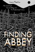
Finding Abbey: The Search for Edward Abbey and His Hidden Desert Grave
by Sean PrentissWhen the great environmental writer Edward Abbey died in 1989, four of his friends buried him secretly in a hidden desert spot that no one would ever find. The final resting place of the Thoreau of the American West remains unknown and has become part of American folklore. In this book a young writer who went looking for Abbey&’s grave combines an account of his quest with a creative biography of Abbey.Sean Prentiss takes readers across the country as he gathers clues from his research, travel, and interviews with some of Abbey&’s closest friends—including Jack Loeffler, Ken &“Seldom Seen&” Sleight, David Petersen, and Doug Peacock. Along the way, Prentiss examines his own sense of rootlessness as he attempts to unravel Abbey&’s complicated legacy, raising larger questions about the meaning of place and home.
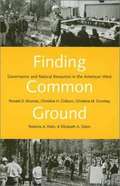
Finding Common Ground: Governance and Natural Resources in the American West
by Ronald D. Brunner Christine H. Colburn Christina M. Cromley Roberta A. KleinOver the past century, solutions to natural resources policy issues have become increasingly complex. Multiple government agencies with overlapping jurisdictions and differing mandates as well as multiple interest groups have contributed to gridlock, frequently preventing solutions in the common interest. Community-based responses to natural resource problems in the American West have demonstrated the potential of local initiatives both for finding common ground on divisive issues and for advancing the common interest. The first chapter of this enlightening book diagnoses contemporary problems of governance in natural resources policy and in the United States generally, then introduces community-based initiatives as responses to those problems. The next chapters examine the range of successes and failures of initiatives in water management in the Upper Clark Fork River in Montana; wolf recovery in the northern Rockies; bison management in greater Yellowstone; and forest policy in northern California. The concluding chapter considers how to harvest experience from these and other cases, offering practical suggestions for diverse participants in community-based initiatives and their supporters, agencies and interest groups, and researchers and educators.
Finding Everett Ruess: The Life and Unsolved Disappearance of a Legendary Wilderness Explorer
by David Roberts Jon KrakauerFinding Everett Ruess by David Roberts, with a foreword by Jon Krakauer, is the definitive biography of the artist, writer, and eloquent celebrator of the wilderness whose bold solo explorations of the American West and mysterious disappearance in the Utah desert at age 20 have earned him a large and devoted cult following. More than 75 years after his vanishing, Ruess stirs the kinds of passion and speculation accorded such legendary doomed American adventurers as Into the Wild's Chris McCandless and Amelia Earhart. "I have not tired of the wilderness; rather I enjoy its beauty and the vagrant life I lead, more keenly all the time. I prefer the saddle to the street car and the star sprinkled sky to a roof, the obscure and difficult trail, leading into the unknown, to any paved highway, and the deep peace of the wild to the discontent bred by cities." So Everett Ruess wrote in his last letter to his brother. And earlier, in a valedictory poem, "Say that I starved; that I was lost and weary; That I was burned and blinded by the desert sun; Footsore, thirsty, sick with strange diseases; Lonely and wet and cold . . . but that I kept my dream!" Wandering alone with burros and pack horses through California and the Southwest for five years in the early 1930s, on voyages lasting as long as ten months, Ruess also became friends with photographers Edward Weston and Dorothea Lange, swapped prints with Ansel Adams, took part in a Hopi ceremony, learned to speak Navajo, and was among the first "outsiders" to venture deeply into what was then (and to some extent still is) largely a little-known wilderness. When he vanished without a trace in November 1934, Ruess left behind thousands of pages of journals, letters, and poems, as well as more than a hundred watercolor paintings and blockprint engravings. A Ruess mystique, initiated by his parents but soon enlarged by readers and critics who, struck by his remarkable connection to the wild, likened him to a fledgling John Muir. Today, the Ruess cult has more adherents--and more passionate ones--than at any time in the seven-plus decades since his disappearance. By now, Everett Ruess is hailed as a paragon of solo exploration, while the mystery of his death remains one of the greatest riddles in the annals of American adventure. David Roberts began probing the life and death of Everett Ruess for National Geographic Adventure magazine in 1998. Finding Everett Ruess is the result of his personal journeys into the remote areas explored by Ruess, his interviews with oldtimers who encountered the young vagabond and with Ruess's closest living relatives, and his deep immersion in Ruess's writings and artwork. It is an epic narrative of a driven and acutely perceptive young adventurer's expeditions into the wildernesses of landscape and self-discovery, as well as an absorbing investigation of the continuing mystery of his disappearance. In this definitive account of Ruess's extraordinary life and the enigma of his vanishing, David Roberts eloquently captures Ruess's tragic genius and ongoing fascination.From the Hardcover edition.