- Table View
- List View
Geoenvironmental Engineering: Principles and Applications
by Hilary I. Inyang Lakshmi ReddiApplies science and engineering principles to the analysis, design, and implementation of technical schemes to characterize, treat, modify, and reuse/store waste and contaminated media. Includes site remediation.
Geoethics In Latin America (The Latin American Studies Book Series)
by Rogelio Daniel Acevedo Jesús Martínez FríasThis book studies geoethics in Latin America and offers comprehensive research on geoethics and geoeducation. Its respective chapters explore geoethics in relation to UNESCO geoparks, mining activities in Latin America, natural hazards and risk management. Geoethics is a key discipline in the field of Earth and Planetary Sciences, and not only includes scientific, technological, methodological and social-cultural aspects, but also addresses the need to consider appropriate protocols, scientific integrity issues and a code of good practice when studying the abiotic world.The position of Latin America’s recently created geoethics associations is based on protection of the environment, together with a reassurance that the balance of nature and the rights of human beings to enjoy it will be preserved.
Geographic Information Management in Local Government
by Peter Thorpe Ian GilfoyleAs early pioneers in the use of digital geographic data, many local governments in the UK were ahead of their counterparts in central government and the private sector in the application of GIS technology. To meet current challenges, local authorities must coordinate the latest technology with effective information management strategies, human and
Geographic Information Science for Land Resource Management
by Shruti Kanga Suraj Kumar Singh Gowhar Meraj Majid Farooq SudhanshuGeographic Information Science for Land Resource Management is a comprehensive book focusing on managing land resources using innovative techniques of spatial information sciences and satellite remote sensing. The enormous stress on the land resources over the years due to anthropogenic activities for commercialization and livelihood needs has increased manifold. The only solution to this problem lies in the stakeholders' awareness, which can only be attained through scientific means. The awareness is the basis of the sustainable development concept, which involves optimal management of natural resources, subject to the availability of reliable, accurate, and timely information from the global to local scales. GIScience consists of satellite remote sensing (RS), Geographical Information System (GIS), and Global Positioning System (GPS) technology that is nowadays a backbone of environmental protection, natural resource management, and sustainable development and planning. Being a powerful and proficient tool for mapping, monitoring, modeling, and managing natural resources can help understand the earth's surface and its dynamics at different observational scales. Through the spatial understanding of land resources, policymakers can make prudent decisions to restore and conserve critically endangered resources, such as water bodies, lakes, rivers, air, forests, wildlife, biodiversity, etc. This innovative new volume contains chapters from eminent researchers and experts. The primary focus of this book is to replenish the gap in the available literature on the subject by bringing the concepts, theories, and experiences of the specialists and professionals in this field jointly. The editors have worked hard to get the best literature in this field in a book form to help the students, researchers, and policymakers develop a complete understanding of the land system's vulnerabilities and solutions.
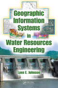
Geographic Information Systems in Water Resources Engineering
by Lynn E. JohnsonState-of-the-art GIS spatial data management and analysis tools are revolutionizing the field of water resource engineering. Familiarity with these technologies is now a prerequisite for success in engineers' and planners' efforts to create a reliable infrastructure.GIS in Water Resource Engineering presents a review of the concepts and application
Geographical Changes in Vegetation and Plant Functional Types (Geobotany Studies)
by Kazue Fujiwara Franco Pedrotti Andrew M. GrellerThis book presents studies on current vegetation topics, from polar to tropical regions. It is a festschrift to mark the 70th birthday of Prof. Elgene O. Box, who has studied vegetation all over the world, both through fieldwork and modeling. It reflects a number of his interests, including basic ecological plant forms (cf ‘plant functional types’), temperate-zone forests, and evergreen versus seasonal patterns. Section 1 discusses the concept of vegetation series, while Section 2 has two global-scale chapters on plant functional traits and whether they are related more to climate or phylogeny. Section 3 has nine chapters focusing on vegetation history, regional vegetation, and how these have influenced current species organizations and distributions. Regions treated include Russia, China, the USA, Mexico and Mediterranean areas. Lastly, Section 4 addresses aspects of vegetation change and plant ecology. Every chapter in this unique book offers original ideas on the topic of vegetation, as the authors are assembled from a world-wide population of leading vegetational ecologists, whose interests range from local communities to global theoretical questions.
Geographies of New Caledonia-Kanaky: Environments, Politics and Cultures
by Matthias Kowasch Simon P. J. BatterburyThis open access book provides a unique overview of geographical, historical, political and environmental issues facing the French overseas territory New Caledonia, also called “Kanaky” by the indigenous Kanak people, who outnumber citizens of European and other origin. New Caledonia has seen a long and complex struggle for decolonization, but is still on the United Nations’ list of “Non-Self Governing territories” and there is little sign of change following three referendums on independence and extensive negotiations with France. The archipelago possesses around a quarter of the world’s nickel deposits, giving it additional strategic importance when demand for the mineral is strong. The islands have unique biodiversity, and Caledonian coastal lagoons have been listed as UNESCO world heritage sites since 2008. The book offers detailed insights into the environmental and human geographies of the archipelago, with a focus on the linksbetween environmental protection and extensive mining operations, between political independence struggles and continued wellbeing and economic development, and the differing visions for the future of the islands. This multidisciplinary volume, one of the few to appear in English, appeals to researchers, students and policy makers across the environmental, social and political sciences.
Geographies of Post-Industrial Place, Memory, and Heritage (Routledge Research in Sustainable Urbanism)
by Amy Walker Mark Alan Rhodes II William R. PriceAll industrialization is deeply rooted within the specific geographies in which it took place, and echoes of previous industrialization continue to reverberate in these places through to the modern day. This book investigates the overlap of memory and the impacts of industrialization within today’s communities and the senses of place and heritage that grew alongside and in reaction to the growth of mines, mills, and factories. The economic and social change that accompanied the unchecked accumulation of wealth and exploitation of labor as the industrial revolution spread throughout the world has numerous lasting impacts on the socioeconomics of today. Likewise, the planet itself is now reeling. The memory and heritage of these processes reach into the communities that owe the industrial revolution their existence, but these populations also often suffered adverse impacts to their health and environment through the large-scale and rapid extraction of natural resources and production of goods. Through the themes of memory, community, and place; working post-industrial landscapes; and the de-romanticization of industrial pasts, this book examines the endurance and decline of these communities, the spatial processes of industrial byproducts, and the memory and heritage of industrialization and its legacies. While based in the traditions of geography, this collection also draws upon and will be of great interest to students and scholars of cultural anthropology, archaeology, sociology, history, architecture, civil engineering, and heritage, memory, museum, and tourism studies. Using global examples, the authors provide a uniquely geographic understanding to industrial heritage across the spaces, places, and memories of industrial development.
Geographies of Us: Ecosomatic Essays and Practice Pages (Routledge Studies in Theatre, Ecology, and Performance)
by Sondra Fraleigh Shannon Rose RileyGeographies of Us: Ecosomatic Essays and Practice Pages is the first edited collection in the field of ecosomatics.With a combination of essays and practice pages that provide a variety of scholarly, creative, and experience-based approaches for readers, the book brings together both established and emergent scholars and artists from many diverse backgrounds and covers work rooted in a dozen countries. The essays engage an array of crucial methodologies and critical/theoretical perspectives, including practice-based research in the arts, especially in performance and dance studies, critical theory, ecocriticism, Indigenous knowledges, material feminist critique, quantum field theory, and new phenomenologies. Practice pages are shorter chapters that provide readers a chance to engage creatively with the ideas presented across the collection. This book offers a multidisciplinary perspective that brings together work in performance as research, phenomenology, and dance/movement; this is one of its significant contributions to the area of ecosomatics.The book will be of interest to anyone curious about matters of embodiment, ecology, and the environment, especially artists and students of dance, performance, and somatic movement education who want to learn about ecosomatics and environmental activists who want to learn more about integrating creativity, the arts, and movement into their work.
Geography: A Very Short Introduction
by John A. Matthews David T. HerbertThis Very Short Introduction answers four basic questions: what is geography, how do geographers work, why is geography important, and where is the discipline of geography heading? Geography has always been important, though it has had only a short history as an academic discipline and is much misunderstood. Modern Geography has come a long way from its historical roots in exploring foreign lands, in mapping the world and in describing the physical and human features of the Earth's surface. There are two parts to the discipline: Physical Geography, which covers natural environments and landscapes; and Human Geography, which investigates people and the cultural landscape. Physical and human geographers commonly do not agree with each other. But there are also common elements and geography as a whole has an important role as a bridge between the sciences and the humanities. Using wide-ranging examples, the book paints a broad picture of the current state of geography, its subject matter, concepts and methods, how it developed, and its strengths and weaknesses. The book's conclusion is no less than a manifesto for geography's future.
Geography: A Visual Encyclopedia
by DKLearn all about geography on planet Earth in this jam-packed visual encyclopedia for children.Get to know the processes that shape our world through amazing facts and colorful diagrams in this fully updated edition of the popular Geography A Children’s Encyclopedia.This encyclopedia for children aged 9-12 is full of beautiful pictures that bring the natural world to life and show Earth’s most amazing features. Each concept is broken down clearly, with colorful diagrams describing geological processes, while the water cycle and the structure of a rainforest canopy are fully explained.This geography book for kids offers:All aspects of physical and human geography explained clearly with the help of maps and country factfiles.A refreshed and updated edition, including a new design and the latest facts and stats on the subject.An essential reference for children, looking at the latest topics like the effects of climate change.Learn about the processes that shape our world, from ice ages to global warming, earthquakes to tsunamis, and explore the wonders of the natural world, from the peak of Mount Everest to the very bottom of the Mariana Trench.Children can carry the world wherever they go, from the deserts of Africa to the low countries of Europe, the lush forests of Brazil to the coral reefs of Indonesia and Australia. This encyclopedia expands horizons and is a fantastic resource for children interested in geography, geology, environmental science, and sociology.Explore the series!Globally, the Children’s Encyclopedia series has sold more than 4 million copies worldwide. Uncover the marvels of our world with Science, explore the deep blue with Ocean, discover our solar system and beyond with Space, understand anatomy with Human Body, and get to grips with world-famous sculptures with Art.
Geohazards and Pipelines: State-of-the-Art Design Using Experimental, Numerical and Analytical Methodologies
by Spyros A. Karamanos Arnold M. Gresnigt Gert J. DijkstraThis book presents state-of-the-art methodologies for the design and analysis of buried steel pipelines subjected to severe ground-induced action, including tectonic (quasi-static) effects, slope movements (landslides), liquefaction-induced actions or excavation-induced settlements. The text is an amended version of the final deliverables of the GIPIPE project, sponsored by the European Commission (Research Fund for Coal and Steel programme, 2011-2014).Geohazards and Pipelines presents an integrated investigation of this subject, using advanced and innovative experimental techniques, high-performance numerical simulations and novel analytical methodologies, which account for the particularities of buried steel pipelines with an emphasis on soil-pipeline interaction.Geohazards and Pipelines will be of use to professionals working in the field of pipeline engineering, including design consultants and industrial practitioners involved in projects related to pipeline infrastructure. Structural engineers, mechanical engineers, geotechnical engineers, geologists and seismologists may also find this book of interest, as may graduate students and researchers in these areas.
Geoheritage and Geodiversity of Cenozoic Volcanic Fields in Saudi Arabia: Challenges of Geoconservation and Geotourism in a Changing Environment (Geoheritage, Geoparks and Geotourism)
by Mohammed Rashad Moufti Károly NémethSaudi Arabia hosts at least six major volcanic fields located on the western margin of the Arabian Peninsula. The volcanic surface covered is comparable to about a fifth of the land surface of the country and the distinct appearance of the volcanic landscape of the region is deeply engraved in the geo-cultural perspective of the territory. Volcanic fields, especially their extensive lava fields form one of the largest if not the largest volcanic region on Earth, which are occupied by the most common volcanic landforms not only on Earth but the known Solar System. Volcanic fields are a vital part of the geoheritage and geodiversity elements of the Arabian Peninsula and beyond in the Middle East. Here we provide the most up-to-date overview of the geoheritage and geoheritage elements of these huge volcanic provinces both qualitative and quantitative outlines of their geodiversity and link to biodiversity. The volcanic province will be treated from the ecosystem, and geosystem services perspective and explore the challenges of such a concept in a region that is primarily industry and resource-based economy driven. This book will look beyond the traditional approach of describing geoheritage of volcanic regions as it will provide a conceptual framework for dispersed volcanic fields where scale and scope to define and estimate the value of geoheritage requires different approaches than those applied for long-lived polygenetic volcanoes. This book aims to provide a succinct overview of geoheritage and geodiversity aspects of monogenetic volcanic fields tested in an area globally outstanding and volcanically active. The book intends to be a good specialist handbook for a broad range of audiences from geologists, volcanologists, natural hazard experts, geoconservation experts, social geology experts, geotourism operators, and heritage researchers. The book will be a valuable resource for anyone directly or indirectly involved or wish to be involved in local development projects or experts looking for external information to apply to volcanic fields elsewhere.
Geoinformatics for Sustainable Development in Asian Cities (Springer Geography)
by Sathaporn Monprapussorn Zhaohui Lin Asamaporn Sitthi Parichat WetchayontThis proceedings volume focuses on the importance and power of spatial thinking and planning, especially by applying geospatial technologies in solving the past and current global problems such as environmental degradation, urban pollution, climate change, agricultural management and epidemiology.The proceedings of the International Conference on Geography and Geoinformatics for Sustainable Development 2018 (ICGGS 2018) consist of a wide range of case studies from developing countries. The contributions address challenges of developing countries in mainstreaming sustainable development paradigm into their economy with the aim to improve and manage natural resources and environment in a sustainable manner. One of the main goals of the conference and the proceedings is to share and exchange different perspectives on global, regional and local spatial issues and how the concept of spatial planning and thinking can be used in building resilience to natural and anthropogenic threats in many sectors (such as water, ecosystem, agriculture and health). This includes a summary of how the key concepts of geospatial technologies could contribute to environmental sustainability and the Sustainable Development Goals (SDGs) as well as an outlook on challenges and opportunities for sustainable development. This book explains how geoinformatics can help analyse, model and explain sustainable development within a geographic context and thus provide the integrative framework necessary for global collaboration consensus and evidence-based decision-making. It highlights the vital and integrative role of geospatial information in driving sustainable development and thus can be used as a tool to put the 2030 Agenda for Sustainable Development into practice. This volume can be a useful resource for readers regarding research on geospatial issues on both the regional and local scale. Both undergraduate and graduate students around the globe can advance their academic and research knowledge of past and present environmental problems and learn how geospatial planning can be applied for sustainable development. It also appeals to researchers, academics, practitioners, community developers and policy makers interested in promoting sustainable development.
Geoinformation Technologies for Geo-Cultural Landscapes: European Perspectives
by Niki Evelpidou Andreas Vassilopoulos Oliver Bender Alenka KrekThe focal main objective of the book is to constitute a meaningful linkage among research problems, geoinformation methods and corresponding applications. The research goals, related both to theoretical and practical issues, derive from multidisciplinary fields such as archaeology, history, geography, landscape planning, environment, geoinformation
Geologic Disposal of Low- and Intermediate-Level Radioactive Waste
by Roland Pusch Masashi Nakano Raymond N. YongThis book will address concepts and techniques for preparation and disposal of low- (LLW) and intermediate-level (ILW) radioactive waste from the nuclear industry, the weapons industry, university labs, research institutes, and from the commercial industry. It will aid decision-makers in finding optimal technical/economical solutions, including how site investigations, design, construction, identification and selection of construction materials (clay and concrete), and monitoring can be made. It will also examine techniques for isolating soil and rock contaminated by leaking nuclear plants and from damaged nuclear reactors such as those at the Fukushima and Chernobyl nuclear plants.
Geologic Trips: San Francisco and the Bay Area
by Ted KonigsmarkThis book is written for the non-geologist and describes seven geologic trips that will give the reader an understanding of the rocks, faults, earthquakes, and landforms of San Francisco and the Bay Area.
Geological Background of Sandstone-Type Uranium Deposits in Ordos Basin, Northwest China (Springer Geology)
by Ruoshi Jin Ren’an Yu Peisen MiaoThis book introduces the geological background of sandstone-type uranium deposits in the Ordos Basin, Northwest China. Through comparative study of a large number of practical data such as uranium, coal and oil boreholes, the research system takes sedimentary basin as a unit and fully utilizes geologicalprinciples and test analysis to study the basic geological, geophysical, geochemical and remote sensing image characteristics of the basin, and to restores the favorable uranium-forming geological background brought by the change of the cognitive sedimentary environment conditions. It can be used as a reference for researchers, practitioners and as well as teachers and graduate students working in uranium deposit geology, sedimentary geology and related areas
Geological Disposal of Carbon Dioxide and Radioactive Waste: A Comparative Assessment
by Ferenc L. TothFossil fuels will remain the backbone of the global energy economy for the foreseeable future. The contribution of nuclear energy to the global energy supply is also expected to increase. With the pressing need to mitigate climate change and reduce greenhouse gas emissions, the fossil energy industry is exploring the possibility of carbon dioxide disposal in geological media. Geological disposal has been studied for decades by the nuclear industry with a view to ensuring the safe containment of its wastes. Geological disposal of carbon dioxide and that of radioactive waste gives rise to many common concerns in domains ranging from geology to public acceptance. In this respect, comparative assessments reveal many similarities, ranging from the transformation of the geological environment and safety and monitoring concerns to regulatory, liability and public acceptance issues. However, there are profound differences on a broad range of issues as well, such as the quantities and hazardous features of the materials to be disposed of, the characteristics of the targeted geological media, the site engineering technologies involved and the timescales required for safe containment at the disposal location. There are ample opportunities to learn from comparisons and to derive insights that will assist policymakers responsible for national energy strategies and international climate policies.
Geological History of the Baltic: Volume 2: Evolution of the Baltic Sea
by Leszek J. KaszubowskiThis book presents the geological evolution of the Baltic Sea area since its inception, i.e., from the Late Glacial to the present day. The geological history of all evolutionary stages of the Baltic Sea is discussed in detail, from the Baltic Ice Lake, through the Yoldia Sea, Ancylus Lake, Littorina Sea and Lymnaea Sea, to the Mya Sea as the modern stage of the Baltic Sea development. The author presents palaeoecological and palaeosedimentological analyses of various evolutionary stages of the Baltic Sea. Detailed paleogeographic maps of the development of the Littorina Sea, Lymnaea Sea and Mya Sea are displayed, with particular focus on the Polish Baltic Sea area. Moreover, characteristic geological cross-sections and synthetic stratigraphic profiles representing individual areas of the Polish Baltic Sea coast are also shown. Each transgressive cycle of the various developmental stages of the Baltic Sea is characterized in terms of the average rate of marine transgression, the fluctuation of Baltic levels and the average rate of marine abrasion of the then cliff and spit shores, as well as the evolutionary changes of the area. In addition, the lithostratigraphic characteristics of the various marine sediment complexes and dune sediments (brown dune spits, yellow dune spits, light yellow-grey dune spits and grey dune spits) are also presented. Individual chapters address key aspects of:• Litho-stratigraphical analysis of the Baltic Ice Lake deposits.• Litho-stratigraphical analysis of the Yoldia Sea deposits.• Litho-stratigraphical analysis of the Ancylus Lake deposits.• Paleogeography, litho-stratigraphy and transgressive cycles of the LittorinaSea.• Paleogeography, litho-stratigraphy and transgressive cycles of the LymnaeaSea.• Paleogeography, litho-stratigraphy and transgressive cycles of the Mya Sea.• New stratigraphic division of the southern Baltic deposits along the Polishcoast.The book will be useful for students and scientists of marine geology, oceanography, geography and environmental engineering. It will also be of practical use for all specialists dealing with marine basins and coastal zones, including marine geologists, coastal geologists and geomorphologists, geographers, as well as engineering geologists, geotechnicians and civil engineers. The book is generally related to the discipline of marine geology, and deals directly with the Baltic Sea basin.
Geological Landscapes of Britain
by Julian AshbournThis book discusses the geological history of Britain from the early geological formation of the British Isles, through to the variety of currently visible rock formations and ensuing natural landscapes. It is presented as an accessible narrative which may be utilised in a variety of educational contexts, or simply enjoyed as an holistic overview of the subject. It additionally provides an important visual record of British geology in the 21st century via a portfolio of high quality, scientifically accurate photographs, which are themselves part of a larger collection, being developed to become the definitive image library for British geoscience. In addition, the book provides an insight into the relationship between the geology of Britain and how early settlers interacted with the landscape throughout Mesolithic and Neolithic times. It is a book which serves equally as a scientific reference, an introduction to the subject of British geology and, no doubt, as an edition which will remain a pleasure to own in its own right.
Geology and Resource Potential of the Congo Basin
by Maarten J. de Wit François Guillocheau Michiel C. J. de WitThis book summarizes the geomorphology, geology, geochronology, geophysics and mineral resources of the Congo Basin, one of the world's most enigmatic and poorly understood major intra-continental sedimentary basins, and its flanking areas of Central Africa. It provides an up to date analysis of the large region's origin and evolution. The book's nineteen chapters take the reader through the entire basement history, as well as the Basin's ca. 700 million years of cover sequences. Starting from its Archean cratons and Proterozoic mobile belts, and proceeding through the Phanerozoic sequences, including the most recent Cenozoic successions, the book also explores the present drainage systems and the subtle but complex topography of the Congo Basin. It also presents and evaluates new basin models and related dynamic processes, as well as revised correlation schemes with its Gondwana counterparts in South America, all of which provide key insights into its rich diamond deposits and other mineral wealth, which are documented in the final chapters. A specific feature of this book is its synthesis, performed by teams of active experts, of a vast amount of geoscientific data previously only recorded in research reports, company reports, survey bulletins, and scattered journal articles and books. The sheer size of the Congo Basin (ca. 1. 8 million km2, or just under half the area of the EU) and Central Africa (some 7 million km2, or more than 70% of the area of the USA) will make this a sought-after source of information and inspiration on this unique region.
Geology and Tectonics of Northwestern South America: The Pacific-Caribbean-Andean Junction (Frontiers in Earth Sciences)
by Fabio Cediel Robert Peter ShawThis book provides a comprehensive overview of the geological evolution of the Northern Andes and contiguous shield areas, with a focus upon Colombia. Updated geological interpretations are supported by modern lithogeochemical, seismic, gravity and magnetic data and radiogenic isotope and radiometric age determinations. The composite data permits a detailed interpretation of the tectono-magmatic history of the Northern Andean Block, including the Andes of Colombia, northern Ecuador, western Venezuela and eastern Panamá.Tectonic reconstructions based upon characterization of more than thirty litho-tectonic and morpho-structural units, terrane assemblages and tectonic realms, and their bounding suture and fault systems, highlight the intimate and complementary Mesozoic-Cenozoic history of the Northern Andean Block and the Pacific and Caribbean Plates.The complex nature of Northern Andean assembly contrasts with ‘‘classical’’ Central Andean ‘‘Cordilleran-type’’ orogenic models. Differences render the application of typical Cordilleran-type models inappropriate for the Colombian Andes.The importance of underlying Proterozoic through mid-Mesozoic elements, in the development of Meso-Cenozoic Northern Andean orogeny-phase tectonic configurations is analyzed in the light of spatial-temporal studies and reconstructions related to basin formation, sedimentation, deformation, uplift mechanisms, structural style and magmatic evolution. The pre-Andean architecture of north western South America has played a pre-determinative role in the development of the Northern Andean orogenic system. 16 contributions analyze key stratigraphic, structural, metamorphic, magmatic and tectonic questions, and provide solutions as far as the most recent published field-based studies permit. The volume provides geological interpretations and tectonic models which contrast with repetitive theoretical proposals frequently found in the available literature.
Geology of Cuba (Regional Geology Reviews)
by Manuel Enrique Pardo EcharteThe evolution of geological cartography in Cuba in its more than 135 years of history has been possible through the consultation of numerous archival reports, publications, maps and personal interviews with different authors and geologists of vast experience. A brief critical analysis is made of the increase in the degree of geological knowledge of the country since the elaboration of the Geological Sketch of the Cuban Island at a scale of 1: 2 000 000 (Fernández de Castro, 1883), first of Cuba and of Ibero-America, until the most recent Digital Geological Map of Cuba at scale 1: 100 000 (Pérez Aragón, 2016). Cuba and its surroundings are a geological mosaic in the southeast corner of the North American plate with rocks from many different origins, from Proterozoic to Quaternary, extended along the southern border of the plate. From the Eocene, this belt has been dissected by several great faults, related to the development of some great oceanic depressions (Cayman trough and Yucatan basin). The fossil record of Cuba, which covers approximately the last 200 million years of life on Earth, is rich in very varied fossils, witnessing a wide diversity of organisms, both animals and plants, that inhabited the Antillean and Caribbean region; and that constitute the inheritance of the biological diversity that the current Cuban archipelago exhibits. As a result of the preparation of the Cuban Metallogenic Map at scale 1: 250 000, forty-one models and eight sub-models of metallic mineral deposits were identified. These models, of descriptive–genetic type, together with the analysis of their spatial distribution and their relationship with geology, allowed the identification and mapping of ten mineral systems, linked to the geodynamic environments present in the Cuban territory. Cuba has large deposits of limestone, loam, dolomite, kaolin, gypsum and anhydrite, rock salt, marbles, sands and clays of different types, zeolites, peat, therapeutic peloids and many more. There are manifestations of decorative and precious rocks such as jasper, jadeite, different varieties of quartz and even xylopals. A compilation of geochemical data of oceanic basalt samples from previous works, together with data of analyzed samples during this study in order to discuss geochemical criteria based on immobile element (proxies for fractionation indices, alkalinity, mantle flow and subduction addition), provide a comprehensive ophiolite classification according to their tectonic setting. This book addresses different facets of the geological knowledge of Cuba: history of its cartography, marine geology, fossil record, stratigraphy, tectonics, classification of its ophiolites, quaternary deposits, metallogeny and minerageny.
Geology of Michigan
by John A. Dorr Jr. Donald F. EschmanIn the eons before the first man set foot on Michigan soil, ancient mountain ranges yielded to the slow but irresistible forces of erosion and slipped beneath the waters of warm inland seas. Great rivers formed their deltas against the pounding surf, filling the seas to create endless swamps. The vast northern ice sheets scoured the face of the state, heaping high their rock debris as they withdrew to make way for the ancestral Great Lakes. Primitive man appeared here late, one of the last in the long parade of life which passes in review in Michigan's fossil record. In text and illustrations, Geology of Michigan tells this fascinating story. The authors, both experienced field geologists, offer descriptions of the principal geologic features of the state, explain the origin of these features, and portray the geologic evolution of Michigan from earliest times to the present. Specific topics include the geologic time scale, the geologic eras, water and wind, petroleum and natural gas, and minerals in Michigan. General principles of geology, which may be applied to the study of other regions as well, are explained with great clarity. The authors also provide a wealth of information on the origin and identification of rock and fossil specimens. Michigan collecting localities are indicated on maps and in the text, and collecting methods are expertly described. Of particular interest to students and geologists for its bibliography and synthesis of heretofore widely scattered information, this abundantly illustrated book can be read by student and layman alike as a comprehensive introduction to the fascinating geology of Michigan.
