- Table View
- List View

Geology of National Parks (Sixth Edition)
by Ann G. Harris Esther Tuttle Sherwood D. TuttleHighlights the local history as well as the geologic features and developments of national parks formed by stream erosion and weathering, glaciers and wave action, igneous activity, mountain building and uplift, and ground water.
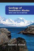
Geology of Southeast Alaska: Rock and Ice in Motion
by Harold StowellThe most powerful forces on earth have shaped the landscape of Southeast Alaska. Scientists and visitors from around the world trek north to experience wild rivers, powerful glaciers, and breathtaking mountain peaks. Now, for the first time, a handy guide to the region is available. Complete with color illustrations revealing millions of years of geological history and in-depth descriptions of Sitka, Juneau, and Glacier Bay, Geology of Southeast Alaska is essential reading for anyone fascinated by rock and ice in motion. Written by a geologist with over twenty-five years of experience in the north, Geology of Southeast Alaska will entertain and inform with abundant photographs and detailed drawings. Whether you want to understand the forces that shaped the state of Alaska, or you want to learn the basics of glacial movement, this compact, authoritative book is for you.
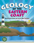
Geology of the Eastern Coast
by Cynthia Light BrownTaking a unique approach to a fascinating region of the United States, this activity guide looks at the underlying processes that have shaped the Eastern Coast. Beginning with the connection between geology and geography, the chapters move into a discussion of plate tectonics and landforms such as the Appalachian Mountains, Piedmont area, and Coastal Plains. The aspects of climate, rivers and lakes, and the ecosystems of the temperate forest and wetlands--including bayous and the Everglades--are covered in detail. Engaging sidebars explain why the New River is one of the oldest in the world, how once-endangered alligators are now thriving, how hurricanes form, and more. Combining fun facts with hands-on experiments, this handbook features projects such as building folded mountains, creating dissolving "corals," and making an eye of a storm.
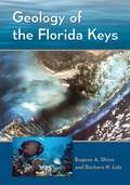
Geology of the Florida Keys
by Eugene A. Shinn Barbara H. Lidz"A joy to read from two of the most prominent geologists who have worked for the better part of their careers in the Florida Keys. Places important environmental focus on modern-day issues facing the island ecosystems, the health of Florida Bay, the nearshore areas, and ultimately the reef tract."--Donald F. McNeill, University of Miami "A compelling narrative that weaves fascinating historical personalities and periods with the geological characteristics of the Florida Keys into a colorful tapestry. A fun, interesting, and informative read!"--Eugene C. Rankey, University of Kansas Two world-class geologists draw on their prolific fifty-year careers in this comprehensive guide to the geology and biology of the Florida Keys and Florida Bay. Eugene Shinn and Barbara Lidz dive into the past, present, and future of an area that has long been a natural laboratory for learning about coral reef formation and the origins of limestone. They explain how underlying Pleistocene topography controls the shapes of today's coral reefs, how sea-level rise created Florida Bay, and how hurricanes mold limemud banks and strip vegetation from the Florida Keys. They discuss the recent decline of coral reefs due to overpopulation, pollution, climate change, and other factors. An itinerary is included for a hands-on three-day field trip, guiding visitors to the best places to see the famous reef formations and geologic processes of the Keys. As glaciers continue to melt and reform at Earth's poles, sea level is currently rising and will fall again at some point in the geologic future. In this volume, Shinn and Lidz demonstrate the value of the Keys and immediate surroundings as an environmental laboratory to study past effects of sea-level change and to stimulate ideas for further research.
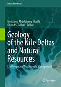
Geology of the Nile Deltas and Natural Resources: Challenges and Sustainable Management (Deltas of the World)
by Mohamed Abdelghany Khalifa Khaled S. GemailThis book is essential for understanding the Nile Delta, recognized as one of the world's most vulnerable deltas due to population growth and the impacts of sea level rise (SLR). Spanning approximately 38,000 square kilometers, the Nile Delta is the largest delta globally, warranting an in-depth exploration of its geology, hydrocarbon potential, and water resources. This comprehensive volume provides detailed geological insights into both the Recent Nile Delta and the ancient deposits of the El-Fayoum Nile Delta. It highlights the subsurface lithostratigraphic rock units, elucidating possible depositional environments and the distribution and extent of water and hydrocarbon reservoirs. Additionally, the book examines the structural elements that influenced sedimentary rock deposition, supported by well logs and seismic data. For the first time, the book presents critical geological information on both onshore and offshore gas reservoirs, assessing the Nile Delta's hydrocarbon production capacity, organic petrography, and the geochemical characterization of its resources. Employing a multidisciplinary approach that integrates geological, hydrogeological, numerical, and machine learning modeling with geophysical data, this book assesses and monitors the quality and quantity of natural resources for sustainable management in the Nile Delta, Egypt. This book crucially addresses the natural resource challenges posed by climatic changes and anthropogenic stressors, while recommending sustainable practices for development. It aligns with several Sustainable Development Goals (SDGs), including SDG 6: Clean Water and Sanitation, SDG 7: Affordable and Clean Energy, SDG 11: Sustainable Cities and Communities, SDG 13: Climate Action, and SDG 15: Life on Land.<span class="EOP SCXW14652096 BCX0" data-ccp-props="{&quo
Geomatic Approaches for Modeling Land Change Scenarios
by Francisco Escobar María Teresa Camacho Olmedo Martin Paegelow Jean-François MasThis book provides a detailed overview of the concepts, techniques, applications, and methodological approaches involved in land use and cover change (LUCC) modeling, also known simply as land change modeling. More than 40 international experts in this field have participated in this book, which illustrates recent advances in LUCC modeling with examples from North and South America, the Middle East, and Europe. Given the broad range of geomatic approaches available, it helps readers select the approach that best meets their needs. The book is structured into five parts preceded by a foreword written by Roger White and a general introduction. Part I consists of four chapters, each of which focuses on a specific stage in the modeling process: calibration, simulation, validation, and scenarios. It presents and explains the fundamental ideas and concepts underlying LUCC modeling. This is complemented by a comparative analysis of the selected software packages, practically applied in various case studies in Part II and Part III. Part II discusses recently proposed methodological developments that have enhanced modeling procedures and results while Part III offers case studies as well as interesting, innovative methodological proposals. Part IV revises different fundamental techniques used in LUCC modeling and finally Part V describes the best-known software packages used in the applications presented in Parts II and III.
Geomorphological impacts of extreme weather
by Denes LoczyThis book presents new research on the geomorphological impacts of extreme precipitation events. It focuses on the extreme summer floods, which affected Central and Eastern Europe in 2010. Case studies on their consequences, including inundations, urban flooding, soil erosion, river bank retreat, alluvial fan accumulation, evolution of karst depressions, debris flows, landslides and soil saturation are presented for Poland, the Czech Republic, Ukraine, Slovakia, Hungary, Romania, Slovenia, Croatia, Serbia, Bulgaria and Macedonia. This key applied geomorphology book is crucial for anyone interested in these processes and their consequences and also for decision makers who face these catastrophes.
Geoparks of Taiwan: Their Development and Prospects for a Sustainable Future (Geoheritage, Geoparks and Geotourism)
by Jiun-Chuan Lin Shew-Jiuan SuThis book offers an essential introduction to Taiwan’s geoparks, issues related to their development, and prospects for a sustainable future. It discusses how promoting geoparks can serve as a tool for a sustainable society based on the lessons learned in Taiwan. Situated in a tectonically dynamic geological setting (at the boundary of the Eurasian and the Philippine Plates) and culturally diversified geographical setting, Taiwan is an ideal candidate for showcasing its “natural wonders” in geoparks, promoting landscape conservation, and expanding the horizons of geoheritage world-wide. The book begins by illustrating the physical and human environments of Taiwan’s geoparks, helping readers understand their foundation. In turn, the second section includes chapters describing the development of all six Taiwanese geoparks, offering comprehensive information on each. Lastly, it illustrates the social development and mechanisms used to promote each geopark.
Geoparks: More Than Just Tourist Sites (Fountas & Pinnell Classroom, Guided Reading Grade 6)
by Steven JohnNIMAC-sourced textbook
Geoparsing Early Modern English Drama
by Monica Matei-ChesnoiuGeo-spatial identity and early Modern European drama come together in this study of how cultural or political attachments are actively mediated through space. Matei-Chesnoiu traces the modulated representations of rivers, seas, mountains, and islands in sixteenth-century plays by Shakespeare, Jasper Fisher, Thomas May, and others.
Geopedia: A Brief Compendium of Geologic Curiosities (Pedia Books #6)
by Marcia BjornerudA garden of geologic delights for all EarthlingsGeopedia is a trove of geologic wonders and the evocative terms that humans have devised to describe them. Featuring dozens of entries—from Acasta gneiss to Zircon—this illustrated compendium is brimming with lapidary and lexical insights that will delight rockhounds and word lovers alike.Geoscientists are magpies for words, and with good reason. The sheer profusion of minerals, landforms, and geologic events produced by our creative planet demands an immense vocabulary to match. Marcia Bjornerud shows how this lexicon reflects not only the diversity of rocks and geologic processes but also the long history of human interactions with them.With wit and warmth, she invites all readers to celebrate the geologic glossary—a gallimaufry of allusions to mythology, imports from diverse languages, embarrassing anachronisms, and recent neologisms. This captivating book includes cross-references at the end of each entry, inviting you to leave the alphabetic trail and meander through it like a river. Its pocket-friendly size makes it the perfect travel companion no matter where your own geologic forays may lead you.With whimsical illustrations by Haley Hagerman, Geopedia is a mix of engaging and entertaining facts about how the earth works, how it has coevolved with life over billions of years, and how our understanding of the planet has deepened over time.Features a real cloth cover with an elaborate foil-stamped design
Geopedology
by Joseph Alfred Zinck Graciela Metternicht Gerardo Bocco Héctor Francisco Del ValleThis book offers a proven approach for reliable mapping of soil-landscape relationships to derive information for policy, planning and management at scales ranging from local to regional. It presents the theoretical and conceptual framework of the geopedologic approach and a bulk of applied research showing its application and benefits for knowledge generation relevant to geohazard studies, land use conflict analysis, land use planning, land degradation assessment, and land suitability analysis. Soil is a vital resource for society at large and an important determinant of the economic status of nations. The intensification of natural disasters and the increased land use competition for food and energy have raised awareness of the relevant role the pedosphere plays in natural and anthropogenic environments. Recent papers and global initiatives show a renewed interest in soil research and its applications for improved planning and management of this fragile and finite resource.
Geopedology: An Integration Of Geomorphology And Pedology For Soil And Landscape Studies
by Joseph Alfred Zinck Graciela Metternicht Héctor Francisco del Valle Marcos Angelini<p>This updated and revised second edition brings geopedology issues into the current context. This new edition extends the work on popular topics such as digital soil mapping, GIS and landscape mapping, and it also gives valuable insight with up-to-date theoretical discussions and new application with relevant case studies. This textbook offers a proven approach for reliable mapping of soil-landscape relationships to derive information for policy, planning and management at scales ranging from local to regional. Filled with didactic elements such as case studies, visual aids (maps, charts and figures), questions and answers, the book is of interest to geohazard studies, land use conflict analysis, land use planning, land degradation assessment, and land suitability analysis.<p> <p>Soil is a vital resource for society at large and an important determinant of the economic status of nations. The intensification of natural disasters and the increased land use competition for food and energy have raised awareness of the relevant role the pedosphere plays in natural and anthropogenic environments. Recent papers and global initiatives show a renewed interest in soil research and its applications for improved planning and management of this fragile and finite resource.<p>
Geophysics of the Cryosphere (Springer Textbooks in Earth Sciences, Geography and Environment)
by Matti Leppäranta Petteri UotilaThis textbook offers a comprehensive introduction to the geophysics of the cryosphere—Earth&’s sphere of snow and ice—intended for advanced undergraduate students in geophysics, geography, geology, and environmental sciences. Unlike broader climate-focused or geographically descriptive volumes, this book provides a structured, physical understanding of snow and ice processes in high-latitude and high-altitude environments. Chapters cover the physical properties of snow and ice, the evolution of seasonal snow cover, the flow and mass balance of glaciers and ice sheets, and the behavior of floating ice on lakes, rivers, and seas. The book also explores the cryosphere&’s role in climate systems and its future under changing conditions. Developed from long-standing courses at the University of Helsinki and international winter schools, this book includes end-of-chapter study problems and a compact annex of key constants and formulas. It is equally useful as a coursebook or reference for researchers in Earth system sciences working with cryospheric elements.
Geopolitical Change and the Antarctic Treaty System: Historical Lessons, Current Challenges (Springer Polar Sciences)
by Shirley V. Scott Tim Stephens Jeffrey McGeeThis book explores how geopolitical tensions have shaped the Antarctic Treaty System (ATS) and offers insights into managing future challenges. The ATS, established with the 1959 Antarctic Treaty during the Cold War, has been a successful model of international governance, ensuring Antarctica's peaceful use and environmental protection. However, the ATS now faces new pressures, including an expanded membership of 57 states, increased economic activities such as tourism, fishing, and bio-prospecting, and the impacts of climate change. These factors are exacerbating geopolitical tensions that could challenge the stability of the ATS. The book examines key moments in the history of the ATS to understand how past tensions were managed and what lessons can be drawn for the future. The volume covers the creation of the CCAMLR marine conservation treaty in the late 1970s-1980s; the developing world's opposition to the ATS in United Nations debates during the 1980s-1990s; the shift from permitting Antarctic mining to establishing the Madrid Protocol on Environmental Protection in the early 1990s; the formation of the International Association of Antarctic Tourism Operators; the management of Illegal, Unregulated, and Unreported (IUU) fishing in the 2000s; and the proposals for marine protected areas under the CCAMLR Convention in recent years. Several contributions also draw on critical and regional perspectives to make sense of geopolitical pressures on Antarctic governance and how they might play out over the years and decades ahead. Through its attention both to critical turning points in the history of the ATS, and a broad range of conceptual approaches, the book provides an authoritative assessment of the ATS's capacity to address emerging geopolitical stresses and provides strategies for future governance. It is a timely resource for understanding the evolving dynamics in Antarctica and ensuring the region remains a zone of peace and scientific collaboration. This book is a companion volume to McGee, Edmiston and Haward, 2022, The Future of Antarctica: Scenarios form Classical Geopolitics, in the Springer Polar Sciences Series.
Georessourcen: Transformationen, Konflikte, Kooperationen
by Helmut Schneider Thomas FeldhoffGeoressourcen sind die Elemente des gesellschaftlichen Stoffwechsels mit der Natur: mineralische Rohstoffe, fossile Energieträger, Wasser, Luft, Böden und in einem weiteren Sinn auch die Biosphäre und das Klima. Mit der Inwertsetzung und Nutzung dieser Georessourcen sind zeitlich und räumlich stark variierende Mensch-Umwelt-Verhältnisse verbunden. Moderne Gesellschaften mit ihren vielschichtigen Verflechtungen sind so abhängig wie nie zuvor. Georessourcen sind dabei immer auch Instrument zur (Re-)Produktion von Machtverhältnissen und zur Durchsetzung politisch-ökonomisch-ideologischer Interessen im Rahmen von Geopolitik. Neben dem Klimawandel ist eine der großen und weiterhin unbeantworteten Zukunftsfragen die nach dem Umgang mit der Endlichkeit nicht erneuerbarer Georessourcen bei wachsendem Ressourcenverbrauch. Wie kann hier mehr Nachhaltigkeit im Sinne von Generationengerechtigkeit gelingen? Der vorliegende Band liefert eindrucksvolle Einblicke in die komplexen Wirkungsketten, die mit der Nutzung von Georessourcen verbunden sind – und die der Mensch in der Regel nicht vollständig kontrollieren kann. Verschiedene konzeptionelle, analytische und kritische Zugänge liefern wichtige Denkanstöße für Energie- und Ressourcenwenden jenseits von Geoengineering und anderen technologischen Innovationen. Denn ohne die Überwindung gewohnheitsmäßiger Denk-, Lebens- und Verhaltensweisen, die sich an fossil-kapitalistischen Wohlstandsmodellen orientieren, dürfte eine konfliktfreie Versorgung der Menschheit in Zukunft kaum zu gewährleisten sein.Das Buch richtet sich an die interdisziplinäre Fachwelt, an Praktiker, an Studierende und Lehrende aller Hochschultypen, die sich für die Schnittstellenthematik Mensch-Umwelt und die große Transformation zur Nachhaltigkeit interessieren.
George Meléndez Wright: The Fight for Wildlife and Wilderness in the National Parks
by Jerry EmoryThe first biography of a visionary biologist whose groundbreaking ideas regarding wildlife and science revolutionized national parks. When twenty-three-year-old George Meléndez Wright arrived in Yosemite National Park in 1927 to work as a ranger naturalist—the first Hispanic person to occupy any professional position in the National Park Service (NPS)—he had already visited every national park in the western United States, including McKinley (now Denali) in Alaska. Two years later, he would organize the first science-based wildlife survey of the western parks, forever changing how the NPS would manage wildlife and natural resources. At a time when national parks routinely fed bears garbage as part of “shows” and killed “bad” predators like wolves, mountain lions, and coyotes, Wright’s new ideas for conservation set the stage for the modern scientific management of parks and other public lands. Tragically, Wright died in a 1936 car accident while working to establish parks and wildlife refuges on the US-Mexico border. To this day, he remains a celebrated figure among conservationists, wildlife experts, and park managers. In this book, Jerry Emory, a conservationist and writer connected to Wright’s family, draws on hundreds of letters, field notes, archival research, interviews, and more to offer both a biography of Wright and a historical account of a crucial period in the evolution of US parks and the wilderness movement. With a foreword by former NPS director Jonathan B. Jarvis, George Meléndez Wright is a celebration of Wright’s unique upbringing, dynamism, and enduring vision that places him at last in the pantheon of the great American conservationists.
George and the Blue Moon (George's Secret Key #5)
by Stephen Hawking Lucy Hawking Garry ParsonsGeorge and Annie are off on another cosmic adventure inspired by the Mars Expedition in the fifth book of the George’s Secret Key series from Stephen and Lucy Hawking.George and his best friend, Annie, have been selected as junior astronauts for a program that trains young people for a future trip to Mars. This is everything they’ve ever wanted—and now they get to be a part of up-to-the minute space discoveries and meet a bunch of new friends who are as fascinated by the universe as they are. But when they arrive at space camp, George and Annie quickly learn that strange things are happening—on Earth as well as up in the skies. Mysterious space missions are happening in secret, and the astronaut training they’re undertaking gets scarier and scarier…
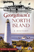
Georgetown's North Island: A History
by Robert McalisterNorth Island has always been the beacon from the sea leading toward Georgetown, South Carolina. It was an island of exploration for the Spanish in 1526 and the first landing place of Lafayette, France's hero of the American Revolution, in 1777. It was a summer resort for aristocratic rice planters and their slaves from Georgetown and Waccamaw Neck until 1861. North Island's lighthouse, built in 1812, led thousands of sailing ships from all over the world past massive stone jetties and through Winyah Bay to Georgetown. Today, North Island is a sanctuary and laboratory for the study of nature's effects on this unique barrier island. Join historian Robert McAlister as he recounts the island's storied past.
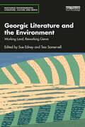
Georgic Literature and the Environment: Working Land, Reworking Genre (Routledge Environmental Literature, Culture and Media)
by Sue Edney Tess SomervellThis expansive edited collection explores in depth the georgic genre and its connections to the natural world. Together, its chapters demonstrate that georgic—a genre based primarily on two classical poems about farming, Virgil’s Georgics and Hesiod’s Works and Days—has been reworked by writers throughout modern and early modern English-language literary history as a way of thinking about humans’ relationships with the environment. The book is divided into three sections: Defining Georgic, Managing Nature and Eco-Georgic for the Anthropocene. It centres the georgic genre in the ecocritical conversation, giving it equal prominence with pastoral, elegy and lyric as an example of ‘nature writing’ that can speak to urgent environmental questions throughout literary history and up to the present day. It provides an overview of the myriad ways georgic has been reworked in order to address human relationships with the environment, through focused case studies on individual texts and authors, including James Grainger, William Wordsworth, Henry David Thoreau, George Eliot, Thomas Hardy, Seamus Heaney, Judith Wright and Rachel Blau DuPlessis. This is a much-needed volume for literary critics, academics and students engaged in ecocritical studies, environmental humanities and literature, addressing a significantly overlooked environmental literary genre.
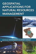
Geospatial Applications for Natural Resources Management
by Chander Kumar SinghShelving Guide: This book will present new research regarding the interdisciplinary applications of spatial information sciences for identification, assessment, monitoring, and modeling issues related to natural resources and environmental management. It will focus on the creation, collection, storage, processing, modeling, interpretation, display and dissemination of spatio-temporal data, which could greatly aid with environmental management issues including ecosystem change, resource utilization, land use management, and environmental pollution. The positive environmental impacts of information technology advancements with regard to global environmental and climate change will also be discussed. Features Explains how geospatial information can best serve environmental management needs, including ecosystem change, resource utilization, land use management, and environmental pollution. Examines the environmental impacts of information technology advancements with regard to global environmental and climate change. Focuses on the creation, collection, storage, processing, modeling, interpretation, display and dissemination of environmental spatio-temporal data. Presents examples of applications for spatial information sciences regarding the assessment, monitoring, and modeling of natural resources. Includes practical case studies in every chapter.
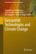
Geospatial Technologies and Climate Change
by Rob Roggema Ramesh Singh Janardhanan Sundaresan K M Santosh Andrea DériGeospatial Technologies and Climate Change describes various approaches from different countries on how to use geospatial technologies to help solving climate change issues. It also details how different geospatial technologies (remote sensing, Geographical Information System. . . ) can be used to help with climate monitoring and modeling, how to work with them and what to be careful about. This book is written by scientific experts from four different continents. Written in a comprehensive and complete way, this book is essential reading material for graduate and undergraduate students interested in these techniques and in climate change.
Geospatial Technologies for Crops and Soils
by Ram Swaroop Meena Tarik Mitran Abhishek ChakrabortyThe sustainable development of the agriculture sector is the only option to meet the demands of increased and economically viable production in a changing climate. This means there is a need to introduce the latest technologies to enhance production, and also help policymakers make decisions for the future. Geospatial technologies & tools, such as remote sensing, geographical information systems (GIS), global positioning systems (GPS), and mobile & web applications, provide unique capabilities to analyze multi-scale, multi-temporal datasets, and support decision-making in sustainable agriculture development and natural resources management. Further, the availability of reliable and timely geospatial information on natural resources and environmental conditions is essential for sustainable agricultural development and food security. Since remote sensing solutions are fast, non-destructive and have large spatial coverage, they can play a significant role in the identification, inventory, and mapping of land resources. Over the past four decades, remote sensing has proved to be a cost-effective and powerful tool to assess crop and soil properties in varying spatial and temporal scales using both visual and digital techniques. Satellite remote sensing coupled with GIS & mobile-app based positional information has emerged as an efficient tool for optimizing input resources, and minimizing cost of production and risk of biotic/ abiotic factors nature to promote sustainable agriculture. This book comprehensively documents the applications of space-based technologies for crop and soil assessments for the sustainable development of agriculture.

Geospatial Technologies for Land Degradation Assessment and Management
by R. S. DwivediThe constant growth of the world’s population and the decline of the availability of land and soil resources are global concerns for food security. Other concerns are the decrease in productivity and delivery of essential ecosystems services because of the decline of soil quality and health by a range of degradation processes. Key soil properties like soil bulk density, organic carbon concentration, plant available water capacity, infiltration rate, air porosity at field moisture capacity, and nutrient reserves, are crucial properties for soil functionality which refers to the capacity of soil to perform numerous functions. These functions are difficult to measure directly and are estimated through indices of soil quality and soil health. Soil degradation, its extent and severity, can also be estimated by assessing indices of soil quality and health. "Geospatial Technology for Land Degradation Assessment and Management" uses satellite imagery and remote sensing technologies to measure landscape parameters and terrain attributes. Remote sensing and geospatial technologies are important tools in assessing the extent and the severity of land and soil degradation, their temporal changes, and geospatial distribution in a timely and cost-effective manner. The knowledge presented in the book by Dr. R.S. Dwivedi shows how remote sensing data can be utilized for inventorying, assessing, and monitoring affected ecosystems and how this information can be integrated in the models of different local settings. Through many land degradations studies, land managers, researchers, and policymakers will find practical applications of geospatial technologies and future challenges. The information presented is also relevant to advancing the Sustainable Development Goals of the United Nations towards global food security.