- Table View
- List View
Mapping Mars: Science, Imagination, and the Birth of a World
by Oliver MortonWho are the extraordinary individuals that will take us on the next great space race, the next great human endeavor, our exploration and colonization of the planet Mars? And more importantly, how are they doing it? Acclaimed science writer Oliver Morton explores the peculiar and fascinating world of the new generation of explorers: geologists, scientists, astrophysicists and dreamers. Morton shows us the complex and beguiling role that mapping will play in our understanding of the red planet, and more deeply, what it means for humans to envision such heroic landscapes. Charting a path from the 19th century visionaries to the spy-satellite pioneers to the science fiction writers and the arctic explorers -- till now, to the people are taking us there -- Morton unveils the central place that Mars has occupied in the human imagination, and what it will mean to realize these dreams. A pioneering work of journalism and drama, Mapping Mars gives us our first exciting glimpses of the world to come and the curious, bizarre, and amazing people who will take us there.
Mapping Nature across the Americas
by James R. Akerman Kathleen A. BrosnanMaps are inherently unnatural. Projecting three-dimensional realities onto two-dimensional surfaces, they are abstractions that capture someone’s idea of what matters within a particular place; they require selections and omissions. These very characteristics, however, give maps their importance for understanding how humans have interacted with the natural world, and give historical maps, especially, the power to provide rich insights into the relationship between humans and nature over time. That is just what is achieved in Mapping Nature across the Americas. Illustrated throughout, the essays in this book argue for greater analysis of historical maps in the field of environmental history, and for greater attention within the field of the history of cartography to the cultural constructions of nature contained within maps. This volume thus provides the first in-depth and interdisciplinary investigation of the relationship between maps and environmental knowledge in the Americas—including, for example, stories of indigenous cartography in Mexico, the allegorical presence of palm trees in maps of Argentina, the systemic mapping of US forests, and the scientific platting of Canada’s remote lands.
Mapping Our Ancestors: Phylogenetic Approaches in Anthropology and Prehistory
by Stephen ShennanMuch of what we are comes from our ancestors. Through cultural and biological inheritance mechanisms, our genetic composition, instructions for constructing artifacts, the structure and content of languages, and rules for behavior are passed from parents to children and from individual to individual. Mapping Our Ancestors demonstrates how various genealogical or "phylogenetic" methods can be used both to answer questions about human history and to build evolutionary explanations for the shape of history.Anthropologists are increasingly turning to quantitative phylogenetic methods. These methods depend on the transmission of information regardless of mode and as such are applicable to many anthropological questions. In this way, phylogenetic approaches have the potential for building bridges among the various subdisciplines of anthropology; an exciting prospect indeed. The structure of Mapping Our Ancestors reflects the editors' goal of developing a common understanding of the methods and conditions under which ancestral relations can be derived in a range of data classes of interest to anthropologists. Specifically, this volume explores the degree to which patterns of ancestry can be determined from artifactual, genetic, linguistic, and behavioral data and how processes such as selection, transmission, and geography impact the results of phylogenetic analyses.Mapping Our Ancestors provides a solid demonstration of the potential of phylogenetic methods for studying the evolutionary history of human populations using a variety of data sources and thus helps explain how cultural material, language, and biology came to be as they are.
Mapping Russia's Natural Focal Diseases: History And Contemporary Approaches (Global Perspectives on Health Geography)
by Dmitry Orlov Svetlana Malkhazova Varvara Mironova Natalia Shartova Vadim Rumyantsev Mikhail SoldatovThis book is the first scientific publication on diseases caused by agents circulating in natural environments independently from humans, covering the whole territory of the Russian Federation. It contains diverse and multifaceted information, both in textual and cartographic form.The book focuses on the historical and current distribution of natural-focal diseases in Russia, epidemiological aspects, natural and socio-economic determinants conducing natural foci. With a series of maps this book depicts population morbidity rates in particular regions and on a national level for the 21st century.With numerous color illustrations this book appeals to a wide audience and is of particular interest to geographers, environmental workers, epidemiologists and other specialists interested in environmental and public health issues.
Mapping Species Distributions
by Janet Franklin Jennifer A. MillerMaps of species' distributions or habitat suitability are required for many aspects of environmental research, resource management and conservation planning. These include biodiversity assessment, reserve design, habitat management and restoration, species and habitat conservation plans and predicting the effects of environmental change on species and ecosystems. The proliferation of methods and uncertainty regarding their effectiveness can be daunting to researchers, resource managers and conservation planners alike. Franklin summarises the methods used in species distribution modeling (also called niche modeling) and presents a framework for spatial prediction of species distributions based on the attributes (space, time, scale) of the data and questions being asked. The framework links theoretical ecological models of species distributions to spatial data on species and environment, and statistical models used for spatial prediction. Providing practical guidelines to students, researchers and practitioners in a broad range of environmental sciences including ecology, geography, conservation biology, and natural resources management.
Mapping Sustainability Measurement: A Review of the Approaches, Methods, and Literature (Sustainable Development Goals Series)
by Agnieszka Gehringer Susann KowalskiThis book explores modern approaches to sustainability and its measurement. It thoroughly reviews a wide range of existing sustainability measurement systems. Accordingly, the book documents the state of progress toward sustainability measurement by first assessing the past development of wellbeing measurement going beyond GDP and synthesizing the various conceptual approaches to sustainability and its dimensions. It then explores crucial methodological aspects that stay at the core of constructing a sound index system. In the main part of the book, we map the available indices or index systems, their conceptual and methodological backgrounds as well as approaches, which have not yet resulted in an index, but have the potential to contribute to a better understanding of sustainability. More specifically, the book assesses the scope, motivation, and potential usage of each index. It also documents their limitations and drawbacks. This mapping exercise is useful for policymakers, researchers, and practitioners as it offers a detailed and compact overview of where we are and what we still need to account for when measuring sustainability.
Mapping The Mind
by Rita Carter'One of the clearest and best-illustrated attempts to explain the virtually inaccessible, the brain' SUNDAY TIMESBrain scans reveal our thoughts, memories - even our moods - as clearly as an X-ray reveals our bones. We can watch a person's brain literally light up as it registers a joke, or glow dully when it recalls an unhappy memory. MAPPING THE MIND shows how these cans can be used to help explain aspects of our behaviour and how behavioural eccentricities can be traced to abnormalities in an individual brain. Dyslexia, for example, may be caused by a short-circuit in the messages converting sound to visual cues; addiction, eating disorders and alcoholism stem from dysfunction in the brain's reward system. In this acclaimed book Rita Carter draws on the latest in brain imaging to give extraordinary insights into how the brain works.
Mapping Urban Practices Through Mobile Phone Data
by Paola Pucci Fabio Manfredini Paolo TagliolatoThis book explains the potential value of using mobile phone data to monitor urban practices and identify rhythms of use in today's cities. Drawing upon research conducted in the Italian region of Lombardy, the authors demonstrate how maps based on mobile phone data, which are better tailored to the dynamic processes at work in cities, can document urban practices, provide new insights into spatial and temporal patterns of mobility, and assist in recognizing different communities of practice. The described methodology permits detailed visualization of the spatial distribution of mobility flows and offers a more extensive and refined description of the distribution of urban activity than is provided by traditional travel surveys. The book also details how maps derived by processing mobile phone data can assist in the definition of urban policies that will deliver services that match cities' needs, facilitate the management of large events (inflow, outflow, and monitoring), and reflect time-dependent phenomena not included in traditional analyses.
Mapping Versatile Boundaries
by Regis DarquesThis book demonstrates the pivotal role played by state confines in the geography of Balkan countries through powerful GIS and remote sensing analyses. It provides unique mapping perspectives on the Balkan region, with over 140 illustrations. The book is dedicated to applied, historical and economic geographers, as well as political scientists. Because of its high fragmentation, the Balkan area has not been studied on a systematic transnational basis. The persistence of frozen and/or open conflicts has also turned the border issue into an absolute taboo subject for the scientific community and civil society. This results in an apparent "chaos" that most Western observers fail to understand.
Mapping an Atlantic World, circa 1500
by Alida C. MetcalfHow did intricately detailed sixteenth-century maps reveal the start of the Atlantic World?Beginning around 1500, in the decades following Columbus's voyages, the Atlantic Ocean moved from the periphery to the center on European world maps. This brief but highly significant moment in early modern European history marks not only a paradigm shift in how the world was mapped but also the opening of what historians call the Atlantic World. But how did sixteenth-century chartmakers and mapmakers begin to conceptualize—and present to the public—an interconnected Atlantic World that was open and navigable, in comparison to the mysterious ocean that had blocked off the Western hemisphere before Columbus's exploration?In Mapping an Atlantic World, circa 1500, Alida C. Metcalf argues that the earliest surviving maps from this era, which depict trade, colonization, evangelism, and the movement of peoples, reveal powerful and persuasive arguments about the possibility of an interconnected Atlantic World. Blending scholarship from two fields, historical cartography and Atlantic history, Metcalf explains why Renaissance cosmographers first incorporated sailing charts into their maps and began to reject classical models for mapping the world. Combined with the new placement of the Atlantic, the visual imagery on Atlantic maps—which featured decorative compass roses, animals, landscapes, and native peoples—communicated the accessibility of distant places with valuable commodities. Even though individual maps became outdated quickly, Metcalf reveals, new mapmakers copied their imagery, which then repeated on map after map. Individual maps might fall out of date, be lost, discarded, or forgotten, but their geographic and visual design promoted a new way of seeing the world, with an interconnected Atlantic World at its center.Describing the negotiation that took place between a small cadre of explorers and a wider class of cartographers, chartmakers, cosmographers, and artists, Metcalf shows how exploration informed mapmaking and vice versa. Recognizing early modern cartographers as significant agents in the intellectual history of the Atlantic, Mapping an Atlantic World, circa 1500 includes around 50 beautiful and illuminating historical maps.
Mapping and Analysing Crime Data: Lessons from Research and Practice
by Kate Bowers Alex HirschfieldOne of the key methods of reducing and dealing with criminal activity is to accurately gauge and then analyse the geographical distribution of crime (from small scale to large scale areas). Once the police and government know what areas suffer most from criminal activity they can assess why this is the case and then deal with it in the most effecti
Mapping and Empire: Soldier-Engineers on the Southwestern Frontier
by Dennis Reinhartz Gerald D. SaxonFrom the sixteenth through the mid-nineteenth centuries, Spain, then Mexico, and finally the United States took ownership of the land from the Gulf Coast of Texas and Mexico to the Pacific Coast of Alta and Baja California—today's American Southwest. Each country faced the challenge of holding on to territory that was poorly known and sparsely settled, and each responded by sending out military mapping expeditions to set boundaries and chart topographical features.
Mapping and Navigation
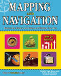
by Cynthia Light Brown Beth Hetland Patrick McgintyHow did we get from 20-foot-long maps to GPS devices small enough to fit in the palm of our hands? How does GPS work and what can it tell us? How do ancient mapmaking techniques used by the Romans and Greeks influence the satellite technologies we use today? The history of mapmaking is full of remarkable characters who charted the unknown with an ever-changing set of tools. In Mapping and Navigation: The History and Science of Finding Your Way, kids ages 9-12 will learn the history and science behind the evolution of mapmaking, and how much is still out there for discovery.Readers will explore ideas through hands-on experiments while learning new terminology and interesting facts. Projects include using triangulation to measure distances, creating contour lines on a mini-mountain to understand elevation changes on a map, and inventing a sundial and compass to understand the basics of navigation. Whether mapping the solar system or mapping their own backyard, all readers will be able to understand mapping technologies and see the world in new and exciting ways.
Mapping and Spatial Analysis of Socio-economic and Environmental Indicators for Sustainable Development: Case Studies from North Africa (Advances in Science, Technology & Innovation)
by Noamen Rebai Mohamed MastereThis book presents most recent research studies on mapping and spatial analysis of socio-economic and environmental indicators used by various national and international contributors to regional development projects. It gathers the best contributions to the 1st International Conference on Mapping and Spatial Analysis of Socio-Economic and Environmental Indicators for the Local and Regional Sustainable Development. The conference was held in southern Tunisia, Tataouine in March 2015.The research studies focused on generating and analyzing indicators in various domains of Agriculture, Energy, Industry, Tourism, Transport, Urban Planning, Exploitation of Natural Resources, Infrastructure, Health, Environment, Education, Information and Communication Technologies, Social Affairs and Employability, and Culture and Sport. Socio-economic and environmental indicators are important in regional development plans and strategies as they allow to observe and analyze changes in the economic growth and to measure their impact on the environment and on social networks/daily life of citizens. On the basis of well-defined geomatic approaches, and particularly, through sophisticated digital mapping and spatio-temporal analyses, authors focused on retrieving indicators to evaluate the exploitation rate of natural resources, intensity of the energy consumption in various economic sector, net migratory flows, quality checking of the air in urban areas, adaptation to climate change, and vulnerability of the coastal domain and risk of marine submersion due to sea-level rise. The book is of interest not only to investors and contributors to regional development projects, but also to all relevant policy makers.
Mapping of Nervous System Diseases via MicroRNAs (Frontiers In Neurotherapeutics Ser. #2)
by Christian Barbato Francesca RubertiIn recent years, understanding of microRNA (miRNA) biogenesis, the molecular mechanisms by which miRNAs regulate gene expression, and the functional roles of miRNAs has expanded. Mapping of Nervous System Diseases via MicroRNAs provides an up-to-date review on the function of miRNA in neurological diseases as well as advancements in technology for
Mapping of Parent Hamiltonians
by Martin GreiterThis monograph introduces an exact model for a critical spin chain with arbitrary spin S, which includes the Haldane--Shastry model as the special case S=1/2. While spinons in the Haldane-Shastry model obey abelian half-fermi statistics, the spinons in the general model introduced here obey non-abelian statistics. This manifests itself through topological choices for the fractional momentum spacings. The general model is derived by mapping exact models of quantized Hall states onto spin chains. The book begins with pedagogical review of all the relevant models including the non-abelian statistics in the Pfaffian Hall state, and is understandable to every student with a graduate course in quantum mechanics.
Mapping of Parent Hamiltonians: From Abelian and non-Abelian Quantum Hall States to Exact Models of Critical Spin Chains (Springer Tracts in Modern Physics #244)
by Martin GreiterThis monograph introduces an exact model for a critical spin chain with arbitrary spin S, which includes the Haldane--Shastry model as the special case S=1/2. While spinons in the Haldane-Shastry model obey abelian half-fermi statistics, the spinons in the general model introduced here obey non-abelian statistics. This manifests itself through topological choices for the fractional momentum spacings. The general model is derived by mapping exact models of quantized Hall states onto spin chains. The book begins with pedagogical review of all the relevant models including the non-abelian statistics in the Pfaffian Hall state, and is understandable to every student with a graduate course in quantum mechanics.
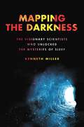
Mapping the Darkness: The Visionary Scientists Who Unlocked the Mysteries of Sleep
by Kenneth MillerNAMED A BEST BOOK OF THE YEAR 2023 BY THE NEW YORKER NEW YORK TIMES EDITOR'S CHOICE SELECTION "A propulsive, utterly engrossing history... None of it is simple and all of it is captivating."—The New York Times "Mapping the Darkness offers two narratives at once: a sweeping journey of discovery about dreams, sleep and the terra incognita of unconsciousness; and a wake-up call about the dangers of chronic exhaustion. It&’s time, Mr. Miller tells us, to take our sleep back."—The Wall Street JournalFrom award-winning journalist Kenneth Miller comes the definitive story of the scientists who set out to answer two questions: &“Why do we sleep?&” and "How can we sleep better?&” A century ago, sleep was considered a state of nothingness—even a primitive habit that we could learn to overcome. Then, an immigrant scientist and his assistant spent a month in the depths of a Kentucky cave, making nationwide headlines and thrusting sleep science to the forefront of our consciousness. In the 1920s, Nathaniel Kleitman founded the world&’s first dedicated sleep lab at the University of Chicago, where he subjected research participants (including himself) to a dizzying array of tests and tortures. But the tipping point came in 1938, when his cave experiment awakened the general public to the unknown—and vital—world of sleep. Kleitman went on to mentor the talented but troubled Eugene Aserinsky, whose discovery of REM sleep revealed the astonishing activity of the dreaming brain, and William Dement, a jazz-bass playing revolutionary who became known as the father of sleep medicine. Dement, in turn, mentored the brilliant maverick Mary Carskadon, who uncovered an epidemic of sleep deprivation among teenagers, and launched a global movement to fight it. Award-winning journalist Kenneth Miller weaves together science and history to tell the story of four outsider scientists who took sleep science from fringe discipline to mainstream obsession through spectacular experiments, technological innovation, and single-minded commitment. Readers will walk away with a comprehensive understanding of sleep and why it affects so much of our lives.
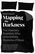
Mapping the Darkness: The Visionary Scientists Who Unlocked the Mysteries of Sleep
by Kenneth Miller&‘Fascinating, magisterially researched, and brilliantly written.&’ Steve Silberman, author of Neurotribes Thirty-two days underground. No heat. No sunlight. 4 June 1938. Nathaniel Kleitman and his research student make their way down the seventy-one steps leading to the mouth of Mammoth Cave. They are about to embark on one of the most intrepid and bizarre experiments in medical history, one which will change our understanding of sleep forever. Undisturbed by natural light, they will investigate what happens when you overturn one of the fundamental rhythms of the human body. Together, they enter the darkness. When Kleitman first arrived in New York, a penniless twenty-year-old refugee, few would have guessed that in just a few decades he would revolutionise the field of sleep science. In Mapping the Darkness, Kenneth Miller weaves science and history to tell the story of the outsider scientists who took sleep science from the fringes to a mainstream obsession. Reliving the spectacular experiments, technological innovation, imaginative leaps and single-minded commitment of these early pioneers, Miller provides a tantalising glimpse into the most mysterious third of our lives.
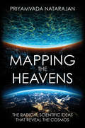
Mapping the Heavens: The Radical Scientific Ideas That Reveal the Cosmos
by Priyamvada NatarajanA theoretical astrophysicist explores the ideas that transformed our knowledge of the universe over the past century. The cosmos, once understood as a stagnant place, filled with the ordinary, is now a universe that is expanding at an accelerating pace, propelled by dark energy and structured by dark matter. Priyamvada Natarajan, our guide to these ideas, is someone at the forefront of the research—an astrophysicist who literally creates maps of invisible matter in the universe. She not only explains for a wide audience the science behind these essential ideas but also provides an understanding of how radical scientific theories gain acceptance. The formation and growth of black holes, dark matter halos, the accelerating expansion of the universe, the echo of the big bang, the discovery of exoplanets, and the possibility of other universes—these are some of the puzzling cosmological topics of the early twenty-first century. Natarajan discusses why the acceptance of new ideas about the universe and our place in it has never been linear and always contested even within the scientific community. And she affirms that, shifting and incomplete as science always must be, it offers the best path we have toward making sense of our wondrous, mysterious universe. &“Part history, part science, all illuminating. If you want to understand the greatest ideas that shaped our current cosmic cartography, read this book.&”—Adam G. Riess, Nobel Laureate in Physics, 2011 &“A highly readable, insider&’s view of recent discoveries in astronomy with unusual attention to the instruments used and the human drama of the scientists.&”—Alan Lightman, author of The Accidental Universe and Einstein's Dream
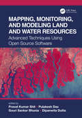
Mapping, Monitoring, and Modeling Land and Water Resources: Advanced Techniques Using Open Source Software
by Pravat Kumar Shit, Pulakesh Das, Gouri Sankar Bhunia, and Dipanwita DuttaThe wide range of challenges in studying Earth system dynamics due to uncertainties in climate change and complex interference from human activities is creating difficulties in managing land and water resources and ensuring their sustainable use. Mapping, Monitoring, and Modeling Land and Water Resources brings together real-world case studies accurately surveyed and assessed through spatial modeling. The book focuses on the effectiveness of combining remote sensing, geographic information systems, and R. The use of open source software for different spatial modeling cases in various fields, along with the use of remote sensing and geographic information systems, will aid researchers, students, and practitioners to understand better the phenomena and the predictions by future analyses for problem-solving and decision-making.
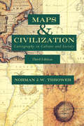
Maps & Civilization: Cartography in Culture and Society
by Norman J. ThrowerIn this concise introduction to the history of cartography, Norman J. W. Thrower charts the intimate links between maps and history from antiquity to the present day. A wealth of illustrations, including the oldest known map and contemporary examples made using Geographical Information Systems (GIS), illuminate the many ways in which various human cultures have interpreted spatial relationships. The third edition of Maps and Civilization incorporates numerous revisions, features new material throughout the book, and includes a new alphabetized bibliography. Praise for previous editions of Maps and Civilization: “A marvelous compendium of map lore. Anyone truly interested in the development of cartography will want to have his or her own copy to annotate, underline, and index for handy referencing.”—L. M. Sebert, Geomatica
Maps of Time: An Introduction to Big History
by William H. Mcneill David ChristianA history of the world from the big bang to the present. "Big history" is a new approach to world history that joins the history of the world as a physical entity to human history. David Christian is the leading proponent of this approach to world history.
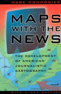
Maps with the News: The Development of American Journalistic Cartography (John D. And Catherine T. Macarthur Foundation Series On Mental Health And Development)
by Mark MonmonierMaps with the News is a lively assessment of the role of cartography in American journalism. Tracing the use of maps in American news reporting from the eighteenth century to the 1980s, Mark Monmonier explores why and how journalistic maps have achieved such importance. "A most welcome and thorough investigation of a neglected aspect of both the history of cartography and modern cartographic practice."—Mapline "A well-written, scholarly treatment of journalistic cartography. . . . It is well researched, thoroughly indexed and referenced . . . amply illustrated."—Judith A. Tyner, Imago Mundi "There is little doubt that Maps with the News should be part of the training and on the desks of all those concerned with producing maps for mass consumption, and also on the bookshelves of all journalists, graphic artists, historians of cartography, and geographic educators."—W. G. V. Balchin, Geographical Journal "A definitive work on journalistic cartography."—Virginia Chipperfield, Society of University Cartographers Bulletin
