- Table View
- List View
Geoecology: An Evolutionary Approach
by Richard HuggettAnimals, plants and soils interact with one another, with the terrestrial spheres, and with the rest of the Cosmos. On land, this rich interaction creates landscape systems or geoecosystems. Geoecology investigates the structure and function of geoecosystems, their components and their environment. The author develops a simple dynamic systems model, the `brash' equation, to form the conceptual framework for the book suggesting an `ecological' and `evolutionary' approach. Exploring internal of `ecological' interactions between geoecosystems and their near-surface environments - the atmosphere, hydrosphere, toposhere, and lithosphere - and external influences, both geological and cosmic, Geoecology presents geoecosystems as dynamic entities constantly responding to changes within themselves and their surroundings. An `evolutionary' view emerges of geoecological systems, and the animals, plants, and soils comprising them, providing a new way of thinking for the whole environmental complex and the rich web of interdependencies contained therein.
Geographic Data Science with Python (Chapman & Hall/CRC Texts in Statistical Science)
by Sergio Rey Dani Arribas-Bel Levi John WolfThis book provides the tools, the methods, and the theory to meet the challenges of contemporary data science applied to geographic problems and data. In the new world of pervasive, large, frequent, and rapid data, there are new opportunities to understand and analyze the role of geography in everyday life. Geographic Data Science with Python introduces a new way of thinking about analysis, by using geographical and computational reasoning, it shows the reader how to unlock new insights hidden within data. Key Features: ● Showcases the excellent data science environment in Python. ● Provides examples for readers to replicate, adapt, extend, and improve. ● Covers the crucial knowledge needed by geographic data scientists. It presents concepts in a far more geographic way than competing textbooks, covering spatial data, mapping, and spatial statistics whilst covering concepts, such as clusters and outliers, as geographic concepts. Intended for data scientists, GIScientists, and geographers, the material provided in this book is of interest due to the manner in which it presents geospatial data, methods, tools, and practices in this new field.
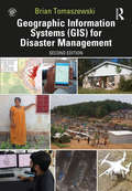
Geographic Information Systems (GIS) for Disaster Management
by Brian TomaszewskiNow in its second edition, Geographic Information Systems (GIS) for Disaster Management has been completely updated to take account of new developments in the field. Using a hands-on approach grounded in relevant GIS and disaster management theory and practice, this textbook continues the tradition of the benchmark first edition, providing coverage of GIS fundamentals applied to disaster management. Real-life case studies demonstrate GIS concepts and their applicability to the full disaster management cycle. The learning-by-example approach helps readers see how GIS for disaster management operates at local, state, national, and international scales through government, the private sector, non‐governmental organizations, and volunteer groups. New in the second edition: a chapter on allied technologies that includes remote sensing, Global Positioning Systems (GPS), indoor navigation, and Unmanned Aerial Systems (UAS); thirteen new technical exercises that supplement theoretical and practical chapter discussions and fully reinforce concepts learned; enhanced boxed text and other pedagogical features to give readers even more practical advice; examination of new forms of world‐wide disaster faced by society; discussion of new commercial and open-source GIS technology and techniques such as machine learning and the Internet of Things; new interviews with subject-matter and industry experts on GIS for disaster management in the US and abroad; new career advice on getting a first job in the industry. Learned yet accessible, Geographic Information Systems (GIS) for Disaster Management continues to be a valuable teaching tool for undergraduate and graduate instructors in the disaster management and GIS fields, as well as disaster management and humanitarian professionals. Please visit http://gisfordisastermanagement.com to view supplemental material such as slides and hands-on exercise video walkthroughs. This companion website offers valuable hands-on experience applying concepts to practice.
Geographic Information Systems for the Social Sciences: Investigating Space and Place
by Steven J. Steinberg Sheila L. SteinbergGeographic Information Systems for the Social Sciences: Investigating Space and Place is the first book to take a cutting-edge approach to integrating spatial concepts into the social sciences. In this text, authors Steven J. Steinberg and Sheila L. Steinberg simplify GIS (Geographic Information Systems) for practitioners and students in the social sciences through the use of examples and actual program exercises so that they can become comfortable incorporating this research tool into their repertoire and scope of interest. The authors provide learning objectives for each chapter, chapter summaries, links to relevant Web sites, as well as suggestions for student research projects.
Geographic Information Systems: Socioeconomic Applications
by David MartinThis second edition of Geographic Information Systems builds on the strengths of the first, and incorporates important recent advances in GIS development and major new socioeconomic datasets including new census data. Martin presents an accessible introduction to the history, principles and techniques of GIS, with a unique focus on socioeconomic applications. This non-technical volume addresses the needs of students and professionals who must understand and use GIS for the first time.
Geographic Perspectives on Soviet Central Asia
by Robert A. LewisIn a unique survey, based on new census data, Geographic Perspectives on Soviet Central Asia highlights the region's geographic, economic and ecological problems since 1945. Painting a grim picture, this book investigates how the combination of rapid population growth and declining per capita investment is causing economic conditions to slide in rural areas and encouraging an ecological catastrophe. The authors discuss the effects of low rural out-migration, and show that at current growth rates the rural working-age population will double with each generation. Unprecedented in a developed country, this is causing the region to become more rather than less rural. Soviet Central Asia is an area of low productivity, and the book considers the lack of support from Soviet central government to the region. Wishing to maximise their return to capital and labour, the government is concentrating its investment in the European West and directing insufficient funds for a growing workforce in Central Asia. Soviet Central Asia also faces grave ecological problems; the declining level of the Aral Sea, extensive soil salinization and water pollution, all largely due to past attempts at irrigation. The authors consider the effect of these disasters on the area, and look to future possibilities in this very important region of the world.
Geographic Profiling
by D. Kim RossmoAs any police officer who has ever walked a beat or worked a crime scene knows, the street has its hot spots, patterns, and rhythms: drug dealers work their markets, prostitutes stroll their favorite corners, and burglars hit their favorite neighborhoods. But putting all the geographic information together in cases of serial violent crime (murder, rape, arson, bombing, and robbery) is highly challenging. Just ask the homicide detectives of the Los Angeles Police Department who hunted the Hillside Stranglers, or law enforcement officers in Louisiana who tracked the brutal South Side rapist.Geographic Profiling introduces and explains this cutting-edge investigative methodology in-depth. Used to analyze the locations of a connected series of crimes to determine the most likely area of offender residence, geographic profiling allows investigators and law enforcement officers to more effectively manage information and focus their investigations.This extensive and exhaustive work explains geographic profiling theories and principles, and includes an extensive review of the literature and research in the areas of criminal profiling, forensic behavioral science, serial violent crime, environmental criminology, and the geography of crime. For investigators and police officers deployed in the field, as well as criminal analysts, Geographic Profiling is a "must have" reference.
Geographic Profiling
by D. Kim RossmoGeographic Profiling explores this cutting‑edge investigative methodology for determining the most probable area of an offender’s residence by analyzing the locations of a series of connected crimes. Geoprofiling allows police detectives and law enforcement officers to prioritize suspects, focus their investigations, and manage information overload. This extensive and exhaustive work explains the underlying theories and operational principles of the methodology. To provide context, extensive reviews of the research on serial murder, rape, and arson, stranger child murder, behavioral/psychological profiling, linkage analysis, and the geography of crime are included.As any police officer who has walked a beat or worked a crime scene knows, streets have hot spots, patterns, and rhythms. Understanding the varied geographic information in a crime series can be challenging. Renowned expert Kim Rossmo explains the concepts and applications of geographic profiling, and in this second edition updates his groundbreaking book with informative and engaging figures, tables, and examples. A range of applications are discussed including suspect prioritization, database searches, tactical response plans, missing person investigations, clandestine grave identification, and the role of geography in wrongful conviction reviews. Dr. Rossmo discusses the nature of police inquiries, criminal evidence, investigative challenges and failures, and more. The book explores the application of geographic profiling to violent and property crime, single offenses, epidemiology, counterterrorism/insurgency, and even earthquake epicenter and pirate base prediction. Fascinating new case studies include the Golden State Killer, Operation Lynx, the Zodiac Killer, the Lindbergh baby kidnapping, the DC Snipers, and the Austin Midnight Assassin.Geographic Profiling is a must‑have reference for detectives, crime analysts, and law enforcement officers who want to follow the geographic clues in their cases. Its clear presentation makes it ideal for college courses, police training, university scholars, and students of true crime.
Geographic Realities in the Middle East and North Africa: State, Oil and Agriculture (History and Society in the Islamic World)
by George Joffé; Richard SchofieldCelebrating the work of Keith McLachlan, a well-known and much-admired geographer of the Middle East and North Africa, this book combines three interrelated topics that define the region. The Middle East has been integral to the growth of the global oil industry, an aspect of its evolution since 1908 which has had profound geopolitical implications as well. The territory was also the arena for the last European experiment in colonialism, a development that has left its legacy even today. And, historically, it has been the location of the great hydraulic civilisations of Egypt and Mesopotamia yet is still dependent on the flow of its two major river systems – the Nile and the Tigris-Euphrates – in an era of impending climate crisis. These themes form the essence of themes that are discussed in the chapters that follow. Keith McLachlan played a significant role in our understanding of these themes and of their effects in the contemporary world, as the comments of those who worked with him and have contributed towards this book reveal. Examining agriculture, oil and state construction, this volume offers an insight into how the contemporary Middle East was constructed after the collapse of the Ottoman Empire. It is a key resource for scholars and students interested in geopolitics and the geography of the Middle East.
Geographic Thought: A Critical Introduction (Critical Introductions to Geography)
by Tim CresswellThis engaging and accessible introduction to geographic thought explores the major thinkers and key theoretical developments in the field of human geography. Covers the complete range of the development of theoretical knowledge of the field, from ancient geography to contemporary non-representational theory Presents theories in an accessible manner through the author's engaging writing style Examines the influence of Darwin and Marx, the emergence of anarchist geographies, the impact of feminism, and myriad other important bodies of thought Stresses the importance of geographic thought and its relevance to our understanding of what it is to be human, and to the people, places, and cultures of the world in which we live
Geographic Thought: A Praxis Perspective
by George Henderson Marvin WaterstoneWithout social movements and wider struggles for progressive social change, the field of Geography would lack much of its contemporary relevance and vibrancy. Moreover, these struggles and the geographical scholarship that engages with them have changed the philosophical underpinnings of the discipline and have inflected the quest for geographical knowledge with a sense not only of urgency but also hope. This reader, intended for advanced undergraduate and beginning graduate courses in Geographic Thought, is at once an analysis of Geography’s theoretical and practical concerns and an encounter with grounded political struggles. This reader offers a fresh approach to learning about Geographic Thought by showing, through concrete examples and detailed editorial essays, how the discipline has been forever altered by the rise of progressive social struggles. Structured to aid student understanding, the anthology presents substantive main and part introductory essays and features more than two dozen unabridged published works by leading scholars that emphatically articulate geographic thought to progressive social change. Each section is introduced with an explanation of how the following pieces fit into the broader context of geographic work amidst the socially progressive struggles that have altered social relations in various parts of the world over the last half-century or so. Doubly, it places this work in the context of the larger goals of social struggles to frame or reframe rights, justice, and ethics. Geographic Thought provides readers with insights into the encounters between scholarship and practice and aims to prompt debates over how social and geographical knowledges arise from the context of social struggles and how these knowledges might be redirected at those contexts in constructive, evaluative ways. The reader is unique not only in knowing Geographic Thought through its progressive political attachments, instead of through a series of abstract "isms", but in gathering together salient works by geographers as well as scholars in cognate fields, such as Nancy Fraser, Chantal Mouffe, Iris Marion Young, and Jack Kloppenberg, whose own engagements have proved lasting and influential. For researchers and students interested in the connections between theoretically informed work and the possibilities for bettering people’s everyday lives, this book provides an innovative and compelling argument for why Geographic Thought is valuable and necessary.
Geographical Aesthetics: Imagining Space, Staging Encounters
by Elizabeth StraughanGeographical Aesthetics places the terms 'aesthetics' and 'geography' under critical question together, responding both to the increasing calls from within geography to develop a 'geographical aesthetics', and a resurgence of interdisciplinary interest in conceptual and empirical questions around geoaesthetics, environmental aesthetics, as well as the spatialities of the aesthetic. Despite taking up an identifiable role within the geographical imagination and sensibilities for centuries, and having what is arguably a key place in the making of the modern discipline, aesthetics remains a relatively under-theorized field within geography. Across 15 chapters Geographical Aesthetics brings together timely commentaries by international, interdisciplinary scholars to rework historical relations between geography and aesthetics, and reconsider how it is we might understand aesthetics. In renewing aesthetics as a site of investigation, but also an analytic object through which we can think about worldly encounters, Geographical Aesthetics presents a reworking of our geographical imaginary of the aesthetic.
Geographical Data Science and Spatial Data Analysis: An Introduction in R (Spatial Analytics and GIS)
by Lex Comber Chris BrunsdonWe are in an age of big data where all of our everyday interactions and transactions generate data. Much of this data is spatial – it is collected some-where – and identifying analytical insight from trends and patterns in these increasing rich digital footprints presents a number of challenges. Whilst other books describe different flavours of Data Analytics in R and other programming languages, there are none that consider Spatial Data (i.e. the location attached to data), or that consider issues of inference, linking Big Data, Geography, GIS, Mapping and Spatial Analytics. This is a ‘learning by doing’ textbook, building on the previous book by the same authors, An Introduction to R for Spatial Analysis and Mapping. It details the theoretical issues in analyses of Big Spatial Data and developing practical skills in the reader for addressing these with confidence.
Geographical Gerontology: Perspectives, Concepts, Approaches (Routledge Studies in Human Geography)
by Malcolm P. Cutchin Mark W. Skinner Gavin J. AndrewsUnderstanding where ageing occurs, how it is experienced by different people in different places, and in what ways it is transforming our communities, economies and societies at all levels has become crucial for the development of informed research, policy and programmes. <P><P>This book focuses on the interdisciplinary field of study – geographical gerontology – that addresses these issues. With contributions from more than 30 leading geographers and gerontologists, the book examines the scope and depth of geographical perspectives, concepts and approaches applied to the study of ageing, old age and older populations. The book features 25 chapters organized into five parts that cover the field’s theoretical traditions and intellectual evolution; the contributions of key disciplinary perspectives from population geography, social and cultural geography, health geography, urban planning and environmental studies; the scales of inquiry within geographical gerontology from the global to the embodied; the thematic breadth of contemporary issues of interest that define the field (places, spaces and landscapes of ageing); and a discussion about challenges, opportunities and agendas for future developments in geography and gerontology. <P><P>This book provides the first comprehensive foundation of knowledge about the state of the art of geographical gerontology that will be of interest to scholars of ageing around the world.
Geographical Indications of Indian Handlooms: Between Legal Right and Real Right
by Nidhi Buch Hetvi TrivediThis book presents a comprehensive analysis of Geographical Indications (GI) in the Indian context with particular reference to the handloom sector. It discusses themes such as the rationale of GI as IP (intellectual property); the domestic position on GIs; GI protection under various international instruments; handlooms from Gujarat and their GI journey; the efficacy of GIs; and GI structure for handlooms. The volume fills the gap between law and policies and recommends the implementation of an efficient legal system. It highlights the status of Indian handlooms, a sector that represents the country’s cultural heritage and supports a range of livelihoods. We examine India’s GI protection system with its diverse cultures and explore how GI can help recognize, support and promote these products to bring socio-economic benefits. The work documents policy measures undertaken for the revival, restructuring and promotion of Indian handlooms and handicrafts, and will serve as an important intervention in Indian law on GI. An investigative study that evaluates the current law and policy on GI protection through detailed case studies and empirical research on select Indian handlooms, this book will be useful to scholars and researchers of geography, economics, development studies, sociology, law and public policy. It will also interest policymakers, legal practitioners, textile and handloom professionals, design and business administration institutes, media, arts and crafts museums and civil society organizations working on handlooms or in intellectual property.

Geographical Information Systems In Archaeology
by James Conolly Mark LakeGeographical Information Systems (GIS) is a rapidly developing archaeological method which is moving from the domain of the computer specialist into that of the broader archaeological community. This comprehensive manual on the use of GIS in archaeology explores the concept of GIS and illustrates how it can be adapted for practical use. Examining issues such as spatial databases, data acquisition, spatial analysis, and techniques of visualization, the book is an essential tool for both students and professional archaeologists.
Geographical Information Systems and Computer Cartography
by Chris B. JonesA concise text presenting the fundamental concepts in Geographical Information Systems (GIS), emphasising an understanding of techniques in management, analysis and graphic display of spatial information.Divided into five parts - the first part reviews the development and application of GIS, followed by a summary of the characteristics and representation of geographical information. It concludes with an overview of the functions provided by typical GIS systems. Part Two introduces co-ordinate systems and map projections, describes methods for digitising map data and gives an overview of remote sensing. Part Three deals with data storage and database management, as well as specialised techniques for accessing spatial data. Spatial modelling and analytical techniques for decision making form the subject of Part Four, while the final part is concerned with graphical representation, emphasising issues of graphics technology, cartographic design and map generalisation.
Geographical Information Systems: A Practical Approach
by Xuan ZhuGeographical information systems (GIS) are powerful tools for reporting on the environment, natural resources and social and economic development; modelling the environmental, biophysical, social and economic processes; assessing environmental and social impacts; evaluating environmental, social and economic policies and actions and dissimilating spatial information. Geographical Information Systems: A Practical Approach provides the fullest available introduction to GIS and their environmental, social and economic applications. This new edition has been substantially revised and updated to incorporate the key developments in GIS technology and spatial data science and their applications that have taken place in recent years.The key features include: A comprehensive coverage of concepts, methods, techniques and tools in GIS for spatial data capturing, processing, visualisation, analysis, modelling and decision-making Incorporation of advanced machine learning techniques for spatial data analysis and modelling Extended coverage of spatial visualisation with 3D mapping and online mapping Weaving together of GIS theory and practice to help readers learn important GIS concepts and methods and develop their understanding through practicals with ArcGIS Pro or QGIS New and updated case studies illustrating the innovative use of GIS for a wide range of applications The second edition of this text continues to bring up-to-date GIS knowledge, tools and practices into one cohesive, comprehensive, concise and self-contained book which is accessible to students, scientists and practitioners in environmental science, earth science, geography, archaeology and other scientific studies that have a spatial dimension.
Geographical Perspectives on International Trade (SpringerBriefs in Geography)
by Purva YadavThis book analyzes spatial and temporal patterns of international trade from a geographical perspective. Trade is an important key to understanding the changing dynamics of economic spaces over time. However, studies by geographers are largely confined to case studies, whereas the spatial dimension is often missing from the approach of economists. This study highlights spatial patterns and commodity composition of global trade and the nature of relationship between trade and other economic attributes. A case study of the MERCOSUR trade block examines inter-regional and intra-regional trade flows. The book captures a comprehensive picture of the structure of international exchange by using ample maps and illustrations as supporting features. Many different methods are applied such as the location quotient to capture concentration and diversification of commodity composition, data reduction techniques such as factor analysis and regression models for relating the economic structures and trade patterns as well as residual mapping among others. This book is a significant contribution to geographical, economical and social sciences research and very useful to graduate and post-graduate students as well as scientists of all related areas who have interest in exploring the changing dynamics of the global economy via trade flows. It provides a road map to further explore different dimensions of international trade and its role in understanding the transforming global economy.
Geographical Places in Transportation (ISTE Invoiced)
by Jean-Baptiste FretignyIn the entanglement of practices, protagonists, techniques and infrastructures that enable mobility, transportation places play a crucial role. While transportation is often approached through the prism of networks, Geographical Places in Transportation invites us to shift our focus toward the places that link transportation and facilitate the movements of people, objects and materials. Through the myriad activities that unfold there, transportation places play an active role in the interdependencies that shape our daily lives. This book looks at transportation production and experience sites as places–processes, where a considerable proportion of society’s challenges and the habitability of territories are at stake: ecological transition; social inequalities; roles of minorities and living beings; access to employment and other resources; role of atmospheres and ambiances; commercial strategies and security concerns; expansion of digital capitalism; and relations with both the near and the distant.
Geographical Reasoning and Learning: Perspectives on Curriculum and Cartography from South America (International Perspectives on Geographical Education)
by Sonia Maria Vanzella Castellar Marcelo Garrido-Pereira Nubia Moreno LacheThis book presents the distinctive theoretical and methodological approaches in geography education in South America and more specifically in Brazil, Chile and Colombia. It highlights cartography and maps as essential tools and provides a meaningful approach to learning in geographical education, thereby giving children and young people the opportunity to better understand their situations, contexts and social conditions. The book describes how South American countries organize their scholar curriculum and the ways in which they deal with geography vocabulary and developing fundamental concepts, methodologies, epistemological comprehension on categories, keywords and themes in geography. It also describes its use in teachers’ practices and learning progressions, the use of spatial representations as a potent mean to visualize and solve questions, and harnesses spatial thinking and geographical reasoning development. The book helps to improve teaching and learning practices in primary and secondary education and as such it provides an interesting read for researchers, students, and teachers of geography and social studies.
Geographical Scale and Economic Development: Lessons Learned from Texas and Mexico
by Michael S. YoderThis book is an attempt to bridge the academic discipline of economic geography with the professional field of economic development. Through case studies of economic development, it illustrates two fundamental concepts of the sub-discipline of economic geography: scale and spatial connections. It demonstrates some of the ways that economic development policies and plans are linked globally, nationally, regionally, and locally. It ties together several studies of communities and transportation systems in Texas and Mexico carried out from the late 2010’s through 2021. The studies shed light on the need to study economic development at multiple scales and to do so through blended qualitative research methods that include conversations with economic development stakeholders, published data, news content from the business and trade media, and direct observation of the built environment.The book is a set of narratives that combine descriptions of the evolution of commercial transportation systems, economic promotion in selected communities, and corresponding changes in the built environment. It is organized into three sections, each of which corresponds to a different scale at which economic development functions: macro, regional, and local.
Geographical Sociology: Theoretical Foundations and Methodological Applications in the Sociology of Location
by Frank M. Howell Jeremy R. PorterThe discipline of Sociology has a rich history of including spatial context in the analysis of social issues. Much of this history has revolved around the development and application of spatial theory aimed at understanding the geographic distribution of social problems, the organization of communities, and the relationship between society and the environment. More recently, the social sciences have seen a large number of technological innovations that now make it possible to place social behaviour in spatial context. Consequently, because of the historical disjuncture in the development of spatial theory and the recent development of relevant methodological tools, the relationship between materials describing both the methodological approaches and their theoretical importance a scattered throughout various books and articles. Geographical Sociology consolidates these materials into a single accessible source in which spatial concepts such as containment, proximity, adjacency, and others are examined in relation to such methodological tools as hierarchical linear models, point pattern analysis, and spatial regression. As these methods continue to increase in popularity among social scientists the ability to more generally understand societies relationship to geographic space will continue to increase in it importance in the field. This book represents a starting point to linking these concepts to practice and is presented in an accessible form in which students, researchers, and educators can all learn, and in turn, contribute to its development.