- Table View
- List View
Remote Sensing Digital Image Analysis
by John A. RichardsRemote Sensing Digital Image Analysis provides the non-specialist with an introduction to quantitative evaluation of satellite and aircraft derived remotely retrieved data. Since the first edition of the book there have been significant developments in the algorithms used for the processing and analysis of remote sensing imagery; nevertheless many of the fundamentals have substantially remained the same. This new edition presents material that has retained value since those early days, along with new techniques that can be incorporated into an operational framework for the analysis of remote sensing data. The book is designed as a teaching text for the senior undergraduate and postgraduate student, and as a fundamental treatment for those engaged in research using digital image processing in remote sensing. The presentation level is for the mathematical non-specialist. Since the very great number of operational users of remote sensing come from the earth sciences communities, the text is pitched at a level commensurate with their background. Each chapter covers the pros and cons of digital remotely sensed data, without detailed mathematical treatment of computer based algorithms, but in a manner conductive to an understanding of their capabilities and limitations. Problems conclude each chapter.
Remote Sensing Digital Image Analysis
by John A. RichardsRemote Sensing Digital Image Analysis provides a comprehensive treatment of the methods used for the processing and interpretation of remotely sensed image data. Over the past decade there have been continuing and significant developments in the algorithms used for the analysis of remote sensing imagery, even though many of the fundamentals have substantially remained the same. As with its predecessors this new edition again presents material that has retained value but also includes newer techniques, covered from the perspective of operational remote sensing. The book is designed as a teaching text for the senior undergraduate and postgraduate student, and as a fundamental treatment for those engaged in research using digital image analysis in remote sensing. The presentation level is for the mathematical non-specialist. Since the very great number of operational users of remote sensing come from the earth sciences communities, the text is pitched at a level commensurate with their background. The chapters progress logically through means for the acquisition of remote sensing images, techniques by which they can be corrected, and methods for their interpretation. The prime focus is on applications of the methods, so that worked examples are included and a set of problems conclude each chapter.
Remote Sensing Handbook, Volume II: Image Processing, Change Detection, GIS, and Spatial Data Analysis
by Prasad S. ThenkabailVolume II of the Six Volume Remote Sensing Handbook, Second Edition, is focused on digital image processing including image classification methods in land cover and land use. It discusses object-based segmentation and pixel-based image processing algorithms, change detection techniques, and image classification for a wide array of applications including land use/land cover, croplands, urban studies, processing hyperspectral remote sensing data, thermal imagery, light detection and ranging (LiDAR), geoprocessing workflows, frontiers of GIScience, and future pathways. This thoroughly revised and updated volume draws on the expertise of a diverse array of leading international authorities in remote sensing and provides an essential resource for researchers at all levels interested in using remote sensing. It integrates discussions of remote sensing principles, data, methods, development, applications, and scientific and social context.Features Provides the most up-to-date comprehensive coverage of digital image processing. Highlights object-based image analysis (OBIA) and pixel-based classification methods and techniques of digital image processing. Demonstrates practical examples of image processing for a myriad of applications such as land use/land cover, croplands, and urban. Establishes image processing using different types of remote sensing data that includes multispectral, radar, LiDAR, thermal, and hyperspectral. Highlights change detection, geoprocessing, and GIScience. This volume is an excellent resource for the entire remote sensing and GIS community. Academics, researchers, undergraduate and graduate students, as well as practitioners, decision makers, and policymakers, will benefit from the expertise of the professionals featured in this book, and their extensive knowledge of new and emerging trends.
Remote Sensing Handbook, Volume III: Agriculture, Food Security, Rangelands, Vegetation, Phenology, and Soils
by Prasad S. ThenkabailVolume III of the Six Volume Remote Sensing Handbook, Second Edition, is focused on agriculture; food security; vegetation; phenology; rangelands; soils; and global biomass modeling, mapping, and monitoring using multi-sensor remote sensing. It discusses the application of remote sensing in agriculture systems analysis, phenology, cropland mapping and modeling, terrestrial vegetation studies, physically based models, food and water security, precision farming, crop residues, global view of rangelands, and soils. This thoroughly revised and updated volume draws on the expertise of a diverse array of leading international authorities in remote sensing and provides an essential resource for researchers at all levels interested in using remote sensing. It integrates discussions of remote sensing principles, data, methods, development, applications, and scientific and social context.FEATURES Provides the most up-to-date comprehensive coverage of remote sensing science in agriculture, vegetation, and soil studies. Discusses and analyzes data from old and new generations of satellites and sensors spread across 60 years. Provides comprehensive assessment of modeling, mapping, and monitoring agricultural crops, vegetation, and soils from wide array of sensors, methods, and techniques. Includes numerous case studies on advances and applications at local, regional, and global scales. Introduces advanced methods in remote sensing such as machine learning, cloud computing, and AI. Highlights scientific achievements over the last decade and provides guidance for future developments. This volume is an excellent resource for the entire remote sensing and GIS community. Academics, researchers, undergraduate and graduate students, as well as practitioners, decision makers, and policymakers, will benefit from the expertise of the professionals featured in this book, and their extensive knowledge of new and emerging trends.
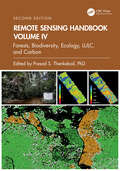
Remote Sensing Handbook, Volume IV: Forests, Biodiversity, Ecology, LULC, and Carbon
by Prasad S. ThenkabailVolume IV of the Six Volume Remote Sensing Handbook, Second Edition, is focused on the use of remote sensing in forestry, biodiversity, ecology, land use and land cover, and global terrestrial carbon mapping and monitoring. It discusses remote sensing studies of multi-scale habitat modeling, forest informatics, tree and stand height studies, land cover and land use (LCLU) change mapping, forest biomass and carbon modeling and mapping, and advanced image analysis methods and advances in land remote sensing using optical, radar, LiDAR, and hyperspectral remote sensing. This thoroughly revised and updated volume draws on the expertise of a diverse array of leading international authorities in remote sensing and provides an essential resource for researchers at all levels interested in using remote sensing. It integrates discussions of remote sensing principles, data, methods, development, applications, and scientific and social context.FEATURES Provides the most up-to-date comprehensive coverage of remote sensing science for forests, biodiversity, land cover and land use change (LCLUC), biomass, and carbon. Discusses and analyzes data from old and new generations of satellites and sensors spread across 60 years. Extensive forestry, LCLUC studies, biomass, and carbon using optical, radar, LiDAR, and hyperspectral data. Includes numerous case studies on advances and applications at local, regional, and global scales. Introduces advanced methods in remote sensing such as machine learning, cloud computing, and AI. Highlights scientific achievements over the last decade and provides guidance for future developments. This volume is an excellent resource for the entire remote sensing and GIS community. Academics, researchers, undergraduate and graduate students, as well as practitioners, decision makers, and policymakers, will benefit from the expertise of the professionals featured in this book and their extensive knowledge of new and emerging trends.
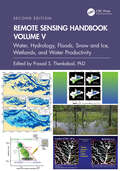
Remote Sensing Handbook, Volume V: Water, Hydrology, Floods, Snow and Ice, Wetlands, and Water Productivity
by Prasad S. ThenkabailVolume V of theSix Volume Remote Sensing Handbook, Second Edition, is focused on the use of remote sensing technologies for studying water resources, including groundwater, floods, snow and ice, and wetlands. It discusses water productivity studies from Earth observation data characterization and modeling, mapping their successes and challenges. Chapters include remote sensing of surface water hydrology; quantitative geomorphology; river basin studies; floods; wetlands, including mangroves and river deltas; groundwater studies; crop water use or actual evapotranspiration modeling and mapping; and snow and ice mapping. This thoroughly revised and updated volume draws on the expertise of a diverse array of leading international authorities in remote sensing and provides an essential resource for researchers at all levels interested in using remote sensing. It integrates discussions of remote sensing principles, data, methods, development, applications, and scientific and social context.FEATURES Provides the most up-to-date comprehensive coverage of remote sensing science for water resources, including wetlands, floods, snow, and ice. Provides comprehensive assessments of crop water use and crop water productivity modeling and mapping, including evapotranspiration studies. Discusses and analyzes data from old and new generations of satellites and sensors spread across 60 years. Includes numerous case studies on advances and applications at local, regional, and global scales. Introduces advanced methods in remote sensing, such as machine learning, cloud computing, and artificial intelligence (AI). Highlights scientific achievements over the last decade and provides guidance for future developments. This volume is an excellent resource for the entire remote sensing and GIS community. Academics, researchers, undergraduate and graduate students, as well as practitioners, decision makers, and policymakers, will benefit from the expertise of the professionals featured in this book and their extensive knowledge of new and emerging trends.
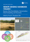
Remote Sensing Handbook, Volume I: Sensors, Data Normalization, Harmonization, Cloud Computing, and Accuracies
by Prasad S. ThenkabailVolume I of the Six Volume Remote Sensing Handbook, Second Edition, is focused on satellites and sensors including radar, light detection and ranging (LiDAR), microwave, hyperspectral, unmanned aerial vehicles (UAVs), and their applications. It discusses data normalization and harmonization, accuracies, and uncertainties of remote sensing products, global navigation satellite system (GNSS) theory and practice, crowdsourcing, cloud computing environments, Google Earth Engine, and remote sensing and space law. This thoroughly revised and updated volume draws on the expertise of a diverse array of leading international authorities in remote sensing and provides an essential resource for researchers at all levels interested in using remote sensing. It integrates discussions of remote sensing principles, data, methods, development, applications, and scientific and social context.FEATURES Provides the most up-to-date comprehensive coverage of remote sensing science. Discusses and analyzes data from old and new generations of satellites and sensors. Provides comprehensive methods and approaches for remote sensing data normalization, standardization, and harmonization. Includes numerous case studies on advances and applications at local, regional, and global scales. Introduces advanced methods in remote sensing such as machine learning, cloud computing, and AI. Highlights scientific achievements over the last decade and provides guidance for future developments. This volume is an excellent resource for the entire remote sensing and GIS community. Academics, researchers, undergraduate and graduate students, as well as practitioners, decision-makers, and policymakers, will benefit from the expertise of the professionals featured in this book, and their extensive knowledge of new and emerging trends.
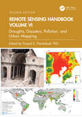
Remote Sensing Handbook, Volume VI: Droughts, Disasters, Pollution, and Urban Mapping
by Prasad S. ThenkabailVolume VI of the Six Volume Remote Sensing Handbook, Second Edition, is focused on the use of remote sensing in the assessment and monitoring of droughts, dry lands, biomass burning, disasters such as volcanoes and fires, and urban studies and nightlights. It discusses land degradation assessment and monitoring, greenhouse gas (GHG) emissions, and pollution from nightlights in megacities. Chapters include remote sensing of agricultural droughts, including US drought monitoring, dryland studies, coal fires, biomass burning and GHG emissions, volcanoes, humanitarian disasters, smart cities, and night lights mapping. This thoroughly revised and updated volume draws on the expertise of a diverse array of leading international authorities in remote sensing and provides an essential resource for researchers at all levels interested in using remote sensing. It integrates discussions of remote sensing principles, data, methods, development, applications, and scientific and social context.FEATURES Provides the most up-to-date comprehensive coverage of remote sensing science for droughts, disasters, and GHG emissions. Discusses and analyzes data from old and new generations of sensors. Highlights remote sensing of agricultural droughts, humanitarian and natural disasters, and GHG emissions from coal and stubble burning. Includes numerous case studies on advances and applications at local, regional, and global scales. Introduces advanced methods in remote sensing, such as machine learning, cloud computing, and AI. Highlights scientific achievements over the last decade and provides guidance for future developments. This volume is an excellent resource for the entire remote sensing and GIS community. Academics, researchers, undergraduate and graduate students, as well as practitioners, decision makers, and policymakers, will benefit from the expertise of the professionals featured in this book and their extensive knowledge of new and emerging trends.
Remote Sensing Image Classification in R (Springer Geography)
by Courage KamusokoThis book offers an introduction to remotely sensed image processing and classification in R using machine learning algorithms. It also provides a concise and practical reference tutorial, which equips readers to immediately start using the software platform and R packages for image processing and classification. This book is divided into five chapters. Chapter 1 introduces remote sensing digital image processing in R, while chapter 2 covers pre-processing. Chapter 3 focuses on image transformation, and chapter 4 addresses image classification. Lastly, chapter 5 deals with improving image classification. R is advantageous in that it is open source software, available free of charge and includes several useful features that are not available in commercial software packages. This book benefits all undergraduate and graduate students, researchers, university teachers and other remote- sensing practitioners interested in the practical implementation of remote sensing in R.
Remote Sensing Image Fusion (Signal and Image Processing of Earth Observations)
by Luciano Alparone Bruno Aiazzi Stefano Baronti Andrea GarzelliA synthesis of more than ten years of experience, Remote Sensing Image Fusion covers methods specifically designed for remote sensing imagery. The authors supply a comprehensive classification system and rigorous mathematical description of advanced and state-of-the-art methods for pansharpening of multispectral images, fusion of hyperspectral and
Remote Sensing Image Fusion: A Practical Guide
by John van Genderen Christine PohlRemote Sensing Image Fusion: A Practical Guide gives an introduction to remote sensing image fusion providing an overview on the sensors and applications. It describes data selection, application requirements and the choice of a suitable image fusion technique. It comprises a diverse selection of successful image fusion cases that are relevant to other users and other areas of interest around the world. The book helps newcomers to obtain a quick start into the practical value and benefits of multi-sensor image fusion. Experts will find this book useful to obtain an overview on the state of the art and understand current constraints that need to be solved in future research efforts. For industry professionals the book can be a great introduction and basis to understand multisensor remote sensing image exploitation and the development of commercialized image fusion software from a practical perspective. The book concludes with a chapter on current trends and future developments in remote sensing image fusion. Along with the book, RSIF website provides additional up-to-date information in the field.
Remote Sensing Image Processing Algorithms for Detecting Air Turbulence Patterns
by Maged MarghanyInjuries due to air turbulence has increased recently, therefore there is considerable concern and interest in understanding and detecting it more accurately. Presently hardly any research deals with air turbulence detection using remote sensing images. Most works use conventional optical remote sensing data with classical methods such as a library spectral signature, band ratio, and principal component analysis without designating new methods and technology. Very little research has attempted to implement optical and microwave remote sensing images for air turbulence detections.This book provides new image processing procedures for air turbulence detection using advanced remote sensing images and quantum image processing. Currently, there is a huge gap between research work in the field of air turbulence detection and advanced remote sensing technology. Most of the theories are not operated in terms of software modules. Most of the software packages in the field of remote sensing images cannot deal with advanced image processing techniques in air turbulence detections due to heavy mathematics work. In this view, this book fills a gap between advanced remote sensing technology and air turbulence detection. For instance, quantum image processing with a new generation of remote sensing technology such as RADARSAT-2 SAR images is also implemented to provide accurate air turbulence detections.
Remote Sensing Imagery
by Jean-Marie Nicolas Jordi Inglada Florence TupinDedicated to remote sensing images, from their acquisition to their use in various applications, this book covers the global lifecycle of images, including sensors and acquisition systems, applications such as movement monitoring or data assimilation, and image and data processing. It is organized in three main parts. The first part presents technological information about remote sensing (choice of satellite orbit and sensors) and elements of physics related to sensing (optics and microwave propagation). The second part presents image processing algorithms and their specificities for radar or optical, multi and hyper-spectral images. The final part is devoted to applications: change detection and analysis of time series, elevation measurement, displacement measurement and data assimilation. Offering a comprehensive survey of the domain of remote sensing imagery with a multi-disciplinary approach, this book is suitable for graduate students and engineers, with backgrounds either in computer science and applied math (signal and image processing) or geo-physics. About the Authors Florence Tupin is Professor at Telecom ParisTech, France. Her research interests include remote sensing imagery, image analysis and interpretation, three-dimensional reconstruction, and synthetic aperture radar, especially for urban remote sensing applications. Jordi Inglada works at the Centre National d’Études Spatiales (French Space Agency), Toulouse, France, in the field of remote sensing image processing at the CESBIO laboratory. He is in charge of the development of image processing algorithms for the operational exploitation of Earth observation images, mainly in the field of multi-temporal image analysis for land use and cover change. Jean-Marie Nicolas is Professor at Telecom ParisTech in the Signal and Imaging department. His research interests include the modeling and processing of synthetic aperture radar images.
Remote Sensing Intelligent Interpretation for Mine Geological Environment: From Land Use and Land Cover Perspective
by Lizhe Wang Weitao Chen Xianju LiThis book examines the theory and methods of remote sensing intelligent interpretation based on deep learning. Based on geological and environmental effects on mines, this book constructs a set of systematic mine remote sensing datasets focusing on the multi-level task with the system of “target detection→scene classification→semantic segmentation." Taking China’s Hubei Province as an example, this book focuses on the following four aspects: 1. Development of a multiscale remote sensing dataset of the mining area, including mine target remote sensing dataset, mine (including non-mine areas) remote sensing scene dataset, and semantic segmentation remote sensing dataset of mining land cover. The three datasets are the basis of intelligent interpretation based on deep learning. 2. Research on mine target remote sensing detection method based on deep learning. 3. Research on remote sensing scene classification method of mine and non-mine areas based on deep learning. 4. Research on the fine-scale classification method of mining land cover based on semantic segmentation.The book is a valuable reference both for scholars, practitioners and as well as graduate students who are interested in mining environment research.
Remote Sensing Land Surface Changes: The 1981-2020 Intensive Global Warming
by Felix KoganThis book discusses the detrimental consequences of climate-related land changes over a 40-year period between 1981 and 2020, and focuses on how climate warming is deteriorating the agricultural system due to excessive heat, lack of moisture and more intensive and widespread droughts leading to a reduction of agricultural production. Most of the existing literature on the unfavourable consequences of global warming for land are based on a relatively short period of weather station data, covering local land areas with limited networks and monitoring parameters. These concerns have led to the use of satellite data, whose measurements are controlled by such vegetation characteristics as chlorophyll, carotenoids, moisture contents in the plants and temperature inside the vegetation community. Therefore, the discussion of this book is completely based on high-resolution global land surface measurements by the sensors on the National Oceanic and Atmospheric Administration’s (NOAA) operational afternoon polar-orbiting satellites. The book also focuses on understanding climate change impacts on land changes where humans are living, and combines biophysically-grounded methods and the 40-year data to develop models for monitoring large-scale Earth warming impacts on land and for timely prediction of climate consequences for humans. These 40-year trends in land characteristics will help to better inform the assessment of potential changes in the future and how to reach human sustainability. The book will of interest to scientists using satellite remote sensing to track climate change impacts on land over time, as well as students and researchers in climatology and environmental sustainability.
Remote Sensing Monitoring and Evaluation of Degraded Grassland in China: Accounting of Grassland Carbon Source and Carbon Sink (Springer Geography)
by Wei Zhou Jianlong Li Tianxiang YueThis book focuses on grassland ecosystem evaluation including vegetation coverage, net primary productivity, carbon sink accounting, and grassland degradation evaluation based on mutual data resource, ecosystem model simulation, remote sensing monitoring and driving mechanism exploration. It aims to provide a guide seeking to understand the overall situation of grassland in China in the context of global climate change and build a scenario for the driving force quantitative evaluation. It will be an essential reference to the terrestrial ecosystem carbon cycle and degraded grassland ecological restoration engineer implementation. Chapters are carefully developed to cover (1) situation of grassland in China; (2) spatial-temporal of grassland coverage in China;(3) net primary productivity evaluation; (4) carbon sink/source accounting and its carbon-hydrology effect;(5) grassland landscape pattern; (6) grassland degradation evaluation based on remote sensing;(7) Grassland degradation restoration and constructing green ecological protective screen. The new scenario and driving mechanism evaluation model make this book a valuable read for researcher of land ecosystem carbon cycle, ecosytem degradation remote sensing evaluation as well as organizations engaged in eco-restoration practices.
Remote Sensing Physics: An Introduction to Observing Earth from Space (AGU Advanced Textbooks)
by Rick Chapman Richard GasparovicRemote Sensing Physics ADVANCED TEXTBOOK SERIES Remote Sensing Physics An Introduction to Observing Earth from Space The development of spaceborne remote sensing technology has led to a new understanding of the complexity of our planet by allowing us to observe Earth and its environments on spatial and temporal scales that are unavailable to terrestrial sensors. Remote Sensing Physics: An Introduction to Observing Earth from Space is a graduate-level text that examines the underlying physical principles and techniques used to make remote measurements, along with the algorithms used to extract geophysical information from those measurements. Volume highlights include: Basis for Earth remote sensing including ocean, land, and atmosphere Description of satellite orbits relevant for Earth observations Physics of passive sensing, including infrared, optical and microwave imagers Physics of active sensing, including radars and lidars Overview of current and future Earth observation missions Compendium of resources including an extensive bibliography Sample problem sets and answers available to instructors The American Geophysical Union promotes discovery in Earth and space science for the benefit of humanity. Its publications disseminate scientific knowledge and provide resources for researchers, students, and professionals.
Remote Sensing Technology in Forensic Investigations: Geophysical Techniques to Locate Clandestine Graves and Hidden Evidence
by G. Clark DavenportRemote Sensing Technology in Forensic Investigations provides a basic understanding of concepts involved in the use of basic geophysical surveying, metal detectors, magnetics, electromagnetics and ground penetrating radar in police and forensic investigations. Such technology can be vital in locating clandestine, buried evidence which is often concealed in the subsurface underground. Crime scene investigation and evidence collection entails locating, identifying, collecting, and cataloging. Such physical evidence searches are time consuming and can often lead to searches that require excavations, which in itself that can destroy evidence. The noninvasive, nondestructive methods outlined in this book can both reduce the time spent on searches and excavations, thereby increasing the probability of locating vital physical evidence. As such, the application of remote sensing methods has gained increased acceptance, and seen increased usage, by investigators. Remote sensing methods are based on making indirect measurements of the surface of and within the earth. The resulting measurement information can be presented in either an imaging format— such as in aerial photography—or a non-imaging format, such as in a profile or contour map. These measurements can be interpreted to identify and characterize contrasts due to differences in physical and natural properties of the materials being studied. This can include physical evidence, remains, and clandestine graves. This book will serve as a handy introductory primer to the technology, techniques, and application of such techniques. Throughout, numerous references and additional resources are provided for those investigators, forensic anthropology, and police professionals who want further information on the technology’s usage for investigative purposes.

Remote Sensing Time Series Image Processing (Imaging Science)
by Qihao WengToday, remote sensing technology is an essential tool for understanding the Earth and managing human-Earth interactions. There is a rapidly growing need for remote sensing and Earth observation technology that enables monitoring of world&’s natural resources and environments, managing exposure to natural and man-made risks and more frequently occurring disasters, and helping the sustainability and productivity of natural and human ecosystems. The improvement in temporal resolution/revisit allows for the large accumulation of images for a specific location, creating a possibility for time series image analysis and eventual real-time assessments of scene dynamics. As an authoritative text, Remote Sensing Time Series Image Processing brings together active and recognized authors in the field of time series image analysis and presents to the readers the current state of knowledge and its future directions. Divided into three parts, the first addresses methods and techniques for generating time series image datasets. In particular, it provides guidance on the selection of cloud and cloud shadow detection algorithms for various applications. Part II examines feature development and information extraction methods for time series imagery. It presents some key remote sensing-based metrics, and their major applications in ecosystems and climate change studies. Part III illustrates various applications of time series image processing in land cover change, disturbance attribution, vegetation dynamics, and urbanization. This book is intended for researchers, practitioners, and students in both remote sensing and imaging science. It can be used as a textbook by undergraduate and graduate students majoring in remote sensing, imaging science, civil and electrical engineering, geography, geosciences, planning, environmental science, land use, energy, and GIS, and as a reference book by practitioners and professionals in the government, commercial, and industrial sectors.
Remote Sensing and Actuation Using Unmanned Vehicles
by Yangquan Chen Haiyang ChaoUnmanned systems and robotics technologies have become very popular recently owing to their ability to replace human beings in dangerous, tedious, or repetitious jobs. <P><P>This book fill the gap in the field between research and real-world applications, providing scientists and engineers with essential information on how to design and employ networked unmanned vehicles for remote sensing and distributed control purposes. Target scenarios include environmental or agricultural applications such as river/reservoir surveillance, wind profiling measurement, and monitoring/control of chemical leaks.
Remote Sensing and Cognition: Human Factors in Image Interpretation
by Robert R. Hoffman Raechel A. White Arzu ColtekinHuman factors play a critical role in the design and interpretation of remotely sensed imagery for all Earth sciences. Remote Sensing and Cognition: Human Factors in Image Interpretation brings together current topics widely recognized and addressed regarding human cognition in geographic imagery, especially remote sensing imagery with complex data. It addresses themes around expertise including methods for knowledge elicitation and modeling of expertise, the effects of different aspects of realism on the interpretation of the environment, spatial learning using imagery, the effect of visual perspective on interpretation, and a variety of technologies and methods for utilizing knowledge in the analysis of remote sensing imagery. <P><P>Written by leaders in the field, this book provides answers to the host of questions raised at the nexus of psychology and remote sensing. Academics and researchers with an interest in the human issues surrounding the use of remote sensing data will find this book to be an invaluable resource. The topics covered in this book are useful for both the scientific analysis of remote sensing imagery as well as the design and display of remote sensing imagery to facilitate a variety of other tasks including education and wayfinding. <P><P>Features <li>Brings together remote sensing, environmental, and computer scientists discussing their work from a psychological or human factors perspective <li>Answers questions related to aesthetics of scientific visualization and mathematical analysis of perceptible objects <li>Explains the perception and interpretation of realistic representations <li>Provides illustrative real-world examples <li>Shows how the features of display symbols, elements, and patterns have clear effects on processes of perception and visual search
Remote Sensing and Digital Image Processing with R
by Marcelo de Carvalho Alves Luciana SanchesThis new textbook on remote sensing and digital image processing of natural resources includes numerous, practical problem-solving exercises and applications of sensors and satellite systems using remote sensing data collection resources, and emphasizes the free and open-source platform R. It explains basic concepts of remote sensing and multidisciplinary applications using R language and R packages, by engaging students in learning theory through hands-on, real-life projects. All chapters are structured with learning objectives, computation, questions, solved exercises, resources, and research suggestions. Features Explains the theory of passive and active remote sensing and its applications in water, soil, vegetation, and atmosphere. Covers data analysis in the free and open-source R platform, which makes remote sensing accessible to anyone with a computer. Includes case studies from different environments with free software algorithms and an R toolset for active learning and a learn-by-doing approach. Provides hands-on exercises at the end of each chapter and encourages readers to understand the potential and the limitations of the environments, remote sensing targets, and process. Explores current trends and developments in remote sensing in homework assignments with data to further explore the use of free multispectral remote sensing data, including very high spatial resolution data sources for target recognition with image processing techniques. While the focus of the book is on environmental and agriculture engineering, it can be applied widely to a variety of subjects such as physical, natural, and social sciences. Students in upper-level undergraduate or graduate programs, taking courses in remote sensing, geoprocessing, civil and environmental engineering, geosciences, environmental sciences, electrical engineering, biology, and hydrology will also benefit from the learning objectives in the book. Professionals who use remote sensing and digital processing will also find this text enlightening.
Remote Sensing and Digital Image Processing with R - Lab Manual
by Marcelo de Carvalho Alves Luciana SanchesThis Lab Manual is a companion to the textbook Remote Sensing and Digital Image Processing with R. It covers examples of natural resource data analysis applications including numerous, practical problem-solving exercises, and case studies that use the free and open-source platform R. The intuitive, structural workflow helps students better understand a scientific approach to each case study in the book and learn how to replicate, transplant, and expand the workflow for further exploration with new data, models, and areas of interest. Features Aims to expand theoretical approaches of remote sensing and digital image processing through multidisciplinary applications using R and R packages. Engages students in learning theory through hands-on real-life projects. All chapters are structured with solved exercises and homework and encourage readers to understand the potential and the limitations of the environments. Covers data analysis in the free and open-source R platform, which makes remote sensing accessible to anyone with a computer. Explores current trends and developments in remote sensing in homework assignments with data to further explore the use of free multispectral remote sensing data, including very high spatial resolution information. Undergraduate- and graduate-level students will benefit from the exercises in this Lab Manual, because they are applicable to a variety of subjects including environmental science, agriculture engineering, as well as natural and social sciences. Students will gain a deeper understanding and first-hand experience with remote sensing and digital processing, with a learn-by-doing methodology using applicable examples in natural resources.
Remote Sensing and GIS Accuracy Assessment
by John G. Lyon Ross S. LunettaBased upon a special symposium sponsored by the U.S. Environmental Protection Agency (EPA), Remote Sensing and GIS Accuracy Assessment evaluates the important scientific elements related to the performance of accuracy assessments for remotely sensed data, GIS data analysis, and integration products. Scientists from federal, state, and local governments, academia, and nongovernmental organizations present technical papers which examine sampling issues, reference data collection, edge and boundary effects, error matrix and fuzzy assessments, error budget analysis, and change detection accuracy assessment. This compilation contains 20 chapters that represent important symposium outcomes.
Remote Sensing and GIS Application in Forest Conservation Planning (Advances in Geographical and Environmental Sciences)
by Chaitanya B. Pande Kanak MoharirThis book focuses on the challenges in conservation, management and protection of forests in India as well as other countries, using recently developed technologies. Various topics are discussed including remote sensing, GIS, land use land cover, forest conservation techniques, social economics effects, fire forecasting models and the effect of fire on natural resources, among others. The book provides multi-disciplinary overviews for academicians, administrators, policymakers and professionals involved in the diverse aspects of sustainable forest development, planning and management, and forecasting and extinguishing forest fires. The book helps readers better understand the development of forests by planning and management in India and other countries, with the following focuses: - Forest area conservation in India and other countries - Advanced techniques for planning and conservation of forest cover - Forest conservation modeling using remote sensing and GIS techniques - Forest fire forecasting models used in remote sensing and GIS environments