- Table View
- List View
Remote Detection and Maritime Pollution: Chemical Spill Studies
by Frédéric Muttin Stéphane Le FlochThe detection of marine pollution requires a scientific and operational response to identify contaminants, chemicals and hydrocarbons, and to support contrasting observations. Remote Detection and Maritime Pollution originates from the proceedings of CEDRE Information Day, held on October 13, 2016 in Brest, France. Containing four parts encompassing 13 chapters, this book explores remote detection channels for the multiform marine pollutions of today and of the future. With a focus on transatlantic cooperation, it covers remote detection sensors, the state of the art of maritime surveillance with regard to the interests of national and international authorities, the benefits of response strategy, and geophysical exploration. Future vectors (airplanes, drones, satellites, among others) and sensors (radar, optical, hyperspectral and so on) are also studied. This book is a valuable resource for practical solutions for marine authorities, industries (chemical, energy, aerospace, petroleum, shipping), lawyers and scientists.
Remote Instrumentation Services on the e-Infrastructure
by Roberto Pugliese Norbert Meyer Franco Davoli Sandro ZappatoreThe book focuses on all aspects related to the effective exploitation of remote instrumentation and to the building of complex virtual laboratories on top of real devices and infrastructures. These include service oriented architecture (SOA) and related middleware, high-speed networking in support of Grid applications, wireless Grids for acquisition devices and sensor networks, Quality Service (QoS) provisioning for real-time control, measurement instrumentation and methodology, as well as metrology issues in distributed systems.
Remote Instrumentation and Virtual Laboratories
by Roberto Pugliese Norbert Meyer Franco Davoli Sandro ZappatoreAccessing remote instrumentation worldwide is one of the goals of e-Science. The task of enabling the execution of complex experiments that involve the use of distributed scientific instruments must be supported by a number of different architectural domains, which inter-work in a coordinated fashion to provide the necessary functionality. These domains embrace the physical instruments, the communication network interconnecting the distributed systems, the service oriented abstractions and their middleware. The Grid paradigm (or, more generally, the Service Oriented Architecture -- SOA), viewed as a tool for the integration of distributed resources, plays a significant role, not only to manage computational aspects, but increasingly as an aggregator of measurement instrumentation and pervasive large-scale data acquisition platforms. In this context, the functionality of a SOA allows managing, maintaining and exploiting heterogeneous instrumentation and acquisition devices in a unified way, by providing standardized interfaces and common working environments to their users, but the peculiar aspects of dealing with real instruments of widely different categories may add new functional requirements to this scenario. On the other hand, the growing transport capacity of core and access networks allows data transfer at unprecedented speed, but new challenges arise from wireless access, wireless sensor networks, and the traversal of heterogeneous network domains. The book focuses on all aspects related to the effective exploitation of remote instrumentation and to the building complex virtual laboratories on top of real devices and infrastructures. These include SOA and related middleware, high-speed networking in support of Grid applications, wireless Grids for acquisition devices and sensor networks, Quality of Service (QoS) provisioning for real-time control, measurement instrumentation and methodology, as well as metrology issues in distributed systems.
Remote Instrumentation for eScience and Related Aspects
by Roberto Pugliese Norbert Meyer Franco Davoli Sandro Zappatore Jan Węglarz Marcin LawendaThis book will focus on new Remote Instrumentation aspects related to middleware architecture, high-speed networking, wireless Grid for acquisition devices and sensor networks, QoS provisioning for real-time control, measurement instrumentation and methodology. Moreover, it will provide knowledge about the automation of mechanisms oriented to accompanying processes that are usually performed by a human. Another important point of this book is focusing on the future trends concerning Remote Instrumentation systems development and actions related to standardization of remote instrumentation mechanisms.
Remote Investment Transactions in the Digital Age: Perception, Techniques, Law Regulation (Intelligent Systems Reference Library #250)
by Agnessa Inshakova Denis Matytsin Elena InshakovaThe book contains the results of the best research developments obtained during the implementation of major scientific events organized and carried out with the financial support of the Russian Science Foundation and the President of the Russian Federation.The scientific novelty of the work lies in the fact that for the first time at the level of Russian and international interdisciplinary social and humanitarian sciences, primarily economic and legal, firstly, philosophical concepts and regulatory legal approaches to the regulation of remote investment transactions have been studied; secondly, a set of economic and legal conditions and means of harmonizing and observing the mutual interests of participants in remote investment transactions has been developed and proposed in order to prevent and minimize potential conflicts between the parties; thirdly, the current state and international regulation of investment transactions concluded and executed on Internet platforms was critically assessed; fourthly, a system of guarantees and protection of the rights of participants in remote investment transactions is proposed, including special contractual structures and an economic and legal model for the proper fulfillment of obligations.Measures are substantiated to expand and increase the intensity of the national investment turnover based on the improvement of the current legislation regulating investments through remote digital technologies in the Internet space, which provided a solution to the world scientific problem of great socioeconomic and economic importance. The book is designed for a wide target audience—scientists of different generations, different disciplinary and industry affiliations. Among them are young researchers, as well as scientists who have received recognition from the world scientific community, studying the socioeconomic, managerial, and legal consequences of the emergence and spread of digital technologies in the field of investment. Readers can be all individuals and legal entities interested in the development of digital technologies in the field of investment.
Remote Patient Monitoring: A Computational Perspective in Healthcare (River Publishers Rapids Series in Biotechnology and Medical Research)
by Rishabha Malviya Priyanshi GoyalThis book provides a multidisciplinary overview of the design and implementation of systems for remote patient monitoring and healthcare. Readers are guided through the components of such a system and shown how they could be integrated into a coherent framework for deployment in practice. The book ends with a discussion of case studies to provide practical examples and design methods for remote healthcare systems with different needs. This book contains information that will be helpful to undergraduate and postgraduate students, academic and professional researchers, and individuals who employ computational intelligence. By presenting new models of care and support, AI in medicine is having an impact on the entire value chain of clinical practice and the patient care delivery system. This is especially evident in telemedicine breakthroughs, where applications of AI are utilized to assist, complement, or create new forms of remote healthcare. Through the use of communications technology, telemedicine enables medical professionals to examine, diagnose, and treat patients remotely. Now, the technology might also integrate online diagnostics, etc., to increase the effectiveness of the healthcare system and enhance patient outcomes. By enabling elderly people to live independently, technological advancements in fields like remote patient monitoring (RPM) systems can revolutionize senior care. Medical diagnosis will improve, and remote patient monitoring will become simpler thanks to artificial intelligence. The resistance of many patients and doctors to using the telemedicine idea for medical visits will probably be overcome by AI automation.
Remote Sensing
by Siamak Khorram Frank H. Koch Cynthia F. van der Wiele Stacy A.C. NelsonRemote Sensing provides information on how remote sensing relates to the natural resources inventory, management, and monitoring, as well as environmental concerns. It explains the role of this new technology in current global challenges. "Remote Sensing" will discuss remotely sensed data application payloads and platforms, along with the methodologies involving image processing techniques as applied to remotely sensed data. This title provides information on image classification techniques and image registration, data integration, and data fusion techniques. How this technology applies to natural resources and environmental concerns will also be discussed.
Remote Sensing Advances for Earth System Science
by Diego Fernández-Prieto Roberto SabiaTo better understand the various processes and interactions that govern the Earth system and to determine whether recent human-induced changes could ultimately de-stabilise its dynamics, both natural system variability and the consequences of human activities have to be observed and quantified. In this context, the European Space Agency (ESA) published in 2006 the document "The Changing Earth: New Scientific Challenges for ESA's Living Planet Programme" as the main driver of ESA's new Earth Observation (EO) science strategy. The document outlines 25 major scientific challenges covering all the different aspects of the Earth system, where EO technology and ESA missions may provide a key contribution. In this framework, and aiming at enhancing the ESA scientific support towards the achievement of "The Challenges", the Agency has launched in 2008 a new initiative - the Changing Earth Science Network - to support young scientists to undertake leading-edge research activities contributing to achieve the 25 scientific challenges of the LPP by maximising the use of ESA data. The initiative is implemented through a number of research projects proposed and led by early-stage scientists at post-doctoral level for a period of two years which are summarized in this SpringerBrief. These projects undertake innovative research activities furthering into the most pressing issues of the Earth system, while exploiting ESA missions data with special attention to the ESA data archives and the new Earth Explorer missions.
Remote Sensing Application II: A Climate Change Perspective in Agriculture (New Frontiers in Regional Science: Asian Perspectives #77)
by Tofael AhamedThis book focuses solely on the issues of agricultural productivity analysis with advanced modeling approaches bringing solutions to food-insecure regions of the world, especially in south and southeast Asia and in Africa. Advanced modeling tools and their use in regional planning provide an outstanding opportunity to help face the challenges of climate change. The sudden effect of flash floods, drought, salinity, and sea water rises causing saltwater intrusions and its impact on agricultural production are some of the disastrous results of climate change. In this edited volume, information on climate-induced impacts for flooding, flash floods, and drought impact on agricultural crops is provided to address possible solutions for food security in south Asia, southeast Asia, and some regions of Africa. Leading-edge research methodology is presented as it relates to remote sensing applications for regional science and allied fields. In regional policy planning, agriculture andforestry play key roles in food security along with environmental conservation and depend on geo-spatial variability. Satellite remote sensing and geographical information systems have an immense potential to encompass all these factors and to catalogue the regional variability of climate change and climate economics. In the satellite remote sensing domain, advanced modeling tools, deep learning applications, and cloud-based earth engines significantly increase the flexibility of decision making and its application for regional perspectives. The result can increase agricultural and forest productivity and ensure its resilience and sustainability. The book’s chapters introduce modeling techniques such as machine learning and fuzzy expert system using satellite remote sensing datasets based on cloud application. These methods assist regional planners to increase crop production, land use, and detection of changes in land cover in order to better understand their vulnerability toclimate-related disaster. Furthermore, remote sensing and in-depth GIS analysis are integrated with machine learning to address natural uncertainties such as flash floods, droughts, and cyclones so that emergency responses for agricultural production management can be adopted more effectively.
Remote Sensing Application: Regional Perspectives in Agriculture and Forestry (New Frontiers in Regional Science: Asian Perspectives #59)
by Tofael AhamedThis book focuses solely on the issues of agriculture and forest productivity analysis with advanced modeling approaches to bring solutions to food-insecure regions of South and Southeast Asia. Advanced modeling tools and their use in regional planning provide an outstanding opportunity to contribute toward food production and environments. In this book, leading-edge research methodologies related to remote sensing and geospatial variability of soil, water, and regional agricultural production indicators and their applications are introduced together—a unique feature of the book is the domain of regional policy perspectives and allied fields. In regional policy planning, agriculture and forestry have a key role in food security and environmental conservation that depends on the geo-spatial variability of these factors. Over the years, nature and climate have determined the variability of soil type, soil quality, geographical deviation for habitat, water quality, water sources, urban influences, population growth, carbon stock levels, and water resources with rain-fed or irrigated land use practices. In addition, human nutritional values and dietary habits have brought cultural adaptation of either mono- or multi-cropping patterns in the region. To encompass all these above mentioned factors and classify regional variability for policy planning, satellite remote sensing and geographical information systems have the immense potential to increase agricultural and forest productivity to ensure the resilience of its sustainability. Therefore, the 13 chapters presented in this book introduce modeling techniques using the signatures of vegetation and water indices, land use and land change dynamics, climatic, and socioeconomic criteria through spatial, temporal, and statistical analysis. As well, remote sensing and in-depth GIS analysis are integrated with machine and deep learning algorithms to address natural uncertainties such as flash floods, droughts, and cyclones in agricultural production management.
Remote Sensing Applications for the Urban Environment (Remote Sensing Applications Ser. #12)
by George Z. XianLand use and land cover changes associated with increased urbanization have led to landscape and environmental changes throughout the world. Remote Sensing Applications for the Urban Environment places emphasis on the rapid development of worldwide urbanization and its impact on the environment, and reviews the assessment of urban land cover condit
Remote Sensing Applications in Environmental Research
by Saumitra Mukherjee Tanvir Islam Prashant K. Srivastava Manika GuptaRemote Sensing Applications in Environmental Research is the basis for advanced Earth Observation (EO) datasets used in environmental monitoring and research. Now that there are a number of satellites in orbit, EO has become imperative in today's sciences, weather and natural disaster prediction. This highly interdisciplinary reference work brings together diverse studies on remote sensing and GIS, from a theoretical background to its applications, represented through various case studies and the findings of new models. The book offers a comprehensive range of contributions by well-known scientists from around the world and opens a new window for students in presenting interdisciplinary and methodological resources on the latest research. It explores various key aspects and offers state-of-the-art research in a simplified form, describing remote sensing and GIS studies for those who are new to the field, as well as for established researchers.
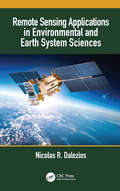
Remote Sensing Applications in Environmental and Earth System Sciences
by Nicolas R. DaleziosRemote Sensing Applications in Environmental and Earth System Sciences is a contemporary, multi-disciplinary, multi-scaling, updated, and upgraded approach of applied remote sensing in the environment. The book begins with an overview of remote sensing technology, and then explains the types of data that can be used as well as the image processing and analysis methods that can be applied to each type of application through the use of case studies throughout. Includes a wide spectrum of environmental applications and issues Explains methodological image analysis and interpretation procedures for conducting a variety of environmental analyses Discusses the development of early warning systems Covers monitoring of the environment as a whole – atmosphere, land, and water Explores the latest remote sensing systems in environmental applications This book is an excellent resource for anyone who is interested in remote sensing technologies and their use in Earth systems, natural resources, and environmental science.
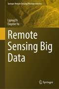
Remote Sensing Big Data (Springer Remote Sensing/Photogrammetry)
by Liping Di Eugene YuThis monograph provides comprehensive coverage of the collection, management, and use of big data obtained from remote sensing. The book begins with an introduction to the basics of big data and remote sensing, laying the groundwork for the more specialized information to follow. The volume then goes on to address a wide variety of topics related to the use and management of remote sensing big data, including hot topics such as analysis through machine learning, cyberinfrastructure, and modeling. Examples on how to use the results of big data analysis of remotely sensed data for concrete decision-making are offered as well. The closing chapters discuss geospatial big data initiatives throughout the world and future challenges and opportunities for remote sensing big data applications. The audience for this book includes researchers at the intersection of geoscience and data science, senior undergraduate and graduate students, and anyone else interested in how large datasets obtained through remote sensing can be best utilized. The book presents a culmination of 30 years of research from renowned spatial scientists Drs. Liping Di and Eugene Yu.
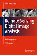
Remote Sensing Digital Image Analysis
by John A. RichardsRemote Sensing Digital Image Analysis provides the non-specialist with an introduction to quantitative evaluation of satellite and aircraft derived remotely retrieved data. Since the first edition of the book there have been significant developments in the algorithms used for the processing and analysis of remote sensing imagery; nevertheless many of the fundamentals have substantially remained the same. This new edition presents material that has retained value since those early days, along with new techniques that can be incorporated into an operational framework for the analysis of remote sensing data. The book is designed as a teaching text for the senior undergraduate and postgraduate student, and as a fundamental treatment for those engaged in research using digital image processing in remote sensing. The presentation level is for the mathematical non-specialist. Since the very great number of operational users of remote sensing come from the earth sciences communities, the text is pitched at a level commensurate with their background. Each chapter covers the pros and cons of digital remotely sensed data, without detailed mathematical treatment of computer based algorithms, but in a manner conductive to an understanding of their capabilities and limitations. Problems conclude each chapter.
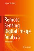
Remote Sensing Digital Image Analysis
by John A. RichardsRemote Sensing Digital Image Analysis provides a comprehensive treatment of the methods used for the processing and interpretation of remotely sensed image data. Over the past decade there have been continuing and significant developments in the algorithms used for the analysis of remote sensing imagery, even though many of the fundamentals have substantially remained the same. As with its predecessors this new edition again presents material that has retained value but also includes newer techniques, covered from the perspective of operational remote sensing. The book is designed as a teaching text for the senior undergraduate and postgraduate student, and as a fundamental treatment for those engaged in research using digital image analysis in remote sensing. The presentation level is for the mathematical non-specialist. Since the very great number of operational users of remote sensing come from the earth sciences communities, the text is pitched at a level commensurate with their background. The chapters progress logically through means for the acquisition of remote sensing images, techniques by which they can be corrected, and methods for their interpretation. The prime focus is on applications of the methods, so that worked examples are included and a set of problems conclude each chapter.
Remote Sensing Handbook, Volume II: Image Processing, Change Detection, GIS, and Spatial Data Analysis
by Prasad S. ThenkabailVolume II of the Six Volume Remote Sensing Handbook, Second Edition, is focused on digital image processing including image classification methods in land cover and land use. It discusses object-based segmentation and pixel-based image processing algorithms, change detection techniques, and image classification for a wide array of applications including land use/land cover, croplands, urban studies, processing hyperspectral remote sensing data, thermal imagery, light detection and ranging (LiDAR), geoprocessing workflows, frontiers of GIScience, and future pathways. This thoroughly revised and updated volume draws on the expertise of a diverse array of leading international authorities in remote sensing and provides an essential resource for researchers at all levels interested in using remote sensing. It integrates discussions of remote sensing principles, data, methods, development, applications, and scientific and social context.Features Provides the most up-to-date comprehensive coverage of digital image processing. Highlights object-based image analysis (OBIA) and pixel-based classification methods and techniques of digital image processing. Demonstrates practical examples of image processing for a myriad of applications such as land use/land cover, croplands, and urban. Establishes image processing using different types of remote sensing data that includes multispectral, radar, LiDAR, thermal, and hyperspectral. Highlights change detection, geoprocessing, and GIScience. This volume is an excellent resource for the entire remote sensing and GIS community. Academics, researchers, undergraduate and graduate students, as well as practitioners, decision makers, and policymakers, will benefit from the expertise of the professionals featured in this book, and their extensive knowledge of new and emerging trends.
Remote Sensing Handbook, Volume III: Agriculture, Food Security, Rangelands, Vegetation, Phenology, and Soils
by Prasad S. ThenkabailVolume III of the Six Volume Remote Sensing Handbook, Second Edition, is focused on agriculture; food security; vegetation; phenology; rangelands; soils; and global biomass modeling, mapping, and monitoring using multi-sensor remote sensing. It discusses the application of remote sensing in agriculture systems analysis, phenology, cropland mapping and modeling, terrestrial vegetation studies, physically based models, food and water security, precision farming, crop residues, global view of rangelands, and soils. This thoroughly revised and updated volume draws on the expertise of a diverse array of leading international authorities in remote sensing and provides an essential resource for researchers at all levels interested in using remote sensing. It integrates discussions of remote sensing principles, data, methods, development, applications, and scientific and social context.FEATURES Provides the most up-to-date comprehensive coverage of remote sensing science in agriculture, vegetation, and soil studies. Discusses and analyzes data from old and new generations of satellites and sensors spread across 60 years. Provides comprehensive assessment of modeling, mapping, and monitoring agricultural crops, vegetation, and soils from wide array of sensors, methods, and techniques. Includes numerous case studies on advances and applications at local, regional, and global scales. Introduces advanced methods in remote sensing such as machine learning, cloud computing, and AI. Highlights scientific achievements over the last decade and provides guidance for future developments. This volume is an excellent resource for the entire remote sensing and GIS community. Academics, researchers, undergraduate and graduate students, as well as practitioners, decision makers, and policymakers, will benefit from the expertise of the professionals featured in this book, and their extensive knowledge of new and emerging trends.
Remote Sensing Handbook, Volume IV: Forests, Biodiversity, Ecology, LULC, and Carbon
by Prasad S. ThenkabailVolume IV of the Six Volume Remote Sensing Handbook, Second Edition, is focused on the use of remote sensing in forestry, biodiversity, ecology, land use and land cover, and global terrestrial carbon mapping and monitoring. It discusses remote sensing studies of multi-scale habitat modeling, forest informatics, tree and stand height studies, land cover and land use (LCLU) change mapping, forest biomass and carbon modeling and mapping, and advanced image analysis methods and advances in land remote sensing using optical, radar, LiDAR, and hyperspectral remote sensing. This thoroughly revised and updated volume draws on the expertise of a diverse array of leading international authorities in remote sensing and provides an essential resource for researchers at all levels interested in using remote sensing. It integrates discussions of remote sensing principles, data, methods, development, applications, and scientific and social context.FEATURES Provides the most up-to-date comprehensive coverage of remote sensing science for forests, biodiversity, land cover and land use change (LCLUC), biomass, and carbon. Discusses and analyzes data from old and new generations of satellites and sensors spread across 60 years. Extensive forestry, LCLUC studies, biomass, and carbon using optical, radar, LiDAR, and hyperspectral data. Includes numerous case studies on advances and applications at local, regional, and global scales. Introduces advanced methods in remote sensing such as machine learning, cloud computing, and AI. Highlights scientific achievements over the last decade and provides guidance for future developments. This volume is an excellent resource for the entire remote sensing and GIS community. Academics, researchers, undergraduate and graduate students, as well as practitioners, decision makers, and policymakers, will benefit from the expertise of the professionals featured in this book and their extensive knowledge of new and emerging trends.
Remote Sensing Handbook, Volume V: Water, Hydrology, Floods, Snow and Ice, Wetlands, and Water Productivity
by Prasad S. ThenkabailVolume V of theSix Volume Remote Sensing Handbook, Second Edition, is focused on the use of remote sensing technologies for studying water resources, including groundwater, floods, snow and ice, and wetlands. It discusses water productivity studies from Earth observation data characterization and modeling, mapping their successes and challenges. Chapters include remote sensing of surface water hydrology; quantitative geomorphology; river basin studies; floods; wetlands, including mangroves and river deltas; groundwater studies; crop water use or actual evapotranspiration modeling and mapping; and snow and ice mapping. This thoroughly revised and updated volume draws on the expertise of a diverse array of leading international authorities in remote sensing and provides an essential resource for researchers at all levels interested in using remote sensing. It integrates discussions of remote sensing principles, data, methods, development, applications, and scientific and social context.FEATURES Provides the most up-to-date comprehensive coverage of remote sensing science for water resources, including wetlands, floods, snow, and ice. Provides comprehensive assessments of crop water use and crop water productivity modeling and mapping, including evapotranspiration studies. Discusses and analyzes data from old and new generations of satellites and sensors spread across 60 years. Includes numerous case studies on advances and applications at local, regional, and global scales. Introduces advanced methods in remote sensing, such as machine learning, cloud computing, and artificial intelligence (AI). Highlights scientific achievements over the last decade and provides guidance for future developments. This volume is an excellent resource for the entire remote sensing and GIS community. Academics, researchers, undergraduate and graduate students, as well as practitioners, decision makers, and policymakers, will benefit from the expertise of the professionals featured in this book and their extensive knowledge of new and emerging trends.
Remote Sensing Handbook, Volume I: Sensors, Data Normalization, Harmonization, Cloud Computing, and Accuracies
by Prasad S. ThenkabailVolume I of the Six Volume Remote Sensing Handbook, Second Edition, is focused on satellites and sensors including radar, light detection and ranging (LiDAR), microwave, hyperspectral, unmanned aerial vehicles (UAVs), and their applications. It discusses data normalization and harmonization, accuracies, and uncertainties of remote sensing products, global navigation satellite system (GNSS) theory and practice, crowdsourcing, cloud computing environments, Google Earth Engine, and remote sensing and space law. This thoroughly revised and updated volume draws on the expertise of a diverse array of leading international authorities in remote sensing and provides an essential resource for researchers at all levels interested in using remote sensing. It integrates discussions of remote sensing principles, data, methods, development, applications, and scientific and social context.FEATURES Provides the most up-to-date comprehensive coverage of remote sensing science. Discusses and analyzes data from old and new generations of satellites and sensors. Provides comprehensive methods and approaches for remote sensing data normalization, standardization, and harmonization. Includes numerous case studies on advances and applications at local, regional, and global scales. Introduces advanced methods in remote sensing such as machine learning, cloud computing, and AI. Highlights scientific achievements over the last decade and provides guidance for future developments. This volume is an excellent resource for the entire remote sensing and GIS community. Academics, researchers, undergraduate and graduate students, as well as practitioners, decision-makers, and policymakers, will benefit from the expertise of the professionals featured in this book, and their extensive knowledge of new and emerging trends.
Remote Sensing Handbook, Volume VI: Droughts, Disasters, Pollution, and Urban Mapping
by Prasad S. ThenkabailVolume VI of the Six Volume Remote Sensing Handbook, Second Edition, is focused on the use of remote sensing in the assessment and monitoring of droughts, dry lands, biomass burning, disasters such as volcanoes and fires, and urban studies and nightlights. It discusses land degradation assessment and monitoring, greenhouse gas (GHG) emissions, and pollution from nightlights in megacities. Chapters include remote sensing of agricultural droughts, including US drought monitoring, dryland studies, coal fires, biomass burning and GHG emissions, volcanoes, humanitarian disasters, smart cities, and night lights mapping. This thoroughly revised and updated volume draws on the expertise of a diverse array of leading international authorities in remote sensing and provides an essential resource for researchers at all levels interested in using remote sensing. It integrates discussions of remote sensing principles, data, methods, development, applications, and scientific and social context.FEATURES Provides the most up-to-date comprehensive coverage of remote sensing science for droughts, disasters, and GHG emissions. Discusses and analyzes data from old and new generations of sensors. Highlights remote sensing of agricultural droughts, humanitarian and natural disasters, and GHG emissions from coal and stubble burning. Includes numerous case studies on advances and applications at local, regional, and global scales. Introduces advanced methods in remote sensing, such as machine learning, cloud computing, and AI. Highlights scientific achievements over the last decade and provides guidance for future developments. This volume is an excellent resource for the entire remote sensing and GIS community. Academics, researchers, undergraduate and graduate students, as well as practitioners, decision makers, and policymakers, will benefit from the expertise of the professionals featured in this book and their extensive knowledge of new and emerging trends.
Remote Sensing Image Classification in R (Springer Geography)
by Courage KamusokoThis book offers an introduction to remotely sensed image processing and classification in R using machine learning algorithms. It also provides a concise and practical reference tutorial, which equips readers to immediately start using the software platform and R packages for image processing and classification. This book is divided into five chapters. Chapter 1 introduces remote sensing digital image processing in R, while chapter 2 covers pre-processing. Chapter 3 focuses on image transformation, and chapter 4 addresses image classification. Lastly, chapter 5 deals with improving image classification. R is advantageous in that it is open source software, available free of charge and includes several useful features that are not available in commercial software packages. This book benefits all undergraduate and graduate students, researchers, university teachers and other remote- sensing practitioners interested in the practical implementation of remote sensing in R.
Remote Sensing Image Fusion (Signal and Image Processing of Earth Observations)
by Luciano Alparone Bruno Aiazzi Stefano Baronti Andrea GarzelliA synthesis of more than ten years of experience, Remote Sensing Image Fusion covers methods specifically designed for remote sensing imagery. The authors supply a comprehensive classification system and rigorous mathematical description of advanced and state-of-the-art methods for pansharpening of multispectral images, fusion of hyperspectral and
Remote Sensing Image Fusion: A Practical Guide
by John van Genderen Christine PohlRemote Sensing Image Fusion: A Practical Guide gives an introduction to remote sensing image fusion providing an overview on the sensors and applications. It describes data selection, application requirements and the choice of a suitable image fusion technique. It comprises a diverse selection of successful image fusion cases that are relevant to other users and other areas of interest around the world. The book helps newcomers to obtain a quick start into the practical value and benefits of multi-sensor image fusion. Experts will find this book useful to obtain an overview on the state of the art and understand current constraints that need to be solved in future research efforts. For industry professionals the book can be a great introduction and basis to understand multisensor remote sensing image exploitation and the development of commercialized image fusion software from a practical perspective. The book concludes with a chapter on current trends and future developments in remote sensing image fusion. Along with the book, RSIF website provides additional up-to-date information in the field.