- Table View
- List View
Remote Sensing for Malaria: Monitoring and Predicting Malaria from Operational Satellites (Springer Remote Sensing/Photogrammetry)
by Felix KoganThis book presents research using high-resolution operational satellite data for monitoring and assessing numerically how to reduce the area and intensity of malaria outbreaks. Satellite data and imageries a powerful and effective tool for malaria monitoring and reduction of the number of affected people as it bypasses the limitations imposed by the dearth of near-the-ground weather data in many malaria-prone areas. With this in mind, this volume provides readers with:In-depth information in monitoring signs of malaria from operational polar-orbiting satellitesExamples of country-specific models for predicting malaria area (1 and 4 km2 resolution) and intensityInformation on the how the effects of climate change on malaria outbreak area and intensity can be monitoredA new Vegetation Health (VH) methodology to estimate vegetation moisture, temperature and moisture/temperature conditions as indicators of malaria vector activityAdvice to users on the application of VH technology for early assessments of malaria area, intensity and risk levelRemote Sensing for Malaria is intended for an audience of public health practitioners, environmentalists, and students and researchers working in spatial epidemiology and disease prevention.
Remote Sensing for Sustainability (Remote Sensing Applications Series)
by Qihao WengDriven by the societal needs and improvement in sensor technology and image processing techniques, remote sensing has become an essential geospatial tool for understanding the Earth and managing Human-Earth interactions. Remote Sensing for Sustainability introduces the current state of the art remote sensing knowledge integral for monitoring the world’s natural resources and environments, managing exposure to natural disasters and man-made risks, and helping understand the sustainability and productivity of natural ecosystems. Bridging the gap between remote sensing and sustainability science this book examines theories and methods as well as practical applications of sustainable development for cities using remote sensing; focuses on remote sensing methods and techniques for sustainable natural resources with emphasize on forests; answers questions on how and what the remote sensing methods and techniques can do for the sustainability of environmental systems; and examines the issues of energy use and sustainable energy sources using remote sensing technology in countries such as Germany, China, the U.S, drawing on case studies to demonstrate the applicability of remote sensing techniques. This comprehensive guide, which can serve to professors, researchers, and students alike, takes in consideration the United Nations set of sustainable development goals and intends to contribute to the GEO’s Strategic Plan by addressing and exemplifying a number of societal benefit areas of remote sensing data sets, methods, and techniques for sustainable development.
Remote Sensing for Sustainable Forest Management
by Steven E. FranklinAs remote sensing data and methods have become increasingly complex and varied - and increasingly reliable - so have their uses in forest management. New algorithms have been developed in virtually every aspect of image analysis, from classification to enhancements to estimating parameters. Remote Sensing for Sustainable Forest Management reviews t
Remote Sensing from Space
by Gunter Zeug Martino Pesaresi Stefan Schneiderbauer Bhupendra JasaniThis volume provides the reader with an overview of the state-of-the-art Earth Observation (EO) related research that deals with national and international security. An interdisciplinary approach was adopted in this book in order to provide the reader with a broad understanding on the uses of remote sensing technologies. The book therefore comprises management aspects (issues and priorities of security research, crisis response), applied methodologies and process chains (treaty monitoring, estimation of population densities and characteristics, border permeability models, damage assessment) and the latest developments in generic tools (feature recognition, change detection and visualization). Moreover, issues of data sharing and standards, as well as new approaches to training security relevant techniques, are addressed. The contributing authors are leading researchers and experts from private companies, national research institutions and international organizations, all of whom were brought together under the aegis of the European research project GMOSS (Global Monitoring for Security and Stability). This book is tailored for the scientific community that deals with the application of EO data, as well as project managers and decision makers working in the field of security having an interest in technical solutions. The integrative use of many figures and sample images are ideal in enabling the non-technical reader to grasp quickly the modern technologies that are being researched in the area of civil security.
Remote Sensing Handbook, Volume I: Sensors, Data Normalization, Harmonization, Cloud Computing, and Accuracies
by Prasad S. ThenkabailVolume I of the Six Volume Remote Sensing Handbook, Second Edition, is focused on satellites and sensors including radar, light detection and ranging (LiDAR), microwave, hyperspectral, unmanned aerial vehicles (UAVs), and their applications. It discusses data normalization and harmonization, accuracies, and uncertainties of remote sensing products, global navigation satellite system (GNSS) theory and practice, crowdsourcing, cloud computing environments, Google Earth Engine, and remote sensing and space law. This thoroughly revised and updated volume draws on the expertise of a diverse array of leading international authorities in remote sensing and provides an essential resource for researchers at all levels interested in using remote sensing. It integrates discussions of remote sensing principles, data, methods, development, applications, and scientific and social context.FEATURES Provides the most up-to-date comprehensive coverage of remote sensing science. Discusses and analyzes data from old and new generations of satellites and sensors. Provides comprehensive methods and approaches for remote sensing data normalization, standardization, and harmonization. Includes numerous case studies on advances and applications at local, regional, and global scales. Introduces advanced methods in remote sensing such as machine learning, cloud computing, and AI. Highlights scientific achievements over the last decade and provides guidance for future developments. This volume is an excellent resource for the entire remote sensing and GIS community. Academics, researchers, undergraduate and graduate students, as well as practitioners, decision-makers, and policymakers, will benefit from the expertise of the professionals featured in this book, and their extensive knowledge of new and emerging trends.
Remote Sensing Handbook, Volume II: Image Processing, Change Detection, GIS, and Spatial Data Analysis
by Prasad S. ThenkabailVolume II of the Six Volume Remote Sensing Handbook, Second Edition, is focused on digital image processing including image classification methods in land cover and land use. It discusses object-based segmentation and pixel-based image processing algorithms, change detection techniques, and image classification for a wide array of applications including land use/land cover, croplands, urban studies, processing hyperspectral remote sensing data, thermal imagery, light detection and ranging (LiDAR), geoprocessing workflows, frontiers of GIScience, and future pathways. This thoroughly revised and updated volume draws on the expertise of a diverse array of leading international authorities in remote sensing and provides an essential resource for researchers at all levels interested in using remote sensing. It integrates discussions of remote sensing principles, data, methods, development, applications, and scientific and social context.Features Provides the most up-to-date comprehensive coverage of digital image processing. Highlights object-based image analysis (OBIA) and pixel-based classification methods and techniques of digital image processing. Demonstrates practical examples of image processing for a myriad of applications such as land use/land cover, croplands, and urban. Establishes image processing using different types of remote sensing data that includes multispectral, radar, LiDAR, thermal, and hyperspectral. Highlights change detection, geoprocessing, and GIScience. This volume is an excellent resource for the entire remote sensing and GIS community. Academics, researchers, undergraduate and graduate students, as well as practitioners, decision makers, and policymakers, will benefit from the expertise of the professionals featured in this book, and their extensive knowledge of new and emerging trends.
Remote Sensing Handbook, Volume III: Agriculture, Food Security, Rangelands, Vegetation, Phenology, and Soils
by Prasad S. ThenkabailVolume III of the Six Volume Remote Sensing Handbook, Second Edition, is focused on agriculture; food security; vegetation; phenology; rangelands; soils; and global biomass modeling, mapping, and monitoring using multi-sensor remote sensing. It discusses the application of remote sensing in agriculture systems analysis, phenology, cropland mapping and modeling, terrestrial vegetation studies, physically based models, food and water security, precision farming, crop residues, global view of rangelands, and soils. This thoroughly revised and updated volume draws on the expertise of a diverse array of leading international authorities in remote sensing and provides an essential resource for researchers at all levels interested in using remote sensing. It integrates discussions of remote sensing principles, data, methods, development, applications, and scientific and social context.FEATURES Provides the most up-to-date comprehensive coverage of remote sensing science in agriculture, vegetation, and soil studies. Discusses and analyzes data from old and new generations of satellites and sensors spread across 60 years. Provides comprehensive assessment of modeling, mapping, and monitoring agricultural crops, vegetation, and soils from wide array of sensors, methods, and techniques. Includes numerous case studies on advances and applications at local, regional, and global scales. Introduces advanced methods in remote sensing such as machine learning, cloud computing, and AI. Highlights scientific achievements over the last decade and provides guidance for future developments. This volume is an excellent resource for the entire remote sensing and GIS community. Academics, researchers, undergraduate and graduate students, as well as practitioners, decision makers, and policymakers, will benefit from the expertise of the professionals featured in this book, and their extensive knowledge of new and emerging trends.
Remote Sensing Handbook, Volume IV: Forests, Biodiversity, Ecology, LULC, and Carbon
by Prasad S. ThenkabailVolume IV of the Six Volume Remote Sensing Handbook, Second Edition, is focused on the use of remote sensing in forestry, biodiversity, ecology, land use and land cover, and global terrestrial carbon mapping and monitoring. It discusses remote sensing studies of multi-scale habitat modeling, forest informatics, tree and stand height studies, land cover and land use (LCLU) change mapping, forest biomass and carbon modeling and mapping, and advanced image analysis methods and advances in land remote sensing using optical, radar, LiDAR, and hyperspectral remote sensing. This thoroughly revised and updated volume draws on the expertise of a diverse array of leading international authorities in remote sensing and provides an essential resource for researchers at all levels interested in using remote sensing. It integrates discussions of remote sensing principles, data, methods, development, applications, and scientific and social context.FEATURES Provides the most up-to-date comprehensive coverage of remote sensing science for forests, biodiversity, land cover and land use change (LCLUC), biomass, and carbon. Discusses and analyzes data from old and new generations of satellites and sensors spread across 60 years. Extensive forestry, LCLUC studies, biomass, and carbon using optical, radar, LiDAR, and hyperspectral data. Includes numerous case studies on advances and applications at local, regional, and global scales. Introduces advanced methods in remote sensing such as machine learning, cloud computing, and AI. Highlights scientific achievements over the last decade and provides guidance for future developments. This volume is an excellent resource for the entire remote sensing and GIS community. Academics, researchers, undergraduate and graduate students, as well as practitioners, decision makers, and policymakers, will benefit from the expertise of the professionals featured in this book and their extensive knowledge of new and emerging trends.
Remote Sensing Handbook, Volume V: Water, Hydrology, Floods, Snow and Ice, Wetlands, and Water Productivity
by Prasad S. ThenkabailVolume V of theSix Volume Remote Sensing Handbook, Second Edition, is focused on the use of remote sensing technologies for studying water resources, including groundwater, floods, snow and ice, and wetlands. It discusses water productivity studies from Earth observation data characterization and modeling, mapping their successes and challenges. Chapters include remote sensing of surface water hydrology; quantitative geomorphology; river basin studies; floods; wetlands, including mangroves and river deltas; groundwater studies; crop water use or actual evapotranspiration modeling and mapping; and snow and ice mapping. This thoroughly revised and updated volume draws on the expertise of a diverse array of leading international authorities in remote sensing and provides an essential resource for researchers at all levels interested in using remote sensing. It integrates discussions of remote sensing principles, data, methods, development, applications, and scientific and social context.FEATURES Provides the most up-to-date comprehensive coverage of remote sensing science for water resources, including wetlands, floods, snow, and ice. Provides comprehensive assessments of crop water use and crop water productivity modeling and mapping, including evapotranspiration studies. Discusses and analyzes data from old and new generations of satellites and sensors spread across 60 years. Includes numerous case studies on advances and applications at local, regional, and global scales. Introduces advanced methods in remote sensing, such as machine learning, cloud computing, and artificial intelligence (AI). Highlights scientific achievements over the last decade and provides guidance for future developments. This volume is an excellent resource for the entire remote sensing and GIS community. Academics, researchers, undergraduate and graduate students, as well as practitioners, decision makers, and policymakers, will benefit from the expertise of the professionals featured in this book and their extensive knowledge of new and emerging trends.
Remote Sensing Handbook, Volume VI: Droughts, Disasters, Pollution, and Urban Mapping
by Prasad S. ThenkabailVolume VI of the Six Volume Remote Sensing Handbook, Second Edition, is focused on the use of remote sensing in the assessment and monitoring of droughts, dry lands, biomass burning, disasters such as volcanoes and fires, and urban studies and nightlights. It discusses land degradation assessment and monitoring, greenhouse gas (GHG) emissions, and pollution from nightlights in megacities. Chapters include remote sensing of agricultural droughts, including US drought monitoring, dryland studies, coal fires, biomass burning and GHG emissions, volcanoes, humanitarian disasters, smart cities, and night lights mapping. This thoroughly revised and updated volume draws on the expertise of a diverse array of leading international authorities in remote sensing and provides an essential resource for researchers at all levels interested in using remote sensing. It integrates discussions of remote sensing principles, data, methods, development, applications, and scientific and social context.FEATURES Provides the most up-to-date comprehensive coverage of remote sensing science for droughts, disasters, and GHG emissions. Discusses and analyzes data from old and new generations of sensors. Highlights remote sensing of agricultural droughts, humanitarian and natural disasters, and GHG emissions from coal and stubble burning. Includes numerous case studies on advances and applications at local, regional, and global scales. Introduces advanced methods in remote sensing, such as machine learning, cloud computing, and AI. Highlights scientific achievements over the last decade and provides guidance for future developments. This volume is an excellent resource for the entire remote sensing and GIS community. Academics, researchers, undergraduate and graduate students, as well as practitioners, decision makers, and policymakers, will benefit from the expertise of the professionals featured in this book and their extensive knowledge of new and emerging trends.
Remote Sensing Image Classification in R (Springer Geography)
by Courage KamusokoThis book offers an introduction to remotely sensed image processing and classification in R using machine learning algorithms. It also provides a concise and practical reference tutorial, which equips readers to immediately start using the software platform and R packages for image processing and classification. This book is divided into five chapters. Chapter 1 introduces remote sensing digital image processing in R, while chapter 2 covers pre-processing. Chapter 3 focuses on image transformation, and chapter 4 addresses image classification. Lastly, chapter 5 deals with improving image classification. R is advantageous in that it is open source software, available free of charge and includes several useful features that are not available in commercial software packages. This book benefits all undergraduate and graduate students, researchers, university teachers and other remote- sensing practitioners interested in the practical implementation of remote sensing in R.
Remote Sensing Image Fusion (Signal and Image Processing of Earth Observations)
by Luciano Alparone Bruno Aiazzi Stefano Baronti Andrea GarzelliA synthesis of more than ten years of experience, Remote Sensing Image Fusion covers methods specifically designed for remote sensing imagery. The authors supply a comprehensive classification system and rigorous mathematical description of advanced and state-of-the-art methods for pansharpening of multispectral images, fusion of hyperspectral and
Remote Sensing Image Fusion: A Practical Guide
by Christine Pohl John van GenderenRemote Sensing Image Fusion: A Practical Guide gives an introduction to remote sensing image fusion providing an overview on the sensors and applications. It describes data selection, application requirements and the choice of a suitable image fusion technique. It comprises a diverse selection of successful image fusion cases that are relevant to other users and other areas of interest around the world. The book helps newcomers to obtain a quick start into the practical value and benefits of multi-sensor image fusion. Experts will find this book useful to obtain an overview on the state of the art and understand current constraints that need to be solved in future research efforts. For industry professionals the book can be a great introduction and basis to understand multisensor remote sensing image exploitation and the development of commercialized image fusion software from a practical perspective. The book concludes with a chapter on current trends and future developments in remote sensing image fusion. Along with the book, RSIF website provides additional up-to-date information in the field.
Remote Sensing Image Processing Algorithms for Detecting Air Turbulence Patterns
by Maged MarghanyInjuries due to air turbulence has increased recently, therefore there is considerable concern and interest in understanding and detecting it more accurately. Presently hardly any research deals with air turbulence detection using remote sensing images. Most works use conventional optical remote sensing data with classical methods such as a library spectral signature, band ratio, and principal component analysis without designating new methods and technology. Very little research has attempted to implement optical and microwave remote sensing images for air turbulence detections.This book provides new image processing procedures for air turbulence detection using advanced remote sensing images and quantum image processing. Currently, there is a huge gap between research work in the field of air turbulence detection and advanced remote sensing technology. Most of the theories are not operated in terms of software modules. Most of the software packages in the field of remote sensing images cannot deal with advanced image processing techniques in air turbulence detections due to heavy mathematics work. In this view, this book fills a gap between advanced remote sensing technology and air turbulence detection. For instance, quantum image processing with a new generation of remote sensing technology such as RADARSAT-2 SAR images is also implemented to provide accurate air turbulence detections.
Remote Sensing Imagery
by Florence Tupin Jordi Inglada Jean-Marie NicolasDedicated to remote sensing images, from their acquisition to their use in various applications, this book covers the global lifecycle of images, including sensors and acquisition systems, applications such as movement monitoring or data assimilation, and image and data processing. It is organized in three main parts. The first part presents technological information about remote sensing (choice of satellite orbit and sensors) and elements of physics related to sensing (optics and microwave propagation). The second part presents image processing algorithms and their specificities for radar or optical, multi and hyper-spectral images. The final part is devoted to applications: change detection and analysis of time series, elevation measurement, displacement measurement and data assimilation. Offering a comprehensive survey of the domain of remote sensing imagery with a multi-disciplinary approach, this book is suitable for graduate students and engineers, with backgrounds either in computer science and applied math (signal and image processing) or geo-physics. About the Authors Florence Tupin is Professor at Telecom ParisTech, France. Her research interests include remote sensing imagery, image analysis and interpretation, three-dimensional reconstruction, and synthetic aperture radar, especially for urban remote sensing applications. Jordi Inglada works at the Centre National d’Études Spatiales (French Space Agency), Toulouse, France, in the field of remote sensing image processing at the CESBIO laboratory. He is in charge of the development of image processing algorithms for the operational exploitation of Earth observation images, mainly in the field of multi-temporal image analysis for land use and cover change. Jean-Marie Nicolas is Professor at Telecom ParisTech in the Signal and Imaging department. His research interests include the modeling and processing of synthetic aperture radar images.
Remote Sensing in ArcGIS® Pro
by Tammy E. Parece John A. McGee James B. CampbellRemotely sensed images are widely available and have countless potential applications. In the past, analyzing these images required specialized software. Esri’s ArcGIS Pro software includes tools that can be used by novice and experienced analysts. In this manual, we provide a series of easy-to-understand, step-by-step tutorials to guide you through image analysis processes. By completing this series of tutorials, you will be able to: •Manipulate data in ArcGIS Pro •Obtain and display Landsat data •Display image data from Landsat or other remote sensing platforms (including Sentinel and sUAS) •Enhance and analyze remotely sensed imagery.Videos available through the Virginia Geospatial Extension Program’s YouTube Channel can be used as additional resources to accompany this manual.
Remote Sensing Intelligent Interpretation for Mine Geological Environment: From Land Use and Land Cover Perspective
by Weitao Chen Xianju Li Lizhe WangThis book examines the theory and methods of remote sensing intelligent interpretation based on deep learning. Based on geological and environmental effects on mines, this book constructs a set of systematic mine remote sensing datasets focusing on the multi-level task with the system of “target detection→scene classification→semantic segmentation." Taking China’s Hubei Province as an example, this book focuses on the following four aspects: 1. Development of a multiscale remote sensing dataset of the mining area, including mine target remote sensing dataset, mine (including non-mine areas) remote sensing scene dataset, and semantic segmentation remote sensing dataset of mining land cover. The three datasets are the basis of intelligent interpretation based on deep learning. 2. Research on mine target remote sensing detection method based on deep learning. 3. Research on remote sensing scene classification method of mine and non-mine areas based on deep learning. 4. Research on the fine-scale classification method of mining land cover based on semantic segmentation.The book is a valuable reference both for scholars, practitioners and as well as graduate students who are interested in mining environment research.
Remote Sensing Land Surface Changes: The 1981-2020 Intensive Global Warming
by Felix KoganThis book discusses the detrimental consequences of climate-related land changes over a 40-year period between 1981 and 2020, and focuses on how climate warming is deteriorating the agricultural system due to excessive heat, lack of moisture and more intensive and widespread droughts leading to a reduction of agricultural production. Most of the existing literature on the unfavourable consequences of global warming for land are based on a relatively short period of weather station data, covering local land areas with limited networks and monitoring parameters. These concerns have led to the use of satellite data, whose measurements are controlled by such vegetation characteristics as chlorophyll, carotenoids, moisture contents in the plants and temperature inside the vegetation community. Therefore, the discussion of this book is completely based on high-resolution global land surface measurements by the sensors on the National Oceanic and Atmospheric Administration’s (NOAA) operational afternoon polar-orbiting satellites. The book also focuses on understanding climate change impacts on land changes where humans are living, and combines biophysically-grounded methods and the 40-year data to develop models for monitoring large-scale Earth warming impacts on land and for timely prediction of climate consequences for humans. These 40-year trends in land characteristics will help to better inform the assessment of potential changes in the future and how to reach human sustainability. The book will of interest to scientists using satellite remote sensing to track climate change impacts on land over time, as well as students and researchers in climatology and environmental sustainability.
Remote Sensing Monitoring and Evaluation of Degraded Grassland in China: Accounting of Grassland Carbon Source and Carbon Sink (Springer Geography)
by Wei Zhou Jianlong Li Tianxiang YueThis book focuses on grassland ecosystem evaluation including vegetation coverage, net primary productivity, carbon sink accounting, and grassland degradation evaluation based on mutual data resource, ecosystem model simulation, remote sensing monitoring and driving mechanism exploration. It aims to provide a guide seeking to understand the overall situation of grassland in China in the context of global climate change and build a scenario for the driving force quantitative evaluation. It will be an essential reference to the terrestrial ecosystem carbon cycle and degraded grassland ecological restoration engineer implementation. Chapters are carefully developed to cover (1) situation of grassland in China; (2) spatial-temporal of grassland coverage in China;(3) net primary productivity evaluation; (4) carbon sink/source accounting and its carbon-hydrology effect;(5) grassland landscape pattern; (6) grassland degradation evaluation based on remote sensing;(7) Grassland degradation restoration and constructing green ecological protective screen. The new scenario and driving mechanism evaluation model make this book a valuable read for researcher of land ecosystem carbon cycle, ecosytem degradation remote sensing evaluation as well as organizations engaged in eco-restoration practices.
Remote Sensing of Agriculture and Land Cover/Land Use Changes in South and Southeast Asian Countries
by Krishna Prasad Vadrevu Thuy Le Toan Shibendu Shankar Ray Chris JusticeThis book sheds new light on the remote sensing of agriculture in South/Southeast Asian (S/SEA) countries. S/SEA countries are growing rapidly in terms of population, industrialization, and urbanization. One of the critical challenges in the region is food security. In S/SEA, although total food production and productivity have increased in previous decades, in recent years, the growth rate of food production has slowed down, mostly due to land use change, market forces and policy interventions. Further, the weather and climate systems in the region driven primarily by monsoon variability are resulting in droughts or flooding, impacting agricultural production. Therefore, monitoring crops, including agricultural land cover changes at regular intervals, is essential to predict and prepare for disruptions in the food supply in the S/SEA countries. The current book captures the latest research on the remote sensing of agricultural land cover/ land use changes, including mapping and monitoring crops, crop yields, biophysical parameter retrievals, multi-source data fusion for agricultural applications, and chapters on decision making and early warning systems for food security. The authors of this book are international experts in the field, and their contributions highlight the use of remote sensing and geospatial technologies for agricultural research and applications in South/Southeast Asia.
Remote Sensing of Clouds and Precipitation (Springer Remote Sensing/photogrammetry Ser.)
by Constantin AndronacheThis book presents current applications of remote sensing techniques for clouds and precipitation for the benefit of students, educators, and scientists. It covers ground-based systems such as weather radars and spaceborne instruments on satellites. Measurements and modeling of precipitation are at the core of weather forecasting, and long-term observations of the cloud system are vital to improving atmospheric models and climate projections. The first section of the book focuses on the use of ground-based weather radars to observe and measure precipitation and to detect and forecast storms, thunderstorms, and tornadoes. It also discusses the observation of clouds using ground-based millimeter radar. The second part of the book concentrates on spaceborne remote sensing of clouds and precipitation. It includes cases from the Tropical Rainfall Measuring Mission (TRMM) and the Global Precipitation Measurement (GPM) mission, using satellite radars to observe precipitation systems. Then, the focus is on global cloud observations from the ClaudSat, Cloud-Aerosol Lidar and Infrared Pathfinder Satellite Observation (CALIPSO), including a perspective on the Earth Clouds, Aerosols, and Radiation Explorer (EarthCARE) satellite. It also addresses global atmospheric water vapor profiling for clear and cloudy conditions using microwave observations. The final part of this volume provides a perspective into advances in cloud modeling using remote sensing observations.
Remote Sensing of Coastal Environments (Remote Sensing Applications Series)
by Yeqiao WangAs coastal environments around the world face unprecedented natural and anthropogenic threats, advancements in the technologies that support geospatial data acquisition, imaging, and computing have profoundly enhanced monitoring capabilities in coastal studies. Providing systematic treatment of the key developments, Remote Sensing of Coastal Enviro
Remote Sensing of Drought: Innovative Monitoring Approaches (Drought and Water Crises)
by Brian D. Wardlow Martha C. Anderson James P. VerdinRemote Sensing of Drought: Innovative Monitoring Approaches presents emerging remote sensing-based tools and techniques that can be applied to operational drought monitoring and early warning around the world. The first book to focus on remote sensing and drought monitoring, it brings together a wealth of information that has been scattered through
Remote Sensing of Energy Fluxes and Soil Moisture Content
by George P. PetropoulosIntegrating decades of research conducted by leading scientists in the field, Remote Sensing of Energy Fluxes and Soil Moisture Content provides an overview of state-of-the-art methods and modeling techniques employed for deriving spatio-temporal estimates of energy fluxes and soil surface moisture from remote sensing. It also underscores the range
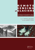
Remote Sensing of Glaciers: Techniques for Topographic, Spatial and Thematic Mapping of Glaciers
by Petri Pellikka W. Gareth ReesGlaciers and ice sheets have been melting significantly during recent decades, posing environmental threats at local, regional and global scales. Changes in glaciers are one of the clearest indicators of alterations in regional climate, since they are governed by changes in accumulation (from snowfall) and ablation (by melting of ice). Glacier chan