- Table View
- List View
Satellite Communications and Networks (Textbooks in Telecommunication Engineering)
by Marko HöyhtyäThis textbook provides fundamental theory and application of satellite communications and networks in a format suitable for university students and professionals working in the field. The book first outlines the types of satellites and their uses, then goes on to cover satellite orbits and constellation design; satellite system architecture; air interface and physical layer; and integrated satellite-terrestrial networks. A thorough discussion on 5G and 6G non-terrestrial networking (NTN) is included. The book shows how and why satellites are playing a key role in supporting critical infrastructures of society, such as energy and telecommunication networks and different forms of traffic on roads, sea and in the air. The book also discusses threats to satellites and how cybersecurity plays a role. The book features end-of-chapter questions and exercises, homework problems including mathematical exercises and practice questions, PowerPoint slides, and a solution manual. The book is ideal for upper undergraduate and graduate students in telecommunications curriculum.
Satellite DNAs in Physiology and Evolution (Progress in Molecular and Subcellular Biology #60)
by Ðurðica UgarkovićThis book gives a comprehensive overview of the unique roles that non-coding repetitive elements such as satellite DNAs play in different physiological and evolutionary processes. It presents the gene-regulatory aspect of satellite DNAs in different model systems including mammals, insects and plants. In addition, evolutionary aspects of activation of satellite DNAs in terms of transcription and proliferation are highlighted, revealing the role of satellite DNAs in the process of adaptation to changing environment and in the speciation process.Finally, the book discusses satellite DNA activation during pathological transformation and the mechanisms by which they affect disease progression. Namely, some satellite DNAs promote the oncogenic processes by affecting genome epigenetic regulation as well as genome integrity. Readers get a full overview of the latest research on satellite DNA.
Satellite Data Compression
by Bormin HuangSatellite Data Compression covers recent progress in compression techniques for multispectral, hyperspectral and ultra spectral data. A survey of recent advances in the fields of satellite communications, remote sensing and geographical information systems is included. Satellite Data Compression, contributed by leaders in this field, is the first book available on satellite data compression. It covers onboard compression methodology and hardware developments in several space agencies. Case studies are presented on recent advances in satellite data compression techniques via various prediction-based, lookup-table-based, transform-based, clustering-based, and projection-based approaches. This book provides valuable information on state-of-the-art satellite data compression technologies for professionals and students who are interested in this topic. Satellite Data Compression is designed for a professional audience comprised of computer scientists working in satellite communications, sensor system design, remote sensing, data receiving, airborne imaging and geographical information systems (GIS). Advanced-level students and academic researchers will also benefit from this book.
Satellite Equivalence Orbits: Analysis of Orbits Combining Different Motions (Space Technology Library #42)
by Ernst Friedrich JochimThis book presents the essential characteristics of the different satellite motions. Satellite motions can be classified as anomalistic, draconitic, tropical, Hansen-, Kepler-, meridional, Sun-synodical, Moon-synodical motion, depending on the relevant reference point. When two of these types of motions (in some cases even more than two) are coupled, satellite orbits are obtained, which are called equivalence orbits in this book. They share the special properties of the different coupled motions and are therefore of particular interest in the selection of special satellite orbits. In the book the author calculates mean equivalence orbits with secular perturbation formulas, as well as true equivalence orbits considering a complete orbit model including periodic motion effects. Some of the equivalence orbits can be determined unambiguously and with extremely high accuracy, they are stable in the long term. Others can only be found with low accuracy and reduced stability. The author investigates all possible combinations and the associated general equations of condition are derived in each case. Some well-known families of satellite orbits, such as the Sun-synchronous orbits, can be interpreted as mean equivalence orbits. The study of their stability is of great interest in orbit mechanics. Special applications and numerous numerical examples, graphical representations of all possible ranges of the Kepler elements, and detailed studies of the stability of particularly important equivalence orbits are carried out using the Brouwer orbit model as well as the modification by Eckstein. This lays the foundation for possible refinements using arbitrary extended orbital models and for possibly required orbital corrections. Numerous problems are to deepen the treated topics and/or to stimulate for further investigations. The book will be of interest to Astrodynamics and Aerospace Engineers as well as graduate students studying satellite orbits.
Satellite Formation Flying
by Danwei Wang Baolin Wu Eng Kee PohThis book systematically describes the concepts and principles for multi-satellite relative motion, passive and near passive formation designs, trajectory planning and control for fuel optimal formation maneuvers, and formation flying maintenance control design. As such, it provides a sound foundation for researchers and engineers in this field to develop further theories and pursue their implementations. Though satellite formation flying is widely considered to be a major advance in space technology, there are few systematic treatments of the topic in the literature. Addressing that gap, the book offers a valuable resource for academics, researchers, postgraduate students and practitioners in the field of satellite science and engineering.
Satellite Formation Flying: High Precision Guidance using Optimal and Adaptive Control Techniques
by S. Mathavaraj Radhakant PadhiSmall satellite technology is opening up a new era in space exploration offering reduced cost of launch and maintenance, operational flexibility with on-orbit reconfiguration, redundancy etc. The true power of such missions can be harnessed only from close and precise formation flying of satellites. Formation flying missions support diverse application areas such as reconnaissance, remote sensing, solar observatory, deep space observatories, etc. A key component involved in formation flying is the guidance algorithm that should account for system nonlinearities and unknown disturbances. The main focus of this book is to present various nonlinear optimal control and adaptive guidance ideas to ensure precise close formation flying in presence of such difficulties. In addition to in-depth discussion of the relevant topics, MATLAB program files for the results included are also provided for the benefit of the readers. Since this book has concise information about the various guidance techniques, it will be useful reference for researchers and practising engineers in the space field.
Satellite Ground Station Antennas: Electrical, Mechanical, and Civil Engineering Design
by Thomas A. Milligan Roland Schwerdtfeger Robert Hoferer Christophe GranetUnderstand all aspects of ground station design with this groundbreaking volume A satellite ground station is a terrestrial station built to communicate or receive signals from spacecraft and other astronomical and interplanetary sources. Since ground stations are subject to weather and other terrestrial conditions, their operations can be unpredictable, and their design offers numerous challenges for engineers. Satellite Ground Station Antennas constitutes the first-ever comprehensive overview of these challenges and the tools by which engineers of all kinds can meet them. Analyzing every aspect of ground station antenna technology, the book can be read both continuously or as a reference, with each chapter functioning by itself to fully apprehend a discrete portion of the subject. Balancing mathematics with mechanics, it combines accessibility and rigor to create an unprecedented resource. Readers will also find: In-depth material published in a fully accessible form for the first timeDetailed discussion of topics including reflector design, structural considerations, proof-of-performance, and moreLavish illustrations and photographs throughout Satellite Ground Station Antennas is ideal for electrical, mechanical, and civil engineers, as well as for any other industry professional working with ground station design.
Satellite Image Analysis: Clustering and Classification (SpringerBriefs in Applied Sciences and Technology)
by Nilanjan Dey Rohit Thanki Surekha BorraThanks to recent advances in sensors, communication and satellite technology, data storage, processing and networking capabilities, satellite image acquisition and mining are now on the rise. In turn, satellite images play a vital role in providing essential geographical information. Highly accurate automatic classification and decision support systems can facilitate the efforts of data analysts, reduce human error, and allow the rapid and rigorous analysis of land use and land cover information. Integrating Machine Learning (ML) technology with the human visual psychometric can help meet geologists’ demands for more efficient and higher-quality classification in real time. This book introduces readers to key concepts, methods and models for satellite image analysis; highlights state-of-the-art classification and clustering techniques; discusses recent developments and remaining challenges; and addresses various applications, making it a valuable asset for engineers, data analysts and researchers in the fields of geographic information systems and remote sensing engineering.
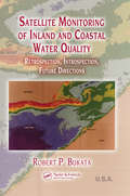
Satellite Monitoring of Inland and Coastal Water Quality: Retrospection, Introspection, Future Directions
by Robert P. BukataSatellite Monitoring of Inland and Coastal Water Quality: Retrospection, Introspection, Future Directions reviews how aquatic optics models can convert remote determinations of water color into accurate assessments of water quality. This book illustrates how this conversion can generate products of value for the environmental monitoring of opticall
Satellite Navigation Systems and Technologies (Space Science and Technologies)
by Peng Li Jun Xie Haihong Wang Yansong MengBased on the design theory and development experience of Beidou navigation satellite system (BDS), this book highlights the space segment and the related satellite technologies as well as satellite-ground integration design from the perspective of engineering. The satellite navigation technology in this book is divided into uplink and reception technology, broadcasting link technology, inter-satellite link technology, time-frequency system technology, navigation signal generation and assessment technology, navigation information management technology, autonomous operation technology of navigation satellite. In closing, the book introduces readers to the technological development status and trend of BDS and other GNSS, and propose the technologies of future development.Unlike most current books on this topic, which largely concentrate on principles, receiver design or applications, the book also features substantial information on the role of satellite system in the GNSS and the process of signal information flow, and each chapter not only studies on the theoretical function and main technologies, but also focuses on engineering development. Accordingly, readers will gain not only a better understanding of navigation satellite systems as a whole, but also of their main components and key technologies.
Satellite Network Robust QoS-aware Routing
by Fei LongSatellite Network Robust QoS-aware Routing presents a novel routing strategy for satellite networks. This strategy is useful for the design of multi-layered satellite networks as it can greatly reduce the number of time slots in one system cycle. The traffic prediction and engineering approaches make the system robust so that the traffic spikes can be handled effectively. The multi-QoS optimization routing algorithm can satisfy various potential user requirements. Clear and sufficient illustrations are also presented in the book. As the chapters cover the above topics independently, readers from different research backgrounds in constellation design, multi-QoS routing, and traffic engineering can benefit from the book. Fei Long is a senior engineer at Beijing R&D Center of 54th Research Institute of China Electronics Technology Group Corporation.
Satellite Photoelectric Sensing Technology: Communication, Navigation and Reconnaissance
by Jing Li Jianjun ZhangThis book helps to solve the problems and challenges of satellite sensing in the current environment of increasing communications bandwidths and multiplicity of electromagnetic signals. It presents technology that makes full use of the broadband low-loss advantages of optoelectronic technology and research into new broadband radio-frequency channelization and receiving technology based on photoelectric sensing. The methods presented allow improvements in system performance in terms of receiving bandwidth, frequency-sensing accuracy, channel equalization, adjacent channel crosstalk, dynamic range, and complexity of the system structure. In addressing the difficulty of satellite spectrum control, including the issue of high-precision and real-time wide-spectrum sensing not being able to be obtained simultaneously, the book solves the problem of accurate and parallel-decomposition sensing technology using the dual-phase optical frequency comb. This method avoids the involvement of fine filtering and does not require fine alignment between the source and the filter but achieves high perceptual accuracy. Satellite Photoelectric Sensing Technology explores the research background, significance, and current challenges associated with the technology, making it relevant and interesting to academics, practitioners, and postgraduate students in this field.
Satellite Precipitation Measurement: Volume 1 (Advances in Global Change Research #67)
by Vincenzo Levizzani Christopher Kidd Dalia B. Kirschbaum Christian D. Kummerow Kenji Nakamura F. Joseph TurkThis book offers a complete overview of the measurement of precipitation from space, which has made considerable advancements during the last two decades. This is mainly due to the Tropical Rainfall Measuring Mission (TRMM), the Global Precipitation Measurement (GPM) mission, CloudSat and a carefully maintained constellation of satellites hosting passive microwave sensors. The book revisits a previous book, Measuring Precipitation from Space, edited by V. Levizzani, P. Bauer and F. J. Turk, published with Springer in 2007. The current content has been completely renewed to incorporate the advancements of science and technology in the field since then. This book provides unique contributions from field experts and from the International Precipitation Working Group (IPWG). The book will be of interest to meteorologists, hydrologists, climatologists, water management authorities, students at various levels and many other parties interested in making use of satellite precipitation data sets.
Satellite Precipitation Measurement: Volume 2 (Advances in Global Change Research #69)
by Vincenzo Levizzani Christopher Kidd Dalia B. Kirschbaum Christian D. Kummerow Kenji Nakamura F. Joseph TurkThis book offers a complete overview of the measurement of precipitation from space, which has made considerable advancements during the last two decades. This is mainly due to the Tropical Rainfall Measuring Mission (TRMM), the Global Precipitation Measurement (GPM) mission, CloudSat and a carefully maintained constellation of satellites hosting passive microwave sensors. The book revisits a previous book, Measuring Precipitation from Space, edited by V. Levizzani, P. Bauer and F. J. Turk, published with Springer in 2007. The current content has been completely renewed to incorporate the advancements of science and technology in the field since then. This book provides unique contributions from field experts and from the International Precipitation Working Group (IPWG).The book will be of interest to meteorologists, hydrologists, climatologists, water management authorities, students at various levels and many other parties interested in making use of satellite precipitation data sets.
Satellite Radiothermovision of Atmospheric Processes: Method and Applications (Springer Praxis Books)
by Dmitry M. ErmakovThis book summarizes the author’s research resulted in developing the satellite radiothermovision approach which allows retrieving dynamical and energy characteristics of atmospheric mesoscale and synoptic-scale processes based on a close scheme of satellite passive radiometry data processing. The book introduces new applications of the satellite passive microwave observations to detailed systematic study of tropical cyclones’ evolution, climatology and characteristics of atmospheric river, parameters of global atmospheric circulation and their variations on climatically significant scales. The results presented in the book demonstrate a clear relation between the convergence/divergence of latent heat from the lower atmosphere to the center of tropical cyclone with variations of its intensity and provide a better insight into the tropical cyclone dynamical energy balance based on remote data.
Satellite Rainfall Applications for Surface Hydrology
by Mekonnen Gebremichael Faisal HossainWhile there are a growing number of high-resolution space-based systems for measuring precipitation, instances of the use of these products for surface hydrology are rare. This book, which covers both scientific and practical matters, aims to change that. With contributions from a panel of researchers from a wide range of fields, the chapters focus on evaluating the potential, utility and application of high resolution satellite precipitation products in relation to surface hydrology. Focusing on the way the algorithms for the precipitation products evolved, the accuracy assessment of those products in different regions of the world, and the application of the precipitation products to various decision support systems, the book is at the interface between satellite rainfall and surface hydrologic applications. It dwells on issues that are of concern at hydrologic scales of application. In doing so, it provides very useful information to practitioners, researchers and graduate students who need to explore the latest on satellite precipitation products for various hydrological purposes. Crucially, the book provides examples of real-world applications of satellite rainfall products in operational hydrology and real-time decision-making. This enables readers to understand the potential of satellite rainfall products for practical applications ranging from agricultural/crop monitoring to flood and landslide detection in developing countries.
Satellite Remote Sensing
by Nicola Masini Rosa LasaponaraThis book provides a state-of-the art overview of satellite archaeology and it is an invaluable volume for archaeologists, scientists, and managers interested in using satellite Earth Observation (EO) to improve the traditional approach for archaeological investigation, protection and management of Cultural Heritage. The recent increasing development of EO techniques and the tremendous advances in Information and Communication Technologies (ICT) have resulted primarily in Cultural Heritage applications. The book focuses on new challenging prospects for the use of EO in archaeology not only for probing the subsurface to unveil sites and artifacts, but also for the management and valorization as well as for the monitoring and preservation of cultural resources. The book provides a first-class understanding of this revolutionary scenario which was unthinkable several years ago. The book offers: (i) an excellent collection of outstanding articles focusing on satellite data processing, analysis and interpretation for archaeological applications, (ii) impressive case studies, (iii) striking examples of the high potential of the integration of multi-temporal, multi-scale, multi-sensors techniques. Each chapter is composed as an authoritative contribution to help the reader grasp the value of its content. The authors are renowned experts from the international scientific community. Audience: This book will be of interest to scientists in remote sensing applied to archeology, geoarcheology, paleo-environment, paleo-climate and cultural heritage.
Satellite Remote Sensing Technologies (Space Science and Technologies)
by Jindong LiThis book provides in-depth explanations of design theories and methods for remote sensing satellites, as well as their practical applications. There have been significant advances in spacecraft remote sensing technologies over the past decade. As the latest edition of the book “Space Science and Technology Research,” it draws on the authors’ vast engineering experience in system design for remote sensing satellites and offers a valuable guide for all researchers, engineers and students who are interested in this area. Chiefly focusing on mission requirements analyses and system design, it also highlights a range of system design methods.
Satellite Remote Sensing in Hydrological Data Assimilation
by Mehdi KhakiThis book presents the fundamentals of data assimilation and reviews the application of satellite remote sensing in hydrological data assimilation. Although hydrological models are valuable tools to monitor and understand global and regional water cycles, they are subject to various sources of errors. Satellite remote sensing data provides a great opportunity to improve the performance of models through data assimilation.
Satellite Remote Sensing of Natural Resources (Mapping Science Ser. #4)
by David L. VerbylaSatellite Remote Sensing of Natural Resources offers an introduction to digital remote sensing. This comprehensive text emphasizes the basics, with simple concepts presented in clear, easy-to-understand language. For those who are interested in practical remote sensing but do not have an extensive background in math and statistics, this primer is invaluable. The main topics covered include satellite images, image processing systems, spectral regions, radiometric and geometric corrections, supervised and unsupervised classification, and accuracy assessment. Each chapter concludes with a section of sample problems and list of additional readings.
Satellite Systems Engineering in an IPv6 Environment
by Daniel MinoliCapitalize on Expert Foresight into the Future of Satellite Communication Satellite technology will maintain its key role in the evolving communications needs of government, military, IPTV, and mobile video industries because of its intrinsic multicast/broadcast capabilities, mobility aspects, global reach, reliability, and ability to quickly suppo
Satellite and Terrestrial Hybrid Networks
by Pascal Berthou Cédric Baudoin Thierry Gayraud Matthieu GinesteThis book offers the reader the keys for a successful understanding, integration and usage of satellite systems in addition to next generation terrestrial networks. The DVB-S2/RCS system is used to illustrate the integration challenges. The presentation uses a system approach, i.e. it tackles the terrestrial and satellite telecommunication systems’ complexity with a high level approach, focusing on the systems’ components and on their interactions. Several scenarios present the different paths that can be followed for the integration of satellite systems in terrestrial networks. Quality of Service management techniques in terrestrial and satellite systems and the solutions to help them to interoperate are provided. Inter-system mobility solutions and performance problems are then addressed. The solutions proposed in this book have been developed within the framework of European and French funded research projects and tested with simulated or real testbeds.
Satellite-Based Mitigation and Adaptation Scenarios for Sea Level Rise in the Lower Niger Delta (Ihe Delft Phd Thesis Ser.)
by Zahrah Naankwat MusaThe Niger delta with its gentle slope and low elevation is extremely sensitive to effects of climate change. Its adaptive capacity is the second lowest in terms of socio-economic development in Nigeria. Quantitative studies on developing measures for coastal planning and management in the lower Niger delta have been limited by data availability and inaccessibility of parts of the delta. The use of satellite data can help bridge the data gap by providing ancillary data (imagery, elevation, altimetry etc.) that can be used to quantify the effects of SLR in the Niger delta. This thesis uses satellite data as the main source for hydrodynamic modelling and GIS analysis. Until recently such data might not have the accuracy and precision of directly measured data. However recent innovative approaches have enabled better exploitation of satellite data to overcome these limitations and produce adequate results to assess the impact of SLR on the Niger delta in an integrated way that will lead to practical recommendations for adaptation. Using projected global eustatic SLR values in combination with land subsidence, this thesis estimated SLR levels for the Niger delta and its effect on inundation areas and flood extent. The results indicate that the Niger delta is very vulnerable to inundation and that even minimal SLR will affect flooding in the lower Niger delta since the area continues to subside. A new coastal vulnerability index was developed in this thesis by evaluating physical, social and human influence indicators of exposure, susceptibility and resilience. The results show that parts of the Niger delta are highly vulnerable to SLR and need adequate mitigation/adaptation measures to protect them. It is recommended that sustainable local resilience practices already being used in parts of the Niger delta should be included in adaptation planning.
Satellitenfrequenzkoordinierung
by Hans Dodel René WörfelFunksysteme bilden zunehmend die Grundlage von Kommunikation, privat ebenso wie in Industrie und Wirtschaft. Von WLAN bis zur Satellitenkommunikation müssen die Kommunikations-, Navigations- und Rundfunksatelliten und ihre Bodenanlagen national und international regulatorisch koordiniert werden. Das Buch beschreibt anschaulich das Prozedere einer Funkanmeldung, erörtert Beispiele von Satellitenprojekten und zeigt Wege auf, wie das endliche Spektrum effektiv genutzt werden kann, damit auch in Zukunft weitere Systeme zugelassen werden können.
Satellitennavigation
by Hans Dodel Dieter HäuplerDie Ortung und Navigation mit Hilfe von Satelliten steht an einem Wendepunkt. Mit dem europäischen Satellitennavigationssystem GALILEO ist die Entscheidung für ein eigenes europäisches Navigationssystem gefallen, das neue Maßstäbe setzt und der europäischen Wirtschaft nachhaltige Impulse geben kann. Wie funktioniert GALILEO? Warum brauchen wir dieses System? Welche Anwendungen werden damit möglich? Diese Fragen beantwortet das Buch und stellt den aktuellen Wissensstand zu diesem Thema dar, einschließlich der mathematischen Grundlagen.
