- Table View
- List View
T-Mobile G1 For Dummies
by Chris ZieglerExcited about the new Google phone? T-Mobile's G1 android phone is packed with possibilities, and T-Mobile G1 For Dummies will help you make the most of them.This fun and friendly guide shows you how to navigate the G1's android interface, make phone calls, view maps, manage contacts, browse the Web, and a whole lot more. Your T-Mobile G1 is so much more than a phone--it's also an administrative assistant, movie theater, jukebox, mobile office, and several more things all rolled into one device. With T-Mobile G1 For Dummies, you can:Find out all about the Android smartphone operating system and what it offersLearn your way around the G1's keyboard, buttons, and touch screenSee how your G1 connects to both Wi-Fi networks and T-Mobile's high-speed networkSurf the Web, download music and picture files, and tweak browser settingsSend and receive Gmail, get where you're going with Google Maps, and stay organized with Google CalendarTake photos, check out YouTube, and fill your phone with mediaManage your e-mail and choose which messages will be synced to your phoneShop the Android Market and discover more cool apps for your G1Don't waste a single cool feature of your T-Mobile G1! T-Mobile G1 For Dummies shows you how to use all the great Google functions, play (and even buy) music, browse the Web, add apps, and more.
T1: A Survival Guide
by Matthew GastThis practical, applied reference to T1 for system and network administrators brings together in one place the information you need to set up, test, and troubleshoot T1. You'll learn what components you need to build a T1 line; how the components interact to transmit data; how to adapt the T1 to work with data networks using standardized link layer protocols; troubleshooting strategies; and working with vendors.
TABS – Thermoaktive Bauteilsysteme: Selbstlernendes und vorausschauendes Steuern mit AMLR
by Elmar Bollin Martin SchmelasDieses Fachbuch gibt einen vertieften Einblick in das dynamische Verhalten von thermoaktiven Bauteilsystemen. Es wird eine neu entwickelte und vielfach erprobte, selbstlernende und vorausschauende TABS-Steuerung vorgestellt. Dazu wird auf die Erfordernisse einer effektiven TABS-Steuerung eingegangen und die Grundlagen und Funktionsweise der neu entwickelten AMLR-Steuerung erläutert. Anhand mehrerer Anwendungsbeispiele wird die Umsetzung in die bauliche Praxis erläutert und mit Hilfe von umfangreichen Messergebnissen die Funktion der neuen AMLR-Steuerung nachgewiesen. Abschließend werden Empfehlungen für die Anwendung von AMLR in der baulichen TABS-Praxis hinsichtlich Anlagenhydraulik und Umsetzung in der Gebäudeautomation gegeben.
TASER® Conducted Electrical Weapons: Physiology, Pathology, and Law
by Jeffrey D. Ho Mark W. KrollTASER® Conducted Electrical Weapons are rapidly replacing the club for law-enforcement control of violent subjects within many countries around the globe. A TASER CEW is a hand-held device that delivers a 400-volt pulse with a duration tuned to control the skeletal muscles without affecting the heart at a distance of up to 6.5 meters over tiny wires. If necessary, it begins with an arcing voltage of 50,000 V to penetrate thick clothing; the 50,000 V is never delivered to the body itself. Due to the widespread usage of these devices and the widespread misconceptions surrounding their operation, this book will have significant utility. This volume is written for cardiologists, emergency physicians, pathologists, law enforcement management, corrections personnel, and attorneys.
TAX HAVENS and Corporate Strategies - Essays on Offshore Investments
by Antonio C. T. de Mello Raul Adalberto de CamposA incerteza política, uma economia volátil, agressões ao sigilo bancário, as ameaças à manutenção da riqueza, aumento da carga fiscal, os serviços governamentais deficientes para compensar o pagamento de impostos, administração pública ineficaz, crises sociais, o medo .. Neste contexto caótico, empresários buscarem constantemente alternativas para salvaguardar os seus investimentos a partir de "confisco legal" resultante da tributação extremamente elevada direta e indireta em que os cidadãos são submetidos. Em um mundo que está cada dia mais inter-conectado, o conhecimento e divulgação de novas oportunidades de negócios e oportunidades de investimento alternativas que existem fora das fronteiras nacionais torna-se uma oportunidade cada vez mais atraente, especialmente quando associada a uma redução em impostos e um aumento da possível lucros obtidos possível através dos assim chamados "paraísos fiscais" ou "Jurisdições Fiscais Privilegiados" .. Apesar de existir uma linha tênue entre a evasão fiscal (legal) e evasão (ilegal), essas práticas e estratégias de negócios quando colocado em prática de acordo com um programa fiscal anterior e cuidadosamente preparado, em conjunto com um estudo aprofundado das estruturas jurídicas no exterior, de fato representam uma oportunidade excepcional para o lucro e também para proteger os ativos e outras formas de riqueza, dentro dos limites da legislação em vigor. Mais do que uma opção para proteger a privacidade pessoal e financeira dos cidadãos que vivem em um universo no mar, o investimento e novas oportunidades de negócio descritas aqui representam verdadeiras oportunidades para qualquer pessoa com a curiosidade de descobrir um novo mundo ainda a ser explorado. Junte-se a esta aventura, esqueça os preconceitos, descobrir um novo mundo no universo offshore e, principalmente, ser livre para pensar, aprender como se comportar e acumular sua propriedade p
TBH #5: TBH, I Feel the Same (TBH #5)
by Lisa GreenwaldThree BFFs try to make new friends but keep the old in the fifth book in Lisa Greenwald’s hilarious series told entirely in text messages, emojis, and notes. Perfect for fans of Invisible Emmie and the Dork Diaries books.Making new friends is a good thing, right? Not when you barely see your besties! Between swim team, the school play, and poetry club, BFFs Cece, Gabby, and Prianka are meeting different people and trying different things. But besties clash when Gabby’s new friends rank the other girls in their grade in categories like looks, smarts, and popularity.The question is: How can you be your best self if your BFFs don’t have your back?
TBH #6: TBH, You Know What I Mean (TBH #6)
by Lisa GreenwaldThree BFFs prove that girls can do anything they set their minds to in the sixth book in this hilarious series told entirely in text messages, emojis, and passed notes. Perfect for fans of Invisible Emmie and the Dork Diaries. TBH, sometimes boys say dumb things about girls. And Cece is sick of it!When she leads a super-successful event at school to raise awareness, everyone starts looking to her to take charge—of everything. Prianka needs ideas for National Poetry Month, Victoria wants advice on volunteer projects, and Gabby needs homework help. To be honest, being a leader is fun but the pressure is OOC (out of control)! Can Cece help her friends without totally losing it herself?
TBH #7: TBH, No One Can EVER Know (TBH #7)
by Lisa GreenwaldWith a Valentine’s Day dance, snooping parents, and way too many secrets, these four BFFs have a lot to deal with in the seventh book in this hilarious series told entirely in text messages, emojis, and passed notes, perfect for fans of Invisible Emmie and the Dork Diaries series. It’s no secret that Victoria’s mom can be OTT overprotective! But lately her anxiety has been too much to handle. So even though Victoria is helping plan the school’s Valentine’s Day dance, she might not be allowed to go!To be honest, she’s going to need lots of help from her BFFs to mend this mother-daughter relationship—and it may mean sharing her most embarrassing secret ever! The question is: Can you take back a secret once you’ve shared it?
TBH #8: TBH, I Don't Want to Say Good-bye (TBH #8)
by Lisa GreenwaldWhen summer break brings BIG changes, these BFFs 4EVA may end up saying good-bye 4EVA in the eighth and final book in this popular middle-grade series told entirely in text messages, emojis, and passed notes. Perfect for fans of Invisible Emmie and the Dork Diaries. TBH, Cece, Prianka, and Gabby thought they’d be together forever. But when Gabby’s mom announces she’s moving to Texas and a backyard BBQ party gets the friends’ blow-out summer off to a rocky start, they end up spending more time apart than together! To be honest, Gabby just wants to get the good-byes over with already. The question is: How can they be BFF 4EVA if everyone goes their separate ways?
TBH, This Is So Awkward (TBH #1)
by Lisa GreenwaldTold entirely in text messages, this addictive new series from the acclaimed author of My Life in Pink & Green is perfect for fans of Lauren Myracle and Wendy Mass. To be honest, middle school is rough! Cecily, Gabby, and Prianka have been BFFAE since pre-K, so it’s totally natural when they don’t include the new girl, Victoria, in their plans and group texts.Between organizing the school Valentine’s Day dance, prepping for their first boy-girl party, and trying to keep their texts so boring their moms won’t use spy apps to read them, the friends only have time for each other.But when Victoria is accidentally sent a hurtful text message, the entire sixth grade gets called out for bullying, cell phones are confiscated, and the trio known as CPG4Eva is forced to figure out just how strong their friendships are IRL.
TBM Excavation in Difficult Ground Conditions: Case Studies from Turkey
by Nuh Bilgin Hanifi Copur Cemal BalciThe book relates experience of TBM drives in difficult geology, making use of case studies from Turkey to demonstrate the influence of the local geotechnical conditions on the selection of a tunnel boring machine and the selection of tools. There is an extensive description how various geological phenomena, such as for example transition zones, dikes, rock discontinuities, blocky ground, squeezing ground, swelling clays and high strength and abrasive rocks, can reduce the advance rate and what countermeasures can be introduced. There is also a discussion of necessary advance probing and safety measures. Since the presented practical experience from Turkey can also be applicable for other tunnel projects in difficult geology, the book represents a valuable source of knowledge for every tunneler.
TCP Performance over UMTS-HSDPA Systems
by Mohamad Assaad Djamal ZeghlacheThe evolution of the mobile communication market is causing a major increase in data traffic demands. This could lead to disrupted mobility and intermittent degraded channel conditions that contribute to poor transmission control protocol (TCP) performance. TCP Performance over UMTS-HSDPA Systems presents a comprehensive study of the effect of TCP
TCP, UDP und QUIC Internals: Protokolle und Programmierung
by Peter MandlDas Lehrbuch vermittelt praxisbezogen wichtige Grundkonzepte der Datenkommunikation mit einem Fokus auf den wichtigsten Transportprotokollen des Internets und auf der Entwicklung verteilter Anwendungen. Besonders ausführlich betrachtet der Autor die Transportprotokolle TCP und UDP, aber auch das neue, ursprünglich von Google für die Webkommunikation mit HTTP/3 entwickelte und inzwischen standardisierte Protokoll QUIC wird in der 2. Auflage ausführlich und verständlich erläutert. Dabei werden auch die zugrundeliegenden Kommunikationskonzepte anschaulich beschrieben. Um die Vorteile von QUIC im Vergleich zu TCP zu verstehen, werden auch die Grundlagen des Transport Layer Security (TLS) Protokolls, das in QUIC nun bereits integriert ist, in der vorliegenden 2. Auflage eingeführt. Die Nutzung von Transportmechanismen in der Programmierung eigener Kommunikationsanwendungen über die Socket API wird ebenfalls mit vielen Beispielen vor allem in Java, aber auch grundlegend in C erläutert. Neben den wesentlichen Protokollmechanismen und Zusammenhängen der betrachteten Protokolle weist der Autor auf die Möglichkeiten der Protokolloptimierung hin. Dadurch wird das Buch zu einem praktischen Ratgeber, der jederzeit zur Konfiguration der komplexen Protokollimplementierungen in Universalbetriebssystemen wie Linux, Windows oder macOS herangezogen werden kann.Die komplexen Sachverhalte werden verständlich erklärt und helfen dabei, die konkreten Protokollimplementierungen besser zu nutzen. Der Schwerpunkt des Buches liegt auf den praktisch relevanten Themen, aber auch grundlegende Aspekte werden erläutert. Viele Bilder veranschaulichen die Protokollmechanismen. Eine Sammlung von Kontrollfragen inklusive Musterlösungen erleichtert die Nachbearbeitung des Stoffes. Komplettiert wird das Buch durch umfangreiches Online-Zusatzmaterial. Lehrende können darüber hinaus auf Anfrage Präsentationsfolien zu den behandelten Themen beziehen.Das Buch richtet sich an Studierende der Informatik und Wirtschaftsinformatik sowie anderer Fachrichtungen mit Schwerpunkt Informationsverarbeitung und an Praktiker*innen wie Softwareentwickler*innen und Netzwerkadministrator*innen.Der Inhalt• Einführung in die Grundbegriffe der Datenkommunikation• Grundkonzepte der Transportschicht• Transportprotokolle TCP, UDP und QUIC• Einführung in das Transport Layer Security (TLS) Protokoll• Programmierung von Socket-Anwendungen
TECHNOLOGY PATHWAYS: Assessing the Integrated Plan for a Next Generation Air Transportation System
by National Research Council of the National AcademiesIn 2003, Congress directed the Secretary of Transportation to establish the Next Generation Air Transportation System (NGATS) Joint Planning and Development Office (JDPO) to plan the development of an air transportation system capable of meeting potential air traffic demand for 2025. All federal agencies involved in aviation participate in the JDPO providing the opportunity overcome many of the major barriers to developing an effective NGATS. To assist this process, the NRC was asked to examine the first NGATS Integrated Plan prepared by JPDO and submitted to Congress in 2004. This report provides a review of the vision and goals, the operational concepts, and the R&D roadmap developed by the plan; an analysis of the JDPO integrated product teams created to carry out the planning; and an assessment of the implementation process.
TERRA- 1: The Role of Earth Observations from Space
by Paul M. MatherThis text aims to offer information on research approaches to assessing global environment changes. It includes suggestions for the exchange of ideas between those studying land surface and remote sensing specialists, and advocates synthesizing the findings of different disciplines.
TFET Integrated Circuits: From Perspective Towards Reality
by Amara Amara Navneet Gupta Adam Makosiej Andrei Vladimirescu Costin AnghelThis book describes the physical operation of the Tunnel Field-effect Transistor (TFET) and circuits built with this device. Whereas the majority of publications on TFETs describe in detail the device, its characteristics, variants and performance, this will be the first book addressing TFET integrated circuits (TFET ICs). The authors describe the peculiarities of TFET ICs and their differences with MOSFETs. They also develop and analyze a number of logic circuits and memories. The discussion also includes complex circuits combining CMOS and TFET, as well as a potential fabrication process in Silicon.
THE DISPOSITION DILEMMA: Controlling the Release of Solid Materials from Nuclear Regulatory Commission-Licensed Facilities
by Committee on Alternatives for Controlling the Release of Solid Materials from Nuclear Regulatory Commission-Licensed FacilitiesA report on Controlling the Release of Solid Materials from Nuclear Regulatory Commission-Licensed Facilities
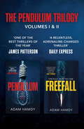
THE PENDULUM SERIES, VOLUMES I AND II: PENDULUM FREEFALL
by Adam HamdyDiscover volumes I and II of Adam Hamdy's explosive and gripping thriller series: PENDULUM and FREEFALL. Adam Hamdy's first PENDULUM novel was called 'one of the best thrillers of the year' by JAMES PATTERSON and chosen as a BBC Radio 2 Book Club pick. These pulse-racing reads are perfect for fans of Lee Child, Simon Kernick and Terry Hayes.'One of the best thriller writers I've read in recent years, Adam's writing is slick and unputdownable' Jenny Blackhurst, #1 eBook bestselling authorPendulum:YOU WAKE. CONFUSED. DISORIENTATED. A NOOSE IS ROUND YOUR NECK.John Wallace has no idea why he has been targeted. No idea who his attacker is. No idea how he will prevent the inevitable.Then the pendulum of fate swings in his favour. He has one chance to escape, find the truth and halt his destruction.But with a killer on his tail, everything can change in a moment...YOU HAVE ONE CHANCE. RUN.Freefall:JOHN WALLACE IS A TARGET AGAIN.Hiding off-grid after exposing the shadowy Pendulum conspiracy, Wallace discovers he is still marked for death.There are only two people he can trust - DI Patrick Bailey, still reeling from the murder investigation that nearly cost his life, and FBI Agent Christine Ash, who is hunting a serial killer linked to an unfinished case.The death of a London journalist triggers an investigation that brings them back together, hurling them into the path of an unknown enemy.Hunted across the world, they are plunged into a nightmare deadlier than they could have ever imagined.Praise for the PENDULUM series:'I read Pendulum in one gloriously suspenseful weekend. Definitely one of the best thrillers of the year' James Patterson'So tense, you will be biting your nails long before the final chapter.' The Sun'A relentless, adrenaline-charged thriller that grips from the first page' Daily Express'Watch out, Jack Reacher and Alex Cross, the new generation is here!' Crime TimeWHAT READERS ARE SAYING ABOUT THE PENDULUM SERIES:'This is a full on action packed, high octane adventure.' Goodreads Reviewer, 5 stars' I was absolutely gripped' Goodreads Reviewer, 5 stars'Edge of the seater thriller that keeps the action coming thick and fast' Goodreads Reviewer, 5 stars
THE RICHARD AND HINDA ROSENTHAL LECTURES 2001: Exploring Complementaryand Alternative Medicine
by Institute of Medicine (U.S.) Staff David Eisenberg Catherine E. WotekiA report on Exploring Complementaryand Alternative Medicine
THRIVE: How to Cultivate Character So Your Children Can Flourish Online
by Dr Tom HarrisonWinner of the International Federation for Family Development Award.When Dr Tom Harrison, a leading expert in the field of character education and the Internet, bought his daughter her first smartphone, a major milestone had been reached: she had entered the 'cyber-world'. Harrison no longer needed to know what to think; he needed to know what to do. This is the first practical book of its kind to show parents and teachers how to develop character as the foundation for helping young people to thrive in their online interactions. It answers the question: How do we prepare our children to do the right thing when no one is watching?Based on his own experience as a parent, more than a decade of research and thousands of conversations with parents, teachers, children and policymakers, the REACT and THRIVE models have been developed to engage with character, wellbeing, social and emotional learning, ethics and digital citizenship - all the ingredients for flourishing online.The world is waking up to the importance of character for individual and wider societal flourishing. Harrison is at the forefront of this movement and is regularly invited to advise policymakers and thousand of teachers and parents around the world. This book is a must-read for parents and educators who want to help children not just survive but thrive online in their cyber-worlds.
THz Communications: Paving the Way Towards Wireless Tbps (Springer Series in Optical Sciences #234)
by Tadao Nagatsuma Thomas Kürner Daniel M. MittlemanThis book describes the fundamentals of THz communications, spanning the whole range of applications, propagation and channel models, RF transceiver technology, antennas, baseband techniques, and networking interfaces. The requested data rate in wireless communications will soon reach from 100 Gbit/s up to 1 Tbps necessitating systems with ultra-high bandwidths of several 10s of GHz which are available only above 200 GHz. In the last decade, research at these frequency bands has made significant progress, enabling mature experimental demonstrations of so-called THz communications, which are thus expected to play a vital role in future wireless networks. In addition to chapters by leading experts on the theory, modeling, and implementation of THz communication technology, the book also features the latest experimental results and addresses standardization and regulatory aspects. This book will be of interest to both academic researchers and engineers in the telecommunications industry.
THz and Security Applications
by Carlo Corsi Fedir SizovThese proceedings comprise invited papers from highly experienced researchers in THz technology and security applications. THz detection of explosives represents one of the most appealing technologies to have recently emerged in dealing with terrorist attacks encountered by civil security and military forces throughout the world. Discussed are the most advanced technologies and developments, the various points of operational strength and weaknesses as well as are suggestions and predictions the best technological solutions to overcome current operational limits The current status of various levels of cooling in THz detectors, sources and associated electronics are also addressed. The goal was to provide a clear view on the current technologies available and the required advances needed in order to achieve more efficient systems. This goal was outlined in part by establishing the baseline of current uncertainty estimations in physics-based modelling and the identification of key areas which require additional research and development.
THz and Sub-THz CMOS Electronics for High-Speed Telecommunication: Architectures and Circuits for Future 6G Transceivers (Analog Circuits and Signal Processing)
by Patrick Reynaert Carl D’heerThis book provides a complete overview of high-speed circuit design for high-speed telecommunication above 100GHz. Covering everything from telecom and electronics fundamentals to system-level modeling, detailed circuit design, and in-depth performance analysis, this book lends itself as the perfect design guide and reference work for beginner and experienced telecommunication circuit designers alike.
TIGER – Kommunikationskonzept Tiefe Geothermie (essentials)
by Anna Borg Mathias Jürgen BauerDas vorliegende Kommunikationskonzept unterst#65533;tzt Investoren, Betreiber und Institutionen bei der #65533;ffentlichkeitsarbeit und Kommunikation f#65533;r den Bereich Tiefe Geothermie und zeigt Wege auf, die Akzeptanz f#65533;r das lokale Projekt zu f#65533;rdern. Es geht auf den Auftrag des durch das Bundesministerium f#65533;r Wirtschaft und Energie (BMWi) gef#65533;rderten Forschungsprojektes ,,TIGER - Tiefe Geothermie: Akzeptanz und Kommunikation einer innovativen Technologie" zur#65533;ck.
