- Table View
- List View
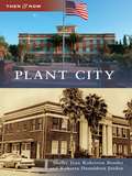
Plant City
by Roberta Donaldson Jordan Shelby Jean BenderNamed for railroad magnate Henry B. Plant, Plant City was incorporated in 1885. Rich in history and the flavor of strawberries, it is known as the Winter Strawberry Capital of the World. Images featured are from the Quintilla Geer Bruton Archives Center and the East Hillsborough Historical Society. Shelby Jean Roberson Bender, an eighth-generation Floridian, and Roberta Donaldson Jordan, a native of Pennsylvania, have devoted many years to historical and genealogical research, publications, and instruction.
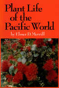
Plant Life of the Pacific World
by Elmer D. MerrillThis Asian ecology book offers an overview of the plant life of the vast Pacific region.Among the topics covered are the tropical forest and jungles, the grasslands, the primary and secondary forest, and the plants of the seashores. <P><P>Weeds and cultivated plants are also discussed with overviews of plant distribution and notes on specific islands and island groups.Plant Life of the Pacific World will fill a great need as an important reference source not only for the ethnobotanist but for the professional botanist and the student interested in the flora of the Pacific basin. The information it contains-adequately detailed and clearly presented-should also open the eyes of both visitors and inhabitants to the natural riches of the Pacific region.
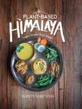
Plant-Based Himalaya: Vegan Recipes from Nepal
by Babita ShresthaThe art of healthy cooking is all about loving yourself and spreading that love to those around you. It's even better when you can cook a delicious meal and also help protect the environment. In Plant-Based Himalaya, Nepalese author Babita Shrestha shares 38 vegan recipes from her home country that she has been cooking and eating since she was very young, including mouthwatering grains, dal, curries, greens, sauces, and desserts. In addition to food, Shrestha introduces her beloved Nepal along with her personal goals for a plant-based diet: decreasing mass production and consumption of unhealthy processed food in plastic packaging. Featuring 250 beautiful full-color photos, Plant-Based Himalaya is designed to inspire you to cook and eat exquisitely vegan home-style Nepali cuisine. Make it exceptional, and share it with your loved ones!
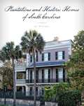
Plantations and Historic Homes of South Carolina
by Jai WilliamsSouthern plantations are an endless source of fascination. That&’s no surprise since these palatial homes are rich in history, representing a pivotal time in U.S. history that truly is &“gone with the wind.&” With the Civil War literally exploding all around, many of these homes were occupied either by Confederate or Union troops. Today, there are more than thirty plantations open to the public in South Carolina. Plantations and Historic Homes of South Carolina takes the reader on the tours and talks to the guides to dig even further if there is more to discover. If only the walls could talk, the stories we might hear!
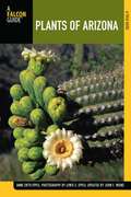
Plants of Arizona
by Dr. John F. Wiens Anne EppleThe only complete guide to the rich and unique flora of Arizona, featuring more than 900 full-color photographs and detailed descriptions of each plant.
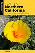
Plants of Northern California: A Field Guide to Plants West of the Sierra Nevada
by Eva Begley Ph.D.Plants of Northern California is the complete guide to the rich and unique flora of Northern California. From lush riparian forests along the rivers and streams to oak woodlands, wetlands, grasslands, and the ephemeral pools known as vernal pools, this handy volume enables both amateur and professional to quickly and accurately identify Northern California plants. Descriptive text that includes blooming period, elevation, and habitat Species organized by color and familyPlant characteristics in easy-to-understand termsNotes that include ethnobotanical uses, history, and other interesting factsGlossary of botanical terms
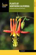
Plants of Northern California: A Field Guide to Plants West of the Sierra Nevada
by Eva Begley Ph.D.Plants of Northern California is an informative guide to the rich and varied flora of Northern California. From lush riparian forests along the rivers and streams to oak woodlands, wetlands, grasslands, and the ephemeral pools known as vernal pools, this revised handy volume enables both amateur and professional to quickly and accurately identify more than 560 Northern Californian plants.Look Inside to FInd:Descriptive text that includes blooming period, elevation, and habitatSpecies organized by color and familyPlant characteristics in easy-to-understand termsTips on how to distinguish similar-looking speciesNotes on ethnobotanical uses, history, and other interesting factsGlossary of botanical terms
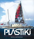
Plastiki
by David de Rothschild&“A modern-day spin on Thor Heyerdahl&’s famous Kon-Tiki exploration . . . documents the 8,000-mile journey in all its hare-brained idealism.&” —The Atlantic Explorer, global green leader, and eco-TV host David de Rothschild recounts the extraordinary journey of the Plastiki, an innovative and mostly untested sixty-foot catamaran that floats on 12,500 reclaimed plastic bottles. It was a voyage that took de Rothschild and a five-person crew 10,000 miles from the US to Australia, sailing through rarely traveled, dangerous waters, risking their lives to call attention to our fragile oceans. Their exploration included urgent study of ocean pollution, island nations threatened by rising seas, damaged coral reefs, and the acidifying ocean itself—and their discoveries are a call to action. Packed with exciting narrative, images, maps, journal entries, plans, and sketches, this is the only firsthand account of what may be the most important adventure of our time. &“Complete with stories of the inspirations for the project, as well as memories of the construction of the boat, and of course, the journey itself, Plastiki is the definitive tome about a project that captured imaginations across the globe.&” —CNET
Plateau Valley (Images of America)
by Nicole InmanKnown to the Ute Indians as Thigunawat (Home of the Departed Spirits), the Grand Mesa has been a beacon for adventurous souls for hundreds of years. In 1776, the Dominguez-Escalante Expedition crossed through the area while searching for a route that would become the Old Spanish Trail. In 1881, with the removal of the Ute Indians to reservation lands, homesteaders arrived and began settling in Plateau Valley. Nestled along the Grand Mesa, the valley is home to the communities of Collbran, Plateau City, Mesa, and Molina. Many of the historic buildings are still in use, and the Community Church Building has been designated a historic landmark. Recreational opportunities abound, both within the valley and nearby on the Grand Mesa. Camping, fishing, hiking, hunting, skiing, snowmobiling, and snowshoeing are among the favorites.
Plats du Jour
by William BlackThere is more than a slight malaise in the air these days about French food and cooking. While the rest of the world delights in the intricacies of molecular gastronomy and even Britain is revelling in a culinary renaissance, in France the years of worship at the temple of the great god Michelin seem to have blinded them to change and evolution. Why is this? What is it about the French that causes them to be so blinkered about their food?Plats du Jour is an attempt to answer that question, as William Black explores the highways and byways of French cooking. Taking as his starting point the great tradition of French food, William tackles years of received wisdom and parochial food snobbery head on, though with his mind (and his mouth) firmly open... He eats tête de veau and fried cow's udder with his French wife's family near Orléans. He samples the dubious (and illegal) delights of ortolan in the south west and has the most painfully disappointing gastronomic experience of his life. He combs the beaches of Brittany for seafood and is chased away from a festival by an enraged Basque villager. His dedication to the culinary cause knows few bounds.Plats du Jour is a book which the French aren't going to like very much. That said, it's a highly entertaining and irreverent look at the world's greatest culinary tradition which will be required reading for anyone with an interest in food and cooking...
Platte County (Images of America)
by Starley TalbottThe North Platte River that flows through a portion of Platte County, Wyoming, lent its name to the new county carved from Laramie County in 1911. Prior to the late 1800s, with the exception of Native Americans, trappers, and some ranchers, few people chose to remain in the territory. Travelers who crossed the windswept prairies followed trails headed for the lush farmlands of Oregon or the goldfields of California and the Black Hills. In 1883, the Wyoming Development Company began an irrigation project that brought an influx of farmers to the promising new acreages around Wheatland, the town that became the county seat. The arrival of the railroad in the late 1800s brought more farmers, ranchers, and miners to the area that would become Platte County. New residents established dozens of communities with schools, churches, and businesses. The remaining viable towns are Wheatland, Glendo, Hartville, Guernsey, and Chugwater. This book covers the history of these towns, and the vanished ones, along with the rural areas of Platte County.
Platypus Matters: The Extraordinary Story of Australian Mammals
by Jack AshbyScientifically informed and funny, a firsthand account of Australia’s wonderfully unique mammals—and how our perceptions impact their future.Think of a platypus: They lay eggs (that hatch into so-called platypups), produce milk without nipples and venom without fangs, and can detect electricity. Or a wombat: Their teeth never stop growing, they poop cubes, and they defend themselves with reinforced rears. And what about antechinuses—tiny marsupial carnivores whose males don’t see their first birthday, as their frenzied sex lives take so much energy that their immune systems fail? Platypuses, possums, wombats, echidnas, devils, kangaroos, quolls, dibblers, dunnarts, kowaris: Australia has some truly astonishing mammals, with incredible, unfamiliar features. But how does the world regard these creatures? And what does that mean for their conservation?In Platypus Matters, naturalist Jack Ashby shares his love for these often-misunderstood animals. Informed by his own experiences meeting living marsupials and egg-laying mammals during fieldwork in Tasmania and mainland Australia. Ashby’s tale not only explains historical mysteries and debunks myths (especially about the platypus), but also reveals the toll these myths can take. Ashby makes clear that calling these animals “weird” or “primitive”—or incorrectly implying that Australia is an “evolutionary backwater,” a perception that can be traced back to the country’s colonial history—has undermined conservation: Australia now has the worst mammal extinction rate of any place on Earth. Important, timely, and written with humor and wisdom by a scientist and self-described platypus nerd, this celebration of Australian wildlife will open eyes and change minds about how we contemplate and interact with the natural world—everywhere.
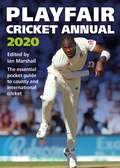
Playfair Cricket Annual 2020
by Ian MarshallThe 73rd edition of the Playfair Cricket Annual is packed with all the information you need to follow the cricket season in 2020. West Indies and Pakistan are the visitors this coming season, and here you'll find comprehensive Test match and limited-overs records and career records to help you follow the action,County cricket is covered in unrivalled depth, with biographies of all players registered to the counties at the start of the season, full coverage of last summer's events and a fixture list for all major domestic matches in 2020.There are also sections on women's cricket and the major domestic T20 competitions from around the world, which in 2020 will include The Hundred. For any cricket fan, the season is never complete without a copy of Playfair to guide you through it all.
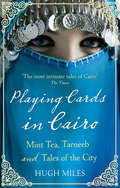
Playing Cards In Cairo: Mint Tea, Tarneeb and Tales of the City
by Hugh MilesPLAYING CARDS IN CAIRO is a fly-on-the-wall account - like THE BOOKSELLER OF KABUL - of life (for western readers) in a strange and exotic environment. Hugh Miles lives in Cairo and is engaged to an Egyptian woman. Twice a week he plays cards with a small group of Arab, Muslim women and through this medium he explores their lives in modern Cairo, the greatest of Arab cities. It is a secretive, romantic, often deprived but always soulful existence for the women as they struggle with abusive husbands and philandering boyfriends. The book is a window onto a city - and a way of life - which is at a crucial juncture in its history. Hugh Miles, who knows the Arab world intimately, is the perfect guide.
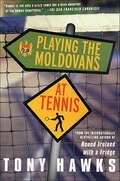
Playing the Moldovans at Tennis
by Tony HawksIt doesn't take much - "£100 is usually sufficient" - to persuade Tony Hawks to take off on notoriously bizarre and hilarious adventures in response to a bet. And so it is, a pointless argument with a friend concludes in a bet - that Tony can't beat all eleven members of the Moldovan soccer team at tennis. And with the loser of the bet agreeing to strip naked on Balham High Road and sing the Moldovan national anthem, this one was just too good to resist.The ensuing unpredictable and often hilarious adventure sees him being taken in by Moldovan gypsies and narrowly avoid kidnap in Transnistria. It sees him smuggle his way on to the Moldovan National Team coach in Coleraine and witness (almost) divine intervention in the Holy Land. In this inspiring and exceptionally funny book, Tony Hawks has done it again, proving against all odds that there is no reason in the world why you can't do something a bit stupid and prove all of your doubters wrong. Or at least that was the idea....
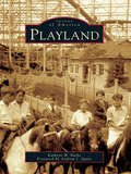
Playland
by Kathryn W. Burke Andrew J. SpanoPlayland offers an inviting look at the historic amusement park on the shore of the Long Island Sound in Rye. This book recalls the early days and the later years of Playland, a national historic landmarkand America's only publicly owned amusement park. Opened in 1928 as part of the newly developed Westchester County Park System, Playland originally drew crowds that arrived via automobile, bus, and steamship for the circus acts, sideshows, and rides, such as the Swooper, an oval roller coaster, and the Derby Racer, one of only two left in the UnitedStates. An all-purpose resort, the park included a beach, bathhouse, pool, and casino with restaurants and games. Today the park draws even larger crowds--nearly a million people each season--that come for theDragon Coaster and other rides, Kiddyland, the indoor ice rink, the pool, the beach, and the boardwalk.
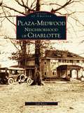
Plaza-Midwood Neighborhood of Charlotte
by Jeff ByersOne of Charlotte's early streetcar suburbs, the Plaza-Midwood neighborhood epitomizes the New South vision of Charlotte. Its history reflects the growing of the New South and the nation as a whole. Plaza-Midwood, known for its architectural and social diversity, has been through the years a proposed enclave for Charlotte's New South elite, an "at risk" inner city area, and ultimately an urban success story. Plaza-Midwood's current prosperity can be attributed to the strength and vision of its "citizens," who continue to preserve the character and history of their community. Plaza-Midwood owes its survival to a dedicated neighborhood organization. Through their efforts, much of the area has been declared an historic district.
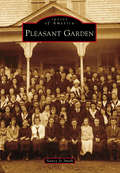
Pleasant Garden (Images of America)
by Nancy Jo SmithThe 20th century brought dramatic change to the closely knit yet independent-minded farming community of Pleasant Garden, North Carolina. Although descendants of the families who migrated from the Eastern Shore of Maryland still lived on the lands of their ancestors and attended Pleasant Garden Methodist Episcopal Church, which was organized in 1788, they welcomed progress. The community became home to one of the first state-supported high schools, and the Pleasant Garden Company built manufacturing businesses alongside the Atlantic & Yadkin Railroad, where eight trains passed each day. These improvements created a ripple effect of development that began with housing needs for students, faculty, and employees. Following World War II, the community no longer had passenger trains; however, new factories relied on rail service. These industries found qualified employees from the surrounding community. As housing developments and recreational and retail opportunities evolved, and as many baby boomer families began commuting to nearby cities for work, Pleasant Garden became a bedroom community. In 1997, it incorporated as a town.
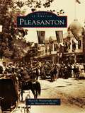
Pleasanton
by Museum On Main Mary-Jo WainwrightThe city of Pleasanton, located in the beautiful Amador-Livermore valley, was formed in 1867 when immigrants John Kottinger and Joshua Neal used land from their Californio wives' dowries and laid out a town. Kottinger named the city after Civil War general Alfred Pleasonton, but a postal clerical error changed the spelling to "Pleasanton" and the name stuck. The men secured Pleasanton's future by offering land to the Western Pacific Railroad for a railroad station and landing. Planning for future growth thus became a legacy that is still embraced by this modern city of 70,000 people. Today families and tourists are attracted to Pleasanton's historic downtown, where 19thcentury buildings still stand and people stroll among its many shops and restaurants.
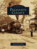
Pleasants County
by Ellen Pope Ruth Ann DayhoffFormed from portions of Wood, Tyler, and Ritchie Counties, Pleasants County was founded in 1851 and was named after Gov. James Pleasants Jr. of Virginia. Residents of Pleasants County fondly recall many of the buildings that no longer exist today, such as the button factory, blacksmith shop, marble factory, and the Quaker State Oil Refinery, all of which are preserved in the photographs that are showcased throughout Images of America: Pleasants County. Taking a step back in time, these photographs illustrate how the town and county looked more than 100 years ago, exploring a variety of the county's activities and historic scenes and offering a colorful insight into the past as well as the present.
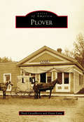
Plover (Images of America)
by Diane Lang Brad CasselberryNestled on the Yellow Banks of the Wisconsin River, Plover was originally used by Native Americans for portaging between the Wisconsin and Wolf Rivers. After being established as the Portage County seat in 1844, the area grew rapidly. Soon, mills sprang up, farmers worked the land, businesses flourished, and lodging could not be built fast enough to keep up with the demand. By 1857, Plover boasted 500 residents and 112 buildings, with 40 more under construction. In 1868, the county seat was moved out of Plover, and by the mid-1880s, Plover had begun to decline. Despite this, and the fact that the village has been dissolved twice, incorporated three separate times, and gone by four different names, Plover has proved resilient. Since being reincorporated in 1971, Plover has thrived and grown at an impressive rate. Today, the main businesses are part of the industrial, agricultural, and retail sectors.
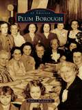
Plum Borough (Images of America)
by Frank J. Kordalski Jr.Plum Township, which later reorganized as Plum Borough, was founded on December 18, 1788, and westward pioneers soon chose to settle in the region. William McJunkin, an Irish emigrant and one of the earliest settlers, came to Plum Borough and in 1790 was granted a tract of land he came to call "Greenfield." In the 19th century, Plum Borough was an agricultural gold mine for the brave settlers who wished to emigrate from their East Coast homesteads. During the 20th century, Plum Borough emerged from being an agricultural suburb of the Steel City to become a vibrant residential community with a wondrously bright future.
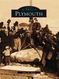
Plymouth (Images of America)
by James W. BakerPlymouth is best known as the Pilgrim landing place, but history did not stop when the dishes were cleared away from the first Thanksgiving. A prosperous fishing village before the War of 1812, Plymouth developed mills and factories to line its modest brooks during the Industrial Revolution, and elegant dwellings were built to replace humble Colonial homes. Steamboats and the railway brought waves of immigrants and summer visitors, transforming the small Yankee village into a bustling town. Later, the mills closed, tourist traffic replaced the clatter of machinery, and massive housing developments transformed the town as the kaleidoscope of history turned yet again. Plymouth's intriguing past is not altogether lost. In Plymouth, the reader will find the elm-shaded streets, mill villages, modest shops, and rustic pond-side cottages that generations of residents and visitors have loved. The reader will see vanished landmarks, such as the Samoset House and the Mayflower Inn, the Cornish and Burton schools, and the Leyden Street Casino. From the world's largest rope manufactory (Plymouth Cordage) to Uncle George's famous woolly horse, from Water Street's ancient wharves and chandleries to the storm of 1898, and from Pres. Warren G. Harding's tercentenary visit to Richard Nixon's welcome of the Mayflower II in 1957, the best of the town's visual history is gathered in Plymouth.