- Table View
- List View
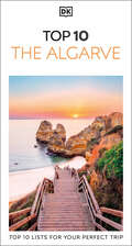
DK Top 10 The Algarve (Pocket Travel Guide)
by DK TravelThe Algarve is an enticing holiday destination – renowned for its ochre-splashed coastline of shallow bays, dramatic cliffs and buzzing resorts. Your DK Eyewitness Top 10 travel guide ensures you’ll find your way around the Algarve with absolute ease.Our updated Top 10 travel guide breaks down the best of the Algarve into helpful lists of ten – from our own selected highlights to the best beaches, wineries and outdoor activities, museums and castles. DK Eyewitness Top 10 Algarve is your ticket to the trip of a lifetime. Make the most of your trip to this sunny coast with DK Eyewitness Top 10. Planning is a breeze with our simple lists of ten, covering the very best that the Algarve has to offer and ensuring that you don’t miss a thing. Best of all, the pocket-friendly format is light and easily portable; the perfect companion while out and about.Inside DK Eyewitness Top 10 Algarve you will find: - Six easy-to-follow itineraries, perfect for a day trip, a weekend, or a week- Detailed Top 10 lists of the Algarve’s must-sees, including comprehensive descriptions of the Faro , Tavira , Silves , Monchique , Loulé , Lagos , Parque Natural da Ria Formosa , Sagres , Albufeira and Portimã- The Algarve’s most interesting areas, with the best places for sightseeing, food and drink, and shopping- Streetsmart advice: for getting ready, getting around, and staying safe- Themed lists, including the best museums, beaches, golf courses, wineries and much more.- A laminated pull-out map of the Algarve, plus four full-color area maps.Looking for more on Portugal’’s culture, history and attractions? Try our DK Eyewitness Portugal.About DK Eyewitness: At DK Eyewitness, we believe in the power of discovery. We make it easy for you to explore your dream destinations. DK Eyewitness travel guides have been helping travelers to make the most of their breaks since 1993. Filled with expert advice, striking photography and detailed illustrations, our highly visual DK Eyewitness guides will get you closer to your next adventure. We publish guides to more than 200 destinations, from pocket-sized city guides to comprehensive country guides. Named Top Guidebook Series at the 2020 Wanderlust Reader Travel Awards, we know that wherever you go next, your DK Eyewitness travel guides are the perfect companion.

DK Top 10 Tokyo (Pocket Travel Guide)
by DK TravelThe world’s favourite pocket travel guidesMake the most of your trip to Tokyo with this Top 10 guide. Planning is a breeze with our simple lists of ten, covering the very best that Tokyo has to offer and ensuring that you don’t miss a thing. Best of all, the pocket-friendly format is light and easily portable; the perfect companion while out and about.Inside this guide to Tokyo, you’ll find:Top 10 lists of Tokyo’s must-sees and must-dos, including visiting the Senso-ji Temple, wandering around the Imperial Palace Grounds and exploring the streets of NihonbashiTokyo's most interesting areas, with the best places for sightseeing, food and drink, and shoppingThemed lists, including the best art galleries, gardens and parks, historic buildings, Onsen and Sento and much moreBrand-new itineraries, perfect for a day trip, a weekend or a weekA laminated pull-out map of Tokyo, plus seven full-colour area mapsDK’s Top 10 travel guides have been helping travellers to make the most of their breaks since 2002.Looking for more on Tokyo’s culture, history and attractions? Try our DK Tokyo travel guide.
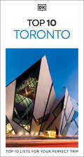
DK Top 10 Toronto (Pocket Travel Guide)
by DK TravelThe UK’s best-selling pocket guides – an unbeatable guide to Toronto, packed with insider tips and ideas, detailed maps, top 10 lists, and a laminated pull-out map, all designed to help you see the very best of Toronto.Explore the charming Distillery Historic District, admire the views from CN Tower, ride a bicycle along the scenic Toronto Islands, or take a trip to the spectacular Niagara Falls. From Top 10 bars and clubs to the Top 10 things to do for free – discover the best of Toronto with this easy-to-use travel guide.Inside DK Eyewitness Top 10 Toronto you will find: - Up-to-date information with insider tips and advice for staying safe.- Top 10 lists of Toronto’s must-sees, including the Royal Ontario Museum, Casa Loma, Ripley’s Aquarium of Canada, CF Toronto Eaton Centre, and more.- Toronto’s most interesting areas, with the best places for sightseeing, food and drink, and shopping.- Essential travel tips including useful transport, visa and health information- Easy-to-follow itineraries, perfect for a day trip, a weekend, or a week.- A laminated pull-out map of Toronto, plus 5 full-color area maps.Staying for longer and looking for a comprehensive guide to the whole country? Try our DK Eyewitness Travel Guide Canada.About DK Eyewitness: At DK Eyewitness, we believe in the power of discovery. We make it easy for you to explore your dream destinations. DK Eyewitness travel guides have been helping travelers to make the most of their breaks since 1993. Filled with expert advice, striking photography and detailed illustrations, our highly visual DK Eyewitness guides will get you closer to your next adventure. We publish guides to more than 200 destinations, from pocket-sized city guides to comprehensive country guides. Named Top Guidebook Series at the 2020 Wanderlust Reader Travel Awards, we know that wherever you go next, your DK Eyewitness travel guides are the perfect companion.
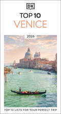
DK Top 10 Venice
by DK TravelVenice is a city like no other: bursting with history, culture and art, and famous for its array of remarkable architecture, paintings and palaces. Your DK Eyewitness Top Ten travel guide ensures you'll find your way around the City of Bridges with absolute ease.Our updated Top 10 travel guide breaks down the best of Venice into helpful lists of ten – from our own selected highlights to the best museums and galleries, places to eat, wine bars, shops and, of course, bridges. DK Eyewitness Top 10 Venice is your ticket to the trip of a lifetime. Inside DK Eyewitness Top 10 Venice you will find: - Ten easy-to-follow itineraries, perfect for a day trip, a weekend, or a week- Detailed Top 10 lists of the Venice’s must-sees, including comprehensive descriptions of the Basilica San Marco, the Doge's Palace, the Piazza San Marco, the Grand Canal, the Accademia Galleries, Santa Maria Gloriosa dei Frari, The Rialto, Torcello, Campo Santa Margherita and the Peggy Guggenheim Collection- Venice’s most interesting areas, with the best places for shopping, going out and sightseeing- Inspiration for different things to enjoy during your trip – including family activities and things to do for free- A laminated pull-out map of Venice, plus ten full-color area map- Practical advice: for getting ready, getting around, and staying safeLooking for more on Venice’s culture, history and attractions? Try our DK Eyewitness Venice. About DK Eyewitness: At DK Eyewitness, we believe in the power of discovery. We make it easy for you to explore your dream destinations. DK Eyewitness travel guides have been helping travellers to make the most of their breaks since 1993. Filled with expert advice, striking photography and detailed illustrations, our highly visual DK Eyewitness guides will get you closer to your next adventure. We publish guides to more than 200 destinations, from pocket-sized city guides to comprehensive country guides. Named Top Guidebook Series at the 2020 Wanderlust Reader Travel Awards, we know that wherever you go next, your DK Eyewitness travel guides are the perfect companion.
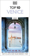
DK Top 10 Venice (Pocket Travel Guide)
by DK TravelVenice is a city like no other — swimming in history, culture and art, and famous for its array of remarkable architecture, palaces and festivals. Your DK Eyewitness Top 10 travel guide ensures you’ll find your way around the City of Bridges with absolute ease.Our newly updated Top 10 travel guide breaks down the best of Venice into helpful lists of ten – from our own selected highlights to the best museums and galleries, places to eat, wine bars, shops and, of course, bridges. You'll discover: - Ten easy-to-follow itineraries, perfect for a day-trip, a weekend, or a week - Detailed Top 10 lists of Venice’s must-sees, including detailed descriptions of the Basilica San Marco, the Doge’s Palace, the Piazza San Marco, the Grand Canal, the Accademia Galleries, Santa Maria Gloriosa dei Frari, The Rialto, Torcello, Campo Santa Margherita and the Peggy Guggenheim Collection - Venice's most interesting areas, with the best places for shopping, dining, and sightseeing - Inspiration for different things to enjoy during your trip – including family activities, hidden gems off the beaten track and things to do for free - A laminated pull-out map of Venice, plus eight color neighborhood maps - Streetsmart advice: get ready, get around, and stay safe - A lightweight format perfect for your pocket or bag when you’re on the moveDK Eyewitness Top 10s have been helping travelers to make the most of their breaks since 2002. Looking for more on Venice’s culture, history and attractions? Try our DK Eyewitness Venice and the Veneto or our DK Eyewitness Italy.

DK Top 10 Vienna (Pocket Travel Guide)
by DK TravelA city that emanates elegance, Vienna wows with its monumental palaces, grand boulevards, shimmering ballrooms and decadent café culture.Make the most of your trip to this beautiful city with DK Eyewitness Top 10. Planning is a breeze with our simple lists of ten, covering the very best that Vienna has to offer and ensuring that you don’t miss a thing. Best of all, the pocket-friendly format is light and easily portable; the perfect companion while out and about. DK Eyewitness Top 10 Vienna is your ticket to the trip of a lifetime. Inside DK Eyewitness Top 10 Vienna you will find: - Top 10 lists of Vienna’s must-sees, including Stephansdom, the Hofburg, the Belvedere and Hundertwasserhaus- Vienna's most interesting areas, with the best places for sightseeing, food and drink and shopping- Themed lists, including the best art galleries, music venues, Viennese dishes, things to do for free and much more- Easy-to-follow itineraries, perfect for a day trip, a weekend or a week- A laminated pull-out map of Vienna, plus six full-color area mapsLooking for more on Vienna’s history, culture and attractions? Try our DK Eyewitness Vienna or DK Eyewitness Austria.About DK Eyewitness: At DK Eyewitness, we believe in the power of discovery. We make it easy for you to explore your dream destinations. DK Eyewitness travel guides have been helping travelers to make the most of their breaks since 1993. DK Eyewitness travel guides have been helping travelers to make the most of their breaks since 1993. Filled with expert advice, striking photography and detailed illustrations, our highly visual DK Eyewitness guides will get you closer to your next adventure. We publish guides to more than 200 destinations, from pocket-sized city guides to comprehensive country guides. Named Top Guidebook Series at the 2020 Wanderlust Reader Travel Awards, we know that wherever you go next, your DK Eyewitness travel guides are the perfect companion.

DK Top 10 Washington, DC (Pocket Travel Guide)
by DK TravelWashington, DC, one of the most captivating cities in the world, is renowned for its remarkable architecture and monuments, museums and green spaces. Your DK Eyewitness Top 10 travel guide ensures you'll find your way around America's capital city with absolute ease.Our annually updated Top 10 travel guide breaks down the best of Washington, DC into helpful lists of ten—from our own selected highlights to the best museums and galleries, places to eat, shops and, of course, historic homes and buildings.You'll discover:• Eight easy-to-follow itineraries, perfect for a day-trip, a weekend, or a week• Top 10 lists of Washington, DC's must-sees, including detailed descriptions of the United States Capitol, the White House, the National Air and Space Museum, the National Museum of American History, the National Gallery of Art, the National Museum of Natural History, the Washington National Cathedral, the National Zoological Park, the Arlington National Cemetery, and Mount Vernon• Washington, DC's most interesting areas, with the best places for shopping, going out, and sightseeing• Inspiration for different things to enjoy during your trip-including green spaces, festivals and cultural events, hidden gems off the beaten path and things to do for free• A laminated pull-out map of Washington, DC and its environs, plus six full-color neighborhood maps• Streetsmart advice: get ready, get around, and stay safe• A lightweight format perfect for your pocket or bag when you're on the moveLooking for more on Washington, DC's culture, history and attractions? Try our DK Eyewitness Washington, DC.

DK Vienna (Travel Guide)
by DK TravelExplore the exciting history, culture, architecture, and fashion of Milan. Discover museums, foods, shops, and more.Discover DK Eyewitness Travel Guide: Milan & the Lakes. -Detailed itineraries and "don't-miss" destination highlights at a glance. -Illustrated cutaway 3-D drawings of important sights. -Floor plans and guided visitor information for major museums. -Guided walking tours, local drink and dining specialties to try, things to do, and places to eat, drink, and shop by area. -Area maps marked with sights. -Detailed city maps include street finder indexes for easy navigation. -Insights into history and culture to help you understand the stories behind the sights. -Hotel and restaurant listings highlight DK Choice special recommendations.With hundreds of full-color photographs, hand-drawn illustrations, and custom maps that illuminate every page, DK Eyewitness Travel Guide: Milan & the Lakes truly shows you this country as no one else can.Series Overview: For more than two decades, DK Eyewitness Travel Guides have helped travelers experience the world through the history, art, architecture, and culture of their destinations. Expert travel writers and researchers provide independent editorial advice, recommendations, and reviews. With guidebooks to hundreds of places around the globe available in print and digital formats, DK Eyewitness Travel Guides show travelers how they can discover more.DK Eyewitness Travel Guides: the most maps, photographs, and illustrations of any guide.

DK Washington, DC (Travel Guide)
by DK TravelPlanning a trip to Washington, DC? Look no further.Whether you want to stroll beneath the cherry blossoms, visit the iconic domed Capitol, or tour the magnificent White House, your DK Eyewitness travel guide makes sure you experience all that Washington, DC has to offer.Washington, DC delights at every turn. Wherever you go, there is a marvel of architecture to be discovered, a scenic view to be savored, or a world-famous museum to be enjoyed. And that's not to mention the lush green spaces and secret sanctuaries waiting to welcome weary travelers after a long day of sight-seeing.Our annually updated guide brings this beautiful city to life, transporting you there like no other travel guide does with expert-led insights and advice, detailed breakdowns of all the must-see sights, photographs on practically every page, and our trademark illustrations.You'll discover:- our pick of Washington, DC's must-sees, top experiences, and hidden gems- the best spots to eat, drink, shop, and stay- detailed maps and walks which make navigating the city easy- easy-to-follow itineraries- expert advice: get ready, get around, and stay safe- color-coded chapters to every part of Washington, DC from Capitol Hill to Penn Quarter, The Mall to Georgetown- our new lightweight format, so you can take your guide with you wherever you goHave less time? Try our pocket-friendly Top 10 Washington, DC for top 10 lists to all things Washington, DC.
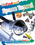
DKfindout! Space Travel (DK findout!)
by DKSupporting STEM-based learning, this fact-filled book for kids ages 6–9 is the ultimate guide to astronauts, rockets, and the future of space exploration. Entertaining and educating young readers through a combination of close-up images, quirky trivia facts, quiz questions, and fascinating tidbits, it&’s the perfect book for any kid who loves learning about outer space.Who was the first person to reach space? How long did the longest recorded spacewalk last? What is the Arecibo message, and how can it help us contact intelligent extraterrestrial life? Find out the answers to these questions and more in DKfindout! Space Travel, which features photographs of space shuttles, satellites, telescopes, and the experts who operate them. This book guides kids through the technical details of space travel, from the planning and operating of government-led missions to the designing of the first fleet of spacecraft for civilian tourists. Readers will also get an unrivaled look at life in space, learning about the rigorous training and exercise that space explorers must undergo both before and after liftoff.Vetted by educational consultants, the DKfindout! series drives kids ages 6–9 to become experts on more than 30 of their favorite STEM- and history-related subjects, whether Vikings, volcanoes, or robots. This series covers the subjects that kids really want to learn about—ones that have a direct impact on the world around them, like climate change, space exploration, and rapidly evolving technology—making learning fun through amazing images, stimulating quizzes, and cutting-edge information. The DKfindout! series is one that kids will want to turn to again and again.
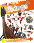
DKfindout! Vikings (DK findout!)
by Philip SteeleThis fun, fact-filled book for kids ages 6–9 is the ultimate guide to Viking history, from Loki and longships to runestones and raids. Entertaining and educating young readers through a combination of close-up images, quirky trivia facts, quiz questions, and fascinating tidbits, it&’s the perfect book for any kid who can&’t get enough of these medieval adventurers.What games and sports did Vikings play? Which animals played a part in their lives? Who was the Viking god Thor married to? Find out the answers to these questions and more in DKfindout! Vikings, which features photographs of Viking forts, artifacts, and weapons, as well as realistic re-creations of family and farming life. This book explores all sides of these legendary seafaring settlers, from famous Viking battles and voyages to feasting, trading, and popular pastimes. Though the Vikings often led violent raids on foreign settlements and cities, they also had strong family bonds and rich styles of art, fashion, and storytelling, which kids will discover as they flip through the pages of DKfindout! Vikings.Vetted by educational consultants, the DKfindout! series drives kids ages 6–9 to become experts on more than 30 of their favorite STEM- and history-related subjects, whether Vikings, volcanoes, or robots. This series covers the subjects that kids really want to learn about—ones that have a direct impact on the world around them, like climate change, space exploration, and rapidly evolving technology—making learning fun through amazing images, stimulating quizzes, and cutting-edge information. The DKfindout! series is one that kids will want to turn to again and again.
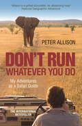
DON'T RUN, Whatever You Do: My Adventures as a Safari Guide
by Peter AllisonThe Okavango Delta, Botswana: a lush wetland in the middle of the Kalahari desert. Aged 19, Peter Allison thought he would visit for a short holiday before going home to get a 'proper job'. But Peter fell in love with southern Africa and its wildlife and before long had risen to become a top safari guide.In Don't Run, Whatever You Do, you'll hear outrageous-but-true tales from the most exciting safaris. You'll find out when an elephant is really going to charge, what different monkey calls mean and what do in a face off with lions. Sometimes the tourists are even wilder than the animals, from the half-naked missing member of the British royal family to the Japanese amateur photographer who ignores all the rules to get the perfect shot.Don't Run, Whatever You Do is a glimpse of what the life of an expert safari guide is really like.
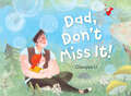
Dad, Don't Miss It!
by Qiaoqiao LiLet&’s stay connected to each other! A distracted parent comes to appreciate a child&’s imagination and the importance of paying attention in this whimsical tale, inspired by Chinese folk culture.A child and his dad are off for a day in the countryside—but the dad is perpetually distracted by his computer screen, unable to see what his child sees: genies outside the bus windows, in the trees, behind rocks, everywhere! As the child tries again and again to get dad&’s attention, the dad grows frustrated, until—oh no!—he turns into a roaring bear. But now, finally, he can see the parade of magical creatures, and parent and child join in a joyful, fantastical parade. Debut artist Qiaoqiao Li&’s dreamy illustrations bring to life this magical story about the power of unplugging from our devices so we can plug into the scenes of wonder ready to burst out of our imaginations.
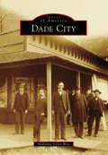
Dade City
by Madonna Jervis WiseDade City was named for Maj. Francis L. Dade, who perished in the Dade Battle, which opened the Second Seminole War in 1836. As the county seat, formality intermingles with frontier roots in a revered, historic courthouse, a stately jail, and an array of churches and historic homes. Dade City entices visitors with antique shops, cafés, and historical architecture. Folks are drawn to the hospitality of the Kumquat Festival, the homespun county fair, and agricultural showcases at area ranches. In 1908, O. Henry included Dade City in one of his short stories as a symbol of Americana. Surrounding the historic town are alluring places that tell the stories of Florida: the Withlacoochee State Forest, Lake Jovita, Trilby, Lacoochee, and San Antonio to name a few.
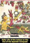
Daily Life of the Aztecs on the Eve of the Spanish Conquest
by Patrick O’brian Jacques SoustelleTireless speech-makers and lovers of verse, the ancient Aztecs were also prodigious record keepers, using a pictographic system to keep records of their history, geography, and rituals. Many of these accounts were destroyed after the Spanish conquest; but fortunately, a few survived, including those kept by the invaders.This book by an international authority on Mexican archaeology and sociology presents a vivid history of that profoundly religious Aztec warrior society--from its days as a primitive people, to the early sixteenth century--when, on the eve of the Spanish conquest, a powerful native government ruled with great organizational ability and restless energy.Rare illustrations of the temples at Tenochtitlán and Tenayuca, human sacrifice, Aztec gods, weddings, the midnight revels of warriors, and many other subjects accompany a highly readable text that describes the problems of living in a great city-state, the ruling classes and living standards, religious beliefs, and the everyday lives of people. Here also are detailed descriptions of public buildings and market places, home furnishings, games and amusements, family life, the conduct of war, the arts of language, music and dancing, and other topics.Amazing in scope and detail, this work will be invaluable to students of Mexican history and of interest to anyone fascinated by this ancient civilization."Soustelle's great book about the Aztecs...takes us deep into the life of this great society..[His] book is one of the best ever written about the Aztecs, his portrait of their society is a triumph of scholarship, understanding, and literary skill."--The Times Literary Supplement"Probably the best general summary available of Aztec culture, both for the general reader and for the student."--Pedro Carrasco, Hispanic American Historical Review
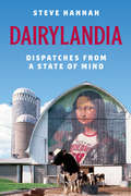
Dairylandia: Dispatches from a State of Mind
by Steve HannahDairylandia recounts Steve Hannah’s burgeoning love for his adopted state through the writings of his long-lived column, “State of Mind.” He profiles the lives of the seemingly ordinary, yet quite (and quietly) extraordinary folks he met and befriended on his travels. From Norwegian farmers to rattlesnake hunters to a woman who kept her favorite dead bird in the freezer, Hannah was charmed and fascinated by practically everyone he met. These captivating vignettes are by turns humorous, tragic, and remarkable—and remind us of our shared humanity.
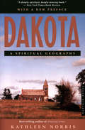
Dakota: A Spiritual Geography
by Kathleen Norris&“A deeply spiritual, deeply moving book&” about life on the Great Plains, by the New York Times–bestselling author of The Cloister Walk (The New York Times Book Review). &“With humor and lyrical grace,&” Kathleen Norris meditates on a place in the American landscape that is at once desolate and sublime, harsh and forgiving, steeped in history and myth (San Francisco Chronicle). A combination of reporting and reflection, Dakota reminds us that wherever we go, we chart our own spiritual geography.
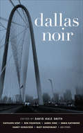
Dallas Noir (Akashic Noir)
by David Hale SmithOne of Texas Monthly's "5 Things You'll be Talking about in November""All in all, the stories in Dallas Noir have an unsettling, slightly creepy presence that is not just appropriate but completely necessary for a collection of noir fiction. If you think Dallas is boring or white-bread -- well, perhaps you haven't gotten out much and seen the dark edges of Big D for yourself. And if you haven't, maybe you don't even want to."--Dallas Morning News"If you want to delve into the creepier sides of Dallas, this is a good start."--Lakewood/East Dallas Advocate"Dallas Noir is a fiction mosaic, showing a city of class divisions precariously held together by money, land, and false love. It also shows the expanse of noir and it's power."--MysteryPeople.com (MysteryPeople Pick of the Month)"The latest entry in Akashic Books' award-winning noir anthology series doesn't disappoint, featuring a Texas-sized serving of writing's heavy hitters and satisfying short fiction."--Criminal Class Press"There are two reasons why you should buy Dallas Noir...Reason No. 1: you'll enjoy reading it. Reason No. 2: the publisher, Akashic Books, has published these noir series all over the country."--D Magazine/FrontBurner"November 22 looms, and as the watershed nears, a new anthology of short stories sets out with a noble purpose: to make Dallas known for something more than the place where President John F. Kennedy was assassinated."--Dallas Culture Map"Yet, Dallas' almost-fleeting presence, the glaring contrasts of the stinking rich and the hapless poor, its buxom women and its Texan masculinity teamed with Hispanic folklore, all find their way into each of these 16 short stories."--The Mercury (UTD Student Newspaper)"If we are going to commemorate the milestone anniversary of the worst crime ever committed in Big D, why not precede it with a few tales of bad luck, bad choices, and bad timing?"--M. Denise C."A great collection of brand new short stories."--Kick Ass Book ReviewsFeaturing brand-new stories by: Kathleen Kent, Ben Fountain, James Hime, Harry Hunsicker, Matt Bondurant, Merritt Tierce, Daniel J. Hale, Emma Rathbone, Jonathan Woods, Oscar C. Peña, Clay Reynolds, Lauren Davis, Fran Hillyer, Catherine Cuellar, David Haynes, and J. Suzanne Frank.From the introduction by David Hale Smith:My favorite line in my favorite song about Dallas goes like this: Dallas is a rich man with a death wish in his eyes / A steel and concrete soul in a warm heart and love disguise . . . The narrator of Jimmie Dale Gilmore's perfect tune "Dallas" is coming to town as a broke dreamer with the bright lights of the big city on his mind. He's just seen the Dallas cityscape through the window of his seat on a DC-9 at night. Is he just beginning his quest? Or is he on his way home, flying out of Love Field, reminiscing after seeing the woman who stepped on him when he was down?In a country with so many interesting cities, Dallas is often overlooked-except on November 22 every year. The heartbreaking anniversary keeps coming back around in a nightmare loop, for all of us. On that day in 1963, Dallas became American noir. A permanent black scar on its history that will never be erased, no matter how many happy business stories and hit television shows arise from here. In a stark ongoing counterweight to the JFK tragedy are those two iterations of the TV show. Dallas is not a TV show. It's a real city . . . For the past forty years, my capacity to be surprised by it has not diminished one bit. I hope the stories in this collection will surprise you too.
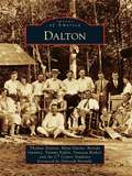
Dalton
by Myra Owens Tammy Poplin Thomas Deaton Vanessa Rinkel Brenda OwnbeyThe Cherokees who first occupied this area called northern Georgia their "enchanted land," but the discovery of gold caused a land rush, an illegal treaty of expulsion, and the Trail of Tears. Dalton was created when the Western and Atlantic Railroad was built to connect Atlanta with Chattanooga, Tennessee. In 1863, during the Civil War, this small town became a battle scene along Gen. William T. Sherman's march, with both armies occupying the community. After the war, the leading citizens built Crown Cotton Mill and Village to expand the town's economy. In 1895, fifteen-year-old Catherine Evans hand-tufted a bedspread, ushering in the bedspread and tufted carpet bonanzas. With the invention of tufting machines in the 1930s and 1940s, Dalton boomed as carpet companies, supply houses, bedspread lines, and retail outlets brought wealth to the city. At one point, there were more millionaires per capita in Dalton than anywhere in the country. Today Dalton is growing with the help of a diverse Hispanic labor force and continues to be the Carpet Capital of the World.
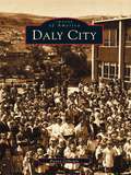
Daly City
by Bunny GillespieNestled in the shadow of San Bruno Mountain and known as "The Gateway City" for its proximity to San Francisco, Daly City is much more than a typical suburb. A thriving and diverse community built along El Camino Real (The King's Highway), the road that connected all of the Spanish Missions in California, the city has evolved from a quaint agricultural town to an important business, residential, and transit center. This new collection of images, mostly vintage and rarely seen photographs, tells the city's journey from the original Spanish land grant through its 1911 incorporation and on to modern times. The town has always been cosmopolitan, developed with the help of Irish, German, and Italian settlers, and today's large numbers of Hispanic and Filipino residents. Aside from natural wonders like San Bruno Mountain and the dramatic Pacific coastline, Daly City also has man-made landmarks like the Cow Palace, which has long been host to large-scale events such as the Grand National Rodeo and political conventions. Nearby Colma is known for its cemeteries, but as readers will see in this book, shares a surprisingly rich history with Daly City.
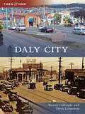
Daly City
by Bunny Gillespie Dave CrimmenA haven for refugees after San Francisco's devastating 1906 earthquake and fire, Daly City incorporated in 1911 with a population of 2,000. With more than 100,000 residents, it is now the largest city in San Mateo County. Adjacent to San Francisco, the Golden Gate, and San Francisco Bay, Daly City has been "The Gateway to the Peninsula" for over 150 years.
Damaged (Rosato & DiNunzio)
by Lisa ScottolineFrom the bestselling author of BETRAYED and CORRUPTED, DAMAGED is the fourth legal thriller in Lisa Scottoline's electrifying Rosato & Di Nunzio series. Perfect for fans of Lynda La Plante and Michael Connelly. One boy. One lawyer. One chance for justice.Shy, dyslexic and small for his age, ten-year-old Patrick O'Brien is a natural target at school. But when Patrick is accused of attacking a school aide, the tables are turned, and the aide promptly sues the boy, his family, and the school district. Patrick's grandfather turns to the lawyers of Rosato & DiNunzio for help and Mary DiNunzio is soon on the case. But there is more to the story than meets the eye and Patrick may be more troubled than he seems.With twists at every turn and secrets about the family coming to light, Mary DiNunzio might have found the case that can make her a true protector, or break her heart...(P)2020 Headline Publishing Group Ltd
Damaged: A Rosato And Dinunzio Novel (Rosato & DiNunzio #4)
by Lisa ScottolineFrom the bestselling author of BETRAYED and CORRUPTED, DAMAGED is the fourth legal thriller in Lisa Scottoline's electrifying Rosato & Di Nunzio series. Perfect for fans of Lynda La Plante and Michael Connelly. One boy. One lawyer. One chance for justice.Shy, dyslexic and small for his age, ten-year-old Patrick O'Brien is a natural target at school. But when Patrick is accused of attacking a school aide, the tables are turned, and the aide promptly sues the boy, his family, and the school district. Patrick's grandfather turns to the lawyers of Rosato & DiNunzio for help and Mary DiNunzio is soon on the case. But there is more to the story than meets the eye and Patrick may be more troubled than he seems.With twists at every turn and secrets about the family coming to light, Mary DiNunzio might have found the case that can make her a true protector, or break her heart...
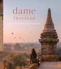
Dame Traveler: Live the Spirit of Adventure
by Nastasia YakoubA breathtaking celebration of Instagram's premier solo female travel community, featuring 200 striking photographs—most of them all-new—plus empowering messages and practical tips for solo travelers. &“For those with passports full of stories, this book carries you away to every dreamy corner of the earth. I can&’t stop flipping through these visually incandescent pages to see where I&’m capable of traveling to next!&”—Caila Quinn, The Bachelor contestant and lifestyle and travel influencerFrom backpackers in Peru to artists in Berlin to storytellers in Morocco, Dame Traveler celebrates the diversity and bravery of women from around the world who are not afraid to think (and live) outside the box.The revolutionary Dame Traveler Instagram account was founded by Nastasia Yakoub, who was born into a strict Chaldean-Middle Eastern community where women are expected to marry young and put aside other personal ambitions. But at the age of twenty, Nastasia embarked on a solo trip to South Africa to volunteer at an orphanage in Cape Town, which sparked a love of world travel. Recognizing a void in the travel industry, she founded Dame Traveler, the first female travel community on Instagram, now more than half a million strong. Nastasia herself has traveled to sixty-three countries on solo adventures, sharing colorful photos of her tantalizing travels along the way.Dame Traveler celebrates these women with a photographic collection of 200 stunning images paired with inspiring captions, 80% of which have never been seen on the Instagram account. Organized into sections on architecture, culture, nature, and water, each entry features travel information, plus tips, advice, unique solo-travel experiences, and wisdom from contributing globe-trotters to embolden the next generation of Dame Travelers.
Dams, Parks, and Politics: Development and Preservation In the Truman-Eisenhower Era
by Elmo RichardsonThis book is a chronicle of the myopia and gamesmanship that dominated Americans' understanding of their environment on the eve of the nation's ecology crisis. Based almost entirely on primary sources, Elmo Richardson's study examines the interplay between the national policies and programs for development and preservation of natural resources in the centralist Truman administration and the localist, enterprise-oriented Eisenhower administration. He shows that the decade examined brought about very little change in the values held by federal policy makers. Although the development of resources was a prominent issue in the elections of 1948, 1952, and 1956, what emerges from Richardson's account is the shallowness of understanding on the part of the decision makers and the public, and the ease with which policy direction could be deflected. The book demonstrates the persistence of the tradition of development and the nonpartisan character of the movement for preservation, which crossed party lines, regional lines, and economic interest groups.