- Table View
- List View
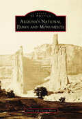
Arizona's National Parks and Monuments
by George Hartz DonnaArizona's 20 national parks and monuments celebrate the natural wonders and rich heritage of Arizona, preserved through the efforts of countless citizens and the American Antiquities Act of 1906. Aggressively implemented by eight US presidents, this legislation permits the president to unilaterally proclaim sites as national monuments without congressional action. The Antiquities Act was applied in Arizona 23 times, more so than any other state in the union. Using more than 200 historical photographs, many of which have never been published, this book contains the stories of the creation of each of Arizona's national parks and monuments, emphasizing the importance of the landscape and cultural heritage to Arizona's identity.

Arkansas Beer: An Intoxicating History (American Palate)
by James Spencer Brian SorensenArkansas�s booze scene had a promising start, with America�s biggest brewing families, Busch and Lemp, investing in Little Rock just prior to Prohibition. However, by 1915, the state had passed the Newberry Act, banning the manufacturing and selling of alcohol. It was not until sixty-nine years later that the state welcomed its first post-temperance brewery, Arkansas Brewing Company. After a few false starts, brewpubs in Fayetteville, Fort Smith and Little Rock found success. By 2000, the industry had regained momentum. An explosion of breweries around the state has since propelled Arkansas into the modern beer age.
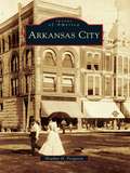
Arkansas City: People, Places, And Events (Images of America)
by Heather D. FergusonArkansas City has often been called "the gateway to the West." The name lends a lot to describing the town--a town that was founded as a border town to Indian Territory, a major trade hub to the Indian agencies in Indian Territory, and a major transportation center for those wishing to travel through the territory and farther west. Arkansas City started off as a small town with false-fronted stores but became a bustling community where the people were forward thinkers and pushed for quality and modernization in everything they brought to the city whether that was business, industry, or entertainment. Arkansas City is known for the Cherokee Strip Land Rush of September 16, 1893, interaction with the Native Americans in Indian Territory, farming, ranching, and aircraft. Although Arkansas City was a civilized community, it was a city on the fringe of a lawless and unsettled territory where outlaws lurked and Native Americans were forced to settle. People loaded their wagons or went by train to cross through Oklahoma to Texas, New Mexico, or Arizona, leaving from Arkansas City. Due to Arkansas City's location, interaction with major figures and events in history, and its importance to travel farther west, Arkansas City was truly "the gateway to the West."
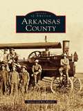
Arkansas County: Arkansas (Images of America)
by Ray Hanley Steven HanleyFirst established by the French in 1686, Arkansas Post was the first permanent European settlement in the Mississippi River Valley. It played a key role in the long struggle between France, Spain, and England for control of the lucrative fur trade. The only battle of the American Revolution fought west of the Mississippi took place in Arkansas County. Located in the heart of the Grand Prairie, Stuttgart, one of two Arkansas County seats, is known as the "duck and rice capital of the world." Bayou Meto and several lakes draw waterfowl to the area each fall, and ducks flocking to Stuttgart attract hunters from across the nation. Each November, the community hosts the World Championship Duck Calling Contest.
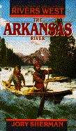
The Arkansas River (Rivers West, #6)
by Jory ShermanEastward, as far as the eye could see, stretched the Great Plains. Westward rose the Rockies, snowcapped shadows against the sky. In the middle flowed a mighty river-- silent, glistening, and turbulent--the bloodline of a wide and wild land. Three hard, tough men staked their claims on its potent shores; Jake Stonecipher, pioneer merchant, seeking his fortune--yet finding a war. Will Burke, a mountain man as savage as the wilderness itself. And Francisco Serrano, determined to carve a fertile ranch out of the stubborn soil. Three men blazing trails, forging a future...building lives as bold-- and as treacherous--as the Arkansas River.
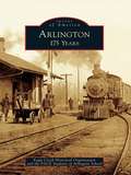
Arlington: 175 Years
by Eagle Creek Historical Organization PACE students of Arlington SchoolIn 1834, Robert Hurd and his family settled on a parcel of land in what is now present-day Arlington. A devout Presbyterian, Hurd named the town after his favorite church hymn. In the late 1800s, the small town of Arlington saw progress in the form of two railroads. The mid-1930s were especially prosperous, as the town enjoyed a bustling business center that included six grocery stores. The famous Arlington Homecoming Festival began in 1946 and ran for 50 years. In the 1990s, George Herbert Bush and William Jefferson Clinton made presidential campaign stops here, making history in this quiet, small town. The heart of this town can be found in its citizens, their churches, schools, and businesses, and their community park. Current and former residents alike share fond memories of their small-town lifestyle and are proud to be Arlingtonians.
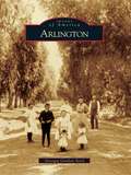
Arlington (Images of America)
by Georgia Gordon SerclThe neighborhood of Arlington, located about five miles southwest of downtown Riverside, was first settled in the 1870s and was later developed as a town site in 1877 by philanthropist Samuel C. Evans and William Sayward. Citrus groves flourished in the area, providing the community with a newfound wealth. Large and gracious homes were built on wide streets lined with beautiful shade trees. Arlington's commercial district at Van Buren Boulevard and Magnolia Avenue expanded to include a bank, chamber of commerce, newspaper, store, church, boardinghouse, and post office with its own Arlington postmark, in use since 1888. In the early 1900s, an electric railway was built down the center of Magnolia Avenue ending at beautiful Chemewa Park with its large trees, dance pavilion, zoo, and polo field. Today Arlington retains much of its neighborhood feeling while undergoing a large-scale redevelopment project for a future retail and commercial district.
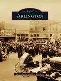
Arlington
by Lea Worcester Evelyn BarkerHistorians dispute the founding of Arlington. Some say Arlington started in 1848 when Col. Middleton Tate Johnson started the settlement called Johnson's Station, a forerunner of Arlington. Others say it was 1876, when the railroad arrived, or 1877, when the post office was established. Still others claim 1884 as the founding, because that was when city leaders incorporated Arlington, naming the town after the home of Gen. Robert E. Lee. Whatever date one chooses for the founding, there is no question that Arlington has grown from its frontier origins into the entertainment center of North Texas. Highlights of Arlington's development include Depression-era gambling at Top O' Hill and Arlington Downs, Progressive values in the Berachah Home for Erring Girls, higher education through the University of Texas at Arlington, and economic expansion with General Motors. More recently, energetic citizens like former mayor Tommy Vandergriff helped bring two professional sports teams to Arlington. Today the Texas Rangers and Dallas Cowboys share top billing with the city's other signature attractions--Six Flags Over Texas and Hurricane Harbor.
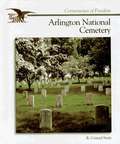
Arlington National Cemetery (Cornerstones of Freedom)
by R. Conrad SteinArlington is one of 114 national cemeteries maintained by the United States government. The major purpose of a national cemetery is to serve as a burial place for veterans of the country's armed forces. Situated across the Potomac River from Washington, D.C., Arlington has long been close to many Americans' hearts. It is the final home of citizens from all backgrounds. Buried there are ex-presidents as well as former slaves.
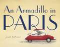
An Armadillo in Paris
by Julie KraulisA winsome armadillo from Brazil takes a trip to Paris in this delightful new picture book from Julie Kraulis. Arlo is an armadillo who is always up for adventure. His grandfather, Augustin, loved adventure too. When Arlo was born, Augustin wrote travel journals about his favorite places for Arlo to use when he was hold enough to go exploring on his own. When Arlo reads about Paris and the one the French call La Dame de Fer, or Iron Lady, he decides it's time to strike out on his first adventure. He travels to France and, guided by Augustin's journal, discovers the joys of Paris: eating a flakey croissant at a café, visiting the Louvre, walking along the Seine and, of course, meeting the Iron Lady... But who is she? Each spread has a clue about her identity, and kids will see hints of her scattered throughout the book. This book is like a gorgeous stroll through Paris with an adorable new friend--a stroll you'll want to take again and again.

The Armchair Birder Goes Coastal
by John YowWith his distinctively witty, anecdotal, and disarming voice, John Yow now journeys to the shore and shares his encounters with some of the most familiar and beloved coastal birds. Out of his travels--from North Carolina's Outer Banks, down the Atlantic coast, and westward along the Gulf of Mexico--come colorful accounts of twenty-eight species, from ubiquitous beach birds like sanderlings and laughing gulls to wonders of nature like roseate spoonbills and the American avocets. Along the way, Yow delves deeply into the birds' habits and behaviors, experiencing and relating the fascination that leads many an amateur naturalist to become the most unusual of species--a birder.Seasonally organized chapters explore the improbable, the wonderful, and the amusing aspects of these birds' lives. Yow embellishes his observations with field notes, anecdotes, and stories from some of America's finest naturalists--including John James Audubon, Arthur Cleveland Bent, Rachel Carson, and Peter Matthiessen. Combining the endless fascination of bird life with the pleasure of good reading, The Armchair Birder Goes Coastal is the perfect companion for any nature lover's next trip to the beach.

The Armchair Birder's Omnibus Ebook
by John YowAvailable for the first time together in this Omnibus E-Book, The Armchair Birder's Omnibus brings together both of John Yow's delightful books into one convenient e-book.While birding literature is filled with tales of expert observers spotting rare species in exotic locales, John Yow reminds us in The Armchair Birder, that the most fascinating birds can be the ones perched right outside our windows. In thirty-five engaging and sometimes irreverent vignettes, Yow reveals the fascinating lives of the birds we see nearly every day. Following the seasons, he covers forty-two species, discussing the improbable, unusual, and comical aspects of his subjects' lives. Yow offers his own observations, anecdotes, and stories as well as those of America's classic bird writers, such as John James Audubon, Arthur Bent, and Edward Forbush. This unique addition to bird literature combines the fascination of bird life with the pleasure of good reading.In his follow-up volume The Armchair Birder Goes Coastal, Yow now journeys to the shore and shares his encounters with some of the most familiar and beloved coastal birds. Out of his travels--from North Carolina's Outer Banks, down the Atlantic coast, and westward along the Gulf of Mexico--come colorful accounts of twenty-eight species, from ubiquitous beach birds like sanderlings and laughing gulls to wonders of nature like roseate spoonbills and the American avocets. Along the way, Yow delves deeply into the birds' habits and behaviors, experiencing and relating the fascination that leads many an amateur naturalist to become the most unusual of species--a birder.

Armenia - Culture Smart!: The Essential Guide to Customs & Culture
by Susan SolomonCulture Smart! Armenia explains how to avoid cultural gaffes when out and about in the country. Giving the historical, political and cultural background, the guide reveals how to read body language and be aware of potential pitfalls in communication, and at the same time provide the cultural essentials business travellers need to successfully develop working relations in Armenia. Culture Smart! Armenia enables the reader to get the most out of a trip, whether on business, or pleasure.
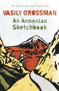
An Armenian Sketchbook
by Vasily GrossmanFew writers had to confront so many of the last century's mass tragedies as Vasily Grossman. He is likely to be remembered, above all, for the terrifying clarity with which he writes about the Shoah, the Battle of Stalingrad and the Terror Famine in the Ukraine. An Armenian Sketchbook, however, shows us a very different Grossman; it is notable for its warmth, its sense of fun and for the benign humility that is always to be found in his writing. After the 'arrest' - as Grossman always put it - of Life and Fate, Grossman took on the task of editing a literal Russian translation of a lengthy Armenian novel. The novel was of little interest to him, but he was glad of an excuse to travel to Armenia. This is his account of the two months he spent there. It is by far the most personal and intimate of Grossman's works, with an air of absolute spontaneity, as though Grossman is simply chatting to the reader about his impressions of Armenia - its mountains, its ancient churches and its people.
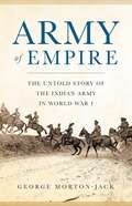
Army of Empire: The Untold Story of the Indian Army in World War I
by George Morton-JackDrawing on untapped new sources, the first global history of the Indian Expeditionary Forces in World War IWhile their story is almost always overlooked, the 1.5 million Indian soldiers who served the British Empire in World War I played a crucial role in the eventual Allied victory. Despite their sacrifices, Indian troops received mixed reactions from their allies and their enemies alike-some were treated as liberating heroes, some as mercenaries and conquerors themselves, and all as racial inferiors and a threat to white supremacy. Yet even as they fought as imperial troops under the British flag, their broadened horizons fired in them new hopes of racial equality and freedom on the path to Indian independence. Drawing on freshly uncovered interviews with members of the Indian Army in Iraq and elsewhere, historian George Morton-Jack paints a deeply human story of courage, colonization, and racism, and finally gives these men their rightful place in history.

Army of She: Icelandic, Iconoclastic, Irrepressible Björk
by Evelyn McdonnellWearing thick glasses, speaking in her thick Icelandic accent, and, well, seeming a touch thick, Björk stormed the public consciousness in 2000 as an unlikely heroine in the experimental musical film Dancer In the Dark. Army of She is an in-depth look at the woman who first took the public stage twenty-three years ago, analyzing her rise from child prodigy to punk anarchist to New Wave novelty (as member of the Sugarcubes) to hit soloist to film star.
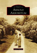
Arnold Arboretum (Images of America)
by Lisa E. PearsonEstablished in 1872 and designed in collaboration with landscape architect Frederick Law Olmsted, the Arnold Arboretum is a National Historic Landmark. Founded as a partnership between the City of Boston and Harvard University, the Arnold Arboretum is a unique blend of a respected research institution and beloved public park in Boston's Emerald Necklace. Occupying 281 acres, its living collection of trees, shrubs, and woody vines is recognized as one of the most comprehensive and best documented of its kind in the world. Its lilac collection is a springtime favorite of visitors, along with the magnificent rhododendrons, and in the fall, trees from maples to dawn redwoods provide a wonderful display of color. The living collection is supported by curatorial documentation, a herbarium, library and archival holdings, and a state-of-the-art research center. These facilities and holdings provide the basis for research and education of visitors, students, and scholars from around the world.

Arnold Palmer: A Tribute to an American Icon
by David Fischer David ArethaBeginning with his triumph in the 1958 Masters, Arnold Palmer took the nation by storm with his small-town charm, "go for broke” style, and Sunday comebacks. "You finally had someone who had this charisma,” said Tiger Woods. "Everyone got hooked to the game of golf via TV because of Arnold.”Palmer won 43 PGA Tour events in the 1960s, became the sports world’s greatest pitchman, and hobnobbed with bigwigs like Bob Hope and multiple presidents. He even guest-hosted The Tonight Show. A licensed pilot, he flew jet airplanes across the globe. As a philanthropist, he founded Arnold Palmer Medical Center, the largest facility in the country dedicated to the care of women and children.In Arnold Palmer: A Tribute to an American Icon, authors David Fischer and David Aretha relive Palmer’s thrilling championship moments while capturing his personal charms: his warmth, humor, and candor. Rarely seen photographs and memorabilia bring his story to life.Golfer Raymond Floyd may have summed it up best when he said that Palmer "set the standard for how superstars in every sport ought to be, in the way he has always signed autographs, in the way he has always made time for everyone . . . . And man, could he play the game.”
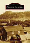
Around Aladdin (Images of America)
by Pam ThompsonAladdin is located in northeast Crook County, in the far northeast corner of Wyoming. The town, the lowest settlement in the state at 3,749 feet, is surrounded by vast plains of waving grass, wooded mountains, and rolling hills. Coal mining brought the early families to the area and has since formed the histories and memories of the people who came and worked to build farms and ranches. Descendents of many of the original settlers still reside in the community, working and raising their families. Around Aladdin contains the stories and memories of those that came to make this part of Wyoming a place to call home for a long, long time.
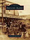
Around Aledo (Images of America)
by Homer Norris Susan Mckeague KarnesIn the mid-19th century, a few hardy settlers of European descent carved out farms in the Clear Fork Valley of present-day Parker County, attracted by the area's springs, tributaries, and a burgeoning market in nearby Fort Worth. For centuries, Comanche and Kiowa had inhabited the land, and a period of dramatic conflict ensued, exacerbated by the Civil War absence of able-bodied husbands and sons. By 1880, ranches and settlements flourished, aided by the Fort Worth-Yuma cattle trail and a Texas and Pacific Railway line connecting Fort Worth to the county seat of Weatherford. As the first mail stop in the newly formed county, Aledo was briefly dubbed Parker Station before having its name changed in 1882--a bow to a railroad engineer's Illinois hometown. Today segments of Bankhead Highway, the nation's first paved transcontinental highway, wind around Aledo, the Annettas, Willow Park, and Hudson Oaks, thriving communities that offer a pastoral lifestyle minutes from the urban amenities of the Fort Worth-Dallas Metroplex. Mere fragments remain of Newburg, Prairie Hill, Willow Springs, and other old settlements, visible only to old-timers and lost to living memory.
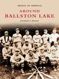
Around Ballston Lake (Images of America)
by Katherine Q. BriaddyBallston is a scenic town located in Saratoga County, with a history that is as long as it is interesting. Katherine Q. Briaddy takes us along on a journey into Ballston's past, providing insight into the lives of Ballston's early residents. Encompassing the years between the late 1700s and the present, the photographs within depict the area as it has changed and evolved over the years. As you peruse through the over 200 images, you will visit Ballston's recreational draws, such as Ballston Lake and Forest Park. You will see the houses that survived the British and Indian invasion of 1780, and the trolleys and railroads that came with the advance of technology. You will tour through the mansions, manors, and humble farms of Ballston's residents; you will see interpretations of the town's landmarks by local artists. You will observe the way life used to be for those who chose to call Ballston home.
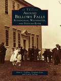
Around Bellows Falls: Rockingham, Westminster and Saxtons River
by Louise Luring Virginia Lisai Anne L. CollinsWith more than two hundred vintage photographs, Around Bellows Falls: Rockingham, Westminster, and Saxtons River explores the fascinating history of these southern Vermont communities. Located along the Connecticut River, Rockingham-the township that includes both Bellows Falls and Saxtons River-was chartered in 1752. Westminster, one of Vermont's oldest towns, was granted in 1736 as Township No. 1.Around Bellows Falls: Rockingham, Westminster, and Saxtons River chronicles the history of these communities up to the mid-twentieth century with photographs of historic homes, businesses, people, and well-known landmarks. In addition to views of the fantastic beauty of the area, this volume includes photographs of Vermont's oldest public building, the Rockingham Meetinghouse (built in 1787), and the Bellows Falls home of Hetty Green, the infamous "witch of Wall Street." Westminster's Cumberland County Court was the location of not only the Westminster Massacre but also the meeting that declared Vermont as a free and independent republic in 1777. Also included are vintage photographs of the scenic village of Saxtons River (named on the National Register of Historic Places), which once had a strong mill industry that took advantage of three falls along the river.

Around Binghamton (Images of Modern America)
by Jim MaggioreThe Greater Binghamton area’s undulating history mirrors that of its terrain. The area has evolved from a transportation center to a hub of manufacturing and technology and, with the expansion of Binghamton University and SUNY Broome Community College, a growing center of erudition. First, canal boats and trains dominated the landscape, then, cigars were produced in abundance, followed by shoes, simulators, and computers. Now, with Binghamton University expanding into downtown, student housing, breweries, and eateries fill Binghamton’s streets. The area has earned the monikers “Parlor City,” “Carousel Capital of the World,” “Sports Mecca,” and the “City of Festivals.” Binghamton’s cultural legacy is rich; besides being the home of professional baseball, bicycling, golf, hockey, running, and tennis, Binghamton’s annual celebrations have included Mural Fest, July Fest, Spiedie Fest, and Luma Fest.
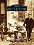
Around Boonville (Images of America)
by Harney J. CorwinNestled in the Black River valley with the Tug Hill Plateau to the east and the Adirondack Mountains to the west, Boonville traces its origin to the failure of a grand investment scheme. In the mid-1790s, Gerrit Boon, agent for the Holland Land Company, purchased vast acreage in northern New York, hoping to establish a plantation for the production of maple sugar. When that enterprise collapsed, Boon founded a settlement in the remote wilderness. Adopting a paternalistic stance, he attracted settlers by extending financial assistance to farmers, artisans, and tradesmen. The village soon prospered, and dairy farming became the dominant industry. With the arrival of a canal and railroad in the mid-1800s, Boonville expanded to become the largest town between Watertown and Utica. Around Boonville documents the growth of the village and surrounding area, with special attention to local landmarks and scenery, industry and recreation, prominent leaders, and ordinary citizens.
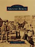
Around Boron (Images of America)
by Barbara J. Pratt Twenty Mule Team MuseumIn the late 1920s, this high desert area with little water and unproductive soil held no attraction for most people, but the small community of Amargo provided a grocery store, gas station, and of course a saloon for the convenience of tenacious gold and borax prospectors. In 1938, after the large deposit of borax was discovered and mining had begun, a town hall meeting was called and Le Roy Osborne, supervisor of Pacific Coast Borax Company, suggested changing the name from Amargo to Boron. Boron is the fifth element on the periodic table and combines with other nonmetallic minerals to form a family of related minerals called borates; after this was explained to those gathered at the town hall meeting, Boron was unanimously chosen as its new name and the community was forever linked to the borax mining industry.
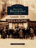
Around Bradford: Volume II (Images of America)
by Sally Ryan CostikAround Bradford Volume II further looks at the history of the area as it has not been seen before. Once one of the largest cities in Pennsylvania, Bradford relied heavily on oil production in the 1880s for its success. Author Sally Ryan Costik allows us to glimpse into the "Age of Innocence" at the turn of the century before she endeavors to examine the city's own tumultuous past. In the 1920s, it was home to KKK activity, gangster slayings, and mob retaliation--events that contrast sharply with the images of Sunday school, industrial growth, and high society from "Millionaires Row"found in this collection. In the years following the Roaring Twenties, Costik takes a unique look at the Depression era through the eyes of sports fans. She chronicles Bradford's baseball team through the decade as they played within the PONY league circuit (comprised of Pennsylvania, Ontario, and New York). No history of Bradford would be complete without giving mention to the Bradfordians who supported the war effort on the home front.
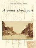
Around Brockport
by William G. AndrewsThe first settlers came to the Brockport area soon after 1800. Located some twenty miles west of Rochester, the towns of Sweden and Clarkson, the village of Brockport, and a college were organized between 1814 and 1835. The Erie Canal, farm implement manufacturing, and higher education fostered their growth and prosperity in the mid-1800s. At Brockport, the United States became a continental nation, the Industrial Revolution came to agriculture, and popular literature came to American women. Today, Brockport is a remarkably well-preserved Victorian village on a revitalized Erie Canal, Clarkson and Sweden are havens for farming and commuting, and the college is an 8,500-student unit of the State University of New York. Around Brockport presents more than two hundred thirty images from private and public collections, many from glass negatives. They depict such aspects of the area's history as farm life in early Sweden, stately homes at Clarkson Corners, industrial plants in Brockport, and student activities at the normal school.
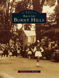
Around Burnt Hills (Images of America)
by Katherine Q. BriaddyAround Burnt Hills offers a unique glimpse into the history of this Saratoga County, New York, community and evokes a nostalgia for the way things used to be. Join Katherine Q. Briaddy in her second Images of America tribute to the people and places of Ballston. Discover an era preserved through the advent of photography and the pieces of history saved by those with an affinity for memories of yesteryear. This volume is made up of a series of love letters found in the attic of a Burnt Hills homethat reveal much about the heritage of the town. They were written between 1926 and 1931, and the engaging stories within them complement the carefully preserved images found in Around BurntHills. All aspects of life are covered, from schoolsto Prohibition to politics and beyond.
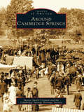
Around Cambridge Springs (Images of America)
by Sharon Smith Crisman Cambridge Springs Historical SocietyIn 1903, Cambridge Springs was described in Cutter's Guide as "the Great Health and Pleasure Resort of Pennsylvania." Located in northwestern Pennsylvania on the banks of French Creek, it fell halfway between Chicago and New York City on the Erie Railroad. From the promotion of the mineral springs in 1884, this town of some six hundred people grew into a luxurious vacation spot that included accommodations such as the Riverside Hotel, the Rider Hotel, the New Cambridge Hotel (now the Bartlett), and more than forty other hotels and cottages. Around Cambridge Springs not only celebrates this town's golden age of resorts and affluence but also remembers the people, such as W.A. Baird Jr.; the places, such as Alliance College; and the events, such as the devastating fires of 1897 and 1931, that have shaped this community over the last two hundred years.
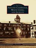
Around Cambridge, White Creek, and Jackson
by Ken GottryThe Cambridge Valley has always been united and divided, each community holding tightly to its identity. In 1773, the Cambridge District was formed, comprised of the current towns of Cambridge, White Creek, and Jackson. In 1788, the area became the Town of Cambridge in Albany County and was annexed to Washington County in 1791. The area was divided into the present town boundaries in 1816. The three communities of Cambridge, North White Creek, and Dorr's Corners, though each only three-quarters of a mile from the next, did not unite into the Village of Cambridge until 1866. Today the village spans the boundaries of the three townships but still divides itself into the East End and the West End.
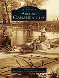
Around Canandaigua (Images of America)
by The Ontario County Historical Society Nancy YacciAs we approach the end of the century, this new book looks back at over one hundred years of Canandaigua's history, with photographs of the people, places, and events that have defined the proud and vibrant community we know so well today. Over 200 never before published photographs are presented in this pictorial history, which spans the early 1800's through the early 1950's. Readers will be fascinated by the immense changes that have occurred since the early days, but will also draw connections to the present and can savor the fact that Canandaigua still holds numerous charms of yesteryear. Works from the collection of renowned area photographer Henry Boyce are featured here. This artist's work documented the events and people that shaped Canandaigua's history and community. Rare images of philanthropist Mary Clarke Thompson and her Sonnenberg Gardens will delight readers. Also included are many photographs of Canandaigua's early downtown area. (This is a reissue of ISBN 0-7524-0464-4)
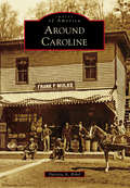
Around Caroline (Images of America)
by Patricia A. BrhelNestled in the rolling hills of the Finger Lakes region of Upstate New York, Caroline is a true community and always has been. In 1795, the first two families came with horses and settled in permanently. The founding mother, Widow Earsley, and her children returned to the cabin that she and her oldest son had built the previous autumn, and Captain Rich and his family began work on their own abode. From these first families to those who followed, pulling together to make circumstances better for everyone has been an important facet of life in Caroline. Residents clustered in several hamlets, including Slaterville Springs, Speedsville, Caroline, and Motts Corners (now Brooktondale), and carved farms out of the wilderness between them. They built houses, churches, and businesses. Recreation included picnics, band concerts, baseball, the Grange, parades, and youth groups.
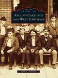
Around Carthage and West Carthage
by Lynn M. ThorntonEarly settlers followed the Black River up to Long Falls, the present site of Carthage and West Carthage, where they found fertile land and dense forests along the rushing waters. The river ran between the two villages and gave life to the young communities. Many industries, dependent on the waterpower, were established along the lower eastern bank, with businessmen settling on the highlands of the west bank. Mills sprang up where blinds, lumber, and furniture were manufactured, and planning mills, tanneries, and pulp mills flourished. After a devastating fire, which destroyed mills on both sides of the river, the focus of industry moved almost entirely to pulp and paper. By the early 20th century, the industry ushered in a golden age for the Twin Villages.
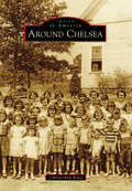
Around Chelsea (Images of America)
by Christi-Ann BonoFrom humble beginnings to magnificent gains, there are few cities that can boast as much growth as Chelsea, Alabama. Where Creek Indians once hunted and roamed, successful businesses, neighborhoods, schools, recreation parks, and churches now stand. In the mid-1800s, pioneer families settled in the hills of what was first called Melrose. The railroad played a vital role in the advancement of the area by offering passenger and commercial transportation, attracting families, businesses, and schools, and in 1996 Chelsea was incorporated with a population of 908. Just over 10 years later, it exceeded 10,000, and Chelsea was the fastest-growing city in Shelby County. With an expanding home market, a growing school system, and a strong sense of community, Chelsea is widely considered one of the top areas in the state for families to live. In fact, the city's motto is "It's all about family."
Around Clarksville (Images of America)
by John Caknipe Jr.Clarksville, Virginia's only lakeside town, is part of Western Mecklenburg County. It was the county's first incorporated town and was named for its founder, Clarke Royster. The area gained its fame when William Byrd II surveyed Buffalo Springs in 1726 and dubbed the waters "the water that Adam drank." The town was originally home to the Occoneechee Indians, who were driven from the area 50 years earlier when Nathaniel Bacon fought his last battle at Fort Occoneechee, massacring over 300 members of the tribe. This battle became his legacy. Today tourists are drawn to the area for annual fishing tournaments and lake activities.
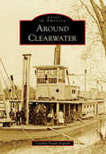
Around Clearwater (Images of America)
by Cynthia Frank-StupnikBurrowed below bluffs overlooking the Mississippi and Clearwater Rivers, Clearwater's houses, its churches, and most of its original businesses resemble those that settlers had left behind in the East. With its arch-like trees sheltering Oak and Main Streets, the community remained home to many who lived and died there and those who had moved on only to return for yearly Old Settlers' gatherings. This sense of community allowed Clearwater to thrive. Flour and pulp mills lined the shores of the Clearwater River. Mercantile, hardware, jewelry, and drug stores cropped up, providing the products for a growing community. Trade once powered by steamboats on the Mississippi was taken over by James Hill's Great Northern Railroad. While the village and surroundings have changed over time, the original charm is still there, ready to be explored again.
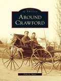
Around Crawford
by Fritz G. MeierThe town of Crawford was initially settled by German, Dutch, Irish, and Scottish families who built mills along the Hudson River tributaries. By the early 1800s, the area was known as "the Butter Capital of the World." Nestled along the base of the Shawangunk Mountains, the town of Crawford has transitioned from a rural farming community to a residential oasis. Along the way, farmlands have become housing developments, local industry has given way to chain stores, and dirt roads have become paved highways. A collection of images from as early as the 1860s depicts the transformation of the communities of Searsville, Bullville, Thompson Ridge, and Pine Bush. Although the surroundings have changed, the hearts of area residents have remained loyal to the small-town ideals that define the town of Crawford.
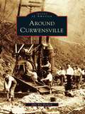
Around Curwensville
by Julie Rae RickardCurwensville, one of the oldest towns in Clearfield County, began as a lumber town. Some of the area's finest families made their fortunes by harvesting the tall pine trees that were used as ship masts. The Irvin and Patton families were instrumental in the development of the town, as they brought the railroad to the area and contributed to the schools, banks, and a water system. In the 20th century, industries such as brick making, stone quarries, and tanneries became vital to the community. Bringing to life an era when every settlement was a stop on the railroad route, Around Curwensville is an exciting collection of historic photographs from Curwensville and surrounding towns, including Clearfield, Grampian, and DuBois.
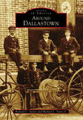
Around Dallastown (Images of America)
by Michael L. Sentz Jr. Richard C. SaylorOfficially incorporated in 1866, the site of Dallastown was once used as a parade ground by local militia during the Revolutionary War era. When James Peeling purchased 95 acres in the area in 1841, he set in motion the community's formation. In 1844, the town was officially named Dallastown, in honor of Philadelphia lawyer and vice president elect George M. Dallas. The final decades of the 19th century saw even more development for Dallastown. The first cigar factory in town opened in 1860, and by 1885, over 38 factories were in operation, creating new jobs, attracting new businesses, and more than doubling the population. Marking its sesquicentennial in 2016, the community of Dallastown continues to celebrate its borough and its unique history.
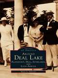
Around Deal Lake: Allenhurst, Deal, Interlaken, and Loch Arbour
by Marie A. SylvesterFocusing on four of the smaller coastal communities in central Monmouth County--Allenhurst, Deal, Interlaken, and Loch Arbour--Around Deal Lake offers a unique look back at the emergence of these towns in the shadows of the large shore resorts of Long Branch and Asbury Park. Utilizing photographs and ephemera from the 1880s through the present, author Marie A. Sylvester captures the excitement of the young communities and the spirited residents who helped to build them. From the magnificent seaside mansions that lined the ocean in Deal, to the lakeside artist studios of Interlaken, there exists an interesting array of architecture and an equally broad spectrum of inhabitants around Deal Lake. Residents of these areas range from the industrial magnates of Deal to the actors, writers, and artists who chose Interlaken as a haven to indulge their muse.
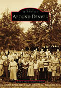
Around Denver (Images of America)
by Matt Boles Jason L. HarpeDenver, known locally as "Denver of the East," is an unincorporated area in eastern Lincoln County, North Carolina, that was originally named "Dry Pond" after a small pond at the intersection of Highway 16 and Campground Road that always dried up during the hottest summer months. Prof D. Matt Thompson, principal at Rock Spring Seminary, led the effort to rename the area after the booming Colorado capital to attract railroad planners whose lines could provide an economic boost to trading and commerce. The area was officially renamed in January 1875. Around Denver are communities such as Triangle, Lowesville, Machpelah, Catawba Springs, Iron Station, and Pumpkin Center, whose names are as significant as the industries and sons and daughters that they birthed and raised.
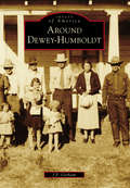
Around Dewey-Humboldt (Images of America)
by J. P. GorhamNestled in the Arizona mountains are several small, unassuming towns that belie the importance of their heyday. These towns are all intrinsic to each other for one reason: mining. The nearby ranches were established to feed the miners, and in many cases, residents moved back and forth among them depending on which mines were prosperous or closed. Some no longer exist, evidenced now by rock walls or other harder-to-find clues. Some have turned into tourist attractions. The first legislative meetings of the Arizona Territory were held at the Woolsey Ranch in nearby Dewey, where the first building in Yavapai County was constructed. Indian wars occurred here, and many of the natural resources used to support the growing country came from iron and copper mines found deep within the bowels of the Dewey-Humboldt area. The towns of Cherry, Dewey, Humboldt, Mayer, Cordes Junction, Crown King, and Bumble Bee still exist. Others, like Agua Fria, Chaparral, Stoddard, McCabe, Poland, and Cleator, have mostly vanished, but their pioneering spirit and importance will never be forgotten.
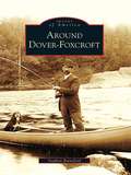
Around Dover-Foxcroft (Images of America)
by Stephen RainsfordPicturesque Sebec Lake is surrounded by the towns of Dover-Foxcroft, Bowerbank, Sebec, and Willimantic. The area's history goes back hundreds of years to the time when Eli Towne walked through the woods and became the first settler in Southern Piscataquis. For generations, Dover-Foxcroft has drawn residents and tourists alike, eager to enjoy the lake's scenic beauty, take in horse racing at the park, or catch a show at the opera house or the Star Theater. Four railroad stations served the five towns, making the region easily accessible. In the early years, residents found work in many industries, from the Mayo and Brown woolen mills to the Hughes organ factory.
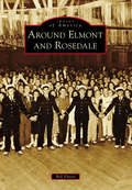
Around Elmont and Rosedale (Images of America)
by Bill FlorioOnce portions of a farming community called Fosters Meadow, Elmont and Rosedale have changed dramatically since Thomas and Christopher Foster first farmed the land in the 1600s. In the 1850s, immigrant German farmers settled in the area abutting Elmont Road, Brookville Boulevard, Linden Boulevard, and Merrick Boulevard. The remnants of that German farming community continued into the early 20th century, despite encroaching suburbanization, renamed streets, and subdivided farmland, along with Irish, Italian, and Jewish immigrants changing the area’s ethnic makeup. This new suburban area covering the southern corners of Nassau and Queens Counties became home to landmarks like the Argo Theatre, Rottkamp Farm, Schmitt Farm, Laurelton Parkway, Gouz Dairy, Sapienza Bakery, St. John’s Methodist Church, and world-famous Belmont Park. Today, Elmont, Rosedale, and the rest of the former Fosters Meadow are home to a large population of Caribbean immigrants, bringing a new culture to the area and, with it, new landmarks and new ideas.
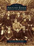
Around Essex: Elephants and River Gods
by Robbi Storms Don Malcarne Ivoryton Library AssociationThree hundred years of history follows you around today as you wander the streets of Essex, Centerbrook, and Ivoryton. Essex harbor is located on the Connecticut River six miles north of Long Island Sound, between Mystic Seaport and New Haven. It is a major stopping point for boaters in the Northeast who come from various ports to dock in the harbor, dine at the Griswold Inn, take in the maritime history at the Connecticut River Museum, or walk along the narrow streets to view the fine old houses in this New England community. Homes once owned by sea captains, shipbuilders, and captains of industry are a reminder of the area's glorious past. True, the old 1,200-foot Ropewalk, a mainstay of maritime manufacturing, was gone by 1900. Gone also are the Uriah Hayden Chandlery, Judea Pratt's New City Smithy, and Abner Parker's warehouse. The harbor where working vessels once ruled is now a vibrant waterfront filled with pleasure boats. A row of elegant Victorian houses lines the main street of Ivoryton village, where only a century ago lived executives from Comstock, Cheney & Company, the once great ivory and piano action factory. Enough of the past remains to remind us of the industry that thrived along these riverbanks.
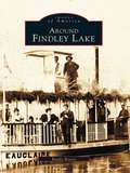
Around Findley Lake (Images of America)
by Randy BoerstAround Findley Lake recounts the story of a mill village that in the late 1800s began to develop into a prime destination-a social gathering place for not only local residents but also members of wealthy and socially prominent families from Cleveland, Pittsburgh, and Buffalo. As time went on, Findley Lake offered plays and musicals in the opera house, steamboat rides around the lake, roller-skating at the rink every night, and two islands for picnics or for viewing the logs being floated down the lake to the mill. Today, with its thriving year-round resort, the area has emerged as a tourist mecca. Showcased in Around Findley Lake are not only the distinct communities that developed around the lake but also the exceptional natural beauty of the lake itself, its importance to the early settlers, its recreational attributes, and most importantly its overall significance to the growth of the area. Each chapter's brief introduction offers historical highlights, followed by pages of fascinating facts and intriguing images of the Lakeside Assembly, steamboats, the Big Island, early cottages, and development of the resort Peek'n Peak.
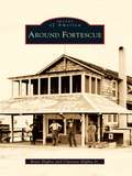
Around Fortescue
by Clarence Higbee Jr. Betty HigbeeFortescue, a small island located in Downe Township, has a history that dates back to the early 1700s. Situated on the shores of the Delaware Bay, it was once portrayed as one of the finest locations for a summer resort, especially for those fond of fishing and hunting. Possessing many natural advantages at little expense to visitors, this charming village became an oasis for vacationers from surrounding towns and cities in the 1800s. At a time when roads were poor, visitors found Fortescue easily accessible by water or horse and buggy, and they flocked to bathe in the water and breathe the invigorating salt air. Although many of the tourist attractions are now gone, Fortescue continues to come alive in the early spring as fishermen return. Around Fortescue showcases the history of this small fishing community.
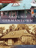
Around Germantown (Then and Now)
by Margaret ColemanGermantown is a new city. Until 1980, Germantown was a quiet, rural community of farms and cows with a few new houses built for employees of the Atomic Energy Commission. When the Maryland-Nation Capital Park and Planning Commission adopted the area, everything changed.
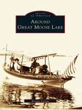
Around Great Moose Lake (Images of America)
by Brenda SeekinsAthens, Harmony, Hartland, and St. Albans surround the 3,500-acre Great Moose Lake in central Maine, and this volume reveals the fascinating history found here. Sportsmen discovered this land in the mid-1800s and established hunting lodges on the lake's shore, which continued for more than 60 seasons. In their heyday, the lodges provided employment for locals and planted alluring mysteries for later generations. Citizens later thrived on the farming and manufacturing in the late 19th and early 20th century. The colorful past left a rich heritage of seasonal and year-round residents and visitors that shaped the personality of the area. Around Great Moose Lake unravels some mysteries of the lodges and focuses on the changing culture around the lake and its four towns.
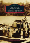
Around Greensboro
by Michele Buday-MurrayAround Greensboro covers communities of southeastern Greene County, including Greensboro at its heart. Greensboro was originally called Delight by the Mingo Indians who lived in the region. Because of its location on the Monongahela River, it quickly became an important trading location for the trappers and settlers moving through in the late 1700s. Later, Albert Gallatin introduced a group of Belgian glassblowers to the area, and in 1807, the glassworks in Greensboro was opened. As the glass business began to fade, another took its place. The area was rich in clay, which would be vital to the development of the pottery industry. From the 1840s to 1915, pottery was king in Greensboro, and the town boomed. As the pottery industry faded, it too would be replaced by another industry: coal. Greensboro, once famous for its glass and pottery, became known for its bituminous coal mines. This book covers the early days of Greensboro to the devastating Election Day Flood of 1985.
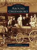
Around Greensboro
by Mayor David Spencer Judy RevealThe quaint town of Greensboro, Maryland, is nestled in the middle of the Delmarva Peninsula on Maryland's Eastern Shore where its American roots travel across the Choptank River and reach deep into the agricultural soil of Caroline County. The Choptank River's path meanders up the peninsula from the Chesapeake Bay, cutting through Caroline County, and it is at the great bend in the river that Peter Harrington brought into full bloom his grandfather Peter Rich's vision of a town. This location was vital to the movement of products to and from people living in the middle of the peninsula, and Greensboro quickly grew into a thriving small port town where businesses, including tanneries and shipbuilding, appeared. Greensboro's accessibility to Washington, Philadelphia, Baltimore, and Wilmington makes this quiet town a convenient bedroom community with big-town access and rural serenity.
Around Gunnison and Crested Butte
by Crested Butte Mountain Heritage Museum Duane Vandenbusche Gunnison Pioneer MuseumThe Western Slope towns of Gunnison and Crested Butte are defined by their placement in the Colorado Rockies. Both are located in alpine valleys surrounded by 14,000-foot-high peaks with sparkling mountain-fed streams, and both dominate the Gunnison country, a unique wilderness covering over 4,000 square miles. Beginning over 400 years ago, Native Americans, fur traders, explorers, miners, railroaders, and cattlemen all made a place for themselves in the area. Today Gunnison, Crested Butte, and the Gunnison country remain isolated and tranquil. Recreation, tourism, and cattle ranching now reign supreme as Gunnison and Crested Butte attempt to preserve their distinctly Western heritage.
Around Haledon: Immigration and Labor (Images of America)
by Angelica M. Santomauro Evelyn M. HersheyBy 1908, when Haledon became independent from Manchester Township, thousands of southern and eastern European immigrants settled in the borough and its surrounding area. Immigrants found work in textile mills, machine shops, and other industries located in proximity to the city of Paterson and the Passaic River and its mighty Great Falls. Land promoters spurred home building in Haledon, a streetcar suburb. In 1913, nearly 25,000 workers went on strike, demanding an eight-hour workday. During the six-month strike, Haledon became the workers' haven for free speech and assembly as they demanded safer workplaces, a living wage, and an end to child labor. Archival photographs, documents, and postcards from 1890 to 1930 share the story of workers and immigrants who fought for the workplace benefits widely enjoyed by Americans today.
Around Hartwick
by Hartwick Historical SocietyAround Hartwick depicts the history of the rural Hartwick Township at the geographical heart of Otsego County, nestled along the Otego Valley between western hills and the Susquehanna River. Named for John Christopher Hartwick, an itinerant German preacher with the dream of a "New Jerusalem" church and school, the township became the site of the first Lutheran Theological Association in America. Abundant water sources powered large woolen, cotton, and paper mills in Clintonville, Toddsville, and South Hartwick. Fertile land produced farm crops, including a contribution to the highest yield of hops in the world. With extension of the electric trolley north through the Otego Valley to the Mohawk Valley, the Hartwick hamlet prospered as the site of railway headquarters, central carbarns, and the sole power source for this vital transportation link. With the advent of the mechanical age and changing economics, mills relocated, the railway ceased, and farm production declined. Today, the township enjoys renewed prosperity with the influence of history museums and baseball from nearby Cooperstown.
Around Herndon (Images of America)
by Margaret C. PeckThe town of Herndon is situated on the western edge of Virginia's picturesque Fairfax County. In the 18th and early 19th centuries, this part of Fairfax County was primarily agricultural, and as additional settlers arrived farming flourished. Early residents found woods, flat open fields, outcroppings of rocks, and workable soil throughout the region. By 1857, the installation of the railroad line brought summer residents, commuters, and real estate developers to the area. Residential growth continued into the 20th century, as more Washington, D.C. workers chose Herndon as a convenient town from which they could commute to their jobs. From 1959 to 1961, the railroad line experienced busy years when it was used to haul sand and construction materials to build neighboring Dulles Airport, which opened in 1962. Although the region has become a center of Internet technology, with several high tech companies located in the area, Herndon still retains a small-town charm.
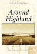
Around Highland (Postcard History Series)
by Ethan P. Jackman Vivian Yess WadlinThe history of Highland began on the shores of the Hudson River in 1754, when entrepreneur Anthony Yelverton started a sawmill, later followed by a brickyard, store, and ferry service to Poughkeepsie. During the 19th century, steamboats made regular stops near Yelverton's settlement. Starting around 1830, riverfront businesses began to relocate to the "high land" above the river, and a new Highland business district was born. The West Shore Railroad was completed in 1883, with a station at the riverfront. The area was called Highland Landing. The Poughkeepsie-Highland Railroad Bridge, now the Walkway Over the Hudson, was completed in 1888, and in 1897, a trolley line began operation from Highland Landing up to the Highland village and, from there, westward. Highland had a new claim to fame as the "Gateway to Ulster County."
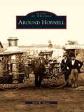
Around Hornell (Images of America)
by Kirk W. HouseAround Hornell tells the tale of western New York's "Maple City" and its neighbors, the rural towns of Canisteo, Dansville, Fremont, Hartsville, Hornellsville, and Howard. The region is set in the dramatic countryside between the Finger Lakes and the Appalachian Mountains, home to the deep gorges of Stony Brook State Park. Great arks floated down the Canisteo River to markets in Baltimore, and for more than a century, Hornell roared with round-the-clock work in the Erie Railroad shops. Hornell is a musical city of community bands, high-school operettas, and barbershop quartets, and its famous residents include radio star and pioneer pilot Blanche Scott, aspiring major leaguer Don Zimmer, and New York's longest-serving mayor, Shawn Hogan, who has graciously provided the introduction to Around Hornell.
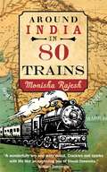
Around India in 80 Trains
by Monisha RajeshTaking a page from Jules Verne's classic tale, Monisha Rajesh embarked on an adventure around India in eighty trains. Indian trains carry over twenty million passengers daily, plowing through cities, crawling past villages, climbing up mountains, and skimming along coasts. Monisha hopes that her journeys across India will lift the veil on a country that had become a stranger to her.

Around India in 80 Trains: One of the Independent's Top 10 Books about India
by Monisha Rajesh'Crackles and sparks with life like an exploding box of Diwali fireworks' -William Dalrymple'One can only envy Monisha Rajesh as she embarks on this epic journey' -Tim ParksWhen she was a child, Monisha Rajesh's family uprooted to Madras in the hope of making India their home, but soon returned to England with a bitter taste in their mouths. Two decades on, Monisha turns to a map of the Indian Railways and takes a page out of Jules Verne's classic tale, embarking on an adventure around India in 80 trains, covering 40,000km - the circumference of the Earth.Her journey takes her on toy trains, luxury trains, Mumbai's infamous commuter trains and even a hospital on wheels. Along the way she meets a kaleidoscope of characters and discovers why the railways are considered the lifeline that keeps the country's heart beating. Most of all, she hopes that these 80 train journeys will lift the veil on a country that has become a stranger to her.
Around India in 80 Trains
by Monisha RajeshTaking a page from Jules Verne's classic tale, Monisha Rajesh embarked on an adventure around India in eighty trains. Indian trains carry over twenty million passengers daily, plowing through cities, crawling past villages, climbing up mountains, and skimming along coasts. Monisha hopes that her journeys across India will lift the veil on a country that had become a stranger to her.
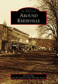
Around Keeseville
by Kyle M. Page Anderson Falls Heritage SocietyNestled in the northernmost section of the Adirondack Mountains, the communities of Keeseville, Port Kent, Ausable Chasm, Clintonville, Harkness, Port Douglas, Ausable, and Chesterfield provided early settlers of the 1800s with a wealth of natural resources in wood, iron, and stone. The Ausable Chasm and Ausable River provided the natural power to refine the materials on-site, while the nearby Lake Champlain provided the transportation to the rest of the world. For early America, this was a booming community that rapidly grew from the 1850s until the 1920s, when modernized transportation and factories around the country made the fairly isolated area less cost-effective. Today, Keeseville is a quiet stop on the Northway that connects New York City and Albany to Montreal. Impressive bridges, closed factories, and some old grand architecture are remnants of the glory days of the once-booming community.
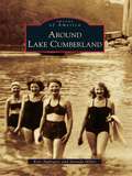
Around Lake Cumberland (Images of America)
by Jarenda Miller Kris ApplegateLake Cumberland is a premier vacation destination for millions of people each year. With its 1,255 miles of federally protected shoreline, an average depth of 90 feet, and a surface area of more than 60,000 acres, Lake Cumberland is one of the largest man-made lakes in the United States, yet visitors may not realize the storied history that lies beneath the deep water. Before Lake Cumberland became a recreational paradise, the wild and wondrous Cumberland River ruled the land. Although plagued by spring floods, towns and communities prospered along her banks. In an effort to control the Cumberland River and reduce flooding, Wolf Creek Dam was constructed following the Flood Control Act of 1938. With the dam in place, Lake Cumberland began filling in 1951. The dam offered protection to South Central Kentucky, but it drowned or forever changed many thriving towns and communities. Images of America: Around Lake Cumberland shows what life was like along the banks of the Cumberland River before Lake Cumberland was born.
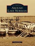
Around Lake Norman (Images of America)
by Cindy JacobsThe year 1957 brought change to Mooresville and southern Iredell County, and that change arrived in trucks. Big white ones flashed the logo of Burlington Industries, the new owners of the Mooresville Cotton Mills. Bright yellow ones from the Duke Power Company brought earth-moving machines to clear the Catawba River bottomland. That project, envisioned by James Buchanan Duke, Dr. Gill Wylie, and William States Lee Jr., had the end goal of harnessing the energy of the Catawba River to provide electricity for the textile industry in the Carolinas. Duke Power's plan for Cowans Ford Lake was the last piece of the network of hydroelectric stations, and the result was beautiful Lake Norman.
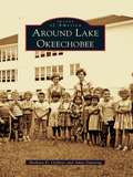
Around Lake Okeechobee
by Barbara D. Oeffner Amie DunningFrom the Calusa Indians to the travelers who used boats for transport in the early 1900s and up to the prosperous farms and cattle ranches of today, the Everglades has evolved into a mecca for fishing, birding, and hiking. The smell of orange blossoms entices the settler to an untamed land where bears, deer, and snakes still inhabit the wilderness and where alligator hunting and fishing are still popular sports. Lake Okeechobee is 110 miles around from Pahokee to Canal Point, Okeechobee, Lakeport, Moore Haven, Clewiston, South Bay, and Belle Glade. To cross Florida from the Atlantic to the Gulf, a boat starts in Stuart and ends at Port Mayaca, crossing Lake Okeechobee to the Moore Haven lock and out the Caloosahatchee River past Lake Hicpochee and west to Fort Myers. Around Lake Okeechobee presents images from the Clewiston Museum, Lawrence E. Will Museum, state archives, and private collections, painting a history of the boom and bust, the boaters and farmers, and the cattlemen and ranchers who have settled and raised their families here.
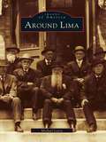
Around Lima
by Michael LeavySome twenty miles south of Rochester lies what was historically the "crossroads of western New York." Lima and its neighbors in the Genesee Valley are unique in many ways. An excellent network of trails had been developed by the Iroquois long before the area attracted its first permanent settler in 1788. As immigrants streamed westward, inns opened at this crossroads to serve them, and some of the travelers stayed to become farmers, tradesmen, and merchants. In the mid-1800s, Lima had several photography studios and a wealth of architectural gems, many of which still remain. Today, Lima has more than fifty structures listed on the National Register of Historic Places.Around Lima explores the fascinating evolution of Lima and the diverse adjoining towns that were inexorably connected. It illuminates the elegant streets of Lima, the rich heritage of nearby Bloomfield, the covered bridge and stone mills of Honeoye Falls, and the grandeur of the resort days of Avon Springs, which rivaled Saratoga Springs. Appearing within these pages are glimpses of Susan B. Anthony and Franklin Delano Roosevelt, as well as accounts of the Underground Railroad and a winter morning's journey to see Abraham Lincoln.
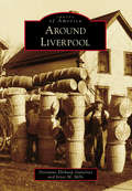
Around Liverpool
by Joyce M. Mills Dorianne Elitharp GutierrezLiverpool, on the shore of Onondaga Lake, was settled by John Danforth and his family due to the natural brine springs near the lakeshore. The population of salt boilers quickly grew. The Oswego Canal opened in 1828, and the village was incorporated in 1830. German immigrants brought willow weaving to the village in the mid-1850s, and by the 1890s, Liverpool willow products were being shipped all over the nation. In the 20th century, as more lucrative work became available and the automobile ruled, the basket weavers gave way to factory workers, nurses, teachers, and engineers. Around Liverpool takes you on a tour of the unique history of Liverpool, with images of its salt boilers, weavers, firefighters, schoolchildren, churchgoers, ice boaters--the people and places that made the community.
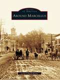
Around Marcellus
by Leslie Church KrausAround Marcellus recounts the rich history of a community founded by strong and determined settlers. Marcellus and its neighbors Otisco and Marietta are located just west of Syracuse. Founded in 1794, the town grew largely because of its successful mills and businesses. Its history from the mid-1800s to the mid-1900s is portrayed here in clear narrative and some 200 archival images from the Marcellus Historical Society.
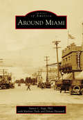
Around Miami
by Marlene Tiede Delvan Hayward Santos C. VegaDuring the late 1800s, prospectors in search of gold, silver, and copper began to settle around the Pinal Mountains area in Miami. By 1918, several mining companies had established roots and contributed to the town's booming growth. The community established housing, schools, a hospital, and a town government, and the population grew to 5,000. Soon, Miami achieved recognition as one of the main mining towns in the state, along with neighboring Globe, Jerome, Morenci, Superior, Ajo, and Ray-Sonora. The new mining opportunities brought immigrants from around the world to settle in the area and eventually turned Arizona into a leading contributor to the copper industry. Although mining's hold on the local economy has changed over the years, today at least 20 percent of Miami-area employment is centered around copper mining, which remains close to the heart of the first hardy miners' descendants.
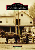
Around Milton
by Timothy StarrThe town of Milton, New York, lies near the center of Saratoga County. It is crisscrossed by a series of rivers, which have played an important role in the town's development--most notably, the Kayaderosseras. Milton's only village, Ballston Spa, with the attraction of its rare mineral springs, was once among the country's most popular tourist destinations. One of the largest and most elegant hotels in the world, the Sans Souci, vied with a host of others for the patronage of thousands of travelers who made the pilgrimage each summer to partake in the "healing waters." When the tourist trade faded, it was replaced by a massive expansion of industry that was situated along the town's waterways. Among the most significant of these concerns were the mills of the "Paper Bag King" George West, Isaiah Blood's ax and scythe works, and the mammoth tannery of Samuel Haight. Today, its proximity to the state capital and other cities makes the town an increasingly popular residential area, complemented by a quaint and bustling business district in Ballston Spa.
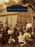
Around Momence
by Kevin Mcnulty Sr.As evidenced by the historic record of Burt E. Burrough's book entitled Tales of an Old Border Town and along the Kankakee (1925), the city of Momence owes its origins to the flow of the Kankakee River through eastern Kankakee County. This diverse tributary linked marshy areas in Indiana to the adjacent fertile fields on the Illinois side. Momence became a beacon, providing traders with the latest conveniences and a break from the frontier. Years later, the historic Dixie Highway crossed the river at Momence, assuring a modern era for the city. In her writings of 1983-1984, the great educator and historian Kay Hess revealed the community spirit, entrepreneurial zeal, and celebratory nature of Momence through the many personalities of this rural city. Today, as Momence approaches its 200th year, massive urban sprawl promises to wash over this ever-changing community and add to its history.
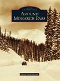
Around Monarch Pass
by Duane VandenbuscheMonarch Country is an incredibly beautiful mountain region spanning both sides of the Continental Divide in the southern portions of Chaffee and Gunnison Counties in the Rocky Mountains of south-central Colorado. Monarch Pass, at 11,312 feet above sea level, divides the Gunnison Country in the west from the Arkansas River watershed in the east. This scenic, wild, and rugged region surrounding the crossroads of U.S. Routes 50 and 285 is rich in mining, railroad, and skiing history and once included booming mining camps such as Maysville, Garfield, Monarch, and White Pine. The crown jewel of this spectacular high-country landscape is the Monarch Ski Area, which enjoys 350 to 500 inches of snowfall every year.
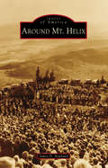
Around Mt. Helix
by James D. NewlandEvery year, the morning of Easter Sunday, thousands of intrepid souls trek to the summit of San Diego County's Mt. Helix. Once there, they experience the nearly century-old tradition of a community-based sunrise service held at the historic Mt. Helix Nature Theater. Constructed for that purpose in 1925, and located in a unique, privately-owned "public" park, the landmark serves as just one of the reasons this conically shaped peak has become a regional, cultural, and natural icon. Named for a rare gastropod, the 1,375-foot-high pinnacle also serves as a geographic beacon for the mostly unincorporated surrounding communities of Mt. Helix, Grossmont, Calavo Gardens, Casa de Oro, Spring Valley, and the adjacent, historically related municipalities of El Cajon, Lemon Grove, and La Mesa. Today, these semirural communities are renowned for their idyllic, family-friendly neighborhoods; classic early-20th-century Revival-style and custom midcentury Modern architecture; and long-standing commercial and civic institutions.
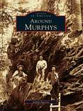
Around Murphys
by Judith MarvinMurphys is a bustling little town in the foothills--a town so popular that it won't be little for long. It's a favorite for weekend jaunts, and home to an eclectic group of people attracted by the natural surroundings, laid-back lifestyle, and, increasingly, world-class wineries. Originally named for the trading camp of John and Daniel Murphy, the area became a boomtown during the Gold Rush, and later hosted such notables as Mark Twain, Black Bart, Ulysses S. Grant, and Horatio Alger. Nearby, the majestic stands of redwood at Calaveras Big Trees State Park stand sentinel over the gullies and ranches of this area, which has changed much since the 1800s but still retains its compelling forested beauty.
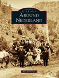
Around Nederland
by Kay TurnbaughNederland survived three boom-and-bust cycles involving three different minerals. During the silver boom, U.S. president Ulysses S. Grant visited Central City in 1873 and walked on silver bricks that had been mined in Caribou and milled in Nederland. The second boom followed the discovery of gold in Eldora in 1897 and lasted only a few years. The third boom was sparked by the discovery of tungsten by Sam Conger, the same man who made the original discovery of silver in Caribou. The Conger mine eventually became the greatest tungsten mine in the world. During World War I, Nederland's population swelled to 3,000--twice the size it is today--and another 2,000 were estimated to live nearby. In each boom, men came to mine, open stores, and transport goods and ore. They brought families with them, and many towns sprang up, including Caribou, Eldora, Lakewood, Tungsten, and Rollinsville. Some of these communities have survived, while others remain only in memories and photographs.
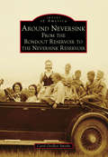
Around Neversink: From the Rondout Reservoir to the Neversink Reservoir
by Carol G. SmytheAround Neversink: From the Rondout Reservoir to the Neversink Reservoir takes readers back to rural life in the Catskill Mountains not long after its first settlers arrived. Before the land was commissioned to provide water for New York City's nine million residents, the area was known for some of the best trout fishing in the world. Red Hill, Peekamoose, Sundown, Branch, Frost Valley, Dewittville, Halls Mills, Willowemoc, Grahamsville, and Claryville were small communities mostly clustered around the banks of the headwaters of the Neversink River or the Rondout Creek. The area became a summer destination, and local farmhouses were converted into boardinghouses to accommodate seasonal travelers. In the 1900s, eminent domain took several communities to create the Rondout Reservoir and the Neversink Reservoir. As a result, Neversink Flats, Bittersweet, Eureka, Montela, and Lackawack ceased to exist. Today, residents and visitors enjoy a host of outdoor activities, including hiking on local mountains, snowmobiling on well-groomed trails, fishing in the reservoirs, bird watching, camping, and hunting.
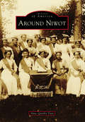
Around Niwot (Images of America)
by Anne Quinby DyniBy the time the Colorado Central Railroad extended its tracks into Boulder County in 1873, much of the land along the foothills was already under cultivation. As rails were laid between Boulder City and Longmont to the northeast, they crossed land belonging to settlers who had first come to the region as prospectors with the Pikes Peak Gold Rush of 1858. At that time, the area was still the hunting and fishing grounds of Southern Arapaho Indians and their tribal leader, Chief Niwot, translated as "left hand" in the Arapaho language. Two ranchers, Porter Hinman and Ambrose Murray, whose land was traversed by the new railroad, platted the town of Niwot in 1875 as a shipping point for transporting local farm goods and livestock to distant markets. Thus the only authentic railroad town in Boulder County was founded.
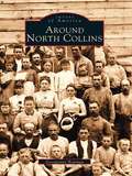
Around North Collins
by Georgianne BowmanSouthern Erie County, around North Collins, was originally inhabited by the Seneca Nation of Native Americans. Beginning in the late 1790s, English Quakers moving west from New England arrived, and as the 1800s progressed, waves of German and Italian immigrants followed, seeking political and economic stability. Later, immigrants of other nationalities settled in the area, adding their contributions to this area of rich diversity.Around North Collins contains a unique combination of vintage photographs and historical knowledge on North Collins and fourteen other communities: Shirley, Langford, Clarksburg, New Oregon, Marshfield, Collins Center, Collins, Gowanda, Lawtons Station, Brant, Farnham, Angola, Pontiac, and Kerr's Corners. The photographs, many of which have never before been published, come from the collections of local historians, historical societies, and area families. Pictured are people at home, at school, at ceremonies, and at work, using the tools of their craft.
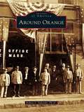
Around Orange
by Robert J. TuholskiLocated between the Quabbin Reservoir and the New Hampshire state line, Orange has developed from a sparsely-settled, agrarian countryside to a thriving industrial community along the banks of the Millers River. Around Orange includes images of this town and the surrounding towns of Athol, Erving, New Salem, Warwick, and Wendell. Through photographs, postcards, and stereoview cards from a bygone era, this volume provides a glimpse of what it was like to live and work in this area long ago. Seen here are vintage images of schools, churches, public buildings, homes, businesses, industries, celebrations, and disasters.
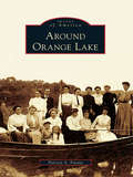
Around Orange Lake (Images of America)
by Patricia A. FavataAround Orange Lake portrays the history of the lake and the adjoining locales of Gardnertown and Meadow Hill. The only natural lake for miles, Orange Lake was the location of a Colonial coinage mill, a source of power for many early industrial ventures, and home to one of the East Coast's most famous amusement parks. In the late 1800s, cabins began to dot its shores, and by the 1920s, bungalow colonies flourished, with cottages that today have become substantial year-round homes. The lake also hosted famous personalities, including a Boston Tea Party participant, an early pilot, and a former governor. Their stories and others are intertwined with the history of the lake to create a picture of a very unique community.
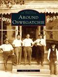
Around Oswegatchie (Images of America)
by David E. MartinAround Oswegatchie provides a vivid look at the lifestyle of an area of far northern New York State during the time that it depended primarily on an agrarian existence. In its early days, the town of Oswegatchie was subdivided numerous times into new townships. From Oswegatchie, Lisbon, Morristown, and DePeyster came artists, politicians, industrialists, inventors, and Civil War heroes-- people who left their footprints on a nation and helped make a better life for all.
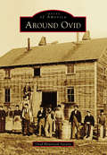
Around Ovid (Images of America)
by Ovid Historical SocietyOn land freed from American Indians upon the orders of George Washington, the town of Ovid was formed in 1794, after military lots were numbered by Simeon DeWitt and his assistants. In 1860, construction was completed on three brick buildings that became known as the Three Bears, which served as the town's courthouse, eventually served as the Seneca County Seat, and now serve as the Town of Ovid municipal offices. Gradually, more settlers came, cleared land, built roads, started businesses, and founded churches and schools. Bordered by the Seneca and Cayuga Lakes, where barges were used to transport goods, the town developed a vibrant farming community with productive orchards and vineyards. Tourism flourished, and summer homes were built by those looking to escape the city. One of these summer homes was that of Herman Westinghouse, who worked together with his brother George Westinghouse on their company's myriad inventions.
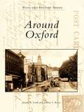
Around Oxford
by Joseph A. Lordi Dolores I. RoweAround Oxford features vintage postcards and photographs from Oxford and the surrounding area, including Lincoln University--the oldest African American institution of higher learning in America--and Nottingham. With the arrival of the Philadelphia-to-Baltimore railroad in 1860, Oxford began to grow and prosper. Because the area is one of the most fertile regions of Pennsylvania, it became a major agricultural center. Along with carriage and candy making, the surrounding area produced important industries, including chrome and magnesium mining, pottery making, and the quarrying of limestone.
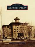
Around Perry
by Christina B. NolanFertile land, waterpower, energetic residents, and a sea serpent all contributed to the growth of the town and village of Perry. The town of Perry was first settled in 1807, and later took the name of Commodore Oliver Hazard Perry, the hero of the War of 1812. Early mills along Silver Creek provided materials for the growing village, which was incorporated in 1830. Perry made headlines in 1855, when a sea serpent was sighted on Silver Lake and people flocked to the area. The mystery went unsolved until remains of the hoax were found in the ashes of the Walker House in 1857. Perry continued to grow, with Main Street businesses changing with the needs of residents. Later industries replaced the early mills, and immigrants arrived to work in the textile factories. Educational, religious, and civic buildings were added to the community, and farms grew in the countryside.
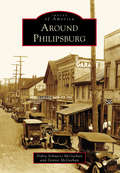
Around Philipsburg (Images of America)
by Dennis Mcgeehan Debra Schnarrs McgeehanPhilipsburg is a community on the Moshannon Creek, which flows east off the Allegheny Mountains in central Pennsylvania. The region was blessed with rich seams of bituminous coal that have provided the area with employment and prosperity. With interests in Philadelphia, the Philips brothers of England founded a colony in the wilds of frontier Pennsylvania in 1797. A gristmill, sawmill, iron forge, and screw factory began the taming of the wilderness. The Philips brothers eventually returned to England over political differences, but the town they founded carried on. Coal, timber, clay, railroads, and metal fabrication have created a community intensely proud of its history. Prone to flooding, the Moshannon Creek divides Centre and Clearfield Counties. This collection of photographs includes communities on both sides of the creek, highlighting the area's people, industry, commerce, architecture, and famous visitors to the town.
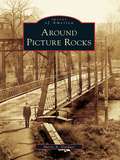
Around Picture Rocks (Images of America)
by Sherry A. GardnerWhen the Sprout and Burrows families purchased what became Picture Rocks for $2,500 in October 1848, the land was considered worthless. The town consisted of a single house and a sawmill that sat at the bend of Muncy Creek. The mill produced window sashes and doors that were in demand for new homes being built in the West Branch Valley. In 1856, S. H. Burrows began manufacturing furniture. Then in the early 1850s, a chapel was built in eight days so that the Baptist community had a place to worship. Around Picture Rocks documents the evolution of this section of Lycoming County. Among the many original structures featured in the book is part of the old Handle and Excelsior building that still greets visitors as they cross the Muncy Creek.
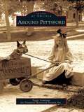
Around Pittsford (Images of America)
by Peggy Armitage Pittsford Historical Society Inc.Winding north through Pittsford, Otter Creek has powered the lumber, grain, and marble mills essential to this region since 1770. Chittenden lies east of Pittsford, on the west flank of the Green Mountains, where iron and manganese deposits supplied Pittsford's iron industry. To the south, Pittsford and Proctor share deep marble formations that support the economies of both towns. The first settlers were farmers drawn to the valley's fertile soil and mountain forests. They were joined by lumber barons, lawyers, merchants, and artists. European and French Canadian immigrants soon followed and farmed, built the railroad, or quarried and carved marble. Closely linked by the industries that helped build them, these communities have evolved into today's thriving hometowns of workers in Rutland.
Around Pottstown
by Patricia Wanger SmithAround Pottstown travels back to Pottstown's golden era. Since its founding in 1752, Pottstown has had a catalytic effect on the surrounding area with its industrial and commercial growth during the nineteenth and twentieth centuries. The horse and wagon gave way to new transportation methods, such as canal boats, railroads, and bridges, which afforded connections to the world market. Most importantly, this collection of vintage postcards shows Pottstown's citizens through the places where they shopped, went to school, worshiped, and celebrated life.
Around Randolph Township and Guys Mills
by Cheryl Seber WeiderspahnThe first frontier settlement in what is now Randolph Township took place in 1795 when a handful of brave pioneers overcame incredible odds to settle in the Pennsylvania wilderness. Slowly Randolph became dotted with small clearings, followed by self-sufficient farms. Ambitious tradesmen sold services, and scores of businesses sprouted up. Schools and churches followed as the crossroads of Guys Mills, Black Ash, Mount Hope, Brawley Stand, and Hickory Corners flourished, attracting men of influence. Rev. Timothy Alden, founder of Allegheny College, was pastor of Guys Mills Congregational Church. Famed abolitionist John Brown walked six miles to church in Guys Mills. During the great oil boom, John D. Rockefeller investigated the town's oil wells. Pennsylvania senator Raymond E. Smith resided here. Black Ash's Clint Brown enjoyed a 15-year major-league pitching career with the Cleveland Indians and Chicago White Sox and held a major-league record.
Around Remsen and Steuben (Images of America)
by Megan Plete PostolThe first settlers of the rugged wilderness that became the towns of Remsen and Steuben were hearty pioneers, Welsh immigrants, and a famous Revolutionary War hero. The untamed forest of Oneida County proved challenging but not insurmountable for Remsen’s first settler Barnabas Mitchell and the noble Friedrich Wilhelm August Heinrich Ferdinand Steuben, who was famed with being the sturdy backbone of Washington’s Continental Army and known as the “Drillmaster of the Revolution.” The area flourished into a place of farming, manufacturing, business, and religion. Settlers ranged from rollicking woodsmen to large working families to pious pastors. There were so many churches that the lands of Steuben became known as “the singing hills.” It has been said that the courage of a Welshman rises in proportion to the obstacles thrown in his path. This book strives to tell their tales through visuals of old Remsen and Steuben.
Around Rocky Mountain National Park
by Suzanne SilverthornFollowing the establishment of Rocky Mountain National Park in 1915, promotional campaigns generated by the railroads lured wealthy travelers to the park with images of the great outdoors and the many luxuries offered by the finest hotels. Postcards were circulated proclaiming the park as the "Playground of the World." The gateway communities of Estes Park and Grand Lake became vibrant hospitality centers, and in 1920, when the two towns were connected with the opening of Fall River Road, a new era of tourism was introduced that continues today. More than 200 postcards are used in this book to provide a chronology of the early hotels, ranches, and other settings that have shaped the park's history for more than a century.
Around Selinsgrove (Images of America)
by Jim CampbellWhile Selinsgrove is typical of the many towns located along the shores of the Susquehanna River, it has cultivated its own identity as the home of Susquehanna University, founded in 1858 as the Missionary Institute and later becoming one of the nation's first coeducational colleges. Prior to the Pennsylvania Canal, several Selinsgrove mills were vital in the worldwide flour trade, where wheat was ground into flour and floated on arks downriver to Baltimore. For most of the 20th century, Rolling Green Park was a leading recreational attraction, and for over 60 years the Selinsgrove Speedway's sprint car races have caused spectators to hail it as "the fastest half-mile dirt track in the East." What truly makes Selinsgrove and the surrounding area prominent is the unique individuals that have marked its history. Through more than 200 photographs, many previously unpublished, Around Selinsgrove depicts the places and people who have made these communities into what they are today.
Around South Hill
by John Caknipe Jr.South Hill was formerly located on the old Buckhorn Road near the Meherrin River. It was the site of the first chartered school in Mecklenburg County in 1814. When the founder/teacher/minister/postmaster died in 1857, many from the community relocated 3 miles east to the Boydton-Petersburg Plank Toll Road. In 1888, W. W. "Buck" Harris, a local wheelwright and landowner at Piney Pond and Plank Road, died. At auction, 55 acres of his property were purchased, platted, and parceled for sale by A. E. Batemen and Charles Peck to establish a new South Hill community, which surrounded the Atlantic-Danville Railroad depot. Following this, South Hill became known as the town of highways. With each new highway came significant changes for the town and county.
Around Squam Lake (Images of America)
by Bruce D. HealdLocated in the foothills of the White Mountains, Squam Lake was not discovered by English settlers until the mid-1700s. However, the lake area had long been inhabited by the Abenaki Nation of the Algonquin Federation. These people called the waters Kees-ee-hunk-nip-ee, meaning "goose lake in the highlands" (later shortened to Kusumpy or Casumpa) and also Asquam, meaning "water." The latter name was eventually shortened to become Squam Lake. With more than two hundred rare images, Around Squam Lake celebrates the beauty, the geology, and the history of Squam Valley. The book includes early Native American lore and the gradual development of what are known as the Five Towns-namely, Moultonboro, Sandwich, Holderness, Center Harbor, and Ashland. It reflects upon "big" Squam Lake and Little Squam Lake (where On Golden Pond was filmed), highlighting the shoreline points and coves, the succession of islands that dot the surface, and the surrounding mountains, which include the Squam Mountain range, the Sandwich range, and Red Hill, which rises at the head of the valley.
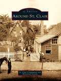
Around St. Clair
by St. Clair Community and Historical SocietySt. Clair lies in a narrow valley rich with anthracite resources. The town was born around 1831, during the great hard coal boom in northeast Pennsylvania. Over the years the town expanded to surrounding areas or patches known as Arnouts Addition, Wadesville, Dark Water, New Castle, Mount Laffee, Crow Hollow, Ravensdale, Lorraine, Diener's Hill, East Mines, and Mill Creek. People came from these areas to work in the mines, railroads, and supporting industries. As the demand for coal increased, the town grew to a high point of 7,000 residents. The decline of the coal industry also brought the decline of the railroads, and the population of St. Clair fell. The photographs in Around St. Clair show the fortitude of its people; the notable residents who have gained national acclaim for their achievements in the labor movement, medical field, and professional sports; and the diverse cultures that make up the town.
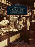
Around Swanzey: Swanzey, Ashuelot, Winchester, Richmond, Fitzwilliam, and Hinsdale (Images of America)
by Pamela Apkarian-RussellNestled against the Massachusetts and Vermont borders are six New Hampshire communities largely unconnected with the rest of their home state. The picturesque bedroom and summer vacation communities of Swanzey, Ashuelot, Winchester, Richmond, Fitzwilliam, and Hinsdale all developed from industrial or agricultural economies, although this fact is less than apparent today. The factories have nearly all vanished, and so has the extreme wealth and glamorous lifestyle of former residents like playwright Denman Thompson. Routes 10 and 12 are still the main roads that connect these towns, however, and the Ashuelot River is slowly recovering from years of pollution in a return to its pure and natural state. In fact, the area's Old Homestead persona seems to have experienced a revival in recent years in the absence of major industry, and it becomes more and more important for residents and tourists alike to be reminded of the area's nineteenth-century economic development.
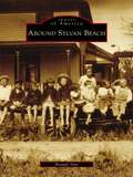
Around Sylvan Beach (Images of America)
by Brandy AnnOn the sandy shores and calm waters of Oneida Lake rests Sylvan Beach. For many years, the entire region was simply known as Fish Creek, and it was settled by George Haskins in the early 1800s. When the Erie Canal was completed in 1825, the area began to flourish. James D. Spencer arrived in the hamlet of Fish Creek in the 1840s and settled near Wood River and the Oswego Midland Railroad station. In the 1870s, he began to develop the sandy shores along Oneida Lake, and the first visitors to Spencer's Grove arrived in August 1878. Sylvan Beach received its name in the spring of 1886, when the New York, Ontario and Western Railroad built a loop into Spencer's Grove. Sylvan Beach continued to thrive with the addition of the railway station, allowing the shipment of produce and lumber as well as the arrival of large numbers of vacationers. These vintage images chronicle the history of Sylvan Beach and its surrounding communities, illustrating the region's strong link to the vast history of America.
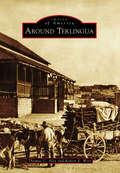
Around Terlingua
by Robert E. Wirt Thomas C. AlexThe origin of the name "Terlingua" is obscure and lost in time. For the past century and a half, the area covered by the name has expanded to include numerous concentrations of people engaged to varying degrees in ranching, farming, and mining, or the support thereof. Farmers and ranchers produced agricultural products, woodcutters supplied timbers for the mines or fuel for the furnaces, and storekeepers supplied the goods needed for sustenance of this diverse community that was spread over much of south Brewster County in West Texas. Hispanic people who began settling the region in the 18th century were the backbone of the mining industry. Many of the families here today are descendants of the mine workers and continue contributing to the community. This story tells of the establishment and abandonment of Terlingua following the rise and decline in demand for mercury and how the ghost town was resurrected in the 20th century.
Around the Bloc: My Life in Moscow, Beijing, and Havana
by Stephanie Elizondo GriestDesperate to escape South Texas, Stephanie Elizondo Griest dreamed of becoming a foreign correspondent. So she headed to Russia looking for some excitement-- commencing what would become a four-year, twelve-nation Communist bloc tour that shattered her preconceived notions of the "Evil Empire." In Around the Bloc, Griest relates her experiences as a volunteer at a children's shelter in Moscow, a propaganda polisher at the office of the Chinese Communist Party's English-language mouthpiece in Beijing, and a belly dancer among the rumba queens of Havana. She falls in love with an ex-soldier who narrowly avoided radiation cleanup duties at Chernobyl, hangs out with Cuban hip-hop artists, and comes to difficult realizations about the meaning of democracy.
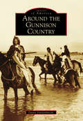
Around the Gunnison Country (Images of America)
by Duane VandenbuscheThe Gunnison country, 4,000 square miles of high valleys, heavy snows, deep canyons, and 14,000-foot-high mountains, is one of Colorado's most beautiful regions. Located on the Western Slope of Colorado, the Gunnison country has a long history involving Native Americans, mining, narrow-gauge railroads, ranching, Western State Colorado University, and recreation. The region has also been influenced by nearby Lake City in the San Juan Mountains, Aspen in the Elk Mountains, and towns on the east side of the famed and historic Alpine Railroad Tunnel. Today, the Gunnison country still is beautiful and tranquil, hosting nearly 2,000,000 visitors yearly while remaining much the same as it was over 125 years ago.

Around the Province in 88 Days: One Woman, Two Pairs of Sneakers and 3000 Kilometers of Nova Scotia Coastline
by Emily Taylor SmithA Nova Scotia woman shares her experience of walking the province&’s coastline for charity and what she learned along the way.Early on a May morning, a young Nova Scotia woman straps on a small backpack and leaves the Halifax Common to start her journey along the coastal roads of Nova Scotia. Planning to cover almost a marathon a day, she will walk the perimeter of the entire province in just under three months to raise awareness for the Heart and Stroke Foundation and the Brigadoon Children&’s Camp Society. She billets with locals each night and meets countless Nova Scotians who come out to walk with her, support her project, and tell their stories. Along the way, fellow walkers share family folklore, tales of buried gold, lost fingers, and detailed instructions on how to catch a beaver by the tail. &“We don&’t wear make-up and we don&’t dust,&” explains one of the women Emily meets near Sable River, when asked how she found the time to rebuild the trails in her area and win the Community Spirit Award. Struggling with blisters, fatigue, and an encounter with a bear cub, Emily walks on, overwhelmed by the generosity of her hosts in each community and by the stunning coastal views at every turn. Around the Province in 88 Days details Emily&’s beautiful and quirky experiences on the road as she develops an intimate connection with the province and its people, unsuspecting of the vast changes the trip will eventually set in motion in her own life.