- Table View
- List View
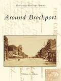
Around Brockport
by William G. AndrewsThe first settlers came to the Brockport area soon after 1800. Located some twenty miles west of Rochester, the towns of Sweden and Clarkson, the village of Brockport, and a college were organized between 1814 and 1835. The Erie Canal, farm implement manufacturing, and higher education fostered their growth and prosperity in the mid-1800s. At Brockport, the United States became a continental nation, the Industrial Revolution came to agriculture, and popular literature came to American women. Today, Brockport is a remarkably well-preserved Victorian village on a revitalized Erie Canal, Clarkson and Sweden are havens for farming and commuting, and the college is an 8,500-student unit of the State University of New York. Around Brockport presents more than two hundred thirty images from private and public collections, many from glass negatives. They depict such aspects of the area's history as farm life in early Sweden, stately homes at Clarkson Corners, industrial plants in Brockport, and student activities at the normal school.
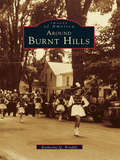
Around Burnt Hills (Images of America)
by Katherine Q. BriaddyAround Burnt Hills offers a unique glimpse into the history of this Saratoga County, New York, community and evokes a nostalgia for the way things used to be. Join Katherine Q. Briaddy in her second Images of America tribute to the people and places of Ballston. Discover an era preserved through the advent of photography and the pieces of history saved by those with an affinity for memories of yesteryear. This volume is made up of a series of love letters found in the attic of a Burnt Hills homethat reveal much about the heritage of the town. They were written between 1926 and 1931, and the engaging stories within them complement the carefully preserved images found in Around BurntHills. All aspects of life are covered, from schoolsto Prohibition to politics and beyond.
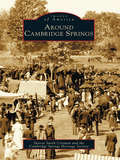
Around Cambridge Springs (Images of America)
by Sharon Smith Crisman Cambridge Springs Historical SocietyIn 1903, Cambridge Springs was described in Cutter's Guide as "the Great Health and Pleasure Resort of Pennsylvania." Located in northwestern Pennsylvania on the banks of French Creek, it fell halfway between Chicago and New York City on the Erie Railroad. From the promotion of the mineral springs in 1884, this town of some six hundred people grew into a luxurious vacation spot that included accommodations such as the Riverside Hotel, the Rider Hotel, the New Cambridge Hotel (now the Bartlett), and more than forty other hotels and cottages. Around Cambridge Springs not only celebrates this town's golden age of resorts and affluence but also remembers the people, such as W.A. Baird Jr.; the places, such as Alliance College; and the events, such as the devastating fires of 1897 and 1931, that have shaped this community over the last two hundred years.
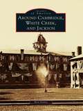
Around Cambridge, White Creek, and Jackson
by Ken GottryThe Cambridge Valley has always been united and divided, each community holding tightly to its identity. In 1773, the Cambridge District was formed, comprised of the current towns of Cambridge, White Creek, and Jackson. In 1788, the area became the Town of Cambridge in Albany County and was annexed to Washington County in 1791. The area was divided into the present town boundaries in 1816. The three communities of Cambridge, North White Creek, and Dorr's Corners, though each only three-quarters of a mile from the next, did not unite into the Village of Cambridge until 1866. Today the village spans the boundaries of the three townships but still divides itself into the East End and the West End.
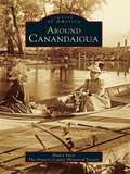
Around Canandaigua (Images of America)
by The Ontario County Historical Society Nancy YacciAs we approach the end of the century, this new book looks back at over one hundred years of Canandaigua's history, with photographs of the people, places, and events that have defined the proud and vibrant community we know so well today. Over 200 never before published photographs are presented in this pictorial history, which spans the early 1800's through the early 1950's. Readers will be fascinated by the immense changes that have occurred since the early days, but will also draw connections to the present and can savor the fact that Canandaigua still holds numerous charms of yesteryear. Works from the collection of renowned area photographer Henry Boyce are featured here. This artist's work documented the events and people that shaped Canandaigua's history and community. Rare images of philanthropist Mary Clarke Thompson and her Sonnenberg Gardens will delight readers. Also included are many photographs of Canandaigua's early downtown area. (This is a reissue of ISBN 0-7524-0464-4)
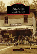
Around Caroline (Images of America)
by Patricia A. BrhelNestled in the rolling hills of the Finger Lakes region of Upstate New York, Caroline is a true community and always has been. In 1795, the first two families came with horses and settled in permanently. The founding mother, Widow Earsley, and her children returned to the cabin that she and her oldest son had built the previous autumn, and Captain Rich and his family began work on their own abode. From these first families to those who followed, pulling together to make circumstances better for everyone has been an important facet of life in Caroline. Residents clustered in several hamlets, including Slaterville Springs, Speedsville, Caroline, and Motts Corners (now Brooktondale), and carved farms out of the wilderness between them. They built houses, churches, and businesses. Recreation included picnics, band concerts, baseball, the Grange, parades, and youth groups.
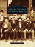
Around Carthage and West Carthage
by Lynn M. ThorntonEarly settlers followed the Black River up to Long Falls, the present site of Carthage and West Carthage, where they found fertile land and dense forests along the rushing waters. The river ran between the two villages and gave life to the young communities. Many industries, dependent on the waterpower, were established along the lower eastern bank, with businessmen settling on the highlands of the west bank. Mills sprang up where blinds, lumber, and furniture were manufactured, and planning mills, tanneries, and pulp mills flourished. After a devastating fire, which destroyed mills on both sides of the river, the focus of industry moved almost entirely to pulp and paper. By the early 20th century, the industry ushered in a golden age for the Twin Villages.
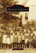
Around Chelsea (Images of America)
by Christi-Ann BonoFrom humble beginnings to magnificent gains, there are few cities that can boast as much growth as Chelsea, Alabama. Where Creek Indians once hunted and roamed, successful businesses, neighborhoods, schools, recreation parks, and churches now stand. In the mid-1800s, pioneer families settled in the hills of what was first called Melrose. The railroad played a vital role in the advancement of the area by offering passenger and commercial transportation, attracting families, businesses, and schools, and in 1996 Chelsea was incorporated with a population of 908. Just over 10 years later, it exceeded 10,000, and Chelsea was the fastest-growing city in Shelby County. With an expanding home market, a growing school system, and a strong sense of community, Chelsea is widely considered one of the top areas in the state for families to live. In fact, the city's motto is "It's all about family."
Around Clarksville (Images of America)
by John Caknipe Jr.Clarksville, Virginia's only lakeside town, is part of Western Mecklenburg County. It was the county's first incorporated town and was named for its founder, Clarke Royster. The area gained its fame when William Byrd II surveyed Buffalo Springs in 1726 and dubbed the waters "the water that Adam drank." The town was originally home to the Occoneechee Indians, who were driven from the area 50 years earlier when Nathaniel Bacon fought his last battle at Fort Occoneechee, massacring over 300 members of the tribe. This battle became his legacy. Today tourists are drawn to the area for annual fishing tournaments and lake activities.
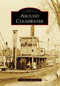
Around Clearwater (Images of America)
by Cynthia Frank-StupnikBurrowed below bluffs overlooking the Mississippi and Clearwater Rivers, Clearwater's houses, its churches, and most of its original businesses resemble those that settlers had left behind in the East. With its arch-like trees sheltering Oak and Main Streets, the community remained home to many who lived and died there and those who had moved on only to return for yearly Old Settlers' gatherings. This sense of community allowed Clearwater to thrive. Flour and pulp mills lined the shores of the Clearwater River. Mercantile, hardware, jewelry, and drug stores cropped up, providing the products for a growing community. Trade once powered by steamboats on the Mississippi was taken over by James Hill's Great Northern Railroad. While the village and surroundings have changed over time, the original charm is still there, ready to be explored again.
Around Crawford
by Fritz G. MeierThe town of Crawford was initially settled by German, Dutch, Irish, and Scottish families who built mills along the Hudson River tributaries. By the early 1800s, the area was known as "the Butter Capital of the World." Nestled along the base of the Shawangunk Mountains, the town of Crawford has transitioned from a rural farming community to a residential oasis. Along the way, farmlands have become housing developments, local industry has given way to chain stores, and dirt roads have become paved highways. A collection of images from as early as the 1860s depicts the transformation of the communities of Searsville, Bullville, Thompson Ridge, and Pine Bush. Although the surroundings have changed, the hearts of area residents have remained loyal to the small-town ideals that define the town of Crawford.
Around Curwensville
by Julie Rae RickardCurwensville, one of the oldest towns in Clearfield County, began as a lumber town. Some of the area's finest families made their fortunes by harvesting the tall pine trees that were used as ship masts. The Irvin and Patton families were instrumental in the development of the town, as they brought the railroad to the area and contributed to the schools, banks, and a water system. In the 20th century, industries such as brick making, stone quarries, and tanneries became vital to the community. Bringing to life an era when every settlement was a stop on the railroad route, Around Curwensville is an exciting collection of historic photographs from Curwensville and surrounding towns, including Clearfield, Grampian, and DuBois.
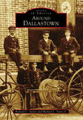
Around Dallastown (Images of America)
by Michael L. Sentz Jr. Richard C. SaylorOfficially incorporated in 1866, the site of Dallastown was once used as a parade ground by local militia during the Revolutionary War era. When James Peeling purchased 95 acres in the area in 1841, he set in motion the community's formation. In 1844, the town was officially named Dallastown, in honor of Philadelphia lawyer and vice president elect George M. Dallas. The final decades of the 19th century saw even more development for Dallastown. The first cigar factory in town opened in 1860, and by 1885, over 38 factories were in operation, creating new jobs, attracting new businesses, and more than doubling the population. Marking its sesquicentennial in 2016, the community of Dallastown continues to celebrate its borough and its unique history.
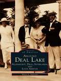
Around Deal Lake: Allenhurst, Deal, Interlaken, and Loch Arbour
by Marie A. SylvesterFocusing on four of the smaller coastal communities in central Monmouth County--Allenhurst, Deal, Interlaken, and Loch Arbour--Around Deal Lake offers a unique look back at the emergence of these towns in the shadows of the large shore resorts of Long Branch and Asbury Park. Utilizing photographs and ephemera from the 1880s through the present, author Marie A. Sylvester captures the excitement of the young communities and the spirited residents who helped to build them. From the magnificent seaside mansions that lined the ocean in Deal, to the lakeside artist studios of Interlaken, there exists an interesting array of architecture and an equally broad spectrum of inhabitants around Deal Lake. Residents of these areas range from the industrial magnates of Deal to the actors, writers, and artists who chose Interlaken as a haven to indulge their muse.
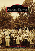
Around Denver (Images of America)
by Matt Boles Jason L. HarpeDenver, known locally as "Denver of the East," is an unincorporated area in eastern Lincoln County, North Carolina, that was originally named "Dry Pond" after a small pond at the intersection of Highway 16 and Campground Road that always dried up during the hottest summer months. Prof D. Matt Thompson, principal at Rock Spring Seminary, led the effort to rename the area after the booming Colorado capital to attract railroad planners whose lines could provide an economic boost to trading and commerce. The area was officially renamed in January 1875. Around Denver are communities such as Triangle, Lowesville, Machpelah, Catawba Springs, Iron Station, and Pumpkin Center, whose names are as significant as the industries and sons and daughters that they birthed and raised.
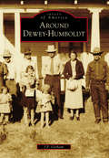
Around Dewey-Humboldt (Images of America)
by J. P. GorhamNestled in the Arizona mountains are several small, unassuming towns that belie the importance of their heyday. These towns are all intrinsic to each other for one reason: mining. The nearby ranches were established to feed the miners, and in many cases, residents moved back and forth among them depending on which mines were prosperous or closed. Some no longer exist, evidenced now by rock walls or other harder-to-find clues. Some have turned into tourist attractions. The first legislative meetings of the Arizona Territory were held at the Woolsey Ranch in nearby Dewey, where the first building in Yavapai County was constructed. Indian wars occurred here, and many of the natural resources used to support the growing country came from iron and copper mines found deep within the bowels of the Dewey-Humboldt area. The towns of Cherry, Dewey, Humboldt, Mayer, Cordes Junction, Crown King, and Bumble Bee still exist. Others, like Agua Fria, Chaparral, Stoddard, McCabe, Poland, and Cleator, have mostly vanished, but their pioneering spirit and importance will never be forgotten.
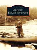
Around Dover-Foxcroft (Images of America)
by Stephen RainsfordPicturesque Sebec Lake is surrounded by the towns of Dover-Foxcroft, Bowerbank, Sebec, and Willimantic. The area's history goes back hundreds of years to the time when Eli Towne walked through the woods and became the first settler in Southern Piscataquis. For generations, Dover-Foxcroft has drawn residents and tourists alike, eager to enjoy the lake's scenic beauty, take in horse racing at the park, or catch a show at the opera house or the Star Theater. Four railroad stations served the five towns, making the region easily accessible. In the early years, residents found work in many industries, from the Mayo and Brown woolen mills to the Hughes organ factory.
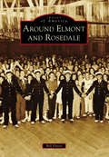
Around Elmont and Rosedale (Images of America)
by Bill FlorioOnce portions of a farming community called Fosters Meadow, Elmont and Rosedale have changed dramatically since Thomas and Christopher Foster first farmed the land in the 1600s. In the 1850s, immigrant German farmers settled in the area abutting Elmont Road, Brookville Boulevard, Linden Boulevard, and Merrick Boulevard. The remnants of that German farming community continued into the early 20th century, despite encroaching suburbanization, renamed streets, and subdivided farmland, along with Irish, Italian, and Jewish immigrants changing the area’s ethnic makeup. This new suburban area covering the southern corners of Nassau and Queens Counties became home to landmarks like the Argo Theatre, Rottkamp Farm, Schmitt Farm, Laurelton Parkway, Gouz Dairy, Sapienza Bakery, St. John’s Methodist Church, and world-famous Belmont Park. Today, Elmont, Rosedale, and the rest of the former Fosters Meadow are home to a large population of Caribbean immigrants, bringing a new culture to the area and, with it, new landmarks and new ideas.
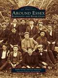
Around Essex: Elephants and River Gods
by Robbi Storms Don Malcarne Ivoryton Library AssociationThree hundred years of history follows you around today as you wander the streets of Essex, Centerbrook, and Ivoryton. Essex harbor is located on the Connecticut River six miles north of Long Island Sound, between Mystic Seaport and New Haven. It is a major stopping point for boaters in the Northeast who come from various ports to dock in the harbor, dine at the Griswold Inn, take in the maritime history at the Connecticut River Museum, or walk along the narrow streets to view the fine old houses in this New England community. Homes once owned by sea captains, shipbuilders, and captains of industry are a reminder of the area's glorious past. True, the old 1,200-foot Ropewalk, a mainstay of maritime manufacturing, was gone by 1900. Gone also are the Uriah Hayden Chandlery, Judea Pratt's New City Smithy, and Abner Parker's warehouse. The harbor where working vessels once ruled is now a vibrant waterfront filled with pleasure boats. A row of elegant Victorian houses lines the main street of Ivoryton village, where only a century ago lived executives from Comstock, Cheney & Company, the once great ivory and piano action factory. Enough of the past remains to remind us of the industry that thrived along these riverbanks.
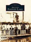
Around Findley Lake (Images of America)
by Randy BoerstAround Findley Lake recounts the story of a mill village that in the late 1800s began to develop into a prime destination-a social gathering place for not only local residents but also members of wealthy and socially prominent families from Cleveland, Pittsburgh, and Buffalo. As time went on, Findley Lake offered plays and musicals in the opera house, steamboat rides around the lake, roller-skating at the rink every night, and two islands for picnics or for viewing the logs being floated down the lake to the mill. Today, with its thriving year-round resort, the area has emerged as a tourist mecca. Showcased in Around Findley Lake are not only the distinct communities that developed around the lake but also the exceptional natural beauty of the lake itself, its importance to the early settlers, its recreational attributes, and most importantly its overall significance to the growth of the area. Each chapter's brief introduction offers historical highlights, followed by pages of fascinating facts and intriguing images of the Lakeside Assembly, steamboats, the Big Island, early cottages, and development of the resort Peek'n Peak.
Around Fortescue
by Clarence Higbee Jr. Betty HigbeeFortescue, a small island located in Downe Township, has a history that dates back to the early 1700s. Situated on the shores of the Delaware Bay, it was once portrayed as one of the finest locations for a summer resort, especially for those fond of fishing and hunting. Possessing many natural advantages at little expense to visitors, this charming village became an oasis for vacationers from surrounding towns and cities in the 1800s. At a time when roads were poor, visitors found Fortescue easily accessible by water or horse and buggy, and they flocked to bathe in the water and breathe the invigorating salt air. Although many of the tourist attractions are now gone, Fortescue continues to come alive in the early spring as fishermen return. Around Fortescue showcases the history of this small fishing community.
Around Germantown (Then and Now)
by Margaret ColemanGermantown is a new city. Until 1980, Germantown was a quiet, rural community of farms and cows with a few new houses built for employees of the Atomic Energy Commission. When the Maryland-Nation Capital Park and Planning Commission adopted the area, everything changed.
Around Great Moose Lake (Images of America)
by Brenda SeekinsAthens, Harmony, Hartland, and St. Albans surround the 3,500-acre Great Moose Lake in central Maine, and this volume reveals the fascinating history found here. Sportsmen discovered this land in the mid-1800s and established hunting lodges on the lake's shore, which continued for more than 60 seasons. In their heyday, the lodges provided employment for locals and planted alluring mysteries for later generations. Citizens later thrived on the farming and manufacturing in the late 19th and early 20th century. The colorful past left a rich heritage of seasonal and year-round residents and visitors that shaped the personality of the area. Around Great Moose Lake unravels some mysteries of the lodges and focuses on the changing culture around the lake and its four towns.
Around Greensboro
by Michele Buday-MurrayAround Greensboro covers communities of southeastern Greene County, including Greensboro at its heart. Greensboro was originally called Delight by the Mingo Indians who lived in the region. Because of its location on the Monongahela River, it quickly became an important trading location for the trappers and settlers moving through in the late 1700s. Later, Albert Gallatin introduced a group of Belgian glassblowers to the area, and in 1807, the glassworks in Greensboro was opened. As the glass business began to fade, another took its place. The area was rich in clay, which would be vital to the development of the pottery industry. From the 1840s to 1915, pottery was king in Greensboro, and the town boomed. As the pottery industry faded, it too would be replaced by another industry: coal. Greensboro, once famous for its glass and pottery, became known for its bituminous coal mines. This book covers the early days of Greensboro to the devastating Election Day Flood of 1985.
Around Greensboro
by Mayor David Spencer Judy RevealThe quaint town of Greensboro, Maryland, is nestled in the middle of the Delmarva Peninsula on Maryland's Eastern Shore where its American roots travel across the Choptank River and reach deep into the agricultural soil of Caroline County. The Choptank River's path meanders up the peninsula from the Chesapeake Bay, cutting through Caroline County, and it is at the great bend in the river that Peter Harrington brought into full bloom his grandfather Peter Rich's vision of a town. This location was vital to the movement of products to and from people living in the middle of the peninsula, and Greensboro quickly grew into a thriving small port town where businesses, including tanneries and shipbuilding, appeared. Greensboro's accessibility to Washington, Philadelphia, Baltimore, and Wilmington makes this quiet town a convenient bedroom community with big-town access and rural serenity.